
Showing posts with label rains. Show all posts

Monday, June 10, 2024

Another Picturesque Thunderstorm Day In Vermont, With A Cold Air Funnel For Added Fun

Dramatic thunderstorm clouds near Sheldon,
Vermont late Sunday afternoon
 After a gloomy start to our Sunday in Vermont with steady rains and a bleak overcast, the sky turned interesting once again over the Green Mountain State.  

That's one of the things I love about summer. The sky is almost always more fun to look at than in the winter.

The pattern was the same as it's been since about Friday. Upper level low pressure was parked nearby. That's a pool of chilly air aloft. 

If you get that weather pattern in the winter, all you usually end up with is a flat overcast and snow showers. 

In June,  you have the sun at peak strength. The surface warms quickly as soon as the sun comes out. The air cools quickly with height with the upper level low around. The updrafts inspired by the sun condense into those big billowing clouds that: A. Are often very pretty and dramatic B. Create showers and thunderstorms (I always like hearing thunder for some reason)  C. Offer cool surprises.  

So it was Sunday, with black clouds gushing downpours and pea sized hail right next to bright sunshine and deep blue skies over emerald green Vermont forests.  It was one of those days that were simultaneously inclement and gorgeous, and even exciting, at least for a few moments. 

THE COOL SURPRISE 

One thunderstorm that passed through St. Albans, Vermont Sunday afternoon had a literal strange twist. The storm fell well short of severe limits. If featured a few flashes of lightning, rumbles of thunder, a torrential but rather brief downpour and outflow wind gusts I'd estimate at a very tame 25 mph. 

An apparent "cold air funnel" forming over St.
Albans, Vermont Sunday afternoon. 
As the storm began to depart, I saw a small but noticeable rotation overhead. It was nearly directly over the house when I first saw it, and it moved on to the northeast, in tandem with the parent storm. 

A section of clouds were clearly spinning, and there was a sort of bulbous-shaped funnel type thing associated with it.  

I was witnessing what was likely  a cold air funnel. WPTZ Meteorologist Matt DiLoreto took a look at a video I shot of this, and concluded I was probably watching a cold air funnel. 

What I saw was not a wannabe tornado or anything dangerous.  A "real" tornado involves a supercell thunderstorm within a soup of very warm, very humid air.  

The supercell usually spits out damaging winds and hail and very often develops a large scale rotation that can easily be detected on radar. This spin can sometimes translate into a dangerous tornado. 

As you noticed, Sunday was not especially warm or humid. 

Cold air funnels can form in showers and weak thunderstorms when the air aloft is much colder than normal.  That was certainly the case Sunday, as an upper low - that pool of chilly upper altitude air - was centered nearby. 

These spins in the clouds or funnels happen with a steep lapse rate, meaning temperatures cool with height at a greater rate than usual.  The spin associated with cold air funnels is pretty weak and small, and weather radar usually doesn't detect it. Cold air funnels almost never touch down and are not dangerous. Just kinda fun to watch. So I had a nice treat Sunday afternoon. 

MORE RAINS

The storms were able to squeeze out more locally heavy rain, so some areas are pretty soaked from the showers and storms that started Thursday. Between Friday and Saturday, I collected another inch of rain, making the total here in St. Albans since Thursday evening an impressive 3.8 inches. 
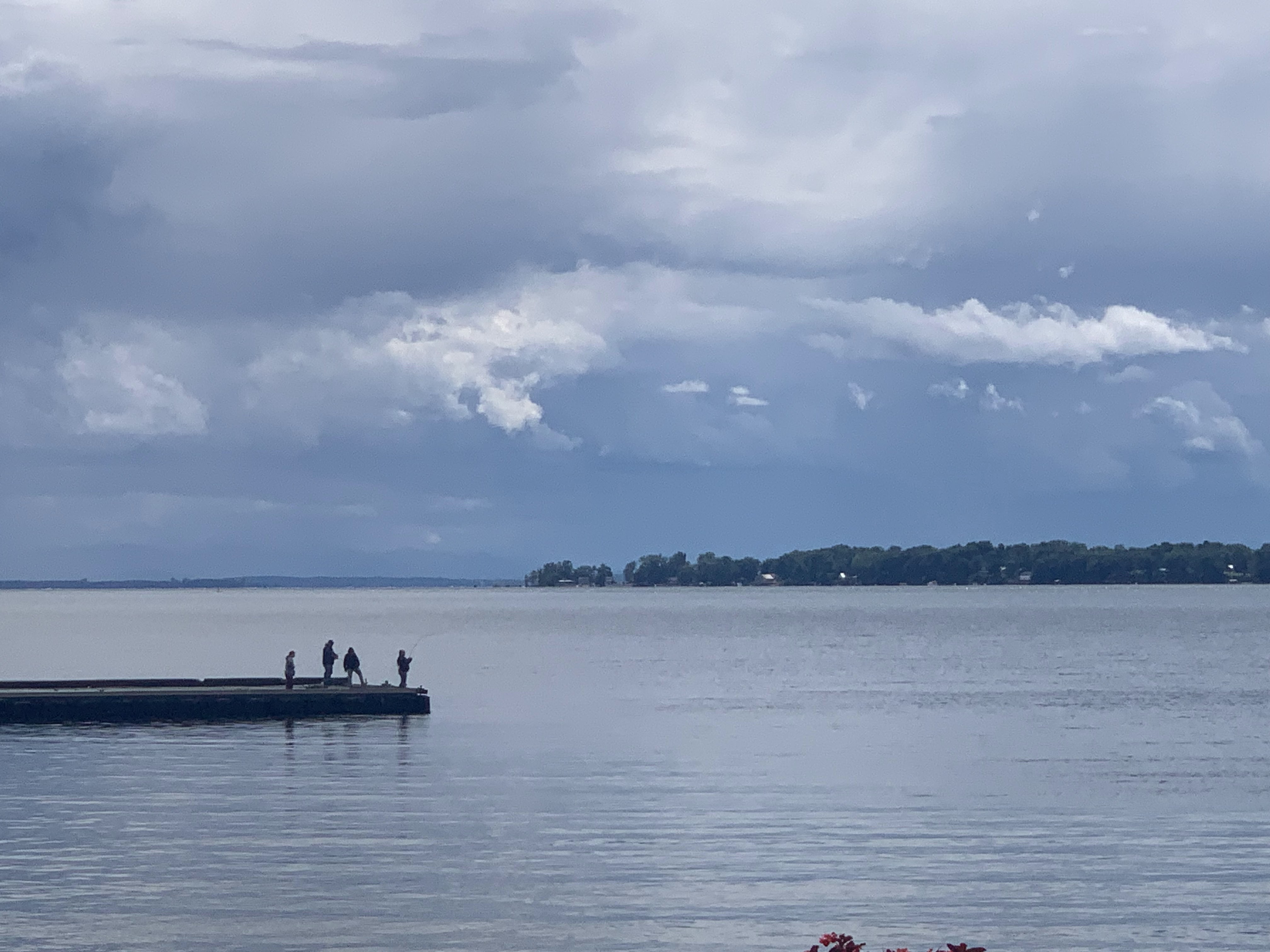
Storm clouds loom over fishing enthusiasts at St. 
Albans Bay, Vermont Sunday afternoon.

I think a few areas a short distance to my north and east have had four or five inches. I noticed some very minor flash flooding around Sheldon Sunday just after an especially intense downpour had passed.

We're near the end of the rainy regime as that pesky upper level low begins to depart. We had quite a few showers around northern Vermont this morning. It was raining at a pretty good clip at around 6:45 am here in St. Albans.

I think those showers will be fewer and further between by this afternoon so you'll be able to get more done outside. 

From there, we have a brighter week with a noticeable warming trend in store. Tuesday will be in the 70s, Wednesday will get close to 80 and by Thursday it should be in the 80s with higher humidity. 

Another cold front appears to be due Friday, so we'll need to watch that for showers and storms.  It might turn briefly cooler, but not chilly by next weekend. 

Long range forecasts, though, suggest any comfortable weather next Saturday or Sunday will be fleeting. If these forecasts are correct, (and that's a big if as forecasts beyond a few days can change dramatically) we could be seeing some awful heat and humidity in a little more than a week from now,

If that happens, I don't know how long it would last or how bad it'll get. But take advantage of the cool weather now to do anything outdoors that would work up a sweat.  

Saturday, September 11, 2021

Can We Ease Northern Vermont Drought Without Flooding Out Southern Vermont

A torrential downpour in South Burlington on Wednesday.
The heaviest rain with Wednesday's storms partly
missed far northern Vermont, which most needs the rain.
We're into that time of year now when we're gradually transitioning out of the normal summer pattern of hit and miss showers and thunderstorms into one where we sometimes get larger areas of rain.

Meanwhile, Vermont is in a weird spot with water needs.  There was too much rain in southern Vermont this summer, and not enough in northern parts of the state. 

 All of northern Vermont within about 30 or 40 miles of the Canadian border are still stubbornly in moderate drought, says the U.S. Drought monitor.

I can sort of confirm that here in St. Albans. We've had some needed rain lately.   But digging through the tough clay soil here two days ago, I found things moist in the top two inches or so of soil, then it was still dusty underneath that.

Also the "Woof River" as we call it here, a tiny stream that runs by our house, is still dry, as it has been since June. 

The drought might or might not continue, but with the normal change in weather patterns, we can hope that northern areas get better rains without flooding out soggy southern Vermont. No guarantees, but here's typical autumn scenarios, from worst to best for southern areas of the state.

DYING HURRICANES

Not a great option for southern Vermont.  Former tropical storms and hurricanes can drop a tremendous amount of rain in the autumn.  Problem is, they usually come up from the south, and can drop their heaviest downpours over southern Vermont.  That would lead to flood problems, but if the rains get far enough north, they can alleviate drought near the Canadian border.

NOR'EASTERS

These coastal storms become more and more common especially as you get toward late autumn. Again, not as great for southern Vermont as they tend to drop more rain there. But if they come inland far enough, northern areas can share in the bounty, too.

Of course, nor'easters can often draw down cold air from Canada and can result in early season snowstorms. 

GREAT LAKES BOMBS

This is a great option for northern Vermont, but can come at a steep price for those who live near the Great Lakes or even northern Plains. 

In the autumn, especially when you get into October and November, storms moving northward from the Midwest into the Great Lakes often "bomb out." They get energy from the still relatively warm Great Lakes and become monster, strong storms.

These can be really, really bad. This type of storm caused the famous "Wreck Of The Edmund Fitzgerald" in 1975, and a November, 2013 example created a large Illinois tornado outbreak that killed 11 people and caused $1.6 billion in damage.

Cold fronts associated with these storms often slow down when they reach the eastern Great Lakes and the east coast. Lots of moisture can ride up along these fronts and cause heavy rain.  Or, a storm can form along one of these slow cold fronts. That sometimes prolongs and intensifies the rains over Vermont.

If we get a few of those storms, that would help

FRIENDLY SOUTHWEST WINDS 

If we get into a long lasting or frequent pattern of a jet stream coming at Vermont from the southwest, that would be a great scenario, especially for northern parts of the state.

That would lead to frequent storms with rain practically every other day.  Each individual storm probably wouldn't drop much rain, but the frequency of these storms would add up. A few of these storms could also scoop up some moisture from the Gulf of Mexico, enhancing the rainfall.

We've sort of been in this pattern for a few days and it looks like it might continue for a few more, so more shower chances are coming. This has helped northern Vermont a little in the past week, and might continue to do so. 

BAD SCENARIOS

Here's two weather patterns common in the autumn which would make the northern Vermont drought persist or even get worse

What I might call a ridge roadblock sometimes sets up in the autumn, in which a strong upper level ridge sets up over southeastern Canada. That would give us delightful Indian Summer weather, with abnormally warm temperatures and lots of sunshine. But it would also deflect storms away from us.  This set up would also tend to steer hurricanes into the southeastern United States instead of recurving harmlessly out in the open Atlantic Ocean

Another common scenario is a deep dip in the jet stream over us or just to the east. That would make it cold here, and deflect wet, juicy storms off to our south and east. We'd be left with almost worthless cold, light rain showers or gusty snow flurries.  And also lousy weather for outdoor fall fun.

I don't really trust long range forecasts, but for what it's worth, many of the predictions I've seen call for warmer than average temperatures. These forecasts are also undecided on whether we'll be wet or dry for the rest of the autumn. 

Again, for what it's worth, the U.S. Drought Monitor is optimistic.  They're predicting we'll get enough rain in the coming weeks and months so that they can remove the drought designation for northern Vermont.