 |
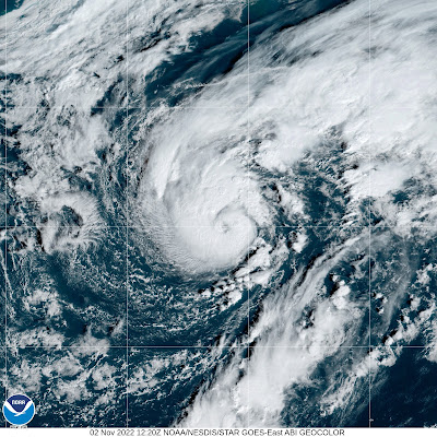
| Satellite view of Hurricane Lisa on approach to Belize this morning. |
However as we opened up November, 2022 on Tuesday, two tropical storms spun up in the Atlantic. One of them, now Hurricane Lisa will hit Belize later today.
The other tropical storm, named Martin is on the verge of becoming a hurricane way out there in the central Atlantic Ocean.
It IS still hurricane season, but stronger upper level winds and cooling water temperatures make it harder for a tropical storm to get going. Such storms are quite a bit less common in November than in October or September..
What's going on now is a little unusual. This is only the third time since at least 1966 we had two tropical systems cranking simultaneously in the Atlantic during November.
And it was quiet recently until now. Before Lisa started getting its act together on Halloween, the last previous tropical system was Karl, which fell apart in the southwestern Gulf of Mexico on October 15.
On the specifics of the storms, Hurricane Lisa slowly intensified all day yesterday and last night, achieving hurricane status this morning. It should strengthen a little more over warm waters on approach to Belize today.
Top winds are forecast to reach 85 mph. The usual, dangerous hurricane hazards apply, besides the wind. Storm surges of up to seven feet could hit the Belize coast. Torrential rains inland will cause dangerous flash floods and mudslides.
Hurricanes are only moderately common in Belize. The small nation has been hit by nine of them since 1966. Also, Belize almost never deals with hurricanes this late in the season. Since 1851, the only other time a hurricane hit that nation in November was in 1942.
Meanwhile Tropical Storm Martin is right on the edge of becoming a hurricane and should do so later today.
 |
| Satellite view of Tropical Storm Martin, almost a hurricane, in the central Atlantic Ocean this morning |
Martin is pretty far north for a developing hurricane, being very roughly halfway between Virginia and Portugal. But water temperatures where it is are a little above normal and instability is strong, so Martin is thriving.
It's also a large sized system and will get bigger in area. It'll get picked up by storminess leaving the Canadian coast.
Martin will convert into a massive and strong, but non-tropical storm moving northeast or north toward Greenland, then take a hard right turn toward an area north of Ireland and Scotland, at least according to current forecasts.
After Martin, we might not be quite finished with tropical systems. Something might get going over the southwestern Atlantic over the next few days.
A tropical or subtropical storm could form, but it's too early to say for sure whether it will and where it would go if it does manage to get its act together. It could potentially bother the Bahamas or even Florida, but that's more than a week away if it does happen.

No comments:
Post a Comment