Showing posts with label Atlantic. Show all posts

Tuesday, October 14, 2025

It's Been A Odd Tropical Storms, Hurricanes Season And The Weirdness Continues

Powerful Hurricane Erin in the central Atlantic Ocean
back on August 16. It's been a really weird 
hurrican
We're nearing the end of Atlantic hurricane season, with just a month and a half to go before things should get safer for another year. 

There's still a chance that more hurricanes could form and even threaten the United States. 

But as it stands now, we're lucky. So far at least, this is the first year since 2015 without a hurricane striking the U.S. coastline.

We needed the break. 

That's not to say tropical storms and hurricanes haven't messed with the U.S.

Moisture from brief, weak tropical storm Barry was a key ingredient into the horrible, deadly Texas floods over the Fourth of July weekend. 

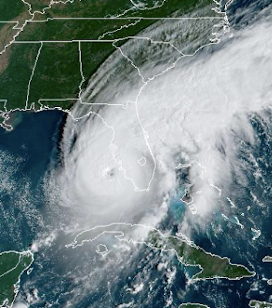
Also in July, Tropical Storm Chantal splashed ashore in South Carolina in July, causing flooding in the Carolinas.

And, offshore Hurricanes Erin, Gabrielle and Humberto sent waves slamming into the U.S. East Coast, sending nearly a Outer Banks, North Carolina dozen homes crashing into the ocean.

This has been a weird hurricane season. It's always been go big or go home. Tropical systems in the Atlantic have either been brief, weak nothingburgers or monsters.

The monsters have all taken a turn north far offshore of the United States. Had this weather pattern been 400 or 500 miles further west, the East Coast would have been raked by repeated strong hurricanes. 

It's been weirder in recent weeks than earlier in the season. We had the drama of Hurricanes Humberto and Imelda setting a record for Atlantic hurricanes being so close to each other. That led to a strange dance between the two storms that changed their directions, and alternately strengthened and weakened both. 

Then we had Tropical Storm Jerry. The disturbance that became Jerry emerged from the west coast of Africa more than a week ago, That's awfully late in the season for something like that to happen.

The African disturbances that can turn into powerful hurricanes usually shut down by the end of September. 

Forecasters originally had high hopes for this storm, figuring Jerry would turn into a decent sized hurricane. But, strong upper level winds keep tearing the storm apart. It stayed a weak tropical storm until it dissipated over the middle of the Atlantic Ocean this past weekend.  

Then we had little-noticed Subtropical Storm Karen. 

Subtropical Storm Karen formed last Thursday, strangely far north in the Atlantic Ocean, at 44.5 degrees north 33 degrees west. That's about the same latitude as Nova Scotia. That's the furthest north such a storm has formed in at least 150 years. 

Subtropical storms are hybrids of the warm core storms that are true tropical storms and regular old storms that have warm and cold fronts and such. 

The water was actually "too cold" to support a tropical or subtropical storm. But because of a pocket of cold air high overhead was such a contrast to the tepid waters below that we were able to get Subtropical Storm Karen. 

It was so far north that its life was a short one. It dissipated Saturday. 

Now we have Tropical Storm Lorenzo, which outdid Jerry for being an incredibly late season African-born storm. 

As of this morning, Lorenzo was struggling just like Jerry did. Stronger upper level winds and dry air are tearing Lorenzo apart. If the storm survives these troubles, it'll head slowly northward and the northeastward out in the middle of the Atlantic.  It won't bother anyone. 

Some models bring a tropical storm or hurricane to the Caribbean Sea or far eastern Gulf of Mexico in a couple weeks, but those long range predictions are notoriously unreliable. 

Monday, September 22, 2025

After A Weird Peak Hurricane Season Calm, Atlantic Ocean Getting Busy.

Hurricane Gabrielle has a classic hurricane look
in a satellite photo taken this afternoon
A very odd spell with no tropical storm activity at the peak of hurricane season in the Atlantic Ocean is over, big time. 

There's a strong hurricane out there now, and there's two more wannabe hurricanes or tropical storms bubbling out there. 

Luckily, there's no real threat to the United States coastline, at least for several days at least. 

Let's go to the hurricane first.

HURRICANE GABRIELLE 

Highest sustained winds in Hurricane Gabrielle reached 120 mph late this morning as it headed slowly northward from a position about 180 miles southeast of Bermuda. 

This qualifies Gabrielle as a major hurricane, because major hurricanes need winds of at least 111 mph. 

It's only the second hurricane of the season, given we had that long quiet period. The trend this year is either big hurricane or wimpy little tropical storms.  All the storms except Hurricane Erin were pretty wimpy, pretty brief tropical storms. 

The exception was Hurricane Erin, which reached Category 5 status in August, them passed well off the U.S. East Coast. It was big enough to cause coastal flooding and beach erosion and dangerous surf, but it thankfully missed us. 

Gabrielle will miss us, too. 

It began its first few days as a wimp struggling with dry air and strong upper level winds. It could have ended up as another lame, small tropical storm.  But in the past three days or so, Gabrielle has really blossomed into a powerhouse. It escaped the dry air, strong overhead winds slackened and warm water fueled the storm.

On satellite pictures today, Gabrielle was a classic looking strong hurricane. It had a distinct eye, with a symmetrical swirl of dense clouds around that center.  It looks like Gabrielle has a chance to strengthen for a few more hours this afternoon and tonight before a weakening trend sets in. 

It'll start accelerating to the northeast and east tomorrow after throwing some gusty outer showers at Bermuda. It's no threat to land, except to the Azores in the eastern Atlantic. It might still be a hurricane when it gets near those islands Thursday night or Friday morning. 

Gabreille will start a weakening trend tomorrow as it encounters colder ocean water and stronger upper level winds 

It will have turned into a nontropical but still powerful storm northwest of Spain by Saturday. The storm could menace the UK as a former hurricane toward Sunday, but we're not sure yet. 

The United States will, like in the case of Erin, see some rough surf and rip currents because of Gabrielle, but that's it for us. But there's other things starting to stir out there.

OTHER SUSPECTS

An area of showers and storms in the central tropical Atlantic is slowly getting better organized, and forecasters think it will develop into Tropical Storm Humberto late this week as it heads northwestward. 

No promises yet, but it's beginning to look like wannabe Humberto might very roughly follow the tracks of Erin and Gabrielle and stay far away from the U.S. East Coast. We'll get a better confirmation of whether or not this is true later in the week, but so far I'm not too worried about this one. Even it develops into a full-fledged hurricane, which seems very possible.

There's another disturbance west of wannabe Humberto that's currently closer to the northern Leeward Islands. It's possible it could turn into Tropical Storm Imelda somewhere over the southwest Atlantic Ocean east of Florida, maybe in the Bahamas. 

Because this one will end up so much closer to the U.S. if it starts to develop late this week, as forecasters expect. Wannabe Imelda could turn into a threat if it develops starting late this week. Nobody is sure on this one yet.  It's nothing to worry about yet, but people in Florida and the East Coast  out to monitor this baby starting this upcoming weekend. 


Saturday, August 9, 2025

Just Calm Down Already About Those Wild Hurricane Forecasts

Despite the hype, we'll go to the National Hurricane 
Center. There's a low chance (in yellow) a tropical
storm might form in the central Atlantic, and a
medium chance (orange) that a storm or huricane
will form further south 
 It's that hazy, crazy time of year when you see those wild hurricane forecasts for a week or two in the future. 

A powerful hurricane will hit Florida! Wait, there will be two giant hurricanes attacking Florida from either side!  Whoops! New England is about to get blasted by the worst hurricane since 1938!  Oh, we lose New Orleans and Houston again!

Of course, it's almost guaranteed we will not see any of the scenarios later this month.  But these forecasts are all over social media, even if they're accompanying by a disclaimer that they're not an actually forecast. (Duh!). 

It's all about clicks and revenue for whoever is posting, you see. 

The forecasts are grounded in just the faintest glimmer of reality. The computer models that meteorologists rely on spit out new scenarios every six hours or so. (Some more frequently).  I've seen all the above scenarios in recent model runs, all happening around August 20 or 21, give or take.

I've written before about these "phantom hurricanes" in computer models. Now that we're getting into peak hurricane season, we've also entered into peak phantom hurricane season.

Despite the fact that the hurricanes depicted a couple weeks down the road won't play out like that in reality, these model runs are still useful.

They're all consistently telling us that the Atlantic Ocean is about to get pretty active with tropical storms and possible hurricane activity.  The model runs are a shot across the bow, warning us to pay attention starting now. 

Nobody can tell you for sure if a hurricane will form, and if it does, where it will go, but something will probably form. If you live in a hurricane prone area, you should finish stocking up the supplied you'll need if you ever receive a hurricane warning 

The fact that we're suddenly seeing hurricanes in the long range forecast is right on schedule. Disturbances  start coming off of the west coast of Africa in the July or the first half of August. Some of those disturbances turn into hurricanes. 

One of them is now in the central Atlantic and has a low chance of turning into a tropical storm or hurricane. If it does, the National Hurricane Center broadly thinks it will head north and not hit land, but again, no promises.

Another disturbance just came off the African Coast and is in the eastern Atlantic. The National Hurricane Center is a little more bullish on this one, so far giving it a medium chance of developing into something. 

This is the one those computer models are depicting, the one that would destroy, Florida, New England, or hell, North Dakota for all I know. 

Again, nobody knows whether this thing will come anywhere near the United States, and if so where and at what strength. As you can see in the map of this post, the National Hurricane Center brings it west to northwestward, ending up somewhere in the tropical Atlantic in several days. The general area they think it might end up is the orange shaded area. 

From there, who knows?  Stay tuned

OVERALL SEASON

The National Hurricane Center this past week updated its forecast for the rest of the season. They're predicting 13 to 18 named storms, including the four tropical storms we've already had. An average season has 14 named storms, meaning tropical storms or hurricanes with sustained winds of at least 39 mph. 

The NHC expects five to nine hurricanes (winds of at least 74 mph) and two to five major hurricanes, with winds of 111 mph or greater. 

Those figures are slightly busier than an average season.

What matters most is where those storms go.  There's some indication the United States East Coast might be a little more vulnerable to hurricanes than usual this year. 

As the Washington Post explained on Thursday, a marine heat wave has developed in the western Atlantic Ocean and Gulf of Mexico. A marine heat wave is when an area of the ocean warms up dramatically to or near record levels. 

If a hurricane encounters those warm waters on the way to the United States, chances are they'll grow to be much stronger than a similar storm that encounters somewhat cooler water. In general, the hotter the water, the greater they chance a hurricane will grow stronger. 

Marine heat waves were a major reason why Hurricanes Helene and Milton proved so destructive when they hit the United States last year. 

Certain weather patterns steer hurricanes toward the East Coast and we seem to be trending toward ingredients that would do that. These include a strong Bermuda High with a westward extension toward the United States that would prevent a westward moving hurricane from the tropics from turning northward, out to sea.

Another ingredient is a strong blocking high pressure system over eastern Canada, which again would steer a hurricane up the coast rather than letting it curve eastward, out to sea

The third ingredient is a dip in the jet stream over the Appalachians. That dip might or might not develop in the coming weeks. But such a jet stream arrangement becomes a little more likely in September, which coincides with what is usually the worst of hurricane season. 

So, when you see those maps into the future on social media, the ones that tell you that your city will be wiped out by a major hurricane within two weeks, honestly just relax.

But don't ignore it. 


Sunday, August 3, 2025

"Slow" Start To Atlantic Hurricane Season Just Started Getting More Interesting

 Now that we're into August, it's time to watch the Atlantic tropics more intently. 

After a slow, but typical start of the Atlantic hurricane
season, the ocean is suddenly abuzz with areas
that might develop into storms. 
Right on schedule, there are signs of life in the tropical Atlantic.  There's nothing dire going on. But it's a sign the danger season is about here.   

As of today, Sunday, there are now two sort of interesting areas in the Atlantic. Neither is a big threat but one of them has potential to be quite a ways down the road. 

The first semi-exciting thing is a small storm forming along an old cold front off the North Carolina coast. The National Hurricane Center gives this thing a 70 percent chance of turning into a tropical or subtropical storm. 

Like the first three tropical systems of this year - Andrea, Barry and Chantal - this thing off the North Carolina coast will be pretty weak and short-lived, if it forms into the fourth named storm of the year, they'll name it Dexter.      

Even weak tropical storms can turn dangerous. The remnants of Barry contributed greatly to the tragic, fatal July 4 weekend flood in central Texas. And Chantal set off destructive flooding in central North Carolina. 

In Wannabe Dexter's case, it should move out into open water and not be a concern. Although a couple models keep it as a weak system but have it hugging the East Coast from North Carolina to New England.   

Since Wannabe Dexter looks lame, it does seem like the 2025 hurricane season is off to a slow start. 

That's actually pretty typical for the early season.  But compared to the hyper-active past few years, the summer of 2025 just seems anemic in the tropical storm department. 

But there's other parts of the Atlantic that's making hurricane forecasters sit up and take notice. One of them is a disturbance off the Southeast Coast that could develop into something late in the week. 

Another, possibly more ominous disturbance is expected to come off the west coast of Africa.  This type of disturbance usually have the potential to develop into a real hurricane, if overall conditions in the Atlantic Ocean work out. 

This one is the first African disturbance that has the potential into developing into something a bit scary. It will be watched carefully once it reaches the central Atlantic Ocean.  It's way too early to figure out for sure if it will indeed turn into a hurricane if so, where it will go. For now, it has a 40 percent chance of developing into...something. 

The bottom line the heart of the hurricane season is just beginning, and hurricane forecasters have to be at the top of their game for the next couple of months at least.  

Wednesday, November 13, 2024

As Northeast Withers/Burns In Drought, Parts Of Canada Soggy

While the parched and fiery Northeast U.S. looks
 on longingly, the west and east coasts of Canada
keep getting drenching rains, which is leading to
some flooding and wind damage up there. 
 Boy, how things have reversed. 

Back in the summer of 2023, drought and wildfires across much of Canada had smoke from those fires belching across the border into the United States, including here in Vermont.

As it rained relentless here in the Green Mountain State, the damp air was tinged with smoke and quite noticeable air quality problems. 

Here we are in the autumn of 2024, and now the Northeast United States is in drought and burning, while parts of Canada soak relentlessly. 

In both cases, persistently stuck weather patterns kept the same conditions going over the same regions for weeks or months. Same thing is happening now, only we're getting the opposite extremes.

In Canada the stormy weather is mostly focused on the Atlantic Coast and way over in British Columbia. 

ATLANTIC

The stuck pattern has storm systems moving northward off the Atlantic Coast of the United States - much too far east to bring any needed rain.  Those storms, though, then get drawn northwestward into places like Newfoundland, Nova Scotia and the far eastern end of Quebec. 

The result is a long slog of rain, snow, ice, and wind in Atlantic Canada. Between Tuesday and Saturday anywhere from about an inch of rain or melted schmutz was expected in eastern Nova Scotia to four inches near St. John's Newfoundland. 

Wind gusts throughout this Canadian region are ranging through the 45 to 65 mph range today. It's really nasty up there. 

Environment Canada, that nation's version of our National Weather Service, is warning of localized flooding and power outages due to this week's wind and rain, 

Up in Labrador, which has never been known for lovely weather, is facing days of snow and freezing rain this week. 

PACIFIC

A series of storms and atmospheric rivers have been slamming into British Columbia this month. The third in a series of storms is hitting British Columbia today, spreading winds strong enough to down power lines, and rains hard enough to cause local flooding. 

The heavy weather is extending down into the United States Pacific Northwest with this round. Flood watches are up for parts of Washington State.

British Columbia is still recovering from an October atmospheric river flood and series of landslides that killed one person and caused damaging floods, including in and around the city of Vancouver. 

THE PATTERN

Those storms that have been hitting British Columbia and the Pacific Northwest have to go somewhere, but they are repeatedly hitting the "wrong" places.

Some of them have crossed the U.S Rockies, creating some snowstorms there. Then they've emerged into the southern Plains and parts of the Midwest, spreading rain, and even floods and tornadoes.  Then, they tend to weaken to nothingburgers by the time they hit the Northeast U.S., so we don't end up with needed precipitation here. 

Then, the remnants of these storms hit the Atlantic Ocean, hit other disturbances and draw lots of moisture from the oceans. They turn into bigger storms that keep hitting Atlantic Canada.

I don't see an end to this pattern for at least a week. Maybe toward the end of the month, there might be a few shifts that bring a change in the weather for all these regions. It remains to be seen. 

Friday, October 4, 2024

The Tropics/Hurricanes Are Now Exciting In Atlantic Ocean, But Thankfully Staying Away

 I've always been impressed by the beauty of satellite photos of strong hurricanes.

Hurricane Kirk way out in the Atlantic Ocean this morning.
Satellite views of strong hurricanes are beautiful, as 
long as said hurricanes are not threatening lives and property.
Don't get me wrong. I hate hurricanes and the lives and property they destroy. We know all too well after Hurricane Helene last week. 

As of Thursday, the Helene death toll had climbed to 213, making it the second deadliest hurricane in the United States in 50 years. Only Katrina in 2005 extracted a higher death toll.  

The Helene death toll is climbing still, as people are still missing. And the suffering in western Florida, Georgia and especially North Carolina continues on.

Hurricane season post-Helene is continuing to be very active, but luckily, two very powerful storms will completely miss the United States.

HURRICANE KIRK

The beautiful satellite photo of the day is Hurricane Kirk. It's a really impressive and large hurricane. Powerful, too, with top sustained winds of 145 mph. .That's a strong Category 4 storm. 

Luckily for everyone, Hurricane Kirk is in the middle of nowhere. This morning, it was about halfway between Florida and the western coast of Africa. It wasn't near any islands to speak of. 

Even better, it's not headed toward land. Kirk is going north, and it will eventually weaken over the colder waters of the North Atlantic. Toward next week, it could become a nasty non-tropical storm in parts of Europe.

The only effects Kirk will have on the United States is large ocean swells that will cause dangerous surf and rip currents along the entire eastern seaboard. The Canadian coast, too. 

TROPICAL STORM LESLIE

There's another one out there, also apparently destined to be a strong hurricane. Which, thank goodness, also won't affect us in the United States.

At the moment, Tropical Storm Leslie is also in the middle of nowhere, well to the southeast of Kirk.  This morning it was kind of halfway between the northeast tip of South America and the westernmost coast of Africa. 

The National Hurricane Center says Leslie had top winds of 60 mph this morning. But it's expected to grow into another powerful hurricane over the weekend, but probably not as powerful as Kirk.

It's heading toward the northwest and that direction will continue through early next week. That should keep Leslie out to sea. Eventually, like Kirk, soon to be hurricane Leslie will move into the cold north Atlantic waters and die out. 

GULF OF MEXICO

If there's any threat coming to the United States in the coming days, it would come from the Gulf of Mexico. 

For a week now, the National Hurricane Center has been eyeing stormy weather in the southern Gulf of Mexico. 

This might or might not develop into a tropical storm next week. It depends on whether the developing system gets tangled up with a cold front coming in from the north or not.

In any event, this will not be another Helene. It'll never get especially powerful. But however it evolves, it does have the potential to produce flooding rains in Florida next week, so stay tuned!

Tuesday, August 27, 2024

Still A Lull In Atlantic Hurricanes, But Pacific Busy, Hawaii On Guard

Hone passing south of Hawaii's Big Island over the weekend.
 An odd lull in tropical storm and hurricane activity continues for now in the Atlantic Ocean, with no signs of a new tropical storm forming for the next few days. 

The Pacific Ocean side of things has gotten busy, though. And that includes a menace to Hawaii.

Tropical Storm Hone (pronounced "ho-NEH") increased to hurricane intensity with top winds of 80 mph as it passed south of the Big Island of Hawaii early Sunday.  

The storm brought tropical storm force winds to parts of the Big Island, along with more than half a foot of rain on slopes that faced the east winds created by Hone. 

Flash flooding was reported in some areas, but overall damage wasn't too bad. A landslide blocked a highway.  High winds blew the roof off at least one home.

Hone weakened somewhat back down to a tropical storm once it got past Hawaii.

Meanwhile, Hurricane Gilma, once a powerful Category 4 hurricane is moving westward in the general direction of Hawaii. It should be somewhere near Hawaiian Islands by the end of the week. But by then, forecasters said, Gilma will have weakened to a swirl of relatively weak winds and showers. 

ATLANTIC

The expected super busy Atlantic hurricane season went into a big stall over the past week with fortunately no activity.  This was a bit unexpected as we approach the peak of what should be hurricane season.  

A welcome sight over the past weeks. No forecasted
tropical storms in the Atlantic from the National Hurricane
Center. This image was on their page Tuesday morning. 

This time of year, disturbances often move off the west coast of Africa into the Atlantic Ocean, where some of them turn into tropical storms or hurricanes. 

 Some meteorologists are saying that in the past couple weeks, the disturbances are moving off the African coast further north than usual.

That puts the disturbances in cooler, drier air than they'd be in had they been further south. The cool, dry air tends to suppress development. 

Ocean temperatures are really warm out there, which is great for developing hurricanes. But the upper atmosphere far above the ocean is also oddly warm.  You need a contrast between a hot ocean and a cold upper atmosphere to create the thunderstorms that eventually turn into hurricanes. 

The lack of a contrast now seems to be helping prevent those thunderstorms from developing.

That said, signs point to tropical activity finally, unfortunately ramping up, perhaps as early as this weekend.  Disturbances coming off the African coast look like they might start drifting further south into the warm, humid air they need to develop.

Other factors also seem to be coming together in the tropical Atlantic to produce storms. So things might get busy after all. By Wednesday, the National Hurricane Center began watching two areas of interest. One stormy area, not far from Bermuda, isn't expected to amount to much. But another system in the middle of the tropical Atlantic. 

That said, there's still no guarantee that new tropical storms will form in the coming week or two. And if they do, it's far, far, far too early to know where they might form and where they'd go.  

Wednesday, July 24, 2024

Where Are All The Hurricanes? They're Unfortunately Still On The Way

Satellite view of Hurricane Beryl in the Caribbean
on July 2. Since then, there has pretty much been
no tropical storm activity in the Atlantic. But experts
say the forecasted very busy hurricane season is
still on the way, with things likely ramping up 
big time during August. 
This year's hurricane season got off to its expected horrible start in late June when Hurricane Beryl, the strongest hurricane in the Caribbean for so early in the season, started its horrible path of catastrophe in the Windward Islands. 

On into early July, Beryl caused disaster and heartache in Jamaica, Mexico, Texas (especially the Houston area), Arkansas, the Ohio Valley, New York, Vermont, New Hampshire, Maine and Nova Scotia. 

Since then, pretty much nothing, thank goodness. Except a nothing burger Tropical Storm Chris on June 30, which lasted barely 12 hours and never produced winds much above tropical storm force. 

This has people asking, "I thought this was supposed to be a super-charged, incredibly busy hurricane season."  

As recently as July 9, the closely watched Colorado State University seasonal hurricane forecast was updated to actually slightly increase the expected number of storms from its previous already record breaking busy prediction. 

So where are the tropical storms and hurricanes? As of Wednesday afternoon, the National Hurricane Center was forecasting no tropical storm development for at least 48 hours, probably even more. 

Ominously, they're still coming. 

Let's just say the National Hurricane Center isn't granting any PTO to its employees in August, September and October. 

After Beryl's departure, vast clouds of dust from the Sahara Desert blew westward across the Atlantic Ocean, precisely in the band in the tropics where hurricanes are most likely to form. 

Saharan dust tends to stifle tropical storm development. These clouds of Saharan dust over the Atlantic are very common in June and July, which is one reason why tropical storms and hurricanes are relatively rare during the first half of summer. 

This year's July dust is by one measure the second-densest since 2002.  However, like virtually every year in history, the dust is getting set to sharply diminish as we head into August.  That'll help tropical storms form. 

There's also a natural cycle that happens every few weeks in which the air over the areas in the Atlantic where hurricanes want to form that causes sinking air. Sinking air prevents the thunderstorms that are wannabe tropical storms from forming. 

That sinking cycle has been over the storm forming region recently, but is now starting to move on. 

So: The dust is going away, the sinking air is going away, the oceans keep heating up more and more, and that's jet fuel for hurricanes.  We're also shifting into a global La Nina pattern which should really start to gets its legs steady in August. 

All those signs point to the Atlantic Ocean exploding with storms during August, especially in the second half, when hurricanes really start to form easily in normal years, much less setups like we're seeing now. 

Already, some long range forecasts are starting to detect signs of a possible tropical storm or storms forming in the first week of August. 

Where all the expected tropical storms and hurricanes go will determine whether we'll have more disasters and calamities like Beryl. 

Thursday, May 23, 2024

Piling On, NOAA Also Says Hurricane Season To Be Nuts

We've listened to a parade of forecasters all this spring say the upcoming Atlantic hurricane season is going to be gonzo crazy. 

Hurricane Ian menacing Florida in 2021.  NOAA
Thursday joined the chorus of forecasters 
expecting an extremely busy hurricane season. 

Now, a week before the official start of the hurricane season, NOAA's Climate Prediction Center is also remarkably confident this hurricane season is one to worry about. 

They give 2024 an 85 percent chance of being busier than average, a 10 percent chance of being pretty normal, and a 5 percent chance that it will be quieter than usual. 

NOAA and National Weather Service meteorologists and hurricane experts rarely give such a confident forecast for an entire storm season. This is the highest confidence forecast NOAA has ever issued in a May outlook, said NOAA Director Rick Spinrad. 

Their forecast calls for 17 to 25 named storms - which are tropical storms and hurricanes with at least 39 mph winds. They call for 8 to 13 hurricanes - winds of at least 74 mph; and four to seven major hurricanes, which have 111 mph winds or higher. 

The average for a season is 14 named storms, seven hurricanes and three major hurricanes. 

Says NOAA:

"The upcoming Atlantic hurricane season is expected to have above-normal activity due to a confluence of factors, including near-record warm ocean temperatures in the Atlantic Ocean, development of La Nina conditions in the Pacific, reduced Atlantic trade winds and less wind shear, all of which tend to favor tropical storm formation."

Forecasters also expect more than the usual number of disturbances moving westward off the African coast into the Atlantic Ocean. These disturbances often form into tropical storms and hurricanes. 

It's rare to have this many factors come together to favor tropical storms, which seems to be giving NOAA that ominous forecast confidence. 

NOAA's forecast is virtually the same as other forecasts from numerous other sources this spring. A closely watched Colorado State University hurricane forecast issued in April predicts 23 named storms, and at least 11 hurricanes. 

NOAA's hurricane forecast, and that of most other forecasters, would bring us close to the record for the busiest season. That was in 2020, when there were 30 named storms.  That year,  the entire United States Atlantic Coast from Brownsville, Texas to Eastport, Maine was under some sort of hurricane or tropical storm warning at one time or another. 

Hurricane season runs from June 1 to November 30 but tropical storms can sometimes form before and after that timeframe. As of this morning there was a disturbance near Hispaniola that hurricane forecasters are watching, but as of today they doubt it will amount to anything.  

What will matter most this year, like every year,  is where hurricanes go once they've formed. The sheer number of storms expected this year makes the chances of one or more hitting the United States greater than it otherwise would be.

Still, the best scenario would be for hurricanes to curve northward well before reaching the United States. That was generally, but not exclusively the pattern last year. 

This year, our luck might run out. I've seen a few forecasts that would favor more westward paths that would bring hurricanes closer to the East or Gulf coasts. 

Up here in Vermont, we're too far inland to have much of a risk from a direct hit from a major hurricane. The last time that happened was in 1938.

However, the Green Mountain State is very much at risk from heavy rains and serious flooding if a dying hurricane or its remnants pass overhead or nearby. 

The last tropical storm to hit us was former Hurricane Isaias on August 4, 2020 which was still a tropical storm on its path from roughly Albany, New York to Rutland, then Newport, Vermont.  Two to four inches of rain fell in western Vermont during that episode, but a drought that preceded Isaias prevented much flooding. 

Winds of up to 50 mph caused power outages in eastern Vermont. 

However, we're rarely not so lucky in those circumstances. We all remember the epic floods from Tropical Storm Irene in 2011. We also suffered from quite a bit of flooding and wind damage in Tropical Storm Floyd in 1999.

After the floods of last summer, which were not caused by any tropical storms, we don't need a disaster like that a second year in a row. Hopefully the hurricanes and tropical storms we're expecting this year stay far from Vermont. 


Friday, April 26, 2024

A Record-Breaking Hurricane Season? One Forecast Group Says So

A University of Pennsylvania team is forecast a 
record busy hurricane season in the Atlantic Ocean
this year. It's the second major prediction that calls
for a potentially chaotic and dangerous season.
A forecasting group from the University of Pennsylvania said they expect a record-breaking Atlantic hurricane season with perhaps 33 named storms.  

If you think I've already written about a hurricane forecast this year, you're right. A  Colorado State University forecast issued in early Apriwhich said 23 tropical storms or hurricanes were in the cards for the Atlantic Ocean this summer and autumn. 

The newer University of Pennsylvania hurricane forecast that just came out is in line with, but definitely more ominous than that Colorado State University prediction. 

The forecast from the University of Pennsylvania team, led by climatologist Michael Mann, actually has a forecast of between 27 and 39 named storms, but 33 is their more pinpointed forecast. If there's 33 named storms, that would exceed the current record for the most number of tropical storms and hurricanes in the Atlantic Ocean in a single season. That was a total of 30 such storms in 2020.

An average season produces about 14 Atlantic storms, about half of which become hurricanes. Seven of the past eight years have been busier than normal hurricane seasons. Warm ocean waters - probably with climate change contributing - have helped force these storms. 

THE REASONING

One big reason for Mann & Co's bullish 2024 hurricane forecast is the already hot water in the Atlantic Ocean in the region where most hurricane develop. Per the Washington Post: 

"The National Oceanic and Atmospheric Administration expects a marine heat wave, or sea surface temperature well above normal, to continue in the tropical Atlantic through at least September. That has forecasters concerned about an active hurricane season because warmer ocean waters typically increase the intensity of storms."

Another reason why the team at the University of Pennsylvania think this year is going to be a blockbuster for hurricanes is that El Nino is rapidly falling apart. El Nino is a periodic warming of the eastern Pacific Ocean.  That warming contributes to strong upper level winds in the upper atmosphere over the Atlantic Ocean.

Those strong upper level winds tear apart thunderstorms that are the building blocks for tropical storms and hurricanes. Rip apart those thunderstorms and you rip apart the chances they'll grow into a hurricane  

Long range forecasts for the summer and fall call for the opposite of El Nino, which is La Nina. That consisted of coolish water in the eastern Pacific and calmer upper level winds over the Atlantic. That would more likely allow tropical storms and hurricanes to form. 

If La Nina fails to develop, the number of expected hurricanes in the Atlantic would decrease this year, Mann says. But only a little. That hot water out there would still contribute to storms. 

TRACK RECORD

Here's something that might make people who don't like hurricanes more nervous. The University of Pennsylvania hurricane predictions in most recent years have more often than not predicted fewer such storms than what actually developed. 

Last year, the University of Pennsylvania team predicted 16 tropical storms and hurricanes. We ended up with 20. Luckily the majority of those missed populated land areas.

In that blockbuster year of 2020, University of Pennsylvania predicted 20 storms, ten less than the Atlantic actually produced.

The last time University of Pennsylvania sort of predicted too many storms was in 2016. They anticipated 19 storms and we got 15. Even so, 2016 was within their margin of error. They actually said there would be 19 storms that year, plus or minus four. 

WHERE THEY GO

What really matters, of course, is where hurricanes go after they form. If they have an opportunity to head north well off the coast and hit cold water in the North Atlantic, then no problem. They just go up there and die.

If a strong Bermuda High is north of a hurricane and that high pressure system extends its influence into the United States, chances are the hurricane would head into the Gulf of Mexico. At that point, anything from Florida to Texas could take a hit, or the storm could just divert to Mexico instead. It depends on the steering patterns over the Gulf. 

If there's a dip in the jet stream in the central United States, that dip could steer a hurricane into the East Coast. If that dip in the jet stream is right along or just off the East Coast, chances are that hurricane would be steered safely out to sea. It all depends on the weather pattern when the hurricane is roaming around out there. 

Of course, the more hurricanes there are, the greater the chance that some will hit land. Which is why the University of Pennsylvania forecast is so worrying. 

Already the Atlantic Ocean is beginning and to throw hints of what might be to come. The National Hurricane Center said Wednesday they were monitoring a swirling disturbance in the east central Atlantic Ocean. 

It looked like a nascent tropical storm, though strong upper level winds were forecast to destroy the small storm before it could grow much.  That one was a fizzle, but soon enough, we'll start having tropical storms and hurricanes that could spell trouble. 


Wednesday, February 21, 2024

Some Forecasters Worry About Potential Big Hurricane Season '24 But There's Caveats

Some forecasters are worries that Atlantic hurricane 
season of 2024 will be busy.  But that all depends
on whether forecasts stay accurate, and where
those eventual hurricanes go 
 There's been some rumblings in the weather news world about a possible hyperactive Atlantic hurricane season this year.  

I've got the reality in this post.  Probably good to know if you live in a hurricane prone area of the United States. Or even an inland area that can get nailed with severe flooding from an ex-hurricane that has moved inland.  

Vermont readers: That can mean us. See: Great New England Hurricane of 1938 and Tropical Storm Irene in 2011. 

The bottom line is that a combination of super hot water already simmering in the Atlantic Ocean where hurricanes tend to form and a waning El Nino has forecasters nervous. But not panicked. 

HERE'S WHY

First: The hot water. The near-record to record warm sea surface temperatures extend all the way fro the African coast to the Caribbean. 

As the Washington Post explains,  the area of the Atlantic Ocean where hurricanes are most likely to develop is running hot. At last check, this area is running 1.1 degrees Fahrenheit higher than any other year on record, says Philip Klotzbach, a tropical meteorologist at Colorado State University.

 If the above normal temperatures in this broad area continue, a disturbance coming off the African coast has plenty of opportunity to strengthen on its long journey westward. 

All other things being equal, warm water helps hurricanes grow. The hotter the water, the hotter the hurricane, unless atmospheric conditions somehow interfere with the storm's development. 

El Nino, that periodic warming of the Pacific Ocean, can easily create atmospheric conditions over the Atlantic that can muck up a wannabe hurricane's fight for survival. El Nino often produces stronger upper level winds over the Atlantic Ocean. Those strong winds rip apart thunderstorms that are the initial ingredients for hurricanes. 

Or a hurricane can run into that buzzsaw of high winds and weaken into oblivion as a result. 

The problem now is that El Nino is widely expected to fall apart this spring, possibly to be replaced by the opposite La Nina by summer and autumn.  That's the peak of hurricane season.

La Nina does the opposite of El Nino, tending to calm upper level winds in the Atlantic.  Which gives hurricanes "permission" to grow. 

Of course, it's still well before hurricane season, and a lot can change. 

Perhaps we might find increased levels of dust blowing from the Saharan desert westward into the skies over the Atlantic Ocean. That would dim the sun, blunting the warming that's now going on in the water.

Maybe the forecast of a dying El Nino is wrong. Forecasters say conditions favor El Nino ending, but it's not any kind of guarantee.

What matters most is where hurricanes go.  If you get a bunch of strong hurricanes, but they curve harmlessly northward and die over the cold North Atlantic without hitting land, then who cares?

The problem obviously comes when a strong hurricane hits land somewhere. There's no good way to know this early in the year where hurricanes will hit. In fact, we usually have no idea of a hurricane's future path until after it actually forms. 

WHAT TO DO NOW 

The advice for anybody living in a hurricane prone area now is to just think about how to fortify your property against hurricanes. Does your insurance policy cover all aspects of hurricanes, including wind damage, storm surge and inland flooding? 

Insurance in many hurricane prone areas is very expensive, hard to get and doesn't provide adequate coverage. Unfortunately, you might have to plan for that. 

If you can afford it, you should probably have a "hurricane fund" set aside that you can dip into to cover expenses associated with these storms. 

You have to think about transportation and lodging if you end up under evacuation orders, buying supplies to gird your property against approaching hurricanes, and money to cover repairs not covered by insurance. 

Also, think about where you'd go if forced to evacuate.  And what you'll need in your home during a hurricane if you don't evacuate. Things like adequate food that you can prepare even if you have no power, non-perishable goods that can survive safely without refrigerations. And don't forget stuff for your pets. 

The chances of a strong hurricane hitting a particular spot on the U.S. coastline is low. But the chances of a big hurricane hitting somewhere in the U.S. is reasonably high.  This year, those chances appear a little higher than in many past years. 

Also, ignore the hype.  It's true forecasters are concerned about the upcoming hurricane season. But the social media hype machine takes it to a whole unreasonable new level. I've seen things already from clickbait that "guarantees" massive hurricane destruction in the U.S. later this summer and fall.

Spoiler: There are no guarantees. 

Even legitimate weather publications are guilty of clickbait. A recent headline: "AccuWeather Sounds Alarm Bells: Super-Charged Hurricane Season Possible in 2024."

Then if you take the time to read the actual AccuWeather article, it's reasonable, accurate and doesn't contain scare tactics.  So take your time with these articles. 

I also can't part without bringing up my favorite target. Climate change.  A big reason why the Atlantic is so hot to begin with is because the world is warmer as we continue to belch greenhouse gases into the atmosphere. 

Ocean temperatures will always fluctuate, but the trend will be up, up, up as the years and decades go by. So this worry over super big hurricanes won't be one-off just for 2024. 

Friday, September 29, 2023

Running Out Of Atlantic Tropical Storm Names Again?

Hurricane Lee off the U.S. East Coast on Sept. 14.
There's been a near record number of tropical
storms and hurricanes in the Atlantic this year. 
 It might not seem it, but it's been an incredibly busy tropical Atlantic hurricane season so far. 

At the moment, Tropical Storm Phillippe is wandering aimlessly in the central Atlantic. Tropical Storm Rina also formed way out there the other day. 

Another trailing system has a decent shot at building into a tropical storm.  The hurricane season lasts through November. And there's now only four names left on the 2023 hurricane or tropical storm list: Sean, Tammy, Vince and Whitney

It doesn't seem like it's been that busy because most storms have mercifully not made landfall.  So far, only Hurricanes Idalia and Lee, and Tropical Storm Ophelia have caused much trouble in the United States. Yeah, they were all bad, but it could have been a lot worse. 

Most tropical storms and hurricanes have stayed out over water. Many of them moved north into colder water and petered out without causing any harm. 

If we run out of hurricane names this year, it will be third time that's happened. 

The first time the Atlantic Ocean basin ran out of names was the horrid season of 2005. That's the year that brought us the huge disasters Hurricanes Katrina, Rita and Wilma, along with other destructive land falling hurricanes in the United States. 

In 2005, they resorted to using Greek names to deal with the last six tropical storms in the Atlantic basin.

Then came 2020 with a total of 30 named storms.  The National Hurricane Center ran through their name list early that season, resorting to the last of the names on the official list with Tropical Storm Wilfred on September 17, barely past the halfway point of the hurricane season. 

The rest of the 2020 season featured a confusing list of Greek named storms, including Delta, Zeta, Eta and Theta.

The whole point of naming tropical storms and hurricanes is to avoid public confusion. If two storms with distinct names happen at the same time, like this year's Hurricane Lee and Margo, it's easy to tell which one is which, and which hurricane you should worry about, and which one you can safely ignore. 

To solve the Greek letter problem if there are too many hurricanes and tropical storms, the World Meteorological has come up with a "B" list of sorts, names to use in the event we run out. So, if we get past Whitney in the Atlantic this year, we'll then go with Adria, Braylen, Caridad etc.   

It's a little odd that there have been so many tropical storms this year.  We're now in an El Nino pattern, which tends to squelch Atlantic tropical storms and hurricanes due to strong upper level winds.

Those winds have materialized due to El Nino. But the Atlantic Ocean is at record warm levels, which is jet fuel for wannabe tropical storms. So, tropical storms are forming left and right. The strong upper level winds are keeping many of these storms, like the current Phillippe and Rina on the weak side, so I guess we can be happy for that. 


Monday, August 21, 2023

As Hilary Floods Subside, Atlantic Ocean Tropical Storms Blossom Quickly

The Atlantic Ocean suddenly blossomed with tropical
storms and potential storms over the weekend. 
 As expected Hurricane Hilary, down to tropical storm status Sunday drenched southern California and surrounding areas with inches of rain. 

Also as expected, there's widespread flooding, mudslides, road washouts, fallen trees and power outages. Unexpectedly, a 5.1 earthquake centered under Ojai, California shook the Los Angeles area. Luckily, the earthquake did not add much to the extensive damage from Hilary. 

Sone of the worst  or most disruptive damage I saw was that both lanes of heavily traveled Interstate 10 near Palm Springs, California was washed out. Traffic was backed up for miles and miles, and it looked like on video a few cars got caught up in in the flooding and mud flows. 

While all eyes were on Hilary, the Atlantic Ocean suddenly blew up with tropical storms. Three tropical storms - Emily, Franklin and Gert quickly formed in the Atlantic tropics and a fourth tropical storm seems set to form as early as today in the Gulf of Mexico.

There's two opposing factors acting in the Atlantic right now. One of them encourages tropical storms, the other discourages them from getting powerful.

The Atlantic Ocean waters overall are at record high temperatures right now.  Tropical storms and hurricanes thrive on warm water - the warmer the better.  That toasty water makes it easier for tropical storms to form, so that's a large reason why we suddenly have so many. 

The opposing factors is El Nino.  That's a periodic warming of the eastern Pacific Ocean that's well under way right now. It's expected to continue for several months at least. El Nino tends to drive up the world's temperatures. Combined with climate change, El Nino is largely responsible for record heat around the Globe this summer. 

El Nino also tends to increase upper level winds over the Atlantic Ocean. Those strong high level winds tear apart the thunderstorms that fuel tropical storms and hurricanes, so they can't develop well. 

That so far seems to be tempering the ability for all those storms in the Atlantic from becoming dangerous.  The caveat is if any of the storms wander into an area with lighter winds up high, they can finally blossom big time. Were that to happen near a coastline a rapidly developing hurricane could be scary, as you might imagine.

Tropical storms and hurricanes can also surprise forecasters, so you alway have to keep an eye on them.  So far, though, these storms are not much of a threat, except for one that threatens Hispaniola with heavy rain and another that hasn't quite developed yet in the Gulf of Mexico.

Let's briefly look at each storm:

EMILY: This is the most distant of all the storms, hanging around way, way out in the central Atlantic Ocean far from any land. As of this morning Emily's top winds were 40 mph, so it's barely strong enough to be regarded as a tropical storm.

Those strong upper level El Nino winds are ripping thunderstorms away from its center, and Emily is expected to pretty quickly fizzle out as it moves northwestward then northward in the central Atlantic. I wouldn't worry much at all about this one. 

FRANKLIN: So far, Franklin is the worst of the bunch, though of course it's nothing extreme compared to many Atlantic Ocean monster hurricanes of the past. 

Of course, Franklin isn't even a hurricane, just a tropical storm, given that its top winds are around 50 mph. It's in the central Caribbean Sea, and it's about to turn northward and head to Hispaniola in the next few days.  It threatens to bring heavy rains, flooding and mudslides to that island and to Puerto Rico.

El Nino's upper level winds are affecting Franklin, but not as much as it is for the other systems in the Atlantic. Franklin is not forecast to strengthen much on its way to Hispaniola.  It might end up becoming a hurricane after it gets north of that island at a point far south of Bermuda.

There's a slight chance that Franklin could eventually affect parts of Atlantic Canada in a week or two, but the risk so far appears low. But it bears watching. 

GERT: Tropical Storm Gert is the oldest but lamest of the bunch.  It struggled all day Sunday as a tropical depression, not even strong enough to be called a tropical storm. But its winds managed to increase to a still paltry 40 mph last night, so it got named Tropical Storm Gert. 

Gert was rapidly falling apart this morning, so we can just forget about it

WANNABE HAROLD:  If the storminess in the Gulf of Mexico becomes an actual tropical storm, it will likely be named Harold.

Wannabe Harold looks like it will indeed develop into a tropical storm and start heading westward. It has a good shot at being a threat to southern Texas or northeastern Mexico late in the week

HOW THIS AFFECT US

So far, tropical storms are absolutely no threat to us here in Vermont. Which is good news. After all the flooding we had this summer and the wet ground we have now, the last thing we need is a tropical storm. 

None of the storms I mentioned are any kind of threat to us. Moreover, we should hope the weather pattern we have this week persists through hurricane season.

The northwest flow from southern and central Canada that we have now would tend to push any northward moving hurricane offshore.  

We wouldn't want to have the weather pattern we did in July. That one featured an upper level low to our northwest and a dip in the jet stream over or near the Great Lakes. That pattern would have on occasion drawn a northward moving hurricane or tropical storm toward New England. That wouldn't be good. 

So, despite the clouds and light showers this morning enjoy an otherwise dry week for a change. 


Wednesday, August 16, 2023

Dora The Explorer: Recent Hurricane Had Incredible Journey

A recent hurricane was dubbed
"Dora The Explorer" for its
long trek through two
oceans. 
Hurricane Dora popped up in the news in a tragic way.

It, and a high pressure system far to its north, helped created the strong winds on Maui that led to those those horrible wildfires. The death toll is now a horrible 106 people, and could easily rise further. 

Far less importantly, but pretty interesting nonetheless is the incredibly long journey Dora and its earlier ingredients as a tropical disturbance took.  The storm had such a long journey that it was inevitable dubbed Dora the Explorer.   

Hurricane experts first noticed what would become Dora on July 17, just off the west coast of Africa.  It moved westward across the Atlantic, briefly almost becoming a tropical storm or at least tropical depression on July 22 before reaching the Central American coast around July 28.  

Upper level winds over the Atlantic Ocean prevented wannabe Dora from becoming a tropical storm. And, being over the Atlantic, had it become a tropical storm, it would have been named Emily.

Anyway, wannabe Dora crossed over the mountains of Central America and landed over the Pacific Ocean on July 29.  Conditions were far more conducive for development over the Pacific, so by August 1, Dora became a hurricane and began its long trek westward across the Pacific Ocean. 

Dora was a beast over the open Pacific Ocean, lasting at least four days as a Category 4 hurricane with winds up to 150 mph near its eye. 

Last Friday, Dora became only the second hurricane on record to survive a trip across the eastern, central and now western Pacific basin, as the Washington Post noted. 

The only other hurricane known to accomplish this feat was Hurricane John in 1994.  Most hurricanes sputter out in the central Pacific Ocean because the water is cooler there, the air is often drier, and wind shear that's common in that area usually tears hurricanes apart. 

One possible reason why Dora was so persistent was its construction.  Most hurricanes look like spirals.  Dora was known as an annular hurricane. That means on satellite photos it looked more like a doughnut than a spiral.

Annular hurricanes like Dora can fend off dry air intrusions and upper level winds that would otherwise rip a hurricane apart. 

On Friday, Dora crossed the International Date Line at 180 degrees longitude. That put it in the western Pacific basin. Since it was now on the Asian side of the Pacific, it forced a rename: It was now Typhoon Dora, not Hurricane Dora. 

Last we checked, Typhoon Dora was finally weakening into a tropical storm somewhere in the western Pacific Ocean. 

Saturday, May 27, 2023

Hurricane Season Forecast Issued; A Really Complicated, Iffy Forecast

Satellite view of Hurricane Ian about to make landfall
in southwestern Florida last year. The number of
expected tropical storms and hurricanes this
year is really a tossup, according to forecasters. 
NOAA released its official hurricane season forecast on Thursday, and there are a lot of ifs and maybes win that prediction. 

There's two opposing forces going on in the Atlantic this year. One factor could give us a lot of hurricanes, but another factor could give us a lighter year than in the recent past. 

NOAA is pretty much splitting the difference, calling for a near-average hurricane season. 

On one hand, El Nino is developing, and that tends to help squelch hurricane activity in the Atlantic. On the other hand, thanks in large part to climate change, the Atlantic Ocean is much warmer than historical averages, and is expected to stay that way all summer and early fall.

Warm water tends to encourage more hurricane development. So the question is which will win out?

NOAA's annual hurricane forecast gives what they believe are the percentage chances of an above normal, quieter than average or typical hurricane season. This year's version really shows what a tossup the season is. 

NOAA tells us there's "a 40% chance of a near-normal season, a 30% chance of an above normal season and a 30 percent chance of a below-normal season."

Yeah, that doesn't tell us much.  I guess the prospect for Atlantic hurricanes this year is anybody's guess.

For the record, NOAA says we should expect 12 to 17 names storms (ones with winds of 39 mph or more) and five to nine of these would be hurricanes, with winds of 74 mph or higher. One to four of these would be major hurricanes with winds of 111 mph or more.

NOAA says it has a 70 percent confidence in these numbers. Again, pretty uncertain. 

Hurricane seasons in the past six years or so have been super active in the Atlantic Ocean, with several devastating hurricanes. Last year, two of them, Hurricane Fiona and especially Hurricane Ian, caused billions in property losses in Puerto Rico, Canada and Florida. 

Other hurricane forecasts for this year in the Atlantic Ocean vary. The British Met Office predicts a busy year, with 20 named storms, compared to an average of 14. The Met Office expects around 11 hurricanes, with around five major hurricanes. 

Colorado State University also issues closely-watched Atlantic hurricane forecasts. They're predicting a comparatively light storm season, with 13 named storms and six hurricanes. 

The two opposing forces - El Nino and the warm ocean water, could create a lot of nuances in the hurricane season. It's possible the warm water will generate lots of relatively weak, disorganized tropical storms that don't last long. Strong upper level winds generated by El Nino could rip them apart.

Or, the opposing forces could just re-arrange where the severest storms form.  As the Associated Press reports, University of Miami hurricane research Brian McNoldy says it's possible that El Nino would suppress hurricane activity in the Caribbean, but shift more activity northward to near Bermuda and the U.S. East Coast.  

Whatever the number of tropical storms and hurricanes we see this year, remember, it only takes one to really strike a catastrophic blow. 

An often used example is the year 1992. Overall, it was a very quiet year, with just seven tropical storms, hurricanes or sub-tropical storms. But one of the storms was Hurricane Andrew, a Category 5 monster with 175 winds that devastated much of South Florida. It directly caused 26 deaths and $25 billion in damage. 

Also, note that places that were struck by severe hurricanes in recent years have not yet fully recovered. .Any new hurricanes striking the same areas would be especially catastrophic.

Given all the uncertain hurricane forecasts out there, we'll just need to hope for great luck with these storms. 


Wednesday, November 2, 2022

Two Late Season Hurricanes Blossoming In The Atlantic

Satellite view of Hurricane Lisa on approach to
Belize this  morning. 
 Hurricane season isn't over, but activity usually wanes quite a bit in November. 

However as we opened up November, 2022 on Tuesday, two tropical storms spun up in the Atlantic. One of them, now Hurricane Lisa will hit Belize later today.  

The other tropical storm, named Martin is on the verge of becoming a hurricane way out there in the central Atlantic Ocean. 

It IS still hurricane season, but stronger upper level winds and cooling water temperatures make it harder for a tropical storm to get going.  Such storms are quite a bit less common in November than in October or September..

What's going on now is a little unusual. This is only the third time since at least 1966 we had two tropical systems cranking simultaneously in the Atlantic during November. 

And it was quiet recently until now.  Before Lisa started getting its act together on Halloween, the last previous tropical system was Karl, which fell apart in the southwestern Gulf of Mexico on October 15. 

On the specifics of the storms, Hurricane Lisa slowly intensified all day yesterday and last night, achieving hurricane status this morning.  It should strengthen a little more over warm waters on approach to Belize today. 

Top winds are forecast to reach 85 mph.  The usual, dangerous hurricane hazards apply, besides the wind. Storm surges of up to seven feet could hit the Belize coast. Torrential rains inland will cause dangerous flash floods and mudslides.

Hurricanes are only moderately common in Belize. The small nation has been hit by nine of them since 1966. Also, Belize almost never deals with  hurricanes this late in the season. Since 1851, the only other time a hurricane hit that nation in November was in 1942.

Meanwhile Tropical Storm Martin is right on the edge of becoming a hurricane and should do so later today. 

Satellite view of Tropical Storm Martin, almost a 
hurricane, in the central Atlantic Ocean this morning

Martin is pretty far north for a developing hurricane, being very roughly halfway between Virginia and Portugal. But water temperatures where it is are a little above normal and instability is strong, so Martin is thriving. 

It's also a large sized system and will get bigger in area. It'll get picked up by storminess leaving the Canadian coast.  

Martin will convert into a massive and strong, but non-tropical storm moving northeast or north toward Greenland, then take a hard right turn toward an area north of Ireland and Scotland, at least according to current forecasts. 

After Martin, we might not be quite finished with tropical systems.  Something might get going over the southwestern Atlantic over the next few days.    

A tropical or subtropical storm could form, but it's too early to say for sure whether it will and where it would go if it does manage to get its act together. It could potentially bother the Bahamas or even Florida, but that's more than a week away if it does happen.  

Sunday, August 21, 2022

A Welcome Hurricane Drought, But How Long Will It Last?

Hurricanes and tropical storms lined up in the 
Atlantic Ocean, September, 2018. It's been a 
slow hurricane season so far, but by next month,
we could well be seeing satellite images
very much like this one. 
 Unlike in recent years, we in the United States and people in the Caribbean have gotten most of the way through this August without a destructive hurricane. 

Which is a very great thing, considering all the other extreme disasters that have befallen parts of the United States and the rest of the world this summer. We've had quite enough trouble with extreme flash floods, drought, wildfires and the like, thank you. 

All the forecasts leading up to hurricane season said we'd have another very busy year in the tropics. And we still might. Right around August 20 is when things normally start to really heat up, as we head toward the peak of hurricane season, which is around September 10 or so.  Big time, bad hurricanes can happen anytime between now and roughly the middle of November.

So far, though, it's been quiet. We had three relatively small tropical storms earlier this year. The biggest, Bonnie, became a hurricane after it completed a rare feat of crossing Central America and winding back up over the Pacific Ocean.

More recently, what would have been Tropical Storm Danielle fizzled yesterday as it failed to get its act together and splashed ashore as disorganized batch of thunderstorms in northeastern Mexico.  The National Hurricane Center is watching another disturbance off the west coast of Africa. It'll take awhile for that one to develop into anything, if it does at all. 

So far, we have gone 320 days without a hurricane in the Atlantic Ocean. That puts us in the top ten list of longest periods of time with no hurricanes.

This is quite a change from recent Augusts.  In August, 2017 Hurricane Harvey unleashed an unprecedented flood in Houston and other large swaths of Texas. 

August, 2020 was part of the busiest Atlantic hurricane season on record, and brought Hurricane Isaias to the East Coast and super-destructive Hurricane Laura to Louisiana.  Last August, Hurricane Ida, as strong as Laura the year before, hit Louisiana, and later unleashed deadly flash floods in and near New York City. 

The 2022 hurricane season up to this point is actually not all that much quieter than normal. By now, we've usually had about four tropical storms or hurricanes. We've had three. Early season storms, the ones that come before about now, are more often than not relatively weak. Almost all major hurricanes have occurred after August 20.

The season has been relatively quiet so far because a lot of dust has been blowing off the Sahara Desert and out into theAtlantic Ocean. That dust tends to squelch hurricanes. It also looks like the Bermuda High, that traditional heat pump, has often been further north than  normal.  

That has allowed that Bermuda High to pull some of the hot, dry air that has been torturing Europe all summer out into the Atlantic Ocean. The dry air can inhibit tropical storms. 

Slow starts to season like this one can easily flip to busy ones, and that's still the prediction for this year. We can look to 1999 as an example. There was pretty much nothing until August 18, then 11 tropical storms, including eight hurricanes formed in the next three months after mid-August. 

One of those 1999 storms, Hurricane Floyd, unleashed a horrible flood in the Carolinas, and here, in Vermont, caused one death, along with some wind and flood damage.   

Yes, we can hope the rest of the 2022 hurricane season is slow, and hope that those predictions for a busy year were just a hot mess. Or if it does get busy, we can pray all the storms curve harmlessly out to sea.

But I wouldn't count on any of that. A lot can happen with hurricanes, especially in the peak season from now into October.