Showing posts with label Fourth of July. Show all posts

Friday, July 4, 2025

After A Stormy Vermont Thursday, A Delightful Fourth, And Then Summer Returns

The first round of strong to severe thunderstorms
approaching South Burlington, Vermont early
Thursday afternoon. The storms caused scattered
wind and hail damage throughout the state, and 
disrupted some pre-Fourth celebrations 
 That NOAA outlook for yesterday indicating Vermont and the rest of New England should watch out for severe thunderstorms certainly came true. 

Numerous reports of wind damage and hail came in from all six New England states, along with New York and New Jersey and eastern Pennsylvania. 

Here in Vermont, two rounds of strong storms hit, one early in the afternoon, the next toward evening. 

The evening round surprised me a bit because it was the stronger of the two, and came after cooler air had already started arriving. 

It shows that some summertime weather disturbances can really pack a punch, even if they're not really feeding on hot, humid air to power them. 

Two rounds of damaging storms blew through Thursday. 

The first round in the early afternoon mostly affected mostly northern Vermont, knocking down trees near Keeler Bay in the Champlain Islands and cutting power to areas in and around St. Albans. The early afternoon storm knocked over a tree onto a parking lot at the University of Vermont, damaging a car.

That first line of storms made its way down to Rutland County by mid-afternoon, dumping hail. Hail the size of ping pong balls pelted East Wallingford, and quarter sized hail hit Danby. I'm sure a few people there have dented cars this morning.  

The second batch of storms roared out of New York State, crossed Lake Champlain and basically traveled down Interstate 89 before cutting through east central Vermont.  Winds at Sand Bar State Park in Milton gusted to 58 mph.

 More trees and wires came down in parts of Burlington, and in Essex, Montpelier and certainly a few other places.

At one point Thursday evening, about 8,500 homes and businesses were without power in Vermont.

Burlington does its fireworks display on July 3 and a crowd had already gathered at the city's waterfront when this storm hit. The storm prompted a hasty evacuation as lightning crackled overhead. The storms moved on pretty quickly, so fireworks later in the evening went off without a hitch, however. Montpelier also cut off its Fourth of July festivities Thursday due to the severe weather. 

 That second round of storms brought some cold air down from aloft. Thursday evening was chilly!  Temperatures were only in the upper 50s in parts of the state in the hours before sunset. 

Overall, Thursday was one of the busiest and most disruptive storm days in Vermont's 2025 severe weather season

TODAY/WEEKEND

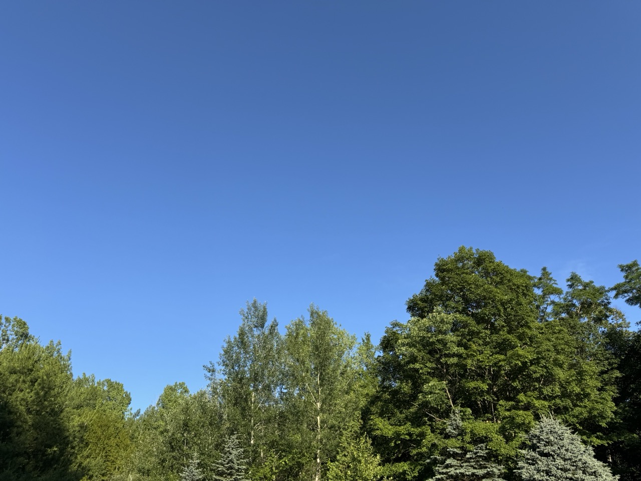
Today, the Fourth of July, will certainly not be one of the stormiest days of the summer. 

There are a bunch of so-called "fair weather clouds" out there. Air high above us is still chilly. The strong early July sun creates updrafts of air. Moisture in that rising air condenses into clouds once it hits the cooler air, so you get some clouds. 

The sun will be in and out all day. The sunniest area will be the Champlain and Lower Connecticut River valleys.  The cloudiest areas will be in the Green Mountain and Northeast Kingdom. But everyone should see at least some sun for the rest of the day. 

Towns holding fireworks displays this evening should be A-OK, with partly clear to clear skies and great visibility. You might want to bring a light jacket. Temperatures should drop from the 70s to the low and mid 60s after sunset. Those temperatures should bottom out in the 50s by early Saturday morning, with some 40s in the cold spots.

Saturday looks awesome with generally sunny skies, and temperatures in most spots reaching the 80s. 

We're still looking at a brief squirt of hot,  humid air Sunday. Many Vermont communities will make it to at least 90 degrees.   

Tuesday, July 1, 2025

After A Classic Vermont Summer Day, We Get Classic July 4 Week Changeable Summer Weather.

My two favorite colors on a summer day. A deep blue 
sky and the rich green of late June trees. Which made
Monday in Vermont a perfect summer day. 
Today, the humidity is back. 
I hope you loved the Vermont weather on Monday.

It was my favorite kind of summer weather. I call them blue/green days, for the two colors that dominated a perfect summer day. 

The wildfire smoke that plagued the skies of Vermont, and most of the United States has diminished for now. 

That left us with deep blue summer skies and hills and Vermont mountains glowing a luxurious, verdant  green.  

After a cool, comfortable start, it turned out to be a very warm day. Burlington just missed another 90 degree day, topping out at 89. 

But it wasn't humid at all. A cool dip in the water, followed by a slight breeze on your wet skin in the relatively dry air cooled you off nicely. 

If you weren't at the beach and opted for a hike or gardening or some other outdoor activity, it was comfortable despite the warmth, especially if you kept to the shade.  A classic summer day. 

TODAY

Well, that's over, and the humidity is back. We'll be dealing with that on and off at least through August, so get used to it. The classic summer weather is continuing, but not in the fashion everybody loves, I guess. 

In the Champlain Valley, it never really cooled off last night. It was still 81 at 2 a.m. At dawn, after some rain arrived, it was in the mid 70s with a dew point of a sticky 69 degrees.

That mugginess will be the theme of the day. 

This morning should be the wettest part of the day.   One band of downpours was heading into central and northern Vermont as of 6:30 a.m.  Showers should be around much of the morning.  

We'll get pretty warm again today, with highs in the mid 80s in many places. But the humidity will make it feel worse. A humid day with a cold front approaching is a recipe for lots of severe storms, so you'd think we need to really be on our toes today.

However, we won't see widespread storms.  A lot of clouds will linger, and there's not a lot of upper air support for organized severe weather.  So it's not a great environment for a wild storm day. 

Central and southern Vermont could have a one or two strong or marginally severe storms, but most of us will see garden variety downpours this afternoon, if anything. It'll all be hit and miss, with perhaps half or more of Vermont being in the miss category this afternoon and evening. 

NOAA also has Vermont under a marginal risk of flash floods, but that's a really low risk today. There might be isolated minor problems, but the downpours won't be lingering in any one place for too long, which minimizes the danger. 

The real flood problems look like they'll be in the Mid-Atlantic States, where torrential rains will hit areas that experienced flash flooding on Monday. 

 WEDNESDAY

The "cold front" coming through later today is just a humidity front. In other words, it won't be any cooler on Wednesday than today, but the humidity will be somewhat lower. It won't exactly be Sahara Desert dry, you'll still feel some mugginess. But it won't be awful as temperatures rise once again into the 80s

THURSDAY

This might be another one of my favorite type of summer days, but in a different way than Monday. Another cold front will be coming in, and a chilly pocket of air will move in high overhead. That'll create some beautiful tall billowing clouds that will develop into showers and scattered thunderstorms.

This is shaping up to be yet another version of a  classic Vermont summer day.  The kind where you lie down in the grass and watch the clouds keep making new shapes. At least until the showers arrive. 

That type of day looks best if there is deep blue sky between the clouds. Unfortunately, a little wildfire smoke from Canada could make things a bit hazy, but it still looks like a pretty day. You'll just be dodging scattered storms. It will probably not be the best day to be out on the lake or on mountain summits, given the risk of lightning and thunderstorms. 

There is a marginal risk of one or two strong storms.  Since there will be cold air aloft, the very strongest storms could produce some hail and some gusty winds.  We'll keep an eye on this to see what future forecasts bring. 

FOURTH OF JULY AND BEYOND

It still looks like July 4 will be cool and partly sunny with rock bottom humidity, so that'll be nice for watching the parades. Maybe.

Some forecasts keep an upper level low nearby, which would create a rather overcast Fourth of July for the Green Mountain State. We'll wait and see on that. But at least we know it won't be blazing hot. OK, a cool Fourth of July isn't exactly classic summer weather, but at least you won't die of heat stroke along the parade route. 

The evening at this point should feature mostly clearing skies (cross your fingers) so you won't have trouble checking out the fireworks.  Warmth and humidity look like they want to return for the weekend. Especially on Sunday.

Sunday, June 29, 2025

Weird Vermont Rain And Humidity Moments On Saturday; Slow Clearing Today, Hot Monday, Maybe Nice Fourth?

A small shower that formed east of St Albans, Vermont
in the humid Saturday evening air created this
pretty sky after a very rainy morning and muggy afternoon.
Meteorological weirdness of a sort continued through the day Saturday, after early morning weather hijinks created some wind, rain and humidity oddness, as noted in yesterday's post.  

At least the weather didn't cause trouble or anything particularly noticeably bad for everyone.   Still it was an odd day.

As Saturday continued, I saw one of the steepest single-day increases in humidity I've ever seen. 

A little before dawn in Burlington, dry air had been pulled down from aloft. The gave the city a dew point of 40 degrees, which is very, very low for June. By 5 p.m. the dew point was 65 degrees, which is pretty muggy.

This led to a typical summer evening with a humid mix of clouds and sun and some pop up showers and storms here ad there. 

Earlier, in the morning, there was quite a maldistribution of rainfall, too. Showers and thunderstorms kept flowing across Vermont, north of Route 2. But they largely missed most other places. 

Here in St. Albans, my unofficial rain gauge caught a storm total of 1.1 inches Friday night and Saturday morning, a really solid rainfall. Meanwhile, Burlington, just south of the rain band, captured a paltry 0.05 inches.  Impressively low, considering some forecast several days ahead of Saturday's system were forecasting more than two inches of rain for Burlington. 

Still, Burlington did have measurable rain Saturday.  There have been 100 days with measurable precipitation so far this year in Burlington, which is the most to date of any year in records dating back to 1884.

Rainfall so far this year in Burlington is actually running close to normal. It's just the precipitation has been oddly frequent. 

 This all leaves us with a far northern Vermont, and southern Vermont with decent soil moisture, and some dry conditions across central Vermont.  Odd "winner and loser" type rain situations often happen in a Vermont summer. Hopefully that will even out soon. 

TODAY

Skies have been slow to clear this morning, so it might be awhile for some of us to actually enjoy some sunshine. It'll get there, eventually. The atmosphere is playing with us again, just as it did yesterday. This time, an inversion has formed, with a layer of warm air above cool air.

That trapped some moisture in the lower atmosphere, hence the cloud. The strong late June sunshine is at work mixing the air up, which should disperse the clouds this afternoon. It should still get sunny this afternoon in most places, with highs near 80, a decent amount sun (we hope!) and comfortable humidity. 

LOOKING AHEAD TO THE FOURTH

Monday still looks hot, but at least the humidity will only be moderately high. Warmer valleys could easily make it to 90 degrees again, but the dew point should be in the 60s. That's kinda muggy, but not terrible. Not like last week's heat. 

A cold front of sorts Tuesday will probably spread some showers and thunderstorms across Vermont. There's a low chance some of them will be strong. Since Tuesday will become terribly humid,  some storms might dump some torrential downpours.  We'll keep an eye on that.  I doubt Tuesday will bring us widespread scariness, but the situation is still worth keeping an eye on.

I call Tuesday's system a cold front of sorts because the air behind it won't be any cooler, really, Just drier. Wednesday could be quite a warm day with readings well into the 80s.

It does look like another front with cooler air and even colder air aloft should come through Thursday with its own packet of non-severe showers and storms.

If this all plays out as expected, the Fourth of July could end up being pretty nice. It'll probably be cool for the season, with highs only in the 70s. I imagine we'd see a fair amount of sun, but that chilly air aloft might clutter the afternoon sky with  some so-called fair weather clouds.

I never understood how they can be called fair weather clouds on days when they make the sky mostly cloudy but what do I know? That said, I think we might end up with a good amount of sun on the Fourth.


Wednesday, July 3, 2024

"Traditional" Fourth Of July Weather In Vermont - Meaning Warm And Humid

Burlington's waterfront on a hot summer day a few years
ago. The area near the lake will be crowded today and 
tonight in anticipation of the fireworks tonight.
Fingers crossed, the rain should hold off. 
 We associated pretty hot, humid weather for the Fourth of July and this year is kind of delivering a traditional serving of it this year in the Green Mountain State.  

Luckily, no extremes are in the forecast, but you'll know it's summer. 

A warm front is passing though Vermont today with very little fanfare. It's replacing the perfect, dry summer weather we've had with a more humid version.

 It won't be so bad today as we slow transition to the ickier side, but you'll feel the humidity start to creep up a little on those south winds. 

You'll notice the difference from yesterday and the day before. 

That warm front will produce some increasing clouds as the morning and afternoon go on, but it probably won't be completely overcast. They're calling it partly sunny, which sounds good. Temperatures should get right up there into the 80s this afternoon. So warm enough, for sure. 

Those south winds are a little gusty in the Champlain Valley today, so take care if you take your boat out onto the lake. Wave heights on the broad lake could end up at around two or three feet as winds gust up to 35 mph out there.

Otherwise the breeze will sort of offset the warmth a bit.

Burlington has its fireworks tonight, and I think they'll squeeze in some good enough weather for it. A dying cold front is approaching, and will set off some overnight showers. Although some raindrops might creep in during the fireworks, most of the rain will probably hold off until overnight. 

Though a few places overnight might have a rumble of thunder and a local downpour, most of us probably won't have much of anything. 

That cold front pretty much washes out overhead and largely disappears by tomorrow morning. That leaves us with pretty typical summer weather.

Expect it to get up into the 80s again, and the humidity will be noticeable. Stay hydrated. It won't hurt to bring a bottle of water with you to watch the parades.  The sun will be in and out all day. 

There will be the ever-present risk of an afternoon or evening shower or garden variety thunderstorms. But they should be very few and far between. If you're unlucky enough to get one,  it won't last long. 

By the way, as mentioned yesterday, the warm, humid weather is going to stick around for awhile, so get used to it. 


Tuesday, July 4, 2023

Classic Vermont Fourth Of July Weather In Progress, Including A Few Hazards

A classic Fourth of July sky at noon today in Vermont.
Hazy blue sky amid high humidity, and some
attempts at showers or thunderstorms forming
in the distance near the mountains. 
 If this isn't quintessential Vermont Fourth of July weather, I don't know what is. 

As of noon, it's really humid, hazy, with some sun and clouds. Some of those clouds are towering up into scattered showers and thunderstorms.  You can't have a Fourth of July without some fireworks, right?  

I'm posting later than usual today because I timed some hard physical labor early in the morning, to avoid the worst of the warmth and especially the humidity. 

I'm still hopelessly dehydrated from all that sweating and sipping Pedialyte in an attempt to recover.

Which leads me to my first caution of the day.  The humidity will sneak up on you, and could give you heat exhaustion pretty quickly. Especially if you're running around in the sun, drinking Bud Light like there's no tomorrow and not taking breaks in the shade. Maybe have some lemonade instead and take a few dips in the lake. Or wander under the lawn sprinkler from time to time. 

That mugginess is nasty out there. And it's going to stick around at least into Friday, if not beyond. 

Then there's another problem. Lightning.  That dip in the lake is probably a bad idea if there's a thunderstorm around. They're just scattered about as of early afternoon. They will continue to be hit and miss. And probably a little more common near the mountains than in the broad valleys.

 That said, anybody could see a storm today.  Have a  plan in place to take shelter from lightning. That means getting into a building or an enclosed car.  Don't get me wrong. I love the show that lightning can provide. Just don't get hit!  

Since the storms will tend to be dying down toward sunset, I think most Fourth of July fireworks in Vermont should go on as planned tonight.  There might even be an added bonus with heat lightning in the distance. One can only hope!

The last potential ;problem to bring up today is flooding. Those thunderstorms are moving wicked slowly. They're feeding off a lot of moisture, so they can produce intense downpours. Some parts of Vermont are already soggy from a lot of rain over the past 10 days or so.

The chance of flooding today is quite low in Vermont, to be honest. But one or two spots could get an unlucky flash flood, If you're planning on camping in the woods, I'd pick a spot that's pretty far uphill from a brook, just in case. 

The greater risk of any high water is south and east of us. I notice a good chunks of New Hampshire, Maine and southern New England is now under a flood watch. And as of noon, a flash flood warning was up for northern Connecticut. 

Bottom line: Happy Fourth of July. Enjoy the holiday, but be ready to change your plans to dodge any storms or showers that come along.  And stay cool! 


Sunday, July 2, 2023

Surprise! Another Humid, Rain Risk Day In Vermont. Bet It Sounds Familiar. Also N. NY Flood

 
Mammatus clouds over St. Albans, Vermont Saturday
evening.  Turbulence in the anvil clouds at the top
of thunderstorms cause these clouds. Thunderstorms'
were approaching St. Albans when this photo was taken.

UPDATE 12:15 pm.

More stalled or slow moving thunderstorms developed shortly before noon over the flood zone of far northern New York.

Radar images show the storms pretty much just sitting there as of 12:15 p.m. 

The National Weather Service office in South Burlington has issued a new flash flood warning

The warning covers an area well northwest of Plattsburgh along the Canadian border.

Images coming-out of Ellenburg show a campground inundated by floodwaters last night. 

Between three and six inches of rain fell in a short time Saturday night. These new storms are likely to dump an inch per two more rain in a short period of time. Since last night's flash flooding hadn't entirely subsided, it will be easy for new, dangerous flash floods to develop

Far northwestern Vermont got a lot of rain last night two, on the order two to nearly three inches.  I don't think these new storms are a threat. At least for now, they appear to be stationary, or possibly headed toward southern Quebec.

Also, the air is much more stable on the Vermont side of Lake Champlain, which would hinder the development of thunderstorms and downpours.

PREVIOUS DISCUSSION

Up in the northwest corner of Vermont, where I live, we managed to get some decent rains out of some evening thunderstorms. Nothing severe, which is nice. 

And since it seemed everybody in the Green Mountain State except the northwest corner got a lot of rain last week, it was nice to have our turn. The rest of Vermont had little if any rain last evening. Burlington reported just 0.04 inches. Montpelier, nada.

The storms were persistent in northeastern New York, prompting flood warnings and some pockets of serious flood damage. Around Ellenburg, New York, campsites were inundated, prompting hasty evacuations.  Sections of several roads in town were washed out, too. 

Several sections of New York State Route 374 near Chazy Lake, west of Plattsburgh, were washed out, as were several secondary roads. 

The storms weakened by the time they got to Vermont.  But rainfall was still impressive in Franklin County. Swanton reported 2.74 inches of rain, St. Albans, 2.25 and Enosburg, 2.24. That amount of rain surely caused some minor washouts and lowland flooding, but it thankfully wasn't quite enough to cause serious problems.    

Lightning caused as few power outages in northwestern Vermont, too. 

We were also treated to mammatus clouds over St. Albans last evening as the storms approached. They look like pouches in the sky. They're usually associated with severe thunderstorms, but last night's weren't. They're kind of rare, at least around here, so it was nice to see, even if the ever-present wildfire smoke dimmed the view a bit. 

Today, even though all of us are at risk of rain, the main show will probably be the southern half of Vermont.

It's the same story you've heard for a week now. It's humid. There's lots of clouds around. Wildfire smoke from Canada lingers.  Most of us will get at least a little rain. A few isolated spots could get enough rain to create some local flood problems.   Not your classic Fourth of July weekend weather you might have wished for,

If you read my posts last week, all the above ought to sound really familiar. 

The best chance for any local flash floods, if they do occur is in the southern half of the state. So keep an eye out. 

Despite the rains, some wildfire smoke lingers. The air quality is better than the unhealthy levels we saw yesterday, but it's still kind of meh. It's still there, and sensitive people with health issues might continue to have problems with the pollution. 

Monday isn't looking all that much better.  Humid,? Check. Clouds?  Check. Smoke? Check, but it will have diminished a little. Showers? Check, but they will be less numerous than today. Still a slight risk of a local flash flood if you get hit by anything persistent. 

FOURTH OF JULY

You'll never believe this. More of the same! 

Any showers and storms that do get going are most likely in the afternoon.  Since most parades are in the morning or very early afternoon, they should squeak through OK.  Even with some hazy sun shining down. 

Bring plenty of fluids because the humidity will sap you. And if you're going to watch a parade, try to snag a spot under a shady tree.

For fireworks displays both Monday and Tuesday night, it's iffy, but I think most of them will be do-able. The showers and storms will be scattered, so either they'll miss where you are, or move away in time. Plus the storms will tend to dissipate after dark.

BEYOND THE FOURTH

More humidity. Maybe a hot spell, too.  It looks like it could reach 90 degrees Wednesday and/or Thursday in some spots. Showers and storms will be few and far between both days, too, so that's a plus. Then it's back to the showery regime by the end of the week. 

A cold front will be approaching and possibly move through next weekend. That could give us relief from the humidity. However, some signs point toward the cold front running out of gas on approach to New England, which would keep the humidity going even longer. 

Sigh. 

Tuesday, July 5, 2022

After A Gorgeous Fourth Of July Weekend, Some Showers

Well, kind of red, white and blue. A patch of astilbe with
a barely visible small blue flower in the foreground,
enjoyed the mild sunshine in my St. Albans, Vermont
gardens during this Fourth of July weekend
 The nation is facing lots of trouble and our Fourth of July weekend was bittersweet because of it. 

Since this is a weather and climate blog, I have to be a bit trivial in this instance: One saving grace here in Vermont to this Fourth of July weekend was that the weather was absolutely stellar. 

There's no data, of course, on what was the "nicest" Fourth of July holiday. You get figures like coldest, hottest, wettest, but not nicest.

For the record, the hottest Fourth of July in Burlington reached 98 degrees, in 1911. The coldest had a morning low of 40 degrees, back in 1962. The wettest had 1.89 inches of rain, in 2013. The most "violent" probably was in 2012, in which a severe thunderstorm brought gusts to 70 mph to the Champlain Valley and up to 1.5 inches of rain within an hour. 

That said, this one was one of the most pleasant Fourth of Julys, at least in terms of weather, I've seen. We dealt with warm afternoons with low humidity and a breeze. Scattered clouds to add interest to the sky, and provide a few short intervals of shade. Plus cool, comfortable sleeping weather. We had a happy medium with temperatures on July 4 with a high of 80 degrees on Monday and a low of 56, with no rain.

The only rain and humidity we had to deal with all weekend was on Saturday morning as a cold front departed, ushering in the good weather. 

All pleasant things must come to an end, and you'll notice it's cloudy out there today. Some rain will move through, especially this afternoon and evening, but I don't see anything huge coming through. Just more gentle showers

The relatively cool regime in Vermont will hold through at least next weekend. Two high pressure systems from Canada will pass through, with more cool nights and mild days. The National Weather Service office in South Burlington says there could be a couple nights mixed in there with temperatures in the upper 30s in the coldest hollows of the Adirondacks and Northeast Kingdom.