
 |
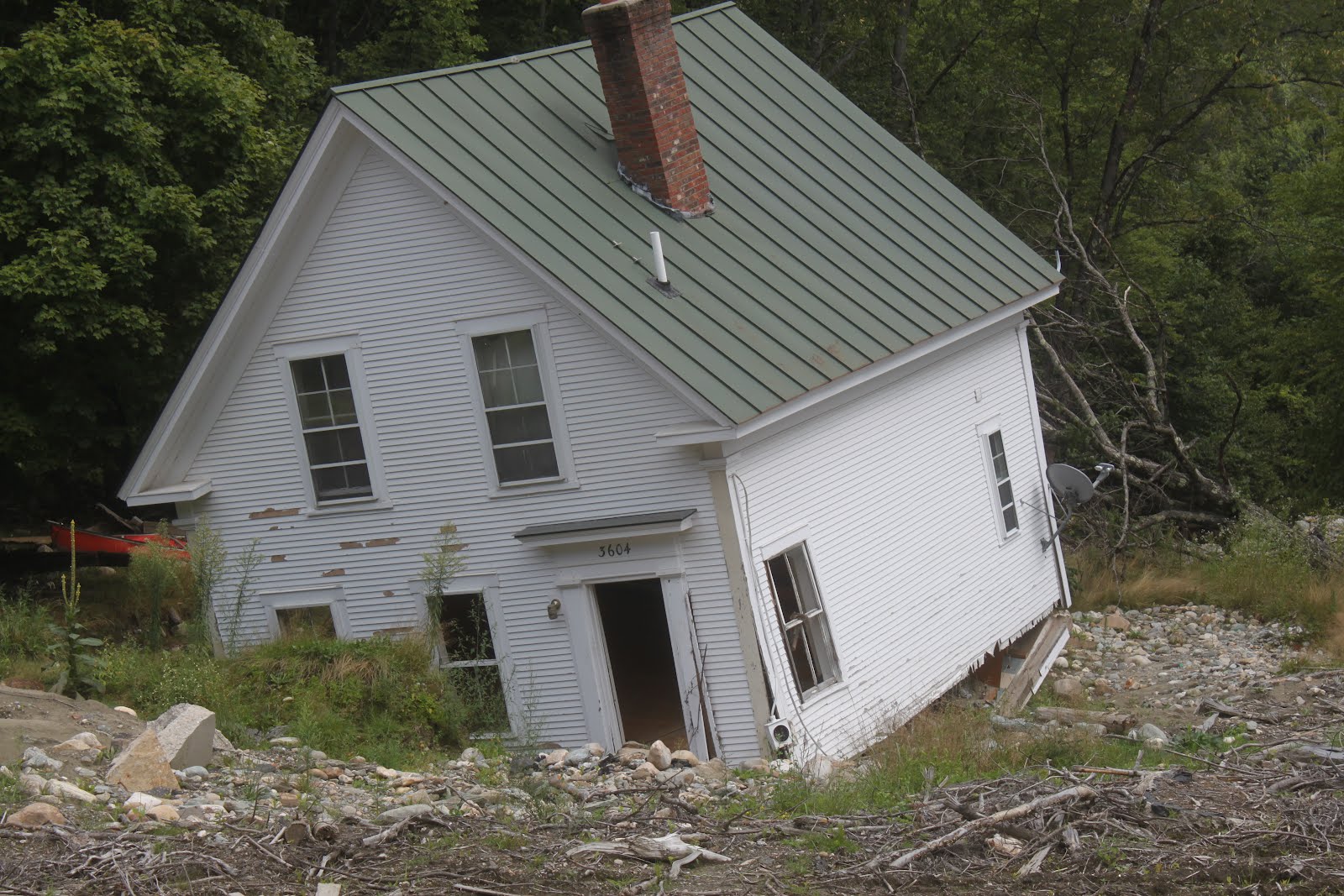
| The prospect of Henri and its weirdness has me thinking more of the consequence of climate change and how it can terrorize us. This is a lovely, old Vermont house destroyed by Tropical Storm Irene in 2011, |
Not all the weather events we've endured this year can be directly tied to climate change, but some of them can.
The prospect of Tropical Storm or Hurricane Henri in New England is one of those cases where I suspect a climate change link, but it's too complicated for little ole me to prove.
But hear me out. One predicted consequence of climate change has been the idea of hurricanes and tropical storms slowing down or stalling over one area, intensifying their destructive power.
After all, hurricane force winds or torrential rain will cause much more damage if those conditions last for 12 or 24 hours instead of three or four hours.
We've seen these stalls happen with Hurricane Harvey in Texas back in 2017, and that resulted in probably one of the most catastrophic floods in U.S. history around Houston, Texas.
In 2019, powerful Category 5 Hurricane Dorian stalled over parts of the Bahamas, inflicting total destruction on some islands. It's very weird for a hurricane that strong to stall. Their forward motion might be slow, but they do tend to make progress.
Though stalling hurricanes are still somewhat a matter of debate among climate scientists, it does seem to be a thing as the world warms.
As I mentioned in this morning's post, the forward speed of tropical storms in New England tends to be pretty fast. It seems most of them go blast northward here at around 30 mph or more. The forward speed of the Great New England Hurricane of 1938 was more than 50 mph.
Current forecasts have Henri moving inland into New England at a forward speed of less than 4 mph. That is just insanely slow for this time of year. Since Henri would linger for a long time in the cold North, its winds might diminish pretty quickly, but its torrential rains would continue much longer than a "normal" New England tropical storm.
I worry greatly about catastrophic flooding in New England from Henri.
Speaking of flooding and rain, I want to pivot over to Greenland for a minute.
The middle and highest point of the Greenland ice cap is insanely cold. It's almost always below zero there. Usually way, way below zero.
But on August 14, at a 10,551 foot elevation at the highest poiny of Greenland's ice cap, it rained. That's the first time rain has ever been observed there. If any precipitation falls from the sky at that station, it's snow. Until now.
It almost never gets above freezing at this location. Temperatures above 32 degrees have only been noted there in recent history this year, and in 2019, 2012 and 1995. But until now, they never had rain, as far as anybody knows
Also, by mid-August, winter usually is arriving in the middle of the Greenland ice sheet. The August 14 rare thaw is the latest above freezing temperature on record at that weather station.
I tied this in with the word "flooding" because if more ice melts off Greenland yearly than accumulates in their long winter, global sea levels rise. Lately the melt has been exceeding the ice accumulation, because of global warming.
Meanwhile, as previously reported, the world had its hottest month on record in July, places too great in number to count hit all time record highs, the West, Siberia and other places are burning, the normal clean air of Vermont keeps getting clouded by smoke from out west and there have been ridiculous floods have hit Germany, Japan, Turkey and other places.
Here in Vermont, the weather this summer hasn't been quite as destructive, at least so far, but still damaging. And incredibly confounding. Henri has just made my unsettled state over the pace of climate change even worse.
No comments:
Post a Comment