
 |
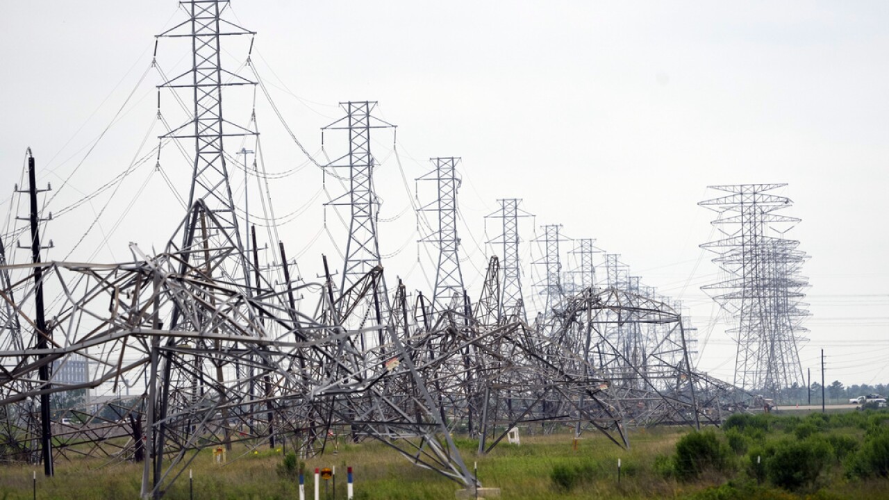
| Collapsed power transmission towers after last week's extreme storm in Houston, Texas. |
Heat and humidity is building in eastern Texas, making clean up harder and more dangerous. People without power are dealing with this without air conditioning. Those with health problems are at risk because of this.
As of late Sunday, about 260,000 homes and businesses were still without power in the Houston area. It might take all week for some of them to get the juice flowing again. In this situation, it seems you alway find one outrageous incident, and here's Houston's.
A residential complex for elderly and disabled people was already in disrepair when the storm hit. It caused added damage to the facility at cut off electricity.
KHOU said management abandoned the 260 or so residents, who did not have electricity, air conditioning, food, ice or other necessities from the time Thursday's storm hit until Sunday. That's when the city's mayor and fire department got wind of the situation. Two people were taken to a hospital, and the city brought ice, water and food. The local utility restored electricity to the complex later Sunday.
People could have died. Houston Mayor John Whitmire vowed to go after the complex owners and managers. Let's hope he follows through.
The only bright spot is no additional severe storms are in the forecast for at least the next week. Even so, many rivers in the general Houston area remain well above flood stage.
National Weather Service meteorologists did their investigations of the storm. They found most of the damage in and around Houston was from intense straight line winds. Part of downtown Houston, where windows were blown out of skyscrapers had winds of 100 mph, says the National Weather Service office in Houston.
There was at least one embedded tornado in Thursday's mess. It hit the community of Cypress, a little northwest of Houston. Several homes suffered extensive damage from the tornado's winds, which reached an estimated 110 mph.
The storm system turned into a derecho - a long lasting line of severe thunderstorms that overnight Thursday knicked the Gulf coastline before smacking into Florida Friday.
That these storms hit so hard was partly due to a dome of extreme heat smothering Mexico, Central America and parts of the Caribbean.
When you get these heat domes, clusters of severe thunderstorms often rid along the curving northern edge of the giant blob of heat. These "ridge runners" as the batches of severe storms are often called, often cause trouble in the Plains, Midwest and sometimes the Northeast and Mid-Atlantic States during the summer.
Water temperatures there have already warmed up to levels usually not reached until August.
The record heat near the Caribbean Sea might have implications for the upcoming hurricane season.
The hotter the water, the more fuel for any hurricanes that drift into the Caribbean Sea. If any of those hurricanes on steroids reach land, there'd be hell to pay, as you'd imagine.
Which means, places that got hit by the derecho and other highly destructive storms this spring from Texas to Florida might face even bigger devastating storms later this year.
No comments:
Post a Comment