Showing posts with label cause. Show all posts

Wednesday, October 8, 2025

An Arrest Has Just Been Made In One Of Two Huge, Deadly January L.A. Wildfires

Jonathan Rindernecht, 29, was arrested in Florida
Tuesday, charged with setting the Palisades Fire
in California.. That was one of two deadly and 
extremely destructive wildfires in
Los Angeles County back in January. 
A Florida man was arrested Wednesday for starting the Palisades Fire, one of two horrific wildfires that tore through Los Angeles County, California in January. 

Beginning on January 7, the two fires combined killed more than 30 people and caused massive destruction in southern California. 

One of the two fires, the Palisades Fire, killed 12 people and damaged or destroyed 8,000 structures in and around Pacific Palisades, California. That's the one Jonathan Rindernecht, 29 of Florida is accused of sparking. 

Prosecutors said Rinderknecht actually allegedly started the fire in the hours before dawn on January 1, after spending New Year's Eve as an Uber driver in the area. 

We learned in mid-January that the fire initially started on January 1. It erupted on Temescal Ridge in the Santa Monica Mountains and firefighters rushed to the scene, called it the Lachman Fire, and managed to contain the fire to eight acres.

They thought it was out, but smoldering embers that were probably semi-buried re-activated on January 7 when Santa Ana winds gusting as high as 100 mph began blasting over the region. 

ABC7 in Los Angeles picks up the story for us:

"(Acting U.S. Attorney) Bill Essayli said two of his passengers told law enforcement that he appeared agitated and angry that night. After he dropped off a passenger in the Pacific Palisades, Essayli said Rindernecht parked his car and tried but failed to contact a former friend. 

Then, Rinderknecht exited his car, walked up a trail, took iPhone videos from a nearby hilltop and listen to a rap song, whose music video included objects being lit on fire.'"

Prosecutors go on:

"After the Lachman Fire ignited, Rindernecht called 911 to report the blaze, fled the scene in his car but turned around when he saw fire engines approach, Essayli said.

'While the Lachman fire burned, the defendant walked up the same trail as earlier that night to watch the fire and firefighters,' Essayli said, adding that Rinderknecht recorded video of the scene using his iPhone."

ABC 7 describes the investigation:

"During an interview Jan. 2, Rinderknecht told investigators where the fire began, information not yet public and that he would not have now if he hadn't witnessed it, the complaint said. He lied about his location, claiming he was near the bottom of the hiking trail." 

According to prosecutors, it looks like the suspect used a lighter to set paper or vegetation ablaze. Prosecutors said Rinderknecht's ChatGPT log shows he created an image depicting a burning forest and crowds fleeing it. 

Rinderknecht is originally from Pacific Palisades but was arrest near his home in Florida Tuesday. He was charged with destruction of property by means of fire. 

Reading between the lines, it looks like Rindernecht didn't intend to cause the death and destruction from the fire. After all, he was not charged with arson. However, prosecutors won't rule out more charges against him. If convicted, he could spend up to 20 years in prison. 

Frustratingly, but not surprisingly at this stage of the proceedings, we don't have a motive for the crime yet. 

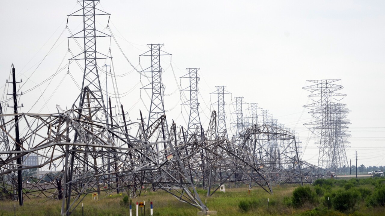
The other big fire that day, the Eaton Fire, raced mostly through Alameda, California, killing at least 19 people and destroying at minimum 9,000 structures.  

The origin of the Eaton fire isn't clear, but might have started from arcing electrical lines. 

Climate change is widely believed to have made both January fires worse than they otherwise would have been. Dry conditions had continued well into what is normally the wet season, making the fires possible. 


Friday, November 29, 2024

Epic Lake Effect Snows Are Now Beginning To Blast Parts Of New York State

Forecasts call for up to five feet of lake effect snow
near Watertown, New York and four feet south of
Buffalo by Monday. 
 Areas around the Great Lakes - especially in New York - are gearing up for an epic lake effect snowstorm. 

Between now and Monday, and probably beyond that, feet of snow will fall east of Lake Ontario, and off of Lake Erie south of Buffalo.

An area near Watertown, New York was forecast to receive more than five feet of snow between this morning and Monday morning. Towns south of Buffalo, New York can expect close to four feet of snow.

The lake effect squalls are expected to be intense enough so that the blizzard conditions would be punctuated by thunder and lightning at times.

Sunday's NFL Buffalo Bills home game could be interesting. The stadium is 10 miles south of Buffalo, right on the edge of where the heaviest lake squalls will set up. So it will either be OK, or a blizzard during the game. 

Other big lake effect snowfalls are happening along the southern shores of Lake Superior, in parts of Michigan, in southern Ontario and northern Ohio.

The New York squalls are powerful enough so that their remnants have started making it into Vermont this evening and should continue to do so through the weekend. That means a few flurries in the valleys, but perhaps a few inches of snow in some of the Green Mountains. 

The most accumulation will probably be near Jay Peak, which is great because that mountain received less snow Thursday than did resorts in central and southern Vermont. Kinda evens things up a little.

The ingredients in place are perfect for these enormous lake effect storms.

An oddly toasty autumn left Lakes Erie and Ontario much warmer than normal.  Now, cold winds are blowing across the lakes and will continue to do so for days. 

The bigger the temperature contrast between the lake water temperature and the air the more powerful the lake effect snows become.  The upcoming long stretch of weather with those persistent chilly westerly and northwesterly winds means a lot of snow can pile up in some spots. 

This won't be the biggest lake effect snow storm ever, but it really is a humdinger. 

The worst of course, was in December, 2022. Buffalo endured 37 hours of continuous blizzard conditions with winds as high as 72 mph.  The blizzard's onslaught came on suddenly, trapping people outdoors and in cars.  Some 41 people died from the storm's effects in and around Buffalo. A total of 52 inches of snow buried the city.

In mid-November, 2014, an intense lake effect snow dumped up to seven feet of snow on towns south of Buffalo, causing numerous roof collapses, and blocking roads to the point where gas and groceries were in short supply. That storm claimed 11 lives.

It's possible climate change is making some of these Great Lakes effect snowfall worse. The lakes stay warmer and more ice free than they used to in the late autumn and early winter. That contrast I mentioned between the unusually warm waters and cold winter air can make the storms more intense. 

Thursday, October 31, 2024

Valencia, Spain Smashed By Extreme Deadly Flood

The latest victim of extreme, deadly, unprecedented floods that have been happening around the world with increasing frequency is Valencia, Spain. 
Extreme flash floods this week piled up these cars
in Valencia, Spain. 


At least 158 people have died in the flooding and that toll is rising fast as more bodies are discovered.

The toll had been increased from 95 that were in news reports this morning. 

Per the Washington Post

"As much as a foot of rain.... fell in mere hours late Tuesday, leading to catastrophic flooding in and around the city of Valencia. Totals throughout the day were reportedly as high as 20 inches. In the town of Chiba, about 20 miles from Valencia, the rainfall in eight hours equaled the normal total in a year, Spain's meteorological agency said."

 Judging from the videos, the flooding in Valencia, Spain this week looks like some of the very worst I've ever seen. Valencia is a region in eastern Spain that includes the city of Valencia. It's a magnet for tourists attracted to its beaches, citrus orchards and food. 

The extreme power of the water pushed hundreds of cars down streets and highways, piling them up as if they were giant junkyards. Searchers on Thursday were finding bodies in some of those cars. 

 The flash floods in Spain looked even more intense in some instances of what we saw in North Carolina with Hurricane Helene.  The flood erupted when an area of low pressure stuck near the Strait of Gibraltar fed off the warm water of the Mediterranean Sea to send persistent waves and lines of torrential thunderstorms into parts of Spain.

As of Wednesday, the low pressure system that caused the Spanish flood havoc was still there, although it was weakening. It could still set off renewed flooding, though, Spanish meteorologists warned. 

 It didn't help that the Mediterranean Sea is unusually warm for this time of year. Warmer water feeding into a storm produces heavier rainfall.

The sea water there reached a record high temperature this year, exceeding records set last year. The water has cooled a bit from a summertime peak, but is still three to six degrees warmer than normal. That can make a big difference with rainfall. 

As usual with this type of disaster, scientists are pointing fingers at human-caused climate change. A large reason why the Mediterranean Sea is so warm is because of climate change.

There's been a rash of extreme flooding worldwide this year, and in recent years for that matter. Just this year, we've had the extreme flooding in North Carolina with Helene. Another enormous flood from a stalled storm in September caused catastrophic flooding in eastern Europe. Also in September, another unprecedented flood hit areas in and around Nigeria.

As many readers well know, we in Vermont have not escaped these big floods. A flash flood damaged areas in Washington County on June 23, only to be followed by much larger, catastrophic flooding on July 10-11.

Then, on July 30, extreme downpours of eight inches in a few hours - something pretty much previously unheard of in Vermont, struck the Northeast Kingdom. 

Videos of the flooding around Valencia are insane. I've found a few.

First one is a news summary showing scenes from the flooding. As always in this blog thingy, click on this link to view, or if you see the image below click on that. 


More news footage, this time from the Associated Press. Again, click on this link or if you see the image below, click on that. 


Monday, May 20, 2024

Houston Recovery: Heat, Bad Air Quality, Power Outages In The Way

Collapsed power transmission towers after last week's
extreme storm in Houston, Texas. 
 I would say Houston is having almost the worst possible weather to recover from that amazing, incredibly destructive storm on Thursday. 

Heat and humidity is building in eastern Texas, making clean up harder and more dangerous.  People without power are dealing with this without air conditioning. Those with health problems are at risk because of this. 

As of late Sunday, about 260,000 homes and businesses were still without power in the Houston area. It might take all week for some of them to get the juice flowing again.  In this situation, it seems you alway find one outrageous incident, and here's Houston's.

A residential complex for elderly and disabled people was already in disrepair when the storm hit. It caused added damage to the facility at cut off electricity. 

KHOU said management abandoned the 260 or so residents, who did not have electricity, air conditioning, food, ice or other necessities from the time Thursday's storm hit until Sunday. That's when the city's mayor and fire department got wind of the situation. Two people were taken to a hospital, and the city brought ice, water and food. The local utility restored electricity to the complex later Sunday. 

People could have died. Houston Mayor John Whitmire vowed to go after the complex owners and managers. Let's hope he follows through. 

The only bright spot is no additional severe storms are in the forecast for at least the next week. Even so, many rivers in the general Houston area remain well above  flood stage. 

National Weather Service meteorologists did their investigations of the storm. They found most of the damage in and around Houston was from intense straight line winds. Part of downtown Houston, where windows were blown out of skyscrapers had winds of 100 mph, says the National Weather Service office in Houston. 

There was at least one embedded tornado in Thursday's mess. It hit the community of Cypress, a little northwest of Houston. Several homes suffered extensive damage from the tornado's winds, which reached an estimated 110 mph. 

The storm system turned into a derecho - a long lasting line of severe thunderstorms that overnight Thursday knicked the Gulf coastline before smacking into Florida Friday. 

That these storms hit so hard was partly due to a dome of extreme heat smothering Mexico, Central America and parts of the Caribbean. 

When you get these heat domes, clusters of severe thunderstorms often rid along the curving northern edge of the giant blob of heat.  These "ridge runners" as the batches of severe storms are often called, often cause trouble in the Plains, Midwest and sometimes the Northeast and Mid-Atlantic States during the summer. 

The heat dome that contributed to the derecho is dangerous in and of itself. All time record high temperatures for this time of year have been reported from  Central America to Florida. Belize had its hottest day in that country's history, reaching as high as 108 degrees

Water temperatures there have already warmed up to levels usually not reached until August. 

The record heat near the Caribbean Sea might have implications for the upcoming hurricane season.

The hotter the water, the more fuel for any hurricanes that drift into the Caribbean Sea. If any of those hurricanes on steroids reach land, there'd be hell to pay, as you'd imagine. 

Which means, places that got hit by the derecho and other highly destructive storms this spring from Texas to Florida might face even bigger devastating storms later this year. 


Tuesday, July 19, 2022

Tornado In Addison County, Vermont, And The Low Down On Vermont Tornadoes

In a still shot from Levi Barrett's video of Monday's tornado
in Addison Vermont, you can just make out a car accidentally
driving into the twister as debris flies overhead.
As you've heard on the news by now, the National Weather Service in South Burlington, Vermont has confirmed that an EF-1 tornado touched down in Addison, Vermont Monday evening. 

Interestingly, the Addison tornado is the only one to be so far reported yesterday anywhere in the United States. The last tornado in Vermont before this, in Middlebury, Vermont in March, 2021, was also the nation's lone tornado that day. 

Tornadoes are pretty much always weak in Vermont, and this one was no exception. It was on the ground for only about two minutes, covering a mile of territory. 

Of course, even weak tornadoes are dangerous, and this one is no exception. It collapsed a metal structure, forcibly bent a street sign and tore down many trees and branches. Though no injuries were reported, the tornado crossed both Routes 22A and Route 17, so anyone caught in it could have been hurt.

In fact, video of the tornado appears to show a car accidentally driving into it as trees collapsed or blew apart around it. 

The video, shot by Levi Barrett, is fascinating. Although the tornado is clearly on the ground in the video, the condensation funnel isn't fully coming into contact with the surface. But it definitely appears to be a multi-vortex tornado, meaning you can see little mini tornadoes in the main twister circulation.

I associate multi-vortex tornadoes with much stronger systems in the Midwest, but as you can see, they happen with weaker storms. 

Also, to the best of my knowledge, this is the only video that exists of a tornado in Vermont. 

It's hard to describe a typical tornado in Vermont because they don't happen very often, but this one had the characteristics of the kind of thing you do see in New England from time to time. I warm front moved north through the state Monday.  

There's some evidence that the Addison tornado was
multi-vortex, meaning it had little tornadoes within
the main circulation. In this still from Levi Barrett's 
video, you can make out a skinny little funnel
descending from the main funnel 

Just south of the warm front, humid winds blew from the south. But the presence of the warm front caused winds to change direction with height. Even though the parent storm was small in size and lacked lightning, it was still capable of producing a tornado because of that spin in the atmosphere. 

In these ultra-humid summer situations that come without other ingredients to produce tornadoes, you can still get brief spinups that can cause some havoc. 

On Monday, there was almost a rare  case of more than one tornado touching down in Vermont on the same day, which hasn't happened in decades. But the idea of two Vermont tornadoes in the Green Mountain State didn't quite come to be.   

As I noted in a previous post, there was convincing radar images of a possible tornado around Marlboro and West Brattleboro around 10 p.m. Monday night. Local National Weather Service offices are responsible for deciding whether to investigate storm damage to determine whether it was a tornado or something else that caused it.

Marlboro and West Brattleboro are covered by the National Weather Service office in Albany, New York. I reached out to the Albany NWS office about this. They said there was indeed mid-level rotation, meaning the winds were spinning pretty vigorously several thousand feet above the surface. But there were no damage reports out of this area, so the wannabe tornado very likely did not touch down.  

I also did not see signs on radar images that anything in southeastern Vermont was flinging debris into the air. So, Albany meteorologists decided not to investigate, which is a perfectly reasonable conclusion, in my opinion.  

Storm chasers also found a storm with significant rotation yesterday in Hartford, New York, just over the border from Pawlet, Vermont.  While it's doubtful a tornado touched down, one could have in the remote, hilly terrain near Pawlet, for all we know. 

With Monday's confirmed tornado in Addison, Vermont, it seems the Green Mountain State has gotten back into the groove of seeing its average one tornado per year.  Of course, we had that infamous March, 2021 Middlebury tornado, which is the only twister known to have ever touched down in March. 

The Middlebury tornado was rare in that it caused at least two injuries. Tornado injuries are rare in Vermont, and I know of no recorded deaths from tornadoes in the Green Mountain State.

Another tornado, packing winds of up to 110 mph touched down in Windham in August, 2020. That tornado ended a twister drought of sorts in Vermont. It was the first tornado the Green Mountain State had seen in eight years. 

Also, in the past few years, there have been tornadoes very close to Vermont. On May 16 of this year, a tornado that was videoed hit Charlestown, New Hampshire, just a mile or two from Springfield, Vermont. 

On June 21, 2021, a supercell thunderstorm that originated in and caused damage in northern New York then moved into Quebec produced a tornado just 14 miles north of Alburgh, Vermont. 

There has been an uptick in the number of tornadoes in the Northeast and Middle Atlantic States in the past decade or two. However, there are so few tornadoes in Vermont that it's pretty much impossible to discern any kind of real trend.