 |
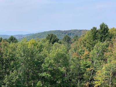
| Another warm, sunny, somewhat hazy day Wednesday as seen in Richmond, Vermont. This spell of 80 degree weather might set a late season record if it continues for a couple more days. |
The high temperature in Burlington Wednesday was 85 degrees, making it the sixth day in a row in the 80s.
If it gets into the 80s today and Friday, it'll be the longest stretch of consecutive 80s for so late in the season, the National Weather Service in South Burlington tells us.
A high in the 80s today is very likely, but tomorrow is a little iffy.
This warm spell has so far been nearly identical to another on on the same dates in 2018.
That year ended up being the second warmest September on record in Burlington, thanks to that mid-month warm spell and an even more intensely hot spell earlier in the month.
It's a little soon to say how this September might rank compared to others overall, but so far, we're still running cooler than 2018.
The warmth this week has mostly fallen just short of setting daily record highs. Montpelier on both Tuesday and Wednesday did manage to tie its record high for the date of 81 degrees. Burlington fell just two degrees short of the record on Wednesday.
These warm September days have capped a year that has featured plenty of warm days.
Through Wednesday Burlington has had 82 days this year in which temperatures have gotten to at least 80 degrees. I could only find two other years with more. 2018 had 83 such days, and 2016 had 85.
Wednesday was also the ninth consecutive day without a drop of rain in Burlington. The last time we had a stretch of rainless weather longer than this was from September 20 through October 5, last year in 2023. The tail end of last autumn's dry spell culminated in the hottest day on record for the entire month of October, with a high of 86 on October 4.
This dry spell, if it maintains itself, doesn't look like it will end in a record heat wave like last year. Instead, we've got a cooling trend coming .
A weak "wrong way" cold is coming in from the northeast to cool us off starting later Friday. High pressure building in from the northeast, plus a storm far offshore, will set up a dry, but easterly wind flow over New England.
That will keep temperatures starting Saturday into next week at merely near normal levels (Highs near 70 in Vermont, lows mostly in the 45-52 degree range).
This type of blocked up weather pattern tends not to break down particularly fast, so it's hard to say when it will rain again. We might squeeze out a couple widely scattered light showers with the cold front Friday, and lingering sprinkles could adorn some higher elevations Saturday.
But any real rain should hold off until at least next Tuesday, or sometime beyond that.

No comments:
Post a Comment