
 |
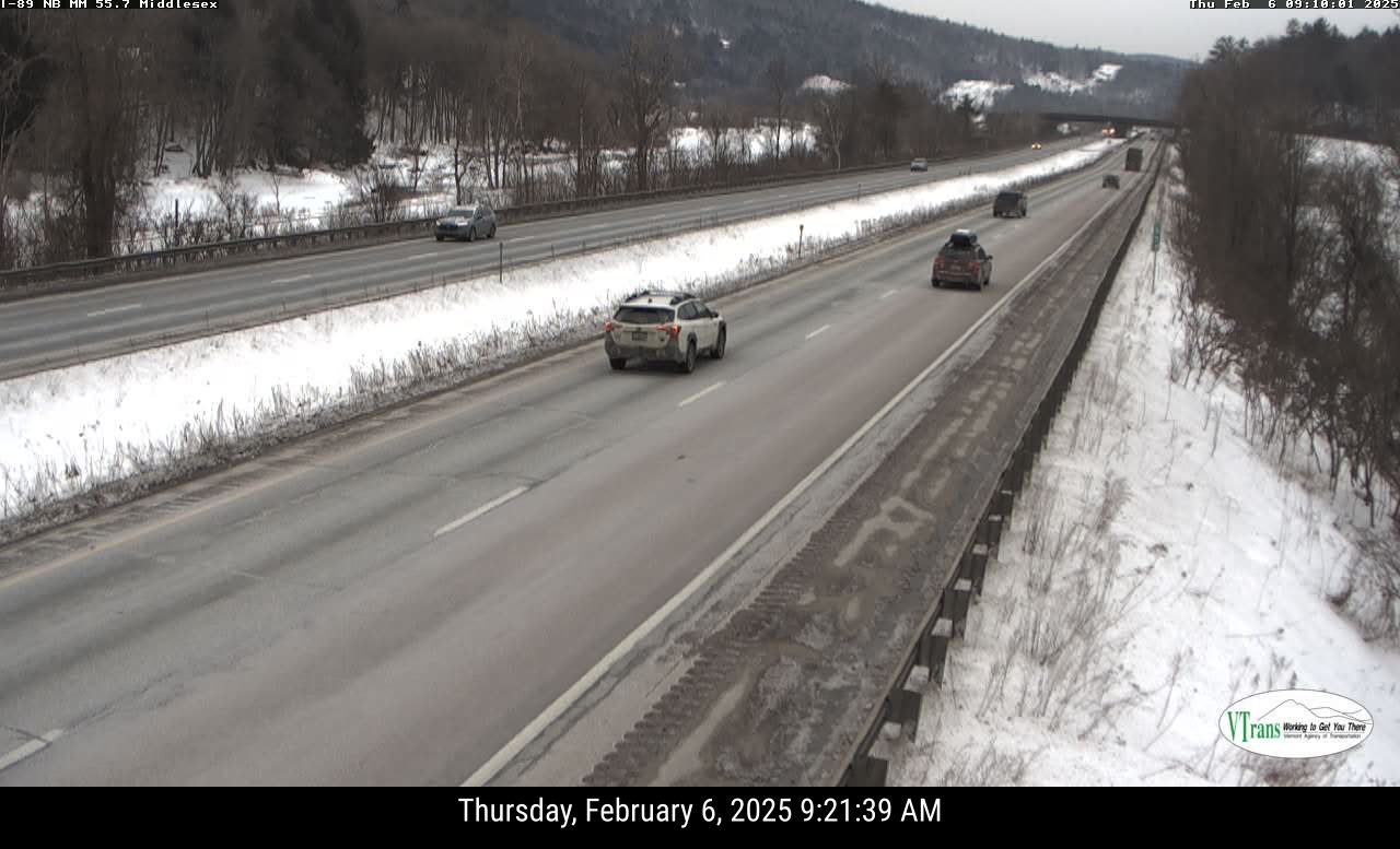
| An example of how things suddenly changed on the roads in Vermont today. This is a screen grab of Interstate 89 in Middlesex at 9:20 a.m. Everything is clear and dry, and it's not even snowing..... |
By mid-afternoon, most places in the state were reporting snowfall in the 2 to 3.5 inch range, in line with forecasts. Those amounts are not exactly a mega-blizzard.
But the mini-storm was among the more disruptive we've had this winter, more proof that the amount of snow isn't necessarily the main reason why a snowfall can wreck plans, or at least slow them down.
Timing and intensity are everything.
The quick blast of snow hit during the middle of a workday, when people are usually out, well, working, or going to work, or headed somewhere they need to be. The snow didn't last long, but it was intense. Many places had an inch of snow within less than an hour the the snow was at its heaviest.
The snow came in suddenly, too, which might have caught people off guard. As the snow advanced through Vermont, it would begin to flurry, then within ten minutes, it was coming down heavily.
 |
| Same stretch of Interstate 89 in Middlesex just an hour later at 10:20 a.m. Snowy roads, poor visibility. |
Which meant it wasn't easy to remove, and would just re-accumulate because it was snowing so hard or wind blew the fluff back on the road.
And god forbid if a truck passed you on the Interstate. If it did, you were lost in a complete whiteout.
A ton of schools in Vermont either didn't open today or had early dismissal ahead of the storm.
TONIGHT/FRIDAY
As we head into the evening commute, Interstates 89 and 91 mostly look a little slushy and greasy. Secondary roads were still snow covered, or at least slushy. The heavy snow is long gone, but we still have patchy light snow and blowing snow.
And that predicted freezing drizzle is starting. There's reports of it scattered across Vermont. I noticed a few drops of freezing drizzle mixed with the flurries when I was outside my St. Albans, Vermont house at around 4:15 p.m.
That'll keep our roads iffy through the evening. But at least it's warmer, so salt is working better on the roads now.
Temperatures continue to slowly climb, and the warmest valleys in western Vermont might actually briefly get above freezing this evening. It was already 35 degrees in Bennington as of 4 p.m. Burlington was 26 at 4 p.m., up from 17 at noon. The forecast is for it to get to 34 degrees in Burlington at around midnight before temperatures start to fall again.
We still have a cold front coming through in the pre-dawn hours that looks like it'll produce a line of snow showers with a few embedded snow squalls. If they develop, they'll come through before 6 a.m in northern Vermont and closer to 7 a.m. or so south. They'll produce an inch or less of snow, but the quiet snow showers could slicken up the roads for your Friday morning commute.
Wind advisories are in effect for northern New York, and far southern Vermont overnight and through most of the afternoon Friday for potential gusts to 50 mph. Elsewhere, southwest and west winds will gust to 40 to 45 mph, perhaps as high as 50 mph in a couple spots along the east slopes of the Green Mountains.
At this point, I'm getting less and less bullish on the snow for Saturday night and Sunday. Trends so far keep taking the storm further and further south. Places near the Canadian border might not get much of anything, while central Vermont gets another modest two to five inch shot. Southern Vermont still looks like they have a shot at six inches.
We shall see!
ELSEWHERE
Away from Vermont, the same storm system spun off at least one tornado, created some serious flash flooding, and spread disruptive and damaging freezing rain through several states.
An EF-1 tornado touched down in Hart County, Kentucky, roughly halfway between Nashville, Tennessee and Lexington, Kentucky. .
A flash flood emergency - a more dire alert than just a flash flood warning - was declared earlier today for the area around Huntington, West Virginia as waves of torrential thunderstorms passed through last night and this morning. The city reported 3.3 inches of rain from the storm.
During a good part of the day Thursday most of West Virginia, and parts of eastern Kentucky and extreme southeastern Ohio were under flood warnings.
Parts of Indiana, southern Michigan, Ohio and Pennsylvania experienced rare "thunder ice" late Wednesday and early Thursday. That was flashes of lightning, peals of thunder all while freezing rain was sagging trees and power lines and turning roads into ice rinks.
As expected, freezing rain caused traffic headaches, tree damage and power outages in parts of Pennsylvania, West Virginia, Virginia and Maryland.
That storm that's supposed to scoot south of Vermont Saturday night is already prompting winter storm watches for heavy snow in southern New England. Some of the same areas hit by freezing rain today could get it again with this weekend storm.
No comments:
Post a Comment