
 |
| This morning's snow prediction update shows a storm total that has been increased to around a foot in far northern Vermont, where less sleet is anticipated. Totals decreased in southern Vermont where more sleet and freezing rain has been added to the forecast |
Overnight, we had the calm phase of the storm, in which snow fell steadily across most of Vermont, but not at a super heavy rate. There wasn't much wind, and the snow is nice and fluffy.
Another pleasant little Vermont snowfall.
But that's about over now.
The wild phase of our storm is just about to begin, and, as we've been advertising, it will be quite a ride.
We've also kept saying that there will be revisions to the forecast right up through the storm, as the degree of mixing with sleet and freezing rain is hard to predict. Which, among other things, makes expected accumulations hard to anticipate.
Plus, we are waiting to see how strong and how widespread the winds are going to be.
Overall, the National Weather Service in South Burlington says that anticipated precipitation amounts have gone up a little. The anticipated warmth aloft that will create that sleet and freezing rain is also just the slightest hint cooler than previous predictions
That doesn't change overall forecasts for the storm all that much, but it does make anticipating what will happen harder.
THIS MORNING
The initial band of steady, light snow was lifting into southern Quebec as of 7 a.m. today. There was a narrow gap south of that in which the snow had become very light and scattered.
 |
| Forecasts for the amount of ice accumulation from freezing rain in southern Vermont continue to increase ominously. Red areas could easily' see some tree and power line damage from this. |
The main body of heavy precipitation with this storm had moved into southern Vermont by 7 a.m. and was steadily making progress northward.
It was still coming down as snow almost everywhere. Except around Bennington, where snow flipped to freezing rain at around 6 a.m. This initial thump of snow will come down at a rate of one to two inches per hour, which is very heavy.
Road conditions that were not great early this morning will become much worse as a result, as it's hard to keep up with that intense of a snowfall.
For many of us, this initial thump will comprise a pretty big share of our total snowfall with this.
THE MIX
The following is just the best guess on how the mix and/or changeover to sleet and freezing rain will play out in Vermont today.
I guarantee it won't go exactly like this - it's just too hard to predict. But at least it gives you a rough idea of how it will unfold.
Sleet should start mixing in across southern Vermont by mid morning and it will move north to near the Canadian border. The sleet was already on Vermont's doorstep just before dawn. Albany, New York reported heavy sleet falling as of 6 a.m.
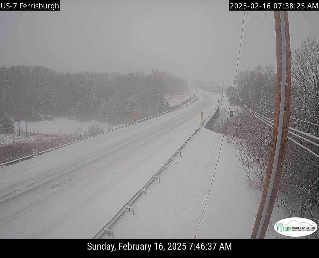 |
| Snowing hard along Route 7 in Ferrisburgh, Vermont in this traffic cam grab a 7:45 a.m. |
It's looking like the period of sleet and maybe some freezing rain will not last terribly long this afternoon in far northern Vermont, so that could boost snow totals up there. The area of Vermont likely to get the least amount of sleet is up in the northwest corner.
I noticed the forecast for St.. Albans has gone from an eight inch snow and sleet accumulation in yesterday's forecast to 13 inches with this morning's prediction
Again, take it with a grain of salt. Or sleet in this case. This is a pull your hair out forecast. We won't know the extent of the mix, really until after it's done and over.
The main area that should have several hours of ice is probably along and south of Route 2. Closer to Route 2, chances are it will be mostly sleet, with very little freezing rain.
In far southern Vermont, a long period of mixed precipitation should dramatically cut total snowfall with this storm to between four and eight inches. Sleet is bad, but at least it doesn't stick to trees and power lines all that well. Freezing rain, however, does.
So I worry about how much freezing rain will accumulate in some areas along and south of Route 4.
That the snow changed directly to freezing rain and not sleet in Bennington early today makes me nervous. Does that mean more freezing rain and less sleet that expected could hit southern Vermont? It could, which would definitely worsen the ice damage and the power outages.
The National Weather Service in South Burlington had the same thought. They increased the amount of expected ice accumulation over southern Vermont, with some areas getting more than a third of an inch.
That weight of that ice, combined with the expected strong winds later, would keep those outages going all day and through tonight as tree branches, whole trees and wires snap under all that ice. Something to watch. .
TODAY'S WIND
We're still looking at strong downslope winds along the western slopes of the Green Mountains today.
The first stirrings of the wind were evident just before dawn in places like Bennington and Rutland, where winds were gusting to 25 mph or so at dawn.
Those winds should ramp up along the western slopes through the day. The high wind warning continues in Rutland County for expected gusts to at least 60 mph. The wind advisory in eastern Addison and Chittenden counties has been upgraded to a high wind warning, as 60 mph gusts are now expected all the way up through places like Ripton, Huntington, Underhill and Cambridge.
Isolated 70 mph gusts aren't out of the question.
Away from the western slopes, winds might be gusty at times, but not particularly dangerous.
Even though the downslope winds will make the precipitation fall more lightly than elsewhere, those winds, combined with the snow and a little ice, will be more than capable of causing power outages.
DRAMATIC EVENING
Late this afternoon and early this evening, things will take a dramatic turn as the storm gets to our east, flushing out all the warm air aloft. We should get a pretty big burst of snow nearly statewide, with snowfall rates of an inch an hour again for a time.
 |
| However, it looks like a switch to sleet and/or freezing rain had already occurred along Route 9 in Woodford in far southern Vermont. |
The snow should get a little lighter and more showery later at night, especially in the valleys. But because the storm is so strong, the winds - this time from the west and northwest should really start to crank up.
Overnight and well into Monday, we should have frequent gusts to 40 mph across most areas of the state.
Areas along the eastern slopes of the Greens, and in a wider area of southern Vermont, could see gusts to 60 mph.
All that wind will exacerbate any power outages, especially where ice covers trees in southern Vermont.
It will be powdery snow tonight, so the strong winds will blow it around horrifically. Not only will the road surfaces be in rough shape, you won't be able to see where you are going with all that snow blowing around.
Wind chills will fall to below zero by late tonight. If you get stuck out there in your car, you'd better have a lot of warm blankets. It'll be nasty.
MONDAY
On Monday, little snow will fall in the valleys, but snow showers will continue to pile up minor additional accumulations in the mountains.
But the strong winds will continue, as will the blowing snow and the bitter cold. Highs will only make it into the teens, and wind chills will stay below zero. The blowing snow will set back the efforts to clear the roads. Also, it will interfere with crews trying to restore electricity to anyone that doesn't have it.
BOTTOM LINE
I'm still saying stay home today, it's not worth getting out there on the roads. If you get up early this morning in far northern Vermont, you'll see that it's barely snowing. That will lead to a false sense of security, because the snow will really crank by mid-morning.
As I mentioned, the wild card is the sleet and freezing rain and the questions of how far north it gets and how long it lasts.
Best guess is by the time we're done Monday morning, six to 12 inches of snow and maybe some sleet will have accumulated north of Route 2. There might be some locally higher amounts.
Central Vermont gets 5 to 10 inches of snow and sleet, again, with a few pockets of higher totals. Southern Vermont will probably end up with a crusty mess of four to eight inches of snow, sleet and ice.
Charge your devices this morning and get your LED candles out, especially in southern Vermont as we do face at least scattered power outages.
Like I said the other day, this will easily be the worst winter storm this season. But we've had worse.
I'll have updates as warranted all day,
No comments:
Post a Comment