
 |
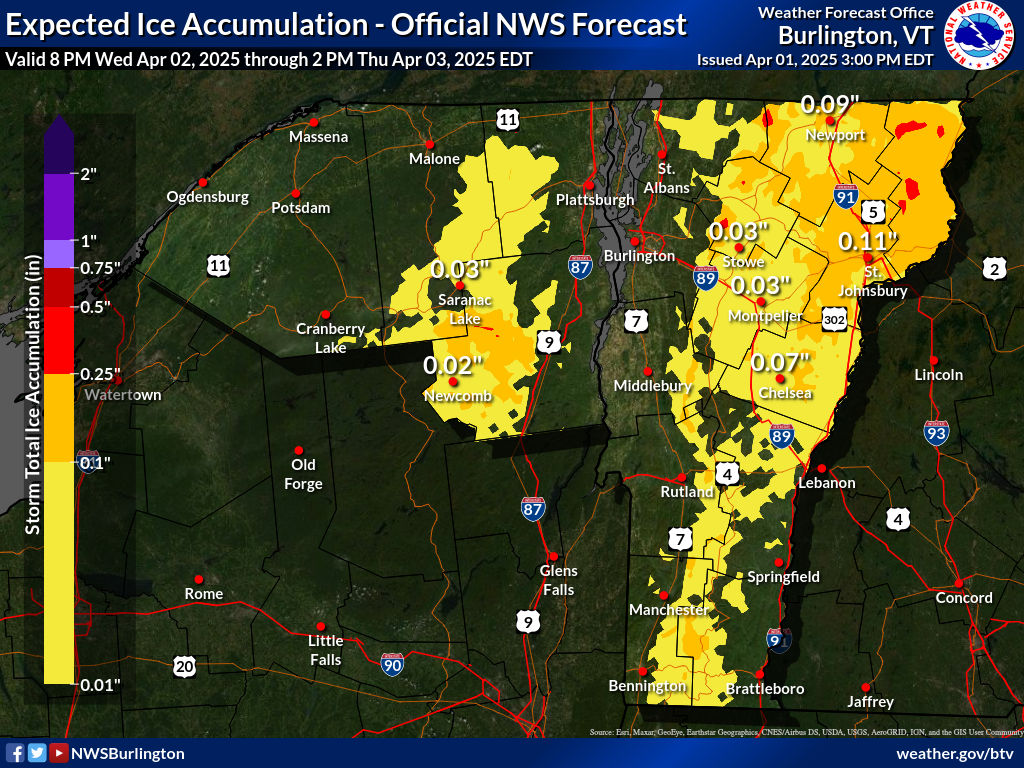
| Yep! Another ice forecast map from the National Weather Service office in South Burlington. This time, at least the ice shouldn't be thick enough to cause more than a few widely scattered power outages in the NEK |
I'll keep it brief this evening.
That new storm will swing a batch of snow into most of Vermont Wednesday evening. That will quickly go over the freezing rain again overnight.
In most of southern Vermont and the Champlain Valley, the freezing rain won't last all that long as temperatures overnight keep warming up. The freezing rain might not even materialize in some spots in the Champlain Valley.
The Northeast Kingdom will hold on to the cold air, though, so the freezing rain could keep going all night and into early Thursday. At the very least the roads up that way will be nasty in many spots overnight Wednesday and for the early morning commute.
The worst hit places could accumulate up to a quarter inch of ice. That might set off some isolated tree damage and widely scattered power outages, but nothing like parts of central and southern Vermont endured over the weekend.
Everybody will be in the rain Thursday, though that rain will be tapering off through the morning. It will be another warm day, kind of like how Monday quickly warmed up.
This storm is looking pretty windy, too. So far there's no wind advisories up, but it could get pretty gusty overnight Wednesday. Forecasters are watching for the possibility of even strong southwest to west winds Thursday afternoon. That's when you might see possible wind advisories popping up.
The storm, though on the strong side, is moving fast, so it won't have a chance to dump a ridiculous amount of precipitation on us. Rainfall won't be enough to cause any flooding issues.
Unlike last night, there won't be an immediate rush of cold air behind the storm. Friday actually looks nice and springlike. There will be at least some sun and temperatures should reach the 50s.
The upcoming weekend looks rainy, with a slight chance of - UGH - maybe a little ice in some spots.
I'll have much more on this tomorrow morning, but there's your update for now.
No comments:
Post a Comment