Showing posts with label avalanches. Show all posts

Monday, January 12, 2026

Juneau, Alaska, Buried In December Snow, Now Faces Rain, Flooding, Avalanches

A bus makes its way through a flooded street in 
Juneau, Alaska. After unprecedented snows, it's
been raining in Juneau, causing flooding, 
avalanches and other trouble in the 
weather-beleaguered city
In December, Juneau, Alaska was buried under more than 80 inches of snow, capsizing boats in the harbor, caving in roofs and blocking streets. 

Now, after some more snow, it's raining up there in Juneau. Now we have an even bigger mess.

Juneau sometimes gets heavy snow and downpours of rain during the winter as storms and atmospheric rivers come in off the Pacific Ocean. 

But the extremes of the past few weeks is totally off the charts compared to what Juneau has experience in the past 

"These are unprecedented times," said Aaron Jacobs, the senior hydrologist at the National Weather Service office in Juneau.  "The amount of snowpack that we are seeing on the ground at the airport, and then this massive warm-up we're seeing, really hasn't been seen in the climate records."

After four additional inches of snow fell on Juneau Friday, the precipitation switched over to rain. The city received 1.58 inches of precipitation that day. Areas around Juneau receive up to eight inches of snow and two inches of rain.  

On Friday and over this weekend, the rain/snow line crept up the steep slopes of the mountains. The higher up the slopes the rain gets, the greater the avalanche risk.

As KTOO reported:

"John Bressette, the city's new avalanche advisor, said multiple avalanches happened on Mount Juneau on known slide paths including White Pass, Chop Gully near Flume Train and above Behrends Avenue. He said he doesn't know exactly how many occurred, but that it's somewhere in the double-digits." 

People in avalanche prone areas in and near Juneau were urged to be ready to leave at the drop of a hat due to the avalanche worries. 

An emergency warming shelter was moved from a converted warehouse to an elementary school Friday due to the avalanche risk. By Sunday, emergency managers deemed that the avalanche risk had diminished, so they moved the shelter back to the warehouse.  There could be avalanches in that areas, but they wouldn't be strong enough to reach the shelter. 

Some avalanches did crash down the steep slopes above Juneau, but none hit populated areas. 

The shelters are open in large part because the weight of the snow, plus the rain water soaking into that snow, is threatening the stability of many roofs in and around Juneau. 

About sixty people were on the roof of the Bartlett Regional Hospital Saturday trying to remove snow because roof loads were nearing capacity, reports KTOO.

The snow-clogged storm drains and ditches in Juneau were no match for the rain and the snow melt. Streets flooded, and water began to seep into basements across the city. 

Another rain storm was set to hit Juneau and the rest of southeast Alaska last night and this morning. A more powerful storm set to hit Tuesday night has prompted a flood watch for southeast Alaska, especially south of Juneau. To add insult to injury, a  high wind watch is also up for Tuesday night and Wednesday for pretty much the entire Alaska Panhandle. 

Video: An avalanche is seen crashing down a steep slope in Juneau on Friday. Click on this link to view, or if you see the image below, click on that. 


Friday, April 5, 2024

A Snowy Vermont Hangover As Epic April Winter Storm Clean Up Begins

 As anticipated, more snow fell overnight in Vermont, but not nearly as heavily as it did yesterday. 
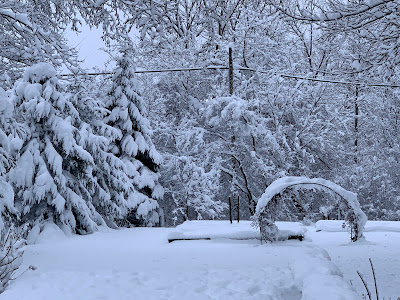
The fresh springtime beauty of April in Vermont, as 
seen this morning in St. Albans, Vermont. 
I'm still awaiting final snow totals, but I'm still convinced this is easily among the top three or four April snowstorms in the Vermont record books.   

As of midnight, Burlington had received an even 10 inches, its fourth snowiest April day on record.  With that even 10 inches, April, 2024 in  Burlington is now tied with 1904 as the 10 snowiest April on record. 

The National Weather Service no new snow fell there overnight, so 10 inches looks like the final total.

What makes this storm wild is that Burlington is actually kind of on the low end of total snowfall with this storm.  So far, I've seen numerous towns statewide report totals in the 14 to 17 inch range.

Here in St. Albans, Vermont, we had another inch of snow overnight, so my storm total is 14.0 inches. I doubt I'll see any real additional accumulation here. That will be more limited to the mountains. More on that below in the forecast section of this post 

The highest totals I've seen so far are 24 inches at a 1,450-foot elevation in Moretown;  23 inches at a 1,950 foot elevations in Killington, 21 inches in Underhill and Eden; 20 inches in Brookfield and Stowe; and 19 inches in Belmont and Chelsea. 

Electricity

After dropping from a peak of 33,000 outages to around 20,000 by evening, the number of Vermont homes and businesses without power leveled off at around 15,000 to 17,000 overnight. 

Looks like this cedar tree in my St. Albans,
Vermont yard didn't make it through the 14
inches of wet, heavy snow. 
The outages remain statewide, with reports from Pownal on the Massachusetts border to Newport on the Canadian border. 

There might be a few new outages today. That's mostly because snow loaded trees could spring back upward as the snow falls off amid thawing temperatures. Those could take a few new power lines.

However, as the day progresses, a blitz by repair crews should overwhelm those new outages and we'll see  power restored to more and more people. 

It might be hard for Vermont to get help from neighboring states with restoring power. It looks like electricity was still out for close to 100,000 New Hampshire residents early this morning. Central Maine Power also reported about 100,000 outages there as dawn broke today. Late last night, 67,000 customers were without electricity in Quebec.

I still wonder whether everyone in Vermont will have their power back by Monday. Most people certainly will, but some remote areas might still have issues.

Roads

Driving conditions are understandably much better than they were yesterday. Interstates 89 and 91 looked fine this morning on traffic cams. Other main highways in valleys looked good, too. High elevation roads, and many back roads will probably remain in iffy shape at best today. 

There's still probably fallen branches and such on some back roads this morning. Those that have been cleared of snow are becoming mud bogs again. That muddy state of affairs should continue as the heavy snow begins to melt over the next several days. 

Today

In the valleys, a tiny bit of melting will start, while the Green Mountains continue to collect snow.

It's interesting in these spring snow events how often the temperature stays locked in at 33 degrees.  All but one of the 25 hourly reports from the Burlington International Airport between 6 a.m. Thursday and 7 a.m. today were at 33. The exception was 4 p.m. yesterday, when it snuck up to 34 degrees.  

A "Sword of Damocles" snow buildup this 
morning over my front door. It threatened to
smush my poor weather observing dog Jackson
when he went out to take snow measurements
so I later hacked away at the snow to make it safer.

With far less precipitation falling, the high angle spring sunshine should send a little heat through eh clouds to get the valleys well into the 30s today. That's still quite chilly for this time of year, but better than yesterday. 

That big old lumbering nor'easter is still there, just off the coast of Maine, sending plenty of clouds and precipitation our way. 

Much of the light stuff that comes down in the valleys today will be cold rain drops. Elevations above roughly 1,500 feet should stay snow. 

Snow showers should continue tonight. Those valley raindrops should change make to snow showers in most places.

By dawn Saturday, valleys will have less than an inch of new snow. The Green Mountain spine will take up an additional two to five inches of snow between now and Saturday morning, with locally higher amounts on some central and northern peaks. 

This is a bonanza for winter sports enthusiasts who finally have their shot at snowy fun after a dismal winter. This is the second time this spring you have lots of snow to play in.

You need to be really careful in the back country, though. Steep terrain in the Green Mountains, Adirondacks and especially the White Mountains are now prone to avalanches.

In Vermont, there was lingering hard packed snow up high from the late March storm, plus previous storms. This storm started as sleet, which can be thought of as millions of little casters for the deep snow that fell yesterday to roll on.

The result is a great chance of snow slides on steep slopes, you know, places like Smugglers Notch and Underhill State Park.  The National Weather Service in South Burlington put out an advisory on this issue earlier today. 

 If you're at a ski resort, stick to marked trails and resist the temptation to go back country. Even if avalanches are not a problem there, getting stuck in the cold deep snow certainly is. The marked trails at Vermont ski areas are safe for you to enjoy. 

Saturday will not be a particularly pleasant day, either. Forecasters are still sticking with clouds, light valley rain showers and a little snow up high. It'll be a couple degrees warmer than today, though. 

We'll probably break back into the sun Sunday, but it still will be a little cool for this time of year with highs in the 40s. 

Eclipse day is still looking at least partly clear. If we do get clouds, chances are they will be high and thin, meaning you can still see the celestial show through those clouds. 

I'll have more on all this snow and eclipse and excitement in upcoming posts, as this one is long enough for now! 



Sunday, March 5, 2023

Avalanches And A Back-Door Warm Front? Quiet Vermont Weather, With Embedded Weirdness

Things are frosted over from yesterday's snow this
Sunday morning in St. Albans, Vermont.
 Now that the latest storm has ended in Vermont, this will be a "flurried to death" week, in which pesky light snow will continue to bless or harass us, depending on your perspective. 

The vast majority of the snow showers all week will be up in the mountains. 

AVALANCHES?

This morning, outdoor enthusiasts are no doubt stampeding toward Vermont ski areas, back country areas, ice cliffs, cross country trails, snowshoe paths, snowmobile trails - you name it. Since it hasn't been a great winter for such activity, who can blame all these people?

However, the National Weather Service Office in South Burlington just had to be a bit of a Debbie Downer regarding this. They're warning of back country avalanche dangers in parts of the Green Mountains and Adirondacks. 

By the way, I'm not complaining about this avalanche alert. The NWS office is wise to give us that heads up. 

The type of snow we had yesterday, on top of pre-existing snow cover in the mountains, has left steep slopes pretty unstable. 

Hikers, snowshoe enthusiasts and ice climbers should probably stick to marked trails and avoid those steep slopes and areas just below them where snow can rush down. 

Avalanches in Vermont are by no means as extreme as they are out West, but they do occur and do injure people and endanger lives. For instance, six Vermont Army National Guard members were injured in a 2018 avalanche near Smugglers Notch. 

By the way, if you are planning some safe snow fun in Vermont, you won't be limited to today. 

THE WEEK AND (SORT OF) BACK DOOR WARM FRONT?

The weather pattern for us this week will  be dominated by what's going on up in Canada. Huge high pressure will be sprawled over the middle of the giant nation to the north. Big storms will spin somewhat aimlessly off both coasts of Canada.  

The National Weather Service caution to outdoor 
enthusiasts in the Green Mountains to watch out
for avalanches sounds like the work of 
Debbie Downer, but they do have a great point. 

This arrangement will ensure that storms coming across the United States from west to east get shoved southward, so they'll miss us here in Vermont.  We'll get some sunshine out of this on Monday, which will probably be the only bright day of the week. 

It will be a cloudy week here in Vermont because the storm off the east coast of Canada will send little bits and pieces of energy southward into northern New England. The strongest one will probably come through Tuesday,

That'll be the coldest day of the week. It probably won't even make it to the freezing point in the afternoon. Frequent snow showers give the mountains a good shot at a few inches of snow, and the valleys could see an inch or two. 

That disturbance on Tuesday is being driven by warm air wrapping around the big storm off of Nova Scotia, then heading southwestward toward Quebec and northern Maine.

So yes, that's sort of a wrong way warm front.  Almost all warm fronts move from southwest or southern to northeast or north.  This one is heading toward the south and west. It might not technically be a true warm front, but it is a definite weirdness to keep us weather geeks engaged. 

Vaguely warmer air will have arrived by Wednesday. The second half of the week will feature continue cloudy skies, occasional snow showers, possibly mixed with raindrops in the valleys.

The mountains will be flurried to death, as I mentioned. They won't see much new snow on any give day. But one to three inches daily for four or five days does kind of add up. Valleys won't see much at all.

Dustings at night will melt during the afternoons. (except on Tuesday!) We'll see a situation in which valleys actually lose a small portion of their snow cover while the mountains make gains. 

The next chance of any more substantial storm would be next Sunday. But at this point, nobody has any idea what kind of storm it would be, if it even hits at all. 


Monday, February 8, 2021

Avalanches Turn Deadly In Utah, New Hampshire

Mount Washington, New Hampshire. A Vermont man died
there earlier this month when he was caught in an avalanche 
It is the heart of avalanche season in most snowy, mountainous areas of the United States, and things have taken a deadly turn lately.  

On Saturday, four people, all in their 20s, died when an avalanche caught two different groups of back country skiers, according to television station KSL. The total number of people buried was eight, but four were able to dig themselves out and try to find the others,  

Two other people died in Utah avalanches in January. Saturday's tragedy was the deadliest Utah avalanche since 1992. 

In New Hampshire, an avalanche on February 2 killed a Vermont back country skier who was buried under 13 feet of snow in the Ammonoosuc Ravine on Mount Washington. A snowstorm that day was contributing to unstable snow on Mount Washington, New England's highest peak. 

According to AccuWeather, we've gone through the deadliest week in the United States for avalanches in over a century.  Fifteen avalanche deaths have been reported in the U.S. in the past seven days or so. 

Avalanches and snow slides are not as common in New England as they are in the larger mountains out west, but they are a risk here in Vermont and elsewhere in the Northeast. Anytime you have steep slopes and weather conditions that destabilize the snow pack, you can get some real trouble. 

The February 2 avalanche was the third fatal one in the Northeast in the past decade.

In March, 2018, six Vermont National Guard members were caught in an avalanche in Smugglers Notch, sending five of them to the hospital. A back country skier reported another avalanche in Smugglers Notch a few days earlier.

These things can also cause property damage. On Christmas, a snow slide smashed into a ski lodge in the Catskills, badly damaging the building. Luckily, nobody was inside at the time.  

Even snow on roofs and piles of snow can be dangerous. 

Just last March, ice fell off a roof up in Hardwick, Vermont and killed a woman. This was really sad.  Just moments before the incident, the woman's husband of 50 years told her, "I don't know how I'd live without you."

This roof hazard was driven home to me the other day. Ice and deep snow slid off my roof in St. Albans in a roar, landing hard where my husband and two dogs had been standing just 30 seconds earlier.  I'm sure the weight of the ice and snow would have killed my dogs and would have seriously injured my husband.

Not much new snow is in the forecast, so of course the risk of trouble from the snow is pretty low. 

Granted, avalanches, snow slides and snowbanks are not the most dangerous things in the world. Lots of things kill more people, unfortunately.  But snow can at times be risky, so it's just one other thing to watch out for in this world. 

Tuesday, January 12, 2021

"Atmospheric River" Soaking Pacific Northwest

Satellite view from yesterdayof a long narrow band of clouds
stretching from the Philippines to the Pacific Northwest. 
That's the atmospheric river dumping torrential rains and
causing flooding and landslides today in 
Washington and Oregon 
 As many of us know, it's really rainy during the winter in the Pacific Northwest. 

The first half of this week, though, is a super soaker out there due to an atmospheric river off the Pacific.

An atmospheric river is a relatively narrow plume of deep moisture that crosses large sections of oceans, and dump heavy rainfall wherever they make landfall.  They're called atmospheric rivers because they act like real, land based rivers.

The amount of moisture in these atmospheric rivers is often equivalent to the water flow near the mouth of the Mississippi River.

These atmospheric rivers usually have their origins in the tropics. The one hitting the Pacific Northwest has its origins near the Philippines. 

The more intense atmospheric rivers can cause catastrophic flooding.  There was a nasty one that caused record rainfall and dangerous, fatal landslides in southeastern Alaska earlier this winter, for instance. 

The atmospheric river now hitting the Pacific Northwest seems pretty impressive, too, so it is or will cause I  plenty of problems with flooding. And landslides. 

Remember I said that atmospheric rivers have their origins in the tropics.  Which means these are often quite warm.  In this case, snow levels in the Cascade Mountains will rise to as high as 8,000 feet above sea level. This will create melting snow, which will feed runoff into already flooding rivers.

Higher elevations are also prone to avalanches, as rain or heavy wet snow falling on top of drier snow layers can start the snow sliding down steep mountainsides. 

Even more dangerous is the risk of landslides which is often a problem in the Pacific Northwest. It's already been a rather rainy winter up there, even by their standards. Soils are saturated and heavy, and the torrential rains with this atmospheric river will make things worse. 

Most of the moisture from the atmospheric river will get wrung out in the Cascade Mountains and in the Rocky Mountains of central and northern Idaho. 

 But the strong jet stream that organized this atmospheric river will continue eastward, contributing to expected high winds today and especially tomorrow in most of Montana, much of Wyoming and the western Dakotas.

Winds could gust to 70 mph or more in some of these areas. 

The jet stream will buckle over the eastern Pacific Ocean in the next couple of days, shutting off the atmospheric river and turning the rain much lighter and more showery in the Northwest starting tomorrow.