Showing posts with label weird weather. Show all posts

Thursday, April 9, 2026

Did Landing Planes Cause Some Weird Little Waterspouts Near Boston's Logan Airport?

Hard to see in this screen grab, but a strange
waterspout is seen approaching shore in
a bay in South Boston. The theory is that
planes landing at nearby Logan Airport
helped set off the strange phenomenon. 
Something strange happened not far from Boston's Logan airport earlier this week. 

This was at Castle Island In South Boston, in a cover of water known as Pleasure Bay. It appeared two waterspouts approaching shore there Tuesday morning.

Video of the incident is at the bottom of this post. 

It's not completely clear from the video, it looks like the two waterspouts, or whatever they were, spun in opposite directions as they both advanced toward shore.

 It seemed like a bit of a mystery, since atmospheric conditions didn't seem conducive to waterspouts.  

There were some rain and snow showers in the area around 8 or 9 a.m.. But they didn't seem the type of thing that would spawn waterspouts.  And it appears the video was taken around 6:30 a.m or so.

On key thing: It appears the area where the waterspout like features appeared was in the flight path of low flying aircraft heading northbound to land at nearby Logan airport. 

The theory is that exhaust from at least one of the low-flying planes somehow reached down and formed a sort of air whirlpool or two which sustained themselves one the plane was gone. 

Obviously, this whole thing wasn't strong enough to cause damage or danger, but it was an example of how the strangest things can cause some local weather effects.  

Click on this link to view the video. If you see the image below, click on that. 


Tuesday, March 17, 2026

Deep Snow, Unseasonable Freezes, Record Heat, Tornado Busts: March Weather Madness Reigns

A scene from the blizzard in northern
Michigan, via Facebook, Michigan
Storm Chasers
 The big storm that was harassing the United States is mostly gone, but its left damage, weird weather and the risk for more problems in its wake. 

BLIZZARD

The blizzard lived up to its promise, as forecasts for somewhere in the neighborhood of three feet of snow verified in the Upper Peninsula of Michigan and in Wisconsin. Harbor Springs, Wisconsin was buried beneath 40 inches of new snow. Cheboygan, Wisconsin saw 38 inches of snow, while Wausau picked up 30.9 inches. 

This all got whipped up into massive drifts as strong winds blew throughout the storm. 

Marquette Michigan picked up 36.3 inches of snow new snow. That makes this month's total there so far 54.4 inches. I think I'd kill myself instead of shoveling my driveway with that amount of snow!

Before the storm was even finished yesterday morning there was 47 inches of snow on the ground. They haven't had less than two feet of snow on the ground since January 4. Talk about never-ending winters!

Video showed vehicles stuck for miles in the snow on an Interstate highway near Green Bay, Wisconsin fPeople in those cars said they'd been stuck for five hours or more. Green Bay had its deepest single-day snowfall since at least 1889, with 17.1 inches on Sunday. The city's storm total came to 26.6 inches.

In Illinois, snow wasn't nearly as deep, but strong winds sent tractor trailers on icy Interstates spiraling into ditches. 

SEVERE WEATHER

The good news is that there were no major tornadoes anywhere on the East Coast yesterday. Ahead of the storm, the atmosphere seemed primed for strong tornadoes in the Mid-Atlantic states.

Thankfully, that isn't what happened.

Some thunderstorms formed early in the day near the North Carolina coast. That siphoned some of the heat and moisture needed to produce rotating supercells and tornadoes. There were a couple of tornado warnings in Maryland, but none touched down. A couple of weak tornadoes were reported in North Carolina. 

We did see 485 reports of wind damage, mostly involving fallen trees and power lines. And even better news: No severe thunderstorms or tornadoes are forecast anywhere in the U.S. during the next week. 

WILDFIRE

A final capture before a trail camera was destroyed in
the big Nebraska fires. The camera owner was able to
recover an SD card from the melted camera.
Strong winds to the south and west of the massive storm that blasted the Great Lakes region helped fan the largest wildfire in Nebraska history. 

Collectively, four fires in central and western Nebraska have burned around 750,000 acres. As of yesterday, there was 0% containment, though updates this morning indicated the fires were now partially contained. One person has died in the fires.

One of the four fires, the Morrill Fire, is the largest in the state's history. At last report, it had burned through nearly 573,000 acres. An update this morning indicated it was 18% contained. 

Most of Nebraska is in drought. Dry, windy weather. A red flag warning is up for Nebraska today, and a fire weather watch is in effect tomorrow, when it is expected to turn windier and even drier. 

Brush fires and wildfires have afflicted the Plains through the second half of winter and now into March. The region has been persistently dry and frequent wind storms have fanned the flames.  

FROSTY SOUTH 

Early season crops and gardens across the South are taking a serious beating from frost and freezing temperatures. The huge storm's strong north winds and an accompanying strong dip in the jet stream brought wintry air far south. 

Last week brought record breaking high temperatures to the South, and that really got plants going after a chilly winter with plenty of freezes. This morning's subfreezing temperatures were surely a big setback. 

Huntsville, Alabama went from 71 degrees just after midnight yesterday to a burst of snow just 10 hours later.

By this morning, several places in East Texas and Louisiana saw record lows . In Shreveport, it was 25 degrees, besting the old record of 27 degrees. Longview, Texas reached 27 degrees, breaking the record low by a degree. 

Birmingham, Alabama got down to at least 27 degrees, which breaks the record low for the date of 28 degrees.

Freeze warnings are up again for tonight from eastern Arkansas all the way to the Carolina coast. 

WESTERN HEAT BUILDS

As noted in a previous post, the Southwest is entering an unprecedented stretch of extremely weird March heat. 

Each day from tomorrow through Sunday in Phoenix will feature high temperatures between 102 and 107. Those highs each day will be at least seven degrees above the current record highs, which is absolutely bonkers. 

Highly unseasonable extreme heat warnings are going into effect in the Desert Southwest. This heat wave is more dangerous than most because people aren't climatized to the heat yet. Plus, the deserts are overrun with tourists who are there to enjoy what is normally a cooler time in the deserts. Plus, extra tourists were attracted to a super bloom of flowers in Death Valley and the Mohave Desert. 

Despite all these weirdnesses around the nation, the odd weather is settling down for now, with the glaring exception of the Southwestern heatwave.

i'm sure the atmosphere is just recharging for more fun and scary and gobsmacking weather times ahead.  

Saturday, November 29, 2025

Winter, Now Re-Established In Vermont, Will Keep Meteorologists On Their Toes

When winter winds returned on Friday, things got a little weird in parts of New England. It snowed in parts of the region, thanks of all things to Lake Huron. 
Satellite view this morning shows bands of snow cover
across southern Vermont and New Hampshire and 
parts of Massachusetts from Great Lakes effect
snows that made it all the way to the 
Atlantic Ocean yesterday. (The snow cover is
those faint streaks of lighter color you see in
the spots I referenced). Photo via Facebook.
National Weather Service/South Burlington


We know that there is always lake effect snows around the Great Lakes, especially this time of year when the relatively warm water contrasts with the cold Canadian air flowing in. 

This time of year, when that contrast is big, some of the snows can make it all the way into New England, but usually as decent snows in western New England mountains and just flurries in the valleys.

As mentioned yesterday, one particularly aggressive band of lake snow originated over Lake Huron, got an extra boost from Lake Ontario and made it all the way to Vermont.

By later yesterday morning, the band got more powerful on its trip into New England. Motorists reported poor visibility and dangerous road conditions along Route 30 in Dorset, Route 11 over the mountains between Manchester and Springfield, Interstate 89 near Sharon and other places.

The dangerous roads and snow squalls from this line continued on through a band across pretty much all of southern New Hampshire. The snow band shifted south during the afternoon, creating bursts of heavy snow across Massachusetts. One of these snow showers created wind gusts to 48 mph as they incredibly headed out to sea.

Snow accumulated to as much as 4 inches in southern New Hampshire and western Massachusetts and 2 inches in Worcester County, Massachusetts. Again, just wild for Great Lakes snow to do that in New England. I'm sure some energy in the atmosphere unrelated to the lakes sustained the snow band, but still!

Back here in Vermont, snow showers coasted the central and northern Green Mountains nicely. The state's perennial snowy spot, Jay Peak, hit the jackpot again. They received eight to ten inches of snow yesterday and last night. 

Jay Peak has had 113 inches of snow this month, which is a record for them. They are about to get more snow, and the rest of us will see some too. 

SNOWY, WINTRY OUTLOOK

Traffic camera image of Route 105 in Jay at about 9 a.m.
this morning. I'm not sure if the guy in the snow-swept
parking lot is getting ready for a backcountry ski
adventure or is discreetly peeing. In any event
this shot shows how wintry it has gotten in
some of Vermont's mountains. 
After a cold, but fairly bright day today, the next storm comes in tomorrow. 

It will be a classic light, but terribly raw and miserable late November/early December festival of snow, then occasional cold, light rain in the valleys, dank, dark skies and in some places, a gusty south wind that will chill you to the bone. 

If tomorrow's weather doesn't depress you, nothing will. There are bright sides to tomorrow's darkness, though. 

There won't be much precipitation of any kind. Rain and melted snow should amount to less than a quarter inch of rain equivalent, with maybe a little more than that. 

Snow accumulation should be less than an inch in the valleys before it changes over to rain. Areas above 2,000 feet in elevation likely won't see any rain at all. And if it does manage to rain on your ski slopes, it won't cause much damage, since the rain will be so light, and it will be barely and only briefly above freezing up there.

After that, another storm -  more of a nor'easter - will threaten on Tuesday. Early indications are the heaviest precipitation will go to our south, but most of Vermont should at least see some snow. And if the path of the storm goes a little further north, we could have a pretty decent snow dump on our hands. 

Then, the first true Arctic cold front of the season might come through Thursday with some snow squalls. And then maybe the first below zero temperatures of the season in Vermont. 

This winter is starting much stronger than most recent ones. That doesn't mean the entire winter will be rough. But the beginning of winter, 2025 kind of harkens back to the "real winters" we had back in the 1960s and 1970s. 

Also, I know long range forecasts beyond a few days are questionable, I still have to leave you with this note: NOAA's latest three to four week outlook calls for mostly below normal temperatures and leans toward above normal precipitation through about Christmas. 


Friday, May 9, 2025

There's Something About May 9 In Vermont That Makes The Weather Turn Weird

Snow dusts a daffodil in St. Albans, Vermont on 
May 9, 2020.  May 9 has a reputation of having
weird weather in Vermont, so the fact that today
is so cold and rainy is par for the course
 It seems like if you're going to get an odd weather day in Vermont in May, it'll hit on May 9.

 Not every May 9 is out of the ordinary, of course. But there's been enough over the years to be wary of this date. 

The current May 9 weather in Vermont isn't all that extreme, I admit. But it's unusually cold out there today, as temperatures in many areas this afternoon are staying locked in the 40s. It should be in the 60s this time of year. 

Today's soaking rain that in some spots might end up being the rainiest day of the year so far.  Burlington has had a half inch of rain so far through 2 p.m. today. We've got a lot more rain to get through, too. 

SNOWY MAY 9s

Past May 9s in Vermont have been even weirder.  The biggest May snowstorm in modern records for Burlington hit on this day in 1966.  Burlington had 3.5 inches of snow. Newport clocked in with 5.2 inches.  It snowed for three days from May 8 to 10, 1966 in Peru, Vermont, leaving them with 11 inches of snow.

I guess if it's going to be cold and snowy during May in Vermont, it would hit on the 9th.  Another snowstorm on May 9, 1977 it mostly high elevations and southern Vermont and New England. 

Some high elevations of central and southern Vermont reported six to eight inches of snow.  Snow dusted valley floors, too. 

It was even worse that day in 1977 in southern New England. A foot of snow fell on Worcester, Massachusetts. 

It snowed again on May 9, 1983.  Burlington had 0.7 inches of snow and the high temperature that day was only 39 degrees. And you thought today was chilly!  South Lincoln, Vermont on that day in 1983 reported 6.8 inches of snow.

Once again snow hit on May 9, 2020. It was a doozy in some spots.  Shaftesbury had 10 inches of snow, Arlington, Vermont eight inches, Concord, Vermont had seven inches and Cabot 6.5 inches. The cold was impressive on May 9, 2020 as well. It was 29 degrees at 4 p.m. that day in Montpelier. 

By the way, Vermont just missed a snowfall on May 9. 1945. Instead, it came on May 10 and 11 that year, with several towns reporting a few inches of snow.   

It IS cold and rainy today, but at least there's no snow!

May 9 had a weird reputation in other ways, at least in some years. It got to 92 degrees on May 9, 1979 in Burlington, which is still easily the hottest for so early in the season. 

On May 9, 2000, 1.91 inches of rain fell, part of a two day storm that dropped three inches of rain.  There was some flooding around that year. 

The weird May 9s tend to end quickly. In almost every case I cited above, the weather was near normal with a couple days after the weirdness of May 9 

Friday, April 5, 2024

A Snowy Vermont Hangover As Epic April Winter Storm Clean Up Begins

 As anticipated, more snow fell overnight in Vermont, but not nearly as heavily as it did yesterday. 
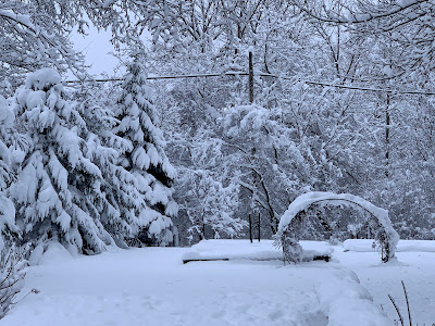
The fresh springtime beauty of April in Vermont, as 
seen this morning in St. Albans, Vermont. 
I'm still awaiting final snow totals, but I'm still convinced this is easily among the top three or four April snowstorms in the Vermont record books.   

As of midnight, Burlington had received an even 10 inches, its fourth snowiest April day on record.  With that even 10 inches, April, 2024 in  Burlington is now tied with 1904 as the 10 snowiest April on record. 

The National Weather Service no new snow fell there overnight, so 10 inches looks like the final total.

What makes this storm wild is that Burlington is actually kind of on the low end of total snowfall with this storm.  So far, I've seen numerous towns statewide report totals in the 14 to 17 inch range.

Here in St. Albans, Vermont, we had another inch of snow overnight, so my storm total is 14.0 inches. I doubt I'll see any real additional accumulation here. That will be more limited to the mountains. More on that below in the forecast section of this post 

The highest totals I've seen so far are 24 inches at a 1,450-foot elevation in Moretown;  23 inches at a 1,950 foot elevations in Killington, 21 inches in Underhill and Eden; 20 inches in Brookfield and Stowe; and 19 inches in Belmont and Chelsea. 

Electricity

After dropping from a peak of 33,000 outages to around 20,000 by evening, the number of Vermont homes and businesses without power leveled off at around 15,000 to 17,000 overnight. 

Looks like this cedar tree in my St. Albans,
Vermont yard didn't make it through the 14
inches of wet, heavy snow. 
The outages remain statewide, with reports from Pownal on the Massachusetts border to Newport on the Canadian border. 

There might be a few new outages today. That's mostly because snow loaded trees could spring back upward as the snow falls off amid thawing temperatures. Those could take a few new power lines.

However, as the day progresses, a blitz by repair crews should overwhelm those new outages and we'll see  power restored to more and more people. 

It might be hard for Vermont to get help from neighboring states with restoring power. It looks like electricity was still out for close to 100,000 New Hampshire residents early this morning. Central Maine Power also reported about 100,000 outages there as dawn broke today. Late last night, 67,000 customers were without electricity in Quebec.

I still wonder whether everyone in Vermont will have their power back by Monday. Most people certainly will, but some remote areas might still have issues.

Roads

Driving conditions are understandably much better than they were yesterday. Interstates 89 and 91 looked fine this morning on traffic cams. Other main highways in valleys looked good, too. High elevation roads, and many back roads will probably remain in iffy shape at best today. 

There's still probably fallen branches and such on some back roads this morning. Those that have been cleared of snow are becoming mud bogs again. That muddy state of affairs should continue as the heavy snow begins to melt over the next several days. 

Today

In the valleys, a tiny bit of melting will start, while the Green Mountains continue to collect snow.

It's interesting in these spring snow events how often the temperature stays locked in at 33 degrees.  All but one of the 25 hourly reports from the Burlington International Airport between 6 a.m. Thursday and 7 a.m. today were at 33. The exception was 4 p.m. yesterday, when it snuck up to 34 degrees.  

A "Sword of Damocles" snow buildup this 
morning over my front door. It threatened to
smush my poor weather observing dog Jackson
when he went out to take snow measurements
so I later hacked away at the snow to make it safer.

With far less precipitation falling, the high angle spring sunshine should send a little heat through eh clouds to get the valleys well into the 30s today. That's still quite chilly for this time of year, but better than yesterday. 

That big old lumbering nor'easter is still there, just off the coast of Maine, sending plenty of clouds and precipitation our way. 

Much of the light stuff that comes down in the valleys today will be cold rain drops. Elevations above roughly 1,500 feet should stay snow. 

Snow showers should continue tonight. Those valley raindrops should change make to snow showers in most places.

By dawn Saturday, valleys will have less than an inch of new snow. The Green Mountain spine will take up an additional two to five inches of snow between now and Saturday morning, with locally higher amounts on some central and northern peaks. 

This is a bonanza for winter sports enthusiasts who finally have their shot at snowy fun after a dismal winter. This is the second time this spring you have lots of snow to play in.

You need to be really careful in the back country, though. Steep terrain in the Green Mountains, Adirondacks and especially the White Mountains are now prone to avalanches.

In Vermont, there was lingering hard packed snow up high from the late March storm, plus previous storms. This storm started as sleet, which can be thought of as millions of little casters for the deep snow that fell yesterday to roll on.

The result is a great chance of snow slides on steep slopes, you know, places like Smugglers Notch and Underhill State Park.  The National Weather Service in South Burlington put out an advisory on this issue earlier today. 

 If you're at a ski resort, stick to marked trails and resist the temptation to go back country. Even if avalanches are not a problem there, getting stuck in the cold deep snow certainly is. The marked trails at Vermont ski areas are safe for you to enjoy. 

Saturday will not be a particularly pleasant day, either. Forecasters are still sticking with clouds, light valley rain showers and a little snow up high. It'll be a couple degrees warmer than today, though. 

We'll probably break back into the sun Sunday, but it still will be a little cool for this time of year with highs in the 40s. 

Eclipse day is still looking at least partly clear. If we do get clouds, chances are they will be high and thin, meaning you can still see the celestial show through those clouds. 

I'll have more on all this snow and eclipse and excitement in upcoming posts, as this one is long enough for now! 



Tuesday, March 26, 2024

Topsy-Turvy In Vermont: Spring Northwest, Winter Southeast

The National Weather Service office in South Burlington
released this map of forecast highs today and it is 
weird. Highs will be as chilly as 36 in Springfield
in the southeast to as high as 58 in the northwest,
up around St. Albans. 
Usually this time of year, the chilliest early spring air is in northwestern Vermont, which makes sense, as that part of the state is closer to those cold fronts that sneak down from Canada.  

Southeastern Vermont tends to be a little more springlike, with generally clearer skies,  a lower chance of snow or ice and warmer temperatures than most of the rest of the state.

Things are totally backwards now.

Southern Vermont is still deep in snow cover from that mega-snow on Saturday, with more than two feet in many spots.  

Up in northwest Vermont, the four to six inches of snow that fell Saturday is disappearing fast. Bare patches in the snow up there today will rapidly expand.  

Today, the backward trend continues with a huge temperature difference between southeast and northwest.  If you like spring, go to the great not-so-white north. 

If  you're down in places like Brattleboro or Springfield, the best you'll do for afternoon highs today will be the mid and upper 30s, definitely on the cool side for late March. An overcast will add to the chill. 

If you're in places like Alburgh, Swanton or Highgate in the northwestern tip of Vermont, temperatures could get close to 60 degrees this afternoon, with quite a bit of sunshine. Springtime balminess for sure.  

In between those two extremes, there will be a gradient with 50s northwest,  and 40s in central Vermont. 

It gets worse. Southern and eastern Vermont will probably see a little freezing drizzle tonight. I suppose a few raindrops could come down late tonight up in the northern Champlain Valley, but they won't freeze

So yes, it's very strange.  

THE REASON

The snow was already starting to disappear from my
St. Albans, Vermont yard late yesterday afternoon, and
a warm day to day will get rid of much more.
Meanwhile, the deep snow in southeastern Vermont
will stay mostly intact amid much cooler readings. 
The cause of today's weirdness is cold high pressure way up in eastern Quebec and Newfoundland and a storm far off the Mid-Atlantic coast.  That combination is creating a feed of cold, wet low level air heading westward into New England. 

The air is damp enough to yield some fog and drizzle, which will turn to freezing drizzle in many areas east of the Greens tonight as temperatures drop. 

It's even a little worse in neighboring New Hampshire where a winter weather advisory is up for tonight for freezing drizzle.  

This flow of chilly dank air will be hitting a road block in the form of the Green Mountains. This is low level cold air we're dealing with, mostly confined to the lowest few thousand feet of the atmosphere. 

Cold air is more dense than warm air, so it tends to stay low. There's not enough of an east wind to really lift the air up and over the mountains. 

Besides, any cool air that does make it over the crest of the Greens would flow downhill on the west slopes. Air flowing downhill compresses, and that tends to make the air warmer and drier.  If you're west of the Green Mountains you'll probably see a bank of clouds peeking over the ridge tops from the east, but not really coming much further west than that. At least for awhile.

As the east winds persist, some of those clouds from the east will eventually win over later today, slowly blotting out the sun further and further west.  Also, high clouds from a storm well to our west and an approaching, dying cold front will filter the sun as the afternoon wears on up in "tropical" northwest Vermont. 

BEYOND TONIGHT

The cooler weather in southeastern Vermont will at least temporarily slow the snow melt. That snow will refrigerate things, keeping temperatures slightly cooler than they otherwise would be even after this chilly east wind dies out. 

Meanwhile, any sun we get in the coming days will heat the increasingly bare ground, and then the air in the northwest.

Even so, the temperature contrast will diminish. It'll be in the low 50s northwest tomorrow and in the upper 40s to near 50 southeast.

Thursday is a wild card, though. A new storm along the East Coast might create a new northwest to southeast weird contrast in Vermont Thursday and Thursday night. 

 The path of the storm is still really open to question, with various models giving the Green Mountain State anything from absolutely nothing to a total soaker with possible snow. 

There's a chance we could have another situation in which northwestern Vermont is quiet and mild, while the southeast has a cold rain or even wet snow. 

Very unsure on this one, so stay tuned.

By the weekend, things should go back to how it should be: Forecasters expect near normal temperatures, which afternoon highs little cooler in northern Vermont than in the south.

As it should be, for a change.  

Friday, February 17, 2023

"Kitchen Sink" Weather Comes To Vermont, Still A Mess Out

UPDATE 5 PM FRIDAY

National Weather Service radar image from around 8 a.m
today shows a cluster of thunderstorms in and around 
Rutland, and a hail-producing cell over St. Albans.  
The storm is pretty much over, save for some lingering flurries in the Champlain Valley and Green Mountains. 

It's amazing how accurate the National Weather Service office in South Burlington was with this forecast.

Any time you have wide temperature differences and quick changes in precipitation types, you're almost guaranteed to get parts of the forecast wrong. 

Not this time. 

Things were a little wonkier than forecast with the thunderstorms and hail. But NWS Burlington did mention the possibility of thunder in some of their forecasts,

For such a tricky forecast, I'm amazed they got the amount of ice correctly, and the amount of snow that followed the ice. For the record, at my place in St. Albans, I got 1.6 inches of snow. 0.3 inches of sleet and more or less 0.05 inches of ice from freezing rain. 

More incredibly, NWS Burlington was spot on with the timing of the changeovers from rain to freezing rain to snow. 

I would say road conditions in northern Vermont - at least the main roads - are definitely better than they were during this morning's mixed precipitation. But I'd advise going slow and taking care. It's not perfect out there, that's for sure. 

It's still looking like a nice day Saturday after a cold start.  Sunday and Monday will bring some thawing to melt the ice. 

PREVIOUS DISCUSSION

The good news is I haven't seen any reports of locust swarms in Vermont today. 

But it's been a "kitchen sink" kind of day as every imaginable type of weather has hit, except of course no kitchen sinks falling out of the sky. That I know of. 

We've had the expected rain, freezing rain, sleet and snow. But also thunderstorms, especially across central Vermont. Oh, and hail.  Did I mention hail? Another thunderstorm-like thing came through St. Albans this morning, dumping a quick, heavy shot of hail. Most of the stones were a little bigger than peas. 

The hail was mixed with freezing drizzle. Lovely. 

We've also had every kind of temperature you could get, too. At 10 a.m., it was 22 degrees with snow in Highgate. At the same time, it was 57 degrees in Bennington. 

So yeah, it was about as weird a winter morning as you can get in Vermont. 

The roads are bad as you might imagine, except in areas to the south and east which as of noon hadn't gotten below freezing yet.

It will remain nasty through the afternoon, but the extremes are settling down. As of 1 p.m. or so, all the freezing rain and sleet had turned to snow in the Champlain Valley. Central Vermont was still seeing that ice, but that should go over to snow soon. (Montpelier flipped from mixed precipitation to snow between noon and 1 p.m. for instance).

An ice glazed bush gets a frosting of snow this 
morning in St. Albans, Vermont. 
The snow will be tapering off to very light stuff or flurries as the afternoon wears on.  

All that ice and snow on the roads will remain there for awhile, since freezing rain and sleet is so hard to clear. Especially with temperatures dropping the way they are. 

If you drove to work this morning, it'll probably be a lousy trip back home, too. Especially in central and northern Vermont. 

Daytime temperatures are now by the lowest they've been since the big cold snap on February 3 and 4.  It's gotten into the teens in the northwest corner of Vermont and those teens should slowly spread south and east through the afternoon. 

It's windy out there, too, with many places gusting to 30 mph or more. That's bringing wind chills into the single numbers. So bundle up when you go out there to hack the ice off your car. 

Tuesday, August 16, 2022

"Wrong Way" Weather Over Vermont/North Country Starts Today

Odd out of season nor'easter seen developing this 
morning southeast of New England. The storm will
cause "wrong way" east to west weather over
Vermont the next couple of days.
 Pretty much everyone knows that in the summertime, when we have those hit and miss showers and storms, to always look to the west.  

If the sky is darkening to your west, chances are it's about to rain where you are. That makes sense. Weather in Vermont, and most of the northern tier of the United States for that matter, generally goes west to east. 

Except for much of this week. 

Today, we'll see a few hit and miss showers and maybe brief downpours. Most of us will stay dry, those of us that get a shower won't be in the rain for very long at all. Typical summer stuff.

Except this time, everything is moving east to west.  Today and tomorrow, we will have a bout of wrong way weather. 

The rule of thumb I started this post with is out the window for a couple days. If the sky is darkening to your west, fuhgeddaboutit. That rain won't bother you.  If you see the eastern sky darkening, grab an umbrella, or be ready to run indoors if you don't want to get wet. 

The culprit is that out of season nor'easter we've been talking about. That's another weird thing. As I noted the other day, we usually don't see nor'easters in August.

It still looks like this storm will stay far enough east so that we won't receive a tremendous amount of rain, though eastern, especially northeastern Vermont might see some beneficial wetting out of this. 

In the winter, when nor'easters usually happen, we just see a high to mid level cold overcast if the storm is too far east of Vermont to produce snow. 

But it's summer. The moisture streaming in from the east will help create scattered showers and perhaps a rumble of thunder this afternoon.  The east to northeast winds around this storm will drive the showers in an east to west direction, the opposite from what we almost always see.

Click on this link from the National Weather Service office in South Burlington for an idea of how radar might look this afternoon. The showers you see on this forecast loop won't be exactly where they are depicted, but you can see the odd east to west movement of all these showers. 

Again, it's summer, so the storm looks a bit odd on satellite imagery.  Ocean water is quite warm.  

The result is something that is clearly not a tropical storm, but a storm that looks as if it has some tropical characteristics.  As of this morning, there were quite a few thunderstorms far offshore of New Jersey, around the storm center.  

This, I think, means the storm will have plenty of moisture as it heads north toward eastern Maine, New Brunswick and Nova Scotia. Up to two inches of rain, could fall in these areas, possibly locally more in Nova Scotia with embedded thunderstorms.

Interestingly, at least for today, the rain will miss drought-stricken southern New England.  Gusty northeast winds caused by the storm, combined with the dry ground, could spark some brush fires down that way today. Also, for beachgoing vacationers, the storm is causing dangerous rip currents, large waves and could cause some erosion along the coast. 

It looks like the nor'easter might take a - here's that word again - weird path, too.  It's starting out well offshore, but once it gets offshore of Maine, it might take a bit of a hook to the northwest.  That would throw more rain moving westward across western Maine, northern New Hampshire and probably into northern and eastern Vermont.

There's some questions still over how much rain will fall in parts of Vermont with this, but it won't be a blockbuster downpour. The only odd thing on Wednesday will be that east to west movement of the clouds and rain.

Eventually this storm will depart, and by the end of the week and the weekend, we'll be back to our regularly scheduled programming of west to east weather. 

It'll warm up, too.  We're expecting high temperatures in the 80s Friday through Sunday, and possibly beyond that. 

Monday, August 8, 2022

Very Slow Transition Out Of Extreme Vermont Humidity Has Begun

Billowing clouds and showers tried to form last evening
around St. Albans, Vermont ahead of today's cold front.
A few spot downpours hit here and there, but many places
remained dry. Wetter today in northern areas, though.
Today begins the transition from the South Florida-like humidity Vermont has endured into something akin to what we should expect in mid-August.  Eventually, it will actually be nice out again. 

I'm less bullish on rainfall than I was with this thing, though there still could be some locally heavy rains. More on that in a bit. 

The cold front is oriented west to east, and was slowly pressing south from Quebec. 

 It does get cooler and less humid behind the front, but after it comes through, it will still be murky and kind of sticky for awhile. 

Temperatures early this morning in Vermont ahead of the cold front were in the toasty 70s with still-ridiculous dew points in the low 70s. North of the front, temperatures were in the low to mid 60s with dew points in that same general range, low 60s or so. 

The cold front looks like it cross the International Border at around 3 a.m. and had only made it to about Plattsburgh by 5 a.m and Burlington by 6 a.m.

 Low level cooler air can bleed south into the Champlain Valley pretty easily. Not so in much of the rest of Vermont. Montpelier was still at 77 degrees at 6 a.m., which is incredible early morning temperature for that normally cool spot. 

Central Vermont might not see relief from the heat and humidity until later today or tonight. Southern Vermont won't see that sweet relief  until tomorrow.

This sets us up for a weird weather day in Vermont. North of Route 15, places like St. Albans and Newport, temperatures today probably won't get out of the 60s to near 70. There will be lots of clouds in place, some fog, and showers. 

Rain was moving west to east, mostly along and north of the front. Rain was right on the U.S-Canadian border as of 6:45 a.m. It was just foggy in St. Albans, but the fog was pretty dense. 

The heaviest stuff looks like it will fall on southern Quebec and in western and northern Maine. A flood watch is up for northern and central Maine this afternoon and tonight. Rainfall warnings are up for much of southern Quebec.

All of these areas could easily see two or more inches of rain out of this system. Already, early this morning, though the cold front is in far northern Vermont, almost all the rain was up in Quebec. So the forecast so far makes sense.

Northern Vermont, mostly north of Route 15, is still in NOAA's slight risk zone of flash flooding today and tonight, but I suspect anything that develops will be relatively minor. Still, it's very much worth keeping an eye on, especially if an area of heavy rain develops in any particular area and lingers there.

The rain up north looks spotty this morning, but is forecast to fill in more later today and tonight. 

We're still playing with rich tropical air nearby, so some downpours can become surprisingly heavy and potentially dangerous. 

Forecast rainfall way up in northern Vermont ranges from 1 to 1.5 inches, give or take.  

In central Vermont, most of the day will be humid and rather cloudy, with breaks of sun. Temperatures will get well up into the 80s in many areas, so it won't really be any better than Sunday.

In fact, heat advisories are up again today for the southern Champlain Valley, valleys of southwestern Vermont and in the lower Connecticut River valley. These areas will feel like they're in the mid to upper 90s today, with that combination of 85-90 degree air, and super high dew points. 

Scattered showers and storms will form, more numerous than yesterday. Most of your showers and storms come late today and tonight.  Expect about a half inch of rain in central Vermont on average, with widely varying totals. Some places that get bullseyed by good downpours might see an inch of rain while some people might lose out and barely manage a quarter inch. 

These slow moving cold fronts are tricky. It was running a bit ahead of schedule this morning, but signs point to it stalling and lifting north a bit again temporarily. If this happens, some people who managed to find themselves in the relatively cooler air behind the front might suddenly get a blast of oppressive humidity again.  At least for a few hours. 

A wiggling front like that could shift who gets the heaviest rain around a bit, too.   

By tomorrow, though, northern and parts of central Vermont will be well enveloped by the cooler, less humid air. Actual temperatures will only be in the low to mid 70s. It looks like showers will linger through a good chunk of the day, but they will probably be pretty light. 

Far southern Vermont will have to wait until later in the day Tuesday to get out of the heat and humidity. That part of the state will continue to dodge showers and thunderstorms here and there. A couple of them might be heavy rainers, but I'm not expecting anything that out of control in southern Vermont.

It's too bad the rain won't focus on southeastern Vermont, which needs the rain more than in other parts of the Green Mountain State. 

Everyone in Vermont should be free and clear of that pesky humidity Wednesday through Sunday at least.

Thursday might be a little on the warm and humid-ish side ahead of a reinforcing cold front, but it won't be nearly as bad as it's been. Otherwise, we can look forward to that fresh air coming our way -- eventually. 

Tuesday, June 21, 2022

Weird Weather Week Continue: Next Up: Narrow Bands Of Heavy Rain

Forecasts are consistently calling for a strange
north to south band of heavy rain somewhere near
Vermont this week. Most models, like the European
 depicted here, keep that heavy rain just to the 
west of Vermont. A tricky forecast that could
change, though. 
 A week or so of very strange June weather is continuing in and near Vermont this week with a very odd rain set up today and tomorrow. And possibly Thursday. 

It started Saturday with New England's June-uary, with snow and ice atop Mount Washington and frigid for June valley temperatures. Then came Sunday's sunny day wind storm, as we had a gloriously sunny day with winds strong enough to cause power failures. Next up: A strange, narrow, hard to predict band of torrential rains.  

This week might not be remembered for generations like big weather disasters. But for this weather geek, it's a bizarre stretch for sure. 

The set up is a north to south oriented stalling warm front in New York State.  Batches of rain are riding this front due south from Canada. Usually precipitation coming in from the north isn't very heavy, since the source region isn't exactly super tropical and wet. After all, why do you think the ginger ale brand is Canada Dry?

However, the air to the west of the warm front is part of that extremely hot, extremely humid air mass that has been torturing sections of the Midwest lately. The disturbance blasting southward along the front will be grabbing some of that wet, hot air and squeezing out lots of rain. 

The band of rain will be narrow. If there's any flood risk, it would be along a narrow 25 to at most 50 mile wide zone.  Best guess right now is the highest risk of heavy rain goes from the northern St. Lawrence Valley, down through parts of the Adirondacks, the Hudson Valley of New York and southwestern New England. 

That would leave Vermont mostly free of any potential flood threat.  Western Vermont will probably get some showers.    It's questionable whether eastern Vermont sees any rain at all from this. 

This is tricky, though, as it wouldn't take much to shift the rain band a little west, or a little to the east. 

A slight shift would radically change the forecast in any given spot.  As an illustration of how big the expected precipitation gradient will be here's this. The National Weather Service in South Burlington has St. Albans receiving just 0.08 inches of rain by Wednesday morning, while Plattsburgh, New York, just 20 miles away as the crow flies, gets nearly half an inch.  The central Adirondacks, just a short distance west of Plattsburgh, are in line for the potentially heaviest rain. 

I could clearly view this whole thing setting up from my perch in St. Albans early this morning.  The sun shone brightly from the east for a bit, but there were clouds directly overhead and I can see a good batch of rain falling to my west over the Adirondacks. 

Again note these forecasts are subject to change.

Things taper off for a time Wednesday. Then on Thursday, meteorologists think this stalled weather front in New York will interact with a storm off the New England coast to perhaps set up another very narrow band of heavy rain somewhere over eastern New York or perhaps western Vermont. Maybe. 

Weather forecasting is generally a little easier in the summer than in the winter. Not this week! 


Friday, March 4, 2022

Weird Ash Cloud Smothers Paraguay

A wall of ash and dust roaring across parts of 
Paraguay earlier this week. 
As I've noted a few times lately already, the parts of South America south of the Equator (meaning all but the northern tip of the continent) have suffered a horrible, hot stormy summer.  

Punishing record heat waves have been punctuated by violent storms and torrential rains that have proved quite deadly in places like Ecuador and Argentina.  

It just got even weirder.

A huge haboob swept into large swaths of Paraguay. Haboobs are usually dust storms. This one was worse - largely ash from wildfires.

Haboobs are usually massive walls of dust, usually triggered by desert thunderstorms, that sweep across the landscape, cutting visibility often to near zero.  You might be familiar with haboobs that often strike Arizona during the summer monsoon season, when thunderstorms throw up these massive dust storms that then sweep into urban areas like Phoenix, Scottsdale and Yuma.

As the Washington Post explains: 

"Residents of southern Paraguay experienced an apocalyptic looking scene Monday when a mile-tall wall of smoke, ash and dust descended on the landscape. Day turned into night around dinnertime as the smoke blotted out the sun, extinguishing the formerly partly cloudy skies as strong winds surged through the region. The smoke, originating from wildfires in Argentina, was enough to cause streetlights to turn on and pose a respiratory danger. Residents' eyes also probably stung from ash and fine particulates."

The worst of this ash haboob hit around Ayolas, Paraguay, a city of 65,000 near the Argentine border.

As the Washington Post reports, the area of Argentina where the ash storm originated has endured two years of drought that allowed wildfires to consume almost two million acres by late February. Nearby farmland has turned to dust in the drought. 

The combination of massive areas of burned out landscape and dust bowl farmlands created the conditions for the ash haboob to form.

The part of Argentina where the haboob originated often gets intense thunderstorms, much like the Great Plains of the United States see in the spring and summer. These storms can produce hail the size of soft balls or greater, tornadoes and ferocious straight line winds. 

Intense thunderstorms formed this past week, and with all that ash just sitting there, the wall of soot was born.  Since there was so much ash mixed in, the haboob was much darker, and felt much more toxic than a regular dust haboob. 

La Nina, an atmospheric and oceanic cyclical weather pattern, often contributes to droughts in the area where the ash haboob originated. But of course chances are that climate change made this situation worse. It was likely hotter in recent months in South America than it otherwise would be without climate change.  

I don't know whether the ash haboob would have happened without climate change, but I imagine it wouldn't have been as bad as it was with it. 

Whether or not there's a strong or weak link to climate change, this ash haboob is the kind of event that sticks in the local populations' collective mind and makes them more concerned about climate change.

Examples of these kinds of weird things are increasing. Residents of the San Francisco Bay area are still weirded out by that day in September, 2020 when massive California wildfires turned the sky into an apocalyptic orange. 

Or the "Day After Tomorrow" like flash flood scenes from New York City last September from the remains of Hurricane Ida.   

What weird, awful scenes will climate change present us with next? Stay tuned! 

 Video: 

The Guardian displays views of the ash haboob in Paraguay:


Tuesday, February 22, 2022

Weird Temperature Regime Focus On Storm Tonight, Tomorrow.

I tried to take advantage of today's mild weather to to
do some outdoor work in my St. Albans, Vermont yard,
but it was awfully slick underfoot after a winter of
repeated icy storms. 
6 p.m. UPDATE

That weird temperature contrast across far northern Vermont and New York is creating headaches for forecasts.

The National Weather Service in South Burlington has just issued a new winter weather advisory for western Franklin and Grand Isle counties, Vermont and northeastern New York around Plattsburgh. 

Freezing rain where it stayed cold today right along the Canadian border has taken hold are dealing with freezing rain this evening. 

It also looks like places that were previously warm today, like St. Albans and North Hero, Vermont and Plattsburgh, New York, might suffer from cold air drainage from southern Quebec, which could lead to a few hours of unneeded freezing rain. 

It'll be touch and go as to how far south the cold air gets. St. Albans and Plattsburgh are right on the edge. Plattsburgh was still in the mid 40s at 6 p.m and St. Albans still seemed mild, so fingers crossed for those two towns! 

This won't last long.  Warm air will decisively win out within a few hours and temperatures will rise to well above freezing levels later this evening.  

PREVIOUS DISCUSSION

As a rain storm approached Vermont this afternoon, temperatures were, well, weird. 

Which makes for a challenging evening forecast near the Canadian border, though most of us are going to avoid ice. A good thing really. 

As the rain has been moving in late this afternoon, a really extreme temperature contrast has set up along the Canadian border.

At my place in St. Albans, in northwestern Vermont, temperatures have been in the mid-40s all afternoon. Only about 12 miles to my north, in Highgate, temperatures never got past 35 degrees, and it was 32 degrees there as the rain was starting, so a bit of freezing rain is in the offing there. 

At 1 p.m., it was 45 degrees in Burlington and just 34 across the pond in Plattsburgh. But two hours later, Plattsburgh was even warmer than Burlington at 49 degrees. Meanwhile, an ice storm was underway in far northwestern New York with temperatures in the low 20s. Montreal was just 19 degrees at 4 p.m., where freezing rain had just started. It's going to be a lovely commute up there in Montreal this afternoon.

It looks like places that are already warm will stay that way overnight, so if you've seen temperatures in the upper 30s to upper 40s  this afternoon, the risk of any freezing rain this evening is very low. 

In the cold spots, sorry, but you're in for at least a few icy patches.

Since the main storm center is still expected to go by to our west, even the places that are coldest late this afternoon will shoot up into the upper 40s and low 50s overnight A couple places in Vermont could approach 60 degrees as temperatures rise overnight.

Again, that's not exactly the way it's supposed to work, but oh well. 

The forecasted amount of rain hasn't changed since this morning, and the rain alone wouldn't be enough to cause much flooding. But he very warm overnight temperatures will melt snow pretty rapidly, so the flood watch is still in effect. Any flood problems that crop up overnight and tomorrow will mostly be caused by ice jams shifting in the rivers

Tomorrow will be another backwards temperature day.  It'll basically be spring when you wake up.  We'll have hints of sun and temperatures will be close to 50 degrees for many of us.  By afternoon, behind a sharp cold front, it will be winter. 

An example of how sharp the temperature fall will be comes from the forecast for Montpelier.  The National Weather Service expects a temperature there of 57 degrees at 10 a.m. and 27 degrees at 7 p.m. 

Any time you get temperature contrasts, chances are you'll also get wind.  Depending upon how temperature inversions play out overnight, it could get pretty windy in high elevations and the Champlain Valley.

I think the strongest south winds in the Champlain Valley will come late tonight or early tomorrow morning,  after the burst of rain ends and we get firmly, briefly into the warm air. 

Behind the cold front tomorrow, west and northwest winds will also get strong and gusty.

SNOWSTORM?

With all the weather happening tonight and tomorrow, Friday's weather is getting short shrift. 

Signs are increasing that we might have a really decent snowstorm on our hands. Early guesses are five to 10 inches, with possibly more in the high elevations of southern Vermont.  The good news is that it appears it will be just snow. No ice, no mix, no rain, no schumtz. Just snow. 

This will replace a lot of the snow we've lost in last week's thaw and the one overnight. And it will cover up the ice that is on the ground from all those mixed storms we've had this weird winter. 

It'll stay cold for several days at least after this expected snowstorm, so you'll have time to play in it. 

We'll have more on that snow in the tomorrow and Thursday