Showing posts with label freezing drizzle. Show all posts

Sunday, March 22, 2026

Brief Vermont Sunday Evening Update: Drizzle To Become Patchy Freezing Drizzle As Tonight's Temperatures Drop

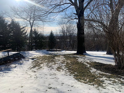
The slush I photographed outside my house late this 
afternoon will be slippery ice by the time I get up
in the morning. Bits of freezing drizzle overnight
won't help, either. 
That slush in northern Vermont is going to freeze soon, while those areas, and some other parts of the state face the prospect of freezing drizzle tonight. 

Most of the snow fell in far northern Vermont, as we alluded to this morning.  It turned out to be much less widespread than predicted. Almost everybody south of Route 2 had less than an inch

The highest accumulations we saw were also less than the highest accumulations we thought we'd see. Those higher amounts include 5.5 inches in West Burke; 5.4 inches in Maidstone and 4.5 inches in North Hyde Park.

The rest of the day turned into the very definition of miserably dreary. The far southwest corner of Vermont did break out into slightly warmer air, as Bennington made it to 48 degrees. The rest of us endured low clouds, fog, drizzle and a cold light rain.

That's about to get worse, As of late this afternoon, temperatures in northern and central Vermont will slowly sinking, and the moisture in the air was not going away. 

That sets us up for freezing drizzle tonight. It will be more widespread than the patches of it we had Friday night. 

A special weather statement from the National Weather Service tells us patchy freezing drizzle will continue off and on all night and into tomorrow morning. And, all that slush and water is going to freeze up overnight, too. The freezing drizzle itself will only create a thin scrim of ice, but that's enough to slow you down on the way to work tomorrow.

There were already a number of traffic accidents earlier today as a bit of snow, then freezing drizzle then drizzle that didn't quite melt the ice kept things hectic for Vermont State Police. 

By afternoon, the character of the day will change as the atmosphere starts getting windier and more unstable. That will send some snow showers flying through the air here and there, but it won't about to much.


For Second Time In A Row, Vermont Storm Had Tricks Up Its Sleeves

Another two and a half inches or so of snow
greeted me and our vehicles this morning in
St. Albans, Vermont. The forecast for this
storm has turned out accurate for places
near the Canadian border, but for other 
places in Vermont, well........
This is the time of year when meteorologists might be tempted to give up on the science and flip a coin. 

Early spring is when you tend to get the most surprises and we have some today. As many early Sunday morning risers have already noticed. 

SUNDAY MORNING SURPRISES

Most of Vermont had little or no snow as of 8 a.m. Had forecasters been right the snow would have started two hours earlier. Snow, and some rain ended up arriving after 8 a.m.   

Despite continued forecast to the contrary, I'm doubting many places along and south of Route 2 will see as much snow as had been forecast. But who knows? We seem to be in the season of surprises. 

Meanwhile, a heavier a slug of precipitation was heading into southern Vermont. The further south you go, the warmer it is. Bennington was at 39 degrees as of 8 a.m., so I imagine they'll see mostly rain. It'll be interesting to see at what elevation you have to reach in the southern Green Mountains before it's mostly snow. 

Another big surprise was the dump of snow early this morning near the Canadian border. That snow did arrive in the hours before dawn, as forecast. From what I can tell, areas within 30 miles of the border have gotten at a few inches of snow. There was 2.6 inches of new snow at my place in St Albans as of 9 a.m.  

As of 8 a.m., the snow in St. Albans had turned to a light sleet, with perhaps a few drops of freezing rain mixed in. That's a clue to what we'll deal with this afternoon and evening. A special weather statement from the National Weather Service in South Burlington noted that most of the Champlain Valley was switching over to light freezing rain or drizzle.

When the precipitation gets a little heavier, it goes toward snow. When it gets lighter, freezing drizzle and drizzle. I noticed at around 9 a.m. drizzle changed back to a burst of snow as a zone of heavier precipitation seen on radar moved in. 

As of 9 a.m., temperatures ranged from near freezing to a degree or two above in the Champlain Valley. However, central Vermont is at risk for some freezing drizzle for a few more hours. 

So that annoying icy stuff should just turn into an annoying misty cold spray in your face this afternoon.  

But it will probably go back to freezing drizzle tonight, which will make you have a workout early tomorrow morning scraping a thin but firm coat of ice off at least some of our windshields. It will also make untreated surfaces like driveways and sidewalks icy traps that could have you tumbling to the ground. 

FORECAST BUSTS

I think this storm forecast is turning out to be more of a bust than Friday's. In Friday's storm, forecasts prior to the snow were obviously wrong in the Champlain Valley. But the forecasts for northern Vermont east of the Greens and southern Vermont were actually quite accurate. 

I'm not busting the chops of the meteorologists at the National Weather Service in South Burlington. They do an awesome job. But, these kinds of things keep happening. I continue to wonder - albeit without evidence so far - that steep National Weather Service cutbacks under the Trump administration, is compromising the data that goes into computerized forecasting. 

Bad data equals bad outcomes.

I'm not the only one who is wondering about this. As we reported recently, Michigan's governor and two U.S. Senators sent out inquiries regarding forecasts ahead of deadly tornadoes in southern Michigan earlier this month. 

 I also have to acknowledge that early spring storms have always been notoriously hard to forecast, so that is definitely one important factor in all of this.  Besides, forecasting for this storm wasn't entirely a bust. We knew yesterday the Northeast Kingdom would probably get the most snow, and that seems to be the case. 

And interestingly, in the northern Champlain Valley up by St. Albans and Highgate, it appears the forecast will come out spot on. 

We also thought southern Vermont valleys would get at least some rain and little snow and that also seems to be happening, 

LOOKING AHEAD

It's a scary prospect to forecast given what I've said above, but those meteorologists working on our behalf need to attempt it. After tonight's patchy freezing drizzle, Monday looks like a somewhat unpleasant day, but something we should be used to in March.

That means mostly cloudy skies, snow showers and a chilling north wind. Highs will only make it into the low 30s at best for most of us. Maybe upper 20s in northern hills, and perhaps upper 30s in southern valleys.

Monday night looks cold, of course, with lows in the teens to low 20s. Tuesday looks like the pick of the week with sunny skies and temperatures near 40. That's near to just a smidge cooler than average for this time of year.

Our next storm looks like it will come along Thursday. I don't dare take a stab of what will happen with Thursday's system just yet. But it will probably be a capricious one, just like Friday's storm and today's weather   


Monday, February 16, 2026

Still Not Much Clarity On Vermont Weather Forecast But Some New Clues Emerging

A big icicle formed on my shed yesterday as the
warming sun of mid-February increasingly fights
against the cold. Today will actually feel rather
springlike but winter isn't done with us yet. 
 If you have plans for this coming Wednesday and Wednesday night in Vermont, we can't help you much with any weather forecasts Those annoying computer weather forecasting models are still arguing amongst themselves. 

Which is odd, since Wednesday is only two days away. More on that in a minute, but if you are more of in the moment type, we've got you covered.

TODAY/TOMORROW

For starters, today will be the most springlike day we've had yet.  Temperatures should get well into the 30s across most valleys, and we should have a fair amount of sun, which feels warmer and stronger now that we're nearly two months past the winter solstice. Winds will be on the light side too,

I get it. A day with a high of 37 degrees isn't exactly full-blown spring. But it's a start after the frigid weather we've had over the past month. 

Any hints of spring are fleeting this time of year, too, and so it goes this time. Yet another weak disturbance should come through later tonight and early tomorrow. As has so often been the case this winter, the system is no big deal, but might have atrocious timing. 

The problem is some light snow showers might switch over to light, patchy freezing drizzle just in time for the Tuesday morning commute. In the case of any kind of freezing rain, it takes only a tiny bit to send your car flying off the road and into a ditch if you're not careful enough.

The tricky thing is this will be patchy and temperatures will be just below freezing. So you'll be cruising along on just wet pavement, then all of a sudden it's ice and the cars and trucks on the Interstate are suddenly doing a literally smashing dance with each other. 

So, slow it down just in case Tuesday morning. 

WEDNESDAY QUESTIONS

We're to the point now in which we can say there will probably be some sort of precipitation in at least part of Vermont Wednesday and Wednesday night.   

Tbat's not very helpful, but that's all we've got for now. 

A storm in the Midwest will be heading in our direction but it will be shearing out on its way east. That means the storm will be pulled and stretched and weakened. And therein lies the forecast questions. 

By the time it gets to New England, it will be a fairly narrow band of snow or mixed precipitation. Colder high pressure from Quebec will on Wednesday try to nose down into New England, while to the south, moisture from the Gulf of Mexico will tried to feed into our weakening storm.

So, will the cold air win out and we get nothing? Or will the warm air win and we end up with a mix? Or, choice #3 favored by our winter sports industry, does this thing just drop a swath of snow right across Vermont.

For now, the best guess is far northern Vermont gets little or no snow, and perhaps far southern Vermont sees a mix with snow in the middle. Whatever happens, this doesn't look like it will be a blockbuster storm. 

But don't hang onto that gift to the ski gods scenario.  We should have a more clear view on this tomorrow. Or at least we'd better, as time is running out. 

After Wednesday, the weather pattern looks really active, so there will be several other chances for snow or a mix between now and early March.  I'm not even going to try and tease those out yet. 

Thursday, February 6, 2025

Vermont Thursday Snow Thump Set To Arrive; Sunday Storm To Focus On Southern Parts Of State?

A gray an ominous sky over St. Albans, Vermont this
morning as we await that quick thump of snow that
will come through midday. A little freezing drizzle
later today will be the literal icing on the cake.
UPDATE 9:30 a.m

Boy, that snow came into Vermont awfully fast, faster than I thought it would.

At 9 a.m. I could see a wall of snow just blotting out the Adirondacks from my viewing point in St. Albans, Vermont.

By 9:15 it was starting to snow, and by 9:25  a.m. it was coming down at a good clip.

Radar seems to show the band of snow might wax and wane as it comes through, but you'll see bursts of heavy snow and poor visibility on the roads.

Sometimes the snow will come down torrentially.   Traffic cams showed near white out conditions at 9:25 a.m. in places like Route 7 in Shaftesbury and Route 9 in Woodford, both in southern Vermont.

Those road conditions should deteriorate awfully fast in the next hour, if they haven't already. If you're on the roads, I'd get home now and wait it out. If it's not snowing where you are, it'll go from nothing to pretty heavy within 10 minutes. At least in some areas if not all.

Be prepared for a very snowy few hours, but it won't last long.

PREVIOUS DISCUSSION 

 Skies were growing dark and ominous in Vermont as that anticipated quick thump of snow rapidly approaches from the southwest. 

Looks like the snow was just creeping into far southwest Vermont at around 8 a.m. and it will rapidly advance northeastward through the morning. 

At least the snow will warm us up. It was another frigid one before dawn today. Burlington in the banana belt managed to stay just above zero with an overnight low of 1 degrees.

 Elsewhere, it was 8 below in Montpelier and as low as 13 below in Morrisville and Lake Eden. 

You can see how the push of snow will eventually warm us up by looking at Bennington. It was 5 above there at 5 a.m. and up to 22 at 7 a.m. 

The snow still looks like it'll come down pretty hard late this morning and early afternoon, but will be in and out of here in a flash - like four hours or so.  That's why accumulations will be limited to one to three inches, or maybe four in some of the mountains and in a few parts of southern Vermont. 

Forecasters also haven't budged from their expectation we'll see some spotty freezing drizzle this afternoon and evening once the band of snow races out of here.  Temperatures look like they'll hold steady or even keep rising slowly late this afternoon through about midnight. 

This mornings snowfall prediction map for today. Aside
from adding a tiny bit more snow than previously
expected in southern Vermont, the forecast is pretty
much the same as that issued yesterday. 

Your drive home this afternoon or evening still looks like it could be dicey 

Warmer towns could get a couple degrees above freezing this evening.  But the ground is frigid from those cold nights. 

Even if your thermometer ends up saying it's 34 degrees out, any drizzle you're also seeing will probably be freezing onto your driveway and sidewalk. 

Overnight, the storm's inevitable cold front comes in with its snow showers and local squalls. Accumulations won't amount to much, but will keep some roads tricky for Friday morning. 

We'll have the added fun of some lingering snow showers (especially mountains) and blowing snow as west winds will start gusting to 30 or even 40 mph in spot starting early Friday morning and lasting pretty much all day.  Gusts could even reach higher than that in spots across northern New York and near some of the eastern slopes of the Green Mountains. 

Temperatures will be seasonably cold Friday and Saturday with highs in the 20s, lows in the single numbers

 NEXT STORM

It still looks like it will snow pretty much statewide later Saturday night and Sunday, but it's increasingly looking like this will be a southern Vermont focus.

Through virtually all of December and January, southern Vermont has missed out on snowfalls. They've mostly focused on northern Vermont mountains.

Now, the script seems to have flipped as the weather pattern is a new one that features storms racing across the nation and going off the East Coast.  Those tend to favor southern Vermont. 

Last Friday night, southern Vermont got a decent snowfall while the north missed out. Today's event looks slightly more impressive in the south than in the north.  

The early look on this Sunday's storm suggests six or more inches of snow south of Route 4, with less than five inches north of Route 2.   Now, this could change. The storm could jog north and give everybody in Vermont a big dump.   But as of this morning, the betting is on the south. 

This new southern bias in the snow is a good thing really. The effects of last autumn's drought are still most noticeable in southern Vermont. All that snow melting in the spring will help recharge ground water for the spring and summer. 

Like all the other storms in this parade, the Saturday night/Sunday system looks like it will race past us, so it won't have time to dump incredible amounts of snow.  But these things add up if you keep getting them over and over again. 

Long range forecasts have fast storms coming near us every third day or so.  It's impossible to tell from this vantage point how those quick hitters will affect us here in Vermont, but forecasters will need to really remain on their toes, probably for at least most of this month. 

I also so far don't see any signs of a huge thaw, which is a departure from recent winters.  It has not been above 45 degrees in Burlington since December 31, and it doesn't look like it will get that warm for awhile yet. Whatever snow you have is going to mostly stick around, and you're also going to get more installments. 

Keep those shovels handy. 


Wednesday, February 5, 2025

Wednesday Evening Vermont Snow Update: Not A Biggie, But Watch The Driving Thursday

Snow-laden spruce trees Wednesday afternoon behind my
house in St. Albans, Vermont stand ready to take on
a little more snow and freezing drizzle that's in the
forecast for Thursday. 
I figure since we keep getting this constant spray of small storms coming through we'll keep you up to date with latest forecasts for the next one, due Thursday.  

Not much has changed with the forecast, as we are still anticipating a midday burst of snow, followed by some annoying freezing drizzle. 

The National Weather Service has added the possibility of some scattered snow squalls late Thursday night or early Friday morning, just for fun. 

I hope you enjoyed the blue skies over Vermont today.   It was a bright, gorgeous chilly day across Vermont. Classic mid-winter. 

 That still air, clear skies and low humidity will make temperatures crash this evening, with most of us outside the Champlain Valley getting below zero again.  The Champlain Valley itself will be close to zero.

As the clouds come in late tonight and stop the temperature free fall. Reading might actually start to rise as dawn approaches, especially in the Champlain Valley

Thursday 

In all except southwest Vermont, if you get to work or school by 9 a.m., you should avoid snowy roads. It should be clear sailing. 

Not much snow is expected here in Vermont tomorrow with
our likely short, sharp burst of snow, but it will add
a little to the increasingly deep snow cover, especially
in the Green Mountains and Northeast Kingdom 
Then, as the storm rockets by, we should only see a four to five hour window in which it will really be snowing. 

Give or take, its start mid-morning beginning first near Bennington then spreading rapidly northeastward to the Northeast Kingdom by early afternoon. 

The snow should pretty much be over by early to mid afternoon west and mid to late afternoon east. 

That doesn't give us much time to accumulate snow, which is why we're only expecting around 1.5 inches in the Champlain Valley to maybe three or four inches in the Green Mountains. 

Of course, forecasters are still saying that after the snow ends, we'll  have a few hours in which we'll deal with patchy freezing drizzle.   So the drive home, between the lingering snow on the roads, and the pesky freezing drizzle, could make things a little slow.

For the record, because of the snow and freezing drizzle, all of Vermont is under a winter weather advisory Thursday. 

It's stay murky and sorta mild amid the freezing drizzle Thursday evening before another cold front blasts through early Friday morning. It won't have as much cold air with it as the last couple of cold fronts had, but it will probably set off some snow showers and a locally heavy snow squall or two.

They'll be brief, and won't amount to much, but will probably leave their calling card on roadways as a little snow and ice for your Friday morning commute. It's winter, after all, what do you expect?

Friday itself looks blustery and seasonably cold, with snow showers mainly in the mountains.  Don't expect much additional accumulation. 

Elsewhere. 

The real action with this storm remains to our southwest. It's vigorous enough so that it might touch off a couple of severe thunderstorms, or even a weak tornado or two tonight in Tennessee or Kentucky.  There's also the risk of a little flooding in and around West Virginia as it should rain pretty hard down in that neck of the woods tonight. 

The big problem still looks like it will be in parts of Pennsylvania and Maryland, where an ice storm warning remains in effect. In addition to horrendous driving conditions, they are worried about power outages and tree damage in the worst affected areas.

Many school districts in the ice storm warning area have already called off classes for Thursday. 

Other Storms

It's still looking like another storm will hit Vermont and surrounding areas Sunday. Some areas could see more than six inches of snow. The early read on this is the heaviest snow is most likely in southern Vermont, but that could change, so stay tuned.

The rapid fire spray of storms continues. Another one looks like it might affect parts of the East Coast next Tuesday, but the early guess is that one might go too far south of Vermont to have any effect on us. We'll keep an eye on it. 

Beyond that, forecasts get even iffier, but it looks possible that yet another quick winter storm could affect us next Friday, and again a week from this Sunday. 

Monday, December 16, 2024

Gusty Winds Northern VT/NY Tonight, Tomorrow, Hang On To Those Christmas Decorations

Wind gusts to near 50 mph slammed this dead tree
down on a garden in St. Albans last spring. We 
might see similar scenes here and there Tuesday
as gusts to 50 mph might tear down a few weakened
and vulnerable trees and branches. 
Two rounds of expected strong gusts, one overnight tonight, another during the day Tuesday have prompted some wind advisories in northern Vermont and New York

Those advisories go into effect at 9 this evening for Franklin, Grand Isle and Orleans counties in far northern Vermont, and for most of Adirondacks and the counties bordering Canada east of Massena. 

Winds could gust in this region up to 50 mph, which could drop a few trees, branches and power lines.

The two rounds will strike two different areas.

The first blast of wind, mostly in the few hours before and after midnight, will focus mostly on the northern Champlain Valley and northern Adirondacks.

After a bit of an early morning lull, the winds will pick up again, this time focusing on the eastern Adirondacks and the eastern slopes of the northern Green Mountain. 

The forecast wind speeds won't be all that odd for winter, but with everybody's Christmas decorations up, it's worth it to be wary.  Make sure all that Christmas stuff is fastened, attached and otherwise secure before the wind really hit.

Decorations blowing around can hit other objects, like houses, cars and power lines, adding to the damage.

Before the winds arrive, areas of freezing drizzle and light freezing rain are possible this evening in Vermont along and east of the Green Mountains.   We could see some icy roads in spots before temperatures start to rise late tonight. 

A winter weather advisory is up for adjacent New Hampshire this evening because of that freezing drizzle risk. 

Rain will arrive later, then end quickly Tuesday morning. The winds will tend to diminish in the afternoon.

No rest for the weary with weather systems, though. Snow and rain look like they'll want to arrive Wednesday night.  We'll see updates on expected amounts of snow tomorrow, but it looks like the Champlain Valley will once again see little snow while the mountains pile it up.

It's also now looking like this coming weekend will be quite cold - even chillier than the temperatures we had over the weekend. 

Tuesday, March 26, 2024

Topsy-Turvy In Vermont: Spring Northwest, Winter Southeast

The National Weather Service office in South Burlington
released this map of forecast highs today and it is 
weird. Highs will be as chilly as 36 in Springfield
in the southeast to as high as 58 in the northwest,
up around St. Albans. 
Usually this time of year, the chilliest early spring air is in northwestern Vermont, which makes sense, as that part of the state is closer to those cold fronts that sneak down from Canada.  

Southeastern Vermont tends to be a little more springlike, with generally clearer skies,  a lower chance of snow or ice and warmer temperatures than most of the rest of the state.

Things are totally backwards now.

Southern Vermont is still deep in snow cover from that mega-snow on Saturday, with more than two feet in many spots.  

Up in northwest Vermont, the four to six inches of snow that fell Saturday is disappearing fast. Bare patches in the snow up there today will rapidly expand.  

Today, the backward trend continues with a huge temperature difference between southeast and northwest.  If you like spring, go to the great not-so-white north. 

If  you're down in places like Brattleboro or Springfield, the best you'll do for afternoon highs today will be the mid and upper 30s, definitely on the cool side for late March. An overcast will add to the chill. 

If you're in places like Alburgh, Swanton or Highgate in the northwestern tip of Vermont, temperatures could get close to 60 degrees this afternoon, with quite a bit of sunshine. Springtime balminess for sure.  

In between those two extremes, there will be a gradient with 50s northwest,  and 40s in central Vermont. 

It gets worse. Southern and eastern Vermont will probably see a little freezing drizzle tonight. I suppose a few raindrops could come down late tonight up in the northern Champlain Valley, but they won't freeze

So yes, it's very strange.  

THE REASON
The snow was already starting to disappear from my
St. Albans, Vermont yard late yesterday afternoon, and
a warm day to day will get rid of much more.
Meanwhile, the deep snow in southeastern Vermont
will stay mostly intact amid much cooler readings. 
The cause of today's weirdness is cold high pressure way up in eastern Quebec and Newfoundland and a storm far off the Mid-Atlantic coast.  That combination is creating a feed of cold, wet low level air heading westward into New England. 

The air is damp enough to yield some fog and drizzle, which will turn to freezing drizzle in many areas east of the Greens tonight as temperatures drop. 

It's even a little worse in neighboring New Hampshire where a winter weather advisory is up for tonight for freezing drizzle.  

This flow of chilly dank air will be hitting a road block in the form of the Green Mountains. This is low level cold air we're dealing with, mostly confined to the lowest few thousand feet of the atmosphere. 

Cold air is more dense than warm air, so it tends to stay low. There's not enough of an east wind to really lift the air up and over the mountains. 

Besides, any cool air that does make it over the crest of the Greens would flow downhill on the west slopes. Air flowing downhill compresses, and that tends to make the air warmer and drier.  If you're west of the Green Mountains you'll probably see a bank of clouds peeking over the ridge tops from the east, but not really coming much further west than that. At least for awhile.

As the east winds persist, some of those clouds from the east will eventually win over later today, slowly blotting out the sun further and further west.  Also, high clouds from a storm well to our west and an approaching, dying cold front will filter the sun as the afternoon wears on up in "tropical" northwest Vermont. 

BEYOND TONIGHT

The cooler weather in southeastern Vermont will at least temporarily slow the snow melt. That snow will refrigerate things, keeping temperatures slightly cooler than they otherwise would be even after this chilly east wind dies out. 

Meanwhile, any sun we get in the coming days will heat the increasingly bare ground, and then the air in the northwest.

Even so, the temperature contrast will diminish. It'll be in the low 50s northwest tomorrow and in the upper 40s to near 50 southeast.

Thursday is a wild card, though. A new storm along the East Coast might create a new northwest to southeast weird contrast in Vermont Thursday and Thursday night. 

 The path of the storm is still really open to question, with various models giving the Green Mountain State anything from absolutely nothing to a total soaker with possible snow. 

There's a chance we could have another situation in which northwestern Vermont is quiet and mild, while the southeast has a cold rain or even wet snow. 

Very unsure on this one, so stay tuned.

By the weekend, things should go back to how it should be: Forecasters expect near normal temperatures, which afternoon highs little cooler in northern Vermont than in the south.

As it should be, for a change.  

Wednesday, January 31, 2024

Constant Vermont Gloom Continues On; Freezing Drizzle To Return?

Those black specs in this photo are crows flying beneath
yet another day of thick overcast above St. Albans,
Vermont this afternoon.
As I write this at 4:30 Wednesday afternoon, the sun - whatever that is - will set at 5 p.m., continuing Vermont's long stretch of exceptional sunshine-free drabness and gloom. 

Some of us optimists out there had pinned our hopes on bits of dry air Tuesday and today that would have created a few brief breaks in the clouds and thus glimpses of sun.

But nope! The low level moisture in the atmosphere stayed put, and so did the low, gray overcast. 

I don't have the stats to prove it but this has to be close to the cloudiest January, and possibly cloudiest winter so far in Vermont. 

The last time most of us saw any sun was on the morning of January 22. By my count, 22 days this January were either completely overcast or very nearly so. 

We're going to endure more dreary weather for a couple more days. 

But here's a tidbit I found in this afternoon's forecast discussion from the National Weather Service office in South Burlington: "Finally for the weekend, we promise, you'll see the sun!"

I'll get into that in a moment. 

First, the dreary outlook for Thursday. Forecasters have a worse outlook on tomorrow than they did. They had initially told us there's be some light mid and high elevation snow in Vermont with rain mixed in down in the valleys.

At least the higher spots would get their snow cover freshened up a bit right? 

Not so fast. 

Now, the updated forecast for Thursday afternoon has trended in the direction of drizzle and our, um, beloved freezing drizzle or, frizzle as I call it. 

The "frizzle" will be very light and spotty and confined pretty much from the Green Mountains east. It won't cause enormous problems, but those icy patches on untreated roads will return, much like we had to endure during most of last week. 

The freezing drizzle will start to trend toward snow showers on Friday but those snow showers will amount to almost nothing. A few mountain locations could get a whole inch of snow.

SUNSHINE?

Now, that promised sunshine. 

I'm skeptical, but there are signs the sun could break through Saturday and Sunday. A high pressure system is forecast to feed dry air from Canada toward us over the weekend. Also, high pressure areas create sinking air, which tends to erode cloud cover.

The National Weather Service isn't promising wall to wall sunshine over the weekend. Instead, they're saying skies should go partly cloudy. That means periods of sun and sizable gaps in the clouds revealing big patches of blue sky.

We shall see.

If we do see that weekend sunshine, chances are it won't last long. A cold front from northeastern Canada and a storm far off the East Coast will probably throw enough moisture back into northern New England to cloud over the skies next week. 


Monday, January 29, 2024

Can't Escape The Vermont Freezing Drizzle; But Quiet Weather Week Ahead

You could just see a little ice on bushes and trees
yesterday morning in St. Albans, Vermont after another
night of freezing drizzle. Same issue this Monday
morning in some parts of Vermont, so be careful
on the roads during the morning commute 
 For the six day in row, parts of Vermont saw some pesky freezing drizzle this morning. 

Like in previous days, it's not much and it's patchy, but it doesn't take a lot to mess with driving. 

The freezing drizzle early today was unexpected, as the atmosphere is transitioning to one in which it is colder aloft. Under that regime, any precipitation that falls should be snow.

But the atmosphere hadn't gotten rid of a warm layer yet, so the freezing drizzle hit in spots. If there is any freezing drizzle or freezing fog still out there as I write this at 6:30 a.m. it will end soon.

The usual caveat applies: Just take it slow and easy.  Untreated surfaces here and there, like back roads, driveways, some sidewalks etc. may be quite icy.  On the highways, overpasses and bridges are more likely to have ice than the rest of the road.  It's best not to use cruise control on your car and keep a big distance between you and the vehicle in front of you. 

Meanwhile that storm system that scooted by to our south obeyed last evening's forecast updates and didn't amount to too much. 

Parts of central Vermont got three or so inches of snow. Norwich, Vermont reported 2.9 inches and East Barre clocked in with 2.8 inches. No snow reached far northern Vermont. 

High elevations of far southern Vermont, as expected got some snow, too. Athens, which is a high elevation town west of Bellows Falls, got five inches. West Arlington in southwestern Vermont saw two inches.

So, not a big deal

REST OF WEEK

Blessedly boring is still the weather outlook for this week in Vermont. Knock on wood, we have no more freezing drizzle on the way. 

We'll start the week off with near normal temperatures.  Readings near 30 this morning won't go anyway as north winds blow somewhat colder air in from Canada. 

It'll be in the upper single numbers and teens tonight, and in the 20s Tuesday.  Tomorrow brings us the best chance of seeing any sun since Monday morning, January 22.  It won't be crystal clear, but patches of blue sky could yield some sunshine. Same on Wednesday. 

Wednesday and Thursday look like they'll be on the mild side again (highs in the 30s) before a cold front brings us a chilly, but not ridiculously cold weekend to start February.  I still see no signs of any big storms until at least a week, probably more. 

Thursday, February 23, 2023

Thursday Evening Update: Dreary Day, Icky Evening In Vermont

After this morning's snow, a combination of temperatures in
the teens, periodic snow showers, moments of freezing
drizzle and a low overcast made for a 
dreary February day in St. Albans, Vermont. 
After last night's and this morning's snow, and a dreary day of low overcast, fog, light, grainy snow showers and freezing drizzle - let's call today's weather snizzle - we're now gearing up for Round 2 of our latest Vermont winter storm.  

Round 2 won't be huge. And though this has definitely not been the biggest winter storm ever to hit Vermont, it still caused its share of problems.

The worst was a likely weather related car crash on Interstate 91 in Hartland this morning that killed one person. 

Slide offs and more minor crashes were reported statewide. 

The latest list of storm reports indicate areas kind of between Route 4 and Route 2 got five to eight inches of snow out of this. Amounts tapered off as you headed toward the Canadian border because dry air won out. Only 1.5 to 5 inches fell north of Route 2. My place received an additional 0.3 inches of snow during the day, bringing my total so far to 3.5 inches as of 5 p.m. I got off easy. 

Or not so easy, as you'll learn further down in this post. 

South of Route 4, mixed precipitation cut back on snow amounts. 

TONIGHT

A new winter weather advisory has been posted for along and south of a  line roughly from Vergennes to White River Junction as Round 2 moves in. 

Though temperatures are remaining quite cold near the surface, another strong push of warm air is coming in aloft. It will ride over the cold air. 

In the winter weather advisory zone, snowflakes from way high up will melt on the way down when they encounter that layer of warm air.  Some of those raindrops will re-freeze on the way down when they hit the cold air a little above the surface. That would be sleet.  Other raindrops won't freeze until they hit the surface. That's freezing rain. 

Luckily, this next push of moisture this evening isn't as vigorous as the one last night. So precipitation will be light. But it will be enough to make road conditions deteriorate again, and make things extra dicey underfoot. 

A sign of spring, believe it or not. The sun shone very 
weakly through the clouds around noon today in St. 
Albans, Vermont while temperatures were in the upper
teens. But with a higher sun angle, the sun's rays
were briefly able to melt a small amount of snow'
and ice on my driveway. 


A tiny amount of freezing rain or drizzle can cause real problems. I learned the hard way today. I shoveled the driveway at my house in St. Albans, Vermont today. Then we had a period of light freezing drizzle which froze onto the pavement. So, clumsy me slipped on that thin layer of ice and took a nasty fall. 

Luckily, the result is only a headache, a slightly scraped and bruised arm and an even more seriously bruised ego. So let this be a warning. Be careful out there! 

A sign of spring, though. Toward noon, the sun shown weakly through the clouds. It was only 18 degrees, but still, the sun was enough to briefly melt some of the ice on the driveway. The increased sun angle as we head toward spring is  making a difference. That brief melt would have never happened in December.

Back to the forecast: 

Near Route 2, any mix will probably be just sleet, but we can't rule out any freezing drizzle. Way up north, within, say 20 or 30 miles from the Canadian border, there should be little if any mixed precipitation. Just snow. That's why there's no winter weather advisory in the north. Because there's not much ice to talk about. 

These northern spots should  receive another one to three inches of snow. Some higher amounts will probably fall in the Green Mountains from near Bakersfield to the Canadian border.

FRIDAY

It'll be all over except for scattered snow showers on Friday. As advertised, it will be a frigid, blustery day. For the fourth Friday in a row, temperatures will hold near study or more likely fall slowly through the day. That's, of course, opposite of what you'd expect, with temperatures rising toward a peak in the afternoon. 

But we insist on being half-assed backwards again. 

Friday night and Saturday morning will be by far the coldest since February 4. Almost everybody will be below zero. The cold spots will make it into the teens below zero. This isn't record cold, but it is quite nippy for late February.  

WEEKEND/NEXT WEEK

Saturday will stay cold - not getting out of the teens. There's a risk of a few lame snow showers, too. Sunday brings us a better chance of snow showers, but it will warm up to the 20s to around 30. The snow showers Sunday will probably only give us two inches or less of snow.

I somewhat more substantial storm seems to be in the cards for Monday night and Tuesday. But we don't know how much or what kind of precipitation we'll get. Odds at the moment are leaning towards light to moderate snow, but that could easily change. 

Monday, February 7, 2022

The Almost No Snow Forecast Stands, But.......(Updated To Include Expanded Winter Weather Advisories)

My driveway in St. Albans, Vermont is pretty much cleaned
up from last Friday's 15.7 inch snowfall. Despite some
hints of flurries and freezing drizzle in the forecast,
I won't have to worry about too much more shoveling
this week with a mostly dry forecast.
UPDATED, 5 p.m. MONDAY

The National Weather Service in South Burlington has expanded the winter weather advisories since this morning.

Those advisories now cover all of Vermont except anything west of the Green Mountains from Addison County north. 

Forecasters are still expecting only light precipitation, but it will come in the form of an ugly light snow and freezing drizzle combination tonight and early tomorrow.

It doesn't take much to ice up the roads, so be careful driving tonight and early tomorrow.

There might be a few snowflakes, or a wee bit of freezing drizzle or freezing fog in northwestern Vermont overnight and early tomorrow.

Though the northwest has no weather advisories, there could still be a few slick spots even there. 

 PREVIOUS DISCUSSION 

For days now, I've been saying that after that big dump of snow we had in central and northern parts of Vermont that we'll next go through a long period with little new snow.  

All that is still true, but if you're in parts of southern and eastern Vermont, it turns out you'll deal with a small bout of icky, wintry weather today and tonight. 

Another nor'easter will take a similar track as the one that brought a blizzard to eastern New England a couple weekends ago.  

The difference this time is the one coming by later today is much, much, weaker than the previous, has much less moisture to work with and will be out of out hair soon.

The upshot is this piddling little nor'easter will still shove a little snow and freezing drizzle into southern and eastern Vermont later today and tonight.  These areas will end up with at most an inch or two of snow and a light glaze. Or additional glaze since trees in southern Vermont are still ice covered from the freezing rain Thursday night and Friday morning.

Today's "storm" if you want to call it that, won't add enough additional ice to renew any power outage problem.  But roads will become slick again in southern Vermont, and east of the Green Mountains. That's especially true south of St. Johnsbury. 

It's all enough for the National Weather Service to issue winter weather advisories for southern and eastern Vermont due to the iffy roads that now seem likely. 

Northwestern Vermont might get some flurries or a few particles of freezing drizzle tonight, but nothing wild. 

The forecast for the rest of the week is still the same: Relatively mild and just little bits of snow showers, with possible very light rain showers in the valleys Thursday. 

Saturday, December 25, 2021

Christmas Night Vermont Update: Still Kinda Gnarly Out There

You an see trees being weighed down by ice in the 
background in this screen shot of an AOT traffic cam
along Interstate 91 in Guilford, Vermont.
 Today, as expected, was a disaster for driving and/or walking in Vermont.

Freezing rain was widespread, and that put an end to plenty of Christmas plans, including my own. I had planned to travel from St. Albans to Rutland to visit family, but the roads seemed a bit much.  

There were accidents and slide-offs galore, and some roads actually closed. So it wasn't worth it. 

Among the roads largely shut down was a 40-miles stretch of Interstate 91 in southeastern Vermont, which was closed to all but essential travel for several hours. A number of secondary, hilly rural roads were impassable.

It doesn't take that much freezing rain to do that. Ice accumulation was mostly around a tenth of an inch, in line with forecasts.  But that's more than enough to stop trapping. Icing was a little thicker in southeastern Vermont, where it piled up to close to a quarter inch. It was enough to cause a few minor and brief power outages.

Far northern Vermont escaped the worst of it, but it was still icy.  For instance, Burlington was pretty iced in by mid-morning, but at my place, there was barely any ice until freezing drizzle and fog moved in during the middle of the afternoon.

For those of you planning on making a car trip in or near Vermont this evening, it's not going to get much better. It could actually get a little worse as temperatures drop.

Freezing sprinkles, freezing patchy light freezing rain and freezing drizzle (or as I call it, "frizzle") will continue over night. And possibly be mixed with a bit of snow in spots.   Total precipitation, if you melt it down, will amount to only a few hundreds of an inch, but that's more than enough to keep roads, sidewalks and such icy. 

Also as expected, it got a little bit above freezing in some valleys of western Vermont from Burlington south. But that will all freeze up again this evening, so you won't get a break there, either.

"Frizzle" and patchy snow will continue into Sunday morning, so don't expect perfect driving conditions until later in the day.

Unless my flight is canceled, which seems like a strong possibility given the news, I'm leaving to visit relatives and friends in Maryland and Delaware, so posting on this here blog thingy might be a bit spotty over the next few days, but I'll try my best of course! 

Check for updates, as I'll have 'em!