Showing posts with label gusts. Show all posts

Friday, November 21, 2025

Hurricane Melissa Had World Record Wind Speed, Could Be Part Of Terrifying Trend

A dramatic view from inside the eye of Hurricane 
Melissa near Jamaica. Photo was taken for a hurricane
hunter plane. One of those planes dropped an 
instrument that detected a 252 mph wind gust
within the storm. That gust was just verified
as the strongest on record detected in a hurricane.
 It looks like Hurricane Melissa achieved at least one world record for hurricanes. 

A weather measuring instrument called a dropsonde was tossed into the hurricane from a NOAA Hurricane Hunter airplane shortly before storm made landfall in Jamaica back on October 28. 

The dropsonde recorded a wind gust of 252 mph on its way down through the storm. 

The 252 mph gust was measured about 820 feet above the ocean. 

This beats the old record for highest wind recorded by a dropsonde in a tropical system. 

That previous world record for the highest gust was 248 mph from a dropsonde that descended through Typhoon Mega in the western Pacific Ocean back in 2010. 

CONFIRMING THE DATA

A dropsonde, is a device NOAA Hurricane Hunter airplane personnel drop into the maw of hurricanes. Dropsondes have a small parachute attached and they take  somewhere between two and four readings per second before splashing into the ocean. They usually throw a bunch of dropsondes into a hurricane pretty much all at once to get a holistic look under the hood of the storm. , 

While on its way down, dropsondes grab information on air pressure, temperatures, and wind, and relay that back to the hurricane hunter plane.

The hurricane hunters knew right away that the dropsonde recorded that 252 mph gusts. But NOAA and other scientists, as they always do, wanted to double check the data to make sure there wasn't something wrong with the dropsonde. 

According to a press release from U.S. National Science Foundation National Center for Atmospheric Research (NSF NCAR) it took until this week to verify the information because NCAR scientists needed to verify the data to make sure there was no glitch with the dropsonde. 

As CBS reported, researchers went through the numbers using quality control software. They also confirmed the 252 mph gust was physically possible, given Hurricane Melissa's strength and structure.

The careful review was necessary because errors can happen with dropsonde data.  A dropsonde that fell through Hurricane Katrina in 2005. A dropsonde measurement in that storm when it was in the Gulf of Mexico recorded a gust higher than that seen in Melissa.

However, researchers found a lot of problems with that Katrina measurement so it was discarded. 

RECORD BIG MELISSA

At the time the 252 mph gust was measured while Hurricane Melissa was officially a storm with sustained winds of 185 mph.  It made landfall in Jamaica at that strength. Damage in Jamaica where winds were strongest looked like they were caused by an EF-4 tornado. 

The gusts might indicate that Hurricane Melissa might have been even a little stronger than that 185 mph at landfall. 

After each hurricane, meteorologists examine the data from the storms and publish a full, detailed analysis. Those analyses often update the strength of hurricanes that differ from original reports.  

Before this 252 mph gusts was verified, Hurricane Melissa was already a record breaker. When Melissa made landfall those 185 mph (as it stands now, anyway) sustained winds ties the record for strongest winds for an Atlantic Ocean hurricane making landfall.

Only two storms the Labor Day Hurricane in Florida back in 1935 and Hurricane Dorian in the Bahamas in 2019. 

The central air pressure in Hurricane Melissa reached 892 millibars. That's another way of measuring the strength of a hurricane. With that pressure, Melissa tied the record for the strongest landfalling Atlantic hurricane since that 1935 hurricane in Florida. 

 As the Washington Post tells us, Hurricane Melissa also set an informal record for the most eyewall lightning observed by satellites. Before landfall, the satellites detected 700 flashes per minute, or 11 per second. 

Most hurricanes don't generate much lightning. When there is lightning in a hurricane, it's a sign of an extremely intense hurricane, or one that is strengthening.  

SCARY STORM, SCARY TREND

Josh Morgerman, very likely the most prolific and expert hurricane chaser in the world, has been in the middle of 84 hurricanes and typhoons so far. He was in Jamaica for Melissa. 

He wrote: "Melissa's winds were absolutely ferocious - the most intense I've witnessed in 84 hurricanes. And the resultant damage was spectacular. This was a truly rare specimen."

Morgerman continued in his technical report on the hurricane, where he monitored the storm in a struck hotel building:

"At the height of the storm, the whiteout was 100% and the screaming sound was so hard that others in the hotel kitchen were putting their hands over their ears. This aside the explosive gustiness of the winds blasted the building, caused one's ear drums to pull painfully, so that the author was often holding or rubbing his own ears"

Morgerman said many trees that were somehow left standing were completely defoliated. In some cases the bark was ripped off.  Wood frame homes were completely flattened, concrete buildings partly collapsed and paint was blasted off some buildings and cars.

Gawd, that had to be absolutely terrifying. 

Just a reminder, though the number of hurricanes in the Atlantic Ocean doesn't seem to be increasing, the number of super powerful ones are increasing. And those top end storms seem to be getting stronger than ever. 

There's even talk of creating a Category 6 for hurricanes. Right now, the strength chart for hurricanes go from Category 1 to 5.

Climate change might well be making horrible experiences like what Jamaica went through ever more likely.  And inevitably, some of these will crash into the United States.

The records being set by Hurricane Melissa are for sure a cautionary tale.  

Sunday, November 5, 2023

The Gales Of November (Well Sort Of) Have Arrived

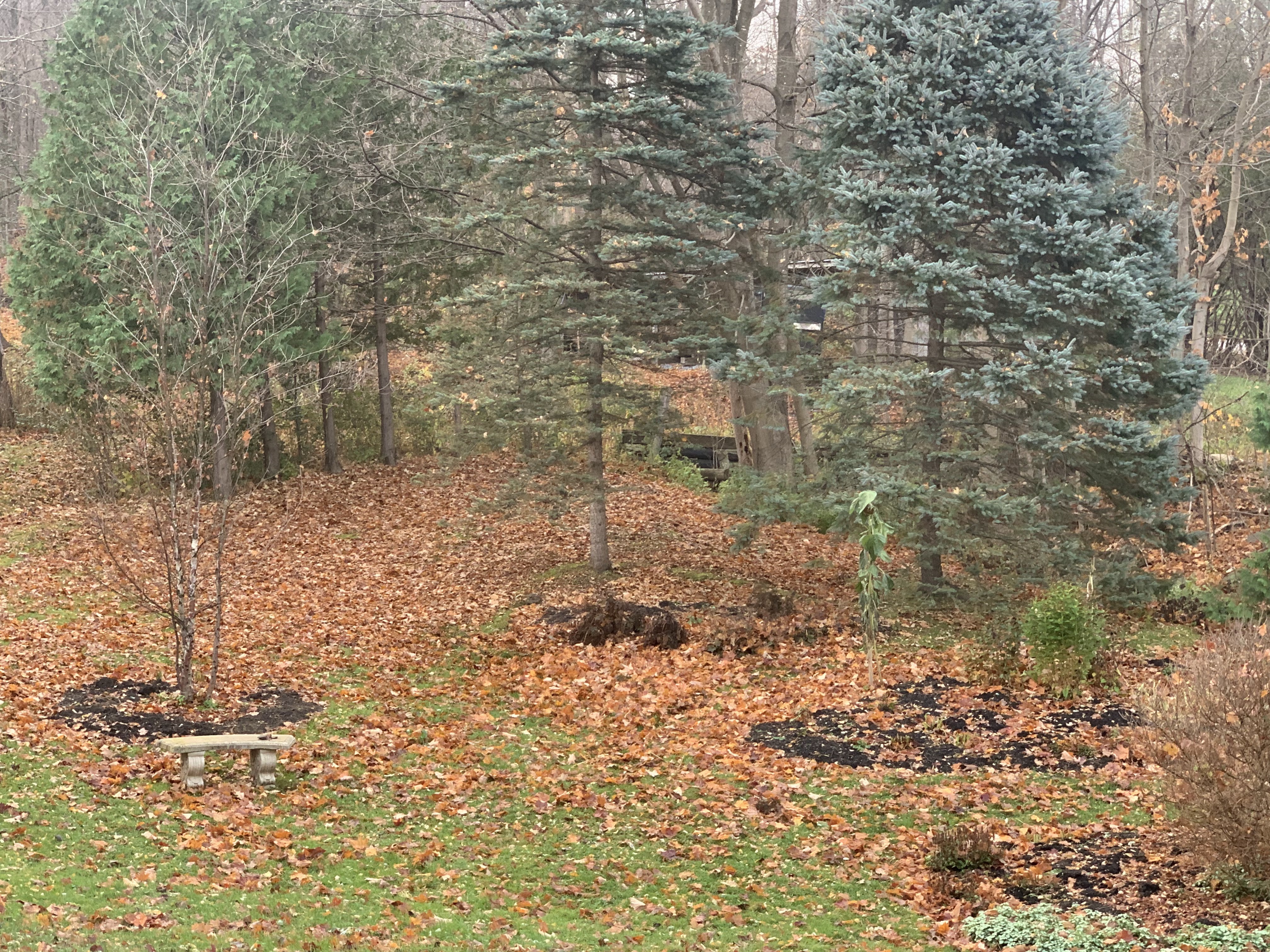
Friday night's gusts to 40 mph took down almost all
the remaining leaves on the trees around my 
St. Albans, Vermont yard, leaving the lawn 
carpeted in orange and brown.
 It was a little late in coming, but the usual windy cold season regime finally arrived in Vermont Friday, which featured a very gusty night in the Champlain Valley. 

We've got another round of gusty winds Monday night and early Tuesday. 

Summer and early fall in Vermont usually feature very little wind, except in strong thunderstorms. By fall, the winds pick up, especially in the Champlain Valley, as stronger large scale storms start to take hold. 

Although it can be windy anywhere in Vermont this time of year and in the winter, the Champlain Valley is ground zero for gusty days and nights. 

That's especially true this time of year. A typical November storm track is up through the Great Lakes and into Ontario and Quebec. That sets up south winds.  The Green Mountains and Adirondacks act as a funnel, constricting the air and making move high speed south to north up the valley. 

These windy spells are frequent, and it doesn't take a very strong storm system to produce them.  One storm passed well to our  northwest Friday night, producing gusts to and maybe even a little over 40 mph in spots. 

It's been such a calm autumn until now that I was surprised how many small branches were on the ground after that windy spell Friday night. Weakened and dead twigs accumulated in trees during a remarkably wind-free summer and fall. The first windy night produced, an, um, windfall of downed small branches. 

Nothing damaging of course. The winds weren't strong enough to cause much trouble.  It did take down most of the remaining leaves on the trees. Most of the straggler leaves still clinging to the trees are about to blow off. 

That's because another modest storm is coming along Monday night. Again, typical of November, this one is going by to our northwest. Though the storm isn't a biggie, the jet stream driving it is strong.  That'll push that storm past us very fast, and perhaps mix down some higher speed air from aloft. 

Not all of the region will get a blast of wind out of this, but it should be breezy everywhere Monday night. 

The central and northern Champlain Valley should see gusts over 40 mph Monday night, so it will be rather noisy and bumpy and spooky outside overnight as the wind roars through the now bare trees and slams shed doors and shutters back and forth. 

In the far northern Champlain Valley winds - say up toward St. Albans, Swanton, Alburgh, and other parts of the Islands - winds could gust to 50 mph.  This might prompt a wind advisory because those gusts are strong enough to produce some scattered power outages. 

I don't know anybody in their right mind who would be on top of Mount Mansfield overnight Monday and early Tuesday, but gusts up there should reach 65 mph, says the National Weather Service office in South Burlington. 

Although the gusty winds coming up aren't due to any strong systems, sometimes the storms that roared through the Great Lakes are truly monsters - the famous Gales Of November. Those huge storms also cause very windy weather in Vermont, and throughout the eastern half of the United States.

Big November storms like that are what the song "The Wreck of the Edmund Fitzgerald,"  is about. It's the true story sung by Gordon Lightfoot about a ship that sank during a powerful storm in Lake Superior in November, 1975, claiming 29 lives.

Another famous November gale was in 1950, with a powerful storm that moved northeastward more along the Appalachians rather than the Great Lakes.  That storm dumped one to as much as five feet of snow on places like Ohio, western Pennsylvania and West Virginia. 

In the Northeast, that 1950 event is easily one of the worst wind storms in history. Gusts reached 160 mph atop Mount Washington, 110 mph in Concord, New Hampshire, 108 mph in Newark, New Jersey and 94 mph in New York City. 

Here in Vermont, the 1950 storm brought the highest wind gust on record at Burlington, with 72 mph. We did come close to breaking that record last December 23rd with a gust to 71 mph in Burlington. 

Nothing extreme like those storms is on the way anytime soon, so don't expect much drama. But if this November is anything close to normal, expect more hang on to your hat and bump in the night weather pretty frequently over the next few weeks. 

Saturday, December 3, 2022

Another Vermont Wind Storm: Some Places Surprisingly Windier Than The Last Time

Another round of high winds this morning in Vermont
especially over the northern Champlain Valley.
UPDATE: 2:30 PM

Some of those gusts this morning up in Franklin and Grand Isle counties, Vermont were pretty impressive.

White's Beach in Grand Isle gusted to 66 mph. I imagine 60 mph gusts must have affected the lake shore in Franklin County, too, and perhaps up toward  

Colchester Reef gusted to 54 mph, and North Fairfax saw a 51 mph gusts.

More gusty winds might come through later this afternoon, but it won't be as bad as early this morning.

PREVIOUS DISCUSSION

 During last Wednesday's windy storm, most of the strongest gusts were outside the Champlain Valley, which surprised me a bit. 

An inversion in the lower atmosphere kept the strongest gusts a few thousand feet overhead, keeping gusts to a minimum

Interestingly, a somewhat weaker storm system than Wednesday's has been really rocking the Champlain Valley since a little after midnight. 

Gusts have surely reached at least 50 mph in some exposed locations on Champlain Valley hillsides and near open water.  .Out on Hathaway Point Road near St. Albans Bay, a large tree fell, blocking the roadway. There were two other reports of trees down in St. Albans, suggesting winds there could have reached near 60 mph. I'd believe judging from the howling winds outside my house. 

Reported wind gusts so far include 52 mph on Colchester Reef, 47 mph on Burton Island and 44 mph at the National Weather Service office in South Burlington. 

As of 6:30 a.m. today, power outages were pretty minimal, with just 500 or so homes and businesses without power in the Champlain Valley.  Of course, as soon as I wrote this sentence, power failed at my house and neighborhood. It was only out for less than a half hour, though.

It is awfully windy, but away from Franklin County at least,the gusts are falling just short of being capable of widespread damage, which is great news. As rain approaches and overtakes Vermont later this morning and early this afternoon, the wind will tend to diminish some. 

As a cold front crosses Vermont this afternoon, there might be renewed strong wind for a time along and just behind the front. 

A wind advisory is in effect for the Champlain Valley through 6 p.m. today. 

Things should be calmer by tomorrow.

Windy days are common in the late autumn and winter, especially in the Champlain Valley, where south winds funnel between the Green Mountains and Adirondacks. 

This autumn had been until recently unusually calm, with not many windy days. But it has gotten gustier. Today is the fourth day in a row in Burlington with gusts of at least 36 mph. 

It's getting into winter, so expect plenty more blustery days ahead.