Showing posts with label sky. Show all posts

Wednesday, February 26, 2025

A Grieving Family Gets Their Father's Sunset, Thanks To The Kindness Of Strangers

Sunset over Mankato, Minnesota on January 16. After a
gloomy two month period in Minnesota, the sky lit up
on the day Vietnam veteran Craig Wilson passed away,
Photo from Sparrow Media via Facebook
In this (in my opinion) dark age of America, I'm always looking for the light. 

So, too, was a grieving Minnesota family this winter

Vietnam veteran Craig Wilson was laid to rest this winter on a dark, overcast day at the Minnesota State Veterans Cemetery in Preston, Minnesota.

In the final couple months of his life, as his family gathered with him at a Minnesota hospital, they couldn't help noticing how gloomy and cloudy the weather had been, darkened their mood even more as the family patriarch faded. 

Wilson died on January 16.  Late that afternoon, the Minnesota sky lit up with what locals say was one of the most spectacular sunsets in memory. Wilson's family took it as a sign.

Wilson's daughter, Emily Canney, took in that sunset. But after it was over, she realized she never took a photo of it. Which was important, given her father's memory 

"'All that night and all the next day, I'm kicking myself because I didn't get a picture,' Emily said. 'How could you not capture this stunning glorious sunset?'"

Sunset over rural Minnesota on January 16. Photo by
Sandy Zimmer Gaulke
Canney went to the "That's so Minnesota" page on Facebook and wrote: "I'm wondering if any of you amazing photographers happened to capture last night's sunset. My dad passed away yesterday and I'm kicking myself that I didn't get a picture."

Canney hoped that maybe one photographer would respond.

Instead, 883 people did. A few of them offered condolences without a photo. But the overwhelming majority of respondents posted photos of that January 16 Minnesota sunset. 

There were pictures of the sunset over cities. The sunset over the prairie. The sunset over the north woods. Sunset over an informal ice hockey rink. You get the idea. 

Then there were comments like this: "Your dad must have been special for God to have painted such a beautiful sky."

In this age when there's too much darkness around, it's gratifying that so many people want to literally show each other the light. 

It might seem like a small gesture, posting a sunset photo to raise the spirits of a grieving daughter.  But every positive, "small" gesture is really a big one.

It's wonderful that the weather cooperated to create this beautiful sunset, this beautiful tribute. Even better were the people who went outside in the middle of a Minnesota winter to capture a sky glowing in all those colors.  

It's all about finding the light. 


Saturday, November 9, 2024

Friday Cold Front Caused Some Vermont Drama; Fire Hazard Remains, But Rain Monday?

Drama in the skies over Vermont with a gusty cold 
front Friday, but again, precious little rain. 
Friday's cold front passing through Vermont caused created some dramatic skies and winds strong enough to cut power to a few places in the Green Mountain State.  

But the front failed to provide what was really needed: A soaking rain did not happen. 

There was never much rain in the forecast. But the front did give us something to watch.

 The dramatic clouds, combined with with shafts of bright, golden late afternoon sun looked quite spectacular. And several places were treated to huge rainbows from the very brief showers. 

If nothing else, then, it was a great day for Vermont sky watchers. 

This was an odd line or two of showers and storms for this time of year. The rare times you get strong gusty winds with a line of showers and storms is along a storm front is when a powerful cold front from one of these Great Lakes "gales of November" storms smashes through.    

But we haven't really had one of those storms yet. 

Instead, yesterday, we had a dry cold front coming in from the northwest. It was moisture-starved, but it made the best of what it had, thanks to some nice lift in the atmosphere and a strong push of northwest winds behind it.

The main line of storms was strong enough to be able to spit out some lightning strikes near Montreal, and in the area where Quebec, New Hampshire and Maine meet. 

A shelf cloud on the front edge of a line of gusty showers
Friday over St. Albans, Vermont. 
By the time it got into northern Vermont, the storms were still strong enough to create a shelf cloud o the leading edge of the line. A shelf cloud is common in summer thunderstorms but you don't often see them in November. 

Gusts exceeded 40 mph, reaching 50 mph in a few spots. Close to 3,000 homes and businesses in Vermont lost power as the winds were strong enough to pull down a few trees and branches. Some spots were briefly pelted by pea sized hail. 

FIRE WEATHER

Since very little rain fell, with none in much of southern Vermont, there's still a risk of brush fires today. It's still windy, too, with gusts as high as 35 mph this morning before beginning to diminish this afternoon. 

So you want to be careful.

As has been the case all autumn, the fire risk is greater in the even drier areas of southern New England and Mid-Atlantic States. Friday's gusty weather set off brush fires in New Jersey's Palisades sent smoke billowing across the Hudson River into upper Manhattan

Massachusetts has really been burning the past couple of days.  Two firefighters were injured fighting a brush fire in Mansfield, while another fire threatened homes in Braintree.

A large brush fire also burned near an apartment complex and a commercial district near Saugus and Lynn, Massachusetts on Thursday and Friday. Another brush fire that began Thursday along the Mass Pike near Chicopee in western Massachusetts forced the temporary closure of that busy highway due to thick smoke. 

RAIN OUTLOOK

It still looks like it's going to rain Monday, which is nice, but this will not be any kind of blockbuster storm. It'll suppress the fire risk in Vermont and the rest of New England, at least for awhile, but won't do much to stunt a building drought. 

Another storm looked like it would give us a bunch more rain toward the end of the week. As of now, long range forecasts are looking less and less bullish on decent rain chances toward Thursday and Friday. 


Wednesday, May 15, 2024

Some Interesting Storms In Vermont Tuesday; Structure Would Do Oklahoma Storm Chaser Proud

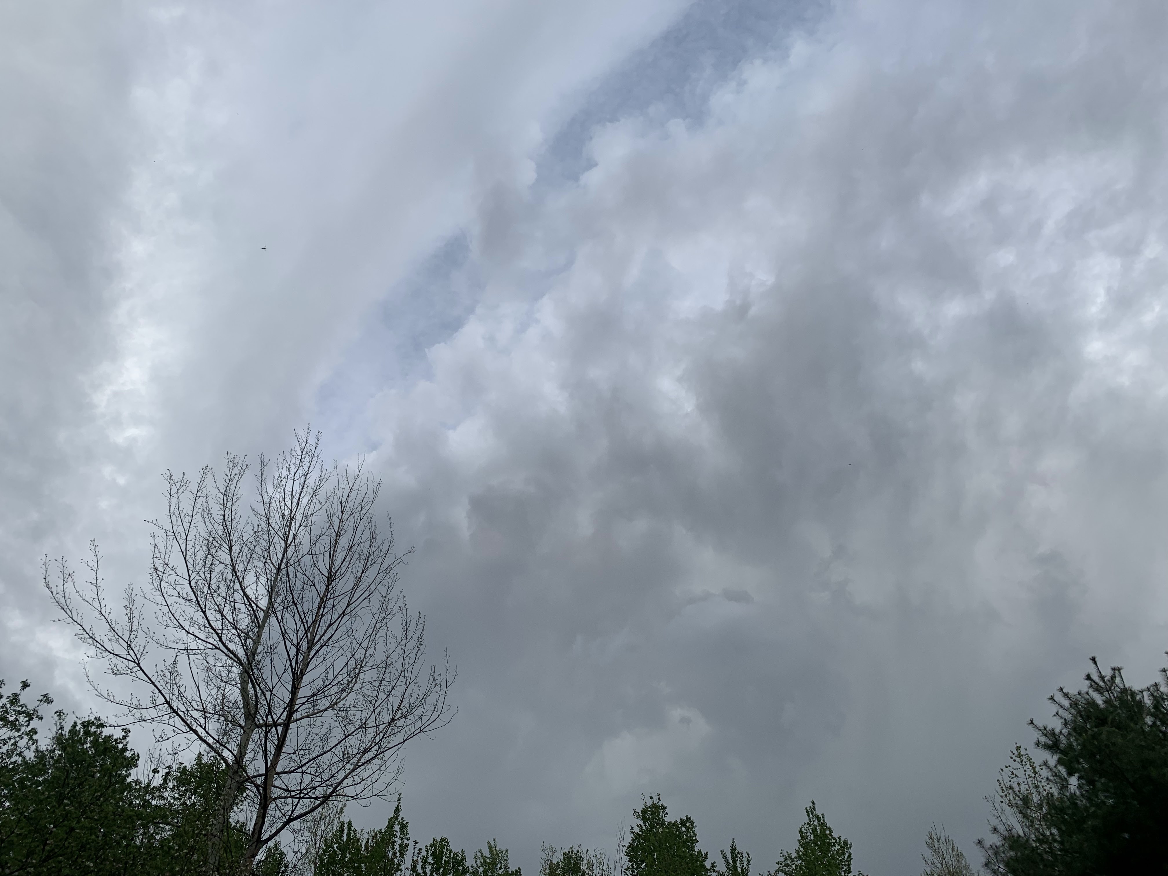
A much weakened version of what had earlier been a
rotating, severe warned storm approaching the
Champlain Islands. This now garden-variety storm
is pictured here near St. Albans. Though tame,
it still showed evidence that it still had a little rotation.
 As expected, scattered thunderstorms developed in Vermont Tuesday afternoon. Also as forecast, just a couple of them became severe or close to it.   

Not very much harm was ultimately done, but the two or three big storms that did form created drama. 

One storm in the Northeast Kingdom dumped tons of hail and created some street flooding in and around Lyndonville. Images on social media showed a torrent of hailstones covering lawns and walkways in the region around 3:30 p.m in the afternoon. 

The largest hailstones were a little smaller than penny sized so luckily it wasn't enough to dent cars and such. 

In the evening, a thunderstorm quickly erupted in New York State south of Plattsburgh and quickly became intense enough to prompt the National Weather Service office in South Burlington at 5:44 p.m. to issue a severe thunderstorm warning. 

The warning covered areas in and around Plattsburgh and across parts of Grand Isle, Franklin and a sliver of Chittenden County. The warning alerted us to the risk of 60 mph gusts and quarter sized hail..

Luckily that didn't happen. But storm chaser Tommy Horn captured some wild photos of the storm as it prepared to go over Lake Champlain. 

You can Horn's images of the storms here and here. The photos would do an Oklahoma storm chaser proud.

Horn's photos showed a great gush of rain, of course. It also showed what appears to be a rotating section of the storm that I think could have potentially created a brief tornado. It didn't for reasons I'll get into in a second. 

There was apparently enough shear in the atmosphere to help Tuesday thunderstorms spin.  Shear just means wind is changing speed and direction with height in the atmosphere. That's one ingredient to create severe storms and tornadoes

However, there wasn't enough instability in the atmosphere, or enough energy to sustain severe storms for any length of time, or allow them to last long. 

But anyway, Horn's images  shows a rotating wall cloud type feature in the storm. A wall cloud is a lowering section of a severe thunderstorm that spins and could potentially create a tornado. 

One of Horn's images sort of shows what looks like a bit of a funnel, but Horn said that was just a scud cloud rising into the storm. There was never any funnel.  

The storm did produce hail to near penny size in Peru, New York and a 38 mph wind gust in Plattsburgh. 

Next, the storm ran into a buzzsaw, namely Lake Champlain. The lake is quite cold this time of year and creates an area of stable air. When the storm went over the lake, it quickly fell apart in the stable air and weather warnings were lifted.

The remnants of the storm continued on its expected path, right toward my house in St. Albans, Vermont.  It partly regenerated once it hit land in Vermont and escaped the cold clutches of Lake Champlain. But never came close to becoming severe again. 

Still, the now not spinning remnants of that wall cloud passed over my house as just a low, dark gray jumble of clouds. However, you could see as the storm departed St. Albans that its entirety still had some rotation to it, even though it would never come close to causing any severe weather, never mind any kind of funnel cloud.

The storm just cause a brief downpour, a couple of rumbles of thunder and a very few pea-sized hailstones as it passed by my place. 

In a way it was the perfect storm - visually stunning but not really anything damaging or dangerous. 

Today's weather won't be as visually stunning. Low overcast and fog this morning was breaking up into an overcast. .We'll have an increasing chance of showers today. That's because the cold front that caused yesterday's weather is coming back as a warm front. 

The showers this afternoon will be pretty frequent, but also on the light side. No sky drama, though. 

Looking ahead through the weekend, the forecast has trended drier than previous runs, so most of the time will be fine for outdoor activity. There will be just be limited chances of showers. Certainly no rotating storms and wall clouds for the next few days.