 |
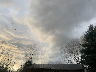
| Drama in the skies over Vermont with a gusty cold front Friday, but again, precious little rain. |
But the front failed to provide what was really needed: A soaking rain did not happen.
There was never much rain in the forecast. But the front did give us something to watch.
The dramatic clouds, combined with with shafts of bright, golden late afternoon sun looked quite spectacular. And several places were treated to huge rainbows from the very brief showers.
If nothing else, then, it was a great day for Vermont sky watchers.
This was an odd line or two of showers and storms for this time of year. The rare times you get strong gusty winds with a line of showers and storms is along a storm front is when a powerful cold front from one of these Great Lakes "gales of November" storms smashes through.
But we haven't really had one of those storms yet.
Instead, yesterday, we had a dry cold front coming in from the northwest. It was moisture-starved, but it made the best of what it had, thanks to some nice lift in the atmosphere and a strong push of northwest winds behind it.
The main line of storms was strong enough to be able to spit out some lightning strikes near Montreal, and in the area where Quebec, New Hampshire and Maine meet.
 |
| A shelf cloud on the front edge of a line of gusty showers Friday over St. Albans, Vermont. |
Gusts exceeded 40 mph, reaching 50 mph in a few spots. Close to 3,000 homes and businesses in Vermont lost power as the winds were strong enough to pull down a few trees and branches. Some spots were briefly pelted by pea sized hail.
FIRE WEATHER
Since very little rain fell, with none in much of southern Vermont, there's still a risk of brush fires today. It's still windy, too, with gusts as high as 35 mph this morning before beginning to diminish this afternoon.
So you want to be careful.
As has been the case all autumn, the fire risk is greater in the even drier areas of southern New England and Mid-Atlantic States. Friday's gusty weather set off brush fires in New Jersey's Palisades sent smoke billowing across the Hudson River into upper Manhattan
Massachusetts has really been burning the past couple of days. Two firefighters were injured fighting a brush fire in Mansfield, while another fire threatened homes in Braintree.
A large brush fire also burned near an apartment complex and a commercial district near Saugus and Lynn, Massachusetts on Thursday and Friday. Another brush fire that began Thursday along the Mass Pike near Chicopee in western Massachusetts forced the temporary closure of that busy highway due to thick smoke.
RAIN OUTLOOK
It still looks like it's going to rain Monday, which is nice, but this will not be any kind of blockbuster storm. It'll suppress the fire risk in Vermont and the rest of New England, at least for awhile, but won't do much to stunt a building drought.
Another storm looked like it would give us a bunch more rain toward the end of the week. As of now, long range forecasts are looking less and less bullish on decent rain chances toward Thursday and Friday.

No comments:
Post a Comment