
 |
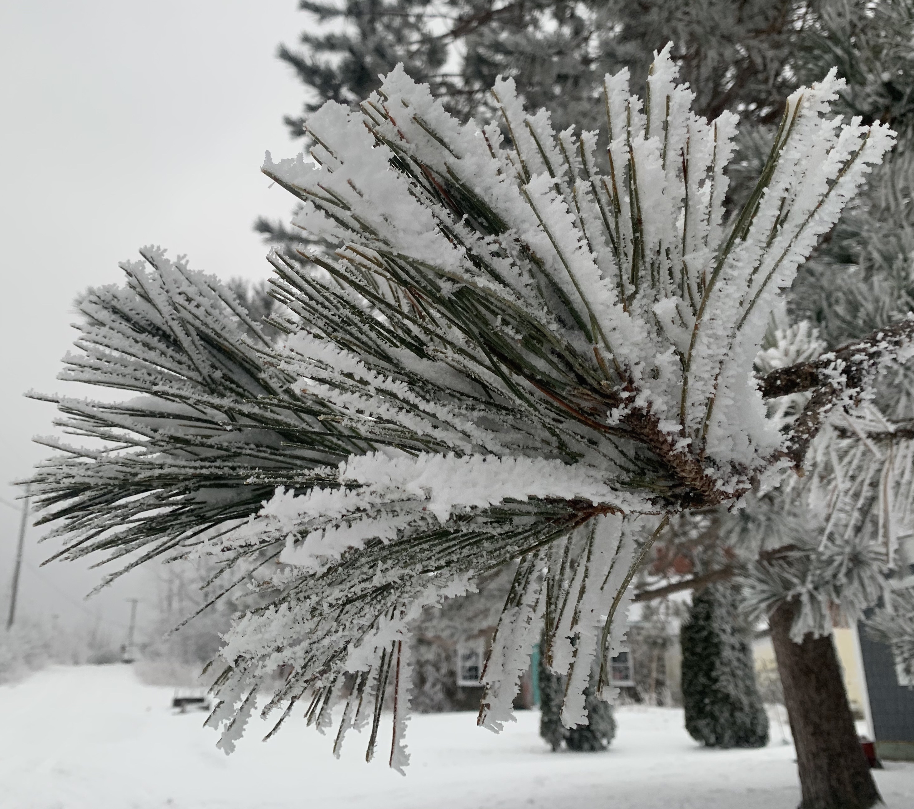
| Rime ice, which accumulated on this St. Albans, Vermont tree branch on Saturday is pretty harmless, but light mixed precipitation due to arrive this evening and overnight is sketchy. A winter weather advisory is up. |
That's all gone and the sun is coming out this Tuesday morning, but not for long! We have more ice and yuck to deal with. A winter weather advisory is up for all of Vermont except the Northeast Kingdom from noon today to 7 a.m. Wednesday.
Precipitation will actually be very light from this evening well into tomorrow. Melted down, whatever comes down from the sky will only be the equivalent of a tenth of an inch of rain or so.
But it only takes a tiny bit of freezing rain and sleet to turn a clear, dry road into a skating rink, and that's the concern with this little episode coming in.
The culprit is a dying storm coming in from the Great Lakes that will probably just wash out and dissipate over us by tomorrow. If this little thing was producing just rain, or just snow, we could just pretty much ignore it.
However, since there's warm air moving in aloft and cold air hanging tough near the surface, the expected drizzles, sprinkles, light showers and little periods of sleet will likely freeze on contact. Although it hasn't been that cold lately, it's been chilly enough for pavement surfaces to drop well below freezing. That means the roads will get bad fast.
In New York state, the mix will come in fast enough to mess with this evening's commute. In Vermont, if you can, try to see if you can make it back home from work by late afternoon. The light mix could hold off until then.
However, things will probably be icy in spots Wednesday morning, so leave home early, go slow and pay attention.
For now, there's no winter weather advisory in the Northeast Kingdom because any real precipitation might not make it that far north and east as the remnants of the storm fall apart overhead.
During the day Wednesday slightly warmer air will come in near the surface and slightly colder air will simultaneously arrive aloft. That will transition any ice to snow showers, perhaps mixed with plain rain in the warmer valleys.
This won't amount to much either, but could add a paltry inch or two to the snow cover in the mountains
We're still looking at another, slightly more substantial storm Thursday into Friday. Forecasters are sticking to their guns saying this will mostly (but not entirely) come as snow. This doesn't look like a biggy at all, but if things play out correctly, it could easily leave most of us with a few fresh inches of snow.
One interesting side note: The dying storm that's expected to spread that bit of ice into Vermont tonight was much stronger on Monday. It managed to spin off at least two tornadoes in Iowa. While tornadoes are common in Iowa during the warmer months, this is only the second time on record that a tornado touched down in that state. The last time was in 1967.
No comments:
Post a Comment