 |
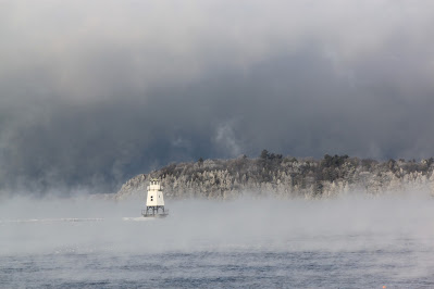
| Steam rises from Lake Champlain on a bitterly cold winter morning several years ago. Similar scenes seem likely Friday and Saturday as a brief but intense Arctic blast is set to engulf us |
The dichotomy might make for a bit of hazardous travel in parts of the state later today and this evening.
Even though all this is happening this afternoon and evening, we still stand a chance of a big forecast bust later on.
Part of the culprit with today's action is a fairly weak and fast moving storm that will zip through northern New York and Vermont later on today. Normally, this doesn't make for much of a forecast challenge. If it's warm, you get some showers. Cold, a period of snow. No biggie.
The trouble is a huge temperature contrast and the question of where that contrast will be centered and when.
It's pretty mild in Vermont this morning. Most places were in the 20s to near 30 at 8 a.m. Go into Quebec, and it's much, much colder. Montreal was at 16 degrees at 8 a.m and Quebec City was at just 5 above. A little north of Montreal, it was below zero.
Where the boundary sets up, and moves is still a bit of a question. Right now, it looks like most of us in Vermont will stay warm through the day. A little light snow this morning will change to a little light rain south and central.
The further south you go, the less of any kind of precipitation you get, as those areas are furthest from that little storm zipping along the Canadian border. Plus, it'll get up into the 35-42 degree range south
The stuff coming out of the sky north of Route 2 will be a bit heavier. Snow will probably at least mix with rain all the way to the Canadian border - at least briefly - this afternoon.
Then the little storm's cold front comes through and pulls down that cold Quebec air. It's looking like wet roads in the Champlain Valley this afternoon will turn icy as rain or a mix changes to snow and temperatures plunge.
One forecast I saw had Burlington's temperature falling steeply from around 36 degrees at 4 p.m. to 23 degrees at 7 p.m. Snow will be falling, at least lightly at this time, so you can see how the road conditions will get ---- not great.
This is NOT a big storm. There could be up to 2 to 4 inches way north, but just a trace to one inch central and nothing south of Route 4.
The front will tend to slow down and get drier as it moves south, these falling temperatures will come later and the fall won't be as steep. And it will be drier further south. Road issues shouldn't be as big a problem.
ARCTIC BLAST
This whole situation will leave us with bitter Arctic air not far to our north in Quebec and milder air to the south during the first half of the week. So, Vermont will be in sort of a no man's land of average temperatures for this time of year and a few snow showers.
Friday and Saturday look awful. The cold wave coming our way looks absolutely brutal. Current forecasts have highs in the single numbers Friday and Saturday and lows Saturday in the morning in the teens and 20s below zero. That's actual temperatures. Wind chills could be in the minus 40s.
Given current indications, this Arctic blast could end up being even more severe than what I'm outlining here.
Mercifully, the intense cold looks like it will be brief - lasting just two days - before it starts to warm up noticeably by next Sunday,

No comments:
Post a Comment