Showing posts with label anniversary. Show all posts

Monday, November 10, 2025

Today Is 50th Anniversary Of Storied Edmund Fitzgerald Shipwreck: The Event And Song That Made It Famous

The Edmund Fitzgerald, which sank in one of the worst
"gales of November" on record, 50 years ago today. 
It seems like yesterday to me, but it's already the 50th anniversary of the day the Edmund Fitzgerald sank in a brutal, unmerciful storm blasting through Lake Superior. 

Thanks perhaps in large part to the song by Gordon Lightfoot, the Edmund Fitzgerald is easily among the most famous shipwrecks in U.S. history, right up there with the Titanic and the sinking of the fishing boat Andrea Gail during the 1991 "Perfect Storm."

At age 13 at the time, I was already a hopeless weather geek and to this day I clearly remember that storm, and the brief, scattered news reports at the time when the Edmond Fitzgerald sank. 

Gordon Lighftoot turned the wreck into modern folklore with his iconic song about the disaster.

Every time the wind comes up this time of year - which is frequently - my mind goes to the vicious "gales of November" on the Great Lakes.

THE EDMUND/EDMOND FITZGERALD

The 1975 sinking of the Edmund Fitzgerald was the second time a ship by that name sank in the Great Lakes. 

Back in 1870 a two-masted schooner, the Edmond Fitzgerald - Edmond spelled with an "o" instead of the "u" we had in the 1975 shipwreck - was built to carry grain and wood in the Great Lakes.

In 1883, the original Edmond Fitzgerald sank in yet another November storm in the Great Lakes. On November 14 that year, the two-mastered schooner was trying to get across Lake Erie with one last cargo of wheat before shipping closed on the lake that season. 

The schooner got caught in a snowstorm with high winds. The crew got disoriented, and the Edmond Fitzgerald ran aground on a shoal near Long Point, Ontario. The schooner broke apart, and the crew of seven all died. 

It's no accident that both ships of the same name were lost in November. The month is the scariest of them all on the Great Lakes.

The water in the lakes isn't exactly warm in November. But those lakes absorbed the sun's warmth all summer, so the water is now much tepid than the frigid air that starts to blow in from Canada this time of year. 

The contrast between the increasingly frigid air and remaining mild autumn air to the south often makes storms in the middle of the nation pretty strong to begin with. 

Once these storms enter the Great Lakes, the relatively mild water gives the storms an added boost of energy.  The storms intensify, the wind howls harder than ever. Torrential rains and thunder peal in the warm air on the east side of these storms. Blinding snow and freezing rain rage on the west and north side of these powerful November Great Lakes gales.   

Even as the storms begin to depart, strong, cold winds blow over the comparatively warm water, causing blinding lake effect snows.

For centuries, hundreds of long ships plied all five Great Lakes carrying lumber, limestone, copper, cars, crops and iron. 

The modern day Edmund Fitzgerald was launched from Detroit in 1958. This was a big deal. As NPR reports:

"It was in fact the greatest ship on the Great Lakes," John U. Bacon said in his new bestseller The Gales of November: The Untold Story of the Edmund Fitzgerald."  "Fifteen thousand people came out to see the launching. When it went through the Soo Locks or Detroit or Duluth, people would sit half a day to see this ship come through. It was a rock star."

Late on November 8, 1975 the storm formed in the Oklahoma panhandle. By the morning of November 9,   the fast-strengthening storm was over Kansas, on a path that would take it over Lake Superior  on November 10. 

While the storm was developing in the Plains, the Edmund Fitzgerald left port with its 26,000 tons of taconite in 21 watertight cargo hatches. 

Weather map on November 10, 1975 shows an
intense storm right over Lake Superior. 

 gale warning was issued for Lake Superior and the captain of the Edmund Fitzgerald acknowledged receiving the warning. Earlier forecasts had indicated that the storm would not be as intense as it turned out to be. 

Subsequent forecasts increased the expected winds with the storm, but by then, literally, that ship had sailed. The Edmund Fitzgerald ended up in the teeth of the storm. 

By mid-afternoon of November 10, the Fitzgerald had "a bad list" according to a radio transmission by the ship's captain. 


Heavy seas were crashing over the deck in one of the worst seas the crew had ever seen on Lake Superior.  Some weather observations on and near Lake Superior were reporting wind gusts of near hurricane force. 

The last radio transmission from the Edmund Fitzgerald came at 7:10 p.m., when the captain radioed that they were "holding their own." 

But very soon after that, the Edmund Fitzgerald was gone. 

The best guess is that the ship suddenly sank shortly thereafter. There were no distress signals. The Edmund Fitzgerald sat 17 miles from the relative calm of Whitefish Bay. The ship was later found, broken in two, in 530 feet of water. 

THE SONG

Gordon Lightfoot wrote and performed "The Wreck
of the Edmund Fitzgerald," a stunning story song
that beautifully illustrates the tragedy
of that shipwreck 50 years ago today. 

"The Wreck Of The Edmund Fitzgerald" was easily among the best songs of the 1970s, created by one of the most gifted songwriters of the era. 

It was an unlikely hit. It ran for six minutes, much longer than most pop songs.  It really didn't have much of a chorus, or a hook. It was wordy. 

But the melody, the arrangement and the meticulous storyline Lightfoot crafted made "The Wreck Of the Edmund Fitzgerald irresistible. 

It hit its peak on the Billboard charts just about a year after the actual sinking of the Edmund Fitzgerald.  The highest it reached was #2 on the charts during the weeks of November 20 and 27, blocked from the top spot both weeks by "Tonight's The Night," by Rod Stewart.

To give you a sense of how awful the music charts could sometimes be in the mid 1970s, I'll give you this nugget:  At the same time "The Wreck Of The Edmund Fitzgerald" was in the Billboard Top 10, so was "Disco Duck" and "Muskrat Love." 

Go figure. 

But at least Gordon Lightfoot graced us with this exquisite folk ballad that year. 

The song is recognizable from the very first chord, and immediately evokes what the 29 doomed men on the Edmund Fitzgerald must have seen and felt on November 10, 1975. 

When I hear "The Wreck Of The Edmund Fitzgerald," my mind immediately goes to a storm-wracked shoreline, all colors of the landscape reduced to a monochromatic dark gray amid the gales. I picture enormous waves crashing onto the rocks, screaming winds battering storm-weary evergreens on land, sheets of rain blasting sideways.

There were about 6,000 shipwrecks in the Great Lakes between 1875 and 1975. Lightfoot turned the Edmund Fitzgerald tragedy into a story for the ages. 

According to Rolling Stone, one night in his home in Toronto, Lightfoot was playing around with the melody of an old Irish dirge that was stuck in his head. Around 10 p.m. he decided to take a break. He noticed how stormy it was outside.

"The wind was howling even in Toronto,"  he said, "and I went back up to the attic thinking, 'I wonder what it's like up on Lake Superior. It must've been awful."

That windy night when Lightfoot was playing with the dirge melody was November 10, 1975, the night the Edmund Fitzgerald sank. He unknowingly started writing the song at just about the same time the ship disappears beneath Lake Superior's punishing waves. 

Shortly after Lightfoot learned about the shipwreck,  the lyrics came quickly. 

 According to Complex.com, Lightfoot wrote the following on an Ask Me Anything (AMA) on Reddit back in 2014: 

"The Edmund Fitzgerald really seems to go unnoticed at the time, anything I'd seen in the newspapers or magazines were very short, brief articles, and I felt I would like to expand upon the story of the sinking of the ship itself."

Lightfoot continued: 

"And it was quite an undertaking to do that. I went and bought all of the old newspapers, got everything in chronological order and went ahead and dit it because I already had a melody in my mind ."  

 Lightfoot was obsessive as he crafted the song

 As NPR reported:

"'He feared being inaccurate, corny or worse, appearing to exploit a tragedy for profit, ' writes John U. Bacon in his new bestseller, "The Gales of November, the Untold Story of the Edmond Fitzgerald. 'But more than that, as a fellow sailor and a child of the Great Lake...this song - whatever it was - was deeply personal.'"

Lightfoot only took a few liberties with the lyrics.  The Edmund Fitzgerald was headed for Detroit, not Cleveland. 

The lyric  "When suppertime the old cook came on deck/sayin it's too rough to feed ya/At 7 pm., a main hatchway caved in/He said, Fellas, it's been good to know ya."

Of course it's impossible to know who said what during the last hours and minutes before the ship sank, but the lyric is a gut punch nonetheless.

After Lightfoot wrote and released the song, an investigation revealed that crew members were blameless in the sinking. So in live concerts, he changed the words regarding the hatchway to "At 7 p.m. it grew dark...."

Toward the end of the song, Lightfoot sings: "In a musty old hall in Detroit they prayed/In the maritime sailors' cathedral."

The "musty old hall" was really the Mariner's Church of Detroit. A parishioner once insisted to Lightfoot the church is not "musty." So, in live concerts, he sang about the "rustic old hall."

Loved ones of the men who died on the Edmund Fitzgerald, and other people associated with Great Lakes shipping obviously embraced the song.

As the Great Lakes Museum tells us:

"After Lightfoot's death in 2023, the Mariner's Church rang its bell 29 times for the crew of the Edmund Fitzgerald and an additional 30th time for Lightfoot himself."

                                                                    ---30----

Click on this link or if you see the image below, click on that for Gordon Lightfoot's "The Wreck Of The Edmund Fitzgerald"  


Saturday, August 30, 2025

If You Need A Heartwarming Weather Story, Here's Two: Baby In A Hurricane And Wedding In A Haboob

Dr. Juan Gershanik rescuing little
baby Christian Stewart from
Hurricane Katrina 20 years ago.
The two have kept in touch 
ever since. 
Christian Stewart of Houston, Texas just celebrated his 20th birthday. 

That shouldn't at first glance be a big deal. Plenty of people celebrate birthdays and you probably don't know Christian Stewart.  

But he's alive today against long odds.  Twenty years ago, Hurricane Katrina almost killed him. Except a kind, brave doctor saved him.

Stewart was born in New Orleans, nearly three months premature in July, 2005.  He weighed just one pound, 12 ounces at birth. He was still in the NICU at Memorial Medical Center in New Orleans when hurricane Katrina hit on August 28, 2005. 

The hospital was swamped with water. The emergency generators clicked on, but the water began to go after those, too. If the backup generators failed, Stewart's mechanical ventilator would stop, and he would die.

Enter Dr. Juan Gershanik, who rescued Stewart via a harrowing helicopter ride to Baton Rouge. 

The obvious spoiler is that Gershanik saved Stewart's life.  The good doctor has been attending Stewart's birthday ever since. 

For the full story in a video, click on this link, or if you see the image below, click on that. Then, below the video, Story #2 starts. 


THE WEDDING HABOOB

Things can get a little dusty with events this time of year in Arizona. Just ask a particular pair of newly weds

As ABC 15 Arizona reports:

Bekka and Jamie Ham just married amid a haboob
near Phoenix Arizona. Photo by Madisen Ruehle
"After a decade together, Bekka and Jamie Ham finally decided to tie the knot. They planned nothing too fancy - just a courthouse ceremony followed by some photos with their photographer and friend Madisen Ruehle to remember the day."

The courthouse ceremony in Chandler, Arizona, just southeast of Phoenix, was quick and flawless. It was the photography afterward that got tricky. 

"'We leave the courthouse and we just see a wall of dust coming. I didn't realize how fast it was coming - we were right in the middle of the dust storm,'" Ruehle said. 

The dust slammed into the couple and the photographer, but a rescuer was nearby.  Paul Roupas was getting ready for the grand opening of his new Aristocrat Coffee Roasters shop in downtown Chandler when he saw the couple in distress.

He hustled them into his shop and made sure they had a memorable if off the cuff wedding reception. Roupas brewed up some heart-shaped lattes, and had the couple pick out music for their first dance on a vintage vinyl record player. He didn't have Champagne, so their first toast to their married life was in the form of his and her ice cream cones. 

Outside, the dust turned into a muddy rain, then a cleaner, but gusty torrential downpour. But the newlyweds were safe inside to start their married life. 

Ruehle put the event on social media, where of course it went viral. She said her favorite comment on her post was:  "If a wet knot is harder to untie, then let it rain."

Here's the news video: Click on this link to watch, or if you see the image below, click on that. 


Friday, August 8, 2025

Hawaii Second Anniversary Of Deadly Wildfire: Slow Recovery In Destroyed Lahaina

A sign of hope in Lahaina, Hawaii,
destroyed by a deadly wildfire on 
this date in 2023 Top photo is the
badly scorched enormous banyan
tree in Lahaina immediately after
the fire. Bottom photo is what the
rejuvenated tree looks like now,
 Two years ago today, one of the worst wildfires in U.S. history hit in and around Lahaina, Maui, Hawaii. It killed 102 people, destroyed more than 2,200 structures and caused $5.5 billion in damage. 

It laid to waste a historic tourist city, and it's still just starting to try to bounce back. 

The tragedy is another cautionary tale -  much like the slow fire recovery in destroyed towns like Paradise, California -  that tells us once a community burns down in a wildfire, the comeback is incredibly slow. 

Even worse, the same places burned in previous wildfires are at risk for getting hit again. 

DIFFICULT RECOVERY

The lead paragraphs in an August 5 Hawaii Public Radio piece tells the continued sad story:

"Two years after the fire, Maui survivors still face challenges with housing, insurance, FEMA assistance, building permits and a laundry list of other obstacles. Under the surface, many survivors are mentally struggling right now - and they're not alone."

The University of Hawaii's Maui Wildlife Exposure Study says almost half the adults in their mental health research said almost half of the adults are still living in temporary housing and a quarter remain unemployed despite trying to find work. 

Home rebuilding is only now getting under way in Lahaina. Hawaii Public Radio says hundreds of homes are now under construction, but only 45 have been completed so far. An additional 450 building permits have been issued, and more than 300 are being processed.

The time consuming process of rebuilding is expensive. Many are still paying a mortgage on their destroyed homes, and simultaneously paying rent elsewhere.   Here's an example Hawaii Public Radio provides:

"Fire survivor Jeremy DelosReyes and his wife, Gracie, have poured the cement foundation of their new home He's constructing their own rebuild, but it's been a financial struggle - and they didn't qualify for FEMA assistance.

'I had a 2,200 square foot house.... At $500 a square foot, my house is going to cost me $1.2 million. I have $400,000 of insurance. I pay $4,000 a month in rent. I got to come up with $6,000 just to cover my mortgage and rent.'"

Lahaina residents are also trying to build more fire-resistant houses, which are more expensive that older styles. For instance. a metal roof could cost $30,000 more than older style roofs, 

The main business district on Front Street was obliterated in the fire. The debris was cleaned up, and then.....nothing.  The future of that area of Lahaina is still up in the air. 

The wildfire claimed about 800 business and 7,000 jobs. Only one business has reopened: The Hi Surf Club Maui, operating out of donated van where the original building once stood on Breakwall Beach, according to KHON.

The shell of the building that used to house Fleetwood's On Front Street, s a popular restaurant owned by Fleetwood Mac found Mick Fleetwood, recently announced they plan to rebuild and reopen in 2026.

NEW FIRE SCARE

I imagine pretty much everyone in Lahaina still has PTSD from that fire. So it had to be frightening when a new wildfire broke out Monday near Lahaina. 

It spread over hills around Kaanapali, about two miles north of Lahaina, closing down a highway and forcing about 50 people to evacuate. 

Unlike the tragedy of 2023, this time, firefighters gained the upper hand and extinguished the fire with any homes being lost. The fire did burn through 33 acres. 

BANYAN TREE

One of the biggest potential losses in Lahaina during the fire was an immense banyan tree that was left entire blackened and scorched in the fire. 

The historic tree was planted by Sheriff William Owen Smith in 1873 to commemorate the 50th anniversary of the first Protestant missionaries in Lahaina..

Immediately after the fire, arborists examine the tree determined much of it could be saved with a lot to TLC.

The result, two years after the fire, is a thriving banyan tree, as KHON tells us: 

"'It's really, really healthy,' explained Duane Parkman, arborist committee chair and Treecovery Lahaina president. 'We're super stoked to see as much growth as we've seen in the past year and a half. We've seen aerial roots coming down from almost 20 feet high, and they're almost touching the ground already. There's so much fruit - it's become a habitat again. It's a thriving tree system."

The tree isn't open to the public yet, as some branches are still unstable, but they'll strengthen up. Replacement benches are being replaced beneath the tree. The banyan is the Lahaina gathering place, especially since it's about ten degrees cooler beneath the tree than elsewhere under the hot Hawaiian sun. 

The hope is the banyan, the centerpiece of Lahaina, is a premonition of a future town - one that might be a lot different than the old one, but thriving anyway. 


Friday, July 11, 2025

For 3rd July 10 In A Row, Vermont Suffers Through Damaging Floods, More Trouble Ahead?

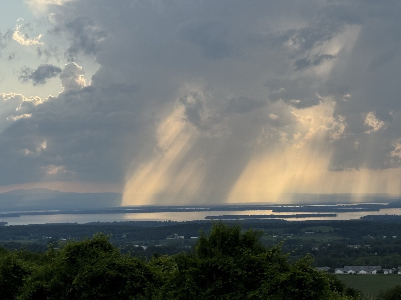
Thunderstorms developing near Lake Champlain 
caused falling rain and sunshine to mix in
interesting patterns, as seen from St. Albans, Vermont
Thursday. Though this storm was picturesque,
other storms elsewhere in Vermont caused a lot
of flood damage for the third July 10 in a row. 
 Yes, incredibly, as you might have already heard, for the third July 10 in a row, Vermont suffered through damaging flooding. 

The worst of the trouble this time was up in the Northeast Kingdom, with reports of water in homes, swift water rescue teams rushing a respond, roads closed, and four to five inches of rain in spots. 

Other flooding was reported in parts of Addison County. 

At least one swift water rescue was reported along Calendar Brook Road in Sutton.  They were there to "assist the residents of one  home cut off by floodwater," according to a Vermont Emergency Management statement, as VTDigger reported. 

Other rescue teams were staged around the state just in case. 

Barton and Orleans, and other Northeast Kingdoms communities have now suffered flood damage for the third July 10 in a row. That has to be incredibly disheartening. 

Damage reports from Thursday were a dime a dozen.  Sheffield Road was washed out in Sutton. School Street in West Burke was under water. Route 114 was closed due to a culvert washout in East Haven. Part of Route 58 in Orleans was washed out.

A number of local town roads in the Northeast Kingdom were either damaged or closed or both by washouts and flooding. 

Rainfall amounts in parts of the Northeast Kingdom were impressive to say the least. West Burke reported 5.07 inches, Sutton saw 4.92 inches. Down in Addison County, 4.32 inches fell in New Haven, where at least one road was closed by flooding. 

The storms this time were hit and miss. Parts of northwest and southern Vermont saw almost no rain. Burlington reported just 0.02 inches. Montpelier reported a tame 0.26 inches, which had to be a relief compared to the more than six inches of rain Montpelier endured on July 10-11, 2023, and the more than three inches they had last year. 

 If you want to find a weak silver lining from yesterday, I suppose the trend line is good. Thursday's floods weren't as widespread as last year's. And the floods of 2023 were even worse than in 2024. 

Almost all the damage from yesterday was in limited to the Northeast Kingdom and parts of Addison County. Last year's floods affected most of northern Vermont. The July, 2023 floods affected almost the entire state. 

So each July 10 is better, maybe?

That's cold comfort to anyone who suffered damage yesterday. It was especially distressing to have another July 10 in which the weather radio was crackling with an onslaught of flood and severe storm warnings. 

Still, another bright side was that some towns and cities that were hard hit in 2023 and 2024 like Barre, Montpelier and Johnson, reported little damage from Thursday's storms.  

Severe thunderstorms with powerful winds also roamed parts of the state Thursday. The roof of Middlbury High School was damage by powerful storm winds. Multiple trees crashed to the ground and blocked parts of Route 125 in Middlebury and Weybridge, along with Route 17 in Weybridge. 

Some tree damage was reported in Williamstown and Hyde Park

I don't know whether Thursday's damage qualified Vermont for federal disaster aid. Complicating the picture is the Trump administration is famously withholding disaster funds.  

The flood and storm reports from yesterday are still coming in, so I'll update as warranted throughout this. 

HEAT AND STORMS TO CONTINUE

Much like in the aftermath of the floods of July 2023, and 2024, Vermont is now settling into a weather pattern featuring hot, humid weather accompanied by some risk of additional damaging storms. 

NOAA's Weather Prediction Center, keeps Vermont (and many other parts of the nation) in a marginal risk for more flash flooding Saturday, Sunday and Monday. That's the least dire of four tiers of flood risk, meaning there's a chance of isolated flash floods.

On Saturday, there's only going to be scattered storms here and there, mostly just because the air mass will be warm and humid. At this point I think Saturday's the lowest risk day, and chances are good we'll get through the day with no trouble.

Forecasters are watching the period from Sunday evening into Monday. The air will be very humid, and a weather front will be approaching from the west. (Some are calling it a cold front, but there's nothing cold about it). 

We could see a few scattered instances of downpours heavy enough to cause some localized new flood issues.  Again, nothing widespread, but something to keep an eye on.

Behind this "cold front" on Monday, the air will stay very warm and humid, so that thing is going to be just a thunderstorm trigger and pretty much nothing else. 

A heat ridge will build in the eastern U.S. next week, ensuring Vermont will stay very warm and humid probably at least until the end of next week. 

Check out these forecast daily highs in Burlington Saturday, through Thursday: 87, 89, 85, 90, 92, 92. So yeah, icky,

Vermont will also be near the northern edge of that heat dome. Clusters of thunderstorms often ride along the northern edge of these things. We'll need to be on guard for the risk of perhaps some severe storms or local flash floods again most of next week. 

We don't know for sure about that. If we're lucky, everything will go by to our north. We'll have better forecasts once we get into next week. 

Tuesday, April 8, 2025

One Year Anniversary Of Great Vermont Eclipse Of 2024: Still Basking In The Afterglow

The view from my St. Albans, Vermont house during
the total eclipse of the sun, April 8, 2024,
 Today is the first anniversary of the Great American Eclipse of 2024.

I'm still in awe of what I saw, as lucky for me, the center of totality passed right over my St. Albans, Vermont home.

 My husband Jeff and I parked ourselves in chairs on our back deck, with a perfect view to the southwest, where the sun was that day. 

Vermont got really lucky on April 8, 2024.   The weather is seldom nice in the Green Mountain State this time of year.  

I mean, look at today. There's lots of clouds, it's colder than hell, and snow showers keep dusting the early spring landscape. 

There had been an 80 percent chance that that eclipse day would be overcast, based on past weather records. 

Instead, the weather was absolutely, improbably perfect on April 8, 2024. The day featured mild weather as temperatures reached the upper 50s to mid 60s. There were quite a few high, thin clouds in the sky, but that actually enhanced the experience. You could still clearly see the actual eclipse, as the moon blocked the sun and you could just see the outer edges of the sun during totality. 

Those high clouds created a beautiful sunset effect during the eclipse, with the horizon lighting up in beautiful yellow, orange and blue tones. 

The whole thing was thrilling. I laughed out loud with joy as I heard a crowd in downtown St. Albans, a mile away, let out a loud cheer when totality hit. Then I sat and watched the sky, slack-jawed, during totality. I didn't want it to end. 

And as if to end the day with a flourish, hours later, we were treated to a spectacular, post-eclipse sunset. 

Barely a month later, Vermont and much of the rest of the nation experienced one of the most spectacular northern lights displays in memory. Once again, Vermont skies were mostly clear, and we got to enjoy it.

It's been back to reality with more recent celestial events. There was a total lunar eclipse early in the morning of March 14. Skies were clear for that, but it peaked at like 2 a.m. I admire anyone who stayed up for that, but I was unfortunately too lazy. I slept through it. A bad hour for this decrepit old man. 

There was a partial eclipse of the sun on the morning of March 29.  Not nearly as wild as last year's total eclipse. But it would have been fun to dig out the solar glasses from last year and take a peek as the moon took a bite out of the early morning sun.

But alas, northern Vermont was experiencing a snowstorm that morning. So much for that. 

Other than that, we have our usual meteor shower and super moons to look forward to in the rest of 2025, but not much else.

But that's OK. The sky is always interesting, even when supposedly nothing special is going on. 

Sometimes, on a clear night, it's fun to just go outside after dark on, day a mild June night. The fireflies at the edge of the woods will compete with the tapestry of twinkling stars in the sky. 

Or there's meteorological displays.  On a muggy night in July, I might sit in our outdoor tub on the deck, glass of wine in hand, Patsy Cline singing in the background as heat lightning lazily flashes in the sky from thunderstorms somewhere over Quebec. 

The year 2025 will end with three "super moons" starting in October. That's when the moon is closer to Earth than it usually is, so the full moon looks even bigger and brighter than usual. It'll be worth grabbing a jacket or coat on those nights if it's clear to enjoy the moon glow, maybe do a little moon dance, I don't know. 

 Maybe the December 4 super moon rise over a snow covered landscape, turning night into day as the moon glow reflects off the snow. 

I'll probably never see another total eclipse of the sun, but I've got the memory. I can look forward to our always fascinating sky and weather to keep me looking up to the heavens in search of both peace and joy.  

Sunday, November 12, 2023

Paradise Lost And Found? Struggles Five Years Since Deadly Fire Wiped Out California Town

Five years after a deadly wildfire destroyed the town of
Paradise, California, the town is still rebuilding, but is
facing financial and insurance headwinds. 
 Hard to believe but it's been five years this week since one of the worst wildfires in U.S. history destroyed the town of Paradise, California, claiming 85 lives.  

In just a day or so, the fire leveled almost every house and business in town.- about 18,000 of them.  You still might remember horrifying videos from that day of people desperately trying to drive through flames and zero-visibility smoke to escape the conflagration. 

So how's the town doing now?

It is bouncing back, but it's also a grim reminder of how long it takes to recover from a mega-disaster like this. That fact has resonance here in Vermont, as we continue to recover from the dramatic, highly destructive floods we had this summer. 

In the age of climate change, these weather disasters are coming at us much more frequently than ever before.  We'll have a lot of balls in the air trying to recover from just one disaster. Now imagine how stretched thin emergency managers, insurers, planners, builders, homeowners and business people are. 

In Paradise, California right now, KCRA says 21 percent of the homes have been rebuilt, and another 1,000 or so are under construction. 

Paradise has technically been the fastest growing municipality in California for the past two years. But that's starting from almost zero, and they've reached the peak of the rebuilding effort.

As you can imagine, it's been incredibly expensive. KCRA said the Fire Victim Trust, created in July, 2020, has issued determination notices on 98 percent of claims and has paid $10.7 billion to victims so far. 

The Fire Victim Trust was created by the electric utility PG&E as part of a legal settlement. The utility was blamed for the fire because one of its power lines is believe to have snapped, sparking the blaze on that windy, super dry November 8, 2018.

Many victims are saying the settlements are inadequate and have not allowed them to even partially recover financially from the blaze. 

Even worse, homeowners insurance in Paradise is unaffordable.  This is an increasing problem in disaster-prone areas like Florida. Insurers say they can't keep taking the losses from this increasing onslaught of disasters.  I think any disaster-prone region of the nation is now prone to newly sky high insurance rates, so be forewarned. 

In Paradise, the Associated Press said some homeowners who used to face roughly $1,500 in annual insurance premiums now have $10,000 annual fees. People can't afford that, so they're not rebuilding. Or, if they don't have a mortgage, they're taking their chances and not acquiring homeowners' insurance, which is a really risky move. 

The higher insurance rates are happening despite stringent new building codes to help prevent future disasters. 

A DIFFERENT PARADISE

By necessity, Paradise is shaping up to look a lot different than it did before the fire. 

The town's newspaper, The Paradise Post, announced sweeping building code changes enacted by the Town Council in May, 2022:

"The first change would require that only non-combustible material be allowed within five feet of any building or structure. It would also outlaw any vegetation within five feet of the structure, including the overhang. The ordinance calls for removing any overhanging limbs or branches within five feet of the structure.  It would also regulate all exterior walls to have six inches of noncombustible vertical clearance from grade."

These extensive regulations would also outlaw any vegetation or the storage of combustible material beneath decks and porches. Mesh covering vents in roofs and walls must have openings of an eighth inch or less to prevent embers from slipping into attics. Combustible fencing material must also not come within five feet of a home or building. 

 Paradise officials also are installing 21 warning sirens around town that would serve much like tornado warning sirens in the Midwest, reports Fire Engineering.  Except these sirens will sound a warning, and then be followed by evacuation instructions. That's a quick way to get people heading quickly in the right direction away from danger. 

Fire Engineering compares the new siren system to the chaotic day in 2018 when the wildfire blasted through town. : 

"Many residents said they received no warning on their cellphones or landlines as the fire quickly spread their way. They jumped in their vehicles to escape only after seeing smoke and flames, or after relatives or neighbors knocked on their doors.

'If that fire would have happened just a few hours earlier than it did, we would have had hundreds of people die from that because they'd been in Bed,' (Paradise Mayor Greg ) Bolin said."

Of course, officials have to decide to activate the sirens. During Maui's deadly fires this summer, people report that sirens did not go off.

The long list of fire prevention rules and ordinances in Paradise are starting to be emulated by other wildfire-prone communities. Climate change does seem to be making wildfires, well, wilder. They spread faster, burn hotter, last long and display extreme behavior.  

Like it or not, communities through the United States - throughout the world, really - are all trying to adapt to climate change. We see it again and again.

Few experts think humans can completely adapt ourselves out of the consequences of climate change. There's just too much going on at once. And what's going on is often too extreme to adapt to. Sure, you can enact fire codes that help protect lives and property in big wildfires. But the wildfires are too big for those measures to keep people completely safe. 

We can buy out homes and properties, enlarge culverts and build stronger bridges in places like here in Vermont that are particularly susceptible to floods, but these extreme floods have a tendency to find new victims as the storms get worse and worse. 

It's a race between human engineering and climate change disasters. One that will continue for the foreseeable future. 

Back in Paradise, California, they held a series of events this week to mark the five year anniversary of the firestorm. That included 85 seconds of silence for the 85 victims of the blaze. 

Mercifully, the start of the rainy season has already provided the forests around Paradise a bit of rain. A moderately heavy rain storm is the forecast for the region for this upcoming week. There's no fires burning and the risk of one starting is on the low side. 

It's another reprieve for Paradise. But the town will be tested again with future fires. We hope they'll get through those fine. 


Thursday, September 28, 2023

One Year After Hurricane Ian, Southwest Florida Still Struggling Physically, Mentally

Satellite view of catastrophic Hurricane Ian about to 
make landfall in southwest Florida one year ago today. 
 One year ago today, on September 28, 2022, Hurricane Ian, just shy of Category 5 strength, slammed into the area around Fort Myers Beach, Florida, killing at least 150 people and becoming the second most expensive United States weather disaster on record. 

I don't mark the anniversary of every hurricane, but Ian was such a monster that I can't avoid it. Thankfully, so far this year, we haven't had a repeat of Ian.  Hurricane Idalia on August 31 in northern Florida was really, really bad, but not at all in the same league as Ian. 

It was the fourth strongest hurricane on record to hit Florida. Two of the  top three hurricanes hit well before the extensive coastal development in Florida ever hit. 

Hurricane Andrew was the most recent of the big three, hitting in 1992. Andrew was incredibly devastating, but the worst of it barely missed super heavy populated Miami. Instead, it destroyed the town of Homestead, Florida, which had a population of 30,000, not hundreds of thousands, like southwestern Florida when Ian hit. 

Recovery has gone in fits and starts, and it will take years before places like Fort Myers Beach, Captiva, Sanibel Island and Pine Island. People whose homes were wrecked are still fighting and in some cases suing insurance companies. 

At least 90 percent of the buildings in Fort Myers Beach were damaged or destroyed. 

Hurricane Ian has of course faded from the headlines, except on this anniversary date. More recent mega-disasters, like the wildfires in Maui last month and the catastrophic floods in Vermont in July, have since came and gone from the headlines

In the months and years after a major disaster, the victims are largely forgotten, but they're still struggling. Fox 13 news in Tampa Bay reported this example, which I think is pretty representative of what people in the Ian region are going through: 

"'My house is still uninhabitable. It has even yet to start repairs because my insurance company won't approve it at all and FEMA did very little to help me. I'm paying an exorbitant amount of rent just to survive. I've lost a year of equity in my home. I'm barely making it. I could be homeless in the future,' said South Venice resident Carrie Smith."

Yes, businesses are gradually reopening, and many residents are moving back into newly repaired homes. But the pace of recovery from disasters like this is glacial. 

This is devastating for mental health. The Tampa Bay Times reports six suicides in the aftermath of Ian. The newspaper also says experts expect more suicides as victims hit one dead end after another, prevent them from moving on from the hurricane. 

I guess this is the most important lesson to take away after a big weather calamities. Let's face it, after a disaster, the people and corporations and governments that are supposed to help serious often let victims down. 

Mental health is a big, scary issue after a disaster. As worrying as the actual physical work of pulling your life back together again. Please, if you know somebody struggling after Vermont's flood this summer, try to help and support them as much as you can. 

Climate change is making these huge disasters more likely and more frequent. Climate change is not only a physical, global and development crisis. It's also a global mental health crisis. 


Sunday, January 8, 2023

Shocking: It's Already Been 25 Years Since Vermont Ice Storm Mega Disaster

Trees on the University of Vermont campus in Burlington
badly damaged by the Great Ice Storm of 1998.
 The weather is pretty unremarkable this weekend. 

Just the usual January chill, though with less snow on the ground than usual, part of a mild winter.  

The winter of 1997-98 was mild, too, temperature wise. But it did bring Vermont, and much of rest of northern New England, parts of New York and especially Quebec one of its biggest disasters on record. 

That disaster was ice. 

Yep, time flies. It's the 25th anniversary of the Great Ice Storm of 1998.The storm lasted from January 5 to 9. During that time period, it was responsible for 16 deaths in northern New England and New York, and caused $1.4 billion in damage in 1998 dollars. (Adjusted for inflation, the cost is $2.5 in current money).

To my knowledge, the ice storm is only one of two billion dollar damage storms that has affected Vermont. The other billion dollar disaster was 2011's Hurricane Irene.

Remarkably, Vermont wasn't the most afflicted region.  Ice accumulations in parts of northern New York and souther Quebec reached an incredible four inches. But Vermont was surely badly affected. In Vermont, the worst ice accumulations amounted to two to three inches in the northern Champlain Valley. 

Generally speaking, during ice storms, you start to see minor trouble with trees and power lines if ice accumulations reach a quarter inch. Once you get to a half inch, you're getting in trouble. Large areas of northern Vermont had one to two inches of accumulation. 

The disaster was created by what was in essence an atmospheric river from the Gulf of Mexico - a train of deep moisture that ended up colliding with a layer of dense cold air from high pressure over northern Quebec.

This setup lasted for four days. During that time, the warm air was forced to rise up over the layer of cold air near the surface. It was a relatively thin layer, so rain falling from up above didn't freeze until it hit the ground. Sleet would have been bad enough. Freezing rain was exponentially worse. Especially this much.

Rain and freezing rain from January 5 5o 9 amounted to 3.52 inches, including 2.11 on January 8 alone.  That amount is about normal for the entire month of January.  Numerous towns along and north of Route 2 reported more than four inches of precipitation from the storm, an incredible amount for a winter storm. 

At the time of the ice storm, Green Mountain Power had 83,000 Vermont customers.  About 40,000 of them lost power, some for more than a week. 

 For those of us who still had power, the whole New England power grid had to be rejiggered. In Quebec, which was hit even harder than Vermont, massive Hydro-Quebec transmission towers collapsed under the weight of the ice. 

Front page of the Burlington Free Press, January 9, 1998

This cut off much of New England's power supply from Canada.  Engineers had to do a quick switcheroo to increase power supplies from south of the region. 

The days during the ice storm were pretty surreal.  The ice devastated some towns, while leaving others unscathed.

At the time, I lived in Richmond and worked at the Burlington Free Press.  It just rained in Richmond. A lot. But not a bit of ice accumulated on anything.

 As I reached French Hill on the way to Burlington, the ice-free landscape suddenly turned into a frozen, awful scene of drooping, breaking trees and snapped power lines all the way to downtown Burlington.

Oddly, the main roads were not especially ice covered and were not overly slippery. Jim Cantore was camped out in the parking lot of Staples Plaza, reporting the storm for The Weather Channel. You know you're in trouble when extreme weather fan Cantore is in town. 

As I worked in Burlington after dark during this crisis, blue power flashes flickered in the sky as power lines and transformers broke.  Each breaking tree sounded like a gun shot, and there were a lot of them. It really felt like a war zone.

Those falling trees were dangerous. A man died in Colchester when a large tree fell on his truck as he was driving along Route 7.  While reporting on the storm in Colchester, I was interviewing officials in the parking lot of the town offices when a large tree branch close by snapped, bounced off the power lines and crashed to the ground next to us. 

We decided to continue the interview indoors. 

The Champlain Islands were cut off, with too many fallen trees blocking the roads to gain access. Cattle died as they could not be milked easily without electric power. Sugarbushes were decimated from the southern Green Mountains to the Canadian border and well beyond. 

The tree damage saddened me the most.  Across New York, Vermont, New Hampshire and Maine, 17 million acres of forests were damaged, including close to a million acres in Vermont. 

Between one fifth and one quarter of the affected trees were severely damaged or killed. So many trees collapsed or had many of their branches sheared off.  Or they just collapsed entirely. The damage was apparent for years afterwards. 

I remember the sense of relief I felt on the evening of Friday, January 9.  After an afternoon of wildly out of season lightning strikes and more collapsing trees, the temperature abruptly spiked above freezing. Water from melting ice poured off the trees, and remaining branches began to spring back into their normal positions. The storm was over. 

Even now, if you look closely, you can see trees with a spray of branches that launch from a point roughly halfway up the trunk.  That's where new growth started in the subsequent spring after the ice storm. 

To this day, when I hear forecasts of freezing rain, I fret a little bit that we'll see another round of tree and forest devastation.  After all, the weather has gotten weird with climate change, and 1998 seemed to be a turning point. Luckily, all of the ice storms we've experienced in the past 25 decades after that storm have been super mild by comparison

ICE STORM AND THE YEAR 1998

The year 1998 turns out to be a bit of a watershed year in terms of climate, both locally and in the world in general.

The '98 ice storm set the tone for the weather year in Vermont. It turned out to be the wettest year on record, with 50.42 inches of rain at Burlington.  (That record was eclipsed in the even more stormy, destructive year 2011 when 50.92 inches accumulated).

In 1998, disastrous floods struck Vermont in June and July, a tornado swept through parts of Bennington County in late May, and what had been until recently the biggest December heat wave brought Vermont temperatures into the upper 60s. 

A big El Nino helped fuel the stormy 1998 weather both locally and worldwide. The El Nino boosted world wide temperatures. That year turned out to be, at the time, far and away the hottest year on record for the globe.  

The temperatures and disasters of 1998 helped focus the public on the dangers of climate change. 1998 was billed as a preview of what climate change would look like.

Indeed it was.  It's gotten a lot warmer (and arguably stormier) since 1998 locally and across the world). The year 1998 is no longer even in the top 10 list of world's warmest years. All of the top 10 years have been since 2010.  Data for 2022 isn't in yet, but almost everybody expects last year to join the top 10 warmest list.

The year 1998 also used to be listed as the warmest year on record in Vermont. However, since then, six years have been even warmer in Vermont than 1998, including 2022. 

Though we haven't seen anything anywhere near the severity of the 1998 ice storm in the 25 years since, weather events have gotten more extreme.  We've seen an increase in record breaking heat waves and more frequent floods. Two storms in December each cut electricity to about as many Vermont houses as did the 1998 ice storm. 

We probably won't see another 1998 ice storm anytime soon, knock on wood, but the weather and climate are in some respects more dangerous than they were a quarter century ago. 

Sunday, August 28, 2022

A Sunny Anniversary Garden Party And A Not So Stormy Marriage

Jeff Modereger and I tying the knot a 
decade ago, August 26, 2012. It's been
sunshine and blue skies since. 
 This post is only tangentially related to the weather, but that's OK, we'll manage for one day, right?

Here in St. Albans, Vermont, we're having a garden party to celebrate our tenth wedding anniversary. Hard to believe Jeff and I have been married ten years, but there you go. 

Our wedding anniversary was actually this past Friday, but we decided the celebration would be today. The weather gods blessed us with a cool morning to get ready for the shindig, and the day promises to be very sunny and comfortably warm. 

On the day we married, August 26, 2012, the weather was very much like what is forecast today. It was sunny and in the 80s. 

I guess our entire marriage has been like that, from my perspective. Sunny and warm. Oh, sure, we've had our chilly. even frosty moments, like everybody does, but those quickly pass. The gusty storms of arguments pass by even faster. These storms were never severe, and didn't seem to leave behind any damage. 

It's one of the reasons I married Jeff in the first place. He has a sunny, optimistic disposition as opposed to the occasion dense fogs of pessimism I try to fight back. 

The winds of time blow strong, and things are of course different now than they were. Our young puppy Jackson of 2012 is now an old dog, not learning many new tricks. Jeff and I have aged, and I've started referring to ourselves as Statler and Waldorf.

Our surroundings are different. Jeff redesigned our decrepit house into a showcase. I took an overgrown sad property and turned it into gardens. 

I think of our marriage as a kind of force field. Knock on wood, we hope it continues. We've been lucky. Disasters have mostly not befallen us. We're like that house on the end of the street that looks fine after the tornado while all the other homes in the neighborhood are leveled.

I'm a challenging person to live with. Some scars from my sometimes problematic childhood sometimes get in the way. And my ADHD is frustrating to me, and more so to the people around me. How Jeff puts up with this, I'll never know. 

He's a strong guy, and I get nourishment from that. He's the long rainy spell to my droughts of doubt. The warm south wind that melts away my icicles of frustration. The sunshine that cuts through the low clouds and drizzle, dispersing all that to create a blue sky life for me. 

We look forward to the future, even though we don't know what that will bring. Long range weather forecasts are seldom reliable, and guessing what things will be like in five to ten years is just as iffy. 

They say that climate is your personality and a day's weather is your mood. The Climate of Jeff is steady,  stable, comfortable, not prone to extremes and makes life feel safe. The opposite of the climate crisis afflicting the real world, I guess. 

So I have that. It's a lot. I got extremely lucky when I met Jeff. He'd better know that. I was actually reluctant to marry him at first. Not because I had any misgivings about Jeff. I didn't. I had misgivings about me. 

It always seems to rain on my parties. So I figured a marriage would just end in a stormy disaster, just like so much of life does.

I thankfully found the courage to run my life without worrying about the "weather" so much. Jeff gently encouraged that. I made by far my life's best decision when I popped the question. That yes I got meant the world to me, and still does. Even more so than it did a decade ago. 

It turned out the marriage did not lead to more storms, more gloom in life. Over the past decade, Jeff has slowly made progress in making me understand that life is partly sunny, not partly cloudy. 

When I was little, I was terrified of thunderstorms. Now, I love them. They're my favorite kind of weather.   Jeff is teaching me to understand that all of life's "thunderstorms" are not something to hide from or fear. but you learn from them. Problems might be a pain, but they're interesting.  I'll never love life's challenges, and I'll always whine about them but Jeff is making me realize when you face storms together, you win.  

 Thanks to Jeff, it's been wall to wall sunshine through a decade of marriage.  Just like the weather will be today during our celebratory outdoor garden party. 

I think today's weather forecast is a good omen for Jeff and me. I love you so much, Chief! 

Wednesday, June 29, 2022

50 Years Ago Agnes Set Benchmark For Worst Eastern U.S. Flood On Record

Elmira, New York during Tropical Storm 
Agnes flooding, June, 1972
At this point 50 years ago today, the Middle Atlantic States were just beginning to pick up the pieces of what was easily among the worst floods the region had ever experienced.  

The culprit was ex-Hurricane Agnes, an early season tropical system that seemed like not that big a deal until it got halfway up the U.S. East Coast.

Agnes dumped up to two feet of rain on eastern Pennsylvania. The storm killed 128 people - 48 in Pennsylvania alone.  More than 115,000 houses were destroyed or damaged, and more than 360,000 people were forced to evacuate.

It was at the time the most expensive tropical storm in U.S. history.  That record would stand for more than a decade.

Tropical Storm Agnes was more proof that a hurricane need not be strong to unleash havoc. And, former hurricanes can stir up major trouble long after the winds associated with them have died down.   

The spring of 1972 had been wet in the Middle Atlantic region.  That primed the pump for what would happen next. 

Hurricane Agnes splashed ashore as barely a hurricane on June 19,1972.  It caused the usual damage from storm surges, and spun off a couple dozen tornadoes that damaged at least 2,000 structures.

As tropical systems do after landfall, Agnes weakened quickly and the worst seemed over. However, the stage was being set. A cold front over the Great Lakes pulled in some moisture from Agnes, prompting more heavy rains ahead of the main show. That was enough to completely saturate the ground ahead of the main show.   

Which was a bit of a surprise. 

When tropical storms moves off the Southeast Coast, especially early in the hurricane season, they usually continue on to the northeast, out to sea, no longer being a bother to anybody.  Agnes, though, got pulled northwestward by a trough of low pressure pushing southeastward from the southern Great Lakes through Ohio and into Virginia.   

Then, there was nothing coming in from the west to push the remnants of Agnes out. It sat and spun pretty much over Pennsylvania and southwestern New York and just rained itself out. 

With such a wide area receiving 8 to 15 inches of rain, with, as noted, amounts up to two feet, rivers went on a rampage. 

Ground zero was the Susquehanna River, especially around the State Capitol of Harrisburg and the city of Wilkes-Barre. The river crested at 32.8 feet, a full 15 feet above flood state. Of that $3.1 billion in damage from Agnes, $2 billion of that was in the Susquehanna River basin. 

The areas around Corning and Elmira, New York were just as hard hit.  

That water was unbelievable. At the time, I remember news footage of people shoveling mud left behind from flood waters out of second floor windows. 

Flood control efforts since Agnes has spared much of the region from similar or worse storms than that 1972 deluge. Flood walls were raised substantially along the Susquehanna River.  

As the Washington Post notes, Tropical Storm Lee in 2011 caused a crest along that river at Wilkes-Barre even higher than that of Agnes. But flood walls installed after Agnes spared that city and Harrisburg from too much damage.

Other towns aren't so lucky. In the age of climate change, deluges like that from Agnes become more likely. 

Ellicott City, Maryland was devastated by Tropical Storm Agnes floods in 1972.  Turns out that was just a preview of what was to come a few decades later. Six big floods followed in Ellicott City after 1972, including two even stronger inundations in 2016 and 2018. (Just on Wednesday, Ellicott City narrowly escaped another big flood).  

I also recall at the time that Agnes gave Vermont a good scare. Many forecasts had it moving further north and east, putting the Green Mountain State in a huge flood danger But, as we know now, Agnes set its sights on Pennsylvania, southwestern New York and other states in that region.

Since it had been quite a wet month in the Green Mountain State, we were lucky that the rains from Agnes weren't that bad. We only had a few tropical showers in Vermont from Agnes.  Rutland  and Burlingtom ended up picking up about an inch of rain over three days from Agnes. Woodstock got about 1.5 inches of rain.

Vermont's turn for severe flooding would come just a year later. On June 30, 1973, after a wet month, up to 7.5 inches of rain poured down on central and southern parts of the state, causing one of the worst floods in history. 

Record or near record flood crests hit the Black, Ottaquechee, White and Ompmpanoosac rivers. Total flood damage in 1973's Vermont flood was $64 million or $421 million in 2022 dollars.  

Videos

This video is pretty cheesy, but still gives you a glimpse of how bad Agnes got in Pennsylvania's Wyoming Valley.  Click on this link if you don't see the video image on your device:


Some good still pictures in this vide of the flooding from Agnes in Pennsylvania. Click on this link to view, or see below: 


Super 8 mm footage of the flood and aftermath of the Agnes flood around Wilkes-Barre, Pennsylvania. Notice the mud lines up to the eaves of single floor houses in some neighborhoods. Click on this link or view below: 


Tuesday, March 15, 2022

30 Years, Already! Since The Big Montpelier Ice Jam Flood of 1992

Ice jam inundated Montpelier on March 11, 1992
 On this date 30 years ago, Montpelier residents and business owners were just starting the cleanup for one of Vermont's most unusual big weather disasters: The big ice jam flood of 1992.   

Ice jams are common in Vermont during the early spring thaw. Usually, they flood a few roads, a few basements and don't cause a whole lot of damage in the grand scheme of things.

This one was different, as it formed in exactly the wrong place: In the Winooski River right in Montpelier.

Just before the ice jam happened, there was quite a bit of water in the snow in the hills surrounding Montpelier than could feed into the Winooski River. The river itself had a thick layer of ice. That winter's temperatures had been pretty close to average, with frequent excursions below zero to lock in those rivers with ice. 

A thaw set in on March 8, and a storm system going by to the west brought an inch of rain and temperatures as high as 51 degrees to Montpelier by the 11th.

Winooski River ice broke up amid the rain and snow melt, and by 7 a.m. March 11, the emergency unfolded with lightning speed in downtown Montpelier. 

Shortly before 7 a.m. an ice jam broke up near Pioneer Street, a little upstream from downtown.  Had that broken ice just flowed through Montpelier, it would have made for a mildly dramatic ice run, but that would have been about it.

But that wave of ice quickly jammed up near the Bailey Avenue bridge. That is precisely the wrong place for an ice jam and guaranteed Montpelier's inundation, 

By 7:15 a.m., propane tanks were floating behind buildings and water began gushing onto parts of State Street. By 7:50 a.m. two to five feet of water had backed up onto sections of State, Main, Langdon, Elm and other small streets downtown. 

Cars stalled in the sudden flood and were soon submerged.  Hundreds of people were trapped by floodwaters in buildings throughout much of Montpelier. 

Meanwhile, as the National Weather Service in South Burlington explains in its event summary,  other people formed human chains to save historic documents from the basement of the Pavilion Building. Similar efforts saved childrens' books from the Kellogg-Hubbard Library and videotapes from the basement of the Savoy Theater. 

A surprising number of kayakers and canoeists paddled up and down State and Main streets during the day 

A young construction company co-owner named Phil Scott, who came into Montpelier to help was quoted in the Burlington Free Press, marveling, "I saw a guy jump in and swim across (the street) just to do it."

(For readers not familiar with Vermont, Scott is now the state's governor).

By mid-afternoon, backhoes and cranes were trying to dislodge the ice near the Bailey Avenue Bridge, but the effort backfired. The jam loosened, the re-asserted itself, leading to the deepest, most destructive water of the day in Montpelier in the late afternoon.

Crews were finally able to dislodge the second jam shortly after 5 p.m. The resulting rush of ice chunks and water destroyed a railroad trestle, and caused rather significant flooding downstream in Middlesex, Bolton, Jonesville and Richmond. 

Temperatures plunged immediately after the ice jam cleared, making recovery a challenge. The temperature fell below 20 degrees in the late evening of March 11, and stayed at or below 20 degrees until the afternoon of March 16.  Temperatures didn't get above freezing again in Montpelier until the afternoon of March 17 and then only briefly.

Meanwhile, basements had to be pumped and HVAC systems had to be repaired quickly as subfreezing temperatures would cause further damage.

One of the first downtown Montpelier businesses to reopen after the flood was Charlie O's, the venerable tavern at 70 Main Street. I, and my drinking buddy Todd decided to head down there Satureay afternoon, just three days after the flood. 

The floor was a bit soggy. On the wall, a damaged poster of Bruce Springsteen's "Born In The USA" album was still on the wall. The poster is a behind view of Springsteen, dressed in blue jeans and a white t-shirt.  The high water line from the flood was at what would have been a particularly painful spot for Springsteen, had he actually been there.  

I think the statute of limitations has passed, so I can report the following. We enjoyed plenty of beer at incredibly low fire sale prices. Labels were missing on the beer bottles Charlie O's served, and I thought I detected a whiff of petroleum residue on the outside of the bottles. 

But the very friendly bartenders rinsed the bottles, and beer tasted fine.  I absolutely did not get sick. 

Ultimately, the ice jam caused $4 million in 1992 dollar damages to downtown Montpelier. Remarkably, given how abruptly the disaster struck, there were no deaths or serious injuries. 

Tuesday, April 27, 2021

Tornado Tragedy: 10th Anniversary Of Epic Outbreak And Also A Huge Vermont Flash Flood

Massive tornado crossing a highway in Tuscaloosa, Alabama,
April 27, 2011.  One of 300+ tornadoes in this outbreak
Today is the tenth anniversary of arguably the 
worst tornado outbreak in U.S. history.
People across the South, Midwest and East today are marking the tenth anniversary of arguably the worst tornado outbreak in United States history. 

Since April 25-28, 2011, all other tornado swarms are measured against this epic outbreak, which peaked on April 27 that year. 

The storms killed 321 people, injured more than 1,200 others and caused $12 billion in property damage, making it one of the deadliest and the most costly tornado outbreak in United States history. 

A whopping 350 tornadoes or so touched down in the United States during this outbreak, the most in any swarm in history. Some videos of this incredible event are at the bottom of this post. 

Meanwhile up here in Vermont, the same storm system spawned our own smaller, but still very significant disaster in the form of a destructive flash flood that also greatly contributed to a record flood crest on Lake Champlain. More on Vermont's issues that week further down in this post.  

The tornado outbreak of 2011 easily outdid the previous record for a tornado outbreak in the United States, one that produced 148 tornadoes in April, 1974.

If you combined all the paths of the tornadoes in the 2011 outbreak into one continuous string, it would extend 3,200 miles. The part of the nation hit by tornadoes was immense, too, extending from central Texas to central New York. 

The tornado outbreak was especially notable for the number of strong and extreme tornadoes in produced, especially in Alabama.  That state suffered 240 of the tornado deaths attributed to the outbreak. 

Fifteen of the tornadoes were rated EF-4 or EF-5, the strongest possible.  It's rare to get as many as three or four tornadoes that strong in a single outbreak. 

These strongest tornadoes also traveled great distances at high speeds, making them especially deadly.  The Weather Channel says the average path length of the 15 strongest tornadoes was 65 miles, and they had a forward speed of between 45 and 70 mph. 

Red dots depict all the tornado reports just on April 27, 2011
and don't include the reports on the previous two days and
the day after. 

 As you can imagine, debris was scattered far and wide by this tornado swarm. 

A photograph sucked up by an EF-5 tornado in Phil Campbell, Alabama was later found 220 miles away in Tennessee. A jacket picked up by a tornado in Hackleburg, Alabama was later found 68 miles away. 

The most famous of the many tornadoes in this outbreak was a monster EF-4 that traveled an 80-mile long path through Tuscaloosa, Alabama through the northwestern suburbs of Birmingham, killing in total 65 people.  

That is a very, very long track for a tornado. The parent tornadic supercell thunderstorm held together for an incredible 380 miles from southeastern Mississippi to western North Carolina. 

The tornadoes were unrelenting, especially in and around Alabama, which suffered at least three rounds of destructive tornadoes.  The town of Cordova, Alabama was struck by two strong EF3 tornadoes on April 27, 2011, one early in the morning and the other during the afternoon.  

Today, the 10th anniversary of this disaster, is surely a somber day, especially in Alabama. 

VERMONT IMPACTS

Vermont escaped the tornadoes of April, 2011, with the closest one touching down west of Albany. Instead, we got a destructive flood, one of several in that devastating year of 2011. 

Snowpack in Vermont in the early spring of 2011 was at near record high levels, especially in the mountains. The month of April leading up to this event was very wet.  There had already been one damaging flood a couple weeks before this event.

Even before the April 26-27 storm, Lake Champlain was well above flood stage.  

Severe flooding along the Lamoille River near Cambridge,
Vermont on April 27, 2011. Major damage from flooding
in much of Vermont that day

The days leading up to this flood were also quite warm, which primed the pump by softening and melting all that mountain snow. 

An initial round of showers and some thunderstorms associated with the storm and tornado outbreak came through Vermont early on April 25, sending rivers close to bank full.

Then, in the evening and overnight hours of April 26, repeated, heavy early season thunderstorms rolled over Vermont. Some were almost severe, which is odd for so early in the season. For instance, St. Albans was barraged by a lot of dime sized hail in one storm. 

More importantly, these storms contained torrential downpours. Two to five inches of rain fell on northern and central Vermont, especially around the Lamoille River Valley.  That evening and overnight, flash flooding from small creeks and streams roared out of the mountains and into northern Vermont towns. 

A little stream by my house in St. Albans, normally a few inches deep at most, was suddenly five feet deep. It caused flash flood damage on my property via washouts and debris flows.  I've never had anything close to a flash flood before or since that event. 

The Lamoille River went into major flood, with one of the highest crests on record. Dozens of homes and businesses flooded, especially in Johnson and Jeffersonville.  Northeast New York and northern Vermont were declared major disaster areas, as flood damage exceeded $9 million. 

The water from this flooding inevitably flowed into Lake Champlain, forcing the lake into its highest crest on record, 103.2 feet on May 6, which of course created yet another multi-million dollar flood disaster. 

ECHO WEATHER PATTERN

Interestingly, the weather pattern this week is vaguely similar to that of late April, 2011, but the ingredients certainly are NOT there for a repeat of that calamity ten years ago. A few tornadoes might spin up in the Plains and Midwest today and tomorrow. A brief twister could conceivably even touch down in western New York tomorrow. 

But this week's rough weather will be a typical spring severe storm episode, and won't be especially noteworthy.

A nearly stalled weather front will also waver near Vermont this week, much as one did on April 26-27, 2011.

Very much unlike ten years ago, the weather front this week will produce only a moderate amount of rain.  This rainfall will do far more good than harm, and won't lead to flooding. The expected rains later this week will help put a dent in Vermont's lingering drought.  

Videos:

Terrifying television tornado coverage by legendary Alabama meteorologist James Spann as the giant tornado roared into Tuscaloosa:


An even scarier close up view of the Tuscaloosa tornado as it roars past an apartment:


Excellent overview of tornadoes/destruction in Alabama from ABC 33/40, which is Spann's television station:


Finally, a video I took of powerful floodwaters along the Lamoille River near Cambridge, Vermont on April 27, 2011.