Showing posts with label good news. Show all posts

Monday, May 4, 2026

For A Change, A Company Does It Right By Employees As A Tornado Loomed

Extreme tornado damage in an industrial area of 
Mineral Wells, Texas that was hit by a tornado
late last month. One employer, Ventamatic, 
took watches and warnings seriously, so they
sent employees home ahead of the storm,
which very likely saved lives. 
 I've written in the past cases in which companies seemed indifferent to their employees as tornadoes bore down on their workplaces. 

For a change of pace, we have a case in which a company protected its employees from a tornado. 

That nobody died is a testament to great warnings from the National Weather Service, a company that enacted its emergency plan and kept a close eye on the weather.

The company in question is Ventamatic which has, or at least had, a manufacturing plant in Mineral Wells, Texas. 

 Company officials on the afternoon of April 28 first noticed a dangerous supercell storm when it was near Wichita Falls, about 80 miles northwest of Mineral Wells. 

An area of Texas, including Mineral Wells, went under a tornado watch, since the supercell was heading in the general direction of tha city. So Ventamatic officials sent all the 120 workers home, because the homes had better protection from tornadoes than the plant. 

Plus, removing the workers meant there wasn't concentration of people at risk. Sending the workers home dispersed them into a wide area.  Many workers went home to houses that were ultimately not in the path of the tornado ,and not damaged.  

Supervisors at the plant also contacted the next shift telling them to hold off on coming in until the bad weather passed. 

The tornado struck the complex as an EF-3 with winds of up to 145 mph. A total of 132 homes and businesses suffered damage.  Nine houses were a total loss and 12 others had major damage. The Ventamatic plant was decimated. 

Aerial video of the industrial complex housing Ventamatic showed leveled buildings and sheet metal strewn everywhere.  The sheet metal must have been swirling wildly in the tornado, enough to cut a person in half if they're hit. 

But there was nobody at Ventamatic to hit.  

Mineral Wells Mayor Reagan Johnson called management a "true, true lifesaver for the community. Incredible that he did that.......Just knowing even what that employer did, the forethought to do that, the awareness, what a hero,!" according to KDFW Fox 4

 It appears not all businesses in the manufacturing complex were sent home.  Unconfirmed reports on Facebook indicated employees at a factory called Parker Hannifin were taken by surprise by the tornado and didn't even have time to reach the safest part of the building, which was the bathrooms. 

They instead huddled in a break room, and managed to escape serious injury.

Bottom line, Ventamatic officials were weather aware, had an emergency plan that included what to do when a tornado threatens, and they followed that plan. Perfect!

That contrasts with past incidents involving workplaces and tornadoes. In December, 2021, a huge tornado rampaged through western Kentucky, approaching the town of Mayfield. Workers at Mayfield Consumer Products, a candle factory claim in a lawsuit that supervisors repeated turned down employees requests to go home and hunker down with families, which they believed to be safer than the factory building. 

Some workers left anyway. 

In the end, the powerful tornado leveled the factory, killing nine people and injuring several  more. At last report, the lawsuit had not been resolved

On the same night as the Mayfield tornado, another twister struck an Amazon warehouse in Edwardsville, killing six workers.

As I wrote in December, 2021, a few days after the tornadoes: 

"Tornado warnings for Edwardsville were issued at least 20 minutes before the tornado hit. However, Amazon managers either didn't take the warning seriously, didn't know what to do with them, or more depressingly if true, prioritized production over worker safety. "

In that same tornado outbreak an Amazon driver heard tornado warnings and sirens and wanted to head back to the warehouse or a safer place. A vehicle is pretty much the least safe place to be in a tornado. 

The driver's dispatcher radioed back, "If you decide to come back that choice is yours. But I can tell you it won't be viewed as for your own safety. The safest practice is to stay exactly where you are. If you decide to return with your packages it will be viewed as you refusing your route, which will ultimately end with you not having a job tomorrow. The sirens are just a warning."

Yes! The sirens are a warning! Meaning get to a safe place immediately. But it's all about profits to keep Amazon's multibillionaire owner happy, isn't it?

The issue isn't just tornadoes. 

During Hurricane Helene, supervisors allegedly didn't allow workers to leave the Impact Plastics factory in Erwin, Tennessee as flood waters rose outside. They weren't allowed to leave until it was too late. 

Twelve people were swept away in the floodwaters and all but five of them died.  

Meanwhile, back in Mineral Wells, there were other success stories that prevented tornado deaths. 

Johnson, the Mineral Wells  mayor, said a teenager was home alone but had the presence of mind to hide in a closet as the tornado bore down on their house.  Probably because tornado safety is drilled into Midwestern kids' heads. 

In another case, a husband got into a closet 10 seconds before the tornado hit because his wife was relentlessly nagging him to do so. 

"She's getting a good anniversary present this year, I hope," Johnson said.  

Saturday, August 30, 2025

If You Need A Heartwarming Weather Story, Here's Two: Baby In A Hurricane And Wedding In A Haboob

Dr. Juan Gershanik rescuing little
baby Christian Stewart from
Hurricane Katrina 20 years ago.
The two have kept in touch 
ever since. 
Christian Stewart of Houston, Texas just celebrated his 20th birthday. 

That shouldn't at first glance be a big deal. Plenty of people celebrate birthdays and you probably don't know Christian Stewart.  

But he's alive today against long odds.  Twenty years ago, Hurricane Katrina almost killed him. Except a kind, brave doctor saved him.

Stewart was born in New Orleans, nearly three months premature in July, 2005.  He weighed just one pound, 12 ounces at birth. He was still in the NICU at Memorial Medical Center in New Orleans when hurricane Katrina hit on August 28, 2005. 

The hospital was swamped with water. The emergency generators clicked on, but the water began to go after those, too. If the backup generators failed, Stewart's mechanical ventilator would stop, and he would die.

Enter Dr. Juan Gershanik, who rescued Stewart via a harrowing helicopter ride to Baton Rouge. 

The obvious spoiler is that Gershanik saved Stewart's life.  The good doctor has been attending Stewart's birthday ever since. 

For the full story in a video, click on this link, or if you see the image below, click on that. Then, below the video, Story #2 starts. 


THE WEDDING HABOOB

Things can get a little dusty with events this time of year in Arizona. Just ask a particular pair of newly weds

As ABC 15 Arizona reports:

Bekka and Jamie Ham just married amid a haboob
near Phoenix Arizona. Photo by Madisen Ruehle
"After a decade together, Bekka and Jamie Ham finally decided to tie the knot. They planned nothing too fancy - just a courthouse ceremony followed by some photos with their photographer and friend Madisen Ruehle to remember the day."

The courthouse ceremony in Chandler, Arizona, just southeast of Phoenix, was quick and flawless. It was the photography afterward that got tricky. 

"'We leave the courthouse and we just see a wall of dust coming. I didn't realize how fast it was coming - we were right in the middle of the dust storm,'" Ruehle said. 

The dust slammed into the couple and the photographer, but a rescuer was nearby.  Paul Roupas was getting ready for the grand opening of his new Aristocrat Coffee Roasters shop in downtown Chandler when he saw the couple in distress.

He hustled them into his shop and made sure they had a memorable if off the cuff wedding reception. Roupas brewed up some heart-shaped lattes, and had the couple pick out music for their first dance on a vintage vinyl record player. He didn't have Champagne, so their first toast to their married life was in the form of his and her ice cream cones. 

Outside, the dust turned into a muddy rain, then a cleaner, but gusty torrential downpour. But the newlyweds were safe inside to start their married life. 

Ruehle put the event on social media, where of course it went viral. She said her favorite comment on her post was:  "If a wet knot is harder to untie, then let it rain."

Here's the news video: Click on this link to watch, or if you see the image below, click on that. 


Monday, August 19, 2024

Monday Evening Update: Vermont Appears To Have Escaped Serious Flood Issues Today

After the first autumn cold front of the season passed
through St. Albans, we see an fall like scene of a fading
perennial garden, hints of color on leaves, and chilly
wet surroundings. 
 The line of torrential showers that passed slowly through Vermont this afternoon was crossing the Connecticut River into New Hampshire shortly before 6 p.m. today. 

The downpours left Vermont with a smattering of flood warnings, but so far, there have been no reports of serious issues.

The saving grace is the line of downpours never stalled. They kept moving eastward, slowly, but steadily. Rainfall rates in some spots were as much as two inches per hour, but the heaviest blasts of rain never lingered long over a particular area.

That prevented major issues. I'm sure we'll see reports from some towns of something like two inches of rain today. But that falls just short of flood weather. 

Flood warnings were issued for parts of the central Champlain Valley, near Springfield, and near Barre, which had to have shook up residents given their history of calamitous floods in recent years. 

There's still time for reports to come in, but it appears that there might have been minor washouts, ponding of water on roads in spots, and small streams and brooks getting loud and rambunctious. 

But unlike Connecticut yesterday, we ended up not having a new disaster. Not even close. 

The warm, humid air that has plagued us for days is gone, replaced by a decidedly autumnal feel. It's still raining in many areas, and that will continue for a few hours yet. But the rain isn't nearly heavy enough to set off any late breaking flooding. 

So, anybody with flooding PTSD in Vermont can relax. 

Typical of a strong autumn cold front (Yes, it's August, but this has all the hallmarks of something that would come through in mid to late September) gusty north winds are funneling down the Champlain Valley. 

If you're silly enough to be on a small boat over on Lake Champlain, it's rough out there. Probably a good idea to head to a marina and wait for nicer days. There's probably some two to four foot waves out there on the open lake this evening.  Gusts have reached as high as 38 mph at the National Weather Service office in South Burlington. 

We can expect more rain showers now into Thursday as a cold upper level low pressure system pretty much parks over us. It won't depart until later Thursday. 

So, we're faced with early October weather Tuesday, Wednesday and a good part of Thursday. That means partly to mostly cloudy skies, scattered showers, and highs only in the 60s, coolest tomorrow.

The clouds and breezes will keep overnight lows "warm" meaning upper 40s to mid 50s. Unlike daytime highs, those lows are only slightly cooler than normal for this time of year. 

It still looks like it will warm up this weekend. But like we've seen much of this month, with a series of upper level disturbances keeping us unsettled, there's hints that another upper level low might take up residence over us starting Sunday.

I'm still not sure that will happen, and to what extent. But if that upper low sets up over us, it will be a much warmer version than the one we'll have this week. Worst case scenario is near normal temperature for late August and scattered showers this coming Sunday through Tuesday. 

At this point, none of those day look like they'll be washouts. 

Monday, October 16, 2023

Nation Gets Rare Break From Endless Disasters: Rare Week Of No Big U.S. Weather Hazards

Roseanne Roseannadanna consistently said, "It's
always something," but today, in a rare treat,
there's nothing. At least in terms of weather
hazards across the United States. 
 Every morning when I'm thinking about this here blog thingy, I check the National Weather Service hazards pages to see what fresh hell the United States is in for. 

As Roseanne Roseannadanna would say, It's always something. This year has been one helluva ride with tornadoes, severe weather, floods, heat waves, cold snaps, winter storms, hurricanes, drought, you name it. Probably even locusts.

Today, Nada. 

It's actually pretty rare to see no major weather extremes going on anywhere in the United States. 

But this morning, the United States gets a real, very rare treat: The National Weather Service is pretty much coming up empty with forecasted weather hazards this week.  Enjoy it. With climate change and El Nino raging, this calm won't last. 

I did check everything:

The current, immediate warning page this morning had alerts for frosts and freezes in Kansas and western Oklahoma, alerts for potential high winds in parts of Montana, and forecasts of minor coastal flooding in New Jersey and Delaware.  In other words, nothing much. 

For tropical storms and hurricanes, lame little Tropical Storm Sean way out in the middle of the Atlantic Ocean died a pitiful death. There's another disturbance out there that has a good shot at becoming Tropical Storm Tammy, but that won't happen until a week or more.  

The National Weather Service severe thunderstorm and tornado page showed the chance of a few non-severe thunderstorms in the Pacific Northwest today, and no thunderstorms at all anywhere in the Lower 48 Tuesday and Wednesday. No severe storm outbreaks are forecast for the next week. 

Next it was on to wildfire hazards.  You can still  get some nasty wildfires, especially in southern California this time of year. Nope, nothing there. 

I almost always find signs of trouble on the NWS Weather Prediction Page, which forecasts excessive rains and winter storms.  There are no early season winter storms in the offing. And, for the first time in ages, I found no signs of any flooding concerns in the Lower 48 for the next five days. 

The Weather Prediction Page did find signs of possibly heavy rains in New England and New York this coming Saturday, but so far it doesn't look like it would be enough to cause any flooding worries.

Extended forecasts into early next week also don't show any real weather hazards in the United States. Of course, that could change, as predictions are always adjusted and a new weather risk might pop up somewhere. But for now, everybody can relax.

They say that no news is good news, and that's certainly the case here. 


Saturday, November 20, 2021

Thanksgiving Travel: Lucky Break Coast To Coast

 Quick update

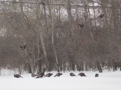
Wild turkeys gather in my St. Albans, Vermont yard several
winters ago.  Maybe thought it was a refuge from becoming
holiday meals?  Speaking of refuge, it looks like holiday 
travel across the nation will be much better than originally
anticipated. 
After some fairly dire computer models that suggested lots of storminess in the United States during holiday travel for Thanksgiving next week, everything is now turning up roses.  

It now appears there will be no major weather in anywhere in the Lower 48, at least. 

The only problems I could find was some non-flooding rains in the Pacific Northwest, early week chill in New England, and the usual patchy snow in the Rocky Mountains. 

That's a huge contrast to some forecasts from a week ago, which suggested a large storm in the Great Lakes and East.  

There will be a large storm, but it will be several hundred miles off the New England coast and no bother to us. 

By the time Black Friday rolls around, it does look like it will get nippy in the upper Midwest and there will probably be lake effect snows around the Great Lakes. 

Friday, June 11, 2021

One Type Of Drought To Love: A Lack Of Intense U.S. Tornadoes Lately

Tornado damage, minor, relatively speaking, in Tupelo,
Mississippi on May 3. There were no recorded violent 
tornadoes in May, 2021 AP photo by Thomas Graning
 It's been a busy year for weather disasters in the United States so far.

We've had crippling winter storms in February, frequent, extensive bouts of flooding in the South since March, big hail storms in Texas and elsewhere, and widespread drought in the West.  

One type of disaster that's been thankfully lacking this year, though, is violent tornadoes. 

May is usually the worst month for tornadoes in the United States.  This year, for the first time since accurate records on these things started in 1950, there were no tornadoes of EF-3 strength or worse.  EF-3 tornadoes have winds of 136 to 165 mph. 

Tornadoes are rated on six-point scale from EF0- to EF-5, with the fives being the worst. The great majority of tornadoes in the U.S. are weaker EF-2 or less. These weaker ones have winds of 65 to 135 mph. 

The ones that tend to grab headlines are the EF-3s to EF-5s, which, if they hit a populated area, cause terrible destruction.

Most years, there's at least a few scattered EF-3s, 4s, or even 5s somewhere in the United States. Unless re-analysis proves otherwise, this will be the first May on record without anything so destructive 

There was actually about an average number of tornadoes across the United States in May.  We have 289 reports of tornadoes, says NOAA's Storm Prediction Center.  The average is around 272, so close

Even the relatively strong EF-2 tornados were lacking in May. So far, there were only eight such twisters confirmed during the month. That's the fifth fewest on record for May, says the SPC.  That means almost all U.S. tornadoes in May were pretty weak, and didn't cause all that much damage.

Here's an even better piece of good tornado news: For the first time since 2014, there were no tornado deaths in the United States for the month of May. 

We also broke another, very welcome tornado record. As of yesterday, it's been eight years and 21 days since the last time an EF-5 tornado hit the United States.  That's the longest we've gone without the strongest tornadoes we can get.

EF-5s are the real monsters of the tornado world, being the strongest they can get. They produce winds of over 200 mph. In these strongest tornadoes, entire homes are swept off their foundations and swept away.  Cars and car-sized debris are blown 100 yards or more through the air. Bark is removed from trees and pavement can be sucked off roadways and parking lots. 

You wouldn't want to be caught in one of these. 

Luckily, with this new record means that nobody has been caught in an EF-5 tornado since May 20, 2013, when an EF-5 swept through Moore, Oklahoma. That tornado killed 24 people and caused at least $2 billion in damage.

There's not a clear reason why the United States has not endured an EF-5 tornado since Moore.  One good theory, writes Bob Henson in Yale Climate Connections,  is that there actually been one or more EF-5 tornadoes since 2013. We just don't know it. 

The strength of tornadoes are determined in post-storm analyses. Meteorologists look at damage to buildings, trees, and other items, and figure out from the damage how strong the tornado was.

But if an EF-5 tornado lumbers through the wide open Great Plains without hitting anybody's house or property, it won't be designated as such because there's no damage assessment to be done.

It could be just dumb luck that EF-5 tornadoes in recent years detoured around towns and farms and patches of woods in the otherwise grassy prairies. 

Tornadoes attract zillions of storm chasers, and some of these chasers bring radar equipment. Their radar has detected likely winds of 200 mph or more in some twisters in remote areas since 2013, so the idea that there are uncounted EF-5s is pretty valid. 

There's no telling when the drought of strong tornadoes will end, but it could end on a dime. 

We've had a similar experience with hurricanes, notes Henson in Yale Climate Connections. No strong hurricanes hit the U.S. from October, 2005 until August, 2017, the longest period we've had without such big storms.

Then Category 4 Hurricane Harvey hit Texas in August 17, and since then the U.S. has been hit by five major hurricanes. 

With that in mind, it's probably just a matter of time before the United States deals with another tornado tragedy like that in 2013 Moore, Oklahoma.

Wednesday, April 28, 2021

Good Weather News: National Dearth Of Tornadoes; Rainy Vermont

A rare March tornado in Middlebury, Vermont. Overall
in the nation, though, it's been a relatively quiet year
for twisters, at least so far. 
 Yesterday's post focused on a historic super outbreak of deadly tornadoes back in 2011, which was a tragedy. 

Today, we bring you relatively good news about tornadoes: This month in the United States, there hasn't been all that many of 'em. 

Up here in Vermont, we still need rain. And we're going to get it. More further down in the post. But first, tornadoes!

QUIET TORNADO APRIL

As Bob Henson notes on Twitter, through this past Monday, only 51 tornadoes had been noted in the United States this month. 

On average,  there are usually between 150 to 200 tornadoes in April.  

There were as many as a dozen tornadoes yesterday in Texas, Colorado and Oklahoma. There will likely be a few more twisters today. But there almost certainly won't be any big tornado outbreaks before April closes out Friday.  We might end April with fewer than 100 tornadoes, only the fourth time that's happened since 1990.  

Several influxes of cool, dry air from Canada into the Midwest and South have squelched tornado activity this month.  One crucial ingredient for tornado outbreaks are surges of warm, very humid air from the Gulf of Mexico into the heart of the country.  That has generally been lacking this month.

Overall, 2021 has been a relatively slow year for tornadoes, at least so far. Through Monday, there had been 269 tornadoes in the United States. Through the month of April, we usually have about 300 tornadoes.

March was a relatively busy month, compared to average. There were 191 tornadoes in the U.S. in March, 2021 including one oddly here in Vermont. 

Long range forecasters had noted earlier this year that large scale weather patterns this spring would have some similarities to that of 2011.  That prompted predictions of a busy, dangerous spring and early summer tornado season of 2021.

That still might happen, of course. May and early June are the peak months for U.S. tornadoes. The average number of U.S. tornadoes in May increases hugely to 276. In June, the average number is 243.

We definitely have a long way to go with this year's tornado season. At least we're off to a good start. 

Sadly, ten people have died in tornadoes so far this year. Still, that's not bad compared to some years, like 2011 when the death toll was in the hundreds.

The very strongest tornadoes, ones with a category of EF-5 with winds of over 200 mph, are obviously the most dangerous and deadly. 

It's been a long time since the nation has seen of those monsters, too. As Andrew Siffert noted on Twitter, we've gone 2,900 days or about eight years without an EF-5 tornado.  If we go another three weeks or so with no EF-5s, that would be the longest stretch on record. Fingers crossed! 

VERMONT RAIN

I've been harping all year that we need rain to overcome a lingering drought in Vermont. It seems this spring the only we get needed moisture it comes as snow.
Perhaps a little hard to see here, but an indication that
Vermont still needs rain.  The other day I dug into a pile
of soil I left last fall. A few inches down, it was still
as dusty as it was when I piled it up. (dusty part is lighter
brown/tan) We haven't had enough rain to percolate down.

So some good news for the rest of the week: We have a decent amount of rain coming.  And unless you live in a high elevation, it'll be all rain, not snow. (And the high elevation snow won't amount to anything much).  

Clusters of showers keep moving roughly west to east along a wavering weather front that is positioned mostly just to our south. One cluster clipped Vermont overnight with some rain central and south. 

Other batches of showers are due this afternoon and evening, Thursday afternoon and evening and on Friday. Overall these showers could accumulate to an inch of rain or more by the time we roll into Saturday. Some places could get more than 1.5 inches. 

That's not exactly torrential, given that the rain will come over three days or so.  But it will help at least a little. We still need a few to several inches of rain to overcome a deficit we've accumulated since last year.