Showing posts with label winter storm watch. Show all posts

Monday, December 1, 2025

Winter Storm Watches Remain In Vermont/Northeast As Snow Forecast Stays Consistent (For Now)

Latest snow prediction map from the National Weather
Service in South Burlington. In Vermont, it still
generally looks like the further south you go 
tomorrow, the more snow you'll get. 
 Overnight the forecast for our upcoming snow hasn't changed all that much in the the Northeast. 

To catch you up, a storm is forecast to rocket northeastward from the Gulf Coast this evening to near or offshore of Cape Cod tomorrow evening. 

Even if the storm had the perfect track to give the region heavy snow, the accumulations wouldn't be extreme, just because the storm wouldn't hang around long enough to dump much fluff.

So far, the Tuesday forecast has a track that would dump the heaviest snow in a band from northeast Pennsylvania, through central New York, central New England and on to southern Maine. 

So far, it looks like most people in this winter storm watch band would receive a quick six to ten inches of snow, more or less.

That's not a spectacular storm, but a sufficient enough thump to get winter started in places that haven't yet seen that much snow so far this winter.

For us in Vermont, southern parts of the state still seem to be in that band of heaviest snow. The winter storm watch is still in effect for the southern half of the state. 

Later today, I'm guessing at least the southern part of that watch zone might turn into a winter storm warning. I'm suspecting central Vermont might end up with a winter weather advisory, since some places north of Route 4 might not get quite to six inches of snow with this. (Usually, a snowfall of over six inches triggers a winter storm warning, while a winter weather advisory goes up for less than that.)

First guesses -based on subject-to-change National Weather Service forecasts - are for six to eight inches along and south of a line roughly from Rutland to Wells River.  The rest of central Vermont should get three to six inches. Northwest portions of Vermont look to be in the two or three inch range at the moment. 

No promises here, but if the snow predictions are adjusted between now and tomorrow, I think the adjustment might be toward slightly lower amounts. 

The timing of this snow is problematic. It'll start to snow probably around the time of the Tuesday morning commute. That makes me nervous because people leave home when it's not really snowing much but then quickly encounter snow and icy roads.

But they're "late" for work, so it's pedal to the metal despite the road conditions. Which leads to crashes and traffic jams. Which makes everyone late for work - or worse. 

The snow will start to taper off at about the time people are heading home from work or just afterwards.  You can see in the timing how quick this thing is.

AFTER THE SNOW

While Wednesday looks pretty quiet and a kind of on the cold side, we're still seeing trouble on Thursday. That Arctic front we've been talking about still looks to be on schedule. We still think it might come through in the morning. 

The timing might be bad again, as there might be dangerous snow squalls for your morning commute. We'll update you on that. 

We're still sure it will turn terribly cold during the day Thursday and that will last well into Friday. Strong northwest winds and crashing temperatures will make Thursday afternoon and evening miserable. By Friday morning, most of us will probably be with a few degrees of zero. Which is a little earlier in the season than we're used to. 

The cold will let up by the weekend, but temperatures will still remain below normal.

Winter is here. 


Sunday, November 30, 2025

Winter Storm Watches Now Up In the Northeast, Including Parts of Vermont

That dark blue area from northeastern Pennsylvania to
Maine is a winter storm watch as heavy snow might
fall in that band on Tuesday. That sort of off-purple
patch in north central New York is for some lake-
enhanced snow tonight. 
We've got a quick little update since this morning:

A wide band of winter storm watches as of late this afternoon have popped up from northeastern Pennsylvania, through central New York, central New England on into central Maine. 

Before we even get into the updates, today's bits and pieces of snow caused some real headaches. Both northbound and southbound lanes of Interstate 89 near Sharon had multiple crashes due to icy conditions this afternoon. Traffic, as you would imagine, was seriously gummed up in that area.

The closest traffic cam to the crash site I could find was along Interstate 89 in Bethel which didn't look too bad late this afternoon. It appears a half inch or so of snow has fallen in the area. That proves it doesn't take much to cause some danger on the roads. 

We've got some chances of snow overnight, so look out for more icy spots, including on your way in to work tomorrow after the Thanksgiving holiday.

Now, the storm. This will be the third of three storms that affected parts of the U.S. this week. The first sent blizzard conditions through parts of the Upper Midwest and Great Lakes last week. The second came yesterday with widespread snows from South Dakota to Michigan. Now we have this thing in the Northeast. 

Here in Vermont, basically draw a west to east line across the middle of the state, and south of that is your winter storm watch. 

It's in effect from early Tuesday morning to late Tuesday night. Somewhere in middle of that time frame, maybe in the afternoon and early evening, there might be a few quick hours where the snow comes down hard.

That is, if the storm goes according to plan. There's still a lot of hemming and hawing among the computer models as to how close to us it will come. 

The storm could blast right over southeastern New England, which would throw the big burst of snow into interior New England, including southern Vermont.  Or, it could race across the waters off the New England, coast, which would reduce how much snow the Green Mountain state catches.

Northern Vermont - at this point anyway - seems to be on the hook for just light snow. There's still even a chance of nothing up by the Canadian border, we'll see.

The more detailed computer models come out during the day tomorrow. Those might be able to better pin down how much everybody gets.  

I'll have an update for you tomorrow morning. 

Friday, February 14, 2025

Weekend Storm Trending Icier In Vermont; Sunday To Be Miserable

The National Weather Service's first crack at predicting
snow and sleet accumulation from the upcoming storm
This depicts six to nine inches. But be ready for
possible sharp revisions either way on these totals.
 I'm not the least bit surprised by this overnight development:

The National Weather Service office in South Burlington (and Albany for our southernmost two counties) has issued a winter storm watch for all of Vermont. It'll start Saturday night and last through Sunday evening. 

Though precipitation for most of us might end up lasting at least into early Monday morning. 

As an aside, Burlington is now pretty much in a lock for having a snowier winter month than normal, which has become a rarity.

 If Burlington gets 1.3 inches of snow or sleet with this one, which will happen, February's snowfall there will be above average. 

The trend  overnight with our upcoming storm has not been our friend, as - so far at least - most of us should see a fair amount of sleet with this. Southern Vermont in particular will need to watch out for freezing rain as well. 

On to the particulars, as updated this morning.

TODAY/SATURDAY

The cold winds will continue today, but at least there's nothing to worry about on the roads, other than patches of lingering ice from yesterday. The blustery gusts should start to taper off as we go through the afternoon.

Most of Saturday looks dry, too, as clouds increase. Dry air feeding in from Arctic high pressure to the north should keep light snow at bay until mid to late afternoon.

SATURDAY NIGHT

Steady light snow should spread across the state overnight. It will remain snow all night and into Sunday morning. We'll get a few inches out of this. 

SUNDAY

Here's where the trouble really starts. 

As we mentioned in yesterday's post, one main storm will travel from the Ohio Valley then into northwestern New York. Another will try to form along the coast. 

A preliminary look at possible ice accumulations with
the upcoming storm. Keep a sharp eye on southern
Vermont for revisions. If expected ice accumulation
goes above 0.30 inches or snow, you begin to have
 some definite trouble with fallen tree branches
and power lines. 

However, it's looking like the eventual storm in New York will be the dominate one longer, which would allow warm air to come in aloft, for our mixed precipitation.

This is the scenario we had on Thursday, except this one is more intense. And there's the potential for more warm air aloft for a longer period than we had on Thursday. 

Unless the forecast shifts, this almost guarantees a shift to a snow/sleet mixture, then all sleet during the day Sunday. 

The mix should start in the morning in southwest Vermont and spread through the rest of the state by afternoon. 

Worse, the warm air aloft in southern Vermont will be thicker and a little closer to the ground. In the north, what will start as rain in the toasty air high above will hit the cold air, freeze on the way down and hit us as annoying ice pellets.

As horrible as sleet is, at least it bounces off things and doesn't do a great job of sticking to trees and power lines, so you don't run into broken tree branches and power lines. 

The risk in southern Vermont is the rain for a time won't freeze on the way down and only turn to ice once it lands on your road, driveway, trees and power lines.  So far, the amount of freezing rain in the forecast doesn't sound like enough to cause a lot of tree or power line damage.

But if things shift a little more and the freezing rain ends up lasting longer than expected, all bets are off, so we'll need to watch this. 

Eventually, Sunday evening or night, the cold air should start crashing back in at all levels of the atmosphere, changing it all back to snow for awhile. Then it tapers off Monday.

Right now, the National Weather Service has all of Vermont seeing a solid (maybe too solid!) six to nine inches of snow and sleet out of this. 

CAVEATS AND WHAT TO DO

The above is what the National Weather Service and other meteorologist envision how this storm will play out.  Given how complex and marginal the temperatures will be in different layers of the atmosphere, this is a tough forecast.

It has a lot of bust potential, as we still could see more mix than expected, or maybe even less mix and more snow.  Forecasters were making revisions right up through almost the entire storm Thursday, and I expect nothing different on Sunday. 

Bottom line: Get your supplies if you need them today and or tomorrow morning or early afternoon. Stay put at home Sunday. 

We know the weather is going to be ugly on Sunday. We're just not 100 percent sure on what brand of ugly. 

Southern Vermont in particular has to stay on its toes as if they get more freezing rain than expected, power outages come into play.  A still-unlikely but not impossible worst case scenario for southern Vermont is a lot of freezing rain with widespread   tree damage and long lasting power outages. 

As I noted yesterday, this is a wide ranging storm that will cause huge problems. Most places east of the Mississippi River are going to have some trouble with this, be it floods, ice, snow, severe weather, tornadoes, high winds or intense cold. 

BEYOND SUNDAY

Don't anticipate any kind of early spring here in Vermont.  It'll be quite windy and cold Monday with flurries, with snow showers piling up a few more inches of fluff in the Green Mountains. 

Another nor'easter looks likely on Thursday. The early read on this one is it will either pass a wee bit too far south of Vermont for us to get much, or perhaps throw a few inches of snow at southern Vermont.

But we've seen a trend this month of later forecasts drawing storms further north than earlier anticipated. If that happens with Thursday's storm - and it might - we might be looking at yet another winter storm. 

Whether or not that happens, I'm seeing no signs of any kind of real thaw at least until the opening days of March. 


Tuesday, December 31, 2024

Record Warmth To Vermont Winter Storm As We Head Into The New Year

Big contrasts in snowfall expected with upcoming storm
Less than an inch in lowest valleys far west and far east
in Vermont, while Jay Peak could get two feet. 
It's toasty out there again this morning, as we get one last day of our end of 2024 heat wave. 

We won't have any record highs again today, but we never did get below freezing last night and many of us will be well into the 40s this afternoon. 

Burlington was the big heat winner with this warm spell. We already told you about the record high of 61 on Sunday, set at around 11 that night.

The city also managed to reach 60 degrees Monday, breaking the record high of 58 for the date set in 2022. 

Other high temperatures around the region Monday included 58 in Bennington and Highgate, 57 across the pond in Plattsburgh, 53 in Springfield, and 51 in Montpelier 

The thaw gave Montpelier a bit of a scare yesterday.  An ice jam formed in town, making the Winooski River rise rapidly in Montpelier. The city is still spooked by devastating floods in recent decades, including a 1992 ice jam flood.

In this case, city officials went to work, breaking up the jam with a backhoe and spraying warm, treated effluent onto the ice jam to make it melt. It worked, the jam quickly broke up, and water receded without every quite making it to flood stage. 

NEW STORM

That oft-mentioned New Years Day storm coming in is going to cause some pretty wildly different conditions in Vermont. We're going to have some big time snow winners and losers here. 

By the end of the week, some of the lower valleys of far western and far eastern Vermont will see barely an inch of new snow, if that.  Meanwhile, the northern and central Green Mountains are in for at least a foot of snow.  I wouldn't be the least bit surprised if the Jay Peak cloud over-performs and dumps two feet of snow on that ski area near the Canadian border.

The storm causing all this is pretty dynamic, judging from the very low, but not zero chance of tornadoes today oddly north in parts of Ohio, West Virginia, Maryland and Delaware.

As I mentioned yesterday, the storm is taking the perfect path to dump at least several inches of snow all over Vermont. Too bad there's not enough cold air for snow. The valleys should see mostly rain overnight and New Year's Day, at least for the first half of the storm. 

There is the slightest chance of a New Year's miracle which would chill the air enough to produce snow even in the valleys, but I'm not holding my breath on that one. 

Once the storm gets to eastern New England, it will really start to crank up, then move northward into eastern Quebec and pretty much stall for a couple days. 

That will set up a strong, cold, wet northwest air flow that will last from Wednesday night to at least Friday. It's a classic setup to dump tons and TONS of snow on the central and northern Green Mountains while people in the Champlain and Connecticut River valleys wonder what all the fuss is about. 

The National Weather Service office in South Burlington has posted a winter storm watch for Franklin, Orleans, Lamoille and Washington counties in Vermont, and also the spine of the Green Mountains all the way to south of Killington. 

Winter storm watches are also up for the Adirondacks and in western New York, where the lake effect blasts are set to start again. 

The snow contrasts here in Vermont will be striking.  In Franklin County alone, I'll be surprised if St. Albans Bay gets as much as 1.5 inches. At my place on a high spot on the eastern part of St. Albans, I'm probably in for four or five inches. 

Head up to eastern Franklin County toward Bakersfield, Richford and Montgomery, we're probably talking more than a foot. Maybe even a foot and a half in a couple high spots.

We're also going to see some screaming northwest winds with this, with gusts over 40 mph, so we'll find plenty of blowing and drifting snow, especially where there's a lot of it. 

Plan on travel trouble in high elevations Wednesday, in most of the state Wednesday night, and in the northern and central Green Mountains Thursday and probably Friday.  

Once temperatures fall below freezing later Wednesday, they'll stay there for a long, long time.  Quite possibly until at least mid-month, so any snow that does fall will stick around for awhile. 

Thursday, March 21, 2024

Saturday Vermont Snowstorm Pretty Much Definite, Amounts Still Open To Question

The National Weather Service in South Burlington has
increased expected snow amounts from this Saturday's
storm in central and northern Vermont. Looks like
rain will cut down accumulations from about
Route 4 south. 
 You know we're getting a storm when I do morning and evening updates on the event.

It's looking pretty definite now that most of Vermont is in for a pretty big snowstorm Saturday that will screw up travel and maybe power lines.  

Let's get into the updates we saw this afternoon:

FORECAST AMOUNTS

In central and northern Vermont, expected snow amounts have been pushed upward a fair amount compared to this morning's forecast.

The exception to that is south of Route 4, which I'll get into in a bit.

First, forecasters are pretty confident now there will be at least six inches of snow north of Route 4. Though not quite confident enough yet to upgrade the winter storm watch to a warning. little compared to forecasts from this morning. 

For instance, this mornings forecast had 5.1 inches falling in Burlington. The latest forecast issued this afternoon has 10 inches in Burlington. Montpelier went from 6.3 to 9.3 inches. St. Albans went from 6.5 to 10.6 inches. 

We have to wait and see whether that upward trend continues, or something short circuits that idea.

The worst case scenario - with a 10 percent chance of it happening - would be a whopping 15 to 24 inches of snow north of Route 4.  That would happen if the moisture flow off the Atlantic is stronger than expected and it stays cold enough for snow. Don't count on it, but it is still plausible. 

A best case scenario - if you don't like spring snow - is warm air would push to the Canadian border for a time, cutting snow totals to six inches or less. That scenario is also unlikely, but could surprise us. 

 Latest forecasts do have the slightly warmer air making it as far north as around Route 4.  If the forecast holds, an initial burst of snow would change to rain or even freezing rain in spots down that way.  Which means snow accumulations would be five inches or less if this comes true. 

A blizzardy look in St. Albans, Vermont this morning
before the air dried out and partial, but cold
sunshine appeared in the afternoon. 
So far at least, it doesn't look like there will be enough freezing rain to sag the trees and break power lines, except perhaps in the mountains of eastern Rutland County and western Windsor. 

Of course the other problem is wet snow.  

It's late in the snow season, and the bulk of the snow will happen during the day Saturday, when the stronger March sun can sort of bleed through the clouds a bit. 

That would turn what might be a relatively powdery snow that comes down before dawn to slush falling from the sky during the day. 

It's a little too soon to tell if the wet snow would be another electricity killer, so we'll have to watch out.

GETTING THERE

It was damn cold today compared to what we got used to this month. You noticed, that, huh?  Some Northeast Kingdom towns were still in the upper teens at mid-afternoon. Those cold hollows should make it close to zero tonight, while the rest of us bottom out by dawn Friday somewhere between 5 and 15 above, warmest in the Champlain Valley. 

Those aren't record lows, but pretty chilly for this time of year nonetheless. 

Sunshine will fade behind increasing high clouds tomorrow, and it'll stay cold. Not as bad as today, but a high of 30 or so isn't great for late March. 

The snow should arrive shortly after midnight early Saturday west and during the pre-dawn hours east. It'll continue all day Saturday, except for that maybe rain or freezing rain crap in the south. 

MOVING ON

The snow should end Saturday night. After the storm, it will remain chilly Sunday, with highs barely making it into the 30s.  The high angle sun should start to melt the snow off pavement, and out of protected corners and such.  

As temperatures rise into the low 40s Monday, the pace of melting will start to ramp up. And it will really get going if daily highs from Tuesday onward next week reach the 40s, maybe near 50 in warmer valleys, if forecasts issued today hold true. 

This cold/snowy episode should prevent an early end to the maple sugaring season. I was worried about that as we had a warm month until now.  We're setting up for an excellent sap run next week. We're also setting up for an extension of our long, long and very rough mud season.  

We'll have to watch out for some spring flooding if we get any big rain storms in the coming weeks. Especially after this new storm there will be plenty of snow in the mountains that will eventually have to melt. 

The water equivalent of the upcoming storm is one to two inches, which is quite a bit. That's on top of the surprising amounts of snow the mountains have gotten since Sunday.

The good news is next week isn't looking super warm, so the melt won't be overly fast. Even better, unless we see some sort of surprise, rainfall next week looks pretty unimpressive. 

Also, the deep snow is pretty much confined to the mountains, at least for now. We'll have to wait and see what happens Saturday.   

Considering all that, I'm not too worried about another big flood at the moment. We don't exactly need another one.  


Weird, Stormy, Snowy Vermont Wednesday Yields To Frigid Thursday, Then Winter Storm

Heavy snow falling in downtown St. Albans, Vermont
late Thursday afternoon. 
Thursday was quite the exciting weather day in Vermont with those snow squalls. Now, today, we're suddenly taken back to midwinter. By Friday night and Saturday we could well have a major snowstorm. Five days from now we hit full time spring weather again. 

March keeps us Vermonters on our toes, doesn't it! 

We'll break it all down piece by piece below, starting with some info on what happened Thursday. 

SQUALLY THURSDAY

That snow really came down hard for awhile, didn't it. Pretty much all of us in Vermont shared in the excitement Wednesday, some more than others. 

The heaviest snow came along and just ahead of a  cold front, so it was a fairly wet snow. That was good, as there wasn't much blowing snow. That prevented visibility from getting even worse on the highways.

Plenty of Vermont towns saw  two to six inches, much of it coming in three hours or less. Marshfield reported 3.5 inches in two hours. Hinesburg had 2.9 inches in three hours, according to reports collected by the National Weather Service in South Burlington. 

The highest snow total I've seen so far is 8.3 inches at an 1,100 foot elevation in Underhill. 

There was indeed thunder snow here and there. A noted a strike on a lightning detector map somewhere near Milton Wednesday aftenoon. 

A line of snow thunderstorms moved across far southern Vermont, too. Bennington reported a thunderstorm with snow at around 6 p.m.  Near high elevations Readsboro, Mitch, or @VermontsterWx on X captured on film what pretty much amounted to a severe or nearly severe thunderstorm.

Mitch's video shows lightning, thunder, heavy snow and definitely strong winds. 

High elevation have really seen the snow pile up this week. Jay Peak reports 21 inches of new snow since Sunday. 

The snow depth atop Mount Mansfield went from 61 inches a week ago, to 81 inches as of 5 p.m. Thursday. It kept snowing on Mount Mansfield after 5 p.m. so there's even more now. And perhaps a LOT more in the forecast, as you'll see further down intros post

Thursday truly was a weather geek's party day, that's for sure. 

COLD WEATHER

Was looking rather blizzardy and frigid Thursday 
morning in St. Albans, Vermont. 
Temperatures plunged last night and the winds picked up even more.   Temperature continued to fall this morning even after sunrise That's a testimony to the strength of this blast of cold air. 

By 8 a.m. pretty much all of us were in the teens to around 20.  Wind chills were in the single digits. 

There were still quite a few snow showers around northern Vermont, but those will wane during the day. 

The cold will hang tough, as we stay in the 20s to around 30 all day with those gusty northwest winds. 

Tonight will be wintry for sure. Lows will be in the single numbers and teens. Pretty close to average for mid-January. 

Friday will also be much colder than normal for this time of year. But at least the winds will be lighter, and some of us will get up near the freezing point in the afternoon

WINTER STORM WATCH

I've prattled on a lot here already, since there's so much to talk about. But there's an elephant in the room that must be discussed. Or at least the elephant will be here shortly.

Said pachyderm is the now-likely snowstorm in Vermont, due Friday night and Saturday.  The National Weather Service has issued a winter storm watch for all but the southernmost two counties in Vermont. Though I suspect that the National Weather Service in Albany, NY, which covers Bennington and Windham Counties, might issue one later. 

The watch goes from Friday evening through Saturday night.  

National Weather Service in South Burlington with
an early snow forecast for Saturday's expected storm.
Predictions will change one way or another 
between now and then. 

For now, the National Weather Service is forecasting five to eight inches of snow for most of us between Friday evening and late Saturday night. 

However, there might well be some big adjustments in the snow totals either up or down.  You can see the uncertainty in the forecasts. 

For instance, the National Weather Service in South Burlington is - for now - forecasting 6.3 inches of snow in Montpelier. But there's a 10 percent chance it could be as little as three inches and a 10 percent chance it could be as much as 18 inches. 

The computer models still haven't figured out how much moisture will feed into Vermont, which will have a huge impact on how much snow we get. 

As of Thursday morning the scariest computer model is the European, which brings about 1.2 to 2.4 inches of precipitation to Vermont. That would translate to more than a foot of wet snow. The American model is less dire, and more in line with the five to eight inch scenario.

This could also mix with or change to a cold rain in spots, especially south. 

This storm forecast will need tons of updates in the next day or so. Stay tuned! 

This belated winter siege should end next week as temperatures warm up pretty drastically after Monday. 


Sunday, February 11, 2024

Springlike Record Highs And Thunderstorms In Vermont Yielding To Snow, Winter Chill

A springlike, painterly sunset in St. Albans, Vermont
Saturday, February 10. Note the snow-free ground.
Record high temperatures and thunderstorms hit
the area on Saturday.

When I said Saturday would end up being very much like an April day it turns out I was not kidding!

As anticipated, we set record highs in and around Vermont yesterday, and the warmth over-performed. It got up to 56 degrees in Burlington, besting the old record high for the date by ten degrees.  The low temperature of 42 degrees was also a record in Burlington for the lowest minimum for the date. 

I've been remarking on how often we've had super warm nights in Vermont and this is another one. The low temperature was 29 degrees warmer than normal, and missed the record low for the date by a mere 68 degrees.   

The weather in Burlington Saturday would have been exactly normal for April 22. 

Elsewhere, Montpelier set a record high for the date of degrees on Saturday. Pretty much everyone in the Vermont made it into the 50s. Bennington made it to 60 degrees. 

Thunderstorms added to the springtime feel to Saturday.  We anticipated a possible rumble of thunder or two, but some bonafide thunderstorms passed through northern Vermont, with some cloud to ground lightning strikes and some brief fairly heavy downpours. 

None of the storms were severe, but I saw one photo on social media of some minor street flooding in St. Albans due to the thunderstorm rains on frozen grounds and possibly an ice-clogged drain.

The thunderstorms were hit and miss, like you'd expect in the spring and summer. Burlington only got 0.02 inches of rain.  

The air Saturday smelled like spring. The billowy shower and thunderstorm clouds and slight haze also felt like spring or summer on Saturday. Some of my daffodils are now trying to come up. 

With few if any storms likely in the coming weeks, Burlington has a chance at having the driest February  on record.  Of course, that partly depends on what the next storm does. More on that in a moment

BACK TO WINTER

A lot of snow could fall on southern and central
New England Tuesday, but there's still a lot of 
questions as to how far north the heavy snow will get.
Expect changes to this forecast.
Springtime in February here in Vermont could not last forever, as we know. We're transitioning back to winter. 

Today and tomorrow will still be warm, just not as toasty as it's been the last three days.  Highs both days will be between 35 and 42 for most of us. That's still a good 10 degree or so balmier than normal.

As always when a winter heat wave ends, there's a risk of snow.  As of Sunday morning, there's a LOT of disagreement as to how much snow and where it will fall. 

A very wet, juicy storm will move from the Ohio Valley, then off the Mid-Atlantic Coast to pass just south of New England Tuesday.

By then, enough cold air will have come into New England to make the stuff coming out of the sky with this system mostly snow.

Winter storm watches are up for pretty much all of southern New England, the southern half of New York and much of Pennsylvania.

The winter storm watch extends as far north as Vermont's two southernmost counties. 

The trick to this storm is the line between heavy snow near the storm and very light to no snow further north will be very sharp.  If the storm jogs just a bit further north than expected, than the southern half of Vermont at least can expect a decent snowfall. If it goes a little further to the south, then even Bennington and Brattleboro miss out on the snow.

Here's an illustration of how uncertain the forecast is. 

As of Sunday morning, the forecast is for 8.4 inches of snow in Brattleboro on Tuesday. But there's a 10 percent chance they get less than an inch, and a 10 percent chance they get as much as 17 inches. That's a huge spread.

If you head well north, the forecasted snow in Montpelier is just 0.8 inches. But there's a 10 percent chance the Capital City could see six inches.

This variation in expected snow should narrow as we get closer to the event. At least I hope so. 

Bottom line: If you need to drive around southern Vermont late Monday and Tuesday, be aware it could snow. Maybe a lot.  Southern New England late Monday and Tuesday really does look like a mess, with wet snow, travel hazards, power outages and flight delays. Such fun! 

Whatever happens with that storm, we're in for a long spell of winter weather afterwards. It won't be anything extreme, but we in Vermont can expect a good week or more of high temperatures staying below freezing.

At this point - after Tuesday, anyway - it doesn't look like there are big storms in the pipeline for us at least through next weeknd. 


Saturday, January 27, 2024

Another Vermont Fog Attack As Gloomy Winter Continues

Crows gather on trees amid dense fog and freezing
drizzle Saturday morning in St. Albans, Vermont. 
 The murk and fog that's been plaguing Vermont this week - all winter, really - intensified last night,  blinding motorists and laying down a very thin but potentially dangerous layer of ice on some road surfaces.  

Meanwhile, far southern Vermont is under a winter storm watch. More in that further below

The dense fog advisory for all of Vermont is in effect until 10 a.m. today. Visibility in some areas was down to a mere 50 feet. If you're caught in that on the roads, you'd better be driving really slowly. It's hard to see even bright tail lights ahead under those conditions. 

I noticed some flights are late or delayed at the Patrick Leahy Burlington International Airport in South Burlington, so check your flights if you're coming in or out of Burlington today. 

Temperatures throughout the Green Mountain State started the day at around 32 degrees, so the fog was freezing on some surfaces. 

Jackson the Weather Dog encountered our icy driveway in St. Albans, Vermont when he went out early today to take observations on the dense fog and temperatures. Jackson noted a little freezing drizzle was also falling here in St. Albans, and I'm sure in several patches elsewhere in the state.

The fog is part of a national weather pattern I posted about the other day which has been socking in wide areas of the nation. Widespread fog broke records midweek for the amount of land they covered.

Traffic cam showed foggy conditions on Interstate 89 in
Georgia, Vermont this morning. 
This morning, there was slightly less fog in the nation than earlier, but it was still remarkably widespread. Especially for midwinter.

In addition to Vermont, dense fog advisories this morning covered most of the states around the western and southern Great Lakes, parts of the northern Plains and numerous spots up and down the East Coast. 

Back here in Green Mountain State, the fog should gradually become less dense as this Saturday morning wears on, but it won't entirely go away.  

We've got another gloomy day ahead of us with a thick overcast, patchy fog, dank conditions and perhaps a few little area of drizzle or a couple wet snowflakes. 

The fog will probably thicken up again tonight, but not become dense in as many areas as it was this morning. Then comes the next little troublemaker

SUNDAY SNOW

That storm we've been watching will pull northeastward out of Mississippi today, carrying boatloads of moisture with it. Flood watches today extend from Alabama to West Virginia.

The storm will move to near West Virginia by Sunday morning. At that point it will fade in favor or a new storm along the Mid-Atlantic coast. That new storm will then scoot east to northeastward away from the U.S.

Still, its projected path has nudged northward a little bit compared to previous forecasts, That puts southern Vermont in play for some snow. 

Snow forecast for Sunday/Monday from the National
Weather Service. Six inches possible in far southern
Vermont, perhaps nothing near Canadian border.
Map is subject to change by tomorrow. 

A winter storm watch has been posted for Bennington and Windham counties Sunday into Monday. Four to eight inches of snow is a decent bet there, especially in higher elevations.

This will be a wet snow, so a few power outages are a risk.

Snow amounts will diminish quickly as you head north.  The National Weather Service has storm totals of around two inches up to about Route 4, and an inch or less up to Route 2, with little or nothing near the Canadian border.

There's a HUGE caveat with that forecast, though.  If the storm track continues to nudge north, heavier snow than that will fall in southern and central Vermont. Whatever happens, Sunday will be another overcast, dreary day. 

If you're looking for a literal bright side, I have just a teeny morsel of good news. The weather during the upcoming week still looks like it will actually be boring. - a little warmer than average with no notable storms. 

However, it doesn't look like we'll be seeing much sun, either. 

Friday, January 5, 2024

Weekend Vermont Snow Forecast Trends Northward Again

The National Weather Service office in South Burlington
has once again nudged expected snow totals upward 
compared to previous forecast. This map was
issued late Friday afternoon
 So far, as of this Thursday evening, forecasters are getting more bullish on snow in Vermont Saturday night and Sunday.   

Once again, the National Weather Service office in South Burlington has bumped up snow accumulation forecasts.

The winter storm watch has been extended northward from its position in Rutland and Windsor counties this morning.  It now encompasses pretty much all of Vermont south of Route 2.

It now also looks like far northern Vermont is in play for a modest two or three inches of new snow, according to current forecasts. That's a boost from the dusting to an inch that was in the forecast yesterday. 

High elevations in far southern Vermont are now under the gun for up to a foot of snow. The winter storm watch has been upgraded to a winter storm warning in Bennington and Windham counties

I don't know whether this northward trend in the storm track will continue right up until the storm hits, but it is encouraging for snow lovers Even if a subsequent storm midweek ends up depositing mixed precipitation or rain.

For the weekend storm, it's looking like the first flakes will come down in the southwest corner of Vermont roughly around 6 p.m. Saturday and spread north to the Northeast Kingdom by around midnight, give or take.

It appears the heaviest snow will come very late Saturday night into Sunday morning. 

Expect snowy, slippery roads and poor visibility later Saturday night and Sunday, especially in central and southern Vermont. 

Of course, we're still more than 24 hours away from the storm, so things can still change either way, with updated forecasts of either more or less snow than I'm talking about this evening.

That expected midweek storm still looks potentially wild, with heavy precipitation and strong winds still possible. I'll do better updates on that storm starting about Sunday, as the Tuesday night/Wednesday storm could end up being on the impressive side.

Saturday, December 9, 2023

Saturday Morning Vermont Storm Update: Confidence Increasing With Heavy Snow Forecast; Flooding Still In Play

Saturday morning's snow prediction map from the 
National Weather Service office in South Burlington.
Expected totals have noticeably increased in
the Champlain Valley compared to previous forecasts.
 I'll start with the bottom line: That long-awaited storm Sunday and Monday now seems more certain, with the flood risk Sunday night transitioning to a nasty snowstorm, at least for many of us in the Green Mountain State.  

Forecast models, which were kind of all over the place Friday evening, have gotten their ducks more in order. Though some surprises with the upcoming storm are inevitable, confidence is definitely up on the rain and snow scenario.

Expect some flooding, and a horrible, snowy, windy Monday, especially north and west. 

Let's break it all down step by step:

BEFORE THE STORM

The Champlain Valley really warmed up overnight, rising through the 30s to reach the low 40s this morning. Highs should flirt with 50 degrees this afternoon. Eastern Vermont is cooler, near freezing, but they should get to around 40 later today. 

All this is getting the ball rolling for snow to begin melting in the mountains. Today is an excellent day to stock up on groceries, LED candles and such and do other errands. You might need these supplies by Monday. 

The warm air will continue overnight tonight and Sunday, and the rain will move in during the day. 

THE RAIN/FLOODING

The rain might start out showery on Sunday amid temperatures in the 40s to low 50s, but it will grow steadier and heavier as the day and evening wear on.  The rather heavy rain will continue into the wee hours of Monday morning before the snow arrives - which I'll get into in a bit.

All rivers in Vermont will see sharp rises, and minor flooding is likely anywhere. The rivers most likely to spill over their banks continue to be the Winooski downstream from Montpelier, the Mad River in central Vermont and the Otter Creek in Rutland and Addison counties. 

Southeastern Vermont has probably a higher flood risk than other areas because the rain there will last quite a bit longer before the changeover to snow.  Still, the entire state of Vermont is under a flood watch from Sunday afternoon through Monday afternoon.  

Note that it will have been snowing for hours Monday morning with a flood watch still in effect. That's because it will take time for runoff to reach larger rivers. Flood crests should come Monday morning or afternoon.    

It continues to look like any flooding will be much less serious than what we had in the summer, but expect some road closures in low lying areas, wet basements, standing water on roads and maybe some urban street flooding here and there. 

WET, NASTY SNOWSTORM

The biggest question marks with this storm has been how much snow will fall. We still have some disagreements in the various forecasts, but the range of possibilities has narrowed. And not in a good way. 

The winter storm watch remains in effect generally for northern and central Vermont. The big change in the forecast is that winter storm watch has been expanded to include the Champlain Valley from about Charlotte north to the Canadian border (It will also end up being unpleasantly snowy south of Charlotte, too.

The storm that will form along the cold front will be oriented such that it will easily be able to funnel cold enough air into the Champlain Valley to produce four to 10 inches of heavy, wet snow. That's a change from the previous two storms, which spared the Champlain Valley. 

Elsewhere across northern Vermont, six to 10 inches of snow is in the cards, with locally up to 18 inches in the mountains. Southwestern Vermont is in for two to four inches, with more in the mountains. 

The only place in the Green Mountain State that looks like it will be mostly spared is the Connecticut River valley floor from about White River Junction south.  Those places should only get a dusting to three inches of snow. Amounts will go up pretty fast as soon as you start climbing the hills west of the Connecticut River valley. 

This still looks like it will be a wet, heavy snow, with temperatures in most areas around 32 or 33 degree during the heaviest snow.

As it looks now, the rain will change to snow before dawn in all but southeastern Vermont. The heaviest snow will probably fall during the Monday morning commute. It's going to be a huge mess. Snow could be coming down at a rate of an inch per hour, which makes it hard for snow plows to keep up. 

Wet snow is worse to drive on as it tends to compact into ice. If you can work from home Monday, do that. We'll probably have lots of school closings, so pay attention to that.

With the heavy, wet snow falling and winds increasing, power outages will be a problem. Green Mountain Power is already warning people to stay away from fallen wires or collapsed trees or branches that might have live wires in them. 

I give this storm a high potential to cause even more outages than the 16,000 outages that occurred on December 4 and  34,000 that occurred on November 27 during two previous wet snowstorms. 

I think road conditions will remain bad throughout Monday, but start to improve at least a little toward the end of the day as snow tapers off. Strong winds will continue even after the worst of the storm is over. That means snow loaded trees will probably continue to collapse onto utility wires into Monday evening 

On the bright side, ski areas and other winter sports areas in northern and central Vermont that lose their snow in the thaw Sunday and Sunday night will get most of their snow back Monday. Southern Vermont ski areas will get snow, but it won't be a gigantic dump.

There will be changes to this forecast, so as always, I'll provide updates. 


Sunday, March 12, 2023

Sunday Morning Storm Update: Southern Vermont Still Looks Like The Big Target

The latest snow forecast from the National Weather 
Service depicts a not big deal 3 to five inches of 
snow far north to a terrible, heavy wet foot and
a half far south. Southern Vermont looks 
locked in for a big storm. Far northern Vermont is
still a wild card. Up there, they could get far
more, or far less than what's depicted on this map.
 Today will be a lovely one to get outside before the weather in Vermont goes downhill in a hurry. 

Aside for increasing high clouds this afternoon ahead of the storm, we'll have a decent amount of sun for a change. It'll only get up to 40 degrees or so, but the sun and expected light winds will make it feel warmer than it really is. 

All great for winter sports, not bad for sugaring, and a small amount of snow will melt to make just a little room for the new snow that's coming. 

THE UPDATE

While all of Vermont is in for some lousy weather with the incoming, giant storm, it's still looking like it will be just a nuisance in far northern parts of the state, but a real challenge south. 

Most of the two southernmost counties of Vermont are now expecting nearly a foot and a half of snow. It's not out of the question that a couple high elevations in far southern Vermont could see more than two feet of snow out of this. So that's up there in the list of would be historic storms.

These areas missed much of the snow this winter, so I guess they're getting their comeuppance of sorts. 

This is going to be a heavy, wet snow, accompanied by quite a bit of wind. This is a recipe of a lot of power outages and tree damage.  Under this scenario, some power outages could last a few days. 

Central Vermont will be in somewhat less trouble, but will still have some real problems with this storm. Most of this area can expect 5 to 12 inches of wet snow. Though not as bad as a foot and a half, this is more than enough to cause trouble with power outages. 

The places in central Vermont that will be closer to a foot of snow are the usual suspects in somewhat higher spots on or near  the eastern slopes of the Green Mountains. We're talking towns like Ludlow, Cavendish, Mount Holly, Shrewsbury, Killington - that neck of the woods. 

Northwestern Vermont is still the real wild card in this storm.  Will a surge of moisture dump a fair amount of snow up there? Or will dry air from Quebec squash that idea?

The National Weather Service has these worst case and best case scenario maps that go either way of the official prediction.  The maps show what would happen if the storm really over-performs or under-performs. 

In this case, the northern Champlain Valley is really questionable. For instance, the official forecast snowfall for St. Albans is 3.1 inches.  But the worst and best case maps give St. Albans either absolutely no snow, or as much as 10 inches.  Either extreme likely won't happen, but you can see the forecast challenge. 

Part of the issue is the time of year.  When it's snowing hard during the day in March, it can really pile up. If it's just light snow with thinner clouds, the sun's warmth can get through.  So the snow will often melt as it hits, or mix with rain. That might be part of the issue in northern Vermont along and north of Route 2. 

TIMING

Some light rain and wet snow could break out Monday afternoon. For the evening commute, I don't think it'll be that big a deal, except maybe a little bit in higher elevations. 

Overnight Monday, the precipitation will gradually pick up speed and the snow will start to accumulate. In low elevations, the snow could be mixed with some rain well into the evening. 

Where the heaviest snow hits, Tuesday will be the main show. Dense, wet snow will come down amid gusty winds in at least a few places. So you know what that will do to power lines and travel. 

The snow will ever so slowly taper off Tuesday night and Wednesday as the huge storm finally starts heading eastbound away from the New England coast. It'll stay windy through Wednesday, so power outages might continue into midweek.

WHAT TO DO

If you're in  northern Vermont, be on guard. This storm might be a bit of a big deal, or it could be a nothing burger.  If you need to run errands, do it today or Monday morning, just in case.  

In central and especially southern Vermont, get ready to stay home, and not travel on Tuesday. Also, stock up for possibly long power outages. That means get your  batteries, LED candles and all that set up.  Don't use candles with real flames. They're a fire hazard. If a blaze starts, don't count on the fire department to get to your place readily during the height of the storm.

Note that secondary and back roads in particular might not only be blocked by snow, but by fallen trees, branches and power cables. 

By the way, the Hudson Valley of New York, Catskills, much of New Hampshire, western and northern Massachusetts and northwestern Connecticut are in the same boat as southern Vermont, so cancel your travel plans for those areas Tuesday and possibly Wednesday. 

Coastal New England, New York and New Jersey face heavy rain and snow, strong winds and possible shoreline flooding. 

Saturday, March 11, 2023

Saturday Evening Update: Tuesday Storm Forecast Trends South A Bit, Zero Guarantees It Will Work Out That Way

An early crack at forecasting the upcoming storm issued by the
National Weather Service office in South Burlington. Mostly
a central and southern Vermont storm, but we have a huge
bust potential. Especially in northern Vermont where there's
 a lot of forecast questions. Map only goes through 8 p.m.
Tuesday. Some more snow is expected after that. 
Winter storm watches are starting to go up for parts - but not all of Vermont - as we draw closer to that big early week storm that will hit........somebody.  

I'm still not finding a whole lot of consensus on what this thing is going to do.  There's a complicated dance of upper level features, storms, winds and such that are making predictions a pain the you-know-what.

If there was any trend in the forecast today, it was to push the storm further south and east than earlier forecasts. 

This pretty much keeps southern, and maybe central Vermont in the crosshairs of this storm, at least for now. It's still looking like that part of the state will be close enough to the storm to get pasted by some heavy, wet snow. Maybe a lot of it. 

Northern Vermont is even more of a wild card than it was this morning. 

Honestly, some areas along and Route 2 could get next to nothing, or they could get more than a foot. I don't think we'll know how northern Vermont will fare with this until just before the storm Monday, or even when we're into it Monday night and Tuesday. 

For now, the winter storm watches - areas that can probably expect at least six inches of snow - cover the southern four counties of Vermont, Orange and Washington counties, and the western slopes of the Green Mountains in Chittenden County. 

Remember, a winter storm watch means maybe. If it's upgraded to a winter storm warning, then you can be pretty confident you're going to get nailed. 

It still looks like most of the precipitation with this storm in Vermont will be a heavy, wet snow, so power lines are still likely to snap under the weight of the snow. If the current forecasts hold. Some of the warmer valleys could see rain Tuesday afternoon as temperatures get up into the mid-30s. 

Whoever gets the heavy snow will see most of it from late Monday night through Tuesday. 

The forecast map issued by the National Weather Service in South Burlington goes from Monday afternoon through 8 p.m. Tuesday. 

This map will absolutely surely change as we get closer to the storm. But for now, the map depicts a modest three to six inches of new snow along and north of Route 2. Some places right near the Canadian border would see as little as two inches.

Central Vermont would get a solid 6 to 12 inches of snow. Far southern Vermont would go over a foot, with local 18 inches in the southern Green Mountains. 

Note that some additional snow not depicted in the map would fall after 8 p.m. Tuesday. Snow should continue well into Wednesday, but it will be tapering off as we go along. 

Other spots that at least for now seem to be on target for getting blasted by at least a foot of snow are the far southern Adirondacks, Catskills, southwestern New Hampshire, the Berkshires of  Massachusetts and the far northwestern corner of Connecticut. 

Even if you don't like big dumps of snow, you can cheer up a little. It won't be particularly warm after this storm. But the strong March sun will start to eat away at the new snow almost immediately after the storm ends. 

As noted, expect big changes in the forecast for this storm, which I will happily update you on tomorrow and Monday. 

Another, weaker storm looks due on Friday. That one, at least for now, looks like it would produce mostly light rain, and not a whole lot of snow, 

Don't worry. Spring is coming. But for the rest for March, it looks like spring wants to come at us only grudgingly. 


Thursday, March 2, 2023

Pesky Questions Remain About Weekend Snow In Vermont

The National Weather Service in South Burlington took
a first crack at forecasting Friday night and Saturday's
snowfall. There's a high chance these predictions will
change one way or another, especially in
northern Vermont. 
We know a snowfall is coming to Vermont Friday night and Saturday. Some of us could get quite a bit of it. 

The National Weather Service offices in South Burlington and Albany are confident enough on this that they've issued winter storm watches for all of Vermont Friday night and Saturday. 

The question now is?  Does anybody get a huge dump?  Does anybody sort of miss out and end up with something that's not that big a deal?

I'm kind of surprised that as of Thursday morning, the computer models, at least, don't have a good handle on this.   

At this point, forecasts are slightly leaning toward more snow in central and southern Vermont and a little less far north.  Note I said slightly leaning. There's still a decent chance northern areas could share in a big snowstorm. But if that happens, does southern Vermont lose out, at least somewhat?

The incoming storm is a little like the last one that came through on Tuesday. Except stronger. 

The basic scenario is the same as what happened on Tuesday, though. The main first storm moves up toward Buffalo, New York by later Friday night. Meanwhile, a new storm gets going just south of southern New England, and scoots eastward out to sea on Saturday.  

If the original storm that ends up near Buffalo fades quickly like some computer models suggest, then northern areas will miss out on a lot of the snow. That's because dry air from Quebec would squelch snowfall near the Canadian border. The coastal storm would then dump snow on southern Vermont. 

If that original storm near Buffalo powers through into Quebec, then northern areas get more snow that expected. That's what happened on Tuesday, but just because it happened once, doesn't mean it will happen again.  Underhill this scenario, southern Vermont would be more at risk for mixed precipitation instead of just snow. 

So now that I have explanations/excuses out of the way, here's what we know: 

1. Be prepared for snow, possibly heavy Friday night, going into at least Saturday morning.  The snow should start after Friday afternoon's commute, so you should be fine there. 

2. Although the snow won't be super soggy, it will be fairly heavy and wet. Strong winds aloft could shred the snow into small dense flakes. Also,  temperatures on Saturday near 32 degrees will make the snow kind of dense. A wild card is still the chance of sleet of freezing rain in far southern Vermont. It's possible we'll see power outages in spots, but we don't know yet how extensive they might be. 

3. The best chances of seeing close to a foot of snow would probably be in central Vermont, with the least chances up near the Canadian border. Expect the forecast to change somewhat one way or another as we get closer to the storm. 

4. The storm will be out of our hair on Sunday, and we'll have rather quiet weather, with temperatures near or just a little below normal heading in much of next week. 

By the way, normal highs this time of year are in the 30s, with upper 30s in the Champlain Valley and valleys of southern Vermont.  Normal lows are in the mid teens to low 20s. 

Tuesday, February 21, 2023

Tuesday Evening Vermont Storm Update: Still Big Snow/Sleet Questions

The latest update this afternoon from the National 
Weather Service office in South Burlington favors
northern and central Vermont for the most snow with
the upcoming storm, but questions remain about
the forecast, and the possibility of ice. 
 As we get close to 24 hours away from the beginning of our long awaited winter storm, there's still big questions about it. 

Where in Vermont where the heaviest snow set up? How far north will the sleet and freezing rain get? Where there is ice, how much will fall, and how much will any ice cut down on snow accumulations. 

Still, it's pretty clear that we're in for some rough weather, be it snow or ice. As of last report, they winter storm watch is in effect from Wednesday evening into Thursday. 

You could kind of tell there's a volatile weather situation by the type of weather in the Northeast today. A weaker storm sent some gusty rain and snow showers through Vermont late this afternoon. Some severe thunderstorms with hail and damaging winds hit northeastern Pennsylvania and southwestern New York. 

As for the main storm, the thinking continues to suggest the most snow will focus on  northern and central Vermont and the least the further south you get in the state. But there's some questions about that 

As the National Weather Service office in South Burlington reports it, some of the models focus the heaviest snow on far northern Vermont, with more than six inches of snow. there.  Less snow would accumulate in this scenario in the southern half of the state. That's because there would be more sleet and freezing rain.

On the bright side, if it does go to ice in southern Vermont, it so far looks like it won't be enough to cause a lot of tree and power line damage. That's a contrast to points west, in western New York, southern Ontario, southern Michigan and parts of Illinois. In those spots, they are forecasting a lot of power outages. 

In another model scenario, the best moisture would be across south central Vermont, and that part of the state would get the most snow. Again, more than six inches. In this version of things, the sleet and freezing rain would be limited to far southern Vermont. Far northern Vermont would get roughly six inches or a little less.

I have no idea which of the two scenarios is more plausible at this point. 

In any case, the first thump of precipitation would come Wednesday night. It'll start in earnest in southwestern Vermont at around 7 or 8 p.m. Wednesday, and spread through the rest of the state between 8 and 10 p.m. 

The heaviest snow will probably come down roughly between midnight and 8 a.m. Thursday. So Thursday morning will be the worst of it if you have to drive anywhere. 

Sleet and freezing rain could start before dawn in far southern Vermont. As noted we don't know how far north it will get. However, whatever comes out of the sky during Thursday late morning and afternoon would probably be much lighter than that initial thump. 

The landscape around Vermont will be radically different by Thursday. In the valleys as of today, it's strangely snow free. It looks like late March, not late February. Our world will return to late February by Thursday.

Relatively light snow will probably continue into Thursday night and at least the first part of Friday behind the storm. As noted this morning, it will probably get pretty cold early Friday through Saturday. 

A lot of us will wake up to subzero weather Saturday morning.

After that, the weather pattern will remain active, but of course it's too soon to say what types of storms we'll get, or whether they'll amount to much. 

Storm Update: Winter Storm Watch Now Up For Vermont; Among Two Dozen States Under Alerts

The National Weather Service office in South Burlington
has taken its first crack at how much snow they
expect from the storm starting Wednesday night.
This map shows most places seeing six to 12 inches,
with less in far southern Vermont due to mixed
precipitation. Expect adjustments to this forecast
in the next day or two. 
 Just a quick update this morning on our looming winter storm. 

The National Weather Service in South Burlington has gone ahead and popped up a winter storm watch. It's in effect from Wednesday evening through late Thursday afternoon for most of Vermont. 

By my count, Vermont is now among 22 states under a winter storm watch, warning or blizzard warning. This stretches from Oregon and Washington to Maine. 

Before we get to the main event, a smaller storm will trigger valley rain showers and mountain snow showers this afternoon, trending toward all snow this evening. 

 There could be brief, heavy snow squalls harassing us in a few spots.  Accumulations will be mostly less than an inch in the valleys, with maybe a few inches way up near the Green Mountain summits.

After a quiet and increasingly cloudy Wednesday, we'll start getting into the main show Wednesday night. 

A warm front separating record warm air well to the south from seasonably cold winter air over us and to our north sets the stage of this thing. The warm front extended this morning all the way west to Iowa. 

Rushes of warm, wet air running up and over this colder air are triggering the winter weather.  Some places will be hit harder than others. Minneapolis, for instance, is bracing for a paralyzing storm that could well be one its largest in history. They're expecting perhaps 20 inches of snow with winds gusting to over 35 mph. 

Don't try to go to Minneapolis this week, kiddos!

It doesn't look like it will be that bad here in Vermont, but it looks like we'll still take a pretty good hit. 

A storm will run west to east along the warm front Wednesday night and Thursday. The clash of warm air vs cold air will be so strong over us Wednesday night and early Thursday that we will have a good burst of heavy snow.  There's even a chance we could hear a rumble or two of thunder. Yes, thundersnow!

Current forecasts have most of us receiving six to 12 inches of snow, but that forecast will surely be refined up or downward in some areas, depending on where things set up.

A huge complication with this storm is a band of freezing rain and sleet that will set up from northern Illinois all the way to somewhere in New England. 

Southern Michigan, southern Ontario and parts of western New York seem set up for a damaging ice storm with this thing. 

Once again, it probably won't be as bad in Vermont, but ice will still be a danger. Especially in far southern Vermont.  Some forecasts call for isolated ice amounts as much as a quarter inch. At that point, you begin to run into a little tree damage and some power outages.

Sleet could extend as far north as Route 2 on Thursday.  Not sure on that yet. By Thursday afternoon, the precipitation won't be coming down as heavily as it did earlier.  Again, expect some adjustments to this forecast. 

It will be colder than we've gotten used to during this storm, especially in northern Vermont. Temperatures Wednesday night and Thursday will barely make it to around 20 in northern Vermont. Not a big deal for late February, but colder than it's been.

An Arctic cold front and another wave of low pressure will bring possibly heavier snow showers Thursday night.  This will also put us in a deep freeze for Friday and early Saturday.  It'll probably get a little below zero Friday night and stay nippy Saturday.

Like the even more intense cold wave earlier this month, this will soon go away. By Sunday afternoon, it should be in the low 30s, which is about normal for late February. 

Tuesday, January 24, 2023

Next Big Thump Of Snow In Vermont Later Wednesday

The last snow forecast map from the National
Weather Service in South Burlington. Most of this
would come Wednesday night. A decent dump for most.
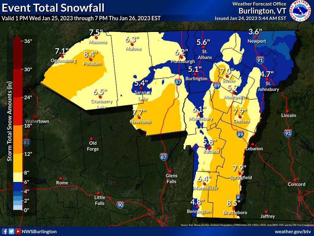
While southern Vermont finishes cleaning up from Monday's snowstorm, meteorologists are busily monitoring the next dump of snow on the Green Mountain State. That dump should come mostly later Wednesday afternoon and Wednesday night. 

This won't be an extreme snowstorm, but for much of the state, it will be another healthy, needed addition to the snow pack.

I noticed many places in Vermont now have a snow cover over 10 inches. That's nothing wild for late January, but it is a little better than what we were doing. 

There's actually snow in the air today from a much weaker system.  Accumulations will be less than an inch for most of us, but the mountains could pick up a couple to a few inches. Forecasters have backed off on the risk of snow squalls this afternoon, but that risk still looms to some extent. So watch out on the roads. 

By the way, one weird Vermont weather factoid I just have to mention. This time of year, the temperatures at Burlington has a daily range of 16 degrees, from a normal low of 12 to an average high of 28. Over the course of two days, Sunday and Monday, the temperature only ranged three degrees, from 28 to 31. Such a narrow range over two consecutive days is extremely rare.  

THE STORM ITSELF

The storm that will affect Vermont was organizing in southern Texas this morning. However, I'll focus on Vermont in this post, and get into the dangers other parts for the United States are facing from this dynamic storm in another post later this morning. 

It's worth bringing up, as for some people this storm is a bit of a doozy.

For us, as is typical with these storms, a push of warmth and moisture will pour toward Vermont Wednesday night and be forced to go up and over some somewhat colder air near the surface. That'll unleash a burst of pretty heavy snow for most of us Wednesday night. 

As always, some places will do better than others. This storm, as mentioned, has some power with it, which means by the time it gets here, it'll have some strong east winds, if not at the surface, then a few thousand feet aloft. 

This arrangement focuses the heaviest snow in southern Vermont, away from Bennington, and the eastern slopes of the Green Mountains. Those areas will see at least six inches of snow, probably more. A few places could conceivably approach one foot. 

These are the some of the same areas that saw the heaviest snow Monday, so the cover on the ground should get pretty deep along the eastern slopes. 

The Green Mountains will block some of the moisture from the Champlain Valley. The White Mountains of New Hampshire will do the same to the Northeast Kingdom. In those places, accumulations will be closer to five inches, or so the current forecasts indicate.

All this is why there's a winter storm watch Wednesday night for southern and much of eastern Vermont, but no advisories yet for the Northeast Kingdom and Champlain Valley. 

The warm blast of air overhead will probably be enough to let a bit of freezing rain enter the picture in southeastern Vermont. Some of the warmer valleys in the southeast might go above freezing for a few hours, too, which would cut down accumulations a bit in places like Brattleboro and Guilford and places like that. 

The storm will begin to depart Thursday, colder air will be drawn in to change any mix or rain to snow, and that snow will taper off. The western slopes might recoup some of the snow they will have missed out on earlier in the storm as northwest winds will favor continued snow showers there. 

We start getting into that long awaited colder pattern after this storm, so anything on the ground should stick around for awhile. Other, weaker little things coming through will give us bits of light snow occasionally into next week. Just to keep the snow cover fresh and clean and white for all of you.