
 |
| As is typical of March, winter blew in again overnight in St. Albans, Vermont after a couple of days of big thawing More highly variable weather is in the forecast. |
Additional interesting weather is coming, too. More on that in a bit.
It was another wild one up and down the East Coast Monday. Record highs were set from around New York City to the Carolinas.
Sorry, Vermont, we missed out on a second day of record highs, we were too far north. Bennington did briefly sneak into the warm air and got to 61 degrees just ahead of the storm's cold front last night.
And what a cold front! At one point last evening, severe thunderstorm warnings extended in solid line from Bennington to Philadelphia.
NOAA's Storm Prediction Center received no fewer than 241 reports of damaging thunderstorm winds last night in the Northeast. The severe storms crossed far southern Vermont, though I haven't seen confirmed wind damage reports there. I do know the thunderstorm wind gusted to 64 mph in Bennington, which is impressive.
Further north in Vermont, we lacked thunderstorms, but the cold front did bring brief downpours. A rush of wind accompanied the cold front, gusting to 50 mph in some spots. Rutland reported a gust to 52 mph and Montpelier reached 44 mph.
There were at least 3,000 power outages in Vermont early this morning, mostly in southern Vermont. It's unclear whether most of the outages were from the severe storms or gusty winds that followed the cold front.
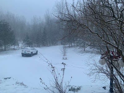
Today will be rather cold and windy, but those winds will slowly diminish. There was some light snow around this morning, including one persistent narrow band that ran from Alburgh to St. Albans to northern Lamoille County. At least an inch of snow fell beneath that band, and I imagine there was a couple to a few inches on a few western slopes of the northern Green Mountains.
Next up, a weak storm later Wednesday will probably spread a little light snow across Vermont Wednesday night, possibly starting as sprinkles of rain. This won't be a biggie by any stretch of the imagination.
We get a pleasant March day Thursday (Sap run alert: Lows in the 20s, highs in the 40s that day!).
Then things get interesting again.
The devil is in the details, and those details aren't available yet. But it looks like a strong storm will affect the eastern third of the nation Friday and Saturday.
The storm will likely cause severe weather and possible tornadoes in the Southeast. Behind it, snow will fall unusually far south for this time of year, possibly getting into Louisiana and Mississippi. The Deep South all the way into northern Florida could get a nasty frost and freeze Sunday night.
The rest of the East will get rain, wind and inland snow with this. Much of this precipitation will come down hard in the Northeast.
So what's in it for Vermont? It could be a big snowstorm, especially over northwestern Vermont and the northern Green Mountains. Or it could be a mainly rain storm, with snow at the end. But chances are it will be a pretty decent amount of something.
It'll get pretty windy around this strengthening storm, too. If there's wet snow and wind, that could be a real problem.
After a quick shot of winter cold Sunday, it'll start to warm up and thaw a little bit a couple days after the weekend storm. We'll have more details as this draws closer.
No comments:
Post a Comment