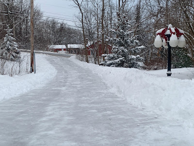
It was probably family day across Vermont today as mom, dad and the kids headed off to the ski slopes or the sliding hills for a day of winter fun enjoying today's snowstorm.
Honestly, it was perfect snowfall. The snow was a champagne powder. Accumulations for most of us were definitely decent, but not overwhelming.
It wasn't very cold, with most of us holding in the 20s all day. There wasn't a whole lot of wind. If I had to design a perfect Vermont snowstorm, this would have been it.
A burst of heavier snow this morning and in the first couple of hours of the afternoon across much of Vermont brought snow totals either in line with all the forecasts or even a little above. The exception continued to be some of the western slopes of the Green Mountains.
Despite some moderate snow in the morning, Rutland only came up with 2.5 inches as of around 3 p.m. today. These "snow shadows" often cling close to the western slopes. Once you get further west beyond the mountains snowfall increases pretty sharply again.
For instance, West Rutland, just four miles west of Rutland picked an unspectacular but respectable six inches of snow. Higher elevation Ira, right near West Rutland, saw 10 inches.
The big winner in today's snow sweepstakes seems to be the high elevations of eastern Washington County, western Orange County and southern Caledonia County Many locations there had at least a foot of snow. Barnet so far is #1 on the leader board with 14.8, followed closely by 14.5 inches in Orange and 14 inches in Corinth.
The Champlain Valley general had six inches of snow, give or take
All in all the forecasts ahead of this storm weren't bad. I'd give them a B+ in terms of accuracy.
LOOKING AHEAD
The storm was pretty much over by nightfall today. Light snow showers will continue much of the night, but most of us will see an inch or less.
Monday looks like a great day to play in the snow, but that will be it.
As I posted earlier this afternoon, a nasty and wet storm is on its way for Tuesday night and Wednesday. I won't repeat all the stuff I said earlier, except to say the National Weather Service office in South Burlington has expanded the high wind watch for Tuesday night and Wednesday.
Earlier, it had only been in effect for the western slopes of the Green Mountains. Now, it covers pretty much all of central and northern Vermont.
That the NWS issued a high wind watch this far in advance makes me think they are both quite confident this will a bad event, and that it's potentially severe enough that we need to have plenty of advance warning.
More on this in future posts, of course.


No comments:
Post a Comment