Showing posts with label Henri. Show all posts

Saturday, November 19, 2022

Florida Hurricanes In 2004 and 2022 Eerily Similar. And Other Strange Tropical Coincidences

The Washington Post gave us this graphic, showing
the remarkable similarities in paths for hurricanes Charle
and Jeanne in 2004, and Ian and Nicole
in 2022
Now that Hurricane Nicole is long gone, the Washington Post and many other meteorologists are struck by a strange Florida hurricane coincidence.  

In 2004, powerful Category 4 Hurricane Charley roared ashore from the Gulf of Mexico into Cayo Costa, Florida. It moved northeastward across the state. Just 43 days later, Hurricane Jeanne came in off the Atlantic and hit the east coast of Florida, making landfall south of Daytona Beach.  Jeanne's path crossed Charlie's in central Florida.

In 2022, powerful Category 4 Hurricane Ian roared ashore from the Gulf of Mexico into Cayo Costa  Florida. It moved northeastward across the state. Just 43 days later, Hurricane Nicole came in off the Atlantic and hit the east coast of Florida, making landfall south of Daytona Beach. Jeanne's path crossed Ian's in central Florida.

You probably noticed the similarities between the two previous paragraphs. 

The Washington Post reports the similarities between the four storms was first noticed by Matt Devitt, chief meteorologist for Tampa television station WINK.

In that busy hurricane season of 2004, Hurricane Frances and the above mentioned Hurricane Jeanne came ashore in Florida at the exact same spot, Hutchinson Island, less than three weeks apart. 

Weather is so complicated, with so much going on, there's bound to be strange coincidences. There's a few others that involve tropical storm, like the double Allison the Weather Channel highlights 

In June, 1989, Tropical Storm Allison, came ashore near Houston and meandered around southeastern Texas and Louisiana for days. The slow moving storm dumped 10 to 25 inches of rain, which produced flooding that killed 11 people.

The National Hurricane Center rotates through names that are repeated once every sixth year. If a hurricane is especially notorious, the name is retired and replaced. Allison was not deemed big enough to be replaced.

Which meant another Tropical Storm Allison came ashore near Houston in 2001. Like the previous Allison, it meandered around southeastern Texas for a few days, dumping up to 40 inches of rain and producing catastrophic flooding that killed 23 people.

With that, the National Hurricane Center decided to retire the name "Allison" from its roster.

On Sept. 16, 1988, Gilbert, which had been a monster Category 5 storm with the lowest pressure ever observed in the Western Hemisphere up to that point, landed as a Category 3 cyclone at La Pesca, Mexico. 

Twenty-five years later on the exact same date, high end Tropical Storm Ingrid hit the exact same spot - La Pesca, Mexico.

In 2021, two dying tropical storms  came ashore within a month or so of each other in Westerly, Rhode Island.  Elsa hit Westerly at 12:15 p.m. July 9.  Henri limped into Westerly on August 22 at - you guessed it - 12:15 p.m. 

By the way, another tropical storm hit the unlikely target of Westerly in 1985.  It's name? Henri.  Yep, another one.  

Tuesday, August 24, 2021

Henri's Outer Edges Made For Photogenic Skies Over Northwest Vermont

Pure tropical air ahead of Henri created some Miami-like
skies over Colchester Vermont Saturday evening. 
Hurricane/Tropical Storm Henri's approach and passage through southern New England, and the pure tropical air it brought north to Vermont, made this probably the prettiest such system to affect northern Vermont.  

Even if that effect was slight to say the least.

Still, the sky over northwestern Vermont because of Henri were spectacular.

The haze from western wildfires was routed by the clean, but oppressive pure tropical air.  The sky Sunday afternoon was some of the bluest I can remember.  

Dying rain bands from Henri produced nothing more than the lightest sprinkle, but created some gorgeous rainbows on two evenings in a row. 

Mid-level cloudiness associated with Henri also created some gorgeous patterns in the sky Monday morning, and prompted a gorgeous orange sunset Monday evening. 

I took photos, and a few of them are in this post. Scroll down to see them all.  Enjoy! 

By Sunday afternoon, the sky turned perhaps the deepest blue
I've ever seen, thanks to pristine, but very humid air
brought in part by Henri straight from the Caribbean. 

Toward Sunday evening, the dying remains of an outer rainband
from Henri, created a delicate pattern and a complex sky over
St. Albans, Vermont.


That dying rain band then produced a lovely rainbow. Here
you can see a dragonfly scooting by in front of the rainbow.

Mid-level clouds from Henri created these beautiful 
patterns in the sky over Burlington, Vermont Monday morning.

Another rainbow, fainter than the night before, with no
actual rain, from Henri's remains as viewed from 
St. Albans, Vermont Monday evening


As Henri began to depart southern New England Monday
evening, it threw out a nice sunset
over St. Albans, Vermont 

Henri Gone; Underperformed Thank Goodness But Still A Very Weird Storm

  Check out this graphic from NBC10 in Boston showing
the bizarre path of Henri through New England. Notice
at one point it ended up passing over the spot
where it came ashore a day earlier.
 I've been intentionally mean to former Hurricane/Tropical Storm Henri because I've been calling it a weird storm right along.  

I can't help it. It was a  very weird storm, with its odd path almost north from a spot off of North Carolina straight to New England. 

Then, almost due west from landfall in Rhode Island to the Catskills, then it's remnants staggering very slowly east again across southern New England to near the Maine coast this morning. 

I brought this tidbit up once, but I'll have to do it again, because this is weird, too.   

Earlier this summer, Tropical Storm Elsa made landfall on July 9 at 12:15 p.m. in Westerly, Rhode Island. On Sunday, Henri made landfall at 12:15 p.m. in - you guessed it- Westerly, Rhode Island.  The exact center of Henri's remnants was hard to discern late yesterday, but it appears that center passed over Westerly again on its way eastward toward the coast.  

Oh, and get this: In 1985 there was another Tropical Storm Henri, a weak thing that limped ashore in - oh why not? Westerly, Rhode Island. 

I'm joking around a bit with 2021's version of Henri, but of course it did do quite a bit of damage, just not nearly as much as it could have had things gone just a little differently. 

Rainfall totals from Henri closed in on nine inches in and near New York City.  Quite a few homes and buildings suffered serious flood damage and many highways closed because they were under water.

As Henri's remains drifted across southern New England Monday, it managed to produce at least three weak tornadoes in Massachusetts.  Each one had winds of only 60 to 70 mph, had brief paths and caused minor damage.

Here in Vermont, there was a tremendous sigh of relief on Monday.  Nothing really bad happened with Henri.  There could have been some very destructive flooding in southern Vermont. Those expected floods would have come during the same week as the tenth anniversary of Tropical Storm Irene's deadly, massive flood in Vermont. 

Henri's rains mostly missed the Green Mountain state. Instead, benign tropical showers scattered themselves through southern Vermont Sunday and Monday amid all the humidity hanging around the state.  Northern areas got pretty much no rain at all from Henri.

To the folks that are mad or upset that Henri turned out not as bad as feared and the forecasts were "hype," listen up.

Yeah, if the forecasts disrupted your plans, that's an inconvenience. Count yourself lucky.  What if it was worse than expected, enough to threaten your life? As for me, I'll go with the inconvenience, thanks.

We're now just entering the peak of hurricane season, and several systems are starting to bubble up in the Atlantic, Caribbean and Gulf of Mexico.  It's way too soon whether any of these will have an effect on the United States.

If any of these storms do approach land, I'm OK if they are as weird as Henri was.  I just don't want them to be any worse than Henri. Time will tell.


Monday, August 23, 2021

Horrific Flash Flood In Tennessee; Vermont Dodges Henri's Bullet

Destruction from extreme flash flooding in central
Tennessee this past weekend. Up to 17 inches
of rain fell in a few hours, sending a tsunami-like
flash flood that killed at least 22 people. 
 While all eyes have been on Tropical Storm Henri over the weekend, a incredible, and terribly tragic  flood just struck middle Tennessee.

On the western side of the upper level low pressure system that tugged Henri toward New England, an incredibly prolific training thunderstorm focused on an area west of Nashville.  

Training thunderstorms, as you might remember, are basically a series of thunderstorms that go over the same path, much like boxcars moving along railroad tracks.

This type of setup often causes scary flash floods, but this one went above and beyond, with tragic results.  At least 22 people died in the flash flood in and near Waverly, Tennessee and many more are missing. 

Up to 17 inches of rain fell in less than 24 hours, shattering Tennessee's record for 24 hour rainfall by at least three inches.

What was described as a tsunami caused by the rain roared into Waverly, sweeping away cars, houses, buildings and people. It came so fast and so hard that nothing could be done to rescue people caught in the torrents.i'm reading terrible story after terrible story about this flood.  Twin babies were killed when they were swept from their father's arms. 

A man names Wayne Spears, a foreman at Loretta Lynn's ranch, went out to the barn to check on the animals when the flash flood roared in, sweeping him away to his death. 

This type of mega-flash flood is getting more common as climate change continues. The warmer air can hold more moisture than before, so under the right circumstances, this moisture can be wrung out in greater quantities than before.

This really was a sneaker attack, in a way.  Everybody, including me, was all Henri, Henri, Henri, during the weekend, when sadly, the real awful death and destruction was in Tennessee.

Waverly wasn't the only place to have such record rainfall this weekend.  This wasn't nearly as dramatic, but New York City had its wettest hour on record Saturday night when just under two inches of rain fell within 60 minutes.

HENRI UPDATE

That was part of a storm total of 4.45 inches Saturday night. So far, Central Park has gotten 7.3 inches of rain from Tropical Storm Henri, and it was still coming down as of early this morning.   

The cloud pattern over the Northeast for what was Tropical
Storm Henri makes for a pretty pattern in this 
satellite photo. From the ground, Henri's clouds have
been photogenic from the ground, too. Vermont dodged
a bullet with Henri, with little if any flooding so far

Most of Henri's flooding was a west and a little south of where it had been anticipated a few days ago.

 The Catskills, the New York City metro area, the northern half of New Jersey and the northeastern corner of Pennsylvania got the worst of it.   Most of this area got four to nine inches of rain, and it was still coming down as of early this morning. 

The remains of Henri having made it west to the Catskills, will stagger back to the east today, prompting more flood warnings in places like Connecticut and the lower Hudson Valley of New York.

Vermont really dodged a bullet with this one.  There was potential for some serious flooding in the far southern part of the state, but that did not happen.  There is still a flood watch in the southeast corner of Vermont, but I don't think the trouble will be widespread.

Flood watches that had extended into central Vermont have been lifted, as no flooding is anticipated now. Though some showers and thunderstorms might develop as a result of Henri in southern Vermont, most of them will not be enough to cause flooding, except maybe in Windham County.

There's a very low chance of showers and thunderstorms in northern Vermont. The only effects we've had from Henri so far is beautiful skies and incredibly clean air. 

We've had a lot of haze and even smoke from wildfires out west all summer so the deep blue skies in northern Vermont yesterday and this morning were a treat.  As was the total lack of haze. The Green Mountains finally looked, well, green, and not blurry and slate blue from the haze in the air.

The air we are enjoying now has come all the way from the currently wildfire-free tropics, so it's pretty pristine.  Basically we in  Vermont are breathing air that was in Barbados or some place like that a week ago.

Video from Tennessee.  Mobile uses click on the hyperlink, others, click on the video itself for a better view.

House being swept away in Tennessee:


Sunday, August 22, 2021

Live Blog: Henri Floods New England, New York, New Jersey, PA

9:15 pm EDT Sunday

I'm going to call it a night already and then revive this first thing in the morning. The heaviest rain and the biggest flood threat has shifted west, at least for the overnight, into southern New York, northern New Jersey and northeastern Pennsylvania.

When the remains of Henri reverse course back toward the east tomorrow, the threat of flooding in southern Vermont would come back. As I noted numerous times, this is a weird, weird storm so I don't believe anything until I see it.  

Expect surprises, good or bad.  But at least for us in Vermont so far, this has been a piece of cake. Let that continue, please.

8:12 pm EDT Sunday
Decayed outer rain band of Tropical Storm Henri made it 
all the way up to St. Albans, in northwestern Vermont
this evening, creating this lovely rainbow. 
You can sort of see a second rainbow to the righ

I don't want to minimize the severity of the flooding and the danger from Henri occurring now, mostly in southern New York and New Jersey and northeastern Pennsylvania.  

But you can tell from these posts that from my perch in St. Albans, Vermont, the fact that the tropics have been brought north to me, I'm absolutely astounded by the skies.

Everything I've seen today is surely just typical for Caribbean islands, but since we don't ever get that type of thing up here in Vermont, it's just wonderful, to be honest.

I was fascinated by the deep blue tropical skies. the balmy east winds that are just like tropical trade winds, and the delicate clouds of Henri's dying rain bands.

It got even better at sunset tonight in St. Albans, Vermont.  A dying Henri rain band approaching from the east built a spectacular rainbow. Almost all the rain was aloft. All we got was a sprinkle. But that evening rainbow just made me happy.  You can see why in the photo. 

8:06 pm EDT Sunday

So interesting, at least for now, that the heavy rains with Henri are movin so far west that southern Vermont is in the clear, at least for now. Connecticut, where I thought the worst of the flooding might happen is in the clear at this hour too.

The worst rains of Henri are now in the Catskills and in the southern Hudson Valley and northern New Jersey. This seems to be the place that will get the worst flooding from Henri.  Up to eight inches of rain are in the forecast for those areas I just described.

I'm not sure how things will evolve tomorrow as the remains of Henri turn around and head back east. I knew this would be a weird, weird, system.  It's even weirder than I imagines.

6:27 pm EDT Sunday

This is just a weather nerd geeking out. The pretty, rather unstable looking clouds I just took a photo of over St. Albans, Vermont are the decayed remnant of an initial rain band with Tropical Storm Henri.  


On the edges of a tropical storm or hurricane, you get outer bands of rough weather, They come in, and you get strong, gusty winds and torrential rains, then they move on.  

Subsequent bands get worse and worse until you are in the teeth of a dangerous hurricane.

The remains of the outer rain bands of Henri obviously petered out by the time they got to northwest Vermont.  It was still interesting though that when these clouds arrived, the wind picked up from the east in the 10-20 mph range

Until this, the winds had been calm all day  These breezes were certainly welcome on this humid evening. But they are also a ghost of what had been a hurricane. 

6:00 pm EDT Sunday

Short term at least, highest flash flood risk is in extreme northeast Pennsylvania, northern New Jersey and southeastern New York. 

5:55 pm EDT Sunday

I don't want to minimize things, especially because former tropical systems always surprise with local downpours, but I'm a LITTLE less worried about southern Vermont. Keep your guard up though!  With tropical air like this, nasty, horrible flash flooding is always possible!  At least so far we are far, far, far short of re-living Tropical Storm Irene.

5:16 pm EDT Sunday

As of 5 p.m., Tropical Storm Henri's center was 20 miles southeast of Hartford, Connecticut. Not that it matters anymore. Flood-producing rains continue mostly west of its center. 

5:13 pm EDT Sunday

Some impressive Henri-related rainfall totals already coming in. As of late this afternoon:


36 hours. Some specific rainfall reports: Jamesburg NJ 8.36" Brooklyn Heights NY 7.82" Plainsboro NJ 7.50" Hopewell NJ 6.69" Central Park 6.35" Surf City NJ 5.81" JFK 4.36" Ardmore PA 4.25" Groton CT 2.59"


4:30 pm EDT Sunday

Can I just say how beautifully clean and blue the sky over St. Albans, Vermont is right now in the air directly from the tropics? 

 It's such a lovely, brief reprieve from the hazy, smoky air we've had most of the summer from western forest fires, and a relief from that smoky, hazy air which will surely return and last for the next month or two?  

The beautiful, deep blue is almost, but not quite, worth the extreme humidity we're enduring. 

4:00 pm EDT Sunday

In their late afternoon forecast discussion, the National Weather Service in South Burlington is really hedging their bets, which is very, very wise. 

Here's a quote from the discussion:

"We continue to remain on the northern edge of a sharp north to south precip gradient, which makes for a challenging forecast. It's always extremely challenging to pinpoint exact locations of qpf associated with a slow moving, weakening tropical system and convection. This becomes a nowcasting type of scenario on Monday."

So, some translations:

QPF is expected  precipitation. Convection is showers and thunderstorms. Nowcasting is updating localized forecasts pretty much minute by minute just before an event actually happens. 

In other words, if you're in a flood prone area, it's best to keep up with weather updates through the day Monday.

My takeaway, anyway, from this logic is there is the potential for flash flooding in south central and central Vermont, but we really won't know for sure until we see how things play out during the day on Monday/.

Scenarios range from no biggie to HOLY CRAP! in some localized spots.  Things might be manageable in most places, but could get out of control in a handful of others. Or not.

Far northern Vermont looks rather safe at this point.

However, I've been most worried about far southern Vermont right along, and that continues to be the cross that we bear. 

As of late this afternoon, there was already a flood advisory in far southern Vermont, as some bands of torrential rains have already blown through the southern tip of Vermont.

Weather radar shows a really, really nasty band of torrential rain moving east to west across far southern Vermont after 4 p.m.
'
The question now is, with Henri moving slowly to the northwest, then expected to turn east, will torrential rain linger over Vermont's southernmost two counties well into Monday? Definitely a tricky forecast.

To me, it looks like far southern Vermont is on the edge of the heaviest, scariest downpours. I'm not sure if this will be a so-so flash flood down there or something really awful.  Bennington and Windham  counties are definitely the worry spot of Vermont tonight and tomorrow. Fingers crossed! 

 
3:55 pm EDT Sunday

Interesting updates coming in now from National Weather Service office in South Burlington. Just a very slight chance of rain in northwest Vermont through this event.  Even central Vermont is downgraded to a 50-50 shot with perhaps locally heavy rain in spots.  If this trend continues, this will be a strictly southern Vermont event, which is the way this summer has been.

3:52 p.m. EDT Sunday

Not important except to weather geeks, but interesting happenings in the sky in northwest Vermont now.  Band of clouds associated with Henri coming in from the east. The sky over us had been cluttered by towering cumulus, but those are evaporating in advance of cloud band. Temporarily most clear and hot and humid over St. Albans, Vermont now

3:34 p.m. EDT Sunday

NYC Central Park, NYC in general just can't catch a break from Henri. After 4.45 inches of rain last night, another 1.31 inches so far this afternoon and still raining heavily. BTW, the 1.94 inches in one hour in Central Park last night was the most rain in one hour in NYC history. 

3:28 pm EDT Sunday

Classic New England Tropical Storm conditions, Windsor Locks, CT, just north of Hartford, winds gusting to 41 mph; 1.04 in just the past hour.  No surprise that flash flood warning in effect there. 

3:01 pm. EDT Sunday

While southern New England in the muggy low 70s under heavy Henri rains, tropical heat continues in northern Vermont. At 3 p.m. Burlington at 88 degrees, heat index 93 

2:53 pm EDT Sunday

First tropical shower of the day in northern Vermont seems to have formed northwest of St. Albans, Vermont.  I don't think there will be too many of these today, but with tropical systems you never know.

This one moving very slowly toward the west, opposite of normal showers around Vermont.  It might or might develop into a very local downpour, but no biggie; just interesting, no real threat.  

2:51 pm. EDT Sunday

Nearly stationary rain band that produced up to 5 inches of rain in NYC area and northern New Jersey in association with Henri is still ongoing. Not as intense as last night, but it CANNOT be helping the flood situation in that area.

Rain bands with flash flooding often set up west or northwest of tropical systems. Thank goodness no sign of that so far in Vermont. 

2:30 pm EDT Sunday

As expected, Henri's forward speed slowing dramatically, raising risk of long lasting, flooding rains. Forward speed at 5 a.m this morning over water was 18 mph.  As of 2 p.m. down to half that. 

2:27 pm EDT Sunday.

Photo here  from Twitter shows it's pretty messy in Richmond, Rhode Island 


2:25 p.m: EDT Sunday

Here's a fun little tidbit: One of Tropical Storm Elsa's landfall was at Westerly, Rhode Island at 12:15 p.m on July 9.  Today, Tropical Storm Henri made landfall at Westerly, Rhode Island at 12:15 p.m. What are the chances?

2:20 p.m.

Getting somewhat cloudier in northern Vermont from Henri, which will temper the sun's intensity somewhat. Still wicked humid, and that won't change anytime soon.

1:40 p.m. EDT Sunday

New flash flood warning now around Hartford, CT as the worst of Henri's rains creep northward


1:25 p.m. EDT Sunday

The smoky haze over Vermont is gone and the sky is a 
beautiful deep blue.  That's not fresh Canadian air, though.
This is from the clean, but very humid deep tropics.
It's dangerously hot and humid north of Henri's clouds
in northern Vermont this afternoon.
You might have noticed today the wildfire haze and smoke that has plagued Vermont much of the summer is gone today.  

That's because Tropical Storm Henri has brought air straight from the tropics. The sky over Vermont is basically the same as the sky over, say Barbados.  

Don't let those deep blue skies with those pretty puffy clouds fool you.  That's not the refreshing blue sky normally get in Vermont this time of year right after a refreshing cold front from Canada.

It's still wicked humid and the heat index is dangerous if you're working outdoors today.  

For instance as of 1 p.m. Burlington, Vermont was 87 degrees with a heat index of 93.  NOT pleasant. Stay in air conditioning if you can, and don't overdo it with work our exercise outdoors. It can be dangerous!

1:13 p.m.: NECN reports 100,000 customers without power already 

First update: 12:52 p.m. EDT Sunday:

I'm going to keep a live blog going with occasionally, sometimes very frequent updates of Tropical Storm Henri.  

This will be full of updates, new forecasts, breaking news and other information to keep you abreast of this dangerous storm. 

Since this is a Vermont-based blog, it will focus a bit on the Green Mountain State, but of course there will be lots of information on how things unfold in the rest of the Northeast.

Please comment and ask questions as this live blog progresses. Also, follow me on Twitter at @mattalltradesb 

Tropical Storm Henri, now inland in southern New England, is
losing that tropical "look" in this satellite view early 
Sunday afternoon. Watch out though, inland flooding
from this thing is a big threat through Monday. 

Keep refreshing the URL on this blog to see the latest updates. 

Henri made landfall at around 12:15 p.m. today near Westerly, Rhode Island with top winds of 60 mph. Technically, landfall was really on Block Island, Rhode Island about an hour earlier, since Henri passed right over that chunk of rock south of the New England coastline. 

The winds were a bit weaker at landfall than many forecasts, so that might slightly limit the destruction to trees and power lines in Connecticut and Rhode Island. But still will be a lot of problems in that department. 

I"ve always known the real danger from Henri in the Northeast is the torrential rain and associated inland flooding that is and will occur.  We've only just begun with the flooding. 

Flash flood warnings are already flying in southern Connecticut and those warnings will migrate north and west as the afternoon goes on. 

Here in Vermont, the first heavy rain bands from Henri are crossing east to west across far southern Vermont.  These are not yet enough to set off any real flooding, that will come later.

Fingers crossed, the heaviest rain and the worst flooding might, just MIGHT stay just to the south and west of Vermont.  But everyone in central and southern Vermont should stay alert for flood warnings and flooding anytime between now and Monday evening. 

If you live in a flood prone area, have a plan to get out of Dodge very, very quickly. These will be flash floods, not something that comes on gradually.  The further south you go in Vermont, the greater the flood threat. 

For this afternoon, dry air aloft is helping to hold any showers at bay in central and northern Vermont. It's wicked humid near the surface, as you know, so there could be some brief pop up tropical showers here and there, but coverage will be scattered at best


at's a bit weaker of a landfall than anticipated 

Henri Already Causing Damage, Getting Worse Through The Day

Satellite view of Tropical Storm Henri closing in
on New England Sunday morning 
Now that Tropical Storm Henri is having direct impacts, there's almost too much to write about this morning.  

I'll give you an early update now with subsequent  updates throughout the event.

Henri was a hurricane earlier this morning with top winds of 75 mph.  It was "downgraded" to a tropical storm with winds of 70 mph, but don't focus on the "downgrade," because it isn't really,  Doesn't matter if it's a low end hurricane or high end tropical storm, the effects on people are the same.

At 5 a.m. the center of Henri was about 80 miles southeast of Montauk, Long Island or about 120 miles south of Providence, Rhode Island.  It was moving a little west of due north with a forward speed of 18 mph. That's a little slow for a New England tropical system and it will slow down a lot more once it makes land fall

More on that in a bit because that will have implications for some serious flooding. 

Outer rain bands have already been sweeping through southern New England as of dawn. Conditions will deteriorate there through the morning ahead of an expected landfall late this morning or early this afternoon near the eastern tip of Long Island and somewhere near the Connecticut/Rhode Island border.

 The drama of storm surges and high winds on Long Island and in southern New England will be relatively brief but destructive. Storm surges of a around three feet on Long Island and Connecticut shores will be destructive, especially on low lying barrier islands like Fire Island.

The winds will take down countless trees, and power outages will certain affect over 1 million homes and businesses.  The power in some areas will stay off all week, and an oppressive heat wave is forecast for the next several days in this area.

The winds won't be strong enough to damage that many houses on its own, but countless homes in, say, Connecticut will sustain serious damage from falling trees.

The main story with Henri will be potentially catastrophic inland flooding. The winds of Henri will die back fairly quickly later today and tonight as the storm slowly works its way into the heart of New England. 

Tropical systems lose their wind quickly once inland, but the torrential rains live on long after the gales have lost their punch. 

The rain issues area already happening and will get worse.

Henri's outer circulation latched on to moisture pooling to its west to give New York City an incredible downpour overnight. They had 4.45 inches in five hours,  and about two inches of it came within an hour.

As you might imagine, there was a LOT of flash flooding in the New York City metro area last night with plenty of streets closed and cars inundated.  As of early this morning that western fringe stuff from Henri was causing a lot of flash flooding in New Jersey.

That downpours in New York last night is a hint of the kind of flood danger Henri will cause in southwestern New England and southern New York today and tomorrow. Rainfall of three to six inches, with local amounts to 10 inches, are still expected in the Catskills and Hudson Valley of New York, Connecticut, western and central Massachusetts, and yes, far southern Vermont.

It has been wet down in this region, so I would expect some terrible flooding.  A few areas in the Catskills and southwestern New England could have Irene-like flooding. 

VERMONT IMPACTS

The further south you go in Vermont, the more dangerous Henri will be.

As I mentioned in past posts, the expected slow forward pace of Henri is very, very weird, and very, very dangerous.  That 18 mph forward speed from this morning will slow to less than 10 mph once inland. 

Tropical Storm Henri had already helped bring tropical
air north to Vermont by Saturday, helping create
this Florida-like sky over Colchester.

The National Hurricane Center forecast map early this morning had the center of Henri near Brattleboro at 2 a.m. Monday, and had it only advance to about White River Junction by 2 p.m. Monday. An elite long distance runner could easily outpace Henri's expected trek.

Of course, you don't focus on just the exact track, but the effects of the storm in a wide area. Areas to the west of a tropical system in this part of the world get the heaviest rains, so that's what's worrying. 

Vermont Emergency Management says they've opened up their Emergency Operations Center to monitor the storm and respond to any issues. My guess is they WILL respond to some issues in southern Vermont sometime between now and Monday night.  

Vermont's southernmost two counties are in the most flood danger from this.

The remains of Henri is still expected to take a sharp turn east at White River Junction or thereabouts and slowly stagger off to the Gulf of Maine. But that won't happen until later Monday and early Tuesday.

That means there's also a flood risk from Rutland and Windsor counties north almost to Route 2. While it doesn't look like the flooding there will be as bad as points south, you still need to take things seriously.  Locally torrential downpours could cause some dangerous flash floods.

Sometimes, bands of particularly heavy rain set up to the north and west of a dying tropical system. This could happen in south-central or central Vermont tomorrow. It's hard to tell in advance if and where these will set up, but pay attention to any flood warnings that might come out. 

North of Route 2, we'll get some rain out of this, but many places won't get much, as it stands now. There might be some embedded areas of heavy rain here and there in the north, but at this point the threat of flooding looks fairly low. 

Stay tuned for updates, though! 

However, it will be close enough to g


Saturday, August 21, 2021

Saturday Evening Henri Update: Southern Vermont/Hudson Valley/Southwest New England Big Flood Threat

Ragged Hurricane Henri continued its march northward Saturday off the East Coast, still ready to batter Long Island, parts of New York and the southwestern half of New England with dangerous storm surges, damaging winds and potentially horrible flash floods.
The expected track of Henri has shifted a wee bit
to the east, but the overall effects will still be the 
same. Bad storm surge, high winds on Long
Island, Connecticut. Serious flash flooding possible
in southern New York, southwestern New England.
Far southern Vermont in play for possible severe
flash flooding


The projected track of Henri has shifted a tiny bit back to the east from its most western proposed track early this morning. But the shifts aren't enough to really change the forecast.  

Be prepared in some areas for a very rough Sunday and or Monday.

There's still some disagreement among the forecast models as to where the heaviest rain will set up. Connecticut, Long Island, the Catskills and the lower Hudson Valley still seem like the most likely targets for dangerous flooding.

However, western and central Massachusetts, southern Vermont and southern New Hampshire are still definitely in play.

Here in Vermont, I'm most worried about the eastern slopes of the southernmost Green Mountains. East winds associated with Henri will force its richly wet air up the slopes, which could release particularly torrential downpours. 

In those areas, small streams and creeks, and other bigger waterways like the North Branch of the Deerfield River, Whetstone Brook, the West River and Saxtons River could really cause trouble. Potentially trouble not seen since the dark days of Tropical Storm Irene in 2011.

That's not guaranteed yet, but just to be on the safe side, if you live in flood prone areas of southern Vermont, I'd get ready.  Couldn't hurt to move some stuff to higher ground, and certainly have a plan to escape. 

Flash flood watches are in effect for Vermont's southernmost two counties. There could be three to six inches of rain with this, with localized areas up to 10 inches, though I think and hope and pray the 10 inches might be a little south of Vermont.  

If a bad flood does come, it will come fast. It'll be a classic dangerous flash flood if it does happen.

Unlike Tropical Storm Irene, it's still looking like parts of Vermont will be spared. Forecasts are still insisting on not all that much rain in northern Vermont, so flooding is unlikely up there. Still, forecasts can change, and there's still a chance of enough rain to prompt flash flood watches in central Vermont. Stay tuned! 

It was brutally hot and humid, especially across the north today, with heat indexes near 100 in the Champlain Valley. It will be almost as bad tomorrow. The possibility of extra cloud cover will keep heat indexes just a little lower, but it will still be too nasty to work outdoors tomorrow.

This is just a brief update. I'll have lots of additional details Sunday morning


Saturday Morning Henri Update: Southwestern New England, Long Island, Hudson Valley Major Target

Tropical Storm Henri was starting to look a little
more symmetrical off the coast of North Carolina this
morning, setting the stage for a brief period of
intensification into a hurricane today.
 As we awoke this steamy Saturday morning, Tropical Storm Henri was still struggling to get its act together off the southeastern United States coast.   

Even if it's slow to turn into a hurricane, Henri still means big trouble for parts of southern New England and New York.  

There will be impacts from Henri in Vermont - pretty much a flood risk - but there are still questions as to how bad and exactly where that flooding might be in the Green Mountain State.

By the way, there are some other hazards in Vermont to think about before Henri makes landfall. I"ll get to those after we get through our Henri walk through. 

Forecasts continue to show Henri as an odd duck. 

Tropical storms and hurricanes have throughout history hit New England in  August so that's not weird. The expected northwestward bend in the track before landfall, taking Henri toward Long Island and Connecticut is weird.

Henri's expected very forward slow motion through New England and the Hudson Valley is unprecedented from what I can tell.  That track is not set in stone, either.  Henri could go a little west of that predicted path, or somewhat more likely, a little east of that path. 

This weirdness could reduce the area battered by high winds, but worsen the inevitable flooding from the storm. 

Long Island and Connecticut, and probably Block Island, Martha's Vineyard and Nantucket are in the most danger from storm surges and wind damage. I'm sure there will be massive power outages, tree damage and some structural damage there.  Henri is expected to come ashore Sunday afternoon as either a Category 1 hurricane with winds of 75 mph, or a strong tropical storm with wind speeds just under that.

Storm surge flooding along Long Island beaches will be pretty intense with this. People on Long Island, in Connecticut, Rhode Island and nearby areas should be finish gathering supplies, food and water today to prepare themselves for long power outages. Note these outages will happen amid oppressive humidity next week, so that in itself will be a danger. 

Tropical storms and hurricane winds almost always rapidly weaken after they come ashore, and Henri will be no exception in that regard. As Henri slowly makes its way north - current forecasts have it crawling to about Albany, New York early Monday morning - winds will die out.  

By the time Henri starts to affect southern Vermont, there might be some gusty winds, maybe a few power outages and trees down, but there probably won't be horrible wind damage in Vermont.  

Torrential rains tend to linger much longer with decaying tropical storms, and this will happen with Henri.   This is where Henri's slow forward motion gets dangerous. The heavy rain will linger over Connecticut, southern New York, western Massachusetts and quite possibly southern Vermont and southern New Hampshire for a long time.

That could cause catastrophic flooding.  At this point, that seems most likely in Long Island, Connecticut and New York's Hudson Valley and Catskills. 

Far southern Vermont is on the edge of this torrential rain prediction.  It's possible, with its western track, a bit of dry air can get pulled into the dying circulation of Henri from the east, slightly reducing rainfall. But don't count on that!  I'm still definitely worried about flash flooding in southern Vermont.

That's in part because the forecasting models haven't settled on the focus for the heaviest rain.  Some forecast the worst of it to be in the Catskills. Others target Connecticut, the Hudson Valley and Massachusetts. Others take the heaviest rain through Connecticut, central Massachusetts, New Hampshire and southern Vermont. 

Anybody in the southern two thirds of New England should monitor flood forecasts through tomorrow night. 

The worst of the rains there would come Sunday night and Monday morning.  

Forecasts tracks of Henri using various
forecasting models. The general idea of
what's going to happen are there, but
you can see some variation.  A slight
difference in Henri's track could have a big
impact on how dangerous the storm is
in any given location. 

The remains of Henri are still forecast to take a sharp right turn through central New England and on into the Gulf of Maine.  If this goes as expected, that's great for most of central and northern Vermont.  That means there wouldn't be enough rain to raise a flood threat.

The usual caveats apply:  There WILL be shifts in the expected track, strength and orientation of Henri.  That means forecasts for the heaviest rain, the strongest winds and the timing of the storm will shift, too.

That means keep a heads up with forecasts, especially those of you in southern Vermont who are at most risk of flooding with this. 

Before we get hit with Henri, we have those other hazards that I mentioned to consider. 

It's wicked humid out there, and with expected high temperatures into the upper 80s today, there's a heat advisory up for Vermont's Champlain Valley.  The heat index will be in the mid-90s, so take it super easy out there.

Another thing to look out for are hit and miss showers and thunderstorms.  They won't be severe, but a few could contain really torrential downpours.  Since we're in bizarro world in the weather department, these storms won't come from the west as usual, but from the east or southeast. 

So contrary to what we usually experience, if you see dark clouds to the west, you're probably OK, but if there's threatening skies to the east or southeast, take cover. 

Friday, August 20, 2021

Friday Evening Henri Update: Still Weird, Still Uncertain

Henri continuing to organize off the southeast US 
coast Friday afternoon. It remains a big threat 
for New England. 
Henri, as of 5 p.m. today, continues to menace New England.  Vermont remains in the danger zone, especially for the risk of inland flooding. 

Especially in southern Vermont.

The late afternoon updates keep things nearly the same as this morning, though the forecast track keeps nudging toward the west. 

Of course, where Henri lands and where it goes after it makes landfall has a huge impact on what will happen in Vermont.

The more westward track is potential bad news for us here in Vermont.  Henri could come ashore as far left as near New York City or even northern New Jersey. 

The consensus is for it to come ashore around Connecticut, and move as far northwest as Albany, New York before taking a sharp right hand turn toward Maine. 

That track, and Henri's expected slow forward pace, makes me pretty worried about this storm. The latest official National Hurricane Center storm track has Henri over the Connecticut/Massachusetts border at around 2 a.m. Monday, and only moves it to about Brattleboro by 2 p.m. Monday. That's a lot of time to dump a lot of rain.

Do note that the forecast track WILL change, but you get the idea. This is potentially horrible for southwestern New England.  

 Its winds would probably diminish quickly, but the fact that it won't get out of New England or even New York any time fast means torrential downpours would linger longer than in a "normal" tropical storm.

That could mean someone - I don't know who - could receive incredible amounts of rain on saturated ground. Not to scare anyone, but some forecasts call for six or more inches of rain somewhere in southern New England, southern New York or even southern Vermont. 

That would unleash a much worse than usual flood on wherever it hits.  For what it's worth, flood forecasts as of late this afternoon put the worst of it in Connecticut and western Massachusetts, but the risk does extend into the southeastern third of Vermont. At least for now.

As noted above, forecasts are likely to change, but I don't know if it will get better or get worse. 

Northern Vermont still looks to escape the worst of it, but questions still remain as to where the heaviest rain will fall. 

This is just a quick Friday evening update. I'll  have more details and more updates tomorrow morning. 


Some Climate Change Thoughts As We Await Henri

The prospect of Henri and its weirdness has me thinking
more of the consequence of climate change and how it 
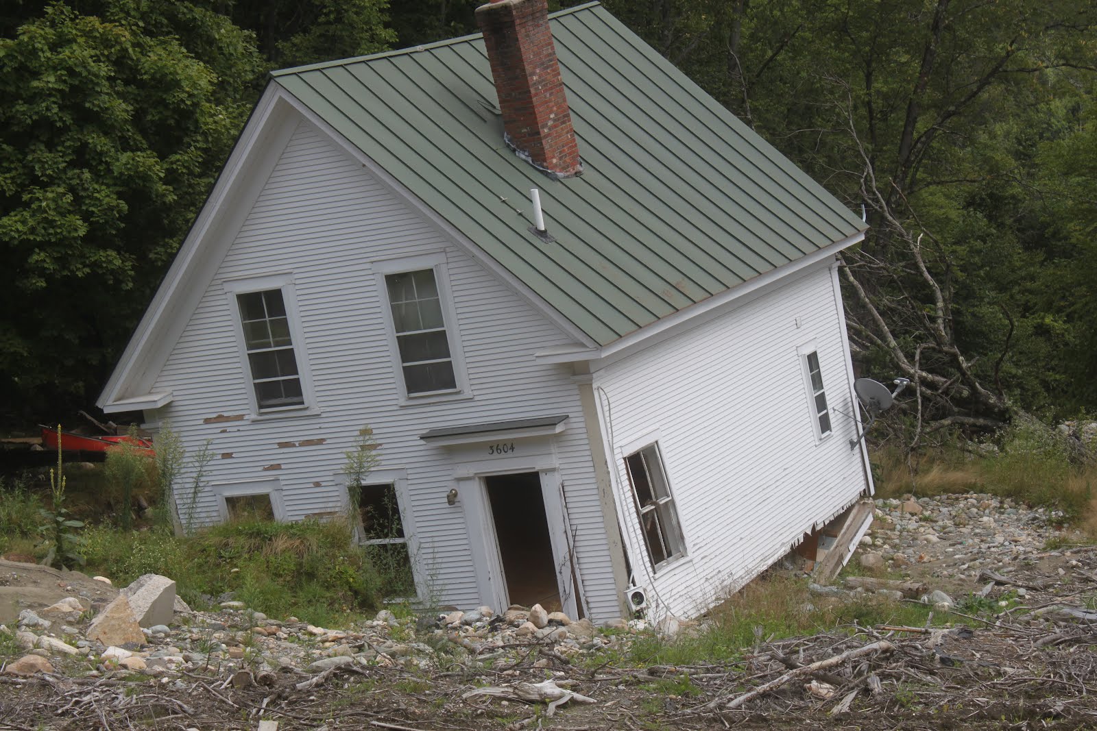
can terrorize us. This is a lovely, old Vermont house
destroyed by Tropical Storm Irene in 2011,
This weird global summer of scarey weather surely makes one worry more about climate change.

Not all the weather events we've endured this year can be directly tied to climate change, but some of them can. 

The prospect of Tropical Storm or Hurricane Henri in New England is one of those cases where I suspect a climate change link, but it's too complicated for little ole me to prove.

But hear me out.  One predicted consequence of climate change has been the idea of hurricanes and tropical storms slowing down or stalling over one area, intensifying their destructive power.

After all, hurricane force winds or torrential rain will cause much more damage if those conditions last for 12 or 24 hours instead of three or four hours. 

We've seen these stalls happen with Hurricane Harvey in Texas back in 2017, and that resulted in probably one of the most catastrophic floods in U.S. history around Houston, Texas.

In 2019, powerful Category 5 Hurricane Dorian stalled over parts of the Bahamas, inflicting total destruction on some islands.  It's very weird for a hurricane that strong to stall.  Their forward motion might be slow, but they do tend to make progress.

Though stalling hurricanes are still somewhat a matter of debate among climate scientists, it does seem to be a thing as the world warms. 

As I mentioned in this morning's post, the forward speed of tropical storms in New England tends to be pretty fast. It seems most of them go blast northward here at around 30 mph or more. The forward speed of the Great New England Hurricane of 1938 was more than 50 mph.

Current forecasts have Henri moving inland into New England at a forward speed of less than 4 mph. That is just insanely slow for this time of year. Since Henri would linger for a long time in the cold North, its winds might diminish pretty quickly, but its torrential rains would continue much longer than a "normal" New England tropical storm. 

I worry greatly about catastrophic flooding in New England from Henri.

Speaking of flooding and rain, I want to pivot over to Greenland for a minute. 

The middle and highest point of the Greenland ice cap is insanely cold.  It's almost always below zero there.  Usually way, way below zero.

But on August 14, at a 10,551 foot elevation at the highest poiny of Greenland's ice cap, it rained.  That's the first time rain has ever been observed there. If any precipitation falls from the sky at that station, it's snow. Until now.

It almost never gets above freezing at this location.  Temperatures above 32 degrees have only been noted there in recent history this year, and in 2019, 2012 and 1995. But until now, they never had rain, as far as anybody knows

Also, by mid-August, winter usually is arriving in the middle of the Greenland ice sheet. The August 14 rare thaw is the latest above freezing temperature on record at that weather station. 

I tied this in with the word "flooding" because if more ice melts off Greenland yearly than accumulates in their long winter, global sea levels rise. Lately the melt has been exceeding the ice accumulation, because of global warming. 

Meanwhile, as previously reported, the world had its hottest month on record in July, places too great in number to count hit all time record highs, the West, Siberia and other places are burning, the normal clean air of Vermont keeps getting clouded by smoke from out west and there have been ridiculous floods have hit Germany, Japan, Turkey and other places.

Here in Vermont, the weather this summer hasn't been quite as destructive, at least so far, but still damaging. And incredibly confounding.  Henri has just made my unsettled state over the pace of climate change even worse.

Thursday, August 19, 2021

Fred Soaks Vermont Today, Threatens Flooding. Then What Will Henri Do?

UPDATE EARLY AFTERNOON

As the first rain bands from former Tropical Storm Fred
moved into St. Albans, the sun rising in the sky to the 
northeast shined into the rain, causing an 
otherworldly orange glow.   While flooding is unlikely
in St. Albans from Ex-Fred, there is a risk of flash
flooding in the southern two thirds of Vermont today.

Ex-Fred has so far behaved pretty well in Vermont, but we're not necessarily out of the woods yet More on that in a sec.

The storm has NOT been friendly in southern New England and southern New York. It looks like there might have been a couple tornadoes in the Hudson Valley or Catskills, New Jersey and/or Connecticut.

There was also a tornado warning for awhile early this afternoon in some of the North Shore communities near Boston, places like Revere, Lynn, Nahant, Swampscott. Not sure if one touched down or not there.

Flash flooding certainly walloped parts of Connecticut and Massachusetts. Streets were badly flooded around Hartford.  Cars were in water up to their rooftops in at least one road in Worcester, Massachusetts. There's quite a few reports of roads closed, flooded basements and some water rescues in southern New England. 

Some showers will get going in southern and central Vermont now that the steady rain has largely passed. The question now is will those showers be torrential enough to cause local flash floods, or will they be pretty benign. 

As of 1 p.m., the flash flood watch had been lifted for far southern Vermont, but no yet for Rutland and Windsor counties, and in central Vermont.  That's being assessed as I write this. The fact that National Weather Service radar has been down for the past couple of hours is unfortunate and unhelpful.

Congress really needs to appropriate funds to the National Weather Service to drag their technology out of the stone age and into the 21st century. 

PREVIOUS DISCUSSION

 Rain started in most of Vermont before dawn, as the remains of Tropical Storm Fred continue to create flooding and storms across the Northeast.  

After spinning up some severe storms and floods to our south in the Mid-Atlantic states, it's New England's turn today.

The biggest zone of worry today will be in central New York, where a few flood warnings are already in effect, then on through central and southern Vermont, southern New Hampshire, maybe southern Maine and northern Massachusetts.

Northern Vermont and New York are getting decent rains this morning, but I think things will be fairly well behaved along and north of Route 2. 

The rain moving into these areas from the northern Adirondacks seemed to be intensifying a little as it moved toward Vermont before dawn, but it doesn't look like there will be much of a flood threat.

The heaviest rain band in this batch was just approaching Burlington as of 8:30 this morning. 

It's been drier up north, and the rain in the north is more of a steady drenching, not the torrential downpours that can set up flash flooding.  There might be some minor urban flooding, ponding of water on roads, and maybe a little erosion on steep gravel roads and driveways, but it won't be a huge deal.

Besides, far northern Vermont could still use more rain, so this is good.  My hot take: A little more rain than originally expected up north, but don't worry too much about it. 

Further south, it's looking decidedly less good.  We're not talking Irene-scale destruction, but I am worried areas of flash flooding that could develop during the day.  Ex-Fred has a feeder band coming in from the southeast, bringing tropical moisture northwestward toward central New England.

The moisture will be forced to rise as it hits the higher elevations of western Massachusetts, and southern parts of Vermont and New Hampshire. This wet air has already caused some fairly substantial flash flooding in parts of Connecticut.

The threat with this is local torrential downpours with this feeder band.  Former tropical systems tend to be really efficient rain makers, so this could be a real threat.

I'd say the highest threat of any flash flooding would be especially on south and east facing slopes of the southern Green Mountains. 

After an initial burst of rain this morning, some predictions indicate clouds might thin for a bit over southern Vermont. That would help trigger thunderstorms. Given the very humid air brought north by Ex-Fred, the rain could be absolutely torrential with these, adding to the risk of local flash floods.

If the heaviest rain is able to work its way into Addison County and maybe Orange County, there could be some real flooding worries there, too. That's because a band of soaking rain set up there yesterday morning.  It's already soggy, so if a lot of rain falls, the water will rise pretty readily. 

I'm already seeing some flash flood warnings pop up in the western Adirondacks, so we'll need to keep an eye on whether that heavy rain makes it to central Vermont.

If your area goes under a flash flood warning, take it VERY seriously.  Move to higher ground if you're in a flood prone spot. Don't drive through water or debris on roads. You won't know until it's too late whether the road is washed out. Also, it takes surprisingly little water to sweep a car away.

If you don't believe my story about flash floods being dangerous, consider this:  When Fred moved through the mountains of North Carolina the other day, walls of water and mud swept down creek beds and hollows and into towns. At this point, 35 people are unaccounted for. 

Things are pretty grim in North Carolina.

Ex-Fred's rains seem to be moving a little faster than at least I expected, so I think the worst of the rain will be over by mid to late afternoon. That will just leave us stuck in the humid air for a few more days. 

And.....we need to watch another tropical system

HENRI AND NEW ENGLAND

Since we're focusing on Ex-Fred, I won't get into the next system that much today.  However, Tropical Storm Henri is lurking southwest of Bermuda.  It was just shy of hurricane status this morning, with top winds of 70 mph.

It is currently forecast to grow into a hurricane, and could threaten New England Sunday or Monday.

Upper level winds right now are hindering Henri's development. If that continues, chances are greater that the storm will pass east of New England, causing relatively minor problems.

If Henri blows up bigger, though, it could smack right into southeastern New England. Right now,  it seems the chances of the smacking into New England scenario is not as great as a close miss. But there's still a decent chance, so let's keep our eye out! More details coming on Henri tomorrow in this space. 

Tuesday, August 17, 2021

Busy, Busy Tropics, Fred, Grace, Henri

Right on schedule, the tropical Atlantic has flared up in the past few days and tropical storms are already causing havoc and damage in different parts of the ocean.   
Satellite view of Tropical Storm Fred making landfall
Monday in the Florida Panhandle.  The storm will 
cause dangerous flash flooding and landslides in the 
southern Appalachians today.

The one pestering the United States the most is now former Tropical Storm Fred. This one reflected a dangerous trend in tropical storms and hurricanes we've seen in recent years. It strengthened pretty rapidly right before landfall.

Luckily, Fred was a disorganized mess Sunday in the southeastern Gulf of Mexico so it got off to a slow start. Then it simply ran out of time to keep getting stronger on Monday when it hit land.

Still, Fred managed to ramp up to sustained winds of 65 mph and create a two to three foot storm surge on the Florida Panhandle.  Several thousand homes and business lost power as the gusty winds took down lines in that area. 

Actually, today is going to be the more dangerous day with Fred. Its winds are pretty much gone, but its remains are moving into the soggy southern Appalachians, where substantial flooding now seems inevitable.

Parts of western North Carolina near Asheville got four to seven inches of rain yesterday, and that same amount is forecast for the same area today with Fred.  Flash flooding, landslides and river flooding are all a good bet.

They're telling people who live near steep slopes of the southern Appalachians to consider leaving for awhile because the rock slide and land slide risk is so great. At the very least, people shouldn't be traveling along mountain roads the next few days due to the risk of flash floods and landslides.

Moisture with Fred will move north the rest of this week, raising the risk of flooding up the East Coast all the way to southern New England. It's been a sopping wet summer in these areas and that trend will continue. 

Speaking of trends, this will sound familiar here in Vermont. It looks like relatively heavy rains will fall on southern Vermont, which really doesn't need it. But not much rain at all will fall in the north, which DOES need the rain. 

That's been the story all year and I guess that state of affairs is permanent, I dunno.

Next in the tropical storm parade is Grace, which was flooding earthquake ravaged Haiti this morning with torrential rains. Current projections have Tropical Storm Grace missing the United States. Instead, it will make a straight beeline from near Jamaica to Mexico this week. It could strengthen into a hurricane by the time it makes it to Mexico.

Then there's new Tropical Storm Henri, out there meandering near Bermuda. At this point, it's expected to stay out to sea and not bother anybody on the East Coast of the United States.

Now through mid-September is the time we need to start watching the west coast of Africa. During this time of year disturbance move westward off that coast line.  These disturbances are the ones that most often turn into the most dangerous powerhouse hurricanes of the season.

There's nothing big bubbling up in that neck of the woods at the moment, but it's only a matter of time.