Showing posts with label Tuesday. Show all posts

Tuesday, December 23, 2025

Quick Tuesday Evening Vermont Snow Update: Road Conditions Going Downhill

Traffic cam grab shows slushy roads in Burlington
late Tuesday afternoon as the snow continued to fall
Here's our quick Tuesday evening snowfall update for Vermont:


The snow arrived about an hour or so later than forecast in much of Vermont this afternoon, but it did arrive.

As of 5 p.m., it was snowing lightly statewide. This evening, we're in the peak of the storm, though this isn't exactly a scary one. 

Still, the roads for the evening commute, or going shopping, or to holiday events won't be great. Temperatures in some areas were at or just above freezing in some warmer valleys for part of the afternoon. But those temperatures have fallen a degree or two as darkness arrived. 

The snowfall rates also picked up a little at sunset, too. Highways that had been just mostly wet at around 4 p.m. were getting snow and slush covered, and more slippery by the minute. 

The steadiest snow in the valleys should last until around midnight, give or take, depending on where you are. Forecast total accumulations haven' changed, with two to five inches expected across most of Vermont. The mountains are still likely to do better than that, with roughly four to eight inches up there. 

Christmas Eve continues to look as if it will bring us quiet and rather cloudy weather. Forecasts for Christmas Day have changed a little, with a bit more snow than originally forecast. But it won't be much, with maybe an inch or two north and less than an inch south. 

Monday, April 28, 2025

Severe Weather/Tornado Outbreak Upper Midwest Today, We In Vermont Could See Severe Storms Later Tuesday

Widespread severe storms and likely tornadoes are 
likely today, especially in red and orange areas 
on this map. 
The Upper Midwest if bracing for a rough day today of potentially strong tornadoes, giant hail and destructive winds as the weather set up is almost ideal for a severe weather outbreak in that neck of the woods. 

That severe weather is forecast to some extent migrate toward the Northeast, maybe affecting Vermont later tomorrow. More on that in a bit. First, today's Midwest threats.

TORNADO RISK DETAILS

Even before our storm really got going, things were looking ominous Sunday evening. Some supercells spit out a handful of large tornadoes in western and central Nebraska.

Some pretty strong storms were ongoing early this morning in eastern South Dakota and southwest Minnesota.

These are just a preview. The main show will get going this afternoon

The area under the biggest threat for dangerous weather today includes most of Wisconsin and Iowa, southern and central Minnesota and northwest Illinois.  

Major cities most likely to be under the gun are Minneapolis-St. Paul, Minnesota; Madison, Wisconsin; Des Moines, Iowa and Rockford, Illinois.

A somewhat lesser but real threat extends southwestward all the way down to Texas.  

We know we'll see severe storms and tornadoes in the Upper Midwest today, but we don't 100 percent know exactly how they'll evolve.

If supercells manage to form and maintain themselves ahead of the main line of storms later today, then we end up with the risk of strong, long-lasting tornadoes plowing through Iowa, southeastern Minnesota and Wisconsin. 

That scenario is a maybe/maybe not. But if these dangerous supercells erupt, they'll go from nothingburgers to extremely dangerous monsters in minutes. The National Weather Service office in the Minneapolis area is not mincing words in their forecast discussion:

"The takeaway from today's severe storm potential is to remain vigilant of the potential for storms to go up quickly. This may mean checking your phone more often or keeping an eye to the sky, but don't let your guard down in this environment."

 If, instead, the main line of storms exerts itself more, there might not necessarily be those supercells out ahead of the storm  This second scenario is still bad news, as there will be zones of destructive straight line winds and quite a few embedded tornadoes in this mess.

The most likely outcome  today is a combination of what I described above. The main question will be how many supercells form ahead of the main blast of storms. 

TUESDAY'S STORM ADVANCE

Tuesday's severe storm risk area is in yellow, with the
orange area at a somewhat higher risk. Note how the
yellow risk area extends into parts of Vermont, 
By Tuesday, the main threat from this dynamic storm heads east. The storm center itself will race up into central Quebec, but its powerful cold front will press east into the Great Lakes. 

Tuesday's threat area runs from southern Quebec and Ontario, then southwestward through northwest New England, the eastern Great Lakes, northern Ohio Valley then all the way down to central Texas. 

The greatest threat looks go from central Ohio, through northwest Pennsylvania and on into western and central New York.  

While there might be a couple tornadoes in this area, the main threat is damaging winds and large, destructive hail.

As noted, the severe threat extend into Quebec and northwest New England, so that puts Vermont in play. Details next:

VERMONT THREAT

This daffodil looks completely defeated and possibly 
dead after Sunday's snow in St. Albans, but....
Before we get into the severe storm threat, a final word or two on Sunday's snow.

A couple places got an impressive amount of snow. A high elevation spot in Greensboro reported .1 inches of snow. Brownington reported 3.5 inches.  

Here in St. Albans, it was striking how snowy and miserable it was in the early afternoon.

 By evening, it was a downright pleasant spring evening, with sunshine and relatively mild air. Go figure.

Today, by the way, will be gorgeous, with sunshine and temperatures in the 60s to near 70. Enjoy!

Now onto our next threat. 

But same daffodil three hours after above photo was taken
shows a nice recovery. This daffodil, and the rest of
them in the gardens, might have to endure some
severe thunderstorms Tuesday evening in northwest Vermont.
South winds ahead of that approaching cold front will throw a squirt of warm, somewhat humid air into Vermont. 

 Most of the day will actually be nice with highs reaching well into the 70s, with maybe an 80 degree reading or two in a couple of Vermont's more "tropical" towns. 

Dew points - a measure of how humid it will get - should reach the mid 50s to around 60. That's kinda humid for this time of year but not oppressive. 

Thunderstorms thrive on humid air, so the more muggy the air is, the more fuel for these storms. 

So the outlook for the thunderstorms in the humidity category is so-so.  

However, there will be strong winds aloft. Storms that do form can grab that high altitude air and shove it down to the surface, where we are. That's why there's the risk of severe storms.  A few of these could have wind gusts to 60 mph or even a little more. 

The heat from sunshine created instability, which is part of the reason why the thunderstorms are likely to be so strong over New York, since they'll hit there in the afternoon.

Timing is such that the storms look like they'll come in very late in the afternoon and evening. For instance, current forecasts have the best chance for thunderstorms in Burlington between 6 and 8 p.m. Tuesday,

By the time they reach Vermont, the storms will be beginning to diminish. At this point, it looks like a few storms still might have enough oomph to be severe generally in an area north and west of a line running from roughly Rutland to Montpelier to east of Newport. 

As the storms head toward southeastern Vermont later in the evening they'll diminish to nothing scary. 

Note that not everyone will get a severe storm. Northwest Vermont is in a level two of a five point risk scale, five being the hair-on-fire top scary alert. Our level two "slight risk" means scattered severe storms are possible, but they'll tend to be relatively short-lived and not terribly widespread.

So, just keep your eye to the sky Tuesday evening if you're in northwest Vermont and head inside if you receive a severe thunderstorm warning or see ominous skies to the west and north. 

The cold front might also produce some fairly strong winds after the thunderstorms go by.  These winds won't be associated with any thunderstorms, but they could cause very isolated power outages in a  few spots.

Unlike the cold front we saw this past weekend, it won't get nearly cold enough for snow.  Instead, Wednesday looks bright, refreshingly cool and breezy.  

Monday, April 7, 2025

A Brief Monday Evening Vermont (Snow!) Update

Most of tomorrow's snow will be in the mountains
But that inch or so of snow you see in this forecast
for places like the Champlain Valley will be timed
just perfectly to screw up the 
Tuesday morning commute
 Just figured I'd update you quickly so you can plan your Tuesday morning.

Because the roads are going to crappy, snowy and maybe icy for your morning commute. 

We're still not expecting much snow in most of Vermont late tonight and tomorrow, except in the mountains. 

The amount of snow isn't the problem. The real problem is the timing and intensity of the snow might well end up being the worst possible combination. 

If the timing in the forecast holds, the combination of a burst of heavy or at least heavy-ish precipitation,  a rain to snow scenario in many spots and a rapid drop in temperatures will hit just perfectly for the Tuesday morning commute.

The disturbance coming in will have a pretty potent cold front with it. As that cold front blusters in,  it will have a fairly narrow but heavy band of precipitation with it. In the Champlain Valley, it might start out as rain, but quick turn into a snow squall-like thing.

So, the roads will quickly get covered with a slush coating of snow. As this happens, temperatures will take a quick nosedive and go below freezing very quickly. So the slush will turn to ice on many surfaces. 

It doesn't take much snow to cause a scene. A half inch to an inch will do it. 

Add to this scenario the idiots driving 80 mph on the ice because they're "late" for work and it's a recipe for a mess on the roads. Of course, they don't consider that if they hit three other vehicles in the process, they'll really be late for work. Or worse. 

If you're planning on being anywhere on Interstate 89 and maybe Interstate 91 and some other Vermont highways tomorrow morning, plan on being stuck in a traffic jam as crashes gum up the works. 

The best guess is this will come into the Champlain Valley between 5 and 7 a.m. and then move west to east across the rest of Vermont between 7 and 11 a.m.

The rest of the day will not be nice.  There might be a lull after that main blast goes through during the morning commute in which the sun might even make an appearance and the wind will temporarily diminish slightly.

But the rest of the day will feature clouds, gusty winds, snow showers and temperatures that will hover right around the freezing mark. 

The snow showers won't add up to much in the valleys, but the Green Mountain are still looking at what amounts to a moderate-sized snowstorm. The ski areas in the central and northern Green Mountain should see a good four to eight inches of snow before things taper off later Tuesday night. 

All this really isn't that unusual for early April. It's just too bad we couldn't time this little late slap of winter to make it more convenient for us. But Vermont weather is seldom convenient. 

Tuesday, March 4, 2025

Burst Of Snow Interfering With Tuesday Northern Vermont Evening Commute

Traffic camera grab for Interstate 89 in Georgia shows
pretty gnarly road conditions as a burst of "warm front"
snow passes through. Roads in northern Vermont
look like they will be pretty slick this evening. 
 A warm front associated with that large storm in the center of the nation is giving a surprisingly hefty burst of wet snow to northern Vermont. 

As of 4:30 p.m. a full inch of new snow had accumulated here in St. Albans. Traffic cameras show iffy driving conditions in Vermont, north of Route 2.

As of 4:30 p.m. traffic cameras showed it had just started snowing along Interstate 89 in Colchester and road conditions didn't look that bad - yet. 

As you headed north along the Interstate, things were just beginning to deteriorate along I-89 at the Lamoille River bridge in Milton. By the time you get up to Georgia, I-89 was obviously snow-covered and slick.

Since the snow is headed east, almost everyone along and north of Route 2 will see at least some snow and likely slick roads late this afternoon and this evening. 

The atmosphere continues to warm, and some of this snow might still flip to rain. 

But still, you might be surprised by some ice and slush under your tires as you head home from work. Be careful out there. I'm sure we'll have some slide offs, a few crashes and some delays on the highways.  If you were planning on going somewhere in northern Vermont but really don't have to, it might be wise to stay home this evening. 

This is all a precursor to the warm rain we're having tomorrow. I'll have much more on that in Wednesday morning's post. 


Tuesday, November 26, 2024

Heads Up Vermont: This Morning's Road Ice Even Worse Than Forecast

Beware, Vermont motorists. Roads throughout the state
will be icy for this morning's commute as freezing
rain moves in after a chilly night. 
 Heads up, Vermont commuters.

Chances are there's more ice on the roads that previously forecast early this morning.  

Skies stayed clear long enough last night so that temperatures fell well down into the 20s. Before dawn, rain was moving in, and it's going to freeze on a lot of roads, bridges and sidewalks. 

Some places will be worse than others, but be prepared for ice no matter where you are in Vermont this morning.  Even in the Champlain Valley, where temperatures were starting to rise above freezing as the rain moved in.

With the temperatures up in the mid 30s or so, you'd think there wouldn't be a problem. But the cold temperatures earlier dropped surfaces below freezing. So even if plain rain hits, it would still freeze on roads and such. 

The winter weather advisory that was in effect in central and eastern Vermont has been expanded to include all of Vermont, including the Champlain Valley. 

Be especially careful when encountering bridges. The road might be OK and you're cruising along on wet pavement. The ground might still be just warm enough under some roads in some areas to keep the rain from freezing.

But there's no ground under the bridges, obviously, so there's nothing to prevent the bridge from freezing. So a wet road turns into a skating rink on the bridge as you're zipping along at or over the speed limit, and that's a recipe for disaster. 

If you can postpone driving until mid morning or after, do that. If you can't, then drive very cautiously and leave plenty of extra time to get to where you are going. 

The rest of the day might be a bit rainy, but the roads should be fine this afternoon.

I'll update our potentially snowy Vermont Thanksgiving in a post later this morning. 

Monday, April 29, 2024

Surprisingly Heavy Downpours Sunday. Will We Do It Again Tuesday?

Heavy looking clouds near South Burlington, Vermont
Sunday afternoon portended some unexpectedly
heavy downpours in parts of northern Vermont. 
We might see some more heavy showers Tuesday. 
 UPDATE 10:30 a.m.:

Surprised again.

More rain showers are making inroads into what we thought was too-dry air for much activity.

So at least parts of Vermont should be more showery today than I indicated below.

It won't rain all the time.  But we are under some risk of showers today. Especially central and southern Vermont as it looks now.

It will probably be even a little cooler than first forecast because of the extra clouds associated with the showers

PREVIOUS DISCUSSION

After the morning thunderstorms Sunday, I thought any showers we'd receive later in the day would be pretty scattered and probably not that impressive. 

If there were to be any downpours, they'd be really brief, and most of us would only get a little rain.

So much for that idea.

Some of those downpours late Sunday afternoon were remarkably heavy and persistent. 

They lacked the spark and crackle of the morning lightning storms. But much of northern Vermont received a half inch to an inch of rain Sunday. I'm sure a few spots had a little more than that. 

I didn't have my rain gauge out yet, silly me. But judging from the sudden river flowing through my property late Sunday afternoon, I wouldn't be surprised if I had more than an inch of rain.

By the way, the lightning Sunday morning had some sad consequences. Lightning struck a four unit apartment building in Morristown, Vermont.  The lightning caused a fire that left extensive damage and occupants of all four units displaced. 

The storms Sunday left things pretty squishy underfoot once again.  That leaves us at risk for perhaps some minor flooding Tuesday if things come together a certain way in the atmosphere.  It's a tricky forecast. It's all about temperature gradients and stubborn weather systems. 

We'll go through it here

TODAY

A cold front came through last night.  That's why we had all that rain.  The air got quite humid Sunday afternoon for this time of year.  The cold front provided enough lift to wring out that moisture. 

The front has sagged south into southern Vermont.  That will set up quite a temperature gradient today. Highs will only reach the mid 50s in many spots north of Route 2 but reach 70 in southeastern Vermont. 

The cool high pressure system is feeding in dry air in at least some layers of the atmosphere. The result will be a fair amount of clouds today, but very little in the way of showers. There might be some spot sprinkles here or there, but that's it. 

TONIGHT/TUESDAY

A surge of very warm, humid air will try to make a run at us. That cold front that came through last night will start to move north as a warm front. But that strong, stubborn cool high pressure over northern Quebec will push back against that surging muggy air.

That places Vermont square in the battleground. We'll mostly stay in the cooler air, but the humid air will try to go up and over that cooler air. The result could be more downpours.  

The question is where those heavy showers will set up. Will they repeat over the same area? How much rain will fall and where?

Those are questions that are tough to answer with this kind of weather pattern. The National Weather Service in South Burlington is going with a round of showers late tonight and tomorrow morning, and another one Tuesday evening. 

As always, forecasts are subject to change. 

Early bets have the heaviest rain in northern Vermont, but we'll see. NOAA's Weather Prediction Center has most of Vermont in a low level marginal risk zone for possible flooding.  If anything does materialize it looks like it will be pretty minor. 

So we're not about to re-live last summer's mess.

Better yet, the rain won't persist for days.  It looks drier and somewhat warmer once we get into midweek with only very low chances of light showers. Another storm system might affect us on the weekend. But computer models are all over the place on that one, so we have no idea yet now the weekend weather will shake out. 


Sunday, February 11, 2024

Sunday Evening Snow Update: Still Very Little Clarity On Vermont Storm Risk

The snow forecast for the upcoming storm on Tuesday in 
Vermont is little changed from this morning. What you don't
see in this map is remaining high uncertainty on the forecast.
There could be quite a bit more, or quite a bit less snow
than depicted on this map for Tuesday. 
 As of late this afternoon, there's still frustratingly little clarity on how far north the snow will come into Vermont Tuesday from a potent storm passing by to our south.  

The basic forecast remains the same, with a fairly strong chance of several inches of snow in southern Vermont. Little if anything is in the cards in the north

However, forecasts are struggling with a sharp cutoff between heavy snow to the south and pretty much a nothing burger north.

Where will that snow/no snow boundary set up? Best guesses are somewhere in Rutland and Windsor counties, but that could shift north or south. 

winter storm watch is still up for Bennington and Windham counties. The fact that that watch, which means maybe, hasn't yet been upgraded to a warning, which means pretty much definitely reflects the uncertainty. 

The National Weather Service is toying with the idea of issuing a winter weather advisory for Rutland and Windsor counties, but they're going to hold off on that until they get more consistent data.

There's no question this storm is a potent one. Winter storm warnings for 8 to 18 inches of snow are up for most of southern New England, much of central and southern New York and parts of Pennsylvania 

Late this afternoon and this evening,  Louisiana and Mississippi were gearing up for a tornado risk, and one or two of those tornadoes might end up being strong, so there's a danger there. 

A flood watch is up parts of Alabama, Georgia, South Carolina and Tennessee.  

As usual, I'll do an update early tomorrow morning. By then, we hope to have more consistency in the forecast for Vermont. 

Tuesday, January 9, 2024

Tuesday Evening Vermont Storm Update: Batten Down The Hatches!

Updated National Weather Service/South Burlington 
wind gust forecast for overnight. Click on image to
make it bigger/easier to see. If anything, the forecast
has shifted to include higher wind gusts in 
the Champlain Valley, compared to earlier forecasts.
 As of  5 p.m. Tuesday, snow has moved into Vermont a little earlier than forecast. 

That will make some roads dicey earlier than we thought they would, so the evening commute is turning out to be not great.  

The snow will be light to at times moderate, but won't amount to a huge amount before, say 7 p.m. We could see a couple inches by then. 

The evening snow is the opening act to the main show which will hit hard later tonight.  We've already seen wind gusts of 70 mph in western New York cities like Buffalo. That high speed air is heading right in our direction. 

The forecast hasn't changed much since this morning. We're in for an awful overnight here in Vermont, with strong winds, bursts of heavy wet snow, downed trees, power lines and blocked roads.

As of late this afternoon, you should have gotten all your outdoor errands done and huddling in your houses for the night. Here in St. Albans this evening, my husband is making a hearty stew to get us through the early evening . We've stored drinking water in jugs. LED candles and head lamps are at the ready. My cell phone is plugged in, hungrily accepting a nice battery charge. 

I don't know whether the power will be out at our house later tonight or for how long. But since widespread power outages are pretty much a sure bet in Vermont, everybody should be prepared. 

THE SCENARIO

Winds have started to increase as of 5 p.m., ,but are still reasonable, with gusts mostly at or under 30 mph. They'll gradually increase over the next few hours.

Heavier precipitation - the kind that will move in soon - more often than not suppresses high winds in Vermont, so the worst of the gusts won't happen  - at least for most of us - until after 10 p.m., when we should have somewhat of a lull in the precipitation.

We're still expecting a heavy thump of wet snow for the first half of the night, and that will prime trees, branches and power lines to fail once the wind really picks up. 

Since a lot of the precipitation will be snow, with only some rain late tonight and tomorrow, I'm even less worried about flooding than I was this morning. 

But of course we really have our hands full with the wind. 

A bit of drier air will move in aloft after midnight to suppress the snow and rain somewhat. At the same time, what is known as a low-level jet will move overhead. A low level jet is a band of high speed winds just a few to several thousand feet overhead.  

Screen grab of a video I took in January, 2016 of a 
downslope windstorm near Cambridge, Vermont 
that had broken trees looming over a road. 
Similar scenes should happen overnight and 
tomorrow morning. 

Meteorology is basically fluid dynamics physics. Air flow acts a LOT like water flow. The Green Mountains act as sort of a submerged boulder in a fast-flowing river in a storm situation like this.

 The strong east winds in the low level jet are forced to rise a bit to accommodate that "submerged boulder" consisting of the Green Mountains.  

It's basically the wave you see above the submerged boulder in the river, and the subsequent waves downstream. 

When the wave reaches its peak over the "boulder" the high speed wind is sort of grabbed and shoved down the western slopes of the Greens. The air gains momentum on its downslope path, which makes the wind even stronger.

 So, we're still expecting winds gusts late tonight in the 50 to 65 mph range. Local gusts very near the western slopes in particularly wind-prone areas could reach or go over 75 mph. 

One interesting - and rather ominous - subtle difference in the National Weather Service forecast since this morning, is the expected highest wind gusts have been nudged a little bit more away from the western slopes and closer to the Champlain Valley and Route 7 corridor in southwestern Vermont. 

It looks like top gusts of 60 to 70 mph could occur along and just east of Route 7. That's a pretty populated area. That makes us prone to more power outages and even some structural damage to buildings overnight. 

Much of the Northeast Kingdom also looks like they are in for quite a blow. 

We're still on track for lots of power outages. The majority  - but not all of us - should be fine though about 11 p.m. or so. Then it hits.

Mercifully, the period of highest winds looks like it will only last roughly six hours - from about midnight to 6 a.m. Then they'll diminish quite a lot. Wednesday will still be gusty, but not ridiculous. 

Actually, Wednesday in most of Vermont is shaping up to be a not terrible day, at least compared to the tempest we'll endure tonight.

Sure, it'll be breezy to windy, and we'll have a risk of showers through much of the day. But temperatures should peak in the low 40s, and only gradually cool down during the late afternoon and evening. 

This storm is being compared to that awful storm in December, 2022. But one big difference is that one featured a flash freeze and moderate snowstorm at the tail end.  That's not happening with this one.

I'm always looking for a bright side, folks! 

I won't get into it tonight, but we're still looking at another storm Saturday that will be similar to tonight's. So far, that Saturday storm is looking slightly weaker than tonight's but it will still cause additional problems. 

I'll get into that storm after we deal with tonight's mess. 

Video

To give you a taste of what to expect late tonight and early tomorrow morning, here's video I shot of a downslope wind event near Cambridge, Vermont in January, 2016. If anything, tonight's windstorm could be worse than this.

Click on this link to view, or if you see image below, click on that to view. 


Tuesday, November 28, 2023

Winter Still Toying With Vermont, Bits And Pieces Of Travel Trouble

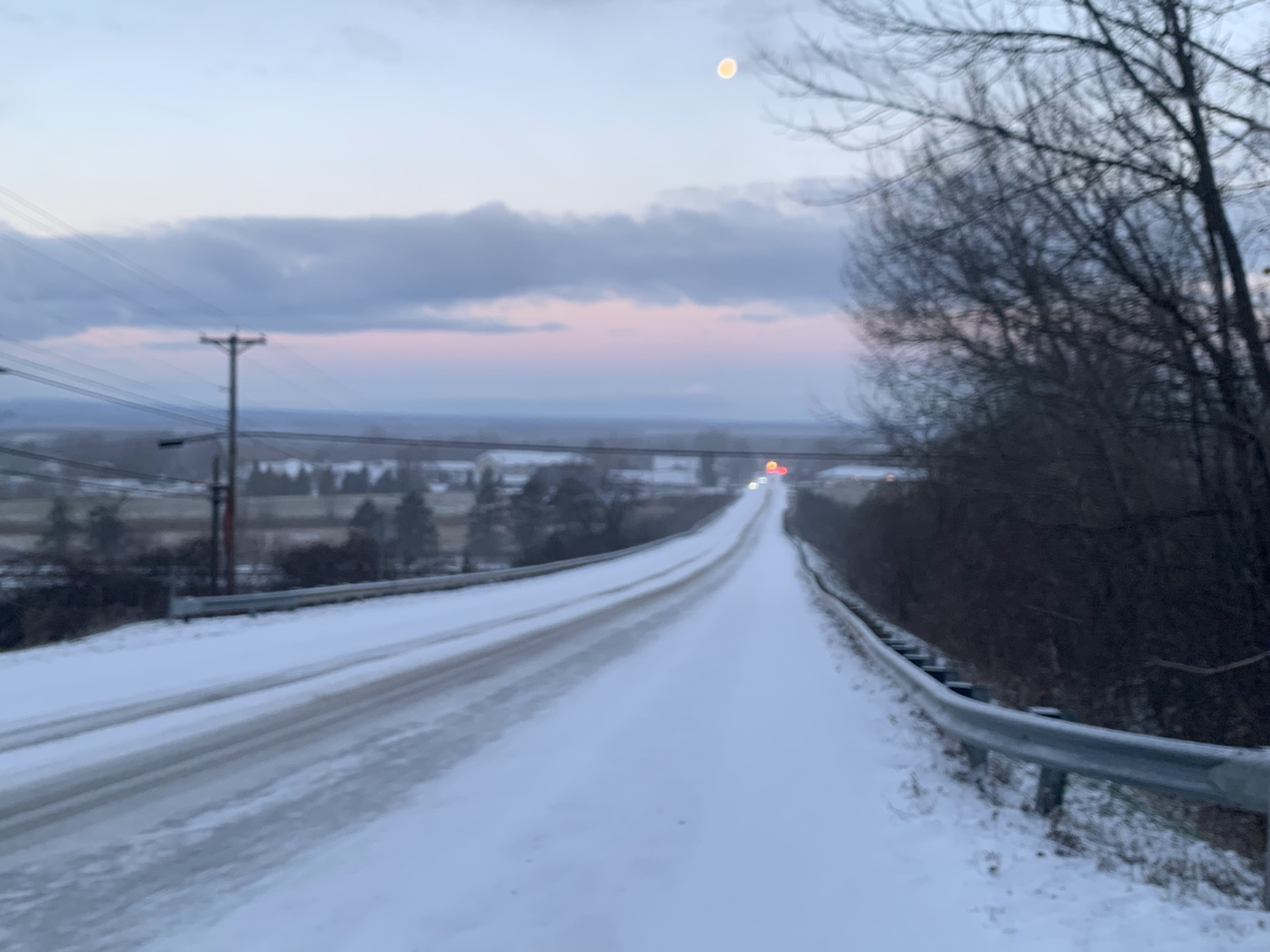
A heavy early morning snow shower iced up the road
in front of my St. Albans, Vermont house, but
shortly after, blue sky and the moon appeared. This
kind of changeable early winter weather
should last all day. 
 I awoke to another surprise heavy snow this morning in St. Albans, Vermont. 

In this case, it was just a pretty hefty snow shower that passed by quickly, leaving partly cloudy skies and a dawn view of the moon in its wake. 

But the snow showers definitely left behind a half inch ofd new snow and some very slick roads, making conditions pretty hazardous for some on their morning commute. 

You'll want to take some extra time getting to work this morning especially if it snowed where you are. 

The snow showers were hit and miss. Some areas were still fine, others a mess between 7 and 8 this morning. That state of affairs should last all day. 

A weather disturbance and cold front is instigating the snow showers.  They could hit anywhere anytime today, but the best chance is this afternoon and in central and northern Vermont, and the entire Green Mountain range. 

Some of the snow showers, like the ones in St. Albans early today, will be on the heavy side. But they're racing along and should be pretty brief.  Which means total accumulations will be an inch or less. The exception to this will be an area along and north of Route 2 from east of Burlington into New Hampshire, which could pick up one to three inches. 

The Connecticut Valley of southeastern Vermont should see pretty much nothing at all. Meanwhile, the Green Mountains, especially from Killington north, should see two to as much as six inches out of this. 

All this will make things unpredictable on the roads all day. Things will be fine one minute then they won't. Or, you'll be blissfully traveling along a snow-free road, only to encounter the next minute some low visibility snow, and ice under your tires. 

This state of affairs should last through today's evening commute, so beware. 

The rest of the week looks fairly quiet, but there are signs of some modest storminess Friday and perhaps something a little more substantial early next week. But the weather pattern is especially hard to predict right now, so any forecast beyond a couple days is suspect. 

Just wait it out and check forecasts as they're updated. 

Tuesday, August 8, 2023

Tuesday Evening Vermont Flood Update: I Wanna Say We Dodged A Bullet But Don't Wanna Jinx It

After yet another unsettled, rainy, humid, Vermont day,
but mercifully without much in the way of flooding,
new storm clouds loomed over St. Albans, 
Vermont Tuesday evening. 
 Figure I owe an update to the lowering but still real flood threat in Vermont this evening. 

KINDA IFFY

As of 5:30 p.m. it was just kind of weird out there in Vermont. Areas of rain, some relatively heavy, developed late this afternoon in scattered spots. These areas of rain don't seem to have a direction in mind, and are sort of drifting. 

A flood warning was issued for beleaguered Addison County, Vermont as one area of sort of heavy rain lingered there for awhile. It looks one to two inches of rain  have fallen in parts of the county, and another inch or so could fall.

Given the wet soils, that's enough to set off flooding, maybe, though things don't look as wild as they did in Middlebury last Thursday.  So far, as of 6 p.m., I've seen no reports of flood damage or roads under water in Addison County, or anywhere else in Vermont for that matter. 

Another area of downpours has lingered in the extreme northeast corner of New York. I'm almost surprised there's no flood advisories there. I also don't know if these kinda heavy showers will get their act together and move into Vermont. They keep trying to, but so far haven't made it across Lake Champlain.

It looks like we have just a few more hours of this weirdness, and relatively low but still real flash flood risk. After sunset, things should really die down. A weak cold front approaching us grudgingly will also come through this evening, which should also help really shut things down. 

So, fingers crossed, we might have finally dodged a bullet, especially considering how dire the forecasts were 24 hours ago. That said, I could be jinxing it, and we could still be in for a surprise in the next few hours. 

I'm as indecisive as the weather has been this afternoon. 

Really, nobody got all that much rain, at least compared to some of the bigger storms this summer. Most of Vermont managed somewhere in the ballpark of an inch of rain, give or take. A couple places, like Waterbury, got close to two inches. 

That band of rain I mentioned in northwestern Vermont this morning more or less hung in there, though in weakened. It did rain off and on all day here in St. Albans. But so far, my storm total has been a manageable 1.1 inches or so. And, as of 6 p.m. this evening, it was starting to rain here again. 

Wet, soggy, humid and icky, but no disaster.  

REALLY BAD EAST

While Vermont might have dodged a bullet (I think!) the same can't be said for eastern New England, which got the storms that yesterday we feared might hit us. 

One problem was tornadoes, or at least tornado warnings. We know at least one tornado touched down in Mattapoisett, in southeastern Massachusetts. The twister had top winds of 95 mph and had a damage path of about a mile long.

Much worse was the flooding. Two to as much as seven inches of rain fell on southeastern New England earlier today, causing a LOT of flooding. 

Up in New Hampshire and especially Maine, it was the same story.  Three to six inches of rain fell on western and central Maine today, and widespread flooding is ongoing. 

WHAT'S NEXT

Wednesday looks actually pretty decent in Vermont, with seasonable temperatures. We'll be virtually rain-free. 

Looking ahead, it still looks like we'll see frequent showers pretty much every other day for the next week or so, and possibly beyond. None of these wet spells at this point look dangerous, though. 

Maybe we can look on the bright side: When was the last time you had to irrigate your garden?

Saturday, March 11, 2023

Storm On Tuesday Could Be Real Mess Parts Of Vermont/New England

This is just one of many depictions of what the
nor'easter might look like on Tuesday. This is
big time subject to change. 
 The forecasts are coming into a little better focus for what could be a messy, sluggish but hefty storm in New England coming up during the first half of next week. 

The devil is in the details, of course, and those details could definitely change between now and storm time. 

However, parts of Vermont could see more than a foot of heavy, wet snow, and that type of deal can cause real trouble with electric utilities.  have a feeling Green Mountain Power and other Vermont utilities are already getting their staffing and repair plans in place for this one. 

Again, though subject to change, at this point it looks like the main target will be mid and high elevations of central and southern Vermont. Parts of New Hampshire, Maine, and Massachusetts are also in for a mess like this, too.

THE SET UP

Most of the storms this year have been hit and runs. They raced in, deposited a quick moderate dose of snow or schmutz and moved on almost before you know what hit you. 

This one looks to be big, slow, lumbering giant, which would linger around New England for quite awhile. One model I looks at has it lurking around southeastern New England from Tuesday morning to Wednesday morning. 

That gives the storm a lot of time to dump its load of snow, or rain, or whatever on the region. 

It kind of reminds me of the storm track of the Blizzard of 1888. Before you get too alarmed, though, this won't be nearly as bad, or nearly as cold as that 19th century snow disaster.  

Still, I foresee trouble for somebody. Since it's not a very cold storm, and it is March, that's almost a  guarantee of heavy. wet snow.  The National Weather Service office in South Burlington is already saying that it's possible for us to see as much as two feet of snow in one or two spots if this plays out as it might well do.

This looks like it might also be a storm that affects mid and high elevations more than anything else. 

The sun's angle is higher now as we head into spring, and some heat can come through the thickest clouds. So in the warmer valleys, we could have a mix with rain. Or the snow would be so sloppy slushy that it would largely melt as it hits the ground. 

That also depends on the intensity of the snow at the time. In places where it's really coming down  hard, that would cool the atmosphere a bit and the snow would pile up fast regardless of the time of day. 

Northern Vermont is once again a wild card, like it was during the last two storms.  It does seem that some snow (and maybe a little rain in the Champlain Valley) is inevitable with this, it's hard to say how badly we'll be affected, especially along and north of Route 2.

We just don't know yet where the heaviest snow will set up. It does seem more likely in the southern half of Vermont, though. 

WHEN IT HITS

An initial, much smaller snowfall was going on in far southern Vermont early this morning. Steady snow has reached as far north as Brandon.  Judging from Vermont Agency of Transportation web cams, mostly places in the southern Vermont snow zone have gotten about a half inch to two inches of snow, with maybe a touch more than that in higher elevations. 

Also, judging from the view out my St. Albans, Vermont window, some flurries have made it as far north as the northern Adirondacks, but I'm sure there's little, if any accumulation. 

That light snow should be out of Vermont by late morning, and the weekend will be quiet. 

As the new, bigger storm gathers, we should see clouds on Monday, with light rain and snow breaking out in the afternoon or early evening.  Everything should turn to snow overnight Monday, but it might not snow that hard until early morning. 

The main show is expected on Tuesday, with a slow decrease in the rate of snow or rainfall Tuesday night and Wednesday.  This timing is of course subject to change. 

I know I've said it already but it bears repeating thatthe storm forecast will probably change. Maybe by a lot. As we draw closer to the storm, meteorologists will be able to hone in on details for more specific areas. 

Monday, February 27, 2023

Vermont Storm Update: Tuesday's Storm Is Different Than Usual

St. Albans, Vermont was a bit of a winter wonderland as
dawn broke today. A new storm Tuesday in much of 
Vermont will dump a few inches of new snow, except
it will largely avoid the Champlain Valley
 It's looking more and more like the winter storm that's going to affect New England late tonight and tomorrow -  including Vermont -  is quite a departure from what we've seen most of this season

Southern New England, areas near New York City and northern New Jersey are in for a pretty good dump of snow with this. Many of those places should see half a foot or more of snow.  

The decent dump of snow still looks like it's going to extend into far southern Vermont.  Most - but not all - of our few sizable snowfalls have avoided the south and instead focused on central and northern parts of the Green Mountain State.

The amount of snow in Vermont from this system is going to be even more variable than usual. Some places might see as little as a half inch. Other places should close in on eight or nine inches. 

There's a little more moisture available in Vermont for this storm than first thought, so forecasted snow amounts have ticked ever so slightly upward for the eastern slopes and summits of the Green Mountains. 

 It's now looking like the eastern half of Vermont, with the exception of much of the Northeast Kingdom, is now in for a decent three to six inch snowfall. The White Mountains will block moisture from the Atlantic as east and southeast winds pick up. 

That means areas near St. Johnsbury could get as little as one to two inches of new snow. 

Which brings us to the Champlain Valley. Those same southeast winds will encounter the Green Mountains. The wet winds will be forced to rise when they encounter the Green Mountains. Rising air means more precipitation. Which means it's going to snow harder on those eastern slopes. 

Once the wind gets to the west side of the mountains, they'll blow downward along those western slopes. Sinking air means less or no precipitation. You see where this is going. The sinking air is really going to squelch the snowfall in the Champlain Valley. This applies to western Rutland County as well. 

It probably won't kill the snow entirely. But it will be very light. And it will mix with rain as we get into the afternoon. I supposed most of the Champlain Valley will get 0.5 to 1.5 inches of new, wet snow. Maybe one or two lucky towns will clock in with two inches. 

So, no excuses this time. Though the roads might be slick in spots for your morning commute in the Champlain Valley, they'll still be very, very passable. Just take a little extra time getting to work or school and you'll be fine. 

In the areas that get the somewhat heavier snow, this will hit during the Tuesday morning commute. Expect some school closures and crappy roads in southern and parts of eastern Vermont. 

After we're through with this little episode tomorrow night, we're still expecting a small storm Wednesday night with probably some annoying mixed precipitation. 

Another larger, probably mostly snowstorm comes along Friday afternoon into Saturday. It's still too soon to figure out how far north the heavy snow gets, and whether it will mix with schmutz. 

As we get into March, it starts to become more likely that a snowstorm can mix with other crappy stuff like ice and cold rain, so keep that in  mind, too.