Showing posts with label statistics. Show all posts

Saturday, April 26, 2025

In Many Areas, Dangerous Summer Heat Waves Now Hit In The Spring

Springtime heat waves are growing more frequent,
widespread and deadly worldwide, 
thanks to climate change 
It's a relatively cool, rainy day here in Vermont, but something weird is happening with spring around the world. 

In many cases across the Northern Hemisphere, it's no longer that pleasant, mild time of year in which everything blooms. 

Instead, increasingly, many locations are getting blasted by strangely torrid weather. 

In many other areas of the world, where extreme summer heat is now a springtime thing, too, thanks to climate change. 

It's been going on pretty much yearly in the past decade, and the phenomenon is becoming more frequent and widespread. It's not just that these spring heat waves are weird. They're dangerous. 

As Vox reports:

"Cities like Phoenix and Palm Springs, California, closed in on triple digits in March; Phoenix usually doesn't reach 100 degrees Fahrenheit until May. This month, hundreds of millions of people across India and Pakistan, experienced temperatures as high as 120 degrees Fahrenheit, triggering power outages and protests. The heat has also created conditions for thousands of wildfires in the region."

It's not just this year in which spring heat waves are popping up all over the place. 

Vox continues:

"It's part of a pattern. Last year, heat waves coursed through Africa and Europe during the spring, setting new temperature records in more than a dozen countries. Mexico experienced a series of heat waves beginning in April. A heat wave in Texas in May sent power demand to a record high for the month."

Heat waves are very often deadly, killing thousands of people every year. In some ways, these new spring heat waves might be even deadlier that ones that hit in July or August in the northern hemisphere. 

People are not acclimatized yet to hot weather and then a heat wave arrives prematurely.  The shock to the system can kill in some cases.

The spring heat waves also just make summer seemingly last forever.  The longer a heat wave goes on, the more punishing they are on the human body, unless people have access to cool rooms and plenty of water. Perhaps billions of people around the world have little or no access to air conditioning.

And spring heat - especially when they keep  going into the summer -   can cause droughts, contribute to wildfires and strain electrical grids. 

LATEST HEAT WAVES

 In the past few days, unprecedented early season heat has hit a broad area of North Africa, the Mideast, and adjacent parts of Asia. 

Climatologist Maximiliano Herrera, who carefully tracks heat waves around the world is calling this huge heat wave an extraordinary event. "Thousands of stations will pulverize their records in the next days... with the hugest margins seen in climatic history," he wrote on X. 

Some examples in the past few days include 113 degrees in Gaya, Niger, the hottest temperature on record for any month in that area. 

 It was also 113 degrees in Hazeva, Israel. At Ben Gurion airport near Tel Aviv, Israel,  it was 104 degrees.

Kuwait gets incredibly hot in the summer, but not quite so much in the spring. Until now. It was 120 degrees in Kuwait this week, their hottest April temperatures on record. 

Saudi Arabia also saw its hottest April weather on record with temperatures as high as 115 degrees. 

In war-torn Sudan temperatures in the past week have gotten as hot as 112 during the day and failed to drop below the mid-80s at night.  Heat waves are more dangerous when it does not cool off at night, as the unrelenting temperatures never give the human body to recover from the extreme heat of the day. 

Other incredible heat examples this week include 108 in Turkmenistan, 104 in Uzbekistan, and 100 degrees in Kazakhstan.  

The Pakistan Meteorological Department has warned residents of that nation to expect more unprecedented April heat through the end of the month before cooler storms arrive in early May. 

VERMONT SPRING HEAT

Dangerous heat waves are of course less likely here in Vermont than in many other parts of the world. But heat waves have been known to kill even here.  Six Vermonters lost their lives in an intense July, 2018 heat wave for instance

Vermont, too, has been experience weird spring hot spells in recent years and decades. So far, this spring has mostly been an exception to the hot early season weather. Though we did have three days in March this year that got into the 70s, which is pretty strange.

Temperatures reaching 90 degrees in May used to be relatively rare in Vermont. But half the Mays since 2010 have gotten to 90 degrees or more in Burlington, Vermont. 

Some specific spring heat waves recently have been really something.  

On April 13 2023, the temperature in Burlington reached 88 degrees, by far the earliest on record it's been that hot. It was 89 degrees that day in Springfield, Vermont. 

On May 27, 2020, the temperature in Burlington reached a torrid 95 degrees, breaking the old record for hottest day in May by two degrees. On June 1, 2023, it was 96 in Burlington, the hottest for so early in the season. 

Thursday, January 23, 2025

A Quiet Weather January In Vermont Will End Just As Quietly

Snow on Mount Mansfield glows in cold sunshine
Wednesday as viewed from Underhill, Vermont. It
has been a quiet weather month in the region. 
 Unless some big surprises happen in the final eight days of January, Vermont will have had a very quiet first month of 2025, at least in terms of weather. 

So far this month, there's been no big snowstorms, no giant thaws, no horrific windstorms like we had last year. Just a bunch of snow flurries, and some decent but not extraordinary dumps of fluff on the Green Mountains. 

For most of us in Vermont, it has been a really dry month and that looks like it will continue right through to February 1 and possibly beyond. 

 I guess the weather this year decided to join the "Dry January" trend in which humans give up the booze for the month.

Or something like that. 

THE STATS

Burlington has a shot at having one of the top ten driest Januaries on record. They've had 0.53 inches of melted down snow (and rain on January 1).  The driest January on record has 0.42 inches, so we won't break that record. But the tenth driest January had 0.69 inches.  

I'm doubting we will have the 0.16 inches of melted snow or rain by the end of the month to escape the top ten. For reference, normal January precipitation is 2.13 inches. 

It also seems like it's been cold this month, but it really hasn't. Through Wednesday, the mean temperature for the month has very close to normal.   This, remember, is the "new normal" based on the average temperature over the past 30 years, which was warmer than the 20th century average thanks to climate change. 

Had this month so far happened in the mid-20th century, we'd be remarking about how mild it has been. 

This month only seems cold because the last two winter were so much warmer than average. Last winter was the warmest on record. And January, 2023 was the fourth warmest on record.

The range in temperatures his month has been a yawner, too. So far, the warmest it's gotten in Burlington is 44 and the coldest is minus 2.  In past years, it's been as warm as 66 degrees during January in Burlington and as cold as 30 below. 

THE OUTLOOK

It looks like the final eight or nine days of the month will pretty much feature a persistent, fast air flow from the west/northwest, taking weather systems quickly from south central Canada, then just north of the Great Lakes and then through southern Quebec or northern New England.  

That means weak, fast moving disturbances will come through at least every other day. Since there will be no humid flow of air coming up from the Gulf of Mexico or the Atlantic Ocean, each little mini storm will have scant moisture to work with. 

Which means all we'll get is little bits of flurries and scattered light snow every once in awhile. Most of that paltry bit of snow would fall in the northern Green Mountains, which has been the state of affairs all month. 

Since this air flow won't really be able to tap a lot of frigid Arctic air from the North Pole, I'm thinking  our temperatures for the rest of the month will vary from close to normal on some days, and just a little below normal on others.

In the short term, it'll be just a little on the cool side through Saturday, then a little on the mild side Sunday through Tuesday, then somewhat chilly again toward the middle and end of next week. 

But we shouldn't see any big wild January thaws or temperatures insanely below zero, either.  

I suppose there could always be a surprise or two around the bend between now and Ground Hog Day. 

Maybe this quiet January is a good omen. Vermont has had way too many instances of extreme weather over the past two years. Sometimes with tragic results. Maybe this January is signaling a comparatively calm weather year in 2025.

Given how extreme the weather has gotten world wide and locally in this age of climate change, though, I wouldn't count on these placid conditions sticking around in Vermont all year. 

There's always something lurking. 

Friday, January 12, 2024

Hot USA In 2023 As Last Year's Final Climate Change Figures Keep Trickling In

National ranking by state of 2023 temperatures
compared to the past 129 years. Red states had their
hottest year on record in 2023. Dark orange states 
were much warmer than normal. 
The number crunchers are still working through the climate data for the hot year of 2023 - widely expected to be the world's hottest on record.  

One of the latest batches came out Tuesday, when we learned that the Lower 48 of the United States had its fifth hottest year on record. 

Six states - Louisiana, Massachusetts, Mississippi,  New Hampshire, Rhode Island and Texas - had their warmest years on record. 

Vermont was among five states that had their second warmest year, though as reported earlier, the National Weather Service office in South Burlington had its hottest year on record in 2023. 

No states had a cooler than average 2023. Only one state, that being Nevada, had a near normal temperature year. The rest of the Lower 48 was on the warm side. 

The 2023 national overall heat was given a year end boost when the Lower 48 had its warmest December on record. 

Seven states all in or adjacent to the Northern Plains, had their hottest December on record. Twelve states, including Vermont, had their second warmest December. All states were warmer than average. In the rankings of the past 129 years, Florida had the "coolest" ranking. It was only the 88th warmest out of 129 years in the Sunshine State. 

The nation as a whole had a near-normal amount of precipitation in December. The Rockies and parts of the Gulf Coast and Mid-South were on the dry side, but the Upper Midwest and especially the East Coast were sodden in December. 

Minnesota, New Jersey and Delaware had their wettest December.  Here in Vermont we had our fifth wettest December. 

This is just a little bit of data. More important information on how the whole world did in 2023 is coming in - a new batch just arrived Friday.  I will of course update this as soon as we can. (Wind storm news is putting me a little behind schedule, but oh well)

Friday, January 27, 2023

Vermont Year Without A Winter? Subzero Cold In Vermont Is On The Decline

Photo taken earlier this month in St. Albans, Vermont is
not the look of a traditional January in the Green Mountain
State. No snow, fog, gloom, even hints of green grass.
Subzero cold is on the decline in Vermont. 
The weather pattern is finally changing.

We/ve managed to receive some decent, if definitely not colossal amounts of snow in the past week to ten days. It's also starting to turn a little colder, though so far it's not nearly like a winter hardy Vermonter has seen before. 

If longer range forecasts pan out, we might even see some below zero weather for a change. Those subzero readings could come as early as this coming Wednesday or Thursday. 

Such weather is a wintertime staple in Vermont, but not this year.  Honestly, it's been a banana belt winter so far. In some ways, it's unprecedented. I've got the receipts to prove it. 

WARM 2022-23 WINTER DATA

At Burlington, it still hasn't gotten to zero degrees or below yet. Subzero weather usually first hits in December, or maybe early January in the warmest winters. 

Since at least 1917, probably earlier, Burlington has had a first zero of the season later than this year only four times.  Well, three, to be entirely accurate.  During the winter of 2001-02, it never got below zero, the only winter on record that has happened. 

The coldest it has been in Burlington so far this winter is 8 above on December 24. 

All of those four winters whose first zeros were later than our current toasty winter still had colder conditions by mid-January than this year. 

Even in the continuously above zero winter of 2001-02, it had gotten as cold as 2 above in Burlington by the 19th of January. All of those other "late" subzero winters were colder than it's been so far this year. 

Back to this winter:  I've only counted 20 days that have failed to get above freezing this winter as of January 23.  We've had at least one winter with 51 days of subfreezing days in a row, never mind a winter's total. 

Neither December nor January this winter will be the warmest on record. But the combination of warmth, lack of intense cold, and until recently, a lack of snow has been really off the charts. 

That's not to say winter still won't hit with a vengeance.

BRUTAL LATE WINTERS 

Sometimes, winters that start out tropical turn into anything but by the time February rolls around. It's been plenty cold in past Februaries and Marches.  

So yeah, if you're a fan of extreme winter cold, there's still time to get your rocks off. In Burlington, it's been below zero as late March 29. (in 1923).

The coldest temperature on record in Burlington came on February 12, 1979 and it's been in the 20s below as late as early March. 

In the past week, we've certainly flipped to a snowier weather pattern, though it's still on the warm side.  Most days over the past week have been around ten degrees warmer than average.

WARMTH TO FRIGID PAST

Warm winters can easily shift abruptly to cold. It's happened before. There's examples.

On February 25, 2017, the temperature reached 72 degrees in Burlington, by far the hottest temperature on record for the second month of the year. It felt like summer, never mind spring. 

Just 17 days later, the Pi Day Blizzard struck. It dumped 30.4 inches of snow on Burlington, the city's second biggest snowstorm on record.

I can also point to a winter that was remarkably similar to this one up until this point. It illustrates how completely things can change. So let's harken back to the winter of 2006-07.

 Each of the 18 days ending December 26 got above freezing. After a near average few days to close out the year, January came in like April. 

Each of the first eight days of January, 2007 were in the 40s and 50s, peaking at a record high of 62 on January 6. It got a little cooler, but stayed mild through January 13

Then, starting in mid-January that winter, things started to get interesting. Temperatures stayed below freezing from January 15 through the end of the month, with the final seven days of the month all getting below zero. 

February, 2007 stayed cold, with only three days barely getting above freezing and all 22 nights dropping to 10 degrees or lower. And who can forget the Valentine's Day blizzard that year, which deposited two to three feet of snow on Vermont in one day. It's still Burlington fifth largest snowstorm in the city's history.

The winter of 2007 extended well into March, with the coldest night of the winter in Burlington coming at the late date of March 7, when the temperature fell to a record 18 below zero. Subzero cold in Burlington came as late as March 21 that year. 

Snowfall that winter amounted to 94.6 inches, well above normal. This,  despite only 14.8 inches falling through January 13 in the winter of 2006-07.

We most certainly might not see a repeat of 2007 this year, but I bring it up to show it's possible.

There's other examples, too. January, 2005 began quite mild, but turned frigid. The third week of the month had daily temperatures below zero, and all but one of those in the teens below zero at Burlington. 

WARMER TREND

So we know winter can abruptly take a colder turn, and this one might. However, in general, we've seen seeing fewer and fewer subzero days and night, at least judging from Burlington, Vermont data. 

In the years, between the early 1930s through about 1980, Burlington would see on average about 22 to 25 days each winter that got to zero or below. There was a peak in the 1960s and early 1970s when there was usually 25 to 35 below zero days during a winter. 

The most winter days in Burlington at or below zero in a single winter was 42 in 1919-1920.

The average number of winter days at or below zero dropped to very rough 15 between the 1980s and currently. But the number got more variable. For instance, the winter of 1993-94 saw 41 zero degree days, but the very next winter saw only 12. 

Since 2002 - two decades -  we've had ten winters with fewer than ten days below zero. In the 85 years between 1917 and 2002, there were only seven years with fewer than ten subzero days. Every winter from 1954 to 1990 had at least a dozen days at or below zero in Burlington. 

It's interesting that before the 1960s there usually wasn't much snow on the ground during subzero cold spells. Often there was only one to three inches on the ground. 

Starting in the 1960s and continuing through the 1970s, snow cover was usually much deeper during winter cold snaps. Snow cover nowadays is much more variable during spells of frigid winter weather. 

Part of the decrease in winter time subzero days might be due to increased urbanization near the Burlington International Airport, where official temperature records have been taken since 1941.  But climate change is very likely a major influence, too.  

This trend will almost certainly continue. Who knows? We might have a stunningly frigid February this year. Anything could happen. But the chances of intense winter cold are declining as the years go by.  

I expect in the future, we'll have more winters like 2002, when subzero cold seemed like ancient history. 


Thursday, January 20, 2022

Long Spell Of Subfreezing Weather Coming To Vermont, But It Won't Break Records. It's Just Winter

We've got a pretty long stretch of continuous subfreezing 
temperatures and several below zero mornings coming
up in Vermont. This phenomenon is called "winter." 
You might have missed it, but it got a little above freezing in the Champlain Valley for a while on Wednesday.  

That's probably the last you'll see of any kind of quote, unquote thaw for awhile.

Though long range forecasts get more and more unreliable as time goes on, it's possible it won't get above freezing again through the end of the month, or possibly beyond.

Technically, the stretch of consecutive subfreezing days won't start until tomorrow, since it was still above freezing just after midnight this morning.  

(As an aside, Burlington could oddly have two days in a row with highs above freezing and lows below zero. It was 6 below early yesterday morning before the mini-thaw in the afternoon and evening, and temperatures will likely get below zero before midnight tonight).

Such an extended spell of subfreezing weather like the one that's coming up seems like a long time to have no thawing weather, but it really isn't.  Though such long stretches of chilly winter weather have become a little more rare with climate change, they still happen quite a bit. 

Plus, if we're going to have a long stretch of chilly weather, this is the time of year to expect it. Right about now is on average the coldest part of winter. True, the sun sets a little more than a half hour later than it did at the winter solstice back in December. However, the adage is true: As the days lengthen, the cold strengthens. 

There's a month-long lag between the shortest days of the year and the coldest days of the year.  Yes, some  years feature the strongest cold waves of the year as early as mid-December and as late as mid-March, but the depth of winter cold is likeliest now. 

If being in the depths of winter depresses you, think of it this way: It's all uphill from here.  

There's no chance we'll even come close to breaking the record for the longest stretch of consecutive days of subfreezing weather here in Vermont. At Burlington, the longest such stretch was 51 days, from December 22, 1976 through February 10, 1977.

We've had plenty of other subfreezing stretches that were longer than this one probably will be.  Even in "warmer" recent years with climate change taking hold. In 2018, we went 27 days in a row without ever getting above freezing. In 2004, the streak lasted 29 days. 

We're just no longer used to these long subfreezing streaks. Since 2016, the longest below freezing period lasted 16 days. Two winters ago, the longest stretch of below 32 temperatures lasted just five days.  The year before that, the longest below 32 degree period just lasted six days. 

One aspect of our current winter that will have a colder statistic than our  recent winters is the number of days that get below zero.

Back in the 1960s, people in Burlington would on average suffer through 27 subzero days per winter.  Now that the climate is warmer, that annual number of subzero days has declined to eight. 

This winter, then, will be above the "new" average in terms of subzero readings.  We've already had six subzero days this winter and at least three or four more are in the forecast.  At least we probably won't reach the 1960s average, so there's that. 

Some signs are beginning to surface in a few long range forecasts that suggest the very cold weather pattern we're stuck in now might start to evolve into a somewhat milder one once we get into February.  If that happens, we'll have a stretch of continuous subfreezing weather that only lasts a couple of weeks.

If that happens, we'll have a phenomenon in Vermont known simply as "winter." 


Wednesday, January 19, 2022

Cool Analysis Of Where Lightning Struck In 2021. One Bad Piece Of News Was Once-Rare Arctic Lightning

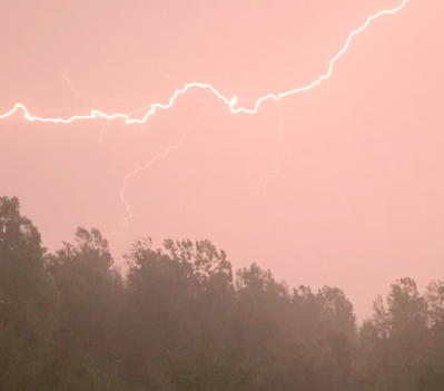
Lightning over St. Albans, Vermont on June 21, 2021.
Lightning activity was actually below normal in 
northern Vermont last year. 
 Lightning struck the United States 194 million times in 2021, according to a fascinating new report, and that was 20 million or so more than the year before.  

Still, believe it or not, the number of lightning strikes in the U.S. last year was still a little below normal.

The report, with oodles of lightning information, comes from Vaisala, a company that, among other things, has state of the art technology to monitor lightning across the globe. 

One disconcerting stat in Vaisala's report comes from the very high Arctic. 

Above 80 degrees north, at the very top of the world, there were 7,278 lightning strikes in 2021. That's not many at all, compared to activity at lower latitudes (Little old Vermont had 71,264 lightning bolts in 2021 for instance).

But those 7,278 bolts in the high Arctic are something completely new.  It was 91 percent more lightning than in the previous nine years combined. 

In general, you need warm, humid air and moisture to get thunderstorms.  Those two ingredients are normally pretty much completely lacking above 80 degrees north.

The high Arctic lightning in 2021 by far set a record for bolts up there. It's a sign that the Arctic is changing, and is no longer the Northern Hemisphere's icebox that it once was. 

In the rest of the Arctic, between 65 and 80 degrees north, lightning hasn't increased by much in recent years. 

Back in the United States, lightning activity in 2021 was above normal around the Great Lakes, central and southern New England, the Mid-Atlantic states and the Desert Southwest.

This tracks well with other weather stats that we saw in 2021.  The Mid-Atlantic States, Great Lakes and southern New England had much more rain than normal, and more bouts with severe thunderstorms than usual. 

The Desert Southwest had a busier than average monsoon season, when moisture gets drawn into the deserts to produce mid and late summer thunderstorm outbreaks. 

Vaisala also breaks down lighting trends in each state. In Vermont, lightning activity was a little above average in central and southwestern Vermont, but decidedly below average north of Route 2 all the way to the Canadian border.  As always, most of the lightning was during the summer. 

This also tracks well with what we know about last summer's weather in Vermont.  It was wetter than normal in southern Vermont, while drought gripped the north. Thunderstorms just avoided northern Vermont last year. 

Vaisala can even tell you which town in each state had the greatest amount of lightning.  In a supplemental report, Vaisala offers a list of towns and cities that are the lightning capitals of each state. Vermont's lightning capital was Ripton with 54 strikes per square mile.  

The lightning capital of the United States was Flatonia, Texas, with 1,043 strikes. 

As the Washington Post reports, the United States hit a record low for lightning deaths in 2021 with just 11, according to the National Lightning Safety Council. The year 2020 had just 17 lightning deaths, which was also well below average. In the past 15 years or so, between 25 and 45 people died annually from lightning strikes. 

Better lightning awareness among the public and possibly more people not going outside during the pandemic might be responsible for the fewer number of deaths in 2021.  

Saturday, September 25, 2021

East Coast A Hot Spot For Severe Storms This Year; Vermont, Not So Much

A strong thunderstorm over Georgia, Vermont on August
11 that would go on to earn a severe thunderstorm warning
in eastern Franklin County.  It was one of a below 
average 45 severe thunderstorm warnings issued so far
this year from the Burlington, VT NWS office. 
You'd expect the place that has had the most severe thunderstorm warnings this year would be some place like tornado alley in Oklahoma or Texas, or maybe the Deep South, or the lightning capital of the nation, Florida.  

Nope. The 2021 hot spot for severe, damaging storms is in the Baltimore-Washington DC area, according to the Washington Post Capital Weather Gang. 

That wouldn't seem like the most likely place.  Sure, there is plenty hot, humid spring and summer air in that neck of the woods to fuel big storms.  But you wouldn't expect that area to be the king of severe.  

Maybe Ma Nature is fed up with the kookiness of Washington and is trying to send a message?  

A severe thunderstorm is defined as one with winds of at least 58 mph and/or hail the diameter of quarters or bigger.  A severe thunderstorm warning means a storm that likely contains those conditions was detected.  It usually, but not always means there really is a severe thunderstorm. Every once in awhile, no damage is reported with a storm that had been deemed severe.

In those cases, the storm really wasn't severe or it hit an area where nobody was around to report or even see damage.  Basically, though, if you receive a severe thunderstorm warning, you should expect such a storm and take shelter right away. A severe thunderstorm warning means trouble looms.

In the Mid-Atlantic, trouble loomed a LOT this  year.

The Washington Post says:

This map shows the number of severe thunderstorm warnings
issued by each National Weather Service local office in the 
nation. Click on the map to make it bigger and easier
to see. Image is from the Washington Post. 
"The National Weather Service office serving the Washington-Baltimore region has issued a whopping 528 severe thunderstorm warnings for its zone of responsibility from eastern West Virginia to the Chesapeake Bay.  That number even surpasses the warning count for the area around storm-prone Norman, Oklahoma, which has received a second-most 489 warnings."

The number of storm warnings in the Washington-Baltimore area is about 223 more than normal.

National Weather Service offices surrounding the Washington-Baltimore NWS district also had much more storm warnings that average.

In our neck of the woods in northern New England and northern New York, though, we've had a light storm season.  

 The National Weather Service Burlington office forecast area covers all of Vermont except our southernmost two counties and northern New York from about Whitehall on the Rutland County, Vermont border to northeast of Watertown, New York along the St. Lawrence River valley.

In this zone, there have been 45 severe thunderstorm warnings so far this year, which is 16 fewer than normal.  

Again, click on map to make it bigger and easier to see.
The departure above or below normal of severe thunderstorm
warnings issued so far this year. Image from the 
Washington Post. 
The rest of northern New England, covered by NWS offices headquartered in Gray, and Caribou, Maine have had a similarly light year.  A vast area of the Great Plains and Mid-South of the United States also had a very light severe storm year so far, relative to average, anyway. 

Up here in northern New England, severe thunderstorm warnings are usually few and far between from now until next spring, so I don't expect the number of severe storm warnings to go up much.  In general, the further south you go, the more likely there will be more severe thunderstorms before the close of 2021.  

Generally speaking, a persistent dip in the jet stream centered over the Great Lakes created this pattern.  The weather pattern favored dry, stable west to northwest winds over the Midwest that helped squelch storms.

This same pattern kept bringing storm systems, cold fronts and lots of humid air to the eastern United States, which encouraged storms. 

In northern New England, persistent ridges of high pressure over southeastern Canada often suppressed the rough weather to our south.  While this Canadian ridge mostly kept us warmer than average, it also kept those storm systems in the East from working their way far enough north to influence much. 

The cold fronts also ran into dry air associated with the southeastern Canadian high pressure, and that helped keep storms to a minimum. 


Wednesday, April 28, 2021

Good Weather News: National Dearth Of Tornadoes; Rainy Vermont

A rare March tornado in Middlebury, Vermont. Overall
in the nation, though, it's been a relatively quiet year
for twisters, at least so far. 
 Yesterday's post focused on a historic super outbreak of deadly tornadoes back in 2011, which was a tragedy. 

Today, we bring you relatively good news about tornadoes: This month in the United States, there hasn't been all that many of 'em. 

Up here in Vermont, we still need rain. And we're going to get it. More further down in the post. But first, tornadoes!

QUIET TORNADO APRIL

As Bob Henson notes on Twitter, through this past Monday, only 51 tornadoes had been noted in the United States this month. 

On average,  there are usually between 150 to 200 tornadoes in April.  

There were as many as a dozen tornadoes yesterday in Texas, Colorado and Oklahoma. There will likely be a few more twisters today. But there almost certainly won't be any big tornado outbreaks before April closes out Friday.  We might end April with fewer than 100 tornadoes, only the fourth time that's happened since 1990.  

Several influxes of cool, dry air from Canada into the Midwest and South have squelched tornado activity this month.  One crucial ingredient for tornado outbreaks are surges of warm, very humid air from the Gulf of Mexico into the heart of the country.  That has generally been lacking this month.

Overall, 2021 has been a relatively slow year for tornadoes, at least so far. Through Monday, there had been 269 tornadoes in the United States. Through the month of April, we usually have about 300 tornadoes.

March was a relatively busy month, compared to average. There were 191 tornadoes in the U.S. in March, 2021 including one oddly here in Vermont. 

Long range forecasters had noted earlier this year that large scale weather patterns this spring would have some similarities to that of 2011.  That prompted predictions of a busy, dangerous spring and early summer tornado season of 2021.

That still might happen, of course. May and early June are the peak months for U.S. tornadoes. The average number of U.S. tornadoes in May increases hugely to 276. In June, the average number is 243.

We definitely have a long way to go with this year's tornado season. At least we're off to a good start. 

Sadly, ten people have died in tornadoes so far this year. Still, that's not bad compared to some years, like 2011 when the death toll was in the hundreds.

The very strongest tornadoes, ones with a category of EF-5 with winds of over 200 mph, are obviously the most dangerous and deadly. 

It's been a long time since the nation has seen of those monsters, too. As Andrew Siffert noted on Twitter, we've gone 2,900 days or about eight years without an EF-5 tornado.  If we go another three weeks or so with no EF-5s, that would be the longest stretch on record. Fingers crossed! 

VERMONT RAIN

I've been harping all year that we need rain to overcome a lingering drought in Vermont. It seems this spring the only we get needed moisture it comes as snow.
Perhaps a little hard to see here, but an indication that
Vermont still needs rain.  The other day I dug into a pile
of soil I left last fall. A few inches down, it was still
as dusty as it was when I piled it up. (dusty part is lighter
brown/tan) We haven't had enough rain to percolate down.

So some good news for the rest of the week: We have a decent amount of rain coming.  And unless you live in a high elevation, it'll be all rain, not snow. (And the high elevation snow won't amount to anything much).  

Clusters of showers keep moving roughly west to east along a wavering weather front that is positioned mostly just to our south. One cluster clipped Vermont overnight with some rain central and south. 

Other batches of showers are due this afternoon and evening, Thursday afternoon and evening and on Friday. Overall these showers could accumulate to an inch of rain or more by the time we roll into Saturday. Some places could get more than 1.5 inches. 

That's not exactly torrential, given that the rain will come over three days or so.  But it will help at least a little. We still need a few to several inches of rain to overcome a deficit we've accumulated since last year.