 |
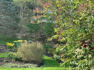
| My rapidly advancing lilacs in St. Albans, Vermont might come and go quickly this year amid record high temperatures for the next three days. |
We're included in that hot spell here in Vermont, as has been advertised for a few days now.
The heat was building Wednesday, with no few than 11 states from Texas to Michigan seeing record high temperatures. Chicago reached 90 degrees Wednesday, the second day in a row with record high readings.
Parts of central Illinois were in the mid-90s Wednesday with heat indexes in some towns getting up to around 100 degrees. Kansas City, Missouri reported a record high of 92 degrees Thursday. Indianapolis had a record high of 89.
Dozens of records will fall today as the heat peaks in the Midwest, interior Northeast and parts of southeastern Canada.
The heat will taper off pretty quickly across the northern tier of states through the weekend, but it will remain hot, with possible record highs in places like Texas, continuing into next week.
Along the western edge of the heat, severe weather and flooding is a big problem. Giant hail, damaging winds and a few tornadoes were reported Wednesday in South Dakota, Iowa and Minnesota. Minneapolis reported two inches of rain and a wind gust of 61 mph last evening, with 75,000 customers without electricity after the storm.
The same areas are under the gun for the same kind of dangerous weather today, except that it will also extend northward into North Dakota as well. Heavy rain and flooding are also in the forecast for already soggy eastern North Dakota and northwestern Minnesota.
VERMONT EFFECTS
The heat hadn't really started in earnest across Vermont yesterday, but we already have one record to report. The high temperature of 84 degrees Wednesday in St. Johnsbury tied the record high for the date.
Montpelier just missed tying Wednesday's record high temperature by 1 degree when it reached 83 degrees.
It seems almost certain that record highs will fall today in Burlington, Montpelier and St. Johnsbury.
The record high temperature today in Burlington is 84 degrees and Montpelier's is 82 degrees. The forecast high today is around 87 or 88 degrees in both cities.
There's an outside chance that Burlington could hit 90 degrees today. Doubtful, but possible. One limiting factor is that you might notice the sky overhead is a bit hazy today. That's wildfire smoke from New Mexico way overhead.
That could dim the sun a tiny bit, preventing a 90 degree hit. Don't worry about air pollution, though, the smoke is not near the surface and not screwing up air quality for us.
Until last night, Friday had been forecast to be the hottest day of this warm stretch. We're still expected record highs on Friday, but some low level moisture might sneak in overnight tonight, according to the National Weather Service in South Burlington.
That could cause morning clouds and fog. Those clouds would mix out and skies would clear in the morning, but that process could slow the day's rise in temperature. If that happens, Friday might actually be a degree or two "cooler" than today.
The "cooler" forecast is not universally accepted among Vermont area meteorologists. I notice WPTZ-TV is still calling for a high of 88 degrees today and 90 on Friday in Burlington. WCAX is going a little more conservative with a Burlington high of 85 degrees today and 87 tomorrow. WVNY is forecasting a high of 86 degrees in Burlington both today and tomorrow
We shall see! And besides, it doesn't really matter which is right. The headline is, record May heat today and tomorrow.
And probably Saturday. There might be a few extra clouds Saturday and a bit of a more humid feel to the air. We could even see a stray afternoon or evening shower or storm. That's because the weather pattern that's causing this record warmth will be starting to break down over the weekend. Still, record highs will probably fall in Vermont Saturday.
Sunday will feel decidedly more humid, and warm, with temperatures still reaching up to near 80 degrees. There's a better chance of showers and storms Sunday afternoon.
Good! We need the rain. Especially after this hot spell. Fire danger is high throughout Vermont.
A dramatic cool down to near normal temperatures (60s to low 70s) is expected by Tuesday. We'll still have needed showers around on Monday and to a lesser extent on Tuesday.

No comments:
Post a Comment