Showing posts with label Idalia. Show all posts

Thursday, August 31, 2023

Idalia Smashes Florida, Not As Bad As Feared, But Gulf Coast Hurricane Trends Worrying

In a screen grab from a video by storm chaser 
Reed Timmer, Hurricane Idalia's storm surge
smashes into condos in Cedar Key, Florida Wednesday.
Now-Tropical Storm Idalia was heading off the coast of North Carolina this morning, and is expected to take a lonely meander in the Atlantic off the Southeast Coast over the next few days. 

As rain diminishes in North Carolina today, the threat of any further trouble in the United States from Idalia is over.

Damage was extensive in Florida from Idalia, as expected. But it could have been worse, mostly because it hit a rather sparsely populated part of the state. 

Severe storm surges wrecked a number of homes and businesses on Cedar Key and in Steinhatchee, along the northwest coast of Florida. Just inland, the town of Perry, population 7,000, was raked by winds gusting to at least 90 mph, shredding roofs, punching through windows, smashing metal buildings, dismantling signs and toppling numerous trees. 

Still, things aren't as bad as they could have been. So far, two deaths have been reported. That's bad, but you could have had dozens of fatalities had things worked out differently.  Tampa only got a glancing blow. The feared storm surge in Tampa Bay did materialize, but it only caused relatively minor flooding. Though a few businesses right along the shore were badly damaged there. 

All in all, it could have been worse. 

There were some really interesting things, though regarding Idalia and some worrying trends involving hurricanes, especially those that have been striking the United States Gulf Coast

LAST MINUTE STRENGTHENING

 Idalia continued an increasing - and dangerous - trend toward hurricanes rapidly intensifying just before landfall.

Storms like that which quickly ramp up before hitting land can more easily catch people by surprise, sometimes with deadly results.

As Jeff Masters reports, since 1950, only ten hurricanes that made landfall in the United States had their winds strengthen by at least 40 mph within the 24 hours before landfall. Five of those hurricanes (Harvey, Michael, Laura, Idalia and Ida) have occurred just within the past six years. 

DID CLIMATE CHANGE CONTRIBUTE?

There have always been powerful hurricanes in the Gulf of Mexico. The water there usually gets quite warm in the late summer. 

Most of the time, you need water temperatures of at least 82 degrees to allow hurricanes to form and strengthen. Water temperatures in the Gulf routinely get hotter than that this time of year.  

The hotter the water, though, the more a hurricane will strengthen, as long as other meteorlogical factors, like upper level winds cooperate. 

Idalia was of course not the strongest hurricane ever to form in the Gulf of Mexico. But it was strong, and it developed incredibly rapidly, as you just read above. 

Jeff Masters again:

"As far back as 1987, MIT hurricane scientist Kerry Emanuel theorized that the wind speeds in hurricanes can be expected to increase about 5 percent for every 1.8 degrees Fahrenheit increase in tropical ocean temperature, assuming that the average wind speed near the surface of the tropical oceans does not change. Computer modeling has found a slightly smaller magnitude (4 percent) for the increase."

Masters acknowledges that a four to five percent increase in hurricane winds doesn't sound like a big deal. But he says damage increases exponentially with an increase in hurricane winds. 

A hurricane with 100 mph winds will do ten times the damage of a minimal hurricane with 75 mph winds, if you take into account destruction from wind, storm surges, inland flooding and tornadoes.  "Bottom line: a 4-5% increase in winds yields about a 40-50% increase in the destructive potential of a hurricane," Masters writes. 

Gulf of Mexico waters were near 90 degrees along the path of Idalia.  It probably would not have strengthened as fast as it did if water temperatures were closer to normal, say 84 or 85 degrees. Climate change is heating the Gulf of Mexico, along with ocean water all over the world.

Climate change was likely not the main driver of Idalia's strength, but it probably contributed some to  it. 

BEWARE THE "I"S OF HURRICANES

For some reason, hurricanes that start with the letter "I" have historically been especially nasty.

Usually, the same hurricane names are recycled every six years. If you get a nothing burger tropical storm named, say, Arlene, you'll see a storm with the same name pop up six years later.

However the National Hurricane Center retires names of hurricanes if they are particularly memorable and destructive. 

Hurricane expert Brian McNoldy recently tweeted (Or X'd?) that of the 13 "I" storms that have been retired in the past 70 years, seven of those names have been retired in just the past 14 years. (Ike, Igor, Irene, Ingrid, Irma, Ida, Ian).

Storms that begin with the letter "I" tend to occur during the middle of the hurricane season, when storms tend to be strongest. So you'd think that storms that begin with "H" and "J" are also frequently retired.

Not so, says McNoldy. Only six "H" storm names have been retired over the past 70 years, and only five "J" storms have been retired during that period. 

GULF COAST BATTERED IN PAST 7 YEARS

The United States along the coastline in the Gulf of Mexico has been especially battered over the past seven years. As atmospheric scientist Tomer Burg notes, ten hurricanes, all with top winds of at least 100 mph, have hit somewhere between Texas and western Florida in the past seven years. Seven of those storms had top winds of at least 125 mph. 

Burg notes that these Gulf Coast hurricane strikes seem to come in phases in recent years. In the seven years between 2009 and 2016, no hurricanes with top winds of 100 mph or higher struck the Gulf Coast. 

However, between 2004 and 2008, eighty hurricanes with top winds of 100 mph or more struck our Gulf Coast.

I don't know what the explanation is for this on and off cycle.   

OTHER HURRICANES

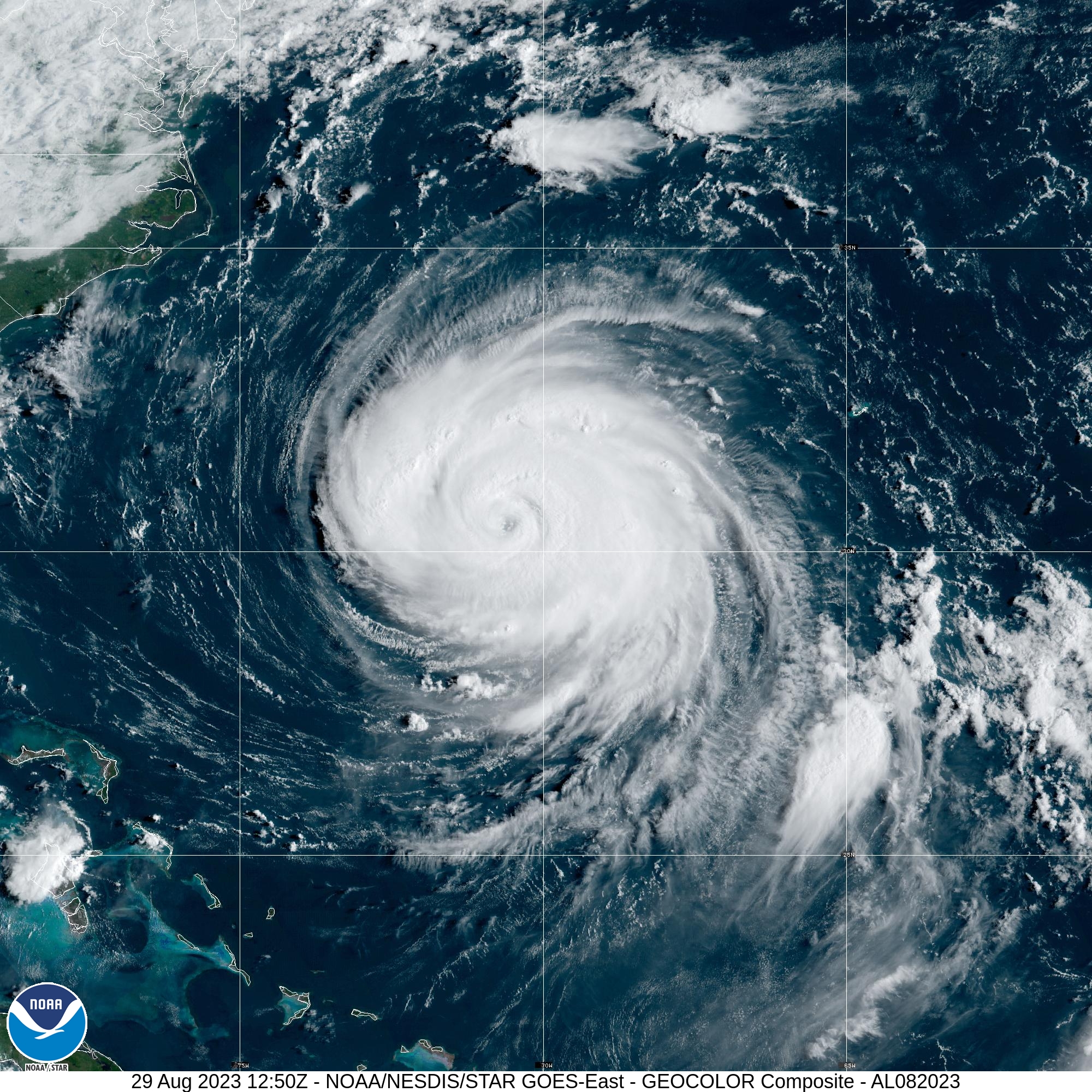
It's near the peak of hurricane season, so the Atlantic Ocean continues to bubble with tropical activity. Big Hurricane Franklin is still out there, lumbering east-northeastward heading away from Bermuda.   It will gradually weaken over the next several days without affecting land. 

Weak little Tropical Storm Jose formed in the central Atlantic Ocean overnight. It has top winds of only 40 mph, and soon will be sucked into the circulation of Hurricane Franklin. Tropical Storm Jose is destined to have a short and lame life. It won't hurt anybody. 

Another disturbance has come off the west coast of Africa.  It's just a collection of thunderstorms now, but there's a high chance it could become a tropical storm within the next couple of days. Nobody is really sure of its future path, but early indications are it might head northwest, instead of west, which would limit how many places it could eventually hit. 


Tuesday, August 29, 2023

Florida Bracing For Hurricane Idalia, Evacuations Ongoing Ahead Of Destructive Storm Surge

Satellite photo of Hurricane Idalia this morning shows
it beginning to take on "that look" of a potentially
very powerful storm.
Thousands of people are fleeing western and northern Florida today, and for good reason. 

What was Tropical Storm Idalia has strengthened into a hurricane, with top winds of 80 mph as of 7 a.m. this morning. Now, the meteorological ingredients have come together that could further strengthen this thing into a monster. 

Thunderstorms have consolidated around the center of Idalia. There's a lot of lightning in those storms. Upper level winds above the hurricane have relaxed. The water beneath the storm is at near record warmth. The combination sets the stage for rapid intensification today from a middling hurricane to a powerful, dangerous one. 

Forecasters expect Idalia to become a major Category 3 storm with top winds of 120 mph by the time it hits land tomorrow. It could even get stronger than that.   That's unquestionably bad, of course, but the worst part of any big hurricane is the storm surge. 

The low air pressure of a hurricane lifts the water, and the intense winds shove the water onshore like a massive bulldozer, taking down anything in its path. Huge waves with the surge just make everything that much worse. 

The National Hurricane Center warnings concerning the storm surge are worrying to say the least: They warn of "widespread deep inundation, with storm surge flooding greatly accentuated by powerful battering waves. Structural damage to buildings, with many washing away. Damage greatly compounded from considerable floating debris. Locations may be uninhabitable for an extended period."

I found it a bit disconcerting that already there was minor coastal flooding in communities like St. Petersburg, Florida on Monday, well in advance of the storm. The storm center was a full 175 miles west of Key West this morning and there was quite a bit of coastal flooding going on there. 

Officials are urging people to high tail it out of danger zones now if not sooner, before escape routes are cut off by rising water. 

All this while the sun is still shining on the Hurricane Idalia danger zone.  But the sun won't shine for long. Outer rain bands and squalls from Idalia should start moving over the area by this afternoon and evening. 

The area under a storm surge warning is huge, running from south of Sarasota in southwestern Florida, all the way northward along the rest of the west coast of Florida and on into the state's panhandle to a little east of Panama City. Evacuation orders are in effect for 21 Florida counties. 

The center of the hurricane, and its worst destruction is still expected to hit land where the coast of Florida starts curving westward into the panhandle. But there's still questions about whether it will shift east or west, so Idalia could strike closer to Tampa or closer to Panama City. 

It's always important to note that even if Hurricane Idalia tracks exactly where forecasts now think it will go. The storm surge will hit a broad area of coastal Florida. As I mentioned yesterday, the geography of the coast line and the path of Idalia will ensure that a storm surge is shoved into Tampa Bay, and the water will have nowhere to go with all that pressure from the southerly gales as Idalia blows past.

In the hardest hit zones, the storm surge could go up to 12 feet. Tampa Bay is expecting a four to seven foot storm surge. 

Torrential rains will also add to the mix, causing inland flooding. Water trying to drain from the land into Tampa Bay will have nowhere to go because of the storm surge blocking the way. 

President Biden has already approved an emergency declaration for Florida. Everyone is battening down. Tampa International Airport closed at midnight last night, and won't reopen until after the storm and damage is assessed. 

The hurricane warning affects 13 million people. Forty-six of Florida's 67 counties are in a state of emergency.  Schools are unsurprisingly closed throughout the western  half of Florida.  You can tell people there are expecting a biggie.   

Meanwhile, Hurricane Franklin swirls off the southeast
U.S coast, and west of Bermuda.

After striking Florida, Idalia will cruise through Georgia and South Carolina as a tropical storm, then head out to sea off the southeastern North Carolina coast by Thursday. From there, its future is uncertain.

HURRICANE FRANKLIN

We have to mention Hurricane Franklin, which as of this morning was very roughly half way between Bermuda and the southeastern coast of the United States.

 It's a monster that I think peaked yesterday, thankfully without hitting land.  Its top winds reached to nearly 150 mph and in satellite imagery took on the look of a classic powerful hurricane.

Its center will miss land and Franklin will eventually die in the cold waters of the North Atlantic. But being such  powerful storm, it's causing and will cause dangerous rip currents from Miami, Florida all the way north along the U.S. and Canadian east coasts to Newfoundland. 


Monday, August 28, 2023

Hurricane Idalia Forecast For Florida Turns Grim

Satellite phot from Sunday shows Tropical Storm Idalia
organizing in the southern Gulf of Mexico and 
Hurricane Franklin northeast of the Bahamas.
 Tropical Storm Idalia continues to get its act together in the southeastern Gulf of Mexico, and now Florida is under a terrible threat from this strengthening storm. 

As of early this morning, Idalia had top winds of 65 mph. It was starting to take its expected path north and will probably brush the western tip of Cuba tonight. 

At first, Idalia should only slowly strengthen into a hurricane as upper level winds are still somewhat interfering with how it's organizing itself.

But starting tomorrow, it's turning into a potential worst-case scenario for several reasons. For one, the water in the Gulf of Mexico in the path of the storm is super warm and toasty to quite a depth.  If the warm water layer was just near the surface, the storm might churn up cooler water from below to blunt its development. 

But all that warm water means Idalia will have plenty of fuel to strengthen quite a lot, as long as upper level winds aren't too strong. 

Unfortunately, those upper level winds look like they'll give Idalia a break, and possibly allow it to get a lot stronger a lot faster. Right now, expected top winds are forecast to go to 115 mph at landfall, which is expected on Wednesday. Forecasts like this are uncertain, as the warm water could maybe make the storm even stronger than that. 

Yet another worry in a long list of problems with this storm is it will likely be strengthening right up until it hits land. So, wherever Idalia lands, people might be taken by surprise by the intensity of the winds and the storm surge. After all, they might hear the storm has winds of say, 110 mph offshore, and that's what they'll expect. Then something even worse hits. 

Speaking of landfall, here's another issue: We don't know exactly where it's going to hit. It will be moving pretty much parallel to the Florida west coast. Any deviation from Idalia's predicted path could bring it onshore anywhere from Sarasota north to Panama City.   

Right now, the current project is for Idalia to hit land in Florida's big bend, where the Florida coastline curves toward the panhandle.  

On one hand, that would be kind of good since that area is lightly populated.  But not that good. That's because Idalia's storm surge will be widespread, and so will its torrential rains. A wide area of northern Florida is under the gun because of that. 

And, as I already noted, that project path could well be wrong. Especially if it goes further to the east and slams in to the Tampa Bay region.

Even if Idalia behaves like forecasters think it might and it goes by to the west of Tampa, that metro area would still be in trouble. 

The way Tampa Bay is oriented, combined with the direction of the wind and water flow with Idalia, a storm surge would keep shoving water up into Tampa Bay, causing widespread flooding.  Many thousands of people live in houses only a few feet above normal sea level.

I'm seeing some comparisons to Category 5 Hurricane Michael in 2018, which also strengthened rapidly until it slammed ashore around Mexico Beach, Florida. I don't think, or at least hope, Idalia won't be as intense as Michael, but you never know. 

Oh, and here's another doozy that might make things worse, at least for some people.  Evacuations are inevitable, and probably have already started. It turns out, more than two dozen Florida Citgo gas stations received shipment of gasoline that were contaminated by diesel fuel.

If a motorist unwittingly filled their tank with that bad gas, they'll end up stranded one the side of the road. Just as Idalia is bearing down.  

Of course, there will be updates as Idalia gets closer to an eventual landfall Wednesday. Florida is in for another very rough ride. 

Sunday, August 27, 2023

Hurricane Worries In Florida, Meanwhile Franklin Shows Its Muscle

Satellite photo from this morning showing what
will become tropical storm and likely eventually
Hurricane Idalia organizing off the coast
of Cancun Mexico. 
Florida is beginning to brace for a potential new hurricane disaster. Meanwhile, another hurricane is flirting with Bermuda, but will otherwise sort of behave itself. Let's get into it:  

WANNABE IDALIA

It's not set in stone yet, but a storm that's now now far from Cancun, Mexico definitely has Florida nervous. 

That storm is soon to become Tropical Storm Idalia, that is if it isn't already a tropical storm by the time you read this.

Wannabe Idalia was just sort of meandering aimlessly early this morning, but is forecast to soon start heading north is expected to head north and probably hit western Florida or the state's panhandle sometimes around Wednesday.  

How strong Wannabe Idalia will be by the time it gets to Florida is anybody's guess.  Forecasts have generally been trending stronger over the past couple of days with this thing. 

One thing going for this storm is the Gulf of Mexico waters are at near record warmth, and that warmth extends deep into the water.  That's incredibly high octane fuel for tropical storms and hurricanes.  It provides the potential for the storm to strengthen explosively, which would make it a powerful, catastrophic hurricane by the time it reaches Florida.

But that won't necessarily happen. To become a monster category 5 hurricane like Michael in 2018 that leveled parts of the Florida Panhandle, you need relatively light winds aloft to avoid disrupting the storm's circulation. 

This, however is an El Nino year. It tends to make higher level winds stronger, which could interfere with Wannabe Idalia's strength. It all depends on how strong those upper winds are.  It's a trade off. The hot Gulf waters want to blow up the storm into a monster, the upper level winds want the storm to chill out. 

Forecasters aren't so sure which factor will be the more dominant of the two. 

In the latest advisory from the National Hurricane Center, they note predictions for upper level winds over Wannabe Idalia are weaker than in previous forecasts. That would favor more strengthening. But again, that's highly uncertain.

So, we know Florida is at risk, but we don't know precisely where in Florida that hit will strike, and we don't yet know how hard the strike will be. 

If you live in Florida, especially the panhandle and the west coast from Fort Myers north, I'd start making early hurricane preparations just in case. Although it will be hot and busy, today's a great day to make a Costco and Home Depot run for supplies, protections for your home, that sort of thing. 

Even if Wannabe Idalia ends up missing you, or becomes a nothing burger, at least you have all that stuff for the inevitable next hurricane, whenever that will be.

It doesn't look like Wannabe Idalia will affect us here in Vermont. I'll get into that in a separate post this morning on Vermont weather, which is currently weird but safe.

HURRICANE FRANKLIN

Meanwhile this morning, Hurricane Franklin was east of the Bahamas, with top winds of 90 mph. It's really getting its act together, and is now expected to rapidly strengthen as it heads north to a point west of Bermuda by Wednesday. Top winds near its center by then could be an impressive 130 mph by then. 

Franklin will probably cause some rough weather in Bermuda as it passes by, but so far, it looks like that island will miss out on the full effects of the storm. 

Most forecasts had a dip in the jet stream moving off the coast in the Northeast U.S. shoving Franklin away from the United States and then zip out into the North Atlantic where it would die. The only effects it would have on, say, New England would be rough surf and dangerous rip current. 

Some predictions now have that weather disturbance missing Franklin, but the U.S. will still not be in trouble. If that happens, Franklin will probably meander eastward in the middle of the Atlantic, and linger longer than first thought. But it would just be trouble for ships and all the fishies out there.