Showing posts with label wildfire smoke. Show all posts

Sunday, August 2, 2026

July 2026 in Vermont Was Mostly Humid, And Stormy

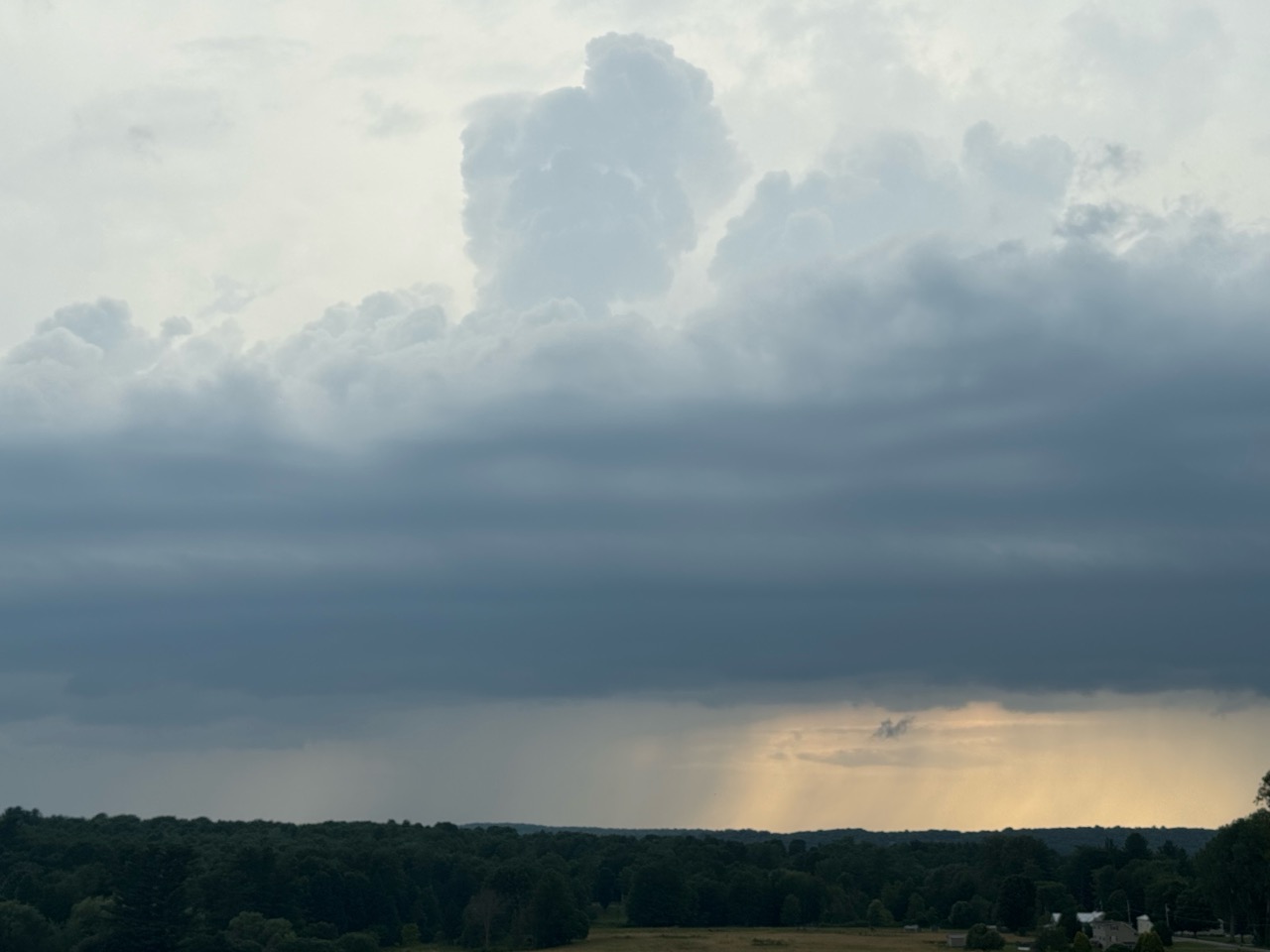
Stormy skies over Lake Champlain in July. The month
of July was relatively hot and quite stormy across Vermont.
 Not that you need reminding, but July in Vermont this year was humid, stormy and kind of hot. 

As measured in Burlington, the average temperature was 73.7 which was 1.3 degrees above normal. That doesn't sound like July was that hot,  but it was the 15th hottest July out of the past 136 years of reliable records. 

I always have to throw in this caveat. Normal nowadays is not your grandfather's average Vermont weather. 

 "Normal" temperatures are based on the average of what we saw between 1990 and 2020, when climate change had already taken hold. 

If this July happened in the 1970s or something like that, July would have been about four degrees above average. Hot Julys have become the norm in Vermont. Six of the top 10 hottest Julys have hit since 2018. 

Overall, the rest of northern Vermont was warm and dry, though it was paradoxically a humid and stormy sort of dry. In other words, not all that much rain came out of those muggy and roiling skies.

Weather stations across northern Vermont reported a monthly average temperature of a little more than a degree above normal.

Burlington had 3.18 inches of rain, which was nearly an inch below average. That turned out to be the 61st driest July out of the past 144 years of reliable records. Most of the northern two thirds of the state were dry, too. Given the fact that showers and storms tend to make summer rainfall highly variable, there were pockets of above normal precipitation. 

Montpelier's rainfall was 4.74 inches of rain in July, which was about a half inch above normal, But 2.45 inches of that came in one ferocious thunderstorm on July 9,

When you got toward southwestern Vermont, it was a little cooler than the modern average, and on the wet side. Bennington's average July temperature was almost a degree cooler than normal, Bennington also had 6.45 inches of rain, which was 1.8 inches above normal,

Much like in Montpelier, Bennington's wet month was due to one storm. They had 3.75 inches of rain on July 28-30, as they were on the edge of that epic storm that caused extreme flooding in New York's Hudson Valley. 

That same storm dumped over five inches of rain on some towns in the far southern Green Mountains. 

STORMY MONTH

The first half of the month was especially stormy. 

July got off to a literal bang on the first day of the month. Hot, oppressively humid weather help light up the sky with waves of severe thunderstorms. The worst of the storms sprung up abruptly in the Champlain Valley, leaving a trail of damage across northern and central Vermont into New Hampshire. 

An area around Underhill, Westford, Essex and Cambridge suffered especially severe damage.  Another wave of storms later that night filled the sky with continuous lightning

On July 9 storms blasted across northern Vermont, especially up in the Northeast Kingdom, nailing areas around Burke Mountain with intense microbursts. Flash flooding hit the area around Barre, but luckily, the flooding was much less severe that the past three Julys. 

Vermont braced for a severe storm and oddly strong tornado threat on July 14 into the early morning hours of July 15. Wildfire smoke squelched many would-be storms, so the problem wasn't as widespread as feared. 

However, supercell thunderstorms spewing microbursts caused lots of damage in a stripe northwest to southeast through Rutland and Windsor counties. 

On July 16, showers and storms developed along a weak southward moving cold front. The storms looked lame on radar, but the gust front packed quite a punch. More trees fell across northern Vermont.

Also, wildfire smoke made an appearance in Vermont, as I alluded to above. The worse of it was at mid-month when some big fires flared up in Ontario and northern Minnesota. Those fires tapered off later in the final weeks of July, so the smoke thinned, too. Just some haze from blazes in the western United States. 

Looking ahead to August, NOAA is predicting a hot month for most of the nation. However, the forecast gives equal chances of above or below normal temperatures in an area from the Great Lakes through the Northeast, including Vermont. 

NOAA is leaning ever so slightly on the wet side, so that's essentially a toss-up, too 

Tuesday, July 21, 2026

Another Nice Day Yields To An Iffy Today In Vermont Then Sweet Summer Weather To Return

A widespread severe weather outbreak is likely today in 
the Mid-Atlantic states. Vermont should be on the
edge of it, with just a marginal risk of strong storms. 
 Monday was another gorgeous day across Vermont. After a cool start, the day warmed into the low 80s. as expected. There was only a slight haze of wildfire smoke so air quality was OK. 

Today, we are going to largely escape a nasty severe weather outbreak in the Northeast and Mid-Atlantic States. 

Much like last Saturday, the severe weather is likely in western New York all the way down to Tennessee and North Carolina. Pennsylvania, New Jersey, Maryland, Delaware, West Virginia, southeast Ohio and northeast Kentucky have a high chance of severe storms and even scattered tornadoes. 

Up here in Vermont, much like this past Saturday, we'll be on the edge of it. The atmosphere is conspiring against much weather violence in the Green Mountain State. That said, there's a marginal, level one out of five alert level of severe storms in most of Vermont later today. 

Back on Saturday, we were in the same situation, with lots of severe storms to our south and west, and we were on the edge of it. The National Weather Service was predicting some risk of severe storms in Vermont, which never materialized as conditions remained cool, cloudy and smoky. 

Unlike last Saturday, there are a few breaks in the clouds today, and the smoke is much thinner than it was on Saturday, as noted. 

Last Saturday, temperatures hovered in the 60s most of the afternoon, which is usually too chilly to support severe weather.   

Today is warmer, as highs should reach well into the 70s to low 80s. Also, like on 'Saturday, it will get more and more humid as we go through the day.  So I think we have a decent shot at thunderstorms. But not a widespread severe event. 

Judging from satellite photos this morning, the old remnants of previous thunderstorms, now decayed, should arrive to cloud up Vermont's skies, limiting the instability in the air just when you need sunshine the most to power up thunderstorms 

There could be showers anytime today, but it looks like they will be pretty scattered until mid or late afternoon and into the evening, when the showers and storms should come through in earnest. Although there a decent area of rain did blossom in southern Vermont during the mid-morning. 

That's when we could see the risk of a few widely scattered strong to borderline severe storms, though I'd emphasize the majority of us won't see anything that dramatic. Some places might hardly see any kind of showers or storms, 

For those of you wanting a nice, soaking rain, this won't be the wettest summer storm system ever. On average, southern Vermont might see a half inch of rain, northwest Vermont a third of an inch, with the Northeast Kingdom seeing less than a quarter inch. 

That's just broad brush. As is always the case with showers and storms, some towns will be big winners with over an inch of rain, while some other communities get sprinkles or light showers, It's impossible to tell in advance exactly who gets what in these situations. 

TOMORROW

We're not quite out of the shower and storm risk. The last of a series of weak weather fronts should cone through midday as a cold front. This should power up some scattered showers and storms.  The usual hit and miss routine. It looks like the timing of the front will be such that the storms will just be beginning to fire up in Vermont when peak afternoon instability begins to hit. 

For now, it looks like none of the storms will become severe until they reach New Hampshire and Maine, and southern New England. Even there, we see only a marginal, level one out of five risk for nasty storms there.

We should still see highs within a few degrees either side of 80 before the chillier air comes in. 

THURSDAY

Back to a hint of autumn, kinda, sort of. In any event, it should be a beautiful day. Sunny to partly cloudy and breezy, with rock bottom humidity with highs in the 70s. 

FRIDAY-SUNDAY

Another nice weekend! We've had a few of those this summer, which is definitely fortunate. Friday and Saturday will feature cool, calm mornings. Sunday morning will be a little warmer, but still comfortable. 

If the forecast holds, highs will be in the 80s, but trending a few degrees warmer each day, starting with low 80s Friday to upper 80s Sunday. 


Saturday, July 18, 2026

Vermont Smoky, Windy, Stormy Saturday; Severe Storm Risk, Especially West. Will Sunday Rescue The Weekend?

A widespread severe weather outbreak is due in the
Northeast today. Vermont is on the edge of it. 
Clouds, wildfire smoke and the strength of the 
parent storm system is making today's 
storm forecast difficult and iffy. 
 We all know the humidity was low and gorgeous and pleasant around Vermont yesterday. If you stepped outside for even a second you might have even frizzed your hair a bit. 

It was the kind of summer day we all look forward to. And the tourists from the humid south get excited about. 

We actually tied a pretty substantial record Friday,  The relative humidity plunged to 20 percent in Burlington, tying the record for the lowest relative humidity in July. It's now a three-way tie with July 16, 2018 and July 1, 1975. 

Interestingly, July 1975 and 2018 were both among the top ten warmest on record. This month is running well above normal so far, but the second half looks like it could be in the cool side. 

Another way to look at how dry Friday was is the dew point.  That's the temperature that you would have had to reach to saturate the air. The dew point, as you keep seeing in this blog thingy, is a good measure of how comfortable it feels out there. 

If the dew point is in the 50s, it's nice and pleasant and not at all sweaty. The dew point got its the 30s in many areas Friday. We usually don't see something like that until we're into September.

SMOKY SATURDAY. STORMS, TOO?

The dry, clean air is in the past for now. This morning, the dew point is rising the smoke is back and getting thicker and the rest of the day isn't going to be so wonderful.

South winds are bringing back the smoke that had gotten flushed out of Vermont by Thursday's cold front. That has triggered a state wide air quality alert until 11 p.m. tonight. Especially for those who have lung problems, or are very young, or the elderly 

That's the part of the forecast that is easy, even if it is depressing. 

The next question is the risk of severe storms. Very much like on Tuesday night, the smoke is making the storm forecast challenging. That smoke could be one factor that could limit storms. Maybe.

his is a completely different weather set-up than we had on Tuesday night, so we can't use Tuesday night as an example. 

Fortunately, the core of today's rough weather will be slightly off to our west. Pennsylvania, New Jersey, Maryland, Delaware and western and central New York have a three out of five risk of severe storms, according to NOAA's Storm Prediction Center. This is an unusually large area to be under this level of a storm alert. 

That area could have numerous strong to severe storms, and probably a few tornadoes. 

That leaves Vermont on the eastern edge of the the severe risk. Roughly south and west of Interstate 89, there's a slight risk of severe storm, a level two out of five risk of storms. That means at least scattered severe weather.  The rest of the state is under marginal risk, one out of five, which means mostly just isolated severe storms.

The parent storm system is unusually strong for July. That adds a lot of energy to the atmosphere, something that could trigger a lot of storms.

But Vermont is not fully getting into the super humid air that fuels storms. It'll turn humid for sure, but it won't get as humid as it possibly could be.  Also, it seems there will be a lot of clouds around today. And smoke. Don't forget that smoke!

The clouds and smoke could hold temperatures down further than they otherwise would be. Hotter air would help fuel storms. Cooler air would tame them down. 

So, we're left with a lot of questions. Will the clouds and smoke thin just in time to juice the atmosphere into severe storms?  Or will the clouds and smoke keep us cool, limiting the storm? 

As noted above, the parent storm is vigorous, so it should overcome the smoke and clouds and produce rounds of showers and storms. The wind is changing direction and strength with height. So, once again, there is a very low, but not zero chance of a brief tornado. This will be south and west of Interstate 89, with the best chance down near Bennington. 

However, the biggest risk from today's storms is damaging straight line winds. 

After our two tornadoes, and a slew of destructive microburst this summer, this isn't exactly what we need. 

Whether or not we see severe thunderstorms, it's not going to be a nice day. 

It won't rain all the time, but a risk of showers and storms will always be there, through this evening. Between showers and storms winds will be fairly gusty, especially in the Champlain Valley. Boating on Lake Champlain will be tricky, even dangerous for small boats. Plus the smoke. And it will feel increasingly humid. 

Bottom line: Keep an eye on the sky, and - once again - have a way to receive warnings of severe weather warnings. 

So, can the weekend be saved?

SUNDAY

The above question gets a yes answer on Sunday. 

We'll have a day exactly the opposite of what today will bring. We could see some clouds early in the day, but it should turn mostly sunny. The storm's cold front will have flushed most if not all of  the wildfire smoke away.

It will be also be cool for the season. Our first subtle hint of autumn! (Don't worry, summer is far from over).  Highs should stay in the 70s, maybe upper 60s in the cooler hills in the north. The humidity will be at rock bottom, not much different than it was yesterday. 

LOOKING AHEAD

It's an active weather pattern, so a new weather system is due Tuesday night and Wednesday. It's too soon to know the details of what will happen with that next storm, but severe storms and torrential rains are possible. 

Thursday, July 16, 2026

Smoke Annoying Vermont, And Much Of Northern U.S. Storms/Rain Lurk In New England Too

A bit of another severe risk. Level 2 out of 5 risk of
damaging winds in the Northeast Kingdom and in
northern New Hampshire and half of Maine.
Northwest and central Vermont are at a level 1
out of  5 risk. This won't be as serious as the
destructive microbursts in south central
Vermont early yesterday morning. 
The smoke is back, especially in southern Vermont. Big wildfires in Ontario and northern Minnesota is causing most of the trouble. 

Smoke will be a problem for the rest of the summer, probably. Rain might tamp down the Ontario fires Friday and Friday night, and that might temporarily help. 

All this pollution makes the overall weather forecast a little harder, both for understanding when the smoke will be thickest and how that will affect overall weather. 

Later yesterday, the thick smoke got suppressed south to near the Massachusetts border and points south and west. Northern Vermont got a temporary break. 

TODAY

Unfortunately, satellite imagery was down this morning so I don't have a full picture of what's going on with the smoke. Just a general idea.

However, we know the smoke moved back north overnight, but it's still thickest in southern Vermont. An air quality alert is in effect until 11 p.m. tonight for all of Vermont except the far north. It's part of a broad air quality alert zone extending from Minnesota to Massachusetts. 

Another cold front is going to temporarily squash the smoke southward this afternoon. The cold front has already set off some needed showers in northwest Vermont, an area that could use some rain  Unfortunately, there is a risk of a few strong or even severe storms today. 

It's been a stormy summer. 

The weather set up is similar to Tuesday, when we were expecting a big outbreak of severe storms. The main difference is that it's much less humid than it was on Tuesday. So there's less potential fuel for storms

This time, the smoke is somewhat lighter in northern Vermont. Despite the lower humidity, the lack of smoke means there could be a few strong or borderline severe storms. Especially as a new cold front accompanied by a weather disturbance approaches us from Quebec.

This will not be a big storm outbreak.  Some of us won't see any showers or storms at all. NOAA's Storm Prediction Center has much of Vermont under a marginal risk of severe storms, a level one out of five risk. 

The Northeast Kingdom, northern New Hampshire and southern Maine have a higher risk, a level two out of five alert level for severe storms. Far southern Vermont is outside the risk zone. 

Again, this won't be anything as serious as those destructive microbursts that hit towns like Shoreham, Whiting, the north end of Lake Bomoseen, Shrewsbury, Windsor and other spots late Tuesday and early Wednesday.  

Just keep an eye to the sky and get into a building if a storm is approaching. A couple spots could have some damaging wind gusts. The storms should be around early to mid afternoon north, and mid to late afternoon south. Though southern Vermont should see few if any showers and storms 

The good news is the cold front will temporarily disperse the smoke later today, especially north. 

FRIDAY

Should be a nice day. After a comfortable night tonight, we should have a sunshine, low humidity with highs in the70s to low 80s. It looks like we should still have some wildfire smoke hanging around. It's hard to say for sure, but current forecasts suggest the smoke might be worse south and west of Interstate 89.

WEEKEND

Saturday looks rather rainy. Which is good, as several places in Vermont have been cheated as thunderstorms have missed them this month. Northwest Vermont seems particularly dry. The first half of July in Burlington had 1.37 inches less rain than normal.  

You might be able to squeeze in some outdoor activity during the first half of Saturday, since the bulk of the rain should come through later in the afternoon and evening. Early forecasts call for an inch of rain in northern Vermont, with a little less than that across the south.  

It looks like Sunday will clear up in the afternoon. It also looks like it might be the coolest day we've had since maybe the third week in June. Highs should stay mainly in the 70s.

The weather pattern has changed. No promises, but it appears the second half of July might be cooler than the first half of the month. 

Wednesday, July 15, 2026

"Smoke Bomb" Might Have Saved Vermont/Northern New England From Widespread Severe Weather

My sister in Shrewsbury, Vermont sent
me several photos of storm damage
in that town. Here's one showing a 
large uprooted tree. However, the
storms weren't as widespread as 
forecasted, likely due to the 
thick wildfire smoke in the air
 We wake up this morning to find our big storms we were supposed to get last night didn't happen to the extent everyone was worried about. 

There were some strong storms in the Northeast Kingdom during the evening. And a collection of supercell thunderstorms  swept from northwest New York through south central Vermont early this morning.  Hail up to the size of baseballs hit St. Lawrence County, New York, and a roof was blown off a house there. 

In Vermont early this morning, tree damage was reported in place like Brandon, Pittsford, Orwell and Shoreham. where several large trees were snapped off. In Shrewsbury, numerous fallen trees blocked town roads and the power was out

 Trees blew down between Springfield and Weathersfield, blocking both northbound lanes of Interstate 91.  One southbound lane was also closed. Southern New Hampshire also had some storm damage. Parts of the region had a big lightning show. 

This wasn't the big scary storm outbreak we were expecting.  That's a good thing, Far fewer of us are picking up the pieces than we feared. 

However, that things didn't get as wild as forecast is frustrating for the public.  Judging from social media, people were genuinely scared at yesterday's forecast.  A small hint of fear is good. It gets people to take precautions. But people were worked up. Then, in many cases, nothing happened, which leaves people saying, "What the hell?"

 Of course, people were told that not everyone would be hit by severe storms, it would just be a minority of us. But that gets lost in the hype. 

But still, as noted, this outbreak of severe weather fell well short of forecasts. I'm not blame the meteorologists. This was about as tough of a weather scenario to forecast as you can get.  And I'd suggest the wildfire smoke really threw a wrench into the severe weather forecasting. 

SMOKE

The science of factoring smoke and climate change into day to day forecasts needs work.

The sky was a sick yellow over St. Albans, Vermont
yesterday morning because of wildfire smoke.
The smoke made severe weather forecasting even
more challenging, and probably reduced the
number of severe storms in the region. 
As soon as we got up yesterday, we knew something was awry. There was a lot of smoke out there.  Fires burning in northern Minnesota and Ontario really smogged us in. 

We're now having another smoky summer. Climate change has encouraged more fires due to hotter weather and in many places, drier conditions. 

Since the problem is newish, I don't think the computer models handle smoke forecasts well. Especially since the amounts of smoke the fires belch out changes often and unpredictably. So sometimes we're surprised by the haze and pollution. 

It gets worse. Meteorologists and other scientists don't have a great handle on how wildfire smoke affects thunderstorm development, especially when wildfire behavior changes abruptly.  We saw that yesterday as meteorologists struggled with whether the smoke would squelch storms or not. 

During a live Facebook event last evening, National Weather Service meteorologists in South Burlington said they doubted the smoke would interfere much with storm development. Meanwhile, at NOAA's Storm Prediction Center,  NWS meteorologists issued a statement saying that while there was a very good chance of severe storm development in northern New England, widespread wildfire smoke and clouds were teaming up to inhibit storms from firing up.

This morning, responding to a question from a person on Facebook, the National Weather Service in South Burlington had a great explanation:

"The thick smoke layer was a big wildcard yesterday. Turns out, the smoke reduced instability just enough that the severe storms weren't as widespread as anticipated. Given the recency of the wildfires in southwestern Ontario  - which was the primary source of the smoke - it wasn't incorporated into the model solution very well."

In the words, the fires blew up so quickly that the computer models couldn't easily feed that information into the forecast they were spitting out. So the forecast was off.

Wildfire smoke is bad, as Captain Obvious would tell us, but it might have helped us last night by limiting storms. 

More research is needed to help us understand how wildfire smoke and thunderstorms interact. Also, we need science on how smoke affects temperature forecasts. The thickness of the smoke yesterday was unexpected, and made us cooler that we thought it would be.  The forecast high in Burlington yesterday was 97 degrees. It only made it to 88.

Smoke wasn't the only thing that created fewer storms than feared. The cold front descending from Quebec was a bit of a slowpoke, coming at us later than forecast

LOOKING AHEAD

You can tell by looking out your window that smoke is still a problem here in Vermont and a lot of other places today. An air quality alert is in effect for New York State. I imagine Vermont officials are considering it. But the bulk of the smoke is aloft.   

Some of it is down here where we breathe, so the air isn't great. It's just not as awful as it can get. Air quality was moderate across Vermont this morning, though it was flirting with "unhealthy for sensitive groups."

Northern Vermont will tend to clear out later today, but southern areas are forecast to stay socked in. Smoke will make another run at us tomorrow. 

There is a low chance of showers and weak thunderstorms today, though the Storm Prediction Center has the Northeast Kingdom in a marginal risk for severe storms. This isn't a huge threat at all, but there could be an isolated strong storm today up there. Don't hold your breath on that, though. 

Today will be warm and breezy with highs up in the 80s. 

Tomorrow

A reinforcing cold front should come through tomorrow, with a new batch of scattered showers and thunderstorms. They will be hit and miss, and the thunderstorms should be pretty much garden variety. Rainfall will be generally light, which is too bad as many of us could use a nice soaking

Wildfire smoke should make another run at us. It'll reduce air quality again. It will also make it more difficult to forecast how widespread the expected showers and storms will be. 

Friday

A nice one, as it looks now. Sunny, dry, with highs in the 70s to around 80. That will make it our coldest day since late June. I don't exactly think we'll be shivering in those temperatures, though. We still have to keep an eye on wildfire smoke. It's a little too early to figure out if that will be a factor on Friday. 

Weekend.

Looking unsettles with rain chances both days. This could change, but Sunday looks like the better of the two days. Fingers crossed, the showers might move out of Vermont early in the day Sunday to reveal increasing sunshine. The storm causing the showers will have to move just a bit faster than forecast to accomplish this, however.


Tuesday, July 14, 2026

Quick Early Tuesday I'Afternoon New England Storm Update

Satellite view as of 1:30 p.m. there's thick smoke
in New England and far southern Quebec. It's 
visible as that brown stuff.The thunderstorms
are further up in Quebec, and beginning
to affect Maine. We're unsure yet whether 
the smoke will affect the intensity of 
the expected storms tonight. 
Early this afternoon, another round of updates has come through the transom regarding the severe weather forecast for this evening in northern New England. 

The overall philosophy is the same: Meteorologists still expect a mix of supercells and clusters of potentially severe storms crossing the border from Quebec toward evening. 

NOAA's Storm Prediction Center updated their severe storm outlook early this afternoon, like they usually do. 

The major change is an upgrade to the tornado risk in western Maine. Up there, we have a 10 percent chance of  tornado within 25 miles of a given point. 

It's still at least a five percent of a twister in a given point across northern Vermont and New Hampshire and extreme northeast New York. 

Strong straight line winds are still be far the greatest risk tonight. 

Wildfire smoke is still a wild card. It's blocking the sun, and it's not warming up as much as forecast. This smoke is much thicker than all the computer models expected. Will that mess up the instability necessary to fuel this severe storm outbreak? 

As of early afternoon the thickest smoke had moved east out of Vermont. But thick smoke was still stretched out in a band along either side of the Canadian border. Here in St. Albans as of 1:30, the atmosphere has a sick puke yellow color, and the sun is showing as a dim red dot in the sky. 

There are a few signs the pollution could diminish the storms. As of 1:30 p.m. I'm kind of unimpressed with the storms far to our north in Quebec. However, there is plenty of time for these storms to develop to dangerous levels.

I'm also seeing hints that Maine and northern New Hampshire, and probably the Northeast Kingdom might have the earliest and most intense storms this evening. There looks like there might be several bursts of storms through midnight, with the severe threat lasting well into the night. 

So far, it seems to be full steam ahead with the severe storm expectations.  The atmosphere is pretty primed for storms.  I'll have an update late this afternoon.  Meanwhile, you can read my full morning report with more details by clicking on this link

Friday, July 10, 2026

Fourth Year In A Row With Vermont Weather Trouble On July 9 or 10. Next Up, Pleasant, But Maybe Smoky, Then A Hot Flash

Torrential rains in St. Albans, Vermont during a strong
thunderstorm late Thursday afternoon. The same storm
 strengthened as it moved east, eventually causing
 substantial tree and power line damage
in the Northeast Kingdom. Flooding hit central Vermont
 It turns out we had weather trouble in Vermont around July 10 for the fourth  year in a row. 

The trouble hit a little early this year, on July 9, instead of July 10 like we saw in 2023, 2024 and 2025. But yesterday, we had flooding in and around Barre, and thunderstorm wind damage in the Northeast Kingdom. 

The core of the wind damage was in Lyndon and East Burke. Video showed numerous trees down along Route 114.  

Somebody in the video background suggests it was a tornado. Perhaps, but since all the trees appeared to fall in the same direction, at least as seen in the video clip, I suspect intense straight line winds.

Another batch of thunderstorms nearly stalled over central Vermont. It was enough to flood the streets of Barre, again. This was mostly poor drainage flooding and not quite as serious as in recent years. 

In Montpelier, nearly 2.5 inches of rain fell yesterday, including 1.75 inches within two hours. 

I guess we should be grateful over a trend line. The worst flooding hit statewide on July 10, 2023. In 2024, most of the destruction was across a broad band through central Vermont. In 2025, destructive flooding was limited to just parts of the Northeast Kingdom.  And yesterday, almost all of Vermont escaped unscathed, except in the Barre-Montpelier area and a small part of the Northeast Kingdom.

Even better, we're done with the rough weather for a little while, anyway. 

TODAY

It looks like the cold front as of 8 a.m this morning was draped across central Vermont, judging from a line of very light showers drifting southward.  The front is too weak to create any dangerous downpours or high winds. We'll have no major weather today. 

This morning started humid, but light north breezes will slowly dry the moisture out of the air. The sun will break through where it hasn't already, and we should make into the low 80s this afternoon.

WEEKEND

It's still looking like a terrific weekend if you love summer.  The humidity should remain low enough, and afternoon highs will reach the 80s under sunny skies. 

Dimmed sun, though. Smoke from wildfires in Quebec near James Bay will probably drift down into Vermont on those north winds. So the Green Mountains of Vermont might well be hidden by haze. I'm not sure whether we'd have enough smoke to trigger any air quality alerts. but we'll wait for more info on that.

NEXT WEEK

A heat dome is setting up in the western United States which will create record high temperatures in places like Montana and North Dakota, and other states.

A storm way up in central and northern Canada will pull a plume of that hot air eastward, arriving here Monday and Tuesday. The National Weather Service in South Burlington is calling it a "jailbreak heat," as it's escaping the heat dome where it originated. 

We should see highs near 90 on Monday and as high as the mid-90s Tuesday. Considering where the air is coming from, it will be pretty dry air.  The kind that doesn't feel quite as bad as most heat waves, but drains the moisture from your garden plants. You'll need to water.

The heat won't last long. If there's a northward bulge in the jet stream with the heat dome in the West, you need a southward dip in the jet stream in the East.

That will start to set up midweek. A cold front will come through Tuesday night or Wednesday. Probably with little fanfare. It won't get that cold, probably seasonably warm late in the week. 

As always, long range forecasts like that are subject to change. At least we have no scary storms or floods in our immediate future.


Sunday, July 27, 2025

Arguably Worst Vermont Smoke Attack Yet, And Sunday Rains Not Behaving As Expected

Smoke obscuring Lake Champlain Saturday, as
seen at St. Albans Bay, Vermont. 
Cough, cough.

Boy, yesterday was rough in Vermont. Sure, it was a nice day, except for the thick clouds of smoke and haze we endured. 

Unexpectedly, Saturday probably brought Vermont the most polluted air of the year, thanks to wildfire smoke from Canada. 

We knew days in advance there would be smoke in the air, but most forecasters expected the bulk of it to remain aloft, with just some relatively minor dents to our air quality down here on the ground. 

Instead, a zone of sinking air pushed the smoke to the ground in a band from southern Quebec down through western New England and extreme eastern New York. The result was some of the worst air I've ever seen, even worse than what we saw in 2023. 

Montreal Saturday morning became the most polluted city in the world, 

The air quality index fell to near 200 in some places across northern Vermont. The air endangered people with pre-existing health issues, and was generally bad for everyone. The air improved somewhat toward Saturday evening, but was still pretty bad. 

Like it or not, we all smoked at least a couple cigarettes Saturday. 

The air quality alert in northern and central Vermont has expired, at least for now.  Far southern Vermont remains under an air quality alert, though. Still, the air isn't great. As of this morning, the air quality index was somewhere in the 115 to 125 range, which is considered unhealthy for sensitive groups. 

Smoke forecasts look better later today as the air cleans up a little more, but not completely. That's temporary.  It looks like another batch of smoke might come down from the north tomorrow, so it's not over.   

Since we're going to have repeated batches of northwest winds from Canada through the upcoming week, and since there's still a lot of large fires burning in Manitoba and Saskatchewan, we can expect more smoky, unhealthy air to blow through probably until at least next weekend. 

TODAY

 This is turning into a long post, as things are actually pretty busy in the weather department.

As expected, a lot of us in Vermont woke up to a rainy early Sunday morning. But the rain wasn't working out quite as predicted, especially in the north. 

It was suppose to barely rain in far northern Vermont, so why did I wake up to a torrential downpour before 7 a.m, in St. Albans?

 I'm not blaming the National Weather Service or anybody else. The subtlest shifts in the atmosphere can radially change things at the last moment.  

The result was a split into two rainy areas. Southern Vermont saw steady, sometimes briefly heavy rain, Sunday morning rains, just as predicted. In fact, forecasters were carefully watching central and eastern New York and perhaps into Bennington County in Vermont for the risk of rains torrential enough to cause flash flooding.

As of 9 a.m. there was no trouble, at least in Vermont. Any flood threat in these areas should end by late morning or early afternoon. 

But another batch of occasionally heavy rain set up in far northern Vermont. So places like St. Albans, Jay Peak and Newport that were expected perhaps a tenth of an inch of rain at most got much, much more than that. 

It looks like a push of humid air acted like a snow plow, causing a narrow band of rising air that formed into a line of downpours that found its way to the Canadian border.

Central Vermont mostly missed out, at least through 9 a.m. Some rain did fall in Burlington, making this the 32nd weekend in a row with at least some rain. We broke the record for most such consecutive weekends last Sunday, and this solidified the record even more,.

Still, central Vermont is getting a bit on the dry side, so it's too bad they missed out, especially since it appears not much rain is in the forecast for the next week. 

REST OF TODAY

After the morning weather disturbance with its locally heavy rain move out, we'll be left with a return to very humid conditions.

That means cloudy skies will give way to some sun, and temperatures should get into the low 80s. The humidity and subtle left over disturbances in the atmosphere could touch off some widely scattered thunderstorms. Most places won't see a storm this afternoon and evening, but some of us will.

I don't see anything severe, just local downpours here and there and some lightning. There might be a bit of an uptick in scattered storms this evening as a weak wind shift line come through. 

GOING FORWARD

The forecast we've been touting hasn't changed much for the upcoming week, other than a few tweaks.

Monday and Tuesday now both look quite warm, with highs in the 80s to maybe near 90 both days in a couple spots. 

Some thunderstorms might develop Tuesday as the first of a series of cold fronts come in.  Wednesday should be slightly cooler, but another cold front could set off more thunderstorms. It's too soon to determine how many and how strong they might be.

Then, after that, we have that cool spell we've been talking about. It doesn't look like it will be quite as chilly or as long lasting as first thought. Only one day - Friday - will be much cooler than normal. It now looks like the coldest air will stay up in Quebec. 

But otherwise, Thursday through Sunday look bright, dry, sunny, mild and refreshing. Then it will warm up again. Don't know how much yet. 


cold snap\

While some guidance continues to show lingering rain behind yet
another boundary on Thursday, our region will largely be high
and dry Thursday through Sunday as an expansive ridge of high
pressure slowly migrates eastward. Only Friday looks to be
anomalously cool, per NAEFS mean and EFI climatological tools, with
temperatures probably resembling what we saw this past Monday.
Generally the much cooler air mass that was on the table is
looking more likely to bypass us to the northeast, but for those
who desire warm, but not hot, days with low humidity should
have a nice weekend in store. As noted by the previous
forecaster, we`ll still need to monitor potential for wildfire
smoke to be advected in from the north, as it may be present
not far away later this week in northern Ontario.

Monday, July 14, 2025

The Usual For Vermont These Days: Humidity, Storms, Wildfire Smoke, But Where Will The Worst Of It Hit?

A menacing thunderstorm with great structure approaching
Georgia, Vermont last evening. Despite appearance, the
storm wasn't severe. Storms that came through parts of
Vermont Sunday were relatively tame, so no problems
with wind damage or floods were reported. 
 It's another humid morning out there in Vermont among many humid morning we've already seen this summer. 

There's more on the way, so that will be a familiar topic. So, too, will be the risk of storms, local flash flooding. Plus our old friend wildfire smoke is returning too. Oh, joy! 

Someday, we'll have cool, dry, clean air, but not too soon I'm afraid.

There is good news to report. None of the showers and storms that came through Vermont yesterday and last evening were severe, even if they were accompanied by menacing looking clouds. 

Some of the storms knocked down a few trees and power lines in northern New York, but none of those storms caused trouble once they crossed the border into the Green Mountain State. 

Those storms kept their flooding issues west and north of Vermont, too.  We was a flash flood warning for a time in part of the Adirondacks. And further west, there was substantial flash flooding in central New York, especially around Newark Valley, New York, southeast of Ithaca. 

Flash flooding was also reported around the Montreal metro area. Up to three inches of rain in a short time flooded basements and highways, cut power and caused flight delays at the city's airports. 

We have a new weather record to report, too. At least a tie.  Burlington received a little rain Sunday, just 0.16 inches. But that's enough to have made this past weekend the 30th in a row with at least some precipitation.  That ties the record for most consecutive weekends with at least some rain or snow in Burlington. 

STORMS/FLOOD POTENTIAL

The additional good news - for Vermont anyway - is that if we do see any flash flooding from additional storms today those instances will be pretty isolated. 

The more substantial flood trouble will be to our south, most in the Mid-Atlantic region. Down by Washington DC, Philadelphia, New Jersey and that area, there's a serious risk of real flood trouble today.  

While we will have thunderstorms in Vermont today they're also unlikely to be severe.

One thing that's helping is the weather front that will be driving today's storms is moving a bit faster than expected. It's technically a cold front, but unlike most cold fronts it doesn't get any cooler or much less humid behind it. 

Showers and thunderstorms seen erupting late
Sunday afternoon looking west from Georgia, Vermont. 

But the front does have a punch of drier air higher up in the atmosphere, and that will help suppress showers and  thunderstorms in northwestern Vermont, which got the most rain yesterday. 

 I suspect areas north of Route 2 and west of the Green Mountains should be done with the shower and storm risk by mid-afternoon at the latest. 

We'll still have to watch through the day for potential isolated instances of flash flooding in the Northeast Kingdom, parts of which are still recovering from last week's flood. 

If we do have any flash flooding today - remember, that's just an if - far southern Vermont will be the most likely place. They had some pretty heavy downpours Saturday. And today's storm and downpour threat will last all day into the early evening down there. 

Do note that almost everybody in Vermont will get much less than an inch of rain today. It will just be a few pinpoint locations that really get hit with the downpours. 

SMOKE

Those wildfires in central Canada, after simmering down for a time, have really perked up again. Those fires have also spread into Ontario.  

Smoke from the fires has been choking the Upper Midwest for a few days now. This weather front coming into Vermont today will help pull some of that smoke into our area starting later today and continuing at least through tomorrow and probably beyond.

You'll notice the haze tomorrow for sure. The air quality will probably not be all that great either. Especially since it will be combined with the expected heat and humidity, the smoke could be a problem for people with health issues. So you'll want to take it easy.  People with asthma will want to have their stuff together in case of an attack

HEAT/HUMIDITY

Despite the sun being dimmed a bit from the smoke, a burst of hot weather is likely Tuesday, Wednesday and maybe Thursday.  Warmer valley could reach 90 degrees all three days. The hottest day looks like it will be Wednesday, when many of us will see highs in the low 90s. 

The humidity will remain awful. On the bright side, I suppose, high pressure will ensure that thunderstorms will probably remain few and far between Tuesday and Wednesday. But the slightest little trigger in this kind of weather can pop up a slow moving storm with torrential downpours, so we won't be completely out the woods. 

THE END?

A slightly better cold front than that poor excuse for today's weather front seems like it wants to approach us later Thursday or Friday. We'll have to watch that one for heavy rains and a flood risk again toward the end of the week. But it looks like temperatures and humidity should fall to near normal levels by the weekend. 

That "normal" is  the new normal of course. In this climate changed world, normal high and low temperatures are higher than they once were. This time of year "normal" highs and lows in Burlington are deemed at 83/63.   The normal high and low in Burlington in mid-July a few decades ago was 80/59.

Saturday, June 14, 2025

Vermont Weekend Rain Streak Lives On, But Weather Will Be Decent. Meanwhile, Baked, Weird Alaska

The sky over St. Albans, Vermont around 7 a.m. tells the
weekend weather story. The darker clouds on the left
are toward the south, the blue skies are to the north.
Those blue skies will spend today fighting their 
way southward across the most of the 
Green Mountain State today. 
The long streak of consecutive weekends with rain or snow lives on in Vermont! This is now officially the 26th consecutive weekend with precipitation in Vermont, at least as measured in Burlington. 

Um, yay?  

A period of light rain early this morning in Burlington deposited just 0.05 inches of rain.  That's actually a tiny bit more than the trace Burlington had last weekend. 

Up here in St. Albans we had just a few raindrops around 6 a.m.today. Not even really enough to make the driveway look wet.

But don't worry, this will still be the nicest weather weekend Vermont has seen in ages. Even if conditions aren't perfect. 

First of all, it was such a relief on Friday to look over at the Green Mountains and they looked......green.

The main thing was you could actually see them, as the wildfire smoke that has been plaguing our area finally got flushed out by clean northerly winds yesterday. There was so little haze left that you could clearly see the lush greenness of our hills and forests in all their summer glory. 

FORECAST

The great news is we're getting the rain out of the way early and we can go on with the weekend. Hell, most people were still sleeping when it rained around here early today, so it doesn't matter. 

Overcast skies will slowly clear north to south today.  Blue sky was already starting to show up over St. Albans as of 7 a.m.

The north should have a pleasant, largely sunny day. It'll take longer for the clouds to clear in the south. If you're down around Brattleboro or places like that, it could take most or all of the day before you get some sun. 

It'll be cool for the season today, with highs only in the low 70s under the sun north and 60s under the clouds south. 

Tomorrow (Sunday) still looks pretty damn good, too. Not perfect, but good. It'll be partly sunny once again, with more clouds predominating in the south again. It'll stay cool with highs only in the low 70s.

There's a very slight chance of a shower Sunday.  But if you do get unlucky enough to see rain on Sunday it would probably amount to just a some sprinkles that last a few minutes.  

It still looks like it will get warmer and more humid as we go through the upcoming week. The ever-present risk of showers and storms will be there, mostly in the muggy air Wednesday and Thursday, 

Over this weekend, you might see just barely some hints of smoke from time to time in the atmosphere over Vermont this weekend, but it will be much, much better than it's been. Air quality here in Vermont will be fine.

For now, winds are taking much of Canadian wildfire smoke northwestward toward Alaska. 

AN ALASKAN EXCURSION

As an aside, things have gotten strange up in Alaska. On top of the smoke, we now have a baked Alaska situation, if you will. A first-ever heat advisory is in effect for tomorrow and Monday for a big stretch of central and eastern Alaska. Temperatures will be between 85 and 90 degrees, which isn't that bad by our standards but torrid for Alaska. 

Fairbanks, Alaska is forecasting high temperatures in the 80s daily through at least Friday. Normal highs there this time of year are in the upper 60s.

Meanwhile, much of far northern Alaska is under a flood watch. The snow pack up until now on Alaska's North Slope has been unusually deep and thick  and persistent for this late in the season. The big warm spell now moving into Alaska will rapidly melt this snow to cause flooding. There's still actually ice on the rivers up there, too, so ice jam flooding would also be a problem. 

So, complain all you want about Vermont's stretch of rainy weekends. At least we got rid of our ice jam and snow melt flood issues way back in mid-March. 

Friday, August 16, 2024

Air Quality Remains Iffy In Vermont, Weekend Rain Slower In Arriving

A very orange looking sun, made that way by wildfire
smoke in the air, hides behind our trees in St. Albans,
Vermont last evening. Air quality will remain
poor today because of all that smoke. 
 So far, we've gotten through our air quality alerts here in Vermont with just mediocre air. 

The air quality index was in the moderate range early this morning, which for the numbers people is between 50 and 100 on the scale.  

Once you get to 101, you start in with the "unhealthy of sensitive people," which is the point of the current air quality alert. That alert is in effect all day.  

Rutland was getting close to that threshold this morning, with an air quality number at 82.

The air will probably worsen a bit through the day as it often does during daylight hours when we have attack of wildfire smoke, from wherever it's coming from.  (For those who wonder, most of the smoke we're having now took a sort of circuitous route mostly from Alberta, Canada).

We'll have another day of brassy colored sunshine, dimmed by all the smoke in the atmosphere. It will be another sort of humid one.   Showers and storms tended to be pretty few and far between yesterday, at least here in in Vermont. They will be even fewer in numbers today, with almost all of us having no rain.

This state of affair will help boost temperatures well into the 80s, with some upper 80s in the warm spots. Which leads us to the weekend. 

WEEKEND SALVAGEABLE?

That sluggish storminess coming in from the Great Lakes is even more sluggish than first thought. At least here in Vermont, it's looking more and more likely most of us will escape with  no rain.  A few showers might develop, especially the further west you go. But many of us will stay dry. Those who do get any showers will only be in the rain for a short burst or short bursts.

Even Sunday now looks like it won't be a washout. Shower chances are better by then. But they will still be hit and miss. 

The weekend will remain on the humid side, and probably still kind of smoky and hazy. Not hard core Chamber of Commerce weather, but probably good enough.

HINT OF AUTUMN

About this time of year, we start seeing cold fronts that suggest that fall is right around the corner. Right on cue, it looks like that slow, slow system from the Great Lakes will swing a cold front through Monday. 

It's that time of year when you start to see tiny pockets of
fall color amid all the summer greenery in Vermont.
It will also briefly feel like autumn next week.

I have a feeling the front will feel like more an autumnal one.  Summer cold fronts usually give us bands and clusters of sometimes strong thunderstorms, but not usually a general soaking hours-long rain.  

Once we get into autumn, cold fronts start to give us full rainy days. At this point, it's beginning to look like Monday will be that type of day.  

It's a few days away, so things could still change, but Monday could well end up being a rainy "autumn" day. 

 It'll be cooler than it's been under the clouds and rain, but it will probably still feel a little humid, and temperatures should still make it into the 70s.

Behind the front on Tuesday, autumn will be in the air. Highs high not make it out of the 60s.  If that happens in Burlington, it will be the coolest day since June 15.  

I wouldn't exactly rush out to the garden and cover your stuff to ward off frost. It's only going to be vaguely cool. Not frigid. Upper 60s for highs aren't that weird for mid-August. Expected lows Tuesday night in the 45 to 55 degree range aren't odd either. The cool air will just seem out of whack because we've had such hot summers in recent years. 

Besides, it really is still summer, for sure. After the cool weather next Tuesday into early Wednesday, we'll get back into a warming trend. 

Thursday, August 1, 2024

No Surprise, July Was A Tough Weather Month In Vermont

 The weather of July, 2024 was easily one of the roughest summer months on record in Vermont. 

A destroyed section of road in Richmond, Vermont after
the devastating July 11 floods. Hundreds of roads in
Vernon have been damaged by big flash floods on
July 11 and 30.
What isn't there to hate? Two major flood disasters, lots of other storms, one of the hottest Julys on record, relentless humidity, only a few refreshing days and even a little wildfire smoke thrown in at the end. 

RAIN/STORMS

The wildest record of the month comes from St. Johnsbury. They had a whopping total of 17.15 rain during July, 2024. That exceeded the amount in the previous record month by a full six inches. 

That includes what was by far their wettest day on record, 8.08 inches during their big flood on Tuesday. During Vermont's other big flood on July 11, St. Johnsbury had its fourth wettest day on record with 4.93

That rain came in incredibly short bursts. St. Johnsbury had about a foot of rain in a total of about 12 hours during July. 

Rainfall in Vermont was incredibly maldistributed. Plainfield, completely hammered by the July 10-11 flood, reported an impressive 10 inches of rain for July.  They were so much less than St. Johnsbury because the July 30 storm that trashed St. Johnsbury and Lyndonville didn't affect Plainfield at all. On July 30, Plainfield reported a boring 0.26 inches of rain. 

A small picturesque storm over Lake Champlain on July 6
Unlike so many Vermont storms in July, this
particular one was harmless. 
Montpelier was very wet with a month's total of 8.08 inches, which was 3.77 inches above normal. Burlington was sort of wet, with a total of 5.35 inches. That's about an inch and a quarter on the wet side. 

But Lebanon, New Hampshire, which is a good proxy for White River Junction, Vermont, had just 3.11 inches of rain, which is nearly an inch on the light side.  Woodstock, Vermont reported just 2.56 inches of rain, nearly 1.5 inches below normal.

The latest U.S. Drought Monitor regards southeastern Vermont as "abnormally dry."

HEAT

Once again, we had another top 10 hottest July. The mean temperature in Burlington came to 75.7good enough to be the third hottest July on record, just behind 2020 and 2018.  
 

With July, 2024 in the books, we now have four of the top five hottest Julys all having occurred since 2018.

This July was in a four- way tie for second most days reaching 80 or more. In 2020, there were 30 such days. This July, 1975, 2018 and 2019 were the ones with 29 such days. .

Nights were particularly tough, as you might have noticed. In Burlington, only four nights got under 60 degrees. Seven nights stayed at or above 70 degrees. 

Storms that can't quit. Hours after a catastrophic flood in
Vermont's Northeast Kingdom, a microburst felled
numerous trees in Colchester, Vermont, just kind of
one last slap in the face in a difficult weather month. 
Down in Lebanon, New Hampshire, they had 12 consecutive days between July 6 and 17 that reached at least 90 degrees. That's easily their longest heat wave on record. 

Also with July on the books, Burlington is still on track to have its hottest year on record. Incredibly, five of the seven months so far this year have been among the top ten warmest in Burlington. Of course, if the rest of the year is cool, that won't happen. But the pace is sure there for now. 

As if the flood disasters and heat weren't enough, the blue skies (when it would stop raining!) of early summer have largely been replaced by a hazy blue-gray tone of wildfire smoke aloft. That state of affairs will probably continue for the rest of summer and early autumn, since there are so many fires burning out west. 

Some days will have that deep blue sky we love, but many more will be hazy. So far, the air quality down here on the ground where we breathe hasn't been too bad. 

I guess one good thing to come out of this July is that severe thunderstorms with major wind damage weren't really more frequent than usual, despite the torrential downpours. We did see wind damage from some storms scattered around the state on July 10, 17, 23 and 30. We still have no confirmed tornadoes in Vermont so far this year, despite them occurring in surrounding states and Quebec. 

Despite the hot, oppressive opening of August, there are some signs that we could have a cooler month. Long range forecasts from August 6 to 14 have odds favoring somewhat cooler than normal temperatures during that period. 

Those same long range outlooks tilt our chances toward seeing above normal rainfall. Good for southeastern Vermont, bad for the rest of us. 

Long range forecasts are iffy, so take that extended outlook with a grain of salt. 


Sunday, July 21, 2024

See The Cold Front Flush Out The Haze/Smoke Briefly In Vermont

Satellite view from this morning. Click on it to make
it bigger and easier to see. That band of clouds
across central Vermont, and northern New York 
and New Hampshire is a weakening cold
front that is flushing out the hazy air you
see in southern Vermont in favor of cooler,
drier, clearer air from Quebec.
 The visible satellite photo this Sunday morning tells you all you need to know about the kind of day we'll have today. Spoil: Nice.  

The photo,  (click on it to make it bigger and easier to see)   you see in this post pretty clearly shows the weak cold front as a band of clouds over central Vermont.  

The photo was taken around 8 a.m. today.  It's kind of a fascinating satellite pic from the perspective of a weather geek like me. 

That front had a bit more oomph to it when it crossed from Quebec into Vermont. A few places north of Route 2 had up to a quarter inch of rain. Not much, but more than many forecasts. Other places got just a few raindrops.

The cold front is weakening as it moves southward, and so the showers are breaking up fast, and it probably won't rain at all in central and southern Vermont. The clouds along it should break up, too. 

 Notice the milky quality to the air just south of the front. You might have also noticed is was slightly hazy Saturday afternoon. That was a bit of wildfire smoke in the atmosphere from blazes in the western United States and Canada.

The smoke is more concentrated just ahead of the front and the clouds. That's because the cold front it acting a bit like a snow plow, pushing the smoke out like that plow driver clearing the road in front of your house after a January six-incher. 

Another spoiler: Snow is not in the forecast, but you knew that. 

Also take a look at the air north of the front in the satellite photo, above Route 2 and up in Canada. That's much fresher, drier almost smoke-free air that we'll enjoy today.  Bright blue skies will spread quickly south across Vermont this morning and afternoon. 

We'll also probably have the "coldest" afternoon since July 1, with highs staying in the 70s, except low 80s in warmer valleys south. These temperatures of course, are only slightly below normal for the season. 

It makes for a total Chamber of Commerce kind of weather day in the Green Mountain State. This is the kind air that really makes the Green Mountains look, well, green. 

After an absolutely delightful sleeping night tonight, the humid, warm, wet air we've been dealing with all summer will start to flood back in. In the photo, you see the slightly hazy, humid air with clusters of showers and storms further down the East Coast. 

That's the air that's coming back this coming week, as our friendly weak Sunday cold front comes back north at us as a less friendly muggy warm front around Tuesday. 

We'll eke out a nice, dry, sunny, warm day Monday before the humidity and showers return for the rest of the week.

Enjoy it while you can.

Thursday, January 18, 2024

QAnon Quebec Man Started Some Of Those Awful Wildfires Last Summer For Bizarre Reasons

Conspiracy theorist Brian Parè pleaded guilty to arson
charges. He set some of last June's wildfires in Quebec
to "prove" some sort of nefarious government plan
that he made up. 
 I'm sure you remember choking on wildfire smoke blowing down from Canada last spring and summer. 

I can now blame one particular nut job person for a little bit of that pollution that hazed out Vermont skies last June.

Meet Brian Parè, 38, who prosecutors said on May 31 and June 1  started 14 fires near Chapais, Quebec. about 260 miles northwest of Quebec City.

On those two days, hundreds of fires broke out across much of Quebec. An intense drought was ongoing. 

Most of the fires were sparked by lightning, and those strikes ignited the dry, vast forests of the region. The result was choking smoke blowing southward into New England. 

For reasons only Parè fully understands, he decided to augment the lightning and start his own fires. Two of the fires Parè set force the evacuation of about 500 homes around the town of Chapais.

As seems to be always the case, Parè is a QAnon nutcase. These are the people who were convinced Hillary Clinton and probably Tom Hanks were running a child sex trafficking ring out of the non-existent basement of a Washington DC pizza shop.

Anyway, Parè claimed on Facebook that the fires were deliberately set by the government to trick people into believing in climate change, CBC reported.

It's unclear why Parè started the fires when he believed the government was already doing so. 

Antihate.ca delved into Parè's social media posts and hoo-boy! 

Here's some examples, notes Antihate.ca: 

"'Our government and elite want it to burn," Parè wrote in a June 26 Facebook post, translated from French by Google. 'Not complicated. Since 2020, we are in a conspiracy of the new world order of 2030.'"

I'm not sure what Parè thinks is the new world order, but oh, wll.

Apparently, according to Perè, the Quebec drought that helped create the wildfires was not the work of climate change or random weather patterns. He explained: "It's NASA who controls the weather and our famous elites."

Parè also thinks that chemtrails are a thing, and he's also into a newer wacko idea called the 15-minute city.

To review, high-flying jets often create a narrow band of cirrus clouds behind them. Hot exhaust condenses into the cold air these aircraft fly through, forming the clouds. The wackos think these are "chemtrails," in which the government is seeding us with stuff to control our minds, or sterilize us for some reason or make us afraid, or........something like that, I guess.  

Haze from Quebec wildfires as seen at St. Albans Bay,
Vermont on June 5, 2023. A Quebec conspiracy
theorist set some of the fires, it turns out. 

The 15-minute city is a real concept, but not in the way that conspiracy nuts would have you believe. Fifteen minute city is an idea in which all urban amenities should be available within a 15 minute walk or bike ride. 

The weirdos like Parè think it's somehow a global plot to allow governments to control their population. 

I'm not sure how the convenience of reaching a subway or a bus stop within 15 minutes controls people like me, but I guess I think differently than these special people.   

 Pare has pleaded guilty to 13 counts of arson and one count of arson with disregard for human life, according to CBC.  He also tried to claim he set the fires to test whether the forests were dry or not. I guess he didn't think to dig into the soil a bit to see whether he came up with dust or mud, I don't know.

You know, I'm annoyed at Parè for setting those fires. And I've been bullying him pretty brutally here. But in a sense I feel for the guy.  I'm far more enraged at the proponents of these conspiracy theories who prey on the gullible, like Parè. 

Because those proponents aren't trying to help people like Parè. They're just trying to enrich themselves, leaving people like Parè as collateral damage that they don't care a whit about.  

I'm not convinced most of the people who promote all this QAnon conspiracy nonsense actually believe any of it. But there's money to be made by this, so they spread this garbage. 

Which becomes dangerous. What if one of the fires Perè set killed someone? But they don't care. Grifters gotta grift, right? 

Wednesday, September 27, 2023

Vermont Likely To See Longest Dry Spell In Six Years. Few Complaints Noted

Blue, slightly hazy skies and wisps of clouds over
Richmond, Vermont Tuesday. It was a continuation
of what will become an oddly lengthy dry spell
in Vermont after way too soggy summer. 
 Yesterday, WPTZ-TV Chief Meteorologist Tyler Jankoski tweeted, (or I guess X'd?) that northern Vermont, at least, might be about to have the longest rain-free period in six years.  

Through yesterday, Burlington had gone through seven consecutive days without a drop of rain. 

Jankoski's forecast, and the predictions from pretty much every other meteorologist in Vermont, indicate no rain for at least seven days, possibly more. Jankoski is guessing Burlington will go 16 days with  no rain.

The last time we had a rain-free spell longer than that was from September 10-29, 2017 when 20 days passed without any rain. (September 2017 as also notable for a four-day period on the 24-27th with temperatures in the low 90s, by far the latest in the season heat wave on record for Burlington).

 True, points from a little south of Burlington all the way down to and past the Massachusetts border had at least a few drops of rain Sunday. 

But almost everyone from Route 2 north has been rain free, and will continue to stay that way. Strong high pressure has stalled, as expected, in Quebec and New England, and doesn't seem to be in a hurry to go anywhere. This high pressure is steering any potential storms away from us.  Any rain storms that come along either pass way to our northwest in Ontario, or south of the United States Mason-Dixon line.

This dry spell looks like it's going to warm up, too.  Temperatures have been pretty close to normal the past few days, but they'll trend warmer into the weekend. It's possible we could touch 80 degrees Sunday   as October opens. 

In fact, long range forecasts call for below normal rainfall and above normal temperatures possibly lasting into mid-October. 

There's a strong El Nino going on now, which affects global weather patterns.  In general, El Ninos tend to create warm, dry autumns here in New England. Not always, but at least more often than not. So I'm guessing El Nino is contributing to this gorgeous weather. 

El Nino could extend the above normal temperatures through much of the winter, too. 

Normally, I'd be a little concerned about going this long without rain. But the summer was so wet soils are still pretty damp.  There's plenty of ground water, so we won't have a drought unless this goes on for months. Which I seriously doubt. 

After the rains and floods we endured this summer, I'm sure a long dry spell will be most welcome for most Vermonters. Including me, I can attest! 

This stalled weather pattern also has had us dealing with wildfire smoke in the air for the past several days. Most of it has been aloft, so air quality hasn't been awful. This state of affairs should continue the next several days, with a relative peak in wildfire smoke today.  But it will probably linger at some level into the weekend.