Wednesday, June 4, 2025

Last Week's Austin, Texas Storm Super Wild, Super Weird

From Facebook, photo of damage at Austin Wildlife
Rescue after the massive supercell and oxymoronically
named large microburst in the city last week. 
 Texas is known for its, well, Texas sized storms.

But even by those standards, what hit the Austin, Texas area was absolutely wild.  I guess the "Keep Austin Weird" slogan applies to the weather there as well. 

A fast developing, giant supercell roared over the city on May 28.   It almost, but didn't quite produce a tornado. But it might as well have, given the damage it caused. There were also no other storms around it, just an isolated, big, bad one, Very bad,

It produces  one of the worst microbursts, one of the heaviest rainfall rates and some of the worst hail to ever hit Texas, and maybe the United States for that matter. 

MICROBURST

As the name implies, microbursts hit a relatively small area.  On average, they'll do their damage in a one to two mile diameter area. 

Microbursts, as noted,  are often are as dangerous as tornadoes, as the storm in Austin demonstrates.  Some microbursts carry wind gusts of 100 mph, which is the equivalent of an EF-1 tornado. (For comparison the tornado that hit in Middlebury, Vermont, in March, 2021, seriously damaging one home and causing lighter damage to several others, was an EF-1

The National Weather Service explains what causes these dangerous thunderstorm microbursts.:

Strong updrafts suspend a bunch water droplets in the upper portion of the storm. At some point, the updraft is no longer able to sustain all that stuff, so it lets them go like a clumsy waiter dropping a tray load of dishes. 

When the "tray load of dishes" hits the ground, all hell breaks loose, like it did in Austin, writ large.

The Austin area microburst, despite its name, was pretty huge.  

The damage path was about ten miles long, with a path ranging from one to 2.5 miles wide. Maximum sustained winds within the microburst were probably between 65 mph and 85 mph, with a few embedded higher gusts. The Austin-Bergstrom International Airport had a 77 mph gusts, reports KXAN.

REAR FLANK DOWNDRAFT

To make matters worse, the supercell had something called a rear flank downdraft in which winds reached up to 75 mph.  As KXAN reports:

The National Weather Service mapped out damage
from the May 28 supercell and big microburst.
Area in red is damage from the microburst, yellow
is from a real flank downdraft. The darker
the color, the worse the damage was.
"A rear flank downdraft is caused by pressure patterns within a supercell thunderstorm that force cool mid-level winds quickly down to the ground before getting pulled back into the rotating thunderstorm."

Rear flank downdrafts are common in in supercells, especially strong ones like that in and around Austin last week.

Like the microburst, the rear flank downdraft moved southeastward, in tandem with the microburst that was just to the north and east of the rear flank downdraft.

This downdraft and its 75 mph wind blew right through downtown Austin.  

DAMAGE

The wind, as you'd imagine, knocked down a lot of trees and power lines. About 180,000 residents lost power.  Winds of that speed tend not to seriously damage well-constructed homes, but it was enough to tear shingles off roofs and break windows  I'm sure several homes and other buildings suffered damage from falling trees

Windows and doors were reported broken by the wind at Austin-Bergstrom airport and the Texas State Capitol building in Austin. The canopy over gas pumps at an Austin service station collapsed onto cars beneath it whose owners were taking shelter from the hail. Thankfully, only minor injuries were reported. 

The largest oak tree in Austin's first Black cemetery toppled over and damaged several headstones.

The wind drove large hailstones sideways, damaging the siding on countless homes, Roofs, crops, trees and gardens were also blasted and wrecked.  

Intense flash flooding swept cars off roads and left at least one person dead. At least five others had to be rescued from submerged cars.

 The spot where the microburst first hits the ground is usually where the worst damage is.  In Austin's case, there might have been a train of microbursts, one after another. Or, the supercell thunderstorm that caused it had much more rain and hail to unload than most storms. 

It was also a single thunderstorm and not a line. While all hell was breaking loose on the north side of Austin and its suburbs, it was a pleasant evening with sunshine in the southern end of Austin.

Austin is weird. 

VIDEOS

Compilation of some of the storm scenes in Austin: As always, click on this link to view, or if you see the image below, click on that,


More images, mostly of the flooding from the microburst last week in Austin: Again, click on this link to view, or if you see image below click on that, 


Vermont's Fate Rest Of Week: Smoke, Heat, Then Storms And (Obviously!) A Rainy Saturday

Visible satellite photo of the Northeast U.S. and part of
southeast Canada at around 4 p.m, Tuesday That hazy
wispy stuff you see stretching from Quebec
through New York and western Vermont and down
off the Mid-Atlantic coast is smoke from 
Canadian forest fires.
A variety pack of weather awaits Vermont during the next few days, but spoiler: You know what Saturday's going to bring!  If you've lived through Saturdays in Vermont this year, you know the wet drill. 

Before that, we have a bunch of stuff to consider

SMOKE

Smoke from Canadian wildfires blew into Vermont as expected Tuesday, or more accurately, over Vermont.

Most of the smoke that turns the sky a sad bluish, yellowish gray and made the sunshine copper colored was high overhead, where we don't breathe.

Some smoke has made it down to the valleys where we live, but not much. Air quality in Vermont was still considered good this morning, though flirting with "moderate" in the north. 

Moderate means the air is still relatively clean, but there's enough stuff like particulates to bother people who are especially sensitive to pollution. 

The smokiness seems to be peaking this morning in Vermont. It looks like it will thin out a little mid to late afternoon, but not entirely go away. It'll still be hazy all day. 

HEAT

Today will be the hottest day of the year so far. You wouldn't think so in eastern Vermont early this morning, as temperatures there were in the 40s. But the Champlain Valley was in the 60s at dawn, and it'll go up sharply from there,

Pretty much everybody will be in the 80s this afternoon.  A few of the hottest spots might touch 90, though the smoke might dim the sun just enough to make us fall short. The National Weather Service is going with a 90 degree high in Burlington today, which would be the first such reading of the year. 

Humidity should be tolerable most of the day, but start to rise this evening. It'll be the first truly muggy night of the summer tonight, with most of us just getting down into the 60s. 

It'll be almost as hot tomorrow, with highs in the 80s, maybe near 90 again this time in the southeastern Vermont valleys. It will be more humid than today, so it will feel worse. And of course, summertime humidity often leads to.....

THUNDERSTORMS

An approaching weak cold front pushing into the heat and humidity will be enough to touch off some showers and thunderstorms in the afternoon and evening. This will be a hit and miss, winners and losers sort of situation. 

Most of us have about a 50/50 shot at seeing an afternoon thunderstorm. Some of us will get absolutely nothing, others will get pretty blasted. Others will have close misses or experience the edges of showers and storms. 

Given the heat and humidity, a couple storms might turn out to be strong to severe. A small minority of Vermont towns could get hit by damaging winds, small hail and torrential downpours. 

NOAA's Storm Prediction Center currently  has all of Vermont and surrounding areas in a marginal risk of severe storms on Thursday. That's a level one out of five alert tiers, and means there could be isolated instances of severe storms.

Only a few areas will see torrential downpours, and the storms will be moving right along instead of lingering over a particular spot, so the chances of flash flooding seem pretty low to me right now.

If things come together more than we think now, there could be slightly more numerous possibly strong storms on Thursday than currently forecast, but we'll wait for updates tomorrow morning.

FRIDAY

That weak cold front will limp into Vermont and stall over us or nearby.  Not sure exactly where yet, but we'll still have a chance of showers, Especially near where the front hangs up.  It'll be a little cooler, too, but still a bit on the warm side. We're calling in mid 70s to around 80 for now.

SATURDAY

It looks like we'll make it Vermont's 11th Saturday in a row with rain.  The entire state has a really good chance of seeing raindrops. It's now a question of whether it will be light and scattered or heavy, Even maybe heavy enough for a flood risk 

Before you panic, we don't even know whether it will rain torrentially anywhere,  That stalled front will be around....somewhere. 

A small storm will ride southwest to northeast along the front, which should produce the band of heavier rain. But the computer models as of this morning were all over the place with exactly where that might be. The area of downpours could be focused near Montreal, Or near New York City. Or someplace in between.

Since Vermont is - duh! between Montreal and New York, that does open the possibility that part of the Green Mountain State could see some torrents on Saturday. I guess we'll have to stay tuned to see where this goes. 


Tuesday, June 3, 2025

New Head of FEMA Apparently Did Not Know U.S. Has A Hurricane Season. He's Also A Bit Of An A$$hole

Not exactly inspiring confidence here,
acting FEMA director reportedly said that
he did not know the United States 
has a hurricane season.
Acting FEMA director David Richardson, who should know better being, you know, with FEMA, reportedly just said he was unaware of the United States has a hurricane season.  

It is another example of how the Trump administration thinks that in general, the best people to lead the U.S. government are white, boorish airheads. 

According to an incredible report in Reuters:

"The remark was made during a briefing by David Richardson, who has led FEMA since early May. It was not clear to staff whether he meant it literally, as a joke, or in some other context."

As pretty much everybody except Richardson knows, especially those living along the Gulf Coast, Florida and much of the East Coast, hurricane season in the United States runs from June 1 through November 30, with the peak of the season hitting in August and September. 

The Department of Homeland Security, headed by Kristi ("ICE Barbie") Noem, which oversees FEMA, did some furious backpedaling, which only seemed to make matters worse. 

Reuters reports that a Homeland Security spokesperson said FEMA is indeed prepared for hurricane season. "FEMA is shifted from bloated DC-centric dead weight to a a lean, deployable disaster force that empowers state actors to provide relief for its citizens."

The translation of that statement is, FEMA officials will make photo ops and do practically nothing else in disaster zones while local and state official try, and fail, to gather enough local resources to handle the crisis. You're on your own, disaster victims! 

Yes, I'm exaggerating, but not by much, I don't think.

FEMA staffers, at least the ones who are left after a Trump administration staff purge left them shorthanded, were reportedly stunned by the "I've never heard of hurricane season" remark by Richardson. 

Many fear the cutbacks will make FEMA unprepared for the expected busy hurricane season, and this would just make it worse,

Not surprisingly, sarcasm reigned after Richardson's apparent hurricane ignorance. 

Turns out Senate Democratic leader Chuck Schumer was unaware of something, too, though the Senator does seem to have a working knowledge of hurricane season. Schumer said of Richardson that he is "unaware of why he hasn't been fired yet."

Maybe Richardson thought that hurricanes are not those very big bad, dangerous tropical storms but instead  a Hurricane, that fruity rum drink mentioned in the famous Alan Jackson/Jimmy Buffett collaboration "It's 5 O'Clock Somewhere."

Sure, those hurricanes are always in season, as far as I'm concerned. Especially after a long day of listening to Trump administration news.  

RICHARDSON BOORISH AS A BOSS 

Earlier this spring, Richardson  made quite an impression on his FEMA staff at their first all hands meeting. "Don't get in my way," he barked. 

"Obfuscation, delay, undermining," Richardson complained about at least some of his staff. "If you're one of those 20% of the people and you think those tactics and techniques are going to help you, they will not, because I will run right over you. I will achieve the president's intent."

Richardson really does like the autocratic tone endemic in the rest of the Trump administration.  "I, and I alone in FEMA, speak for FEMA," he said, according to CBSwarning staffers not to leak any of their own opinions to the public. 

Richardson is a former U.S Marine Corps ground combat officer and commander, which explains a lot   What works well in the military isn't necessarily appropriate for the civilian work space. I mean, I'd quit my job if it resembled a Marine boot camp.

Yes, the reasonable expectation at any job is for staff to work hard and well.  But what is Richardson going to do. Have FEMA staff march out in formation into a hurricane storm surge when he finally disbands the agency?

CBS reports, tellingly, that Richardson said during the earlier meeting with staff, "I have never read a book on leadership."  Great. Which probably also explains his obliviousness to hurricane season. 

Regarding other types of disasters, I hope Richardson isn't like the lunatic in Pennsylvania a few years back who claimed an increase in tornadoes in his state was because the Pennsylvania DOT was building more traffic circles. (The cars going around in circles apparently spin the air into these "tornaders" as the dude explained on a radio show).   

In any event, Richardson also told the spring staff meeting that "I'm fine operating in chaos and a very ambiguous environment."  That makes him perfect for the Trump administration anyway and for managing those mysterious hurricanes later this summer and fall.

Monday, June 2, 2025

Trump's Hate Of "Green New Deal" Will Especially Hurt Red States That Voted For Him

The "Big Beautiful Bill" is anything but for the clean
energy industry in the United States.
 Donald Trump hates so called "green energy," which is produced by sources other that fossil fuel, such as wind and solar. He calls that type of thing the "Green New Scam."

He is reversing, or plans to reverse, subsidies to states for that type of project. 

The green energy cutbacks are largely contained in the (ugh!) "One Big Beautiful Bill" that passed the House last past week. The bill has moved on  to the Senate, where it's their problem, at least for now. 

As it stands now, billions of dollars in tax incentives within former President Joe Biden's signature Inflation Reduction Act are on the chopping block. 

The bill would also end a tax credit for up to $7,500 for the purchase of an electric vehicle. That would of course slow the shift to EVs. \\slow the shift to EVs.

The "Big Beautiful Bill" would also end subsidies and tax breaks for the clean energy industry. 

Trouble is, most of green money is flowing to Red States that voted for Trump. 

Republican Congress creature who love Trump face a dilemma.  All this is going to hurt the very people they represent. 

Per Washington Post:

"Republican senators now must grapple with the reality behind the slogan: Cutting hundreds of billions of dollars of clean energy subsides that are flowing to their own states."

'The majority of the government spending is creating jobs and manufacturing capacity in red states,' said Jason Bordoff, the founding director of the Center on Global Energy Policy at Columbia University, 'So this puts Republicans, generally and now in the Senate, in the position of having to choose whether to support the party line or maintain support for government programs that are creating a lot of economic activity in the states."

Given the recent track record of Republic Congress Creatures, I'd bet on fealty to Trump instead of what their constituents want.  That's particularly true of House Republicans, whose districts are so gerrymandered that they'll get voted in no matter what. After all, some hard core MAGAs in these districts love Trump so much they'll vote against their own interests every time.

For Senators, it's more complicated.  They represent entire states. Even the hard core red states aren't exclusively Republican.  They can still lose if Democrats turn out in force and a percentage of Republicans get disillusioned by the Trump policies and by extension their senators. 

And there will be activism. Forces are gathering against legislation to kill green energy programs. As Washington Post reports in their article about this:

"Climate advocates are mobilizing against the legislation, warning the it threatens to cede the United States' leadership role in global efforts to combat climate change. They plan to pressure Republican senators by citing home-state economic damage."

Now that the "One Big Beautiful Bill" (I still have trouble writing that without getting the dry heaves) is now in the Senate, it's probably in for a rough ride. Partly for the green energy cutbacks and certainly for a myriad of other reasons.

As WaPo says, "To pass it, Trump will  need votes from Senate Republicans who have championed the green subsidies in their home states."

Sen. Thom Tillis (R-North Carolina) one of the most vulnerable senators up for re-election next year, suggested....that he would push for a slower phaseout of the clean energy subsidies. An immediate phaseout, he said, would 'have a chilling effect" on 'future investments in the domestic energy sector. 

In Tillis' home state of North Carolina, the law has helped attract $23 billion in investment, according to data compiled by Atlas Public Policy and Utah State University. Forty-seven new facilities in the state - including a massive Toyota battery plant - could create about 20,000 new jobs, the data shows."

Of course, I'm not sure how a "slower phase out" would help much since the subsidies would still disappear, making investors less likely to risk their money in United States green energy. 

Tillis is probably trying to have it both ways. Like virtually all Republicans he's afraid of Donald Trump's wrath, yet he knows Trump's policies hurt the economy. Just speculation here, but perhaps Tillis is trying to buy time until Trump is no longer a problem so that the money flowing into his state through green energy subsidies will continue. 

Trump's ideas on clean energy indeed might also be shooting himself in the economic foot. Washington Post again: 

"Factories that would manufacture solar panels, wind turbines, batteries and other crucial pieces of America's energy future as envisioned by former president Joe Biden and Democrats are on the chopping block."

So, other countries will take over, reaping the economic benefits instead of the United States.  Clean industries in other nations probably shouldn't worry too much about Trump's tariff spree.   These overseas clean energy companies will just find other places to sell their wares,  After all, there's plenty of markets for solar panels, turbines, batteries in Europe, Asia, Africa and a host of other places.

Fossil fuel companies, of course, love the "Big Beautiful Bill."  The American Petroleum Institute said in a statement it will "help restore American energy dominance."

The Institute shouldn't be too sure about that. 

Over the past few decades, old, dirty coal fired plants have been decommissioned. If we're so bent on returning to fossil fuel and getting rid of clean energy, it won't be so easy to develop that infrastructure.

It's hard and takes years to build new coal and gas plants. Local opposition is sure to slow down any proposals to build them. Plus, it takes forever to get the supplies, engineers and construction workers to actually construct these things. 

Meanwhile, more than 80 percent of the electricity added to the power grid in 2024 came from solar panels and industrial batteries that store the energy they capture says the U.S. Energy Information Administration. 

There appears to be public support for at least some clean energy initiatives that are under the chopping block under the "Big Beautiful Bill."

A clear majority of Americans support the tax credits for electric vehicles.  Republicans obviously are less enthusiastic about the idea. But still, a Yale Program on Climate Change Communication poll found 42 percent of liberal or moderate Republican and 28 percent of conservative Republicans support the tax rebates for EVs.

We haven't even talked about how the Big Beautiful Bill advances Trump's efforts thwart efforts to fight climate change.  Which is itself a danger both to lives and the economy of the United States and the world. The increasingly extreme weather climate change has wrought is a drag on the economy, one that will continue to get worse.

Think about the disruption to industry as factories, offices and such are destroyed by giant storms, or at least shut down temporarily due to evacuations, power cuts and transportation disruptions. 

In addition to battling climate change, clean energy provisions are at least causing some benefits to employment and the economy in general for the population at large. The Big Beautiful Bill funnels money from a variety of worthwhile programs in favor of giving more money to a cadre of billionaires and millionaires, who certainly don't need it. 

It's a shameless transfer of money and power from most of us to a few very rich people. Of course, the Republicans who support this will lie their way through this, trying to convince the public - some successfully - that up is down and down is up. 

Such is the world we apparently live in these days.  

Canadian Wildfire Smoke Is Back. And It's Coming For Us In Vermont Again

Atmosphere smoke map over Canada and the United
States for midafternoon tomorrow. Map is from
firesmoke.ca  Click on the map to make it
bigger and easier to see. 
Much like two summers ago, Canada is having another horrific wildfire season already.

Though not quite as bad as 2023, it's bad. (I don't think it can get worse than 2023, but who knows?) 

Most of the wildfires so far are in Manitoba, Alberta and Saskatchewan.  More than 25,000 people have been evacuated in the three provinces. 

The fires continue to spread amid hot (for Canada) and dry conditions, so there's no end in sight. 

More than 5,000 people have been evacuated from the interestingly named city of Flin Flon, Manitoba, which is on the Saskatchewan border about 400 miles northwest of Winnipeg. That's the entire community's population. 

Flin Flon has been menaced by wildfires for a week now. As of Sunday, no homes in Flin Flon had burned, but an expected change in wind direction this week could change that, CBS reported. 

Canadian firefighters are being helped by other firefighters from as far away as Alaska, Oregon and Arizona. 

Much of that wildfire smoke has been billowing southward through southern Canada into the United States. 

Air quality alerts were in effect Sunday for south central Canada, and in North Dakota, along with parts of South Dakota, Montana and Minnesota.

An air quality alert continues in effect for much of Minnesota today. 

The smoke has spread well beyond that, but is mostly aloft in other areas of the United States, Some Canadian wildfire smoke was in the air this morning across a huge area of the Midwest and Southeast, all the way down to Georgia.

VERMONT EFFECTS

Traffic makes its way along Interstate 89 near 
Georgia, Vermont through a smoky atmosphere
on June 25, 2023.  Smoky skies are expected
to return to Vermont this week, but it won't 
be nearly as bad as it was in the summer of 2023.
The nor'easter we had this weekend sort of kept the smoke at bay, but those completely haze-free days are numbered. 

You'll start to notice the hazy skies over Vermont as soon as this evening. The haze over Vermont will look even thicker tomorrow and Wednesday,  according to current smoke forecasts.

Once it arrive over Vermont, most of the smoke will be aloft and not near the surface, so air quality down where we breathe might not be perfect, but also not particularly dangerous. 

Still, the smoke will have an effect. Forecasts issued Sunday said that by Wednesday parts of Vermont would have their first 90 degree day of the year during this week's dramatic warm up. 

But now it looks like the smoke will dim the sun enough to hold temperatures in the 80s. Still very warm, but the smoke will make a bit of a difference.  

Smoke can have a widespread cooling effect.  There was so much smoke from Canada in 2023 that the entire northern hemisphere that summer was more than 1.5 degrees cooler than it would otherwise have been, New Scientist reports.

There isn't nearly as much smoke now as in 2023, so this year's temperature effects won't be as dramatic. 

It's also a psychologically disappointing and disconcerting to stare up at a milky grayish and yellowish and smoky sky instead of the deep blue that signifies a fresh Vermont summer. Especially since we had precious little sunshine in May. 

So far at least, there aren't a lot of fires burning in Quebec, and those that might be smoldering up there are small and contained. Quebec is of course much closer to Vermont than Manitoba, so a nearby fire in Quebec fire means more smoke for us in the Green Mountain State.

The relative lack of Quebec fires so far means in the immediate future at least, Vermont shouldn't have those choking clouds of smoke that really messed up air quality at times in the summer of 2023.  

But in the next few months, we will probably have an increase in the number of hazy skies over Vermont like we have in recent summers. The wildfire season in the western United States will soon go into high gear, potentially adding to the smoke-clouded skies.

Climate change is increasing the number and ferocity of wildfires, so the now nearly annual summer smoke is just one price we have to pay here in Vermont for a warmer world.  

Sunday, June 1, 2025

Torrential Nor'easter Done In Vermont, But Its Remnants Will Mess Up Chances To See Big Northern Lights

The National Weather Service in South Burlington
released this map of total rainfall from yesterday's 
nor'easter. Almost all of Vermont had at least an
inch of rain (yellow shading). Orange was more
than 1.5 inches, red is two inches or more,
Northern New York had much less rain 
than Vermont did. 
The nor'easter is pretty much done, with all the heavy rain well out of Vermont. 

Aside from ponding and high water on maybe a couple roads, we avoided flooding, 

But the nor'easter has one last bummer for us. It will block an expected spectacular sky show tonight, More on that in a minute. 

THE RAIN 

First, some rainfall and details and forecasts and news from Saturday. Rain totals were in line with expectations, with almost everybody in Vermont seeing one to two inches.

The heaviest rain, again, as forecast, were in or near the Green Mountains. Also far southeast Vermont and parts of the southern Champlain Valley collected more than most people. 

The winner of the Vermont rainfall sweepstakes was Guilford, in the far southeast corner of the state with 2.88 inches. Runners up were 2.76 inches in Brattleboro; 2.66 in the Nashville section of Jericho; 2.43 inches in Bolton, 2.4 inches in Quechee and, 2.35 inches in Jeffersonville.

My unofficial rain gauge here in St. Albans, Vermont caught an impressive 1.75 inches of rainfall.

Ye of little faith thought the main rivers in Vermont would get higher than they got. I knew there would be little if any river flooding, but I thought that the National Weather Service and the USGS were under-forecasting peak crests a little.

But nope! They got it exactly right. 

The usually problematic Otter Creek in Center Rutland peaked at about 1.7 feet below flood stage. The Mad River at Moretown, another traditional trouble maker, stopped at more than three feet below minor flood level.

Those rivers and all the rest of them in Vermont, rose noticeably but stopped far, far from flooding anything. So good news there. 

The rain shut off for the most part by midnight. But there's a little more on the way from this. Not much, though. Those of us who do get more rain between now and Monday morning will see less than a tenth of an inch, 

You've no doubt noticed it's been cold today for June 1, Temperatures have been running in the 50s all afternoon, with a spot 60 or two in southern Vermont, where they have been glimpses of sun. This is nearly 20 degrees cooler than average for this time of year. 

The clouds, and the lingering few showers out there this afternoon sets us up for a potential big disappointment tonight. 

NORTHERN LIGHTS

Naked eye view, with no photographic enhancement
of northern lights over St. Albans, Vermont on
May 10, 2024.  Another spectacular northern 
lights display is forecast for tonight, but 
unfortunately, Vermont is also 
forecast to be under a thick blanket of clouds.
The sun erupted with large outburst, known as a coronal mass ejection the other day.  It was bigger than usual and more or less aimed at Earth. 

Which heightens the chances of seeing northern lights far more south than usual, and covering more of the sky than you'd expect. 

 Some observers think this one would be the best since at least May 10, 2024, when most of the United States had quite a show. Here in Vermont, skies unexpectedly cleared that evening, so we got to enjoy it, too.  

NOAA's Space Weather Division says the event will have its greatest impact on Earth today and tonight, meaning you should be outdoors looking at the sky after dark. 

Except if you live in Vermont (and a few other places in northern New England and southern Quebec). It turns out Saturday's nor'easter will take one last slap at us tonight. 

That storm is way up in Quebec now, but it will a swing one last disturbance through Vermont tonight. The disturbance will bring a lot of clouds and light showers overnight, especially to northern and central  parts of Vermont.  

The overcast would block any view we have of what's going on in the sky. The forecast timing of the thickest clouds is atrocious. As of this afternoon, forecasters expect the cloudiest skies with fewest breaks between 8 pm. this evening and 5 a.m. Monday. 

After that, once daylight hits, skies should rapidly clear in much of Vermont. It figures. 

The valleys of southern Vermont, especially the Connecticut River Valley below White River Junction, do have a shot at partly clear skies overnight. 

NOAA says the effects of this thing might linger into Monday night. So Vermonters have another shot at seeing the northern lights, but they might not be as good as tonight would have been.  Skies over Vermont Monday night and before dawn Tuesday are expected to be mostly clear. 

On the other hand, we already have reports of some spectacular shows in the northern Plains and Rockies before dawn today. So the show might well be over by Monday night. 

These things can new pretty unpredictable, so you never know. 

If You Thought This May In Vermont Was Awfully Wet And Cloudy, Then BINGO!

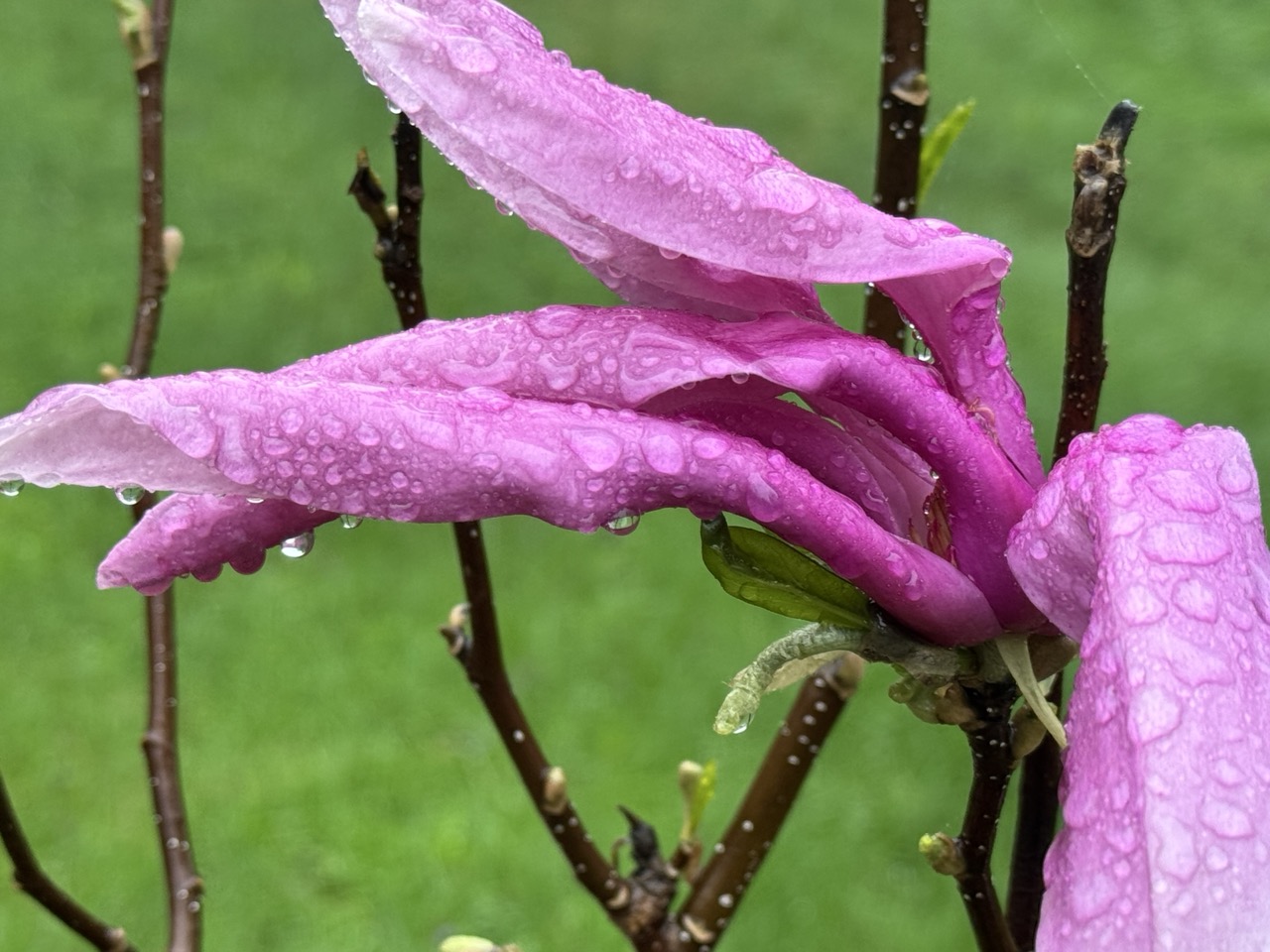
Magnolia blooms struggle in a May 10, 2025 
rain storm in St. Albans, Vermont. The month
proved exceptionally wet and cloudy throughout
the Green Mountain State.
 The May, 2025 Vermont climate numbers are in and they confirm it was an oddly wet, cloudy month at a time of year when spring sunshine normally predominates.  

TONS OF RAIN, AND A LITTLE SNOW

Burlington was in the "driest" part of the state as northwestern Vermont didn't get quite as much rain as the rest of the state. 

Still the 6.11 inches of rain that fell in Burlington still made it the seventh wettest May on record. Precipitation was 2.35 inches above normal. 

Montpelier was deluged with 7.51 inches of rain during May, more than double the normal for the month. It was the same story down in Bennington, which also had more than double the normal rain fall. They received about 7.5 inches of rain in May, compared to the normal of 3,5. St. Johnsbury with 6.86 inches of rain in May, 2025 was three inches above normal.

The wettest place I found  so far - but probably by no means the wettest in Vermont - was Woodstock, in the southeastern part of the state. They had 8.36 inches of rain in May, a full 4.75 inches above normal.

Considering the amount of rain we had, Vermont was lucky we only had one flood event during May, and even that one wasn't terribly widespread. Especially considering the big, destructive ones we've had in recent years.

The flood on May 17, though damaging, only really affected a handful of towns, most notably White River Junction, Hartford, Waitsfield and Warren. And to an extent Bristol.

The May 17 storm was also notable for the amount of sometimes damaging hail that hit some parts of the state  especially southern Chittenden County and parts of the central Vermont.

The lack of flooding I think was partly due to the fact the rain was distributed through the month, instead of falling in just a few days. Burlington had only eight days without rain during the month. Three of those days had more than an inch of rain, but most days brought a half inch or less.

The gradual rains - except for the torrential downpours of May 17 - meant that streams, creeks and rivers in Vermont usually behaved themselves pretty well, despite the constant rain. 

We even had bouts of unseasonable snow, at least in the mountains, especially on May 22 to 24 where most elevations above 3,500 feet were dusted with snow.

That snow helped keep measurable snow on the ground atop Mount Mansfield until yesterday, when it was down to a trace. The graduals decrease in snow cover up there stopped on May 21, as it stopped at a depth of five inches from that date through the 25th.

CLOUDS INFLUENCED TEMPERATURE

It was a very cloudy May with all the rain we had. That influenced temperatures a great deal.

Across Vermont, the average temperature for May, believe it or not, was really close to normal. It seemed colder than that. 

The reason was the clouds. Cloudy skies keep daytimes cooler than they otherwise would be. But those clouds keep nights warmer than they would be if the skies were starlit.

Because of the clouds, the average high temperatures in May, 2025 were much cooler than normal, while nights were much warmer than they should have been. That's unusual because the average high temperature and low temperature usually closely match the overall mean temperatures for the month, if that makes any sense.

Across Vermont, average high temperatures were around two degrees cooler than they should have been for May. But nights were on average about two degrees warmer than you'd expect. So the bottom line was May, 2025 had normal temperatures on paper even though the month was anything but.

Still we did manage to have a couple warm periods. Burlington had five consecutive days in the 80s mid month, and a couple more 80 degrees last week.

LOOKING AHEAD

As always, it's very hard in advance to determine who the upcoming month will shape up. And it's often wrong. In late April, NOAA said May in Vermont would be warmer than  normal, with equal chances of above or below normal precipitation.

So much for that. 

But we'll play the game again anyway. NOAA says that in June, the parts of the nation that stand the greatest chances of hotter than normal weather are in the central Rockies and in New England, including here in Vermont. 

The month is opening today with much, much chillier than normal weather for the opening day of June, which would seem to contradict that prediction. But, a sharp warming trend will bring us to near normal temperatures by Tuesday and warmer than normal weather by Wednesday and Thursday. Overall, the forecasts call for mostly warmer than seasonal temperatures through mid-month, at least, so we'll see. 

As in the forecast just before May started, NOAA is giving Vermont equal chances of above or below normal rainfall in June. So, flip a coin on that one.