Showing posts with label May. Show all posts

Tuesday, June 2, 2026

A Cool, Wet Spring In Vermont Kept Gardens Blooming, Frustrated Warm Weather Fans. With Some Exceptions

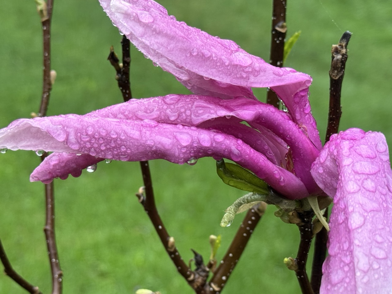
The cool, wet character of May, 2026 made it a great daffodil
growing month. This photo was taken May 10 in St. 
Albans, Vermont.
I didn't finish our May Vermont climate summary yesterday, so my bad. 

The weather forecast this week is straight forward enough. Sunny with a warming trend through the week, with perhaps some showers late in the week. Summer weather is here .


So let's 'get into what we Vermonters went through during the month of May

 The month of May in Vermont that just ended was definitely on the cool side, and in most places, wet, too.

We didn't break any records with temperatures or precipitation, but it was cooler, cloudier and more damp that we've gotten used to in recent Mays.

COOL MAY

In Burlington, the average temperature was 57.1 degrees, or 1.3 degrees below what is now considered average. As I always mention, average isn't what it used to be.  Nowadays, we compare months to the average of a recent 30 year period. Months in the 20th century were cooler than they are now. 

You can see that in the stats. Out of the past 135 years, this May was the 82 coolest, or 53rd warmest. So by historical standards, May was a little on the warm side.  

Most weather stations in Vermont were about the same degree cooler than the modern average as Burlington. Rutland, Montpelier and St. Johnsbury were all around one to two degrees on the cool side. Bennington was 2.3 degrees below normal. 

Nineteen days in Burlington were cooler than  normal, but the cold was never extreme. All of the cool days were less than 10 degrees below normal. The month's chill was offset by a brief heat wave that set temperatures soaring to near record heights on May 18-19. The low temperature in Burlington on the 19th was a muggy 71 degrees, a record for the date.

WET MAY

It was a wet month, with rainfall pretty well distributed throughout the month. We never came close to dealing with any flooding issues.  

Burlington had 4.88 inches of rain, which was a little over an inch above normal. It was the 22nd wettest May out of the past 143 years. (The wettest May was in 2013, with 8.74 inches.)

Most other places in Vermont, with the exception of the far south, had a wetter than average May, too. Montpelier had nearly six inches of rain, which was 2.39 inches above average. St. Johnsbury was given a boost by a super soaker of a rainstorm on the 30th. Their month total worked out to 6.46 inches, which was 2.7 inches above average.

Far southern Vermont was drier. Bennington had 2.56 inches of rain, nearly an inch on the dry side.

LOOKING AHEAD

For what it's worth, NOAA's monthly outlook says odds lean fairly heavily toward a warmer than normal June. There's also a somewhat greater than even chance of a dry June, according to NOAA's predictions.

That matches the forecast for the opening week of June, anyway, which will be warm and dry. 

NOAA got May's prediction basicalliy right. They said the month's temperatures would be near to somewhat below normal, and that's true. They also said there were equal chances of above or below normal precipitation. Since most of the state was wet but the south was dry, I'll give it to them.


Sunday, May 3, 2026

Vermont's Damp, Chilly Start To May Is No Match For Past May New England Nightmares

Only the briefest breaks in the clouds yesterday as 
clouds billowed up to produce showers. 
Highs were only in the low 50s and chilly 
breezes made it worse. We face daily rain
chances tomorrow through next weekend. 
 We've gotten ourselves into a weather pattern share in New England in which clouds predominant and rain is an almost constant threat. 

But if you're slightly depressed about the weather, it can get a lot worse this time of year. More on that in a minute. 

We're only into the third day of May, and it hasn't been all that bad yet. Sure, yesterday was sort of unpleasant, with clouds, chilly breezes and on and off light showers. 

The next couple of days don't look terrible. But rain is coming back, and after a brief warm up, chilly weather and rain will be back. 

DETAILS

Today:

The only day in the near future I see without a rain threat seems to be today.  Morning clouds should dissolve into at least a partly sunny day. Highs should get into the 50s, which is a little cool for this time of year. 

Monday

A weak warm front tomorrow morning might set off a few light showers, mostly north and west. The rest of the day looks pretty good again under partly sunny skies and highs in the seasonable low 60s. Southwest breezes might occasionally help keep the black flies at bay. They're terrible this year! But I guess the black flies are horrendous every spring. 

Tuesday

A warmer and eventually wetter day.  The southwest breezes should continue and highs should rise into the low 70s. We also having a rising chance of showers and thunderstorms in the afternoon. I'm not sure yet whether any of thunderstorms will become strong, but the chances of a lot of severe thunderstorms is looking quite low.

Wednesday 

A slow moving cold front will keep us rainy and much cooler again. Highs should stay in the 50s.  This could change but rainfall totals Tuesday night to Wednesday night look like they might be a decent half inch to an inch. Nothing incredible, but we actually need the rain, so we'll take what we can get. 

Thursday and Beyond

Starting Thursday and continuing for perhaps several days, we're back to annoying weather. We probably won't have much rain Thursday and next weekend. Unless a nor'easter type storm comes closer to Vermont than we now think it will. 

But there will be an ever-present chance of showers, we will probably have a fair amount of clouds and temperatures will definitely be cooler than average for this time of year. 

IT COULD BE WORSE

The unsettled weather pattern has be thinking about past bouts of bad May weather. Just because I like to prove that if you're a little peeved about the weather, it could definitely be worse. 

1917

The coldest May on record. Only two days that month were warmer than 63 degrees. Nowadays, at least, in our climate changed world, normal May highs in Burlington range from 64 degrees on the 1st to 74 degrees on the 31st. 

The coldest it got that month was 32 degrees, which actually isn't that bad for May, but 18 mornings were in the 30s.  On eight days in May, 1917, temperatures in Burlington never got out of the 40s. 

1966

It's a tight battle, but my vote for the worst May on record in the past several decades is 1966. There were  series of bad Mays in the 1960s - cold, frosty, sometime snowy. But 1966 is probably the most miserable. Especially the first half. 

In Burlington, each morning from the May 1 through 15, 1966 were in the 20s and 30s. Eleven of those mornings were below freezing. That includes a low of 24 degrees on May 3, still the coldest temperature on record for May. It was 15 degrees in West Burke, 18 in Bloomfield and Chelsea and 19 in Cavendish, according to the Vermont Weather Book. 

On May 9, Burlington had 3.5 inches of snow, which is still the city's largest May snowstorm on record. Peru, Vermont had 11 inches of snow that day,  Newport had 5.2 inches. 

The second half of May, 1966 was better, with four days actually making it into the low 80s. 

1997

The most depressing May that I can remember clearly was in 1997.  There really weren't any temperature extremes, but we could just not get a warm day.  The temperature never got past 70 degrees until the 28th. May, 1997 is still the 10th coldest on record, 

 I remember the trees not fully leafing out until we got into June that year. Spring, 1997 was especially depressing because April was quite cold, too, 

2013

May, 2013 was actually pretty nice until we got toward the end of the month. Burlington had more than an inch of rain on four consecutive days on May 22-25.  May 21 came close to making it five days with 0.96 inches. I don't think there's any wetter stretch of weather than that on record. A whopping 7.39 inches of rain fell within six days.

The month's total was 8.74 inches, making it the wettest May on record. 

The first part of this wet spell was warm, with torrential thunderstorms. Those storms caused some damaging flash flooding in eastern Chittenden and Lamoille County, Vermont. 

A cold front passed and stalled to the east of Vermont, causing heavy snow in the mountains. Three feet of snow covered the summit of Whiteface Mountain in New York. The summit of Mount Mansfield had 13.2 inches, the latest in the season the mountain has gotten a foot of snow.

Nothing extreme like that is in the forecast for now. I guess we're blessed this May looks like it will just turn out mediocre. 


Wednesday, June 25, 2025

World Had Second Warmest May as #2 Trend Continues; U.S. Had Second Warmest Spring On Record

For the umpteenth time in recent years, the world saw
red in May, 2025, indicating almost every place was
warmer than the 20th century average. It was the
2nd hottest May on record for the globe. 
Most of the climatologists had said that this year would not quite measure up to the worldwide heat of 2024. 

More data that came in this week indicate that so far, at least, that prediction is coming true, but 2025 is pretty damn close to being the hottest as climate change rages on.

The world had is second warmest May on record, according to the National Centers for Environmental Information. That's been the trend the entire year so far. Most months have been second warmest, behind 2024.

It's pretty much a lock that 2025 will be yet another year that scores among the top five warmest the world has had, at least since reliable records began more than a century and a half ago,  Still, experts give 2025 only a 1 percent chance of being THE hottest on record.

We'd need some pretty off the chains heat for the rest of the year to see that.

May's second hottest ranking is concerning, of course. And of course meteorological spring, running from March 1 through May 31, was the world's second hottest on record.

Averaging out through the world, May's temperature was right around 2 degrees Fahrenheit, (1.1 degrees C) warmer than the 20th century average. 

The ten warmest Mays have all happened since 2014. If you are under the age of 49, you've never seem a global May that was even the slightest bit cooler than the 20th century average. 

In May, the hottest spots relative to average were the Arctic, British Isles, parts of the far northeastern Atlantic Ocean,  areas of the western Indian ocean and southwestern Pacific Ocean. 

As usual, relatively chilly spots were hard to find in May.  The coolest areas, relative to normal, were only near or just a little under the 20th century averages. These semi-cool spots including most of India, part of the northern Atlantic Ocean, Iceland, large sections of Greenland, the southeastern Pacific Ocean, parts of central and eastern Europe and eastern Antarctica.

A strange heat wave hit Iceland and Greenland in May. Temperatures reached as high as 80  degrees in Iceland during the May 15-21 heat wave, which is unprecedented for May and a national record high for the month of May.  So was the 58 degree reading at a weather station in Greenland on May 19.  

The heatwave also got Greenland's summer melt season off to an ominously early start. I don't know if the warm spells will keep hitting Greenland for the rest of the summer, but we should hope not.

Meteorological spring for Earth (March 1 to May 31) was also the second warmest on record, after 2024. 

Meanwhile, as I reported recently record and unprecedented heat waves have been hitting many parts of the world this month. We in Vermont got a nice taste of that Monday and Tuesday, didn't we? It's looking like June will be another top tier hot month around the world, too. 

UNITED STATES

May in the United States was overall the 25th warmest out of the past 131 years on the warm side across much of the United States. 

The West Coast and Southeast were warmest relative to average, Florida had its second warmest May on record. The only state that was fairly substantially on the chilly side was Oklahoma, which had its 36th coldest May out of the past 131 years. 

May was the nation's third wettest on record, powered largely by torrential downpours up and down the East Coast and in the Southeast. 

Alabama had its wettest May on record. Maryland, Pennsylvania, Rhode Island and Vermont each had their second wettest May. Every state along the East Coast had one of their top 10 wettest Mays on record except Florida and Maine. And those two states were wetter had average.

The only relatively dry states were along the West Coast, and in Iowa, Minnesota and Wisconsin.

Meteorological spring, March 1 through May 31, was the second warmest on record for United States.


Sunday, June 1, 2025

If You Thought This May In Vermont Was Awfully Wet And Cloudy, Then BINGO!

Magnolia blooms struggle in a May 10, 2025 
rain storm in St. Albans, Vermont. The month
proved exceptionally wet and cloudy throughout
the Green Mountain State.
 The May, 2025 Vermont climate numbers are in and they confirm it was an oddly wet, cloudy month at a time of year when spring sunshine normally predominates.  

TONS OF RAIN, AND A LITTLE SNOW

Burlington was in the "driest" part of the state as northwestern Vermont didn't get quite as much rain as the rest of the state. 

Still the 6.11 inches of rain that fell in Burlington still made it the seventh wettest May on record. Precipitation was 2.35 inches above normal. 

Montpelier was deluged with 7.51 inches of rain during May, more than double the normal for the month. It was the same story down in Bennington, which also had more than double the normal rain fall. They received about 7.5 inches of rain in May, compared to the normal of 3,5. St. Johnsbury with 6.86 inches of rain in May, 2025 was three inches above normal.

The wettest place I found  so far - but probably by no means the wettest in Vermont - was Woodstock, in the southeastern part of the state. They had 8.36 inches of rain in May, a full 4.75 inches above normal.

Considering the amount of rain we had, Vermont was lucky we only had one flood event during May, and even that one wasn't terribly widespread. Especially considering the big, destructive ones we've had in recent years.

The flood on May 17, though damaging, only really affected a handful of towns, most notably White River Junction, Hartford, Waitsfield and Warren. And to an extent Bristol.

The May 17 storm was also notable for the amount of sometimes damaging hail that hit some parts of the state  especially southern Chittenden County and parts of the central Vermont.

The lack of flooding I think was partly due to the fact the rain was distributed through the month, instead of falling in just a few days. Burlington had only eight days without rain during the month. Three of those days had more than an inch of rain, but most days brought a half inch or less.

The gradual rains - except for the torrential downpours of May 17 - meant that streams, creeks and rivers in Vermont usually behaved themselves pretty well, despite the constant rain. 

We even had bouts of unseasonable snow, at least in the mountains, especially on May 22 to 24 where most elevations above 3,500 feet were dusted with snow.

That snow helped keep measurable snow on the ground atop Mount Mansfield until yesterday, when it was down to a trace. The graduals decrease in snow cover up there stopped on May 21, as it stopped at a depth of five inches from that date through the 25th.

CLOUDS INFLUENCED TEMPERATURE

It was a very cloudy May with all the rain we had. That influenced temperatures a great deal.

Across Vermont, the average temperature for May, believe it or not, was really close to normal. It seemed colder than that. 

The reason was the clouds. Cloudy skies keep daytimes cooler than they otherwise would be. But those clouds keep nights warmer than they would be if the skies were starlit.

Because of the clouds, the average high temperatures in May, 2025 were much cooler than normal, while nights were much warmer than they should have been. That's unusual because the average high temperature and low temperature usually closely match the overall mean temperatures for the month, if that makes any sense.

Across Vermont, average high temperatures were around two degrees cooler than they should have been for May. But nights were on average about two degrees warmer than you'd expect. So the bottom line was May, 2025 had normal temperatures on paper even though the month was anything but.

Still we did manage to have a couple warm periods. Burlington had five consecutive days in the 80s mid month, and a couple more 80 degrees last week.

LOOKING AHEAD

As always, it's very hard in advance to determine who the upcoming month will shape up. And it's often wrong. In late April, NOAA said May in Vermont would be warmer than  normal, with equal chances of above or below normal precipitation.

So much for that. 

But we'll play the game again anyway. NOAA says that in June, the parts of the nation that stand the greatest chances of hotter than normal weather are in the central Rockies and in New England, including here in Vermont. 

The month is opening today with much, much chillier than normal weather for the opening day of June, which would seem to contradict that prediction. But, a sharp warming trend will bring us to near normal temperatures by Tuesday and warmer than normal weather by Wednesday and Thursday. Overall, the forecasts call for mostly warmer than seasonal temperatures through mid-month, at least, so we'll see. 

As in the forecast just before May started, NOAA is giving Vermont equal chances of above or below normal rainfall in June. So, flip a coin on that one. 


Wednesday, May 21, 2025

Cold, Damp May Weather In Vermont/New England About To Get Worse

Snow fell atop Mount Manfield, Vermont earlier this week.
An unseasonably cold nor'easter starting tomorrow might
bring even more snow to the Green Mountains summits.
In the valleys, we're in for a long spell of wet, raw, chilly
weather for this time of year.
After last week's summer warmth, the past few days have been a shock. 

Damp, overcast, drizzly and cold. It even snowed a little atop Mount Mansfield earlier this week. 

After sort of, kind of a break today, it's about to get even worse. 

An out of season nor'easter is going to make things even wetter and a little colder than it's been. 

 There probably will even be a little more snow on the mountain summits.  High temperatures Thursday through Saturday throughout most of New England will be near record lows.  

Let's take it day by day.

TODAY:

Today will be the pick of the week, which isn't saying much at all. Highs will be a little warmer than recent days with temperatures poking up to maybe 60 degrees instead of just 50.  That 60 degrees is still about ten degrees chillier than average for this time of year. 

We might even see breaks of sun, but clouds will still predominate. Chances of showers are actually pretty low.

THURSDAY/THURSDAY NIGHT

Here comes the nor'easter. Overall, rainfall will be much heavier in southern Vermont, and in southern New England that in central and northern sections.  If current forecasts hold, more than an inch of rain will fall in far southern Vermont through Saturday morning.  Northern areas should see a third to a half inch. Roughly three quarters of an inch will fall in central Vermont. 

Down in southeastern New England, windswept rain will total one to two inches, maybe even locally three inches. 

The first wave of rain will come in Thursday morning, then wane some in the afternoon. But it will stay cold, with highs near 50 at best. A raw east wind will make it feel even worse. 

The bulk of the rain will come through Thursday night.  It will be a cold night for late May.  Temperatures will only be near 40 as it rains, and those gusty east winds will continue.

Up on the mountain tops, especially in the southern and central Green Mountains, it will probably snow,  The summit of Killington could get a few inches of snow out this, believe it or not.

Snow will be mostly limited to elevations above 3,000 feet but I wouldn't be surprised if a few wet snowflakes get a little lower than that. 

By the way, had this been winter, the storm coming would have been a very nice dump of snow for New England, including much of Vermont.

It seems odd we're getting a nor'easter this time of year. But they can happen at any time. They're just way more common in the late autumn, winter, and early spring. 

FRIDAY/SATURDAY

This particular storm will be in no hurry to leave.  It'll be near southeastern New England Thursday night and only make it as far as the eastern tip of Maine by Saturday morning. 

That will keep the cold, showery conditions going on Friday and Saturday. It won't rain heavily during that time. Just pesky, frequent light showers as daytime temperatures continue to hover near 50 degrees.

I suppose there might be some slight improvement Sunday and Monday as the storm slowly pulls away. At least the clouds might break a little Sunday and temperatures should be a little warmer,

With any luck - and it will take some luck - Memorial Day might actually be reasonable, with just a chance of a few showers, breaks of sun and temperatures up in the 60s to near 70. Unlike the next few days, if that forecast comes to pass on Monday, it will be just slightly cooler than normal.  Not ridiculous. 


Wednesday, June 26, 2024

May Was Yet World's 12th Consecutive Record Hottest Month; June Could Do It Again

Lots of red in the world temperature map for May 
Shades of red represent warmer than average areas
and the darkest red is record warmest in those locations.
 Catching up with climate statistics I had to note that climatologists think June could well be the warmest on record.  

This might be even more surprising than May's global performance as the world's 12th consecutive hottest month.

May beat the previous record set in 2020 by about a third of a degree Fahrenheit. That doesn't sound like much at all, but when you compile all the world's data, that amounts to a huge margin above the previous record level.

El Nino teamed up with climate change to boost global temperature to new heights.  El Nino heats up the eastern Pacific Ocean, and tends to make the world's overall temperature a little warmer. 

El Nino has been crashing fast, to be replaced by La Nina, which tends to cool the world's atmosphere just a little. 

So far, we haven't seen that.  There's usually a lag in which the subtle La Nina cooling begins. Climatologists are starting to tap their feet and check their watches nervously as that hasn't happened yet. 

The scientists for now are still convinced months during the second half of 2024 won't keep breaking monthly records for the world. But there's no question the heat is on forever, even if some months "only" score in the top 10 warmest.

With La Nina in the picture, there's "only" a 50/50 shot at 2024 becoming the world's hottest year on record, besting 2023, according to the National Centers for Environmental Information.

We won't know until we get into July whether the current month ended up breaking the record for hottest June, obviously set just last year.

But we know May solidly broke the world record. Almost nobody on the planet had a cool May. The only pockets of "chill",  at least relative to the heat of recent years. Southern South America, western Russia, a few pockets in Antarctica, a couple areas of Greenland and a small dot in the western United States were a little on the cool side. 

If you are under the age of 48, you've never seen a May in which the overall world temperature was even a teeny, tiny bit cooler than the long term average. 

By the way, as May was the 12th consecutive record hot month, the oceans had their 14th consecutive record hot water month in May. 

With each month through May at record levels, the world as a whole had its warmest January-May stretch on record. 

The United States had its 13th warmest May out of the past 130 years.

Florida had its warmest May on record. Thirteen other states, including Vermont had one of their top 10 warmest Mays in 2024,


Saturday, June 1, 2024

Vermont Experienced One Of Its Warmest Mays On Record. Entire Spring, Too

May, 2024 was great for lilacs in Vermont, though they
came early and didn't stick around for long since it
was such a warm month.
Yep, May, 2024 Vermont climate figures are in, and we've had yet another really warm month. There's been a lot of those lately. 

 Burlington clocked in with its second warmest May on record, with a mean temperature of 63.3 degrees. That's 4.9 degrees above the "new normal." 

 I keep calling it the new normal because average is based on the aggregation of 30 years of data ending in 2020.  

That period was warmer than previous thirty-year intervals because climate change had already begun to take hold in the late 1990s and first two decades of the 2000s

In Burlington the only May in the past 140 years or so that was any warmer than this one came in 2015, which was just 0.3 degrees warmer than this one. 

What is now #3 on the list on warmest Mays isn't even close to being as warm as 2015 and 2024. 

Statewide the figures were pretty consistent, with most stations running somewhere around 4.5 degrees above our "new normal." 

Montpelier reported its eighth warmest May on record and St. Johnsbury had its fifth balmiest May. 

WARM NIGHTS

Following a trend I've seen frequently in the past couple of years, nights were especially warm in May. 

This was another month in which nights in particular were particularly warm, running a full 5.5 degrees above average in Burlington. 

The warmth was consistent. 

The coolest it ever got in Burlington during this May was 44 degrees on May 1. I checked back as far as 1900 - all I had time for, I'm afraid, and the closest Burlington came to such a warm monthly minimum in May came in 1904, when the coolest night reached 42 degrees. With this year included, there have only been four Mays that failed to at least get into the upper 30s if not colder in Burlington. 

All the other weather stations in Vermont had warm May nights this year. Except for Burlington, the chilliest morning of the month came Friday, May 31.  You'd normally expect the coldest readings of May to come near the beginning. Oh well. 

Unlike in most of the rest of the United States, there
wasn't much in the way of severe weather in Vermont
during May. There were some strong to severe
storms in a few Vermont towns on May 21, though.
Photo here is a storm moving into Georgia, Vermont that day.

Frosts and freezes in May are pretty common.  This year, we largely escaped that. 

Since 1900, 89 of the 124  Mays saw temperatures of 32 degrees or cooler, so you can see how odd a month's low of 44 is.  

In Burlington, May, 2024 joined the 90 degree club, as it got that warm on 22nd.  I looked back over 132 years of records in Burlington and found only 23 Mays that had a maximum temperature of 90 degrees or better. 

Probably with the help of climate change, 90 degree weather in May is beginning to get more common. Seven of the 23 Mays with 90 degree weather have happened just in the past quarter century. 

We've had a string of warm months. The last time we had a cooler than "new average" month was in November. 

RAINFALL

As with temperatures, precipitation was pretty consistent across Vermont. It was around an inch or so drier than normal in most places, give or take. The rainfall was on the light side, but it was frequent enough to keep things wet enough for spring blooms. Burlington had 13 days with measurable rainfall in May, all pretty evenly distributed through the month.

Overall, precipitation amounts were sort of in the middle of historical averages. Of the 140 years since records began in Burlington, 77 Mays were wetter than the one we just had and 63 were drier. 

May, 2024, blessedly, was not a month for weather extremes in Vermont, which was a nice break. While  repeatedly rounds of tornadoes, very severe thunderstorms, derechos, giant hail and flooding afflicted huge sections of the United States, we pretty much sat all that out. 

The only severe weather of note was in eastern Franklin County on May 21, when a severe storm threw down trees and power lines and tossed down a bunch of hailstones. 

The one other big event in the skies over Vermont during May wasn't exactly meteorological. Much of the nation - including Vermont - enjoyed a spectacular display of northern lights on May 10.  Leading up to the event, skies had been expected to remain mostly cloudy, so we'd miss out on the display.

But skies largely cleared, especially in the northern half of Vermont, leading to quite a show.  This was the second time this spring we lucked out with weather for a big celestial event. Skies over northern Vermont also remained mostly clear for the total eclipse of the sun back on April 8.

NEAR RECORD WARM SPRING

Meteorological spring runs from March 1 through May 31. In Burlington, it turned out to be tied with 1903 as the second warmest spring on record, with a mean temperature for the three months of 49.3.  The only spring that was warmer was 2012, with an average temperature of 50.3 degrees.

We've had a string of very warm springs. 2021 and 2023 are also in the top ten list of warmest springs, at least as measured in Burlington. 

Saturday, July 22, 2023

Another Disaster Declaration In Vermont: This Is A Cold One

Ash tree leaves in Huntington, Vermont killed by a May 18 freeze
All of Vermont was declared a disaster area on Friday. 

No, not that one. We're talking about the mid-May freeze that wrecked a lot of the state's agriculture way before the first drops of flooding rains fell at the beginning of this month. 

As WPTZ-TV reports, the disaster declaration from the U.S. Secretary of Agriculture means eligible farmers can be considered for Farm Service Agency emergency loans to help them bounce back from the deep freeze that damaged a variety of crops on the night May 17-18.

"This declaration is important as our farmers try to recover after the May freeze,'" said Vermont Agriculture Secretary Anson Tebbetts in a statement. "This designation will offer more resources to those that were hit hard by this weather event."

Farmers have eight months to apply for the emergency loans.  

Gov. Phil Scott is also seeking an agricultural disaster designation for this month's extensive flooding.

Under a separate Federal Emergency Management Agency umbrella, Caledonia, Chittenden, Lamoille, Rutland, Orange, Washington, Windham and Windsor counties have all been declared disaster areas due to this month's flooding. .  More counties might be added to that disaster list. 

Thursday, June 22, 2023

Global Temperature Checkup: May Was World's Third Hottest

Lots of red again. Most of the world was warmer than
average in May.  Ranked as third hottest on record.
 As we do every month, let's check in with NOAA's Centers for Environmental Information to see how the previous months climate did across the globe.  

As always, the news is lousy.  May, 2023 was the world's third hottest month, at least during the past 174 years of records. 

The first five months of 2023 combined were the fourth warmest overall.  This pretty much already guarantees that this year will once again be among the top ten warmest on record. 

Climate change continues apace. 

I say this every single month when I do this update, but it's worth saying again, just because it's so dramatic. If you're under the age of 47, you have never seen a month on Earth that was cooler than the long term average.

The world's oceans, along with both North and South America, had their hottest May on record. The Earth's southern hemisphere was why the world as a whole "only" had its third hottest May.  That southern hemisphere logged just its 23rd warmest May out of the past 174 of 'em. 

The hottest areas of the world, at least compared to historical averages, was virtually all of Canada (no wonder they have so many wildfires!); much the northern tier of the United States;  southwestern and northeastern Europe and most of South America. 

The few relatively chilly areas included a large chunk of India, parts of southern China, central Australia and substantial parts of Antarctica.

Looking at just the United States, we had the 11th warmest May out of the last 129 years. The northwestern quarter of the nation was very warm. Washington had its warmest year on record and seven other states in the northwest/Northern Rockies had one of their top ten warmest. 

The Southeast was cool, with South Carolina reporting its 10th coldest May on record. 

I remember being struck an odd temperature pattern in Vermont for May, which featured warm days and chilly nights. The NCEI data back me up.  The Green Mountain State had its 18th coldest average minimum temperatures for May, but somewhat warmer than normal highs, ranking 54th out of 129 years. 

 As of May 31, the United States was up to nine weather disasters each costing at least $1 billion. These do not include the near-constant storms in the southern United States so far this June. These disasters cost 99 lives and have caused at least $23 billion in damage.

June data will be available in mid-July or so. Not sure if the United States will be warmer than average, but I do know the world as a whole will be on the hot side.  A series of epic heat waves have already hit large swaths of Asia, Canada and Central America, to name just a few hot places so far this month. 

Friday, June 2, 2023

May Weather In Vermont Was Simultaneously Gorgeous, Smoky, Disastrous And Very Weird

The intense May 18 freeze killed this set of leaves on a 
tree in Huntington, Vermont. The freeze also caused 
extensive damage to fruit crops throughout Vermont,
and defoliated numerous trees. 
I didn't get a chance to do my monthly climate summary for May yesterday, so I'll give a shot today. 

What a weird month! 

Most people who aren't extreme weather geeks are probably thinking what a gorgeous weather month May, 2023 was. And they're right! I would rate more than half the days during the month as clear or mostly sunny,

Temperatures on most days were comfortable, with low humidity and a nice breeze.  On paper, too, it was nice. The average temperature for the month was not that far from what is currently considered average.

But we saw some glaring nuances that made the month really kooky. 

FREEZE

The most obvious example is that killer freeze we had on May 18. Temperatures in most of Vermont that morning were between 18 and 28 degrees. Plants had blossomed prematurely amid what had been a very warm spring. 

Just six hours after those cold temperatures, it was back to sunny and pleasant. But that one frigid, record cold night caused an agricultural disaster in Vermont and surrounding states. Apple orchards, vineyards, blueberries, strawberries and other crops suffered severe damage. Some trees had their leaves frozen off, and those oaks, ashes, locusts and sumac are yet to recover. 

Although there has been no official declaration yet, I'm pretty sure at least some counties in Vermont will be declared a disaster area due to the extensive crop damage. 

SMOKE

Wildfire smoke from Canada mostly obscured the evening
sun over St. Albans, Vermont on May 8.
Then there was the the smoke.  Most of Canada was very oddly warm and dry during May. Large wildfires broke out in Alberta and British Columbia early in the month. By late month, those wildfires had spread to Ontario, Quebec, New Brunswick and especially Nova Scotia.

Since over the air over Vermont most of the time during May had come from Canada, smoke was almost a constant presence in the atmosphere. Most of the smoke was aloft, so it didn't cause much in the way of health problems for us. 

But it did haze over the skies, and sometimes the mountains. By my count, no fewer than 14 days featured some haze in the sky because of that smoke. 

RAIN PROBLEMS

Some nice, soaking rains arrived in late April and the first three days of May, which seemed to set us up for a nice drought-free early summer for a change. 

Not so fast. 

The rain shut off on May 4 and never really came back. Burlington's rainfall total for the month was just under two inches, which was about 1.8 inches below normal, and bad enough. But only 0.64 inches fell after May 3, a time period which should have seen a good three inches of rain.  That explains why your garden was so dusty by Memorial Day. 

Most other places in Vermont were about two inches shy of normal during May. 

Average temperatures for the month had an interesting slant, too. The trend this year so far has generally been nights being much warmer compared to average, while daytime highs weren't as far above normal.

By the end of May, we really had to irrigate gardens as
very dry weather had taken hold, starting around May 4. 
May had the opposite setup.  The past month had a bigger range between high temperatures and daily lows. Pretty much every reporting station in Vermont had somewhat warmer than average high temperatures but decidedly cooler than normal overnight lows. 

Rutland was especially notable in this regard. Nights in May averaged 4.6 degrees cooler than normal. And 18 nights during May in Rutland got below 40 degrees, with seven of those nights getting to or below freezing.  

Officially, the overall average May temperature in Burlington was 57.6 degrees.  That is 0.8 degrees cooler than what is now regarded as the normal average temperature for the month. But that's based on the average of the 30 years ending in 2020.

Because of climate change, that period is definitely warmer than the historical 20th century average.

If you compare how May, 2023 did with what the average was in say, around 1980, the just ended month was really 2.5 degrees above what was considered normal back in the 20th century. 

Which means we're still on a streak that began on February, 2022 in which every month since then has been warmer than the 20th century Burlington average. Even if a few of those months were slightly cooler than the new, warmer "normal" they're using now. 

Who knows, maybe June will break that streak.  The first two days of June have seen record heat in Vermont, but long range forecasts suggest we could be cooler than average for the next two weeks.

That's not a guarantee of course, but it's something to watch. 

Sunday, May 14, 2023

Another Big Round Of U.S. Tornadoes, But This One Was Typical For May

People try to recover items from destroyed homes after
a deadly tornado in Laguna Heights Texas on Saturday.
Photo by Julio Cortez/AP.
 There were LOTS of tornadoes in the United States over the past several days. But unlike some big outbreaks earlier this year, the spate of twisters this past week was mostly typical for the United States this time of year. 

NOAA's Storm Prediction Center has a preliminary count of 108 twisters, mostly in the Plains and western Midwest between Wednesday and Saturday.  While many of the tornadoes caused a lot of damage, we don't have any reports of fatalities in the main tornado zone.

However, there was one strong tornado along the extreme southern Texas Gulf Coast early Saturday that unfortunately killed one person, injured 10 and caused extensive damage to the little town of Laguna Heights, Texas. 

A tornado watch in Iowa prompted former President Trump to cancel a rally in Des Moines. Although this will make people mad, I can't resist asking why Trump didn't simply use a Sharpie to move the tornado threat to another location so he could have his little festival. 

On average, the United States sees an average of about 275 tornadoes each May. That makes May the busiest tornado month of the year for the United States. 

It's hard to say if this May will end up turning out busier or lighter than average in terms of tornadoes. An odd for May weather pattern features a record breaking heat wave in the Pacific Northwest and southwestern Canada.

April this year was also light on tornadoes, with 109 preliminary reports as opposed to a monthly average of about 190. However, tornadoes, some quite deadly, were much more frequent than average in January through March.

So far this year, we've seen at least 64 deaths from tornadoes in the United States. That's definitely above average for the date, but thankfully not the worst it's ever been. Fingers crossed it stays that way. 

That will introduce a rather dry northwest flow over much of tornado country.  That type of weather pattern sure really suppress the severe weather threat for the next week or so. There still could be a handful of tornadoes during that time. After all, it is May. But won't' be any big outbreaks for awhile. 

 However, we don't know whether the final week or so of May will become busy again.  Some long range forecasts suggest the weather pattern in the final week of the month might be pretty favorable for tornadoes, we'll have to wait and see.

Here in Vermont, we know tornadoes are rare, but we do receive severe thunderstorms from time to time. Severe weather season in Vermont starts about now, and peaks roughly from mid-June to early August.

The same weather pattern that is suppressing national tornadoes for the upcoming week will prevent severe thunderstorms in Vermont for the time being. Sure, we might get some showers Tuesday and next weekend, but nothing scary. 


Thursday, May 11, 2023

How Dry I Suddenly Am: Rain Really Shuts Down In Vermont

Yet another clear morning in St. Albans, Vermont today.
Aside from a scattering of showers and local 
thunderstorms over the next couple of days. mostly dry
weather should continue for another week at least.
 We've been realty whiplashing between almost two dry too nearly too wet to too dry again this spring here in Vermont.  

I was getting vaguely concerned in April during a long stretch of unseasonably warm, dry days. That was followed by a couple weeks of wet weather that moistened everything up nicely.

Then the rain shut off again, and it's going to stay largely off for quite awhile yet. For many of us, today will be the seventh day in a row without rain, though a few lucky spots might squeeze out a little later this afternoon.

Still, we'll soon be getting to the point where we'll need a good soaking.   Other that scattered showers, on a couples days here and there, nothing is in the offing through most of next week. 

The culprit is that building western ridge, or heat dome that is going to cause a record breaking early season heat wave over southwestern Canada and the Pacific Northwest of the United States.

This heat dome is getting huge, and creating a corresponding northwesterly flow through central Canada and into the northeastern U.S.

Cold fronts and little disturbances will ride this northwesterly flow and cross over us from time to time over the next week.  These could spit out scattered showers and thunderstorms when they pass through. 

But systems coming down from the  northwest tend to be moisture-starved, so rainfall with them tends to be unimpressive. Plus, they'll zip through quickly, so they won't linger and bring us long soakers.

Oh, sure, a few lucky people will manage a downpour if a stray thunderstorm in this regime happens to hit squarely where they live.  But most of us will get sprinkles and splatters and not much more. 

 It's hard to say when the pattern will break down to provide us with rainier weather. Some extended forecasts make us wetter during the final week of May, but long range forecasts aren't all that reliable.

This is no crisis yet. We're not in any kind of drought. It could be worse. In May, 1903, for instance, there was no measurable precipitation for the whole month, That probably withered a few spring blooms that year. 

Besides, the weather is pleasant. The dry weather is presenting plenty of opportunities to enjoy spring.  . 

Today and tomorrow will actually be quite warm - near 80 degrees. The warmer air will interact with a couple of those disturbances I talked about to trigger some scattered showers and storms. Especially on Friday. 

Then, it's back to dry and sunny over the weekend. 

The haze aloft from those fires in Alberta will also linger off and on through the upcoming week. Batches of smoke will ride that northwest air flow and pass over the Northeast,

Wednesday, June 1, 2022

A Hot, Dry May And Warm Spring In Vermont Ends With A Cool, Wet Start To June

Some convection fires up near Burlington on May 14
after a record hot day.  May tied for the fourth hottest
on record in Burlington. 
UPDATE:

I found some other interesting climatology out of Burlington for this spring.

Turns out spring, 2022 was the fifth warmest on record in Burlington, with a mean temperature of 47.7 degrees  This takes into account meteorological spring, which runs from March 1 through May 31.

We've had back to back toasty springs. In 2021, spring was the seventh warmest.

As noted below, data for Burlington goes back to the 1880s. In keeping with climate change trends, four of the top 10 warmest springs in Burlington have happened since 2010.

The last time we had a spring that was among the top 10 coldest was in 1972. 

PREVIOUS DISCUSSION

 It's cool and cloudy in Vermont this morning, as a few showers and thunderstorms race southeastward across the Green Mountain State. 

This state of affairs will continue today, as the disturbances race along yesterday's wrong way cold front, not stalled just to out south and west. 

Pretty much all of us will get wet today, with probably the heaviest rain I'm guessing to be along and south and west of Interstate 89.   It'll only get into the 60s today, which is definitely chillier than normal.

I guess Ma Nature needs a break from May, which was very warm and dry across Vermont. 

Burlington ended up tying the record for the fourth hottest May, with a mean temperature of 62.2 degrees. In keeping with the climate change trend, four of the top 10 hottest Mays in Burlington have occurred since 2012.  Records go back to the 1880s. 

In Burlington, ten days reached to 80 degrees or more, which is impressive.  Burlington had three record highs in a row on May 12-14, the first time there were three consecutive record highs since September, 2017

Although Burlington did not reach 90 degrees during May, we came close. Plus, Montpelier, St. Johnsbury and Bennington, along with other Vermont communities, did reach 90 degrees during the month. 

Everybody in Vermont was at least three degrees warmer than normal in May. Remember, this is the warmer "new" normal that started last year.  This new normal takes into account the average of the years 1990 to 2020, which were warmer than previous periods. 

Rainfall was unfortunately on the light side, except around Rutland, which was bullseyed by intense thunderstorms at mid month. Most towns in Vermont were nearly an inch on the light side. 

Partly because of the unusual warmth in May, scattered severe thunderstorms made appearances, especially at mid-month and in scattered fashion on May 21. 

Despite a relative lack of rain in May, Vermont is not under any kind of drought or real drought risk as U.S. Drought Monitor maps indicate.

You never know what the new month will ultimately bring to Vermont, but signs are fairly encouraging. We have several chances of rain over the next week, starting with today. Long range forecasts into mid June call for near average temperatures and somewhat wetter than average conditions in Vermont.

Tuesday, May 3, 2022

Could We Be Nearing The First Burst Of Summer Weather In Vermont?

Forecast weather map for next Tuesday shows
strong high pressure stalled in New England and
southeastern Canada, stalled low pressure near
Bermuda and storminess stuck in the middle of
the nation. It's a classic May weather pattern
that could bring summer-like conditions to 
Vermont during the second half of next week.
 An interesting weather pattern is looking like it wants to develop. 

If all goes just right, we could be in for our first real summer-like weather of the year.  If things go really off the rails with this set up, we could even see near record high temperatures in a little over a week.  

It's way too soon to tell if that will come to pass. But it's a classic May weather pattern that I've seen in hot Mays like 1975 and 1977, so you never know.

Here's how it will play out: The last good soaking rain will hit tonight before a pretty long dry spell sets in. This will be due to a weakening storm moving through. It's the same one that produced a few tornadoes in Oklahoma yesterday.

Though the storm will be weakening, it's got decent moisture and lift with it, which is why we'll be on the receiving end of these moderate rains.  Definitely no severe weather with this, though. 

Most of us will receive more than a  half inch of rain by noon tomorrow. It doesn't seem like it now, but we'll need the rain, since it looks like we will have very little or no precipitation for more than a week after that. 

Next, the weather pattern gets blocked up again. Everything gets stuck.  Like I said, it will evolve into a pattern that from my experience is unique to this time of year.  It happens every once in awhile in May, but I don't see it often at other times of the year

High pressure will nose down from Hudson Bay after that rainstorm passes by later Wednesday. It will be cool at first, Thursday through Saturday as, after all, the air is coming from Canada.

This high will deflect a storm that is expected to cause severe weather in the Midwest tomorrow off the southern New England coast, keeping us dry. 

Then everything  really stalls out. No more normal west to east flow of weather systems for awhile. The storm that  will have gone off the Mid-Atlantic coast will sit and spin near Bermuda or drift slowly southwestward toward the Bahamas for nearly a week, sending coolish air, for the season, into the southern and Middle Atlantic Coast. 

Meanwhile, that high pressure will drift around southeastern Canada and northern New England. The days are long now, so day by day, the strong May sun will heat the air in that high pressure system, so by Monday, we'll start seeing some highs in the 70s.

This high pressure might pull a little further east to off the southeastern Canadian coast later next week, opening the door for some very warm air to enter the picture from the southwest. Meanwhile, since the sun will be out day to day with no fresh cold fronts to rout the air, the sunshine will keep the airmass warming up over  us as well.

This stalled high pressure system will deflect storms coming into the middle of the country northward, toward the Great Lakes. This pattern could keep severe weather going in the middle of the nation for several days. 

Eventually this will all break down and we'll probably return to somewhat cooler, wetter weather.  Long range forecasts are tricky, so we don't know how warm it will get during the peak of this balmy spell, or exactly when it will end. I'm thinking it will get at least past 80 degrees during the second half of next week.

There's even a low, but not zero chance of the first 90 degree reading of the season, though I certainly wouldn't count on that. 

In any event, it is looking like the middle and last part of next week will be pretty toasty, so stay tuned! 


Friday, June 11, 2021

One Type Of Drought To Love: A Lack Of Intense U.S. Tornadoes Lately

Tornado damage, minor, relatively speaking, in Tupelo,
Mississippi on May 3. There were no recorded violent 
tornadoes in May, 2021 AP photo by Thomas Graning
 It's been a busy year for weather disasters in the United States so far.

We've had crippling winter storms in February, frequent, extensive bouts of flooding in the South since March, big hail storms in Texas and elsewhere, and widespread drought in the West.  

One type of disaster that's been thankfully lacking this year, though, is violent tornadoes. 

May is usually the worst month for tornadoes in the United States.  This year, for the first time since accurate records on these things started in 1950, there were no tornadoes of EF-3 strength or worse.  EF-3 tornadoes have winds of 136 to 165 mph. 

Tornadoes are rated on six-point scale from EF0- to EF-5, with the fives being the worst. The great majority of tornadoes in the U.S. are weaker EF-2 or less. These weaker ones have winds of 65 to 135 mph. 

The ones that tend to grab headlines are the EF-3s to EF-5s, which, if they hit a populated area, cause terrible destruction.

Most years, there's at least a few scattered EF-3s, 4s, or even 5s somewhere in the United States. Unless re-analysis proves otherwise, this will be the first May on record without anything so destructive 

There was actually about an average number of tornadoes across the United States in May.  We have 289 reports of tornadoes, says NOAA's Storm Prediction Center.  The average is around 272, so close

Even the relatively strong EF-2 tornados were lacking in May. So far, there were only eight such twisters confirmed during the month. That's the fifth fewest on record for May, says the SPC.  That means almost all U.S. tornadoes in May were pretty weak, and didn't cause all that much damage.

Here's an even better piece of good tornado news: For the first time since 2014, there were no tornado deaths in the United States for the month of May. 

We also broke another, very welcome tornado record. As of yesterday, it's been eight years and 21 days since the last time an EF-5 tornado hit the United States.  That's the longest we've gone without the strongest tornadoes we can get.

EF-5s are the real monsters of the tornado world, being the strongest they can get. They produce winds of over 200 mph. In these strongest tornadoes, entire homes are swept off their foundations and swept away.  Cars and car-sized debris are blown 100 yards or more through the air. Bark is removed from trees and pavement can be sucked off roadways and parking lots. 

You wouldn't want to be caught in one of these. 

Luckily, with this new record means that nobody has been caught in an EF-5 tornado since May 20, 2013, when an EF-5 swept through Moore, Oklahoma. That tornado killed 24 people and caused at least $2 billion in damage.

There's not a clear reason why the United States has not endured an EF-5 tornado since Moore.  One good theory, writes Bob Henson in Yale Climate Connections,  is that there actually been one or more EF-5 tornadoes since 2013. We just don't know it. 

The strength of tornadoes are determined in post-storm analyses. Meteorologists look at damage to buildings, trees, and other items, and figure out from the damage how strong the tornado was.

But if an EF-5 tornado lumbers through the wide open Great Plains without hitting anybody's house or property, it won't be designated as such because there's no damage assessment to be done.

It could be just dumb luck that EF-5 tornadoes in recent years detoured around towns and farms and patches of woods in the otherwise grassy prairies. 

Tornadoes attract zillions of storm chasers, and some of these chasers bring radar equipment. Their radar has detected likely winds of 200 mph or more in some twisters in remote areas since 2013, so the idea that there are uncounted EF-5s is pretty valid. 

There's no telling when the drought of strong tornadoes will end, but it could end on a dime. 

We've had a similar experience with hurricanes, notes Henson in Yale Climate Connections. No strong hurricanes hit the U.S. from October, 2005 until August, 2017, the longest period we've had without such big storms.

Then Category 4 Hurricane Harvey hit Texas in August 17, and since then the U.S. has been hit by five major hurricanes. 

With that in mind, it's probably just a matter of time before the United States deals with another tornado tragedy like that in 2013 Moore, Oklahoma.

Tuesday, June 1, 2021

Vermont May: Dry Again; First Half Well Behaved, Second Half, Not So Much

May was a dry month, but at least there was enough rain,
and some irrigation, to keep the seasonal flowers blooming
 We've closed the book on May's weather in Vermont, and we endured another dry month.

Except in southeastern Vermont, where precipitation was pretty close to normal, rainfall ran two inches or so on the light side. 

So, we keep dealing with what could be some dangerously dry conditions heading into the summer. Just since January 1, we're more than 3.5 inches on the dry side for the year in northwestern Vermont.  

To give a sense of how dry it is, I dug down more than a foot to plant a sapling near my house in St. Albans, Vermont the other day. It was pretty much dust at least a foot down into the ground. 

I expect some wells to go dry in Vermont this summer. 

Temperatures were almost uniformly about half a degree above normal this month, which basically means pretty close to average.

Remember, though, this is the "new normal." Starting in May, the "normal" temperature for any give month is the average from all the months from 1990 to 2020. Due to climate change, normal ain't what it used to be. It's higher. 

For instance, in this past month, the average temperature in Burlington was 58.9 degrees. Under the "new" normal, that works out to 0.5 degrees warmer than the new average.

Had we been operating under the "old" normal, this May would have been 2.6 degrees warmer than average, which was the mean for 1980-2010 under the old way of calculating. 

The first half of May, 2021 was pretty well behaved. Temperatures during that period never strayed too far from average, and we never came close to any records. We even had the only soaking rain of the month, on May 4-5, when most of us got close to an inch of precipitation. 

The second half of the month definitely went more rogue. Record-heat enveloped Vermont on May 2021, with Burlington peaking at 92 degrees on the 20th, and most other valley locations getting to, or at least close to 90 degrees. 

That was followed by a round of severe storms on May 26, which caused quite a lot of tree and power line damage, especially in a broad path from Addison County into the Northeast Kingdom.

Then, last weekend, late season snows hit the upper elevations of the southern Green Mountains. 

It looks like heading into June, we have new extremes in the offing. After some pretty seasonable weather and a welcome threat of showers on Thursday, it looks like another early season heat wave is building. It looks like a long one, with 90 degree temperatures starting to pop up by Sunday in Vermont and continuing well into next week. 

If  you haven't already, now is a good time to drag your air conditioner out of storage and get it ready for use.

Time will tell if this expected heat wave is a harbinger of another hot summer. Last summer in Burlington, Vermont was the hottest on record, with a mean temperature of 72.3 degrees for the period from June 1 through August 31. 

Hot summers have become a bit of a trend. In Burlington four of the five hottest summers have happened since 2005. Three of those top five hot summers have been since 2016. 

Very cool summers might be a thing of the past. The last time Burlington had a summer that made the top 10 coolest list was way back in 1968.


Friday, May 21, 2021

Record Heat In Vermont Yesterday As May Hot Spells Become More Common

Record heat and very dry air helped these late season 
daffodils to finally give up the ghost in the past couple of
days in my St. Albans, Vermont gardens. Don't worry,
pretty much everything else is thriving, with a little
help from irrigation
The temperature soared, somewhat unexpectedly, all the way up to 92 degrees in Burlington, Vermont on Thursday breaking the high temperature record for the date of 91, set in 1975.

It was also the first 90 degree reading of the season, definitely hitting earlier than average.  There's a decent shot Burlington could hit 90 degrees again today. 

Temperatures in this hot zone were once quite rare in May.   There was some 90-degree May heat in 1911, and a spate of more days like that in 1975, 1977 and 1979.

There were a couple more May days in the 90s in the 1980s and 1990s. But lately, such weather has gotten a lot more common in May. 

Including yesterday, it's been in the 90s during May in Burlington six times just since 2010.  In 2017, we tied the record for the hottest May temperature of 93 degrees. Then, just last year, that monthly record in Burlington was broken with a high of 95 degrees. 

Could be yet another sign of climate change, huh?

Here in New England, most hot spells are accompanied by relatively high humidity, making the heat seem more unbearable. 

Yesterday's heat was bone dry.  The relative humidity was in the upper teens to low 20s, basically making the day feel like springtime in Phoenix.  Because of the dry air, I was able to work aggressively outdoors in the gardens without wilting - as long as I stayed in the shade. Too bad it was my garden plants wilting in the bone dry heat. 

Needless to say, the heat and arid air made the dry woodlands and fields of Vermont even more parched.  The forest fire danger was already high when we started yesterday, so it's probably even worse now. 

Today's very warm conditions will also be accompanied by low humidity. Like yesterday, there just might be one or two isolated thunderstorms in the mountains. Yeah, just what we need. Dry lightning to risk new fire starts.

There's a somewhat better chance of hit and miss showers or storms Saturday afternoon, but they won't amount to much. Temperatures will also be slightly lower, and humidity will creep up just a bit. 

A strong cold front is forecast to push through on Sunday, accompanied by a band of showers and storms. Again, these won't produce blockbuster amounts of needed rain. But we'll take anything we can get. 

Depending on the timing of the cold front and how much sunshine we can get before it passes through, there's a chance a few storms could be locally severe, with strong winds the main risk. At this point, the chances of severe weather is fairly low. 

The heat will get squashed to the south, at least temporarily, as we in Vermont have a delightful day on Monday, with much cooler temperatures, sunshine and low humidity. 

The Southeast will then suffer under a heat wave well into next week as that ridge of hot high pressure holds firm in that neck of the woods. 

The hot weather will make another run at us next Tuesday and Wednesday, though it's unclear how hot it will get. Still, 80s are a good bet. Another sharp cold front will come through Wednesday or Thursday to bring back the normal, cooler spring weather. Unfortunately, rainfall next week at this point looks unimpressive.

If Thursday's heat was a bit much for you, it was still better than the opposite kind of weather in the western states. Parts of Montana were hit with a late season snowstorm Thursday. 

It's common for the mountain summits there to have snow in May, but this snow extended into the valleys, smushing green trees and shrubs under several inches of snow in some towns. Cut Bank, Montana, which already has a reputation for dreadful weather, was down in the mid-20s Thursday afternoon during a day-long snowstorm. 

It's been super dry in Montana, so they needed the moisture, but come on, snow?  Another wet storm is due there over the weekend and early next week, but that one will be mostly rain. 

We'd love for those wet storms out there to head to Vermont, where the precipitation is desperately needed. We'll skip the snow, though, thanks. 


Wednesday, May 12, 2021

Frost Advisory In Vermont As We Get Clipped A Bit By Large Cold Spell

My lilacs in St. Albans, Vermont starting to make an 
attempt at blooming, despite some damage from a 
hard freeze in late April. A frost advisory is up
for much of Vermont tonight, but won't be intense
enough to cause further damage to lilacs.
However, sensitive plants should be covered up
or brought indoors this evening
 A heads up for gardeners and such in Vermont and surrounding areas:

There's a frost advisory up for most of the state tonight. 

This won't be a hard, killing freeze by any stretch of the imagination, though the usual cold spots will probably get below freezing.  

Areas near Lake Champlain are not covered by tonight's frost advisory, because current forecasts have temperatures staying warm enough to avoid frosts there. We hope. 

Temperatures elsewhere in Vermont will be marginal, and frost could easily form as skies clear overnight and winds slacken off. If you already planted tomatoes or other really sensitive stuff in your garden, a dope slap to you!

It's too early. You should have waited. Cover them up if you have them out there. For those who are hardening off their sensitive plants, bring them indoors this evening, just in case. Large scale crops, like apples, should be fine as the cold will not be intense enough to cause problems with blooms or anything like that. 

After tonight, you should be fine for awhile as it looks like a bit of a warming trend will set in.

The risk of frost in mid-May around Vermont as you might well know, is pretty common. It's rare not to have a night or two with a frost risk this time of year .

It's been as low as 25 degrees in "tropical" Burlington as late as May 31 and frosts away from Lake Champlain sometimes happen in early June. 

This cool weather is part of a large cold snap that affected much of the northern tier of the nation.  It snowed in northern Pennsylvania Sunday, and Colorado got a late season snowfall yesterday. 

Frost advisories and local freeze warnings covered areas extending from Nebraska to Maine.  Just like in Vermont, all these areas are expected to warm up over the next few days, minimizing the risk of frosts heading into the weekend. 

Freezing levels were low enough in the atmosphere yesterday so that some of the showers that developed in Vermont Tuesday contained pea sized hail. I got pelted briefly by such hail while working in a South Burlington garden, and there were at least a dozen reports of the hail elsewhere in Vermont. 

All the hail was brief and the hailstones were all much too small to cause any damage. 

Saturday, May 1, 2021

April Summary: A Little Bit Of Everything, But Needed Moisture; May Starts A Bit Off Too

A bit of a dusting of snow on some garden plants in 
St. Albans, Vermont this morning to greet the 
month of May. 
 As expected some places in Vermont woke up to a little snow on the ground this morning to meet the month of May. 

It wasn't quite as extensive as I feared. There was no snow on the ground at dawn today in Burlington, but they did have a few snow flurries. 

Here in St. Albans, nothing on the ground, at least when I first woke up. A snow shower shortly after 6 a.m. deposited a dusting of snow, though that quickly melted. 

They had to close Route 108 through Smuggler's Notch again this morning due to snow.  There was a report of 1.5 inches of new snow this morning from Shrewsbury, Vermont. 

A traffic cam at high elevation Route 17 in Buel's Gore early this morning showed a good one to two inches of new snow on the ground.  In southern Vermont, an area along Route 9 in Searsburg showed about an inch of snow.

Route 302 Topsham, Route 4 near the top of Mendon Mountain, Interstate 91 in Sheffield, among others, showed dustings of May snow as well. 

The odd antics of the first morning of May continue the topsy-turvy weather we dealt with in April.  It was dry, it was wet, it was wintry, it was summer-like. We really had a bit of everything, except tornadoes. We go through that back in March. 

If you average April all out, it was somewhat warmer than normal, and - Glory Be! - somewhat on the wet side.  Drought lingered, though starting on the 15th, welcome rains began to arrive. 

The month of April opened with lots of sunny, dry weather,
prompting more early flower blooms than usual. 

The first two weeks of the month put us on a pace that would have brought us one of Vermont's warmest and driest Aprils on record.  Temperatures by the 14th were running more than eight degrees warmer than average.  The maple sugaring season ended abruptly, and much sooner than we'd expect as result.

Only about a quarter inch of precipitation had fallen on Burlington through April 14, against an average about 1.4 inches for those two weeks.

The dry conditions by April 14 were getting scary.   Early season Vermont gardens were dust bowls. Wildfire concerns were rising. With precipitation deficits piling up since last spring, ,the Green Mountain State was looking at the risk of a severe summer drought in 2021.

Then the weather pattern changed. It turned a bit cooler, and much wetter.  The rainfall wasn't all that extreme, but at least we were getting something.  The drought is by no means over, but at least we gained a little ground, especially with soaking rains on the final three days of the month.

Overall, rainfall in Vermont during April was around an inch above normal, thanks to the late month soakers.  

This being Vermont, there had to be a priced paid for this moisture.  And there was.  It seems like every storm that came along just HAD to bring snow along with the rain.  In the end, the snow didn't cause all that much damage, but it was disheartening. 

We had snowfalls on April 1, April 16, and April 21-22, along with at least some snow showers on April 26 and of course, this morning, May 1. 

The April 16 and 21 snows were especially impressive, given the time of year. The April 16 storm dumped as 10 to 11 inches of snow on towns like Winhall, Ludlow, Shrewsbury, Bridgewater and Mount Holly.  

A daffodil in St. Albans, Vermont collapses and freezes
amid several inches of snow, subfreezing air and strong
northwest winds April 22.  This flower death was an
an exception. About 80 percent of the daffodils and
other flowers that were blooming before the snow 
and freeze recovered once temperatures warmed up. 

The April 21-22 was a bit of a surprise with eight inches in some towns, and three to five inches all the way down into the Champlain Valley.  Heavy snow squalls on April 22 rivaled the worst ones we get in the middle of the winter, and cold winds held temperatures below freezing in some areas most of the day 

Yet, two days later, it was 70 degrees.  

April is a notoriously fickle month in Vermont, so what happened this year with the weather I guess is something we should have expected.

May in Vermont can and usually does have its extremes. Just look at last May, when we had a snowy Mother's Day weekend, followed late in the month by the hottest May temperature on record in Burlington. 

I don't know whether this May will be that off the rails or not, we'll see.  In general, forecasts seem to indicate the first half of this May will feature generally cool and showery weather.  That's good if we want to keep whacking away at any lingering dryness out there, bad if you crave a lot of sunshine. 

And, I'm sure there will be a few surprises along the way.