Showing posts with label week. Show all posts

Monday, March 23, 2026

It's Burlington Vermont's Snowiest Season In 7 Years, But That's Not Saying Much

Heavy snow seen her crushing one of my lilac bushes
in the winter of 2018-19.  That was the last winter
we had more snow than this winter. This year's snowfall
is running close to normal. The winter of '19 was our 11th
snowiest on record. So we're lucky this year, I guess. 
The bad news: It's going to snow again today in Vermont. The good new: It won't amount to much.  

The snow we get today will be because the sniveling, drizzling, frizzling mess of a storm from yesterday is still dying to keep harassing us a little. 

The storm is now for to our east, but it's leaving a pool of frigid air high overhead as a parting gift.  

That pool of chilly air up there adds enough instability to the air to set off snow showers through today and into tonight. 

Most of us will see an inch or less. But the central and northern Green Mountains, along with many areas of the Northeast Kingdom, could collect two to five inches today. 

Today will also be cold, to put my Captain Obvious hat on again. It'll barely get into the low 30s in most of Vermont. Temperatures should stay below freezing in the far north, and upper 30s in the warmest valleys far south. 

Be careful under foot, too. As expected, all that slush from yesterday froze solid. And there were still a couple patches of freezing drizzle here and there to start the day.  The freezing drizzle will yield to the snow showers soon. Tis the season winter becomes like a guest who stays way too long. 

REST OF THE WEEK

Looking ahead, we have a bright side: The next in our series of storms coming in from the west looks like it will be mostly rain. Fingers crossed, anyway, as we've had some unpleasant surprises with the last two storms. 

Before we get there, Tuesday looks like the only day we'll have with no precipitation. With sunshine, it should get up to near 40.

A warm front will stir up some clouds Wednesday, and drop a few rain and/or snow showers, mainly north. 

It looks like the next storm coming by on Thursday might go to our north, which means mostly rain. But  forecasts issued this morning have it going barely to our north. If the outlook for the storm sinks its path  southward just a bit, we're looking at another snow north/rain south scenario.

Stay tuned on that one. 

Whatever happens with Thursday's storm, we get a very cold for the season blast of frigid air Friday into Sunday.  We'll stay below freezing all day Friday and probably Saturday, and overnight lows will be in the single numbers to low teens. That would be a solid 15 degrees or so colder than normal for this time of year. 

This being early spring, that cold won't last forever. Somewhat warmer air will start to come in next Sunday afternoon.

SEASONAL SNOWFALL

The snows of the past week or so have brought Burlington's snow total for the season to 79.4 inches. That's the most snow in seven years, but as you might imagine it's not all that much compared to some winters. 

If by some miracle we receive no more snow this season, this winter's snow would be in the middle of the pack. The current total of 79.4 inches would make this the 51st snowiest winter out of the past 124 seasons. 

More snow is inevitable (I mean, look at today's forecast, above), but we won't get to the total we did see seven years ago in the winter of 2018-19, when we had 103.6 inches. Well, at least I hope we don't see another two feet of snow or so this season, which would bring us to that level. 

I'll do another update on these stats several weeks from now when I'll be reasonably sure we're done with snowier the season. 


Sunday, October 26, 2025

Vermont Weather Week Ahead: Somewhat Encouraging For Drought Relief

For most of Vermont, today is dawning as another dreary one, as the sky is having a lot of trouble clearing out. 

A carpet of leaves beneath a sugar maple in St. Albans
Vermont during yesterday's overcast. We're rapidly
getting into stick season. The hope is November will
be wet, and there are chances of some storms, 
We've gotten into that time of year in which it doesn't get sunny too easily, even if there's high pressure nearby. 

We're actually going through a typical November/December type thing now, in which moisture from the Great Lakes, cold air aloft and lingering moisture keep us cloudy. 

Going into this week, it looks like an inversion might set up, meaning we'll have a layer of warm air a few thousand feet up.

That kind of set up also tends to keep thins pretty overcast. The heat from the sun when it is high and strong in the late spring and summer tends to mix the air and get rid of inversions. Which clears the sky. '

The low sun angle this time of year doesn't really have the power to do that.  WHile there is a chance we might clear out at times Monday, Tuesday and Wednesday, don't count on it. Especially in northern valleys.

In a way, this is good, because the overcast doesn't allow us to dry out as much as a sunny, unseasonably warm day would.  With our ongoing drought, we don't need things to get worse. 

RAIN CHANCES

What we really need is a series of nice soaking rains like we had this past week. We do have an uncertain shot of something like that toward the end of the upcoming week. And extended forecasts are slightly optimistic on precipitation chances.

The late week shot at rain would come from a potential nor'easter. As always, whether we in Vermont get some decent rains depends on the track of the storm. Too far offshore, and we get nothing spectacular. 

A track that hugs the coast or goes a little inland would be wonderful. And wet.

There's even a chance that horrible Hurricane Melissa would do some good after causing a lot of pain and suffering in the Caribbean.  By the end of the week. Melissa is expected to be out in the Atlantic Ocean, far off the East Coast, zipping northward and weakening. 

There is a chance that the nor'easter could syphon some moisture extra
off of Melissa, and that would enhance the rains in New England. That scenario is far, far from a slam dunk, but it would be nice. 

After our hoped for late week or weekend nor'easter, we want to look for even more rain. We've kept telling you it would take a long time to dig ourselves out of the drought, and that's still so true. Yeah, it might seem damp to you outside now, but we need a lot of rain to really soak into the ground and recharge aquifers and such. 

Extended forecasts are not as reliable, and much more broad brush than the predictions for the next few days. The long range forecasts out this weekend do give us some more hope for more rain. 

The six to ten day outlook, which runs from Halloween to November 4, leans toward above normal precipitation, which makes sense, considering there might be a coastal storm around then. 

The 8 to 14 day outlook, which goes from November 2 to  9, is a tossup, giving us near normal precipitation, with below normal temperatures. Maybe the first snows of the season? We shall see! 

There's also a NOAA three to four week outlook, which takes us well into mid-November. That forecast slightly favors above normal precipitation in northern New England,  but it's not a perfect setup for big soakers. 

A decent share of the computer models in that three to four week range  place a dip in the jet stream somewhere near or over Quebec.  That's not ideal, as it could steer the wettest storms off to our south and east.

However, even if the three to four week forecast is correct, the location and the strength of that dip in the jet stream would vary.   Exactly where it sets up, if it sets up, and how it interacts with other weather systems would determine how much and what kind of precipitation we get.

Note I said what kind. Once we get into November, all bets are off. We could get rain, snow, ice, a mix, you name it.  

At least it's beginning to appear we're escaping that horrible weather pattern we had in August, September and much of October in which warm, arid, sunny high pressure systems would stall over us for weeks at a time. 

This blog thingy might, for a change, frequently mention oncoming inclement weather.  For once, if we get lucky, Vermonters might end up embracing our famously bad November weather. 

Sunday, July 6, 2025

Heat And Storms: Must Be July In Vermont, Also, Will This Be First Rain Free Weekend Since Last Year

A small sea of day lilies in St. Albans, Vermont this
morning gear up for a hot, humid Sunday. 
 It seemed strange Saturday morning waking up to cool temperatures in the 50s and finding parts of Vermont were under a heat advisory. 

But that heat advisory is indeed in effect for this afternoon in the Champlain and lower Connecticut River valleys and some low elevations in southwestern Vermont today as we get ready for a brief but pretty strong squirt of hot weather.

The surging heat struggling to make it toward Vermont Saturday as a weak warm front lingered to our north in Quebec. 

That sent some clouds down our way in the afternoon, tempering readings that had been expected to reach the mid-80s. Instead, at least in northern Vermont in was in the 70s to near 80.  

A few of those northern Vermont clouds yielded sprinkles. A few rain drops fell late Saturday afternoon here in St. Albans. So in a sense, that ruined the chances of having our first precipitation-free weekend since mid-December. 

But not officially. Not so much as a single raindrop fell at the National Weather Service office in South Burlington, which is where this rainy weekend streak is being measured. So the 28 consecutive weekends with precipitation will end today unless at rains at the NWS office.

TODAY 

It could actually rain in Burlington today, which is a change from previous forecasts, though odds are still somewhat tilted against showers or storms there today.  

This morning, many of us woke up to a fairly comfortable dawn. Temperatures bottomed out near 60 in most places in Vermont away from the Champlain Valley. . Lows this morning in the Champlain Valley were in the armer low 70s. 

Temperature and humidity will rapidly increase through this morning as the hot blast of air flows in. In areas where the heat advisory is in effect, actual temperatures should hit the low 90s with a heat index in the upper 90s. 

Elsewhere in Vermont it will be uncomfortably hot, too.  It won't be as bad as that extreme, record breaking hot spell on June 23-24, but you will still want to take it easy.

The change in the forecast is the risk of a few thunderstorms this afternoon, especially over the northern half of the state. Previous forecast had indicated too much sinking air and dry conditions high overhead for any storms or showers to form.  

Now, we're not so sure. Some computer models have scattered storms developing while others have practically nothing this afternoon. It's a waiting game to see which ones are correct.  Already, an odd little downpour formed seemingly out of nowhere around  St. Albans shortly after  9 a.m. this morning. 

Almost anytime you have heat and humidity, there's always a chance a storm could fire up. If you have outdoor plans today, go ahead and enjoy, but just be ready to seek shelter inside a building, away from potential lightning, just in case.

MONDAY

There's a much better chance of showers and storms Monday as a weak cold front slowly sinks southward and approaches us from Quebec.

It'll still be very warm and quite humid, with temperatures in the 80s, with low 90s south. With the cold front pushing into that, we could get some decent storms. 

There's a fairly low but still real chance a couple storms could be severe, and an equally low but real chance we could have a few local flash flood issues. 

The biggest threat would be a microburst here or there. A microburst works as follows: 

Strong updrafts feed thunderstorms. Those updrafts also suspend lots of rain drops and hail stones up in the storm. Some storms will reach a point at which the updraft collapses, and all that rain comes down in a  great, high speed gush of downward moving air and water.

That gush hits the ground and causes an small swath of damaging winds and torrential rains. The damage area from these things are usually at most a mile or two wide and a few miles long. But they mean business!

Individual storms Monday should have a fast enough forward motion to prevent flash floods. The problem is the cold front itself will just be crawling southward at a snails pace.

Which means you could get one thunderstorm after another traveling west to east over the same path just south of the cold front. If that happens, a particular spot could get a few thunderstorms, and enough downpours to cause some local flash floods. At this point, it looks unlikely for Monday, but still definitely possible. 

The best chances of storms are in the northern half of Vermont, which will be closer to the front. 

BEYOND MONDAY

The cold front, such as it is, will still be struggling through southern Vermont Tuesday, so the best chances of more storms are down that way.  One slight wild card is soon to be former Tropical Storm Chantal.

It came ashore in South Carolina early today with top winds of 50 mph. Not a huge storm. Chantal's remnants are forecast move northeastward along the coast into or near southern New England midweek. 

Former Chantal's path could possibly slow the cold front down even more. We'll see.

In any event, this isn't exactly a powerhouse cold front. Temperatures for the rest of the week will remain near or a little warmer than normal for the rest of the week. We might get a bit of a break from the humidity Wednesday, but it will be brief.

It looks like humid, unsettled weather will probably return by Thursday.  

Monday, February 24, 2025

Vermont Week Ahead: Thawing For Awhile With Frequent Rain/Snow Chances

A few snowflakes seen drifting down yesterday -
a gloomy but somewhat milder day than we've
had recently. A thaw starts today. 
OK, technically, our anticipated thaw sorta, kinda started Sunday, but it was essentially another winter day. 

In Burlington and here in St. Albans, the temperature got up to 34 degrees for a little while, which didn't exactly set off a rush of melting snow.  A few places in southeastern Vermont managed to reach the mid-30s. 

Snowflakes occasionally wafted down out of the sky, and a few places picked up an inch or so of snow. 

Except of course near the usual snowy Jay Peak, where nearby towns such as Westfield and Montgomery got about four inches of new snow Saturday night and early Sunday. 

After more snow flurries and snow showers last evening, we're starting this Monday morning pretty mild.  That should set the stage for our long awaited thaw.  

It won't be a dramatic thaw.  It won't suddenly get wildly warm, then immediately crash to near 0 temperatures within hours. Instead, temperature trends will be gradual. 

There won't be any big storms, either. Just a near constant risk of drizzle, cold rain drops here and some potential slight snowy interruptions. Especially in higher elevations where the thawing won't amount to too much to begin with.   

And like the skies we saw on Sunday, it will mostly a gloomy thaw.   

We might see a little sun this morning. But don't count on it. The sun might also come out a little bit on Wednesday.  You might not want to hold your breath on that one, either .

And spoiler: We're not done with winter. It's going to come roaring back before you know it. 

Let's break down the week.

TODAY

A storm passing far to our north means we'll pretty much miss out on any real precipitation today. There probably will be a few snowflake and raindrops around, especially close to the Canadian border, but they won't amount to anything.  The Champlain Valley looks like it will turn a bit gusty, as south winds could get as high as 35 mph.

The breezes will keep tonight mild, as lows in the Champlain Valley and a few other warmer valleys probably won't even get below freezing.  That sets us up for Tuesday.

TUESDAY

The best guess is this will be a cloudy gloomy, possibly foggy, drizzly damp day. Highs in the valleys should make it to about 40 degrees. There's some questions as to whether the mountain summits might see a little snow, rime ice or freezing drizzle. 

There's a weak little system coming through which will provided us with some light sprinkles or wet snowflakes. One computer forecasting model is a little stronger with this system, which if it pans out could end up giving us a slight accumulation of wet snow Tuesday afternoon and evening. Forecasters are dubious about this, however, so don't count on any replacement snow, unless perhaps you're on a mountain peak. 

A thaw day, but not a nice day, if it works out as planned.

WEDNESDAY

Perhaps the "nicest" day of the week? At least there very little if any precipitation. And it will be mild, with highs in the 36 to 42 degree range. 

THURSDAY

Last day of the thaw. At this point it looks like a modest storm might start us out with a little snow in the morning, but most of us should change to a light, cold rain during the day. We'll keep an eye on this because if the colder air gets here faster, we could have a little more snow.  

Earlier forecasts had called or a somewhat larger storm on Thursday, but now it's looking pretty tame. More gloom and dampness, but that's about it. 

FRIDAY

Colder and windy as the thaw ends. Morning snow showers should taper off. Of course, the timing could change this far out.   Road conditions from light snow showers will be a question once again. We shall see.

SATURDAY

Another round of snow showers, but again, so far it's not looking like a big storm. There's some questions on temperatures. If the storm goes a little to our north, we could briefly pop back up above freezing again. If it goes to our south, we stay cold. The forecasting models are split on this one so far. 

Beyond that we get another winter cold shot, but we'll address that when we get closer to the event. 

For those of you who aren't ready for spring, there will be plenty of snow left in the mountains and many areas of northern and central Vermont after this week's little thaw to carry on with your winter fun


Sunday, December 8, 2024

Vermont Snow Keeps Coming, But Snow Lovers Will HATE This Forecast

As dawn broke, gusty winds, snow and blowing snow
greeted early risers in St. Albans, Vermont. The state
got another installment of snow overnight. 
As forecast, another round of snow came through Vermont last night and early today, depositing a few inches of additional snow on what has surprisingly turned out to be a good start to the snow season, at least in higher elevations. 

Unfortunately for snow lovers, it won't last. More on that in a moment.  

For now, it's wintertime out there. Enjoy!

The first round of snow finally really whitened what had been the bare central and southern Champlain Valley. 

By Saturday, Burlington had accumulated 4.9 inches of snow. It was pure fluff, with just over a tenth of an inch of water equivalent, so I'm sure that quickly packed down to a couple inches or so by evening. 

The next round of snow last night was marginally richer in moisture content, but stronger winds put much of the Champlain Valley in a "shadow" much like we saw last Wednesday.  Southwest winds blocked moisture for coming down into the Champlain Valley, so probably an inch or less fell in most places south of Milton. 

But the moisture was able to skip over the Burlington area and blanket the rest of Vermont - including the far northern Champlain Valley in a few to several inches of snow.  i 

It was actually rather blizzardy here in St. Albans, Vermont very early Sunday with moderate snow, plenty of blowing snow and winds gusting to roughly 35 mph. I would have hated to be on the roads.

New snow total reports from overnight are sparse so far.  Marshfield reported 5.5 inches of new snow overnight. Five inches was reported in Waterbury Center, West Newbury and Morrisville. Swanton clocked in with four inches.  The snow was difficult to measure here in St. Albans due to the wind, but a close guess would be a little under three inches.

In the mountains, the snow cover is becoming kind of impressive for this early in the season after a very slow start. As of yesterday, there was 35 inches of snow on the ground near the top of Mount Mansfield. On average, about 18 inches of snow would grace that mountain snow stake this time of year.

More snow fell up there  overnight, as we know. Jay Peak says 55 inches of snow fell there in the seven days ending Saturday. 

That catches us up to today. Now what? The spoiler is, no rest for the weary.  Let's take it day by day.

TODAY:

 The snow should exit Vermont soon, if it hasn't already. We'll be left with a mild, cloudy day, and there will probably be a few patches of very light drizzle or sprinkles around. In the valleys, it'll turn the snow into something wetter and better to create ammunition for snowball fights and construction material for snowmen and snow sculptures. 

MONDAY:

The next little system comes at us from the southwest. Not a big storm, but enough to screw things up for us a little. Light snow will break out in the afternoon, and there could be a mix with some freezing rain toward evening and overnight. 

Not great for the evening commute, but that's what we're stuck with.

TUESDAY: 

The relative calm before the main event. It'll be cloudy and mild, with maybe a little rain here and there, no biggie

WEDNESDAY:

Here's the part that will make snow lovers despise the forecast. Don't hate me, I'm just the messenger! 

It still looks like one or two very wet waves of low pressure will move northward along a stalled front in the Northeast, sending boatloads of rain into New England, including Vermont. 

Rain and melted snow forecast for next seven days.
Anything in purple is at least 1.5 inches of rain or'water
equivalent. Much of this will be rain up here in Vermont.

Despite the ongoing drought, flooding is a real possibility. Unless forecasts change, the best chance of any flooding would be in eastern Massachusetts, New Hampshire and Maine, where up to three inches of rain could come down in a short period of time.

But initial forecasts bring one to two inches of rain to Vermont. Combined with snow melt, this could cause local flooding problems. You might remember we had a similar storm in mid-December last year - heavy rain and melting snow that caused some destructive flooding. 

The early guess is this year won't be another repeat of last December, thank goodness. There's far less soil moisture, so where the ground isn't frozen it can absorb water.  Main rivers wouldn't cause too many problems, as they're running pretty low from this autumn's drought. 

But still, keep an eye on this, because we could have some local problems with small streams, or water flowing into basements. Especially in areas where the ground is frozen so water can't soak in readily. And areas with a lot of snow on the ground that will melt. Plus, we've had a lot of experience lately with storms that tend to "over-achieve" and be more intense than forecast. 

Nature will throw a bone to snow lovers as it does appear the rain will change to snow Wednesday night. It's too soon to say whether anybody will pick up a lot of snow, or just a dusting. But my initial guess is we will end the midweek storm in most of Vermont with less snow than when we started. 

THURSDAY/ONWARD

It will turn seasonably cold after the midweek storm, but of course forecasts are questionable beyond a few days, so I won't get into what will happen late in the week and next weekend. It's just too soon to call, but if I had to guess, I'd say nothing that exciting would happen in the weather department a week from now. 


Monday, November 4, 2024

Vermont Week Ahead: More Big, Weird Temperature Swings, Lack Of Rain Continues.

Late autumn light on a bright and chilly late afternoon
Sunday in St. Albans, Vermont. Another big warm
 up is on the way, though. 
As we get set for the week in  Vermont, which I hear also includes some sort of election, the weather is going to be all over the place. 

Again.

It's already been weird. We had those hottest for so late in the season record highs on Halloween. On November 1, more record highs before dawn, and the afternoon turned out chilly. 

Here in St. Albans on Saturday afternoon, just 48 hours after it was in the upper 70s, it snowed briefly. 

In Burlington, thew low temperature Sunday morning was 29 degrees, the coldest temperature so far this autumn.

The only remarkable thing about that is how mild that coldest so far reading is. Especially if you consider the normal low is in the mid 30s and record lows in Burlington this time of year are in the teens. 

This week, the temperature roller coaster continues, with precious little rain as our long dry spell continues. 

Today

A warm front is approaching, so clouds will be increasing. 

Here's a first in the season alert:  There could be a patch or two of light freezing rain or sleet in a couple spots early this morning. Mostly in northern New York, but there could be isolated instances in northern Vermont.

It won't last long or be widespread.  But it's a here we go again moment, huh?

This afternoon won't be much warmer than Sunday ahead of this front, with highs reaching the 40s. Maybe 50 in the warm spots. Gusty south winds this afternoon could increase the fire danger, especially in southern Vermont where absolutely no precipitation is forecast. The forest fire danger in Vermont is listed as very high today, except "just" high up in the Northeast Kingdom, where they might get those sprinkles. 

Tonight, the temperature won't fall, and might even rise a bit overnight. 

A few showers might break out Monday night with the warm front, but they won't amount to much if they happen at all. Southern Vermont will again probably stay dry, the north might get vaguely damp. 

Tuesday

Election day and night will be weird for a whole bunch of reasons, as you can imagine. But that will include Vermont weather. 

 Temperatures will soar once again to frankly weird levels. Not like Halloween, but still. By afternoon, many of us will be in the 60s again. Maybe near 70 in a few spots if the sun shines a fair amount. 

Then it gets weirder Tuesday night. Many places, especially in western Vermont, will have another oddly balmy, summer-like night. Temperatures might  fail to drop below 60 degrees in some towns. Probably Burlington will be one of them. 

Wednesday

You'd think that the extreme warmth of Tuesday night would set us up for insanely warm temperatures Wednesday. It will be toasty, with some us making it to the low 70s. That is indeed pretty insane for November 6. 

But it will also be falling on the anniversary of one of increasingly bizarro warm spells in the age of climate change. On November 6, 2022, we had our warmest November day on record, making it to 76 degrees in Burlington. The low temperature that day was a July-like 62 degrees.

We probably won't be able to compete with that. Besides, a cold front will be coming through, probably in the afternoon, to keep temperatures ever so slightly in check. Depending on the timing of this front, temperatures might start falling back in the afternoon.

Once again, this cold front looks like it won't have much rain along it. This despite some strangely humid air for this time of year. The atmospheric dynamics aren't there. We just can't catch a break. There could be a tenth of an inch of rain north, and once again, probably nothing south.

For comparison, when the November 2022, heat wave began to break late on the sixth that year, downpours deposited a very nice 0.72 inches of rain on the Champlain Valley. Parts of Franklin and northern Chittenden County got two inches of rain in that episode. Not this year, I'm afraid.

Thursday and Beyond

Temperatures once again head downhill for the end of the week, but signs point to a cool down not a steep as the one we had this weekend. Highs would be in the upper 40s and 50s, which is near to a little bit above normal for this time of year. 

The air by the end of the week will be dry. The ground will be dry. The wind will be dry. And stiff at times. So, we'll have to worry about forest and brush fires again. 

The Long Haul

Once we get beyond five days, forecasts get less accurate. But NOAA's extended forecast that runs to November 17 continues to lean heavily toward warmer than normal temperatures through the middle of the month. 

Maybe not every day will be warm, but the odds are strongly tilted toward most days being, well, not winter..

Those extended forecasts lean slightly toward somewhat wetter weather by the middle of the month, but forecasters are hedging their bets on that one. 


Sunday, October 6, 2024

Vermont Week Ahead: MUCH Cooler, Autumn Finally Here

A peaceful autumn late afternoon Saturday around my
yard in St Albans, Vermont. Expect a decided turn
toward colder weather this week. Summer couldn't
last forever, you know. 
First off, the hoped-for northern lights last night fizzled. The solar flare from the sun wasn't aimed quite right, so we didn't have much in the way of an aurora. Oh well, better luck next time. 

It was as chilly as expected, though. Most of us were in the 35 to 40 degree range, and there were some areas of frost in the colder spots here and there. Nothing unusual for this time of year, but it is a change from what we've seen lately.

Those changes will intensify this week. 

We don't face any big storms, but we do have some spots of rain in the forecast for the week. Maybe even a little high elevations snow. It's that time of year. 

More importantly, you will know summer is over this week. 

A couple of cold fronts will introduce us to reality, starting tonight.

We started off crystal clear this morning, but you will notice some clouds coming in this afternoon. That's the first sign of the chillier air. It will still be a gorgeous day for leaf peeping, though, with highs well into the 60s. 

Peak foliage now covers the Northeast Kingdom and mid and high elevations of most of the Green Mountains. Low elevations aren't at peak yet, but the color is coming along nicely.

Tonight, the first of two cold fronts comes through. This will be the wetter of the two, and we can expect maybe a quarter to half inch of rain. Nothing scary at all. Just some rain. 

Monday-Thursday

The first day of the work week actually looks not bad. The first cold front will have past, and we'll see some sun. It will be somewhat cooler, but seasonable - highs in the 58 to 65 degree range.

But another cold front comes through later in the day. This one will only have scattered showers, but it does have the real chilly air behind it.

Expect highs in the 50s all week, with lows in the 30s to around 40.  If you have sensitive plants outside, or houseplants that need to come in to protect from the cold, like I do, you'll probably need to do it this week. 

It looks like the best chance of frosty weather this week is late Tuesday night and early Wednesday. 

During the day, Tuesday and Wednesday, the air will be unstable enough to trigger some light showers here and there. Those showers could take the form of snow up in the mountains. You might end up with some snowliage to look at Wednesday or Thursday, with a smidge of white maybe visible on the higher summits with colorful leaves further down the slopes. 

A few snow flurries could make it down as low as elevations of 1,500 feet Wednesday or Thursday, the National Weather Service said. 

Early indications are next weekend could turn brighter and somewhat milder before the next noticeable weather system arrives in about eight or nine days from now. 

Sunday, September 29, 2024

Vermont Weather Week Ahead: No Drama As A Reluctant Autumn Continues

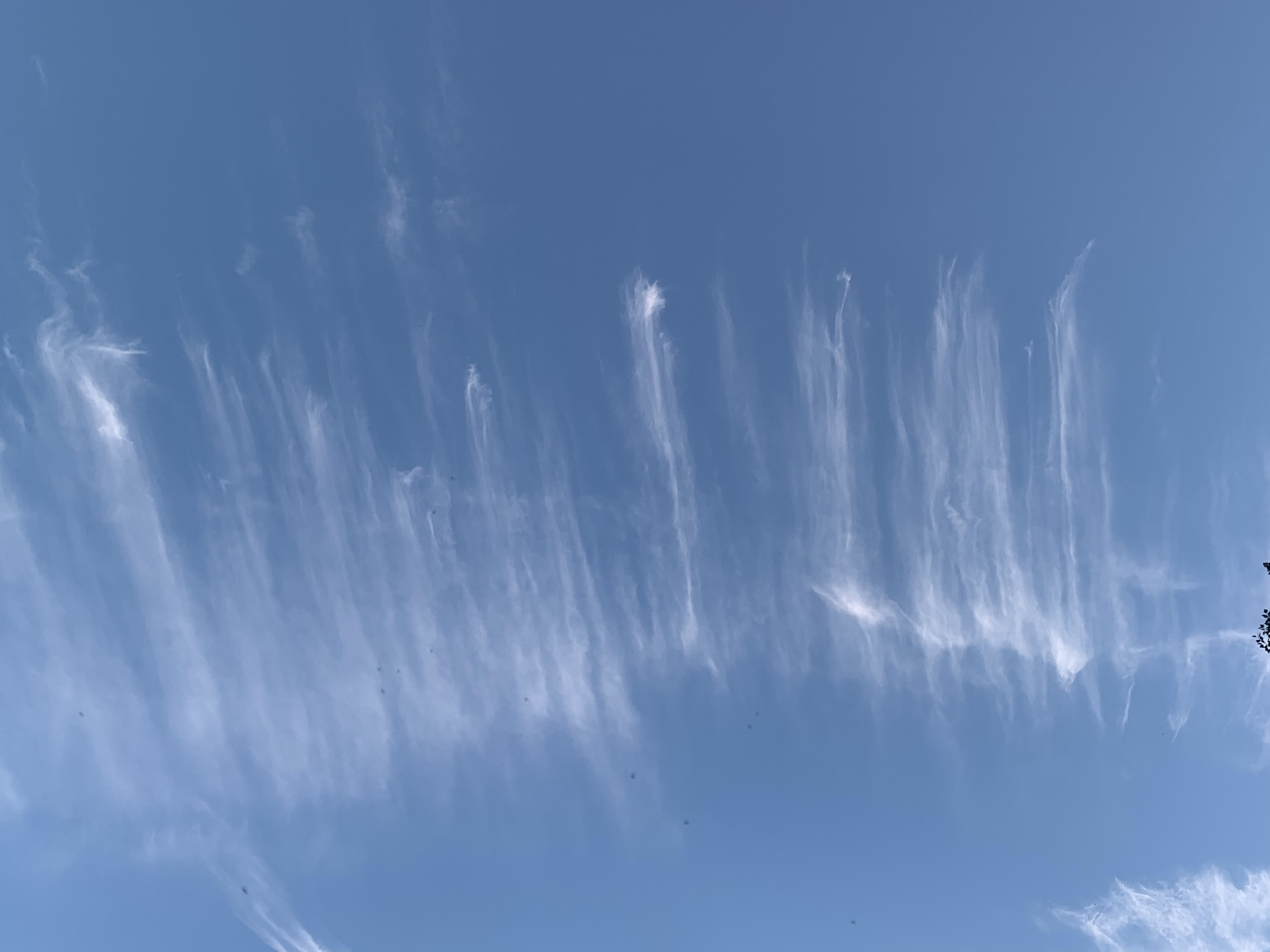
Outflow from former Hurricane Helene sent these feathery
high clouds across the sky over St. Albans,
Vermont Saturday morning. Helene is having no
effect on us, and it's going to be a quiet weather week.
It's Sunday, time to look ahead at another autumn week.

With so much drama happening in the weather news, it's a relief to report that we in Vermont are involved in none of that. And that will continue through the week. 

This is going to go down as another September that will make the top five warmest list, at least as measured in Burlington. It's remarkable that only the very coldest hollows in the Northeast Kingdom and Adirondacks have had any frost yet as we head into October.

The opening days of the new month look like they'll be frost-free, too.

In Burlington, normal lows for the last couple of days of September are in the upper 40s. Remarkably again, it has stayed constantly above 50 degrees in Burlington since the morning of September 11. The next time it will go below 50 degrees will probably be Wednesday night, and then probably just barely. 

Despite the warmth, the fall foliage in Vermont is getting real, at least in the high elevations and in the Northeast Kingdom. There's color elsewhere, too, but it's a way from peak.  The color will continue to get better and better this week, and the viewing weather should be mostly good to great, too.

Since it's been a warm month, it's fitting that today and Monday, the final two days of September, 2024 will be on the balmy side, too. Many of us should make it into the low 70s today, under sunshine. Those of you who were in the usual autumn fog and low clouds this morning should see increasingly sunny skies. 

It'll probably get foggy again in many spots Monday morning. 

The weather maker of the week, such as it is, will be  cold front coming through Wednesday. This one isn't exactly a powerhouse.  The remnants of horrible Hurricane Helene are still swirling aimlessly in the Ohio Valley. The cold front will finally give that a swift kick eastward, out to sea.

Those remnants will pass by too far south of Vermont to have any effect. Instead, it looks like a line of showers will come through sometime Wednesday. Nothing heavy, as there's nothing in the atmosphere to gather a lot of moisture or create a lot of lift. 

Outflow from former Hurricane Helene sent these odd
looking cirrus clouds over Vermont Saturday. 

Plus, the contrast between the air ahead of the cold front and the air behind it isn't much.  So the cold front will be a yawner. 

But the air behind that front is a little cooler. It is autumn, after all. You can get days with highs in the 40s and low 50s and even snow flurries in early October.  That won't happen this time. 

Instead, we'll enjoy a second half of the week with daytime temperatures well into the 60s, and lows mostly in the frost-free 40s. 

 There's another little cold front that will zip through maybe Friday or Saturday, but that one will be even more lame than Wednesday's. Don't expect a whole lot of weather with that one.  Just some clouds and maybe a light shower or two to mix with the sunshine.  It'll just have the effect of adding a little extra interest to your autumn foliage photos. 

Eventually, as we head into October, those cold fronts will pack more and more oomph, so the warm weather will disappear for good until next spring. 

Sunday, March 17, 2024

Vermont's Last Winter Week? This MIGHT Be It

A springlike sunset with grass starting to turn green
this past Friday in St. Albans, Vermont. With astronomical
spring arriving this week, we will take a multi-day
plunge into wintry weather. 
 Astronomical spring starts at 11:06 p.m. this Tuesday, March 19.

After a springlike winter, the arrival of the new season will plunge us Vermonters back down into winter.   

Don't worry, it won't be terribly painful.

A change in the weather pattern is going to put at least a temporary stop to an incredibly warm March. Up until now, it's been on pace to become one of the top three warmest Marches on record.

After this week, maybe not.

The first of a series of cold fronts is coming through in scattershot fashion today. It will still be on the mild side, with temperatures well into the 40s, maybe flirting with 50.

Monday will be seasonable with scattered rain and snow showers. It'll get up to near 40. So meh weather to start the week. Then winter hits.

REST OF WEEK

Tuesday looks chilly, then a reinforcing cold front comes blasting through Wednesday with a batch of snow showers. Accumulations won't amount to much in the valleys. But between tonight and Thursday the mountains could pick up a few inches. A little late season catch up snow for them, I guess.

Then, on Thursday and Friday, it will be downright cold for this time of year. On both days, high temperatures won't get above freezing for many of us. That'll be the first time that's happened since late February. Lows will be well down in the teens. 

I don't think the cold will destroy too many of the early season plants that have prematurely started to come up in Vermont gardens.  Magnolia buds might be nipped and blooms on some crocuses might not survive.

But the green shoots of crocuses, daffodils and other plants that have emerged are still young enough to skate through the cold weather just fine. 

The air this week will be nippy, but nothing all that odd for March. We've just gotten used to the strange balminess of February and March this year. 

LAST WINTER WEEK?

Even though we had a winter that wasn't, many of us still want to emerge into full-blown spring.  The chill might last into next weekend but there are hopeful signs that it could start to warm up again after that. 

This could well be the last week of the season that feels like winter, but don't count on it. 

Historically, we've endured some pretty wintry weather in late March and April. Not to depress you, but here are some examples:

In 1923, the final week of the month featured three mornings that were below 0 in Burlington, including minus 8 on the 29th. That's the latest subzero reading on record.

On April 7, 1972, Burlington endured a high of 24 degrees and a low of 2 above. That's colder than average for mid-January.

And in April, 1975, measurable snow fell on each of the six consecutive days from April 3-8. Between April 4 and 9 that year, only one afternoon made it above freezing and then only to 33 degrees. And the first overnight thaw of April, 1975 didn't hit until the 19th. 

So yeah, if you complain about this upcoming week, you haven't seen the worst that a Vermont spring could bring. 

Sunday, January 21, 2024

Vermont Weather Week Ahead: Back To The Longest "November" Ever: Warm-ish And Gloomy

Still cold this morning in St. Albans, Vermont, but at
least there's some blue sky.  Sunshine has been an
extremely rare commodity this winter. 
 We've got a day or two of actual winter weather left in Vermont until we return to our ridiculously long stretch of November-like weather. 

You know, the warm-ish, gloomy stuff that set in around the end of October and has never really left except for just a handful of brief exceptions.

It took a massive outbreak of Arctic air to flood the nation to make us seasonable cold here in Vermont.  In the grand scheme of things, it hasn't really been that cold. Many of us are not even seeing any subzero chill around here.

That massive Arctic outbreak is now decaying and getting ready to leave the United States. There's still trouble with a brewing ice storm in Arkansas.  Freeze warnings and wind chill advisories were still up in northern and central Florida this morning. 

Warmer Pacific air is now starting to make its way across the Lower 48. We'll feel that here in Vermont as the week goes on.

TODAY AND MONDAY

We're still on the cold side of that decaying Arctic high pressure, so most of us will stay in the teens, to possibly near 20 today. That's still a little chiller than average but by no means ridiculous for January.  It's also turning nice and bright out there, too. For a change. Despite today's nippiness, the sun will make it seem a little happier. 

Enjoy the sun today, and perhaps part of tomorrow, because it's back to the persistent clouds, gloom and mild temperatures we've had for almost all of this winter after that point. 

Tonight should get into the single numbers again, with a few spots below zero east of the Green Mountains. West of those mountains, temperatures should start to climb late tonight, and it'll be 32 by afternoon.

MONDAY NIGHT/TUESDAY

Temperatures will stay mild Monday night, and peak again Tuesday morning. The warming trend looks like it will get briefly cut off at the pass Tuesday morning by a bit of a cold front from Quebec. Temperatures should fall back through the 20s for most of us.

BEYOND TUESDAY

Starting Tuesday we'll be stuck in a warm, moist southwest airflow that guarantees warmth, at least for this time of year, lots of clouds, and some mostly light precipitation. It'll start as light snow, turning to a wet snow, and finally an unpleasant rain for most of us.

It'll be occasional, light stuff Wednesday through Friday, with big gaps with no precipitation at all. Daytime highs Wednesday through at least Friday will be in the upper 30s to a few low 40s.  It'll be a little cooler than that in the mountains, though, so perhaps most of the precipitation will come down as snow up there. 

The real story will be the nighttime lows during this spell. It seems that -  especially for the last year or more - toasty nights have been the most pronounced part of most of the warm spells we've gotten.

That'll be the case here. In the warmer valleys, especially the Champlain Valley, it could stay continuously above freezing from Wednesday morning through most of Saturday. That means three nights in a row have a shot of seeing record warm minimums for the date.  Record high minimum temperatures in Burlington currently for Thursday and Friday are 37 degrees, and 36 degrees for Saturday.

It'll eventually turn colder, of course, at some point. We're still in January here. Long range forecasts hint at some pushes of Arctic air moving southeastward from central Canada into Quebec.  Though long range forecasts are big time subject to change, so far, those cold blasts will only give us in Vermont glancing blows, with central and northern Quebec taking the brunt of the subzero, frigid Arctic air.

January is pretty much guaranteed to be yet another warmer than normal month in Vermont. 


Sunday, October 15, 2023

Vermont's Week Ahead: Staying Mild, Remarkably Frost-Free, But A Little Drama Next Weekend

This past week's weather has been remarkably steady state in Vermont. 

It's been so warm and frost-free in Vermont that this
photo taken from a Richmond hillside shows a 
fair amount of green remaining in the trees. Really
late in the season for that. 

Without fail, each day was partly too mostly cloudy, with a few scattered annoying sprinkles and light showers. Each day will get into the 50s to around 60, each night would drop into the upper 30s and 40s.

So much for that trope about just waiting a minute in Vermont and the weather will change. 

This week is looking a little more changeable, but that's not saying much. There will be no dizzying weather whiplashes for the next few days. 

Except this: Shockingly for so late in the season, we're still not seeing sign of a first frost. For many areas away from Lake Champlain, including such places as Island Pond, St. Johnsbury, Springfield and numerous towns around central Vermont  look like they will experience their latest first frost of the season since at least 1970.

For today through the end of the week,, if you want to pick your least favorite day, it was probably today. 

Clouds today were  even more stubborn than they've been lately. That held temperatures down in the low 50s for highs. A few ridge line towns stayed in the 40s, probably. And those annoying light showers continued here and there. A little semi-cold front from Canada was increasing the showers in the north late this afternoon and evening. 

Those showers won't amount to much, maybe a tenth of an inch of rain or less. But they will be just enough to make outdoor activities iffy and sometimes bothersome. 

Although you can still get brilliant blue sky days this time of year in Vermont, it's getting harder to do so. We're heading full steam toward November, which is the cloudiest month of the year.  Which means the rest of the week might not always be bright and beautiful. But it will still be awfully nice for the third week in October.

We actually have a bit of a warming trend setting in.  It won't get ridiculous, like those all-time record highs at the beginning of this month. 

Monday will still be pretty cloudy with a risk of light showers, but temperatures will bump up a couple degrees. Tuesday looks OK, too with afternoon readings bouncing back into the upper 50s. 

Wednesday and Thursday at this point are looking a bit sunnier, and warmer, as highs pop back up into the 60s. That's actually solidly milder than normal for this time of year. 

Foliage is very late turning toward peak in the Champlain Valley and warmer valleys of southern Vermont. So you might be able to enjoy some late season leaf peeping this upcoming mild week. The colors seem like they might end up being a bit more vibrant than they were this year in central and northern Vermont away from the lake. 

There's a lot of question marks for next weekend. Some sort of storminess seems to want to head our way, but it's too soon to get any agreement on what might happen and when. 

Just plan on the risk of rain  next weekend just in case.

Long range models are tentatively backing off on the idea of the first wintry blast of the season at the very end of the month.  Not sure yet, but the trends are toward more sort of average weather to close the month. 

Sunday, March 19, 2023

Vermont Weather Week Ahead: Not As Wild As Last Week, But Still "Interesting"

After a brief snow squall, a cold wintry sun tries to fight
its way through the clouds in St. Albans Sunday morning.
Warmer weather is on the way, though. 
 As is customary, I like to start Sunday with a look ahead, at least as best we can, at the Vermont weather week ahead.  

For those of you adverse to winter, a couple pieces of good news: For one, unlike last week,  nobody in Vermont will get 40 inches of snow this week. In fact, only a little snow will fall, and many of us will see a dusting at most.

The big snow winners will be in the central and northern Green Mountains, where the remnants of lake effect snows from New York could pile of several inches of fluffy snow.  That's a far cry from fell last week, though! 

The second piece of good news for those anxious for spring is that today has a very good shot at being the coldest day until next winter. 

Normal highs in Vermont valleys are now in the low 40s, and rising day by day as we head into spring. It's gradually getting harder and harder to stay below freezing all day. 

Today, though, we'll stay at January-like levels, with temperatures for many of us not getting out of the mid-20s. Gusty northwest winds bring wind chills into the single numbers and teens. You'll see spots of sun, but also snow showers, especially north of Route 4 and in the mountains all the way down to and past the Massachusetts border.

A few snow showers might be briefly heavy, so you'll want to watch for sudden problems with low visibility and slick pavement on the highways here and there today. As drier air moves in this afternoon and evening, the snow showers should lighten up somewhat. 

After a rather cold night tonight, things get better.  

Most valleys, except for some of them north of Route 2 on Tuesday, will to 40 or above each day Monday through the end of the week. (Northern valleys might have to settle for highs in the 35-39 degree range on Tuesday).

The weather should be fairly quiet, and great for sugaring in the first half of the week. 

The second half gets questionable. Storminess seems to want to come in, or at least some precipitation. 

Although Vermont big snowstorms are possible into mid-April, it is getting harder and harder to snow as we get into the second half of March. It's just getting too warm. 

It's looking like whatever comes in the second half of the week will be mostly rain.  The computer models disagree on how much rain and the timing of it. 

If it's just light rain, the snow will just continue to melt in an orderly fashion and there would be nothing to worry about. If it's a heavier rain, we'll need to watch for some flooding from that rain and melting snow. 


Sunday, February 12, 2023

Vermont Weather Week Ahead: REALLY Toasty, Springlike

An early sign of spring we often see in February. The
sun, strengthening since December, helps collect
heat near darker objects, helping to melt snow near
deep green evergreens. Speaking of spring the 
weather this week in Vermont will be decidedly 
springlike. 
 We in Vermont have definitely settled back into our warm, snow drought winter, and that's going to continue this week for sure. 

As of Saturday, for instance, Burlington has received a grand total of 0.4 inches of snow so far this month. By now, we should have picked up 7.7 inches. 

Each of the past seven days in Burlington have gotten above freezing. Each day today through Friday will also get above freezing. That's an awfully long spell of thawing weather. 

Most low elevations in Vermont should lose virtually all of their snow cover this week. Mountains will take a hit, too. Not great for the ski areas, since we're into the Presidents Day holidays now. 

Let's break it down in the dailies:

Today: Nice!  Temperatures will get up well into the 30s, with a few low 40s. We won't see much wind, and there will be quite a bit of sun.  The sun angle is increasing from its December lows, so you're really starting to feel it when it shines now. 

Monday: Clouds increase as a weak disturbance zips in from southern Canada. It'll get up to near 40 degrees again in the valleys. By Monday night, light snow will break out, but it won't amount to much. Expect a dusting to an inch most places, especially north. It will be kind of a slushy dusting in warmer valleys. 

Tuesday: Snow showers diminish, and we get into the upper 30s again.

Wednesday: The real warm stuff begins to arrive. A warm front will send temperatures well into the 40s with increasing south winds. The warm front will kick off a few rain showers, but they'll just be scattered and light. Temperatures will stay well above freezing Wednesday night, too.

Thursday; The peak of the heat as a fairly strong storm goes by well to our west. Temperatures will get into near record territory - in the 50s. I wouldn't be surprised to see a few 60 degree readings pop up here and there. 

This storm could bring severe thunderstorms as far north as Ohio.  As the storm's cold front approaches us Thursday night, we'll see rain showers and continued very warm temperatures. Dew points could be in the low 50s, which is wildly high for this time of year. Such high dew points could support springlike rumbles of thunder in Vermont. We'll see. 

Friday: Could be warm, could be cold. It depends on the timing of the cold front. At this point, it looks like temperatures will start of warm, then crash.  We don't know the exact timing yet.  There could be a little snow as it gets colder, but again, it won't amount to much

Saturday: A chilly, windy day. At this point temperatures look like they'll stay in the 20s all day. But another warm up seems likely after that one cold Saturday. 


Monday, January 16, 2023

Vermont: The Weather Week Ahead (Spoiler: A Bit Weird)

Rime ice accumulates on branches amid, cold, low
clouds Saturday. Welcomed sunshine broke out on Sunday
The upcoming week's weather will be "meh" and unsettled
 As I often do at the beginning of the work week in Vermont, I try to tease out what kind of weather we'll have to face as we make our way toward next weekend.   

Before I do that, can I give a shout out to the weather on Sunday. Sure, in the Champlain Valley, we had to wait until afternoon to see any decent sunshine. But what a gorgeous day. 

Temperatures were perfectly seasonal, in the 20s. Many of us, especially in the high terrain, had some snow on the ground, so we could enjoy some winter sports for a change. 

The transition from icky mess this past Friday to at least a semblance of normal snowy January is at the bottom of this post. 

Now on to the upcoming weather, which isn't quite so nice. (But could be worse!)

TODAY

Today's conditions won't be anything close to extreme, but the weather systems driving out there are a bit weird.

As expected, a second storm formed off the coast along the cold front from our previous storm Thursday and Friday.  This one turned into a pretty big nor'easter that's taking a slow, weird path northwestward.

Which means it's flinging moisture westward into New England. Usually things go roughly west to east, so this is backwards. While we were enjoying a gorgeous Sunday in Vermont, coastal New England was dealing with snow, mixed precipitation and wind.

This moisture is pushing further inland into northern New England now. It's awful in eastern Maine, where heavy sleet, freezing rain and some snow is making things miserable.

Winter weather advisories extend through northern New Hampshire but stop at the Vermont border.  That's because the ocean storm's moisture is running into a buzz saw of really dry air. That's courtesy of the same high pressure that gave us that nice Sunday

The result will probably be only light mixed precipitation making it into far eastern Vermont and clouds elsewhere. This wont' be a huge impact, but look for patch slippery roads, bridges, sidewalks etc, east of especially if the surfaces are untreated.

Western Vermont might see a bit of sunshine, especially this morning. 

By the way, this storm is also weird in that its center was over the Gulf Stream off of New Jersey (the moisture feed coming into New England is well to the north of the center.  The storm's center has developed a few characteristics of a subtropical system, with a sort of warm core instead of a cold core typical of non-tropical storms.

While this isn't by any means a tropical or subtropical storm, and very likely won't become one, it is interesting for  this to happen in January.

The reason this is mixed precipitation and not just snow in New England is because, as has been the case all month, there's not enough cold air around to support it. Which leads us to.....

MIDWEEK

Another one of those storms from California is zipping across the country and heading our way.  The good news is this one will be falling apart as it encounters us here in New England. The bad news is whatever we do get will from this will be another mixed bag.

Look for patchy freezing drizzle, light sleet and snow showers later Tuesday into Wednesday. Again, this won't amount to much, but we'll have to deal with the nuisance of potentially slippery spots on roads, hacking a thin layer of ice off our windshields, and just being graceful when trying to walk on a bit of ice on the front steps.

During the afternoons Tuesday through Thursday, temperatures will go to a little above freezing in many valleys in Vermont, so that would melt away some of the ice that will form from this little bugger coming through. 

LATE WEEK

A somewhat more substantial storm is on the agenda for Thursday night and Friday in Vermont. It's several days away, so the details aren't in yet. Some of the broad outlines are there.  It's looking like this, too won't be a blockbuster, as it will be moving along fairly quickly.  So just a mid-sized thing.

The National Weather Service in South Burlington is holding out hope that this late week storm could turn out to contain mostly snow.  There are signs that just enough cold-ish air will drain down from Quebec through a thick enough layer of the atmosphere to produce snow.

That's not a guarantee.  It already looks like there will be some mix in this late week storm, especially in southern Vermont.  This forecast could change either way, so stay tuned.

As you can tell by the above, temperatures will remain above normal in Vermont after this blip of near normal readings over the weekend and today.  But it won't be as warm as the first ten days of the month, so most of the snow in the mountains should stick, and there will probably be minor additions to the snow pack for once. 

VIDEO

Taken Friday in St. Albans, Vermont. A slow, grudging transition from wet snow, sleet and freezing rain to snow. We ultimately received about three inches of accumulation Click on this link to view or on the image below if you see it. 


Monday, May 10, 2021

Cool Regime Continues This Week; Warm Up Later?

Despite relatively cool weather in the past week, the woods
and fields near my house in St. Albans, Vermont
continue to green up quickly.
 It's been a relatively cool May so far here in Vermont. Not that cool, mind you.  Just lacking in the types of spurts of 70 degree weather we saw in April. 

This state of affairs looks like it will continue this week.  However, due in part to the fact that normal temperatures are still rising with the season, it will get somewhat warmer by the end of the week. 

More importantly the weather pattern is adjusting to something in favor of bringing us weather a little closer to summer like.  At least eventually. 

Though the weather was fairly pleasant in Vermont Sunday, chilly weather  especially near the Great Lakes illustrated the cool weather pattern the Midwest and Northeast is in. 

Snow fell in parts of northern Pennsylvania on Mother's Day.  Frost and freeze warnings and advisories were up this morning in Michigan and Wisconsin. 

For us Vermont, we're getting another shot of chilly weather for the first half of this week.  The storm that caused the Pennsylvania snow was bringing a cold rain to southern Vermont this morning. Cold air aloft will contribute to scattered showers this afternoon.

On Tuesday, an even colder pocket of air will come in aloft over Vermont and surrounding areas. This will make instability even greater in the atmosphere, so there should be a fair number of showers around, especially in the afternoon. 

Expected high temperatures only in the low 50s Tuesday would be a good 15 degrees colder than normal. Stiff northwest winds will make it feel nippier than that . By Tuesday night, mountain summits will probably get another dusting of snow. 

Wednesday will be brisk, too, but not as bad as Tuesday. 

The second half of the week looks milder.  Temperatures will get well into the 60s which is a bit below the "new normal" temperatures that are out now. But it will basically be seasonable - pretty normal by mid-May standards. 

Long range forecasts are hinting at warmer than normal temperatures starting in about a week and continuing for a spell afterwards. That could be our first real taste of summer.