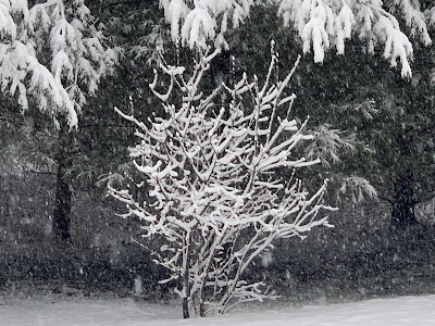
We've had it all, and it's a mess out there in Vermont this morning,
 |
| Nice green buds were visible yesterday on this cute little lilac bush in my St. Albans, Vermont. It's shivering today in the snow. |
The snow was still coming down at a good clip as of 8 a.m. so power failures are rising again.
The heavier snow will last through much of this morning before turning lighter this afternoon. More power outages and bad road conditions will continue for many areas this morning.
It'll get a little better in lower elevations this morning as temperatures rise, snow mixes with rain in the warmest valleys and precipitation gets less intense
SO FAR
The storm has played out pretty much as expected so far. The first half featured the expected strong winds in the western slopes of the Green Mountains, a fair amount of sleet and some snow mostly in the higher elevations.
The wind and precipitations created 15,000 or so power outages in Vermont by 3 a.m. The bands of precipitation had some oomph to them. There was some lightning strikes northwest of Plattsburgh, New York last evening, for instance.
The wind died down some by the wee hours of this morning and mixed precipitation, as expected, transitioned to snow overnight. For awhile, crews were able to start restoring power as the number of outages was cut in half by 5 a.m. this morning.
But the snow is wet and heavy, especially in low elevations, so all that good work by the power crews was undone. By 8 a.m., we were back where we started, with about 15,000 outages statewide. That number was rising. (Over 16,000 by 8:30 a.m.)
Some of these bands of snow coming through this morning are really heavy, piling up more than an inch of snow per hour at times. More lightning was detected around 5 a.m. this morning in the Northeast Kingdom. That tells you what a dynamic system this is.
I'd stay in this morning. Roads are awful. Trees and branches and even power lines are falling on back roads where the snow is wettest and heaviest. I'm getting many, many reports of crashes, cars sliding off roads or traffic jams due to vehicles stuck in the wet, slippery snow.
Driving anywhere this morning just isn't worth the trouble. Road crews are out, but they can only do so much.
You probably already know by now that schools statewide are closed once again. (Ironically, many schools will close again Monday because of maybe, potential nice weather so kids can watch the eclipse).
 |
| Tree branches are sagging under the weight of the heavy wet snow today. Power outages are blossoming instead of flowers as we'd like to see in the spring. |
Accumulations so far through 8 a.m, have been pretty uniform statewide, with generally four to eight inches reported. Even in the Champlain Valley. That uniformity in snowfall amounts is about to change.
TODAY
As mentioned, many of us have a few more hours of moderate to heavy snow to get through. Valley temperatures were hovering near 32 degrees as of 8 a.m.
It is April, though it looks nothing like that spring month out there. But the sun angle is high and will cut through the clouds. That will allow temperatures to sneak upward by a couple or few degrees by this afternoon
Also, heavy snow, like we're getting this morning, tends to keep the air colder. Lighter precipitation this afternoon means the air will also be able to warm a bit.
It will by no means be a warm day. But temperatures in the 33 to 37 degree range in the valleys will cause the snow on the ground to settle a bit. Raindrops might mix with the snow. The bottom line is, in the valleys, after the heavier snow tapers off later this morning or early afternoon, new snow accumulations will pretty much stop. At least until tonight.
This might create a window for power crews to begin to get an upper hand on those power outage.
In the upper elevations, it will stay a little colder, so the snow will just keep piling up. The rate at which it accumulates will be slower. But since it will be snowing in the high elevations probably through tonight and off and on during Friday and Friday night, accumulations there will be impressive.
When it's all said and done total accumulations look as follows, with exceptions of course:
Warmer Valleys: 5-10 inches.
Most towns away from the lower valley, mostly above 1,000 feet: 8-15 inches, locally higher in a few spots.
Mountain summits 18-24 inches, locally more.
WIND DOWN
Each day will get a little warmer, and each day will have less precipitation as we get from Friday and Saturday.
Friday will be another not great for outdoors, unless you're into winter sports in the mountains. Valleys will be overcast and blustery with occasional light but cold rain showers, mixed with wet snow at times. Highs in those valleys should get into the 35-42 range. Still pretty chilly for this time of year.
Mountains will continue to add light amounts of additional snow all day and night.
Saturday will be a little better, with larger breaks between valley rain showers. Highs in the valleys should make it to or above 40 most places, so the snow melt down should gradually start.
Snow showers in the mountains will continue pretty consistently.
Most of this should be over by Sunday with skies really beginning to clear, especially away from the mountains. Highs should be more seasonable, going well into the 40s to near 50.
Forecasters are still (very) cautiously optimistic about the eclipse Monday, with a fair amount of sunshine still in the forecast. (No sunshine during the total eclipse, though, of course).
I'll have updates as warranted through the day.

No comments:
Post a Comment