Monday, September 16, 2024

Vermont Foresters Think Foliage Season Will Be Gorgeous, Despite (Or Because Of) Wet Summer

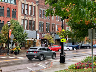
Fall foliage in Charlotte, Vermont in October, 2023.
After a rough, wet summer, foresters still expect
the upcoming foliage season to be beautiful.
 The weather is very much like you'd expect in July this week, but if you look at Vermont hillsides, the colors of autumn are starting to creep in. 

So will this year be a dud or a beauty?

Vermont Public recent interviewed Josh Halman, the forest health lead for the Vermont Department of Parks and Recreation. He's one expert who thinks we're in for a good season. 

He has reasons. 

For one thing, the state is certainly not in drought, despite the current stretch of dry weather. 

Soil moisture is still good. Trees were never stressed for want of water this year, and they aren't now as they prepare to go into dormancy. 

Stressed trees sometimes create lackluster foliage, so we're in good shape there. 

On the other hand, if it's too wet, like this summer certainly was, fungus can thrive on the tree leaves. While this doesn't harm the overall health of the trees, it can make leaves turn brown and fall off early in the season, dulling the fall colors. 

While autumn, 2023 was certainly pretty, a few spots suffered because some of Vermont's trademark sugar maples struggled with the fungus. Their leaves, instead of turning brilliant orange and red, in some instances just turned brown and shriveled.

Autumn, 2022 brought very little of that fungus, and that year was subjectively, in my opinion the best in quite a few years. 

The good news is Halman said he has seen much less of the that fungus on sugar maples this year, at least compared to last year. That means the sugar maples should put on a good show. 

Some birch and aspens, however, are having trouble with fungi, so leave on some of those varieties are failing and falling fast. 

Fall foliage season is quite important to Vermont. The summer's floods might not have an effect on the actual foliage, but could limit the number of leaf peepers that come up for the show. 

 Vermont tourism officials and attractions in the state are putting out the word that Vermont is very much open for business, the roads are back open so you can get from Point A to Point B,  The inns and restaurants and corn mazes and such are all ready for visitors. 

There's spots of color already, now that we're into mid-September. That's probably thanks in part to cool weather a week ago. It's gotten unseasonable warm again, and largely sunny, so I think the pace of color change is temporarily slowing slightly. But it will continue on its march to an eventual peak season, as it always does. 

Changes will come rapidly late this month and in early October,. How long foliage season stays gorgeous depends on the weather, of course. . Calm, still days in October will keep it going for quite awhile. Windy rain storms will have the opposite effect. 

No matter how you slice it, though, you should have plenty of opportunities between now and mid to late October to enjoy the color, as we do every autumn. 


Sunday, September 15, 2024

Followup: Hurricane Damaged Louisiana High Rise Imploded, Is Gone

 Back in June, we told you about the 22-story Capital One Tower in Lake Charles, Louisiana, that sat vacant and boarded up since Category 4 Hurricane Laura trashed it back in August, 2020.  

The old Capital One skyscraper in Lake Charles, Louisiana 
comes down on September 7 after sitting vacant for
years. It was badly damaged when 
Hurricana Laura struck in 2020.

Much or even most of its green reflective glass windows were blown out. Offices inside the tower - the tallest in Lake Charles - were severely damaged or destroyed. 

The building sat boarded up, sad, ugly and untouched since then, as insurers, property owners and developers wrangled over its fate. 

Finally, with the help of the mayor of St. Charles putting his foot down, it was decided to just get rid of it. The mayor said the damn thing had kind of outlived its usefulness even before the hurricane. 

On September 7, demolition crews imploded the building as people in the city gathered to watch. It came down in a matter of seconds. This might well be the largest building-  or at least the tallest - in the United States that had to be demolished due to damage from a weather disaster

The area where the building was will be redeveloped. 

Videos

News crew guides us through the demolition. Click on this link or if you see the image below, click on that:

Another video: Again, click on this link, or if you see the image below, click on that. 


WaPo: Facebook Deleting Wildfire Warnings In Tinder Dry West

Something is going on with Facebook that is removing
emergency information near disasters from the platform
as misleading spam. 
 Apparently, Facebook doesn't want people in the wildfire -prone west from receiving potentially life-saving fire information on the social media site.   

As the Washington Post reports: 

"During a scorching relentless wildfire season, Facebook has been flagging and removing dozens of posts containing links and screenshots from Watch Duty, a widely relied-upon wildfire alert app, as well as from federal and state agencies, according to interviews and Facebook conversations with nearly 20 residents, Facebook users and moderators, as well as employees from disaster response organizations."

Where this is happening, Facebook tells users they violated the "Community Standards on Spam" due to trying to get likes, follows shares or views in a "misleading way."

WaPo said it happens mostly with links including to official and reputable from Cal Fire, The U.S Forest Service, various sheriff's departments and AlertCalifornia, which monitors fires and other disasters in real time. 

The problem extends to other areas. Facebook removed emergency information on Hurricane Debby in Florida back in August. 

The problem seems to have developed, or at least intensified, back in June when something on Facebook changed, reports WaPo. Since then, emergency information has been disappearing as fast ast it's posted, it seems. 

I want to be charitable and say something is screwy with Facebook's algorithms or some damn thing. My conspiracy minded brain almost wants to think that accurate emergency information isn't a money maker.  After all, what makes money is engagement. Facebook and other social media platforms want controversy and argument as that brings in the revenue.

 Perhaps helpful information doesn't make people angry enough to "engage." 

It's interesting that there's so much spam and junk of Facebook, but this useful information during emergencies is being down. 

For their part, a Facebook spokesperson said the company is "investigating this issue and working quickly to address it."  Facebook said it was not aware of the problem until the Washington Post contacted them. 

Which might be a stretch, since people and organizations whose posts have been removed have been complaining of Facebook since June. Most of those people have never heard back from Facebook. 

Even when and if everything is working as it should, Facebook isn't necessarily the best place to seek emergency information during a disaster. But the social media platform is, as the Washington Post says, familiar, accessible and hyper-localized. It's a place where people can share information on evacuation orders, where shelters are, how to get meals, help for pets and to find missing relatives and friends. 

And let's face it: Facebook is the go-to for many people who are older or not especially tech-savvy.

Complicating the issue more is Facebook doesn't notify people if their posts have been taken down, so they're blissfully unaware. Also, people are now avoiding posting what could be valuable information because if there's too many supposed "violations," Facebook might entirely shut down the page permanently. 

I do hope this is just a problem with dumb algorithms and Facebook straightens it out quickly. I also hope WaPo follows up on this. 


Something Weird And Warm Is Going On With Vermont Septembers

A little hard to see in there, but a bumblebee is seem
here enjoying a white rose on a warm September
Sunday morning in St. Albans, Vermont. Recent
Septembers in Vermont have grown sharply warmer. 
 As we all know, we are in the midst of a long spell of oddly warm, dry September weather in Vermont. 

Sunday was the third day in a row of 80 degree temperatures, with at least four more in a row coming.  

It hasn't rained in Burlington since a sprinkle on September 9, and there's a chance it won't rain again for another 10 days.

 That depends on whether a weird little possibly subtropical storm expected to hit the Carolinas Monday can throw enough moisture our way to set off a few sprinkles toward the middle of this week. 

Spells of September weather like this used to be rare in Vermont, but in recent years, it's gotten far more common.

Thanks climate change, the top 10 lists of warmest months throughout the calendar has a number of recent years clustered in those lists, at least as measure in Burlington.  It's just warmer than it used to be, so we're more likely to have near record warm months thrown in. 

But September is ridiculous.  The ninth month of the year has taken a sharp turn toward becoming an extension of summer, especially in the last decade or so.

The top five warmest Septembers have all occurred since 2015. Until recent years, the warmest September in Burlington had an average of 65.4 degrees, set in 1961. Now, the warmest year is 67.4 degrees, set in 2015.

Even the recent Septembers that didn't make the top ten warmest list have been balmy.

Septembers with an average temperature of under 60 degrees used to be the usual. Only 40 out of the 100 Septembers between 1900 and 1999 had an average temperature of over 60 degrees, as measured in Burlington. 

Then it changed. All Septembers since 2010 have had an average temperature of over 60 degrees, and only one September since 2000 has fallen short of a 60 degree average.

Recent Septembers have also featured very long dry spells, longer and hotter than the one we're having now. The warm to hot, and rainless spell in September, 2017 was as extreme as they get. That month featured 20 consecutive days with absolutely no rain at Burlington. 

That dry spell culminated in a seriously whacked out heat wave. Until 2017, the latest 90 degree temperature of the season was on September 16, 1939. But on September 24-27, 2017, Burlington saw four consecutive days in the 90s. 

The 2017 autumn heat extended through October, which became by far the warmest on record in Burlington. 

In 2015, each of the first nine days of September were over 80 degrees, and three of those got above 90 degrees. In 2018, there were five consecutive days of temperatures of 85 or more from the fourteenth through the 18th. 

Our current warm, dry September - as toasty as it is - will probably not be the warmest on record. I question whether it will even make it into the list of top ten warmest.  But once again, this September is not your grandfather's early autumn month. 

Saturday, September 14, 2024

Yet Another Disaster Declaration In Vermont; This Time For Late June Storms

A storm that carried a tornado warning dumps torrential 
rain on South Hinesburg, Vermont on June 23. That and
other storms that day caused flash flooding in central
Vermont, prompting news Friday of yet another
disaster declaration in the Green Mountain State
 It's getting really hard to keep up with all the disasters and disaster declarations in Vermont since last year. Now we have yet another one. 

Remember that Sunday in June when your radio and television crackled with tornado watches and warnings and flash flood warnings?

That day caused enough damage to warrant yet another federal disaster declaration in parts of Vermont. 

This latest disaster focuses pretty exclusively on Lamoille County and parts of the Northeast Kingdom. They were hit hard with flash flooding on June 23 as two waves of intense downpours swept through that region with supercell thunderstorms. Serious flash flooding caused a lot of damage in Stowe, Walden and in parts of the Worcester Range. 

This June storm caused at least $1 million in damage in just the town of Stowe.

Gov. Phil Scott had asked the federal government to include Caledonia County in the June 22-24 declaration, but the feds responded by only declaring Lamoille County.  

The declaration frees up federal money to reimburse municipalities for 75 percent of funds already spent on debris removal, road and public building repair and staff overtime, Scott's office reported in a Friday press release.

The tornado watches and warnings made the initial headlines with that June storm, but no tornadoes are known to have touched down in Vermont, and wind damage was spotty. The real damage on June 23 came from the flooding. 

Though Caledonia County was left out of this declaration, it is under what will probably become two other disaster declarations from this summer. The first is for disaster declaration prompted by the big July 10-11 flash flood associated with the remnants of Hurricane Beryl.

A federal disaster declaration has not come yet for the intense downpours and extreme flash flooding around St. Johnsbury, Lyndonville, Burke and other Northeast Kingdom communities on July 30, but I imagine that declaration is on its way. 

As I wrote earlier this month, I find it ironic  that Lamoille County was cited in a 2021 ProPublica/New York Times study as being perhaps the best refuge in the nation from the effects of climate change. 

Lamoille County has now been designated a federal disaster area for six storms since December, 2022. So much for being a refuge. 

Vermont as a whole has now had eight major federal major disaster declarations since 2021 with six of those happening since July, 2023.

Those disaster include:

Epic flooding across Vermont on July 9-11, 2023

Severe flash floods in Addison County on August 3-5, 2023

Widespread flooding on December 18-19, 2023

Severe windstorms on January 9-13, 2024

The above mentioned flash flooding and storms on June 22-24, 2024

Severe floods on July 9-11, 2024

And, as mentioned, the July 30, 2024 flood in the Northeast Kingdom will probably get a declaration. 

Vermont, blessedly, hasn't had any extreme weather of note since the strong, damaging winds we saw on August 9 from former Hurricane Debby.   (I kind of doubt that one was bad enough to warrant yet ANOTHER disaster declaration but who knows?)

We've gone over month with no problems and there's nothing in the forecast. Such calm weather seems so strangely odd in our stormy, sometimes dangerous climate change world.

Friday, September 13, 2024

August Was Surprisingly The World's 15th Consecutive Hottest Month

Another red planet map from NOAA as August was
the world's 15th consecutive hottest month. Anything
in pink or red is warmer than the long term average.
 Experts have continually told us that a long streak of global record hottest months would come to an end as El Nino faded, to be gradually replaced by a cooler La Nina atmospheric and ocean pattern. 

Some said the record streak should have ended by now. 

Well, the August data is coming in, and that long record streak is unexpectedly persisting. 

According to NOAA's National Centers for Environmental Information, August, 2024 was the world's hottest. And since the previous two months also set record highs, the Northern Hemisphere summer was also the hottest in at least 175 years.  That 175 years is the period in which pretty accurate global records are available. 

If you are under the age of 46, you  have never experienced a global year that was even a tiny bit cooler than the long term historical average.

Given that the first eight months of 2024 year each were the hottest on record, there is now a 97 percent chance this year will be the globe's hottest, besting the incredible level reached in 2023.

The hottest areas, relative to average in August were most of Antarctica, most of Australia, eastern Asia, southern Europe, northern Africa, northern Mexico and the southwestern United States; north-central Canada, northern Scandinavia and western Siberia. 

In all, about 10 percent of Earth's surface had a record hot August. which is a pretty remarkable percentage when talking about world-wide, long term comparisons to average. Whatever that is nowadays. 

Once again, it was hard to find cool spots in all that global heat in August. An area of the northern Pacific  between Alaska and Russia was chilly. Parts of southern South America and a piece of western Russia were near or a little cooler than normal. 

Central Africa's temperatures managed to be normal or even a bit cool in a few spots, at least by modern standards. But that was due mostly to excessive rains in that region. 

For the summer as a whole, June 1 through August 31, the world -  as mentioned - had the hottest summer on record. And yes, I know it was winter in the southern hemisphere, but let's call it summer since that's what we experience up here in the northern half of the world.

The past 11 June-August periods have been the warmest such periods on record. The only place on Earth that I could find that had a noticeably cool June-August was the southern tip of South America. 

Climate change will keep monthly global temperatures wicked high for the indefinite future. Experts still think the long stretch of monthly record highs will end, at least temporarily. We'll just probably keep seeing top 10 hottest months, not necessarily ones that score at Number One. We hope anyway 

El Nino, which tends to warm the Earth even more on top of climate change, has indeed ended. But the opposite La Nina, which has a slight cooling effect, hasn't really kicked in yet. That should happen in the final months of this year. 

But that won't be much of a break, since we're already so much warmer than in pre-industrial times. And gawd knows what will happen when in a few years, we get the inevitable next El Nino. 

Intense Connecticut Flood Captured In Store Surveillance Camera

An intense flash flood struck western Connecticut back on August 18.

Screen grab from security video showing a flash
flood destroying the interior of a 
Seymour, Connecticut shop in August.
Up to ten inches of rain fell in just a few hours that day, causing two deaths and extreme damage from intense flash flooding. 

That type of disaster was unfortunately all to common this past summer in the Northeast and southeastern Canada, as we in Vermont know all too well.

A video, which you will see below, is just one graphic example of how flash floods are so sudden and extremely dangerous.  No wonder they're so deadly. 

The video is clips of security footage taken inside The Yankee Quilter, a popular craft, quilt and sewing machine shop in Seymour, Connecticut. 

The footage shows water already in the store. But then the intense flood overwhelms the doors and walls of the store, sending a surge into the retail space, destroying everything in seconds. At one point, the surge of water into the store creates a debris-filled whirlpool on the sales floor. 

Luckily, nobody was in the shop at the time. If people were there, they could have easily been severely injured or killed. 

The destruction in Connecticut store was similar - and just as scary - as video of floodwater invading a Ludlow, Vermont restaurant during the extreme floods of July, 2023.

The two people who died in this Connecticut flood were two women caught when their cars were suddenly overwhelmed. 

Video: To see the CCTV footage of the flooding at The Yankee Quilter in Connecticut, click on this link to view, or if you see the image below, click on that. 


Thursday, September 12, 2024

Trump and RFK Jr. Make Up Quite A Climate/Science Team. Or Not. Meanwhile Harris Climate Policy Emerging Slowly

Donald Trump and RFK Jr have some rather....
interesting thoughts on climate and science 
 Donald Trump and Robert Kennedy Jr are not exactly science guys

Which makes the idea of a climate policy under a Trump administration a bit of a fantasy, to say the least. 

For one thing, Trump doesn't even think climate change exists, at least most of the time, as his opinion on everything under the sun is a bit of a moving target. He also has some novel thoughts on the concept.   

Trump recently said that sea level rise would be great because it would create new oceanfront property. 

As any logical person would know, the higher the sea levels, the less land would exist above the water. Continents would be a little bit smaller, which leaves less oceanfront property out there for savvy real estate investors, like Trump imagines himself to be. 

To be Captain Obvious here, if sea levels rise a lot, it will remove existing sea front property by submerging it. Land that used to have no beach would suddenly become oceanfront property.  You also have to then figure out where those people who used to live on now submerged beach front property would move.

Trump also informs us that the sea level will "rise one-eighth of an inch in the next 400 years."

Um, it's a little more than that, buddy. The sea level actually rise a full third of an inch between 2022 and 2023 and about 3.7 inches in the past 34 years.

I get it that 3.7 inches doesn't sound like much. But on flat sea coasts, it starts to make a big difference. Plus, the rate of sea level rise is accelerating. By 2050, scientists think the sea level will be up 7.9 inches compared to current levels. At that point, you're really starting to talk about the oceans headed inland.

Trump also still tilts at windmills as Kamala Harris noted the other night in the debate. He obsesses over them   probably because he's annoyed at Scotland for installling them off the coast of his golf course over there? Not sure....

 Meanwhile, back in August Robert Kennedy Jr, having decided to suspend his hapless presidential campaign and is now Donald Trump's problem.   

Kennedy went with Trump Mostly because Harris wouldn't give him the time of day, which was probably a smart move. 

Kennedy's grasp of science, to put it charitably, is tenuous, which makes the prospect of climate policy, or lack thereof under a Trump administration even worse. 

He is even one of those chemtrail nuts. You know the ones, who think those icy water vapor condensation trails from high flying jets are some nefarious plot to spray the global populace with some type of chemical to..... who knows what. 

As HuffPost reports:

"'We are going to stop this crime,' Kennedy posted on social media... in response to an X (formerly Twitter) account sharing a conspiracy theory video, which claimed that pilots use planes to secretly spray chemicals on unsuspecting populations. These pilots, according to the video are 'hardened to humanity' and 'could car less about killing off unwanted or leeching aspects of American and the world."

Whatever the hell that means. 

Harris and Climate

Kamala Harris is quite a bit less, um, eccentric in her attitudes toward  climate change. 

Her climate policy is still slowly emerging. At least so far, her ideas are not nearly as out of whack as her opponent's positions are, to say the least. 

Kamala Harris' climate positions are still an emerging 
issue, but at least she's trying to follow the science.
She's shown here speaking at the annual UN
Climate meeting in Dubai last year. 

She firmly believes climate change exists and is making weather extremes and disasters worse. So that's a refreshing difference from Trump. 

I noticed Harris was against fracking back in 2019 when she first ran for president, but now is for it, as she made clear in the debate earlier this week. 

This debate was in Pennsylvania, after all, where fracking is small but important. 

Harris in 2022 cast the tie-breaking vote to pass the Inflation Reduction Act. Its provisions include several hundred billion dollars in government subsidies for electric vehicles and clean energy technology. 

Harris enthusiastically supported President Biden's Inflation Reduction Act which also set up a huge infusion of money into tax credits for clean energy and energy efficient home projects. 

She also is framing climate change as a pocketbook issue, citing rising insurance costs in climate disaster prone states as one good reason to combat the problem. 

Bottom line: If you're a single issue voter and your single issue is climate change, go with Harris. At least she's coherent. 


Francine, No Longer A Hurricane, Still Spinning Off Flooding, Twisters

True to form The Weather Channel's Jim Cantore
reports from near the eye of Hurricane Francine
on Wednesday in this screen grab 
from the Weather Channel. 
 Then Hurricane Francine did what forecaster said it would do last evening, pummeling hurricane-prone Louisiana with another blow.   

Though this one won't go down in history as among the worst, its 100 mph winds, storm surges and blinding rain, smashing through an area not fully recovered from even stronger hurricanes in 2020 and 2021.

So far, fingers crossed, I haven't heard of any deaths from this storm in Louisiana. But damage reports are just emerging. At least 390,000 homes and businesses were without power in Louisiana, reported the Associated Press, with another 46,000 in Mississippi.

Video emerging on social media show mobile homes blown apart, trees snapped, roods damaged, power lines down and a lot of flooding. 

New Orleans streets were flooded after the city was battered by 7.33 inches of rain and wind gusts as high as 78 mph. 

Francine has moved well inland, and as of 7 a.m. today was a tropical depression over central Mississippi with top winds of just 35 mph. 

As you can tell, winds are no longer a factor with Francine. But its remnants are spreading heavy rain and a real flood risk over parts of the Southeast. The byproducts of Francine might also spin up a few tornadoes today in the Florida Panhandle and Alabama. 

The remnants of Francine are trapped over the Southeast by strong high pressure over New England snd southeast Canada. That will prevent us here in Vermont from seeing any effects from the former hurricane. 

Another disturbance way out there in the eastern Atlantic Ocean is likely to become Tropical Storm Gordon later today. It's far away and expected to develop only slowly.  It's days away from any threats to land, and we are not quite sure where wannabe Gordon will go as it develops. 

A storm might also form in the coming days off the Southeast coast and possibly become a subtropical or tropical storm next week. If it forms, it could head into the Carolinas. Also, again, if this system does become something, the same high pressure that is keeping Francine at bay would also keep this thing well south of Vermont, so it wouldn't bother us. 

Wednesday, September 11, 2024

Vietnam Reeling From Typhoon Yagi

Satellite view of intense Typhoon Yagi, shortly before
it caused an extreme disaster in Vietnam.
 While people in Louisiana deal with Hurricane Francine today, on the other side of the world Vietnam is staggering in the aftermath of Typhoon Yagi.  

The storm has killed at nearly 150 people at least, with many more missing, reports the Washington Post.  It's believed to be the worst typhoon to hit Vietnam in at least three decades.

 It was the worst typhoon on record in northern Vietnam, which is usually less prone to these storms as southern parts of the nation. 

Crises hit all over the place in Vietnam. The capitol, Hanoi, was flooding as a river through the city burst its banks. Thousands have been evacuated from parts of the city and many schools are closed. 

The Guardian reports a landslide caused by flash flooding swept away an entire village, killing 16 people and leaving dozens missing. 

A metal bridge collapsed from flooding during the storm, taking five cars and four motorbikes with it, the Washington Post reported. Nine people died in that incident, but three others were rescued. 

Typhoon Yagi had winds of 125 mph, gusting to 155 when it came ashore in Vietnam.

The typhoon might seem awfully distant to us, but it could still affect you and me. As The Guardian explains: 

"Typhoon Yagi also severely damaged a large number of factories and flooded warehouses in northern Vietnam's export-oriented industrial hubs, forcing plants to shut, with some expected to take weeks to resume full operations, executives said.

The disruptions could affect global supply chains as Vietnam host large operations of multinationals that mostly export their products to the United States, Europe and other developed countries."

 Before hitting Vietnam, Typhoon Yagi struck Hainan, an island province in southern China. At landfall on that island, Yagi had top winds of around 160 mph, becoming the strongest typhoon in China in a least a decade. Four people died there.

At one point, Yagi was directly over the city of Haikou, population three million, with 140 mph winds, so it's impressive that so few people died on Hainan. 

The storm extended its reach into the Philippines, killing at least 20 people there. 

Videos:

A dash cam recorded the moment a bridge collapsed from flood waters created by Typhoon Yagi. The collapse killed several people. Click on this link to view, or if you see the image below, click on that:


Dramatic scenes from Haikou, China from Typhoon Yagi.  Note the brief view of the cars on a Ferris wheel being flung in circles in the wind. Click on this link to view or if you see the image below, click on that. 


 Huge amounts of downed trees in Vietnam from Yagi. Click on this link or click on the image below if you see it to view:


Hurricane Francine To Smack Louisiana This Evening With Intense Winds, Storm Surge, Flooding

Satellite view of Hurricane Francine late this morning.
UPDATE: 5:30 p.m. EDT

Hurricane Francine managed to strengthen a little bit late this afternoon shortly before making landfall in Louisiana. 

Top sustained winds were 100 mph as of the 5 p.m. advisory from the National Hurricane Center.

This despite increasing upper level winds which tend to weaken hurricanes.

The storm should come ashore this evening, with those 100 mph. Francine has pretty much run out of time to either strengthen or weaken. 

As of late this afternoon, winds were increasing and storm surges were moving in along the Louisiana coast. 

Expect a rough evening in Louisiana.

PREVIOUS DISCUSSION

The forecast for Hurricane Francine has so far turned out to be accurate as the storm bears down on Louisiana today. 

At last check, top sustained winds were at 90 mph.  Francine has a brief opportunity to strengthen before stronger upper level winds prevent further gains in power right before landfall. 

Still, this storm will be a big problem for much of Louisiana. Storm surges will rise to as much as ten feet right where the storm comes ashore and just east of that spot. Landfall looks like it will be somewhere near Morgan City, Louisiana late this afternoon or evening. 

Luckily, Francine is no Katrina, so main levees in the most flood prone areas like New Orleans should hold.

However, smaller levees in somewhat less populated areas, or smaller levees elsewhere might get overwhelmed, so there certainly will be some coastal flooding. 

Winds at landfall should still be around 90 mph, but those will diminish quickly once the storm moves inland. However, the risk of flooding won't disappear once Francine is inland. 

The upper level winds that are forecast to hit Francine just before landfall might change the shape of the storm from something circular to more of a comma shape. Areas within that expected "comma" with a feeder band coming in from the Gulf of Mexico, will be most at risk for flash flooding and tornadoes. 

Both New Orleans and Baton Rouge could see rainfall rates of up to four inches per hour in the worst of it.  People in both cities spent Tuesday filling sandbags to at least try and ward off the expected floodwaters. 

Once inland, Francine or its remains will sputter out in the lower to mid Mississippi Valley, spreading the risk of some flash flooding in that region later today and tomorrow. 

As I mentioned in an earlier post today, Francine won't have any effect on us up here in Vermont. 

Just A Couple Small Hiccups In Very Long Vermont Dry, Sunny Spell

A blue sky morning today in St. Albans, Vermont. Get
used to it, as it will last much of the month. Although
every once in awhile a few clouds or wildfire smoke
and haze could intrude. 
Vermont's long stretch of warm, fair weather is just beginning now, and all the forecasts indicate this will stick around for a long time.  

September so far in the Green Mountain State has turned out to be a little on the cool side. 

Through yesterday, the month was running about three degrees cooler than the "new normal" in Burlington. That "new normal" is warmer than decades ago, so by historical standards, the first week of the month was pretty average.

That will change. 

Starting this afternoon, temperatures will start to run warmer than average for this time of year. Those temperatures will stay above normal for probably at least the next ten days, probably more. Quite possibly through the end of the month, in fact.

Despite the cool start, September, 2024 in Vermont will go down as yet another warm one. 

If you like warm, dry weather, this will be your month. But as always, there's a few hiccups thrown in. 

Hints of Humidity

 The humidity has been incredibly comfortable the past couple days. In fact, dew points - a rough measure of how humid it feels out there - hit the rock bottom 30s on Tuesday. 

It usually starts to feel a bit sticky when the dew point reaches 60 or so. It does seem like we will have more of a humid feel to the air starting tomorrow and lasting who knows how long. An ultra-weak system from Canada might temporarily drop the humidity to comfortable levels over the weekend, but those hints of mugginess should return next week.

This won't be super oppressive. Those dew points should rise into the low to mid 60s, enough to make it feel like summer. The humidity will also keep most nights somewhat on the warm. I guess it's a little soon to take down the window air conditioner. 

Fog and Sunshine Interruptions

Despite the remarkable strength and staying power of high pressure parking itself nearly overhead for days on end, tiny little disturbance should make inroads from time to time.  You might see somewhat cloudy periods here and there. One such little thing will come through tonight and part of tomorrow, which will interrupt the sun at times. Perhaps an isolated spot could even see a couple raindrops. But that's it. 

Much more importantly, this type of calm, mostly clear high pressure is a recipe for dense morning fog, especially this time of year. 

As the nighttime air cools, warm ground and water helps moisture condense into fog, especially in the valleys. Early morning commuters will need to be careful most mornings. Probably for the rest of the month at least. 

Wildfire Smoke

Record heat in the West as greatly intensified wildfires across California, Nevada and other states. Some of that smoke aloft will drift our way, so skies could become hazy at times once again. The amount of smoke in the air will wax and wane over the coming week or two. However, most of it will be aloft, and not so much near the surface. So, knock on wood, air quality will remain OK down here where we breathe. 

Tropical Storm Shield

This big, fat, stuck high pressure over New England and southeast Canada will deflect any tropical storms,  hurricanes or former tropical storms away from us during the next couple weeks. Hurricane Francine, set to slam into the Louisiana coast this morning, will at first head northeastward once it comes inland.

Often, that would eventually mean a good rainstorm for us. In this case, though, the remnants of Francine will smack into the high pressure and get trapped in or near Arkansas and die. No problem for us. 

There are some signs some sort of subtropical storm or tropical storm might form off the Southeast coast next week.  Some forecasts have it heading inland into the Carolinas.  Again, though, early indications are the high pressure will hold firm, keeping that potential system away from us. 

So bottom line, enjoy!

Tuesday, September 10, 2024

Vermont's First Snow, And New York Tornado Year Continues

Screen grab from a video shows
snow flurries Sunday atop
Vermont's Jay Peak. 
Snow and tornadoes are the theme of today's little update:

Vermont Snow

As we in Vermont gear up for what will almost certainly be a long stretch of sunny, dry, warm weather, we can confirm the Green Mountain State had its first snow of the season on chilly Sunday. 

Jay Peak Resort posted on X video by Scott Shear showing gusty snow showers atop that northern Vermont mountain Sunday. It doesn't look like it was accumulating, but it was clearly snowing in the video. 

Over on Whiteface Mountain in New York, rime ice accumulated on a web cam lens, and a dusting of snow was reported.

The core of the coldest air Sunday passed over the Adirondacks and far northern Vermont. Mountains south of Jay Peak in Vermont reported no snow as it was just marginally too warm on the summits. 

It'll be a long time before any more snow falls on Vermont. Heck, it could be a long time before any rain falls in the state. 

It looks like it will be totally dry save for the rock bottom low chance of an isolated sprinkle this weekend for at least a seven days, possibly even two weeks.

New York Tornadoes

This continues to be the Year of the Tornado in New York State.

A little hard to see in this 
screen grab from a video
but that's an apparent
tornado behind the cars
Monday in Grand Island,
New York. 
New York quite possibly had one or two surprise tornadoes Monday. Video posted on X showed an apparent tornado in Grand Island, New York, which is between Buffalo and Niagara Falls. 

The National Weather Service has yet to confirm that twister, though I'm sure they will be investigating. 

There was another tornado warning southeast of Watertown, New York Monday, but I don't know yet whether anything touched down. 

On paper, there shouldn't have been much in the way of severe weather or tornadoes in western and central New York on Monday. It was relatively cool, and not humid, conditions not normally conducive to twisters. Forecasters knew a disturbance would set off some storms, but there was only a marginal risk of severe ones. 

The strong thunderstorms in western and central New York Monday afternoon and evening weakened dramatically as they moved east toward Vermont, so we only got some scattered showers out of the deal. 

Before Monday, the tornado count this year in New York was up to 29.  That includes a fresh report of a confirmed tornado came on Friday in the town of Wirt, New York, which is southeast of Buffalo near the Pennsylvania state line. 

The National Weather Service in Buffalo, New York say that tornado was an EF-1 with top winds of 100 mph. It had a damage path of six miles long, though it lifted for a time halfway through its path.  

At least a couple of the tornadoes this year in New York were pretty notable. The worst  one - an EF-2 with winds of at least 135 mph, slammed Rome, New York, causing widespread severe damage.

Another tornado unexpectedly tore through downtown Buffalo on August 5. 

The previous record for most tornadoes in a single year in the Empire State was 25, back in 1992. 

Another National Hot Summer With Another Central U.S. "Warming Hole"

Long range predictions issued in the spring for what the nation's summer would be like turned out to be pretty darned accurate.  

Those forecasts said the West and East coasts had the best chances of a hot summer this year, while there was a somewhat lesser chance of that happening in the central and northern Plains.  

Here was the forecast for chances of above or
below normal temperatures for this past summer
This forecast was issued on May 16. 
That's just what happened.

As the Washington Post tells us:

"Many dozens of cities in the West, Northeast and Gulf Coast posted their hottest summer on record (as measured by average temperature for the three-month period). California and Arizona had the most locations with record hot summers."

For the record, here in Vermont, Burlington logged its third hottest summer.

Though the northern and central Plains and Midwest had some heat waves over the summer, it wasn't really a blockbuster one for heat.

Which follows a well defined trend. Summer temperatures in much of the middle third of the nation have not been warming like the East and West coasts. It's as if climate change is vacationing away from the Midwest during the summer. 

A recent paper in the Journal of the American Meteorological Society helps explain what's going on. Ironically, the seeming lack of climate-related summer warming in the Midwest is largely the fault of (drum roll......) climate change. 

This is how summer actually turned out. The deeper the
red, the warmer relative to average it was. Blue areas
were slightly cooler than average. This is pretty
darn close to that forecast from May 16.
The Plains have gotten wetter in the summer than in previous decades, according to the paper.  It's interesting that daytime highs in months like June, July and August in the Plains have not risen, but  overnight lows have.

Wetter, more humid days tend to suppress daytime temperatures in the summer, but such weather can keep nights warmer.   Writers of the paper note that average atmospheric pressure during the summer in the Plains has gone down, indicating the presence of more storm systems. 

Extra storm systems also pull down batches of cooler Canadian air as they pass through, contributing to that lack of warming.

 Fewer storms would have allowed air either move up from the south as heat waves, or just warm up under the strong sunshine of summer. 

Land use such as increased irrigation might also be contributing to the relative coolness in the Plains, but that doesn't seem to be the main factor.

And yes, climate change could well be contributing to the increased wetness in the Plains, so as usual with this type of thing, yes, a warming world might actually be cooling the the central U.S. in the summer.  

Monday, September 9, 2024

Tropical Storm Francine Forms; Will Be A Hurricane

Tropical Storm Francine was beginning to have
"that look" that suggests a potential formidable
hurricane as it organized early Monday afternoon
off the northeastern coast of Mexico.
 That Gulf of Mexico system I mentioned in this morning's post did what I said it would do: It became Tropical Storm Francine.    

It was organizing pretty fast off the coast of northeastern Mexico as of early afternoon. It will head north to northeast while gaining muscle.  It might actually strengthen pretty fast, given the near record hot waters of the Gulf of Mexico that are feeding the system. 

There's not much in the way of strong winds high in the sky over the top of Francine, either, which will help it blossom further. Stronger upper level winds, called shear, tends to interfere with hurricanes.  Since there's not much shear, Francine is free to gain more power. 

The pace at which Francine was strengthening and organizing early this afternoon seems a little faster than earlier forecasts, which feels a little ominous. 

Francine should end up along the coast of southwestern Louisiana, probably around Wednesday evening. Determining how strong a hurricane will be at landfall a couple days in advance is always a chancy proposition. 

Current thinking has it maybe with top wind speeds of 90 mph.  One potential saving grace is that stronger winds aloft are forecast to develop at the time Francine is approaching the coast. That, hopefully, would squelch its efforts to intensify.  

Still, people in Louisiana had better stay on their toes with this one, as damaging winds, dangerous storm surges and inland flooding are all very much on the table.

Once Francine goes inland, its strong winds will diminish quickly, but it will remain a flood threat with heavy rains in the lower Mississippi Valley. 

At this point, the strong high pressure I highlighted this morning over the Northeast should deflect the remnants of Francine away from Vermont. Not a guarantee on that, but that's really the way it looks now.

Francine ends a long pause in tropical storm and hurricane activity that had been unexpected. Atlantic hurricane season this year has been widely expected to be a doozy. 

It certainly got off to rousing start with three hurricanes by mid-August. Beryl was the earliest Category 5 on record. Debby caused damage in Florida and on up the East Coast. The remnants of both Beryl and Debby caused flood and/or wind damage here in Vermont.

Ernesto hit Bermuda in August.  It eventually died on August 20 over the cold waters of the North Atlantic, and there had strangely been no tropical storms or hurricanes in the Atlantic until Francine formed this morning. 

The National Hurricane Center is also watching two other disturbances that have a pretty high chance of turning into tropical storms. One of them is in the central tropical Atlantic Ocean, and another one seems like it might get going in a few days off the western African coast.

It's still way too early to figure out what those two systems might end up doing or where they'll go. Despite the long, welcome lull in tropical storms that just ended, this could still end up being a pretty busy hurricane season. 


Long Dry Spell Set To Begin In Vermont/Most Of Northeast

Dark rain clouds approach St. Albans Bay, Vermont on
Saturday, Sept. 7. The resulting downpours will have been
the last substantial rain we'll get for possibly two
weeks or more. 
 After what has been a rather wet year, especially the summer, it turns out September is looking like it will be quite a dry month here in Vermont and much of the rest of the Northeast. 

Dry, despite the burst of drenching rain we had Saturday. 

The overall pattern features a strong ridge of high pressure over the Northeast and southeast Canada, perhaps to near the end of the month, according so some forecasts.

If that holds, the next couple of weeks will feature mostly warmer than  normal temperatures and especially less rainy than usual. Perhaps much less rain than we usually see. 

Some Final Showers

Before we get there, one last disturbance associated with the cool shot we just experienced will come through today. Unlike yesterday, when it was cold enough for rime ice and snow flurries atop Whiteface Mountain in New York, it will be warmer, so it won't seem so October-like under those showers. 

Like yesterday, though, the scattered showers this afternoon and early evening should be light. They'll amount to a quarter inch at most, but most of us should see something like a tenth of an inch of rain, if that. 

Warm, Dry Week, No "Francine" Here

After today, the high pressure takes over big time, ensuring dry weather the rest of the week and a waring trend. By the second half of the week, some of us will be back up in the low 80s again. 

Meanwhile, after a long break in the Atlantic Ocean is finally once again beginning to bubble with tropical troubles.  

The most immediate problems is a big disturbance in the southwestern Gulf of Mexico that will probably become Tropical Storm Francine later today. 

A field of golden rods in Georgia, Vermont glows in brief
sunshine Sunday. Golden rods - and everything else in 
Vermont - will enjoy lots of sun most days for 
the next couple weeks. 

Wannabe Francine is expected to strengthen into a hurricane as it moves north and northeastward through the western Gulf of Mexico this week. 

It'll probably smack into the Louisiana coast Wednesday or Thursday. People will need to be on their toes in the that neck of the woods, because wannabe Francine could strengthen pretty fast and catch people off guard. 

Sometimes, the remains of former Gulf Coast hurricanes end up in New England as pretty good rain makers, but it doesn't look like that will be the case this time. At least so far. 

While I suppose it's possible some moisture from what will be a former hurricane could make it this way, chances look strong that our strong high pressure will deflect most or all of that wetness away from us. 

Beyond This Week

Forecasts always get dicier the further out in the future you try to predict, so what you'll read next is so not cast in stone. 

But here goes: 

At times the center of the high pressure in higher layers of the atmosphere might be a little to our west. That could invite a back door cold front or two to come our way. 

They're called back door because they come at us from the east and northeast instead of the usual west or northwest.

These fronts usually tend to be dry, and cause only clouds or just very light showers.  One such front might come through this coming Sunday or Monday. If it does, it might  temper the warmth some over Vermont, but the coldest air with these would probably hit Atlantic Canada or possibly Maine. 

I'll be surprised if that front gives any more than a trace to a few hundreds of an inch of rain 

Beyond that, those long range forecasts are pretty consistent with keeping the mostly high pressure over us to possibly near the final week of September.

I'm not worried about this dry weather getting into a drought. There's plenty of moisture in the ground given the summer we've had.  In the autumn, things don't dry out as quickly as they do amid the strong sun in the height of summer. 

Who knows? This long dry spell, as pleasant as it will be, might also actually protect us. If some sort of former tropical system comes our way in the final days of September or in October, the rain would fall on dry soil and with rivers running low.  That would make it harder for Vermont to endure another desperately unwanted flood. 


Sunday, September 8, 2024

Flood/Climate Buyouts Beginning To Greatly Change Vermont Towns

A flood-damaged  house in Cambridge, Vermont in
July, 2023. I don't know whether the owners of this
home took advantage of a FEMA buyout program
for flood mitigation, but other owners of damaged
property in Cambridge have done so. 
Dozens of Vermont property owners have had it. 

Too many floods, too many fears if more to come. 

A good three dozen or so homes in Lamoille County are now involved in the buyout program. 

Under this scheme funds from the Federal Emergency Management Agency are used to buy the flood-prone properties. Houses on those properties are then demolished and the land becomes open space - forever free from development.    

 Says WPTZ:

"In Johnson, 17 properties are being considered and (Johnson Town Administrator Thomas) Galinat said the town's selectboard has given support to each one. 

'We're losing property and we're losing our grand list, but we're also identifying the need to change and I think getting off the river and getting away from risk and into a new tomorrow is really the focus,' said Galinat"

 Galinat crystallizes one major aspect of disasters and climate change in the Green Mountain State.  Towns and cities depend upon property tax revenue to run. Everything from street repairs to schools need that revenue. 

Get rid of houses and property through buy outs, you get rid of some of that revenue. 

There's also a well-documented housing shortage in Vermont. The buyouts get rid of some of that needed housing stock. 

But you can't expect people to live in homes that have already been flooded multiple times and are always under threat from future inundations. So the buyouts make complete sense. 

The added challenge now for Vermont communities is to grow, add more housing, but do it in a way that doesn't get in the way of climate change.

Johnson isn't the only Lamoille County town involved in the buyouts, reports VTDigger. .Wolcott is thinking about nine buyout requests. Morrisville has two in the works. There's another buyout proposed in Hyde Park, and another in Stowe.

Cambridge has approved seven buyouts in the village and only rejected on application. That was for a house that had not suffered damage in any of the three big floods along the Lamoille since July, 2023. 

Already, houses are set to be torn down, the properties about to become undevelopable, open land. One in Cambridge is set to come down any day now. 

All these flood and climate buyouts in Lamoille County feel ironic to me considering that 2021 ProPublica/New York Times study calling that county the "safest" refuge in the United States from the effects of climate change. 

That study was based largely on risk factors such as heat, oppressive humidity, farm crop yields, sea level rise and large wildfire risk.  Lamoille County is indeed fairly safe from those threats, but not flooding. 

A recent analysis puts Lamoille County, and surrounding Vermont counties as having had among the most federally declared disasters of any in the nation.  

Most of those declarations have involved flooding, so I suppose you're relatively safe from climate change in that county, and Vermont as a whole if you're away from a flood-prone area.  

Which means I anticipated more and more buyouts involving flood prone houses and neighborhoods in the coming years and decades. It's all one of the more visible ways climate change is changing the face of Vermont, as it is the entire world.  

Saturday, September 7, 2024

Long Vermont Sunny Spell Is Over; But Another Long Vermont Sunny Spell On The Way

A very clear, nearly haze-free view from near the summit
of Mount Mansfield, Vermont on Friday. It was the last
day of a long stretch of sunny weather in the Green 
Mountain State. After an interruption in the good
weather this weekend, another long spell of 
fair weather seems likely next week. 
 Gosh, that was a gorgeous few days in Vermont wasn't it. 

Lots of sunshine, comfortable temperatures - it was perfect.  

All good things must come to an end. But all good things must also return!

I'll explain. 

A slow moving high pressure system through deep layers of the atmosphere ensured a lot of slowly sinking air over us the past few days. 

Sinking air suppresses clouds, which is why we saw so few of them Tuesday through Friday. 

Friday's scattered clouds amid a still gorgeous day hinted that the high pressure system was departing. Sure enough, we have a sharp dip in the jet stream, which means a storm system, a cold front, and plenty of rising air. 

Rising air means rain. Hence, an ill-timed burst of Saturday afternoon and evening rain and a sharp drop in temperature is on the way. 

SUN INTERRUPTED

Clouds were noticeably increasing across Vermont this morning, and that cold front should come through this afternoon. Be ready for changing weather during the day, for sure.

We'll have a few hours of soaking rain with the cold front this afternoon and tonight. Along with the umbrellas, bring a hoodie, since temperatures will start to crash through the 60s and into the 50s this evening. 

The rain will mostly shut down later tonight, within a few hours after sunset, but the chill will keep flooding in. That dip in a jet stream is bringing a flow of chilly Canadian air. We're getting into autumn, remember?

I had the opportunity to take the Stowe Gondola to near the Mount Mansfield summit with visiting relatives Friday, and it was really gorgeous up there. We saw lots of comfortable temperatures (70s in Stowe Village, probably low to mid 60s mountain summit), lots of blue sky, and remarkably light winds for a Vermont mountain summit.

Video from the trip is at the bottom of this post.

I'm glad we didn't plan that trip for tomorrow. The National Weather Service in South Burlington is warning hikers of near winter conditions on the summits during Sunday. Atop the mountains Sunday, expect temperatures in the 30s to low 40s with winds gusting to at least 40 mph. That translates to wind chills in the upper teens and 20s. Definitely dress right for a hike

Down in the valleys, it'll be cool but reasonable (near 60 degrees or so for highs). There might be a few light showers, but nothing to get too worried about.  Monday will also be cool, with some clouds, maybe a light shower or two. 

WARM SUN COMES BACK

If you liked the past week, the signs are growing that we're going to do it again. Forecasts call for another strong high pressure system to park itself over the Northeast through next week, and quite possibly beyond.

That would mean another long stretch of sunny weather with a warming trend. It could be 80 degrees again toward the end of next week.  The overall pattern features high pressure to mostly dominate the Northeast possibly into the third week of the month. 

If that happens, we'll end up with overall a gorgeous September. Even if today's rain interrupts some of your outdoor plans.  

Video: Views from near the top of Mount Mansfield on Friday, courtesy of the Stowe Mountain Resort gondola.  Click on this link to view, or if you see the image below, click on that.


Friday, September 6, 2024

Warm Vermont Day Continues 2024 Trend That Could Exceed Last Year As Hottest

Our flowering hibiscus tree along with the tropical
orange trees, calla lilies and agapanthus not pictured
here, continue to thrive in late summer warmth
on our St. Albans, Vermont deck. The year is
on pace so far to be the warmest on record.
 It made it to 81 degrees in Burlington, Vermont Thursday as we enjoyed another blue sky, wall to wall sunshine September day. 

Although that reading wasn't odd for the opening week of September, it did continue a trend. We're having a hot year. 

Thursday was the 77th day this year in Burlington in which the temperature reached at least 80 degrees. The only other years I could find with more such days were all recent - 81 days in the 80s during 2020, 83 days in the 80s in 2018 and 85 days in the 80s in 2016.

Although I kind of doubt we'll break that record for most 80s in a single year back in 2016,  It's still possible.We do have a shot at making it to 80 degrees today. And some forecasts get us that warm toward the middle and end of next week.

Though the chances of any given day making it to 80 will being falling steeply as we head through autumn, such warmth is possible into October. The latest 80 degree day on record was October 25. 1963.  And who knows? With climate change, we will probably one day break that latest 80 record. We came close in 2022 when it was 78 degrees on October 26.

Year to date so far during 2023 in Burlington is also the hottest on record. I don't know whether the entire year will exceed last year as the city's hottest year on record. It all depends on whether if the warm trend of 2024 continues through December. 

Long range forecasts from NOAA's Climate Prediction Center, for what they're worth, continue to indicate a warmer than average temperatures more often than not through December.  

Still, there's an excellent chance 2024 will be among the top ten warmest years. Due to ties, there are 13 years in Burlington's top ten warmest. If this year joins the top ten list, that means all of Burlington's warmest years will be since1998.  Which isn't that long ago, considering the temperature records go back to the 1880s. 

Also, the top six warmest years in Burlington have all happened since 2012. 

Colder than normal weather is still always possible.  We'll see the occasional chilly month or season from time to time.

It's the roll of the dice. But the dice are now loaded by climate change, so the odds now always favor warmer weather than the type we had in the 20th century. 

As I always keep saying, this isn't your grandfather's climate.