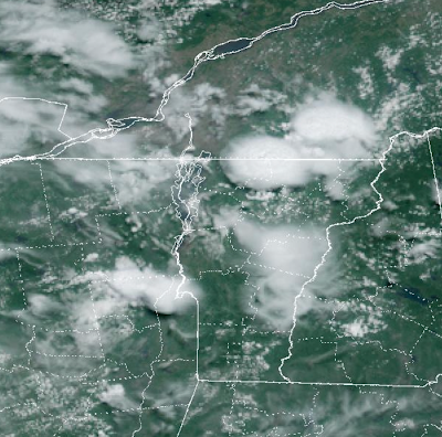
It'll probably be one of the worst weather days of the year by the time we finish up today, depending on your tastes.
As expected, the heat and humidity have built up even more than yesterday. Scattered thunderstorms have also been developing, and rains from those have only added to the humidity.
From now through sunset is a great time to find a cool place, don't exert yourself outside and stay hydrated.
Thunderstorms are proving to be an interesting part of the mix.
NOAA's Storm Prediction Center singled out eastern New York, Vermont and New Hampshire as a likely place for widely scattered severe storms this afternoon
While they won't be widespread enough to warrant a severe thunderstorm watch, we should still really be on the lookout for these things.
They've already started.
As I mentioned this morning, many of them form super quickly. One storm formed as just a small cloud with a sprinkle under it on the west shore of Lake Champlain at around 10:50 a.m. By the time it was over Swanton and St. Albans just over a half hour later, it was a strong storm with torrential rains, frequent cloud to ground lighting and winds gusting to 30 mph.
Less than 15 minutes after that, it was a storm carrying a severe warning with possible gusts to 60 mph heading into Sheldon and Enosburg.
Within 15 minutes of the storm ending, it was sunny, hot and humid again in St. Albans. This is the type of afternoon we'll have all day in Vermont. Always a risk of a quick pop up storm with dangerous lightning and downpours, and that constant oppressive feel.
In other words, a typical July day in South Florida.
We'll do it all tomorrow too.
So today, stay safe from the heat, the humidity the lightning and the storms


No comments:
Post a Comment