 |
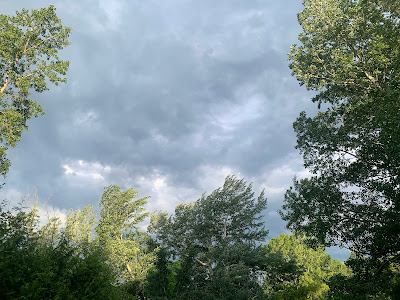
| Early morning thunderstorms, somewhat of a surprise, approaching St. Albans, Vermont around 6:30 this morning. |
Yesterday marked the first hint of our coming transition to wetter weather here in Vermont. Today will drop a few more widely scattered hints, while we'll really notice the rain Thursday.
The vast majority of us stayed dry Tuesday. Most of us will avoid rain today.
Temperatures Tuesday rose well into the 80s across Vermont's valleys, even touching 90 degrees in Burlington Despite some pretty dry air, a couple isolated showers and storms formed over the mountains. The slopes helped initiate updrafts which grew enough to become slow moving, isolated showers and storms.
I saw one on radar over southeast Vermont that seemed to be moving so slowly that I imagine one or two towns bulleyed by this might have had an inch or two of rain while places literally a couple miles down the road saw nothing.
When there's summer warmth, any little disturbance has the potential to prompt a couple of showers. Early this morning, a real wimp of a wrinkle in the air flow overhead and a small pool of moisture in the atmosphere were enough to fire up a few widely scattered storms this morning.
As of 7 a.m., showers and thunderstorms were mostly focused over the central and northern Champlain Valley, heading slowly east and southeast. Which left some of us pleasantly surprised by an early morning wetting for the gardens. Other early storms were lingering over southwestern New Hampshire.
Any of us could see a shower or storm because of this today, though as I mentioned most of us stay dry.
Drier air aloft will probably mix down to the surface this afternoon, which will probably limit the showers. Usually summertime storms peak at the height of afternoon heating, but today's might wane a little bit by mid to late afternoon. We shall see.
Despite the smattering of storms around, we'll see enough sunshine to once again boost us all well into the 80s today.
THE REAL RAIN
Thursday still looks like a wet one. Humid, too, as the incoming cold front will draw quite a lot of moisture into our area.
Generally speaking, the National Weather Service in South Burlington is forecasting anywhere from a half inch to 1.2 inches of rain through Thursday night. Enough for a decent wetting.
A few spots might get nailed with a slow moving downpour or a string of them, leading to a few isolated spots seeing more than two inches of rain.
NOAA's Weather Prediction Center does put Vermont in a marginal risk zone for flash flooding, the lowest of four risk levels. They're concerned about repeated downpours along the same area near a warm front that will stall somewhere near or over Vermont for a time.
That said, we had that long dry spell, so it would take a LOT of rain to create any local flash floods. Most of us have gone at least a week without rain. There's been lots of sun and humidity has been low until now. Things have dried out nicely.
If there is any flash flooding Thursday and Thursday night, and that's a fairly big if, I imagine it will be very localized and probably not that bad. Still, if by chance you do encounter water over a roadway, don't drive through it. Turn around, because you won't know how deep the water is, or whether or not there actually is a road under the way. It could have washed away for all you know.
The showers will continue on Friday through at least Sunday. None of those days will be washouts, but there will always be the risk of getting a quick dose of rain. You never know when that rain will hit, but it'll probably be most likely during the afternoons and evenings.
Although it will be much less warm over the weekend than it's been, highs near 70 and lows in the 50s would be just a slight touch cooler than average. No biggie.


No comments:
Post a Comment