Tuesday, November 7, 2023

After Spell Of No Change Weather In Vermont, Now It's All Over The Place

The weather went from benign, sunny and pretty calm
Monday morning as seen here, but is now changeable,
windy, with a bit of a snow/ice threat by Thursday morning.
I thought the weather was really odd in the second half of October in Vermont. 

We know there's usually a lot of change day to day, but in October, it was one dreary day after another, with temperatures about the same each day. No excitement, no drama.  

I guess a lack of drama is a good thing, but we all crave a bit of spice. And now the Vermont weather has reverted to its usual tricks of switching gears seemingly every minute. 

We have wind, showers, maybe even thunder, snow, sleet, freezing rain, rain and weird temperature trends all in the forecast. 

So we're back to normal. 

TODAY'S CHANGES

As expected, it was a windy night and early morning, mostly in the Champlain Valley and high elevations. 

Temperature trends overnight were also backwards, rising slowly instead of falling like they should. By 7 a.m., temperatures in much of Vermont were near what normal highs should be this time of year. 

But it won't be an extraordinarily warm day. A cold front was on our doorstep as of 8 a.m. It has showers and even some isolated rumbles of thunder along it. Skies were definitely darkening over St. Albans, Vermont as of 7:45 a.m. 

The showers will move through roughly northwest to southeast through the morning and early afternoon, and fading as they head into southern Vermont. Rainfall doesn't look like it will be impressive. But most of the northern half of the state should get a tenth to a quarter inch in a short period of time as the cold front moves through. 

The gusty south winds will turn into gusty west winds, with the strongest gusts near 35 mph in the northern Champlain Valley and along some of the east slopes of the Green Mountains. Temperatures will begin to go backwards again, starting to fall in northern areas by early afternoon instead of rising toward their peak of the day. 

Wednesday is looking a bit wintry.   Snow flurries might dust a few areas early, then most of us northern and central Vermont won't get out of the 30s all day even as skies brighten in the afternoon. North winds will add to the cold. The chilly air will set the stage for an icky Thursday.

THURSDAY SCHMUTZ 

Another storm is expected to zip eastward just to our north Thursday bringing another slug of light precipitation. Though it won't be heavy, but it might still be a bit of a mess. 

It'll arrive just in time for the morning commute. It's hard to say exactly what will be falling out of the sky at any particular time or location, but it won't be pretty. It seems at this point it might start as a burst of snow, then go over the sleet, freezing rain and rain. 

Again, not much, but a little dab will do ya. Plus it's unpredictable where roads might be icy and where they would be just wet. Especially this time of year. Freezing rain might be falling in a particular location, but just melts on the relatively pavement still relatively warm from a mild autumn, But the rain would freeze on bridges and overpasses, and that could surprise unsuspecting drivers.

The Champlain Valley has the lowest chance of snow and ice, but even there, we expect patches of trouble. Away from the valley, as it stands now, you might well be facing a lousy commute to work Thursday morning. It's getting to be that time of year. 

As the day wears on Thursday, things will go to a light, cold non-freezing rain, then taper off.  By the end of the week and weekend, we'll just settle down into a typical  most cloudy, chilly, temporarily quiet weather regime. 

Monday, November 6, 2023

Can They Invent New Apple Varieties To Withstand New Climate Extremes, Like Vermont's Devastating Spring Freeze?

A wild apple tree on a St. Albans, Vermont property
adjacent to mine managed to yield a good crop
for the deer this year. Many other apple trees in
Vermont had low or no yields due to an 
intense May freeze. People are trying to 
develop new hybrids that can withstand
climate change-induced extremes. 
From what I understand, Vermont's apple crop mostly sucked this year. 

The trees bloomed to early thanks to record heat in April. Then came a very late and intense freeze on May 18 that murdered a huge number of the nascent apples.  

As Vermont Public reported in September, Vermont lost roughly half of its apple crop this year due to the May freeze. Experts and growers are saying this is the worst freeze and apple crop failure in memory. 

It was an uneven disaster. Some orchards lost almost their entire crop for 2023.  Others, especially near Lake Champlain, were unscathed and actually had a great harvest this autumn. 

We weren't the only ones who struggled with an apple shortage due to weather this year.

World apple production is expected to be down by almost five percent this year, according to the Washington Post.  Last year's United States harvest was the weakest since 2013. Heat waves damaged crops in Washington State, China and elsewhere. Storms wrecked New Zealand's crops. 

A bacterial disease called fire blight is damaging apple crops, too.

The Washington Post tells us that two new apple varieties, developed by researcher Chris Walsh at the University of Maryland, might solve some of the problems with apple crops.

Per WaPo:

"Walsh had an ambitious goal: develop apples that were heat-tolerant but also fire blight-resistant, and on trees short enough to be easily pruned or harvested from the ground."

The new varieties are heat resistant, which is great. People (including me!) love a crunchy crisp apple, and are kinda grossed out by a mushy, mealy one.  Heat waves tend to give us mushy, mealy.  The new apples would survive heat waves and still end up being satisfying at harvest time. 

This doesn't solve the problem like weird early spring bloomings followed by late frosts, or storms that wreck trees or at least knock all the apples to the ground before they can be harvested. But it's a start. And maybe some scientists and growers can develop varieties that resist frost. Or at least bloom so late that frosts and freezes are less likely to affect them. Who knows?

We don't know yet when these two new varieties, which don't yet have warm fuzzy marketable names yet, will be in grocery stores. But Walsh says they'll at least be available at pick-your own orchards and farmers markets as soon as September, 2026.

Meanwhile, here in Vermont, we can hope we don't get weird early spring heat waves and no late frosts in 2024.  

Sunday, November 5, 2023

The Gales Of November (Well Sort Of) Have Arrived

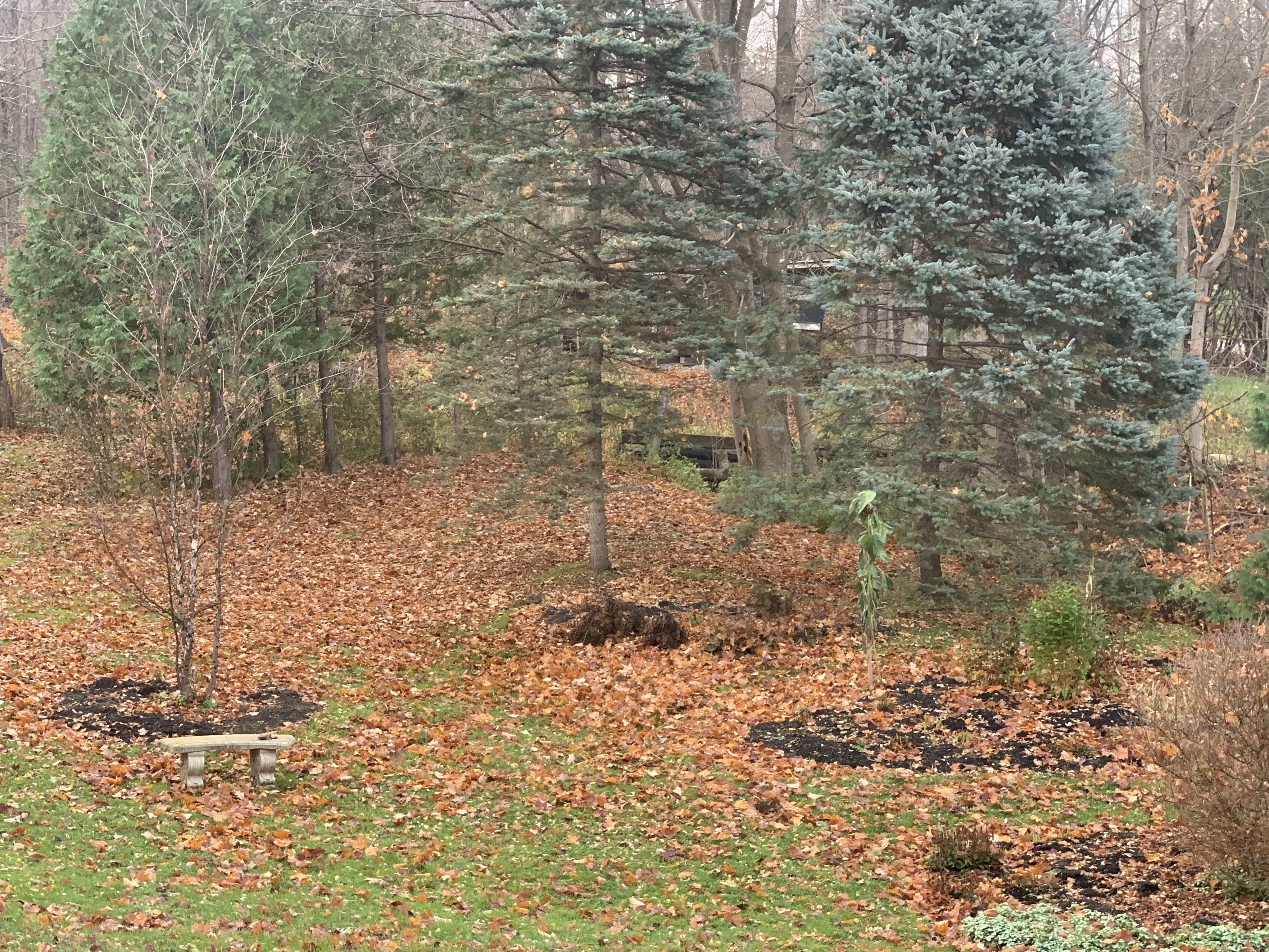
Friday night's gusts to 40 mph took down almost all
the remaining leaves on the trees around my 
St. Albans, Vermont yard, leaving the lawn 
carpeted in orange and brown.
 It was a little late in coming, but the usual windy cold season regime finally arrived in Vermont Friday, which featured a very gusty night in the Champlain Valley. 

We've got another round of gusty winds Monday night and early Tuesday. 

Summer and early fall in Vermont usually feature very little wind, except in strong thunderstorms. By fall, the winds pick up, especially in the Champlain Valley, as stronger large scale storms start to take hold. 

Although it can be windy anywhere in Vermont this time of year and in the winter, the Champlain Valley is ground zero for gusty days and nights. 

That's especially true this time of year. A typical November storm track is up through the Great Lakes and into Ontario and Quebec. That sets up south winds.  The Green Mountains and Adirondacks act as a funnel, constricting the air and making move high speed south to north up the valley. 

These windy spells are frequent, and it doesn't take a very strong storm system to produce them.  One storm passed well to our  northwest Friday night, producing gusts to and maybe even a little over 40 mph in spots. 

It's been such a calm autumn until now that I was surprised how many small branches were on the ground after that windy spell Friday night. Weakened and dead twigs accumulated in trees during a remarkably wind-free summer and fall. The first windy night produced, an, um, windfall of downed small branches. 

Nothing damaging of course. The winds weren't strong enough to cause much trouble.  It did take down most of the remaining leaves on the trees. Most of the straggler leaves still clinging to the trees are about to blow off. 

That's because another modest storm is coming along Monday night. Again, typical of November, this one is going by to our northwest. Though the storm isn't a biggie, the jet stream driving it is strong.  That'll push that storm past us very fast, and perhaps mix down some higher speed air from aloft. 

Not all of the region will get a blast of wind out of this, but it should be breezy everywhere Monday night. 

The central and northern Champlain Valley should see gusts over 40 mph Monday night, so it will be rather noisy and bumpy and spooky outside overnight as the wind roars through the now bare trees and slams shed doors and shutters back and forth. 

In the far northern Champlain Valley winds - say up toward St. Albans, Swanton, Alburgh, and other parts of the Islands - winds could gust to 50 mph.  This might prompt a wind advisory because those gusts are strong enough to produce some scattered power outages. 

I don't know anybody in their right mind who would be on top of Mount Mansfield overnight Monday and early Tuesday, but gusts up there should reach 65 mph, says the National Weather Service office in South Burlington. 

Although the gusty winds coming up aren't due to any strong systems, sometimes the storms that roared through the Great Lakes are truly monsters - the famous Gales Of November. Those huge storms also cause very windy weather in Vermont, and throughout the eastern half of the United States.

Big November storms like that are what the song "The Wreck of the Edmund Fitzgerald,"  is about. It's the true story sung by Gordon Lightfoot about a ship that sank during a powerful storm in Lake Superior in November, 1975, claiming 29 lives.

Another famous November gale was in 1950, with a powerful storm that moved northeastward more along the Appalachians rather than the Great Lakes.  That storm dumped one to as much as five feet of snow on places like Ohio, western Pennsylvania and West Virginia. 

In the Northeast, that 1950 event is easily one of the worst wind storms in history. Gusts reached 160 mph atop Mount Washington, 110 mph in Concord, New Hampshire, 108 mph in Newark, New Jersey and 94 mph in New York City. 

Here in Vermont, the 1950 storm brought the highest wind gust on record at Burlington, with 72 mph. We did come close to breaking that record last December 23rd with a gust to 71 mph in Burlington. 

Nothing extreme like those storms is on the way anytime soon, so don't expect much drama. But if this November is anything close to normal, expect more hang on to your hat and bump in the night weather pretty frequently over the next few weeks. 

Saturday, November 4, 2023

Latest In Series Of Severe Storm Trashes Western Europe, At Least 14 Deaths

In this screen grab from news video, people in 
northwestern France struggle in hurricane force
gusts and flooding from Storm Ciaran 
During the past couple weeks at least, he United States - including us here in Vermont - have been getting a welcome break from the extreme weather brought on by El Nino and climate change.

Not so in Europe, where intense storms coming off the Atlantic Ocean have caused widespread destruction over the past month or so. 

The worst of the storms hit this past week. They name winter storms in Europe, and this one was Ciaran. 

The intense wind and rain storm tore across much of western and central Europe, so far killing at least 14 people and likely causing several billion dollars in damage. 

France and Italy appear to be the two  hardest hit nations. The coast of France endured wind gusts as high as 129 mph. The port city of Brest in northwestern France had record high wind gusts of around 100 mph. The city has widespread structural and tree damage. Half a million French households had no electricity for at least two days because of the storm. 

The island of Jersey in the Channel Islands is said to have worse damage than the Great Storm of 1987, which is the benchmark for the severest storms in the region. Most houses on the island have at least some damage, ranging from broken windows to missing roofs and caved in walls. 

Storm Ciaran unleashed severe floods in Italy, where at least six people died.  Damage was worst in and around Tuscany.  Video showed dozens of cars being shoved down city streets in Italy by powerful torrents of water. 

Flooding extended as far north as Northern Ireland, where the cities of Downpatrick and Newry were inundated, 

Recently, on and around October 20, Another storm, named Babet, hit the U.K,, causing some of the worst flooding on record in Scotland and parts of the British Midlands. 

Yet another storm, named Domingos, is sweeping through France and surrounding areas today. Though not nearly as strong as Ciaran, it is still causing damaging gales and prolonging flooding in parts of western Europe. 

Vicious fall and winter storms have always hit Europe, especially when there's an El Nino, like we're having now. But the storms are also being turbo charged by climate change.  Oceans are warmer, so incoming storms can gather more energy and become stronger. 

The warmer atmosphere can also hold more moisture, so downpours are more intense, causing worse flooding than in the past. 

Friday, November 3, 2023

Why Worsening Antarctic Ice Problems Are Your Problem, Too

Two new reports paint a worrying picture of Antarctic
ice, which is a problem for the whole world. 
 The amount of sea ice surrounding Antarctica reached a new low for the end of winter, increasing worries that the South Pole and surroundings are now in an ice decline similar to the Arctic at the top of the world, the Washington Post reports.

Additionally, according to another article the Washington Post, 40 percent of Antarctica's ice shelves - which are separate and different from sea ice - have dwindled in the past quarter century, and that's allowing more land ice to flow into the oceans. The extent of ice shelf melting is more extensive than previously thought. 

Yes, this stuff is oh-so-distant away from us, so you'd think who cares?  Well, everyone should. What goes on in Antarctica doesn't stay in Antarctica.

The Antarctic ice problems will probably worsen sea level rises on every coastline around the world. If you don't live anywhere near the coast, the ice crisis in Antarctica might worsen the climate changed we're all already feeling. 

SEA ICE ISSUES

 The sea ice around Antarctica usually reaches its peak in September, when winter is ending in the Southern Hemisphere and spring is beginning.

This year, the maximum sea ice extent around Antarctica this September was the lowest on record. As the Washington Post reports, the season's maximum ice extent around Antarctica was reached on September 10 - much earlier than normal, The ice was remarkably lacking. Says the Post:

"At that time, the annual ice coverage was at a record low of 6.55 million square miles - a whopping 398,000 square miles lower than the previous low set in 1986."

That's still a lot of ice.  But any decline is worrying. A lack of sea ice won't directly increase sea levels.  Ice melting on an ocean is like an ice cube melting in your gin and tonic. It won't increase the amount of liquid in your glass.

But sea ice is white. Or at least white-ish. It's great at reflecting sunlight out to space. That, in turn, helps air condition all of Earth. Open ocean is darker and absorbs sunlight, helping to warm the world.  It's called a positive feedback.

Climate change is already boosting global temperatures.Then the effects of that warming, in this case a dark surface to absorb the sun't heat, accelerates the mess even more.  

ICE SHELVES LOSING

Also, the sea ice surrounding Antarctica stabilizes the ice sheets on the continent or near its shore. The new lack of sea ice, and that darker water absorbing the sun's heat, could allow warmth to further eat away at the ice sheet,  glaciers and ice shelves

Ice shelves are enormous floating pieces of ice extending out into the ocean from glaciers on land in Antarctica. They act like dams in a way, slowing the flow of ice on the land into the oceans. Ice shelves surround most of Antarctica's coastline. 

That study I mentioned at the beginning of this post about the ice shelf decline is probably more serious than this year's crappy sea ice extent around Antarctica. 

Damage the ice shelves and you damage the ability for Antarctica to hold onto its immense glaciers.  That glacial ice flows into the oceans, melts and helps accelerate sea level rise around the world. 

Says the Washington Post: 

"'The surprising result to me was just how many ice shelves are deteriorating that substantially and continuously,' said Benjamin Davison, lead author of the study. 'Lots of ice shelves not just the big ones, are steadily losing mass over time with no sign of recovery."

The study sounds like a lot of work, but I guess most scientists are used to this. The team analyzed more than 100,000 satellite images from 1997 to 2021.   During that time, 71 of 162 ice shelves lost mass, another 29 managed to get a little bigger and the rest didn't change much one way or the other. 

West Antarctica showed the biggest ice shelve diminishment, and the numbers are huge. The Getz Ice Shelf lost 1.9 trillion tons of ice over the 14 years analyzed. Another ice shelf lost 1.3 trillion tons. 

In West Antarctica, warming ocean water is undercutting the ice shelves, prompting them to melt. The ice shelves in East Antarctica are much more stable, because the water along the immediate coast there has still managed to stay almost as cold as it ever was.

The scientists said you don't need a complete collapse of most or all of the ice shelves to cause real problems. As long as many are weakening, more land-based ice can flow into the water to melt, and raise those global sea levels. 

This is all just one more thing to worry about in the age of climate change. 


Thursday, November 2, 2023

First Widespread Vermont Snow Wednesday Was "A Very Pretty Snoliage" Surprise

Everybody gets excited about the first snow of the season. 
Snow falls in Burlington Wednesday afternoon. Some trees
still have leaves on them, making for some pretty scenes.

Like on Wednesday, when snow fell across most of Vermont. It didn't amount to much in most places, though a few places in southern Vermont did pick up a surprising amount of snow.   

People were thrilled to go out into the snow when it arrived. Never mind that many of these same people will be cursing the snow by the time March and April roll around. 

The first snow of the season is usually pretty benign, and so it was Wednesday.  Pavement was mostly too warm to freeze amid the snow, so there weren't a lot of traffic problems.

That said, temperatures were below freezing in most of Vermont early this morning, so there's probably some icy patches here and there on the roads. 

We got an added treat with this snow due to the warm autumn we've had. In low elevations, colorful leaves are still clinging to some of the trees. This resulted in a classic "snoliage" day in which the snow dusted orange and yellow and red leaves to make Wednesday a very photogenic day.

Video is below to give examples of how pretty the day was. 

This snow was an over-performer.  We knew a weak weather disturbance was on its way, and we knew it would trigger some scattered snow showers.

However, a  particularly heavy batch of snow went through southern Vermont and western Massachusetts Wednesday morning and early afternoon. Most places down there got just a dusting to an inch, but a few spots were nailed, all things considered. A location near Ludlow saw 5.3 inches of snow. Perennial snowy spot Shrewsbury, Vermont picked up two inches. 

Snow dusted St. Albans, Vermont on Wednesday.
A second batch of somewhat heavier than expected snow hit the Champlain Valley and some other parts of northern Vermont during the early to mid afternoon. 

Although the word "heavy" is an overstatement, since most places in northern Vermont had an inch or less of snow.   North of Burlington, the snow didn't melt immediately, and was still on the ground this morning.

It was quite a pretty drive on the way home from Burlington yesterday afternoon as dark clouds contrasted with the white snow on lingering oak leaves and on the dark green pine trees.  It looks like my place in St. Albans picked up about 0.8 inches of snow. 

There were some climatologically oddities in Wednesday's snow. That Vermont would receive a trace to three inches of snow in early November isn't weird - that's not it. 

The stat that stands out is Burlington. Almost always the first snow of the season there (and pretty much anywhere) is a trace.  A few flurries fall, but nothing sticks, and accumulation is regarded as a trace.

In Burlington, the first snow of the season was actually measurable. True, it was only 0.1 inches which is practically nothing. But the fact that the first flakes of the season actually amounted to something - albeit very minor - is odd.

There's been weirdness in snowfall in the region this season. Montreal had its first measurable snow of the season on Monday. But according to some reports, it was the first time on record the first measurable snow of the season in Montreal came before the first freeze of the season. 

This, of course, was just a foretaste of winter. We're not going to see anymore snow for at least a few days.  It'll be too warm. We do have a risk of showers Saturday through Monday, but it won't rain all of the time. In fact we have a shot at a pretty decent Saturday all in all. 

However, a relatively cold weather pattern looks like it will return next week, bringing us renewed chances of light snows,.

Here's a video of yesterday's pretty snow in Burlington and St Albans, Vermont. Click on this link to view, or if you see the image below, click on that: 


Wednesday, November 1, 2023

Vermont October Wildly Warm, Wet, Especially Northwest Part Of State

October was warm, but rather cloudy, especially after
a record early season heat wave during the first week
of the month. This all made foliage season late.
This is a view of South Burlington, Vermont on Oct. 26
October, 2023 really re-wrote the weather history book in Vermont, especially around Burlington. 

 The month in Burlington was the fifth warmest and third wettest October in Burlington. On top of that, the high temperature of 86 degrees on October 4 set a new record high for the entire month. 

Elsewhere in Vermont, it wasn't quite as wet, but it sure was warm.  Towns across Vermont were consistently five to six degrees warmer than normal, which I'm sure that like Burlington, that puts them in the top ten list for October warmth. 

If anything, that early October heat burst was more intense in much of the rest of Vermont than in Burlington.  St. Johnsbury got up to 87 degrees for two days in a row. Woodstock got to 86 degrees three days in a row.

After that sunny hot spell, the rest of October settled into a rather cloudy, dreary, but still warm pattern. That is until Halloween, when Vermont finally got its first frost of the season. Again, record late timing for that. 

It's not surprising that October was so warm.  Autumns during El Nino patterns, which the world is under now, tend to be on the mild side in New England. Not always, but usually.

Northwestern Vermont was pretty much the wettest spot in the Green Mountain State during October. 

That's because two big storms accounted for most of the rain during October, and both storms focused on the Champlain Valley. 

Burlington's top ten showing in the list of wettest Octobers seems to be part of a trend. Five of the top six wettest Octobers have occurred since 2006.

Montpelier, for a change was actually a smidge on the dry side. Rainfall in October, 2023 there was 3.37 inches, about a third of an inch below normal.

Rutland was just at normal with four inches for the month. St. Johnsbury had 4.51 inches of rain, which is a little over a half inch on the plus side. 

Bennington managed a rather wet October with 5.23 inches, which is 1.72 inches above normal. 

Like I say every month, I don't trust long range forecasts, but still, it feels like November could be shaping up to be quite different than recent months. 

It's starting out on the cold, and forecasts for the next couple weeks - if they verify - indicate a decent possibility of a colder than normal month. No guarantees on that, though. Forecasts beyond a week or so are iffy. And who knows what will happen during the second half of November.

November can really be a wild card in Vermont. Last year, we had our warmest November day on record. On the other hand, in November, 2019, winter cold and snow settled in by the second week of the month, with single digit temperatures by mid-month.  

Anything can happen.