Friday, January 31, 2025

Some Kinda Tricky Weather This Evening, Overnight In Vermont, Especially South

A Vermont State snowplow was caught on a traffic cam
around 5 p.m. today as wet snow fell on Route 9 in
Woodford.  About a half hour before this photo
was taken, the road appeared to be just wet, 
highlighting the rapidly changing road
conditions this evening in southern Vermont. 
 A storm is scooting by to Vermont's south early tonight as another blast of at least semi-Arctic air is poised to drop down on us from Quebec.  

The combination of these two things should give you a heads up if you're planning on driving in the state or surrounding areas tonight, especially in southern Vermont. 

Most valleys managed to get above freezing today. Filtered sunshine north of Route 2 made for a rather pleasant day. 

The further south you went, the worse the weather got. 

 There's been light mixed precipitation in southern Vermont all afternoon, and conditions will get a little thornier as we go through the evening. 

That's because the cold air is just beginning to advance. And the bulk of the precipitation and its most northward extent is coming this evening.

A winter weather advisory is up and running in Bennington and Windham counties - the southernmost part of the state - until 4 a.m. Saturday.  A mix of light rain, sleet, freezing rain and snow was in the process of turning to all snow as darkness fell. These areas can expect two to six inches of snow. 

Central Vermont - places like Rutland, Middlebury, Montpelier and St. Johnsbury  - can expect about 1.5 to as much as three inches of new snow this evening. 

One to four inches of snow is in the forecast overnight
in the southern two thirds of Vermont, with maybe a 
little more than that in high elevations south.
Very little snow is in the card for near the 
Canadian border. Rapidly falling temperatures
tonight will make the wet snow on roads in
southern Vermont freeze, so it'll be tough going. 
I noticed that rain that had been falling in Bennington and Rutland and a few other places in southern Vermont had switched to wet snow as of 5 p.m.  

The wet snow combined with water on the roads across southern Vermont will tend to freeze up soon, making roads dangerous. 

I saw that starting to happen on traffic cams in higher elevations of the bottom half of Vermont already as of 5 p.m.  

North of Route 2, amounts will drop off sharply, but it's a little hard to tell where the cut off between light snow and no snow is going to be. Places up by the Canadian border might not get anything at all. 

If you don't have to travel to the southern half of Vermont tonight, I wouldn't bother. The road crews and salt shakers are out, but there's only so much they can do when temperatures crash into the single number and teens overnight. 

Saturday will be another cold day as the temperature roller coaster continues. That roller coaster of suddenly warm/suddenly cold weather will continue all week. I'll have more on that in a post sometime tomorrow, as we do also face a couple of storm chances as well. 

Hawaii Storm Creates Floods, High Winds, Even Snow And Tornado Risk

A KHON reporter gets splashed by water from passing
vehicles as she reports on flooding in Hawaii Thursday.
The island chain is being hit by an unusually
strong storm that will also bring heavy rains
to California this weekend. 
An unusually powerful storm is slapping Hawaii with a wide variety of rough weather. 

The entire island chain was under a high wind warning until noon Friday. Flooding was developing. There was a risk of severe thunderstorms and even the risk of a tornado or two, which is very rare for Hawaii. 

Power outages were already increasing across Hawaii during the day Thursday. Residents inMaui were told to stay off roads due to high winds and flooding. 

As of early Friday several roads were blocked by flooding as rain came down at a rate of one to as much as three inches per hour. 

The city of Kahului on Maui reported an inch of rain in an hour and wind gusts to 50 mph, which is highly unusual stormy for the location. The National Weather Service warned Maui residents of impending significant and life-threatening flash floods and landslides. 

One town in Maui received 13 inches of rain in the storm. A weather station atop a Maui mountain reported a wind gust to 120 mph. 

Honolulu was slammed by more than 3.5 inches of rain, including just under two inches of rain in two hours. That two inches in two hours is more rain than what normally falls on Honolulu during the entire month of January.  

Winter storms sometimes affect Hawaii this time of year, but this one is especially powerful. 

The storm was expected to deepen to 986 millibars, at a latitude a little south of 30 degrees N which is unusual for a storm that far south. It's about the same latitude as northern Mexico.

The storm is close enough to drag a cold front through Hawaii, which is kind of rare for that far south. Ahead of the front, forecasters were worried about rotating thunderstorms that could produce those waterspouts or potential tornadoes. 

 Early Friday our time on the East Coast, the torrential rains were just moving into the Big Island of Hawaii, and new flash flood warnings were issued for parts of that island.  

Atop the highest volcanoes on the Big Island of Hawaii, winter storm warnings were in effect.  Winter storm warnings up there are actually not all that weird for Hawaii.  The summits are expecting five to ten inches of snow, with wind gusts possibly reaching as high as 90 mph. 

ATMOSPHERIC RIVERS

What goes on in Hawaii doesn't stay in Hawaii.  The storm north of Hawaii will contribute to atmospheric rivers that will start hitting California today and intensify over the weekend. 

Flood watches are already up for central California, including San Francisco and Sacramento.  This is a "Pineapple Express" from near Hawaii, as we mentioned so it's a warm atmospheric river. That means rain instead of snow will fall pretty high up the slopes of the Sierra Nevada range. Elevations as high as 7,800 to 8,000 feet look like they are in for rain instead of snow. 

There could even be some flooding near Lake Tahoe. 

Southern California, still suffering from a drought, is expected to mostly miss out on this atmosphere river. It probably won't rain down there until Tuesday. It's just as well the rain in southern California won't be torrential, as that would lead to more mudslides and debris flows in areas that suffered through those huge January wildfires. 

Eventually the atmospheric river could consolidate into a storm that might affect us here in Vermont around next Thursday. Watch this space for updates in the coming days. 


Local Meteorologists Fired In Ill-Advised Cost Cutting Move, Public Outcry Ends Up Saving Those Jobs, Offers Lessons For Trump Admin

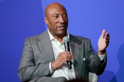
Allen Media Group, owed by billionaire Byron Allen,
pictured here, tried to get rid of dozens of 
meteorologists at their local television stations and
replace them with a consolidated group
of Weather Channel meteorologists in Atlanta.
This did not go over well and was rescinded,
but it's a reminder of how corporate consolidation
hurts locals, including their important weather info,
Local television meteorologists very often quickly get a big fan base, for very good reasons. 

They tend to be personable, and also quickly learn the lay of the land, meaning they're on top of local conditions that make storms worse or less severe depending on which neighborhood they hit.  These meteorologists really become the public's eyes and ears on the ground when the weather crap hits the fan.

Which leads us to the Allen Media Group's really stupid, now rescinded move to fire meteorologists at local stations it owns.  Their weather forecasts would come from Weather Channel meteorologists in Atlanta, who might be excellent at their jobs, but have little idea of the nuances that really make local weather forecasters indispensable. 

This whole kerfuffle gives us lessons on the evils of corporate consolidation, which ensures big money for the CEO but messes with the quality that the public should expect.  

The hijinks of these private corporations also gives us a warning regarding the fate of the National Weather Service. The NWS is  a critical resource in which their meteorologists in regional offices,  like their local TV counterparts, know the areas they cover like the back of their hands, making their storm warnings all the more accurate and effective.

I bring this up because there are fears that the Trump administration could actually disband the National Weather Service and rely on corporate meteorological corporations without that local expertise, and the sense of duty you'd expect from local experts. 

More on that in a moment. 

ALLEN MEDIA AND THE RESCINDED PURGE

Local meteorologists tend to be underpaid, but their dedication to their craft is legend. 

They come to us every day with useful information, and sometimes, with timely, life-saving alerts and warnings. They'll tell you the precise neighborhood the tornado is heading towards, which streets are about to go under water in a flash flood, and why the roads in, say, Waterbury are about to get snow covered and slippery while the roads up in Burlington will stay just fine. 

As one person LeeWatson_357 posted on X:  "Laying off Weather People in tornado prone areas is very dangerous. People based in Atlanta don't know the local areas in markets like Tupelo, Mississippi."

All this made the supposed  cost-cutting move by Allen Media Group, owned by billionaire Byron Allen, this month really stupid.. They axed local meteorologists for television stations and would just send forecasts from its Weather Channel headquarter in Atlanta to its stations across the county. 

As Variety reports:

"Handing out pink slips to dozens of beloved small-market local TV news weathercasters would be ill-advised even in the best of times. But to do it right as unpredictable and dangerous weather disasters tear across the country this month - from wildfires in California to a historic freeze in the south - was particularly tone deaf."

Apparently, local viewers understand this. A huge public outcry led Allen Media Group to rescind the firings. At least for now.

It looks like all the affected television stations were given the same statement from Allen Media Group to read: "After receiving significant feedback across various markets, Allen Media has decided to pause and reconsider the strategy of providing local water from the Weather Channel in Atlanta and (local television station) will continue to provide market-leading coverage from your Storm Tracker Meteorologists."

As tvtechnology.com reports, local stations affected by the layoff cancelations were grateful to their audiences. "Your calls, emails texts... every word spoken in support of our team was heard, and without your outpouring of messages that rang so loud, this change may not have been possible," said Craig Ford, the news anchor for ABC affiliate WTVA in Tupelo, Mississippi. 

LESSONS LEARNED

This bad move by Allen Media was averted, but these consolidation efforts are happening throughout the media. It's not just meteorologists: 

Variety reports:

"Sinclair, CBS, Gray Media and others have done variations of the same in recent years. These cost-cutting moves are a disappointing financial reality given a soft advertising marketplace and audiences turning their attention away from TV.  It's also happening in newspapers of course. But what's lost in these moves to centralize coverage is the local expertise and nuance that goes from having your boots on the ground, knowing the intricacies of your community and having a personal relationship with viewers. 

Ironically, removing all of that will only hasten the demise of local media as we know it. What is more local that the daily weather forecast? Stripping away the very selling point that still makes broadcast valuable - it's live, local nature - may help save a few coins in the short run, but it's a recipe for obsolescence in the long term."

I witnessed that here in Vermont when I worked at the Burlington Free Press. It was founded in 1827 and became a daily in 1848.  It had a storied past of ground breaking Vermont journalism. When I joined the paper in the late 1980s, it was still the to-go source for news and information. 

The paper's corporate overlord kept doing its cost cutting, laying off workers in waves (I was finally led go in 2013). Now the Burlington Free Press is pretty irrelevant, online only, and no longer a source of local news brought to you by journalists who really knew the community. 

NATIONAL WEATHER SERVICE

During his campaign, Donald Trump professed to know little about Project 2025 and he said he had even less involvement in it.

Project 2025 is a detailed plan developed in recent years by the conservative Heritage Foundation explaining how they wanted to radically change the federal government. This plan would only happen, the conservatives thought, if Trump was elected. 

And here we are. 

As I wrote last August, one of the ideas in Project 2025 would privatize the National Weather Service. Some private corporation would issue forecasts from somewhere, probably with less expertise, never mind any expertise on local conditions.  Perhaps the forecasts and life saving weather warnings would be behind a paywall, making only people with means to be able to hear, say, a tornado warning.

So far, nothing like this has been proposed, but the Trump administration is still very young. It could definitely still happen.

Which brings us back to public outcry. 

Loud opposition to Trump's steamroller of dubious decisions won't overturn all of them.  But public opposition is already slowing down and in some cases at least temporarily stopping some bad idea. As seen in the Allen Media Group blunder, the public can change things it doesn't like. 

Especially when it involves crucial resources and safety that are held near and dear to hearts of the public. 


Thursday, January 30, 2025

Baked Alaska: How That Frigid Northern State Not So Frigid This Winter, Compared To The Lower 48.

Not something you see very often: Water on top of ice
during a January thaw in normally frigid interior 
Alaska. Photo taken last week near Fairbanks. Photo
from National Weather Service office, Fairbanks. 

The Washington Post just had an interesting piece comparing the kind of January Alaska has had compared to the rest of us in the tropical Lower 48. 

Compared to Alaska, the Lower 48 ain't so tropical.  There's quite a role reversal going on. 

Anchorage, Alaska is having one of its warmest Januaries on record. With just a few days left in the month, the average temperature for January is 29.3 degrees, or a whopping 13 or so degrees warmer than normal.

Anchorage in January has been warmer than such cities as Indianapolis, Pittsburgh, Cincinnati, St. Louis and Louisville. 

We also had that famous snowstorm along the Gulf Coast earlier this month, which means New Orleans and Pensacola, Florida have had more snow this January than Anchorage. 

It's not just Anchorage. Fairbanks, in interior Alaska, is normally known as a forbidding icebox, where low temperatures often get into the 40s below zero and sometimes in the 50s to near 60 below. 

For only the second time on record, Fairbanks had a low temperature on a January day that was above freezing. (33 on January 25). On seven days this month,  the temperature in Fairbanks rose above 32 degrees. 

The normal high during January is 3 above zero and the normal low is about 15 below.  

Meanwhile, most of the Lower 48 has been unusually cold this January. That's especially true in the southeastern half of the United States. Though that region is having a mild spell in the closing days of this month, it will still be among the colder Januaries on record in much of the South.

The only regions of the Lower 48 that have been warmer than average are Maine, and large sections of Nevada, California, Oregon and Utah. 

REASONS AND OUTLOOK

The Alaska warmth is probably a mix between a fluke and climate change. A persistent northward bulge in the jet stream has kept Alaska on the mild side. A corresponding dip in the jet stream has pushed frigid air that's normally up in Alaska and northern Canada down into the United States. 

A marine heat wave, which is a zone of much warmer than normal ocean temperatures, has been ongoing in the Pacific from near Japan to the Gulf of Alaska. The marine heat wave is likely at least partly due to climate change and has probably been bolstering the Alaska balminess.

Plus, cold waves are in general less cold than they once were and hot spells are hotter in this age of climate change. That's likely a factor that has caused record heat in Alaska.  

The cold temperatures in the Lower 48 have broken few record lows, except near the Gulf Coast, where a previously unheard of snow cover combined with clear nighttime skies caused all time record lows as cold as 1 below zero not far from the Gulf of Mexico in Louisiana. 

(Editor's note: Yes, the Trump administration has renamed it Gulf of America, but international regulators, as well as the Associated Press style book still call it the Gulf of Mexico, so that's what we'll do here). 

The Alaska winter warmth is expected to mostly continue for awhile yet. The latest National Weather Service extended forecast out to two weeks calls for continued above normal temperatures in most of Alaska at least until a tad before Valentine's Day.  

For the Lower 48, the outlook is mixed, with variable conditions over the next two weeks. The northwestern United States is most likely to stay on the chilly side. 

Theses kinds of things do have a tendency to even out, usually. Although everything is skewed by climate change, I'm sure the Lower 48 will have its torrid hot spells in 2025 while Alaska will at least at times, revert back to its usual chilly vibe 

While Vermont Mountains Bask In Snow For A Change, Valleys Continue To Struggle With Snow Cover

A snow squall manages to put down another 1.5 inches
of snow in St. Albans, Vermont Wednesday. Vermont
valleys continue to lack snow, while many mountain
areas have a decent snow cover for a change. 
It continues to be a winter of two very different Vermonts in one season.

Many mountain locations are basking in some of the best snow conditions in years for skiing and riding, while many valleys can't seem to hold on to their snow cover. 

A big part of the problem is a persistent weather pattern that has favored snowfalls in the central and  northern Green Mountains while valleys get cheated. 

Another issue is something we've dealt with frequently in the past couple of decades; Frequent winter thaws. As climate change has taken hold, it's gotten a lot easier for temperatures to get above freezing in Vermont even in what should be the coldest times of the year. 

Most recent winters have features spells where temperatures rise well into the 40s and 50s, sometimes near 60, melting snow even in the highest elevations. These warm spells have also lasted for several days in a row.

Hard to keep a snow cover under those conditions. 

This winter, the thaws have been brief and not all that warm, which is why the mountains have hung on to their snow cover.  The very thin snow cover in some valleys evaporates as we occasionally see days that get into the mid 30s and low 40s. Higher terrain has mostly stayed below freezing, with only brief excursions into the mid-30s.   . 

So far this winter, Burlington has not gone longer than eight days in a row with continuous subfreezing temperatures, so the bits of snow the city gets don't last long. (The record for longest stretch of continuously at or below freezing weather is 51 days from December 22, 1976 to February 10, 1977).

The result is there's never been more than five inches of snow on the ground in Burlington this winter, and then, only pretty briefly.  Meanwhile, the snow depth near the top of Mount Mansfield reached 66 inches by Wednesday, which is above the average of 50 inches for late January. 

THE LATEST SNOW AND OUTLOOK

Yesterday was yet another example of mountains rich in snow and valleys losing out.  Most valleys saw one to three inches of snow, while parts of the northern Green Mountains saw more than eight inches.

Valleys in central and southern Vermont also once again briefly got above freezing. Rutland, Springfield and Bennington all had highs Wednesday in the upper 30s.

I managed to eke out 3.2 inches of snow here in St. Albans, for a total snow depth of five inches, the most I've seen all winter. A snow squall in the late morning boosted my total. See video at the bottom of this post. 

A five inch snow depth is not exactly overwhelming, and forecasts indicate I shouldn't expect much more anytime soon. At least I haven't broken my back shoveling deep, soggy wet snowfalls like we've seen in recent winters, so I'm thankful for that. 

This state of affairs will our winter weather pattern will continue. 

Another fairly minor system zips through Friday and Friday night, bringing precipitation mostly to southern Vermont. But once again, after a cold Thursday, most valleys in Vermont will end up just above freezing again by Friday afternoon. Rain will probably actually mix with the snow in some parts of southern Vermont. 

After turning cold again Saturday, yet another relatively minor system will poke temperatures up in to the upper 30s and low 40s again on Monday, leading to valley thawing and perhaps a little rain mixed with snow, but probably another inch or two of snow up in the mountains.

VIDEO

A St. Albans, Vermont snow squall at least briefly makes things look pretty wintery. The squall deposited 1.5 inches of snow atop 1.7 inches that hit earlier in the morning.  At least it was pretty. Click on this link to view, or if you see the image below, click on that. 


Wednesday, January 29, 2025

Kindness, Generosity, Heroics Emerge From The Ashes Of California

Edgar McGregor, who offers weather and climate
information on social media from Altadena, California,
warned residents to get out quickly as the wildfires
escalated quickly earlier this month. His warnings
are credited with saving an unknown number
of lives as people heeded his messages.
I still keep hearing inspiring and good stories coming out to the tragedy borne of those horrible California wildfires this month.

I thought I'd highlight a few, mostly in video reports that you see below. 

First, though, we introduce you to Edgar McGregor, 24. 

Altadena Life Saver

McGregor is one of those weather geeks you find on line, a little like me, but much better. For several years, he's been the leader of the "Altadena Weather and Climate" group on Facebook. 

Days before the fire, he was passing on tips to Altadena residents, warning them that a serious fire weather was coming, to gather their important documents and go bags. He even told people to park their cars front end toward the street, which would make hasty evacuations quicker. 

McGregor saw the Eaton Fire as it was just starting that horrible windy day. It would go on to devastate  neighborhoods in Altadena and elsewhere.

The expertise McGregor gleaned over the years made him understand shortly after the fire stated it was just getting going on a mountainous area, with thick brush and wind funneling through that area. He knew the blaze would establish a powerful fire front that would mow through neighborhoods. 

So he started warning residents to flee even before any official evacuation orders had been issued by county authorities. As the fire just started to gain steam, he released a 31-second video on social media: "Don't wait for an official evacuation notice,!" he said in the video, smoke visible billowing behind him. . "If you think you should leave, get out! 

People trusted McGregor because he's not one to overhype weather events, a very smart move on his part. He doesn't do his thing just for clicks and likes. "You know I don't overhype things, you know that if I'm saying it, it's serious, and you need to take it serious, and you need to get out," he told ABC7.

As a result, when McGregor offered his strongly worded warnings, people fled immediately.  People who did heed McGregor's warnings said he saved their lives.

For the record, McGregor himself escaped the fire unharmed and his house is still standing. 

VIDEOS

The Photographer:

I've really got to hand it to the local journalists in the Los Angeles area who covered the wildfire disaster. They brought quick information, insight, serious investigations and most important humanity to this horrible event. 

Gina Ferazzi is a veteran photographer, a Pulitzer Prize winning one, for the Los Angeles Times is featured in a video from the paper showing what it's like to cover a wildfire calamity like this. Stick to the end, too as some of Ferazzi's incredible photographs are shown. Click on this link to view, or if you see the image below, click on that. 


The Note

Examples of generosity and kindness keep emerging from the ashes of southern California neighborhoods.

In one case, a woman, originally from Iran had years ago purchased a tile at a historic mosque in her home country. As she fled her Pacific Palisades home ahead of the wildfires gave two firefighters the tile as a token of her appreciation.

The woman returned days later to discover firefighters had saved her home and a note was attached to her door. It was from the two firefighters, thanking the woman for the gift and wanting to keep in touch.

The video news story tells it better. Click on this link to view, or if you see the image below, click on that:


The Beer Coolers

Los Angeles television station ABC7 tells the story of a family who returned after their evacuation to find their house destroyed by the fire. But they also found two blue beer coolers that had been mysteriously left in their driveway. 

They opened the coolers to find their family photos stacked inside. 

Turns out firefighters were trying to save the family's home, but the fire roared through the attic and the firefighters realized the fight to save the house was lost. But on the way out of the house, they pulled down the family photos from walls and shelves and stashed them in the coolers, hoping to at least save them.

The plan worked, as this wonderful to watch news video shows. Again, click on the link to view, or if you see the image below, click on that.


The Paintings

In another case of a few saved belongings, an NBCLA reporter during the firestorm encountered a man trying to escape his home on a bike while struggling with some paintings under his arms. There's no way the man could have managed with those paintings on his bike.

So the reporter grabbed the paintings and promised to keep them in safekeeping until they could meet again. The reporter did give the paintings back. Click here to view the news video, or if you see the image below, click on that. 


The Marriage Proposal

One particular couple in Altadena were among thousands that lost their homes. Brian McShea had just purchased an engagement ring before the fire, but when they fled, he left it in a desk drawer. 

Miraculously, he found the ring in the rubble and proposed on the spot. Spoiler: She said yes. Click on this link to view or if you see the image below, click on that:


Vermont Weather Remains Busy, Snowy, Squally With "Wrong Way" Temperatures

Traffic cam of Route 2 on the Causeway between Milton
and South Hero looks windblown, as you can see
on the Lake Champlain ice next to the road. 
 A peaceful light snow was falling across much of Vermont early this morning, as expected. 

Of course, the roads are iffy with that snow, so once again, you'll need to take care driving to school or work.  Much like yesterday, after those early morning snow squalls we had, there's some school closings and quite a few delayed openings, so check your local listings.

Temperatures overnight went the wrong way, and that trend of weird temperature swings will continue for the next several days.  It'll seem like one moment it's frigid, the next balmy. For the next few days, it will be as if winter is really angry, keeps storming out of the room and then coming back in to yell, "OH, AND ANOTHER THING!"

That's life in a Vermont winter, I guess. 

TODAY

As the snow moved in overnight, temperatures slowly rose, instead of falling like they should before dawn. At daybreak, it was mostly in the teens, except low 20s west. So still kinda chilly this morning. 

Those temperatures keep rising for awhile this morning, peaking in the mid and upper 20s north and 30s south by around noon. 

At that point, things get more interesting. The storm is bringing an Arctic cold front with by very late morning or early afternoon. The result: Everybody in the state will face snow showers, blowing snow and crashing temperatures this afternoon. 

Snowing pretty hard this morning along Route 
105 in Berkshire, Vermont on this traffic cam

Similar to early Tuesday, such an abrupt cold front can create dangerous snow squalls. Tuesday's squalls focused o the north, and the weakened somewhat by the time they hit southern Vermont. 

Today will be different, with the squalls most likely in the south, mostly south of a line roughly from Middlebury to Wells River,  The National Weather Service in Burlington says they are less likely north of Route 2.   . 

It'll get gusty everywhere, with the strongest winds in the southern half of Vermont, so the blowing snow will probably be worse there. 

The snow showers will continue all day statewide into the early evening, so unlike your drive home Tuesday, today's will be tricky, too. 

Total predicted snowfall hasn't changed much since yesterday. Pretty much everybody gets two to five inches, including what already fell overnight. Most of the ski resorts should see at least six inches of new fluff.

TOMORROW/FRIDAY

Expected snowfall between this morning and 
Saturday morning. Doesn't include what we got
overnight, but does include predicted snowfall
today and Friday. 
We get a brief break in the snow, but it'll be cold.  We'll start out windy and nippy in the morning with temperatures within a few degrees of 0.  The wind will diminish as clouds increase during the day and it gets up to about 20 degrees, so better by afternoon.

Breaking the rules again, temperatures will keep heading slowly upward Thursday night instead of falling like they're supposed to. 

Friday, it'll be warm again with a little snow. Temperatures should get into the 30s.  The pattern this winter has been for light, fluffy snowfalls. Friday will be a little different. 

We probably won't get much snow, as current forecasts call for maybe one or two inches. But it'll be a wetter, heavier snow than we've gotten used to lately.  

The exact path of Friday's little event is still questionable, so expect some shifts in the forecast.

The temperature roller coaster will continue, though, as we go back in the deep freeze Saturday. (Highs in the low teens, morning readings within a couple degrees of zero. Sunday warms up again, and that continues on Monday when it might actually rain for awhile instead of snow. Then, next Tuesday, it gets pretty cold again. 

On and on it goes. 

Tuesday, January 28, 2025

Tuesday Evening Vermont Snow Update: Pretty Decent Dump In Mountains As Wide Temperature Swings Continue

This isn't saying much, but Wednesday could bring
Vermont and many surrounding areas the biggest
snow in weeks. Don't get too excited, as valleys should
see two to five inches, with up to eight inches up
in the Green Mountains. Western Adirondacks could
see up to a foot of new snow. 
Vermont and surrounding areas are about to get hit by the biggest snowfall in weeks, but don't worry this won't be a mega storm by any stretch of the imagination. But it does deserve a Tuesday evening update. 

The Alberta Clipper doesn't have huge amounts of moisture to work with, but it will be pretty damn efficient at grabbing what water it can from the atmosphere and dumping it on us as snow.

Roads will be iffy tomorrow and there could also be some problems with blowing snow and - once again - a few heavier snow squalls. 

THE DETAILS

In general, valleys can expect two to five inches of new snow, with locally more. Mountains will see several inches of new snow. I wouldn't be at all surprised to see many ski resorts in the Green Mountain State clock in with a good six inches of fresh fluff by later Wednesday night. 

The National Weather Service has posted a winter weather advisory for the entire length of the Green Mountains, with three to six inches expected. The advisory runs from later tonight into Wednesday evening. 

In the far southern Green Mountains in eastern Bennington and western Windham counties, there's a full fledged winter storm warning for an expected six to nine inches of snow, mainly above 1,500 feet in elevation. Gusty winds would blow the snow around too. 

The central and western Adirondacks and to an extent the White Mountains of New Hampshire look like they will be the big winners with this storm. Both those areas should see at least eight inches of snow, with some totals going over a foot in the western Adirondacks.

The water content of the snow will be low, so expect fluff. Melt the snow down, and you'll get the equivalent of a quarter to a half inch of rain for most of us, with a little less than that in the Champlain Valley.

The snow should start for most of us before dawn.  It'll be a light, steady snow for the first half of the day as temperatures climb into the 20s for most of us in the north, with 30s in the low elevations south. 

But during the afternoon, another sharp cold front comes in. That means more scattered heavier snow showers, maybe a snow squall here and there, blowing snow and temperatures once again heading toward the cellar.

So, you're going to deal with messy roads during the morning commute and afternoon one as well. The morning mess will be more widespread. Toward evening, most of the snow showers will be focused on the  Green Mountains and across much of northern Vermont. 

TEMPERATURE SWINGS

I'll get into more details in tomorrow mornings post, but the big up and down swings in temperature are going to keep going for at least the next week. 

If you like variety every day will be different for awhile. 

Thursday looks cold and blustery.  Friday looks warm enough at this point to get above freezing in some places, with rain drops mixing with snow showers. Then Saturday and Saturday night look damn cold, with highs near 10 and lows below zero. Sunday and Monday warm right back up again at least into the low 30s, then it's back to the icebox next Tuesday. 


California Rain Benefitted Greatly, But Not All That Much Rain Set Off Burn Area Debris Flows

To virtually everyone's relief in southern California, 
rain arrived as expected to tamp down those horrible
wildfires. The fires left the area prone to debris flow
in the rain, though, and some did in fact materialize.
 After going 262 days without any rain, showers finally blew through Los Angeles Sunday. 

The showers -which included small hail in some sections of the city and snow in the mountains - was a tremendous relief to everyone dealing with this month's wildfire nightmare in southern California. 

Though greatly beneficial, the rain, as expected in some ways continued the wildfire nightmare for some.

The rain storm hasn't been that big by southern California standards. Los Angeles just under an inch of rain from the weekend system. It was the first real rain the city has had since March 20.  

With the fires, that was enough to set off mudslides. One of the largest was in Topanga Canyon near the site of the big Palisades fire. 

Another mudslide poured down onto Mulholland Drive in Woodland Hills, trapping at least four vehicles in muck and rocks. A Los Angeles city fire truck also had to be pulled from the morass. 

This particular mudslide thankfully didn't damage any homes. 

A small section of the Pacific Coast Highway also had to be shut down due to mud and debris pouring onto the roadway. 

The rain obviously tamped down the fire and finally prevented new ones from starting, at least for now. The largest fires from this month are now almost entirely contained and are just barely smoldering in the damp conditions. 

Extended forecasts call for a few more chance of rain over the next couple of weeks.  Those extended forecasts lean slightly toward above normal precipitation in central and northern California and near normal in still much to dry southern California. 

Video

News station aerial view of one of the mudslides due to fire-denuded hills and the rain over the weekend. Click on this link to view, or of you see the image below, click on that


Heads Up Vermont: This Morning's Commute Might Be A Slog. Wednesday Might Not Be Much Better

National Weather Service radar at around 5 a.m. today.
The green is fairly heavy snow. That smudge of dark green
and yellow southeast of Burlington is an intense snow
squall. The purple outline depicts a snow squall
warning that was in effect at the time of this radar image.
A line of ferocious snow squalls swept southeastward through northern and central Vermont this morning, dropping a quick inch or two of snow and turning wet or slushy roads into ice skating rinks just in time for your drive to work this morning. 

The squalls will keep heading into southern Vermont by around 7 or 8 p.m., so that part of the state will deal with poor visibility and rapid changes in road conditions.

The squalls might weaken just a tad by the time they reach southern Vermont, but will still be dangerous. 

Meanwhile, the aftereffects of the squalls will be the main problem north of Route 4. Temperatures just after midnight were a little above freezing in many areas. The initial bits of snow just ahead of the snow squalls melted into water on many roads.

Then the snow squalls hit with rapidly falling temperatures and heavy, wind driven, blinding bursts of snow. That water on the roads froze, then snow fell on top of it.

The snow squalls were moving fast enough to only leave an inch or two of new snow in most areas, but that was more than enough to make the roads slick. 

I noticed road crews were out here in St. Albans shortly after the worst of the squall had passed and I'm sure that will be true everywhere else in Vermont.  But there's only so much they can do with crashing temperatures. 

Main roads might improve some through the morning commute, but they won't be entirely cleaned up.

Take it easy, take it slow early this morning. 

This Afternoon

The good news is the snow showers will be out of here this afternoon and roads should be in pretty good shape. Expect a cold day. As noted, we already had our high temperatures for the day. It'll stay in the teens all day if we're lucky and a stiff north wind will make it feel like it's below zero.

But there's no rest for the weary.  Tomorrow's trip to and from work won't be fun either.

Wednesday.

National Weather Service snowfall forecast through 
Thursday morning. Almost all the snow predicted is
from an Alberta clipper storm coming through on
Wednesday. Most of us can expect two to four
inches of fluff on of this one. 

We're on a temperature roller coaster as several quick weather systems come through with snow or even something else possible on Friday. But we're getting ahead of ourselves.  

The crash in temperatures will halt later this evening as an Alberta clipper comes in with clouds and snow. 

Alberta clippers are those fast moving storms that come in northwest to southeast from near Alberta, through or north of the Great Lakes then into our neck of the woods.  

Temperatures will moderate into the 20s tomorrow, but it will also snow pretty much all day. 

The snow will get here before dawn, and it will still be on the cold side in the morning. 

Even though the snow will be coming down lightly, it will still stick effectively to the roads. The plows will be out but it'll be a slow commute once again. The trip home in the evening will feature light snow, too, so even that won't be so great. 

Most of us can expect about two to four inches of fluff out of Wednesday's system, with a little more than that in the mountains. 

Behind this little snowfall, the temperatures will crash once again, getting down to near or even a little below zero by Thursday morning

Thursday And Beyond

The roller coaster continues big time. A break in the weather comes Thursday afternoon as sunshine returns (hopefully) and temperatures mostly stay in the teens. It looks like temperatures will actually start to rise overnight Thursday ahead of our next quick hitter. 

Friday is a wild card.  Another Alberta Clipper will be coming in from the west, while what was the rain storm that tamped down the Southern California wildfires lurks to our south and heads east toward the Atlantic Ocean,

The Friday Alberta clipper might suppress the wetter, southern storm to our south so that it misses us. Or, the clipper  might help draw the southern storm closer to us, giving us somewhat heavier precipitation.

 We don't know yet. Friday will probably be warmer again, possibly near freezing. But we don't know whether we'll see just a little snow and a few raindrops or a somewhat more substantial storm.

Watch this space for updates.

Then, once again, temperatures get frigid again Friday night and Saturday. Then, rinse and repeat as yet another Alberta Clipper comes in next Sunday and Monday with another modest warm up and probably another couple inches of snow. 

I did say in yesterday's post that the weather pattern around here was finally getting a little more exciting, and all this is your proof.

Monday, January 27, 2025

Trump Intensifies Threats Against FEMA And All Aspects Of Disaster Relief As Calamities Continue To Mount

President Trump wants to get rid of FEMA and let
states handle disasters on their own, but that
could further harm the people he claims to champion.
President Trump on Friday doubled down on his idea to get rid of FEMA as he toured disaster sites in North Carolina and California. 

He also continued to float other ideas that will make life much harder for victims of weather disasters, which are increasing in number and scope due to climate change and increasing populations in the way of such calamities. 

Trump said instead, the federal government could provide money directly to the states, but I'm unsure how exactly it would work. 

Though all states have emergency plans for disasters, simply throwing money at states without resources in place to deal with the immediate aftermath of an emergency is dangerous. 

FEMA is rightly criticized for its performance with long term recovery that is supposed to kick in after the immediate emergency has passed.  Disaster victims deal with long waits and a miserable bureaucracy trying to get aid to rebulld homes, businesses and infrastructure. 

Where FEMA usually shines is during and in the hours and days immediately after a catastrophe like a flood, hurricane or wildfire.  Sure, local and state resources immediately respond in a disaster, but if the emergency is huge, states would be left scrambling with short supplies and manpower when time is of the essence.

The sooner and more complete a response happens in a disaster, the more lives are saved. Trump is threatening to upend all of that initial response. 

Also, disasters often cover wide areas, often multiple states at once. These emergencies create a whole bunch of issues that need involvement from federal agencies.  The Army Corp of Engineers might need to step in with debris removal. The Environmental Protection Agency might have to deal with toxic debris and residue after a disaster. 

What if more planes, trucks and emergency vehicles are needed than a local government or state has?  This is where FEMA comes in to help. 

Disbanding FEMA would probably hurt the working class that Trump tries to champion, as people with low and moderate incomes are far less likely to easily recover from disasters than people with more cash lying around. 

Contrary to probably his own beliefs, Trump can't just erase FEMA with the wave of his magic wand.  Congress would have to vote to disband the agency. 

Since an increasing number of disasters are hitting both blue and red states, there is bipartisan support for FEMA, regardless of any real or alleged flaws, as the Washington Post reminds us. 

OTHER TRUMP ISSUES

As expected, Trump has not been kind to weather and climate disasters and issues since he took office this month. 

California Aid

While Trump contemplates getting rid of FEMA, he's still on his kick to attach strings to any aid to recover from the horrific wildfires there. 

As The Hill reports, Trump wants to force California to institute Voter ID before it gets disaster aid. Never mind that Voter ID has nothing to do with the disaster and several other states lack this law.  Trump is also demanding California turn on this mysterious spigot that would allow lots of water to flow to southern California.

Such a big giant spigot does to exist. 

There's actually plenty of water stored in southern California reservoirs at the moment. Hydrants did go dry in the Palisades wildfire because so much water was being used all at once. Sounds like the hydrant system needs to be redesigned and improved, but that can be done without any fictitious spigots. 

Paris Climate Accord

This wasn't a surprise, but Trump withdrew the United States from the Paris Climate Agreement, just as he did during his first term. (President Biden got us back into the accord during his term).

Under the Paris agreement, nations around the world agreed to cut greenhouse gas emissions to limit global warming. Trump keeps saying the Paris accord burdens the U.S. economy. 

For their part, reports NPR:

"Laurence Tubiana, CEO of the European Climate Foundation and an architect of the Paris Agreement, said in a statement that the U.S. pulling out of the deal is unfortunate. But, she said, international climate action 'has proven resilient and is stronger than any single country's politics and policies."

Exiting the agreement will probably harm the United States more than it harms the world as a whole.

NPR again, quoting David Waskow, who leads international climate policy and politics at the World Resources Institute: 

"Leaving the accord could prove damaging, Waskow said, by potentially sidelining the U.S. from some clean energy and and green tech markets and reducing leverage with other countries. That could hamper some of Trump's broader economic goals for the U.S."

Other Ideas

Trump has always been obsessed with wind turbines. He hates 'em.  The theory is they installed turbines off the coast of Scotland offshore from one of his golf courses and he thinks they're ugly. So he hates 'em all. Anyway, Trump has imposed a moratorium on new wind projects on all federal lands. So far, Trump hasn't been able to do anything about turbines on private land. 

Trump might hate offshore wind turbines, but he loves offshore oil drilling, despite the obvious environmental dangers.  

Finally, Trump figures if he somehow makes information about an issue go away, the issue itself goes away. Case in point: A page on the White House that dealt with climate change has disappeared now that Trump is in office. 

Vermont Week Ahead: A Very Quiet Winter Gets A Little More Exciting

After some cold, blustery snow showers during the
first half of Sunday, the weather turned quite nice
in the afternoon, as you can see in this view of
my St. Albans, Vermont back yard. 
Vermont has enjoyed a really drama-free winter so far, with temperature extremes lacking, no big giant storms to speak of, and modest snowfall.  

The lack of scary weather is due to continue this week, but at least it will be a little more interesting than it's been

The week features gusty winds, maybe some snow squalls, some sharp temperature changes, and perhaps, a somewhat more substantial storm a week from now. Maybe.

We got a good start Sunday with some variable weather.   A few heavy snow squalls roamed around in the morning and afternoon, dumping a quick inch or two of snow in some places, while leaving nearby areas with just flurries.

Then it turned into a party sunny, mild, breezy day. 

If you like variety, you liked Sunday.

Snow Deficit  

Coming up, it doesn't look like there will be huge amounts of new snow.  So the Vermont  snow deficit in all but the northern Green Mountains of Vermont.

It seems like it's constantly snowed this month with little to show for it, except again in the mountains. 

At least a trace of snow has fallen in Burlington on 20 out of 26 days we've had so far this month, but total snowfall in January  has been 11.3 inches, which is 6.4 inches below normal through the 26th.

Meanwhile, there is 58 inches of snow at the stake near the summit of Mount Mansfield, which is actually a little above the average for this date, which is 47 inches. 

This coming week, Burlington will probably add just a little to its seasonal snow total, while the Green Mountains once again get some decent, but not overwhelming new snows.  

Let's take it day by day:

Today: Warm-ish on paper, but as I mentioned in a post Sunday morning, the wind will add some bite to the air. High wind warnings and advisories are up for northern New York with gusts there in the 50 to 60 mph range in spots.

It won't be so bad in Vermont, as the gusts should hold to near 40 mph in the Champlain Valley and probably no more than 30 to 35 most other places. Temperatures in the valley should make it into the 30s in many of the valleys like they did Sunday. 

Tonight: A little drama as a cold front comes blasting through. It will probably have some snow squalls along it, or at least some pretty heavy snows showers.  Accumulations won't be all that much, since none these will last long. 

National Weather Service snow prediction map from
today to Thursday morning. One again the Green
Mountains will receive a few to several inches of
sow while the valleys only receive a little. 

Most of us will see an inch or less, with locally higher amounts, especially in the mountains and in northern New York will the snow squalls will have more heft than they will in Vermont. It'll get gusty again, with some blowing snow around to make things even more fun.

In Vermont, the best chances for bursts of heavy snow are between midnight and 4 a.m. 

Tuesday

Those snow squalls late Monday night will probably mess up the Tuesday morning drive to work. 

Temperatures that will start out near 30 at midnight will crash before dawn breaks, making any water and slush on the roads freeze. Plan to take a little extra time getting to work or school.

It'll be windy and cold all day with highs probably not getting out of the upper single numbers to low teens with wind chills definitely below zero.

Tuesday Night//Wednesday

We get a little Alberta clipper coming through. It'll be a compact little thing, but maybe a decent snow producer in some areas. If it goes right over Vermont, places just to the north of the storm track could see maybe one to four inches of fluff. Once again, the Green Mountains would get a little more than that.  

Wednesday Night/Saturday

Cold, but the computer models are trying to back off a little on the expected chill. Instead of nighttime temperatures solidly below zero, the forecasts have nights getting to near zero, with single numbers above zero in the Champlain Valley.

Highs are now forecast to be in the teens to low 20s through the period, instead of squarely under 10 degrees. So that's good, at least in my opinion! 

Beyond Saturday

As is often the case, models are all over the place as to what will happen a week or so from now. Some of them are suggesting storminess but it's iffy.

Up until Sunday morning, most of the computer models had the storm that finally brought rain to southern California surging some warm air northward, giving us mixed precipitation or rain by Sunday.

Then the models trended cooler, so maybe snow? Then they trended south, meaning the storm could miss us entirely?  The models will keep flipping on this, so watch this space. 

The weather pattern will stay on the active side, so there might be some sort of second storm toward next Monday. 


Sunday, January 26, 2025

Update: Storm Eowyn, As Expected Leaves Big Trail Of Destruction In Ireland, Scotland

Fallen trees across railroad tracks in Scotland after 
Storm Eowyn.  Photo helps explains why the Scottish
rail system and to shut down during and after
the storm due to wind damage. 
As expected, Storm Eowyn, as it's known, crashed into Ireland, Northern Ireland and Scotland Thursday night and Friday, leaving behind a trail of power outages and damage. 

So far, only one death has been reported, which is one glimmer of good news.

At least a million power outages were reported in Ireland and northern Ireland, with 100,000 more across Scotland.  Power could be out for some people for as many as ten days. 

Photos and videos from the area show many roofs and building walls damaged and collapsed from the winds, along with countless trees blown over.  

Winds gusted as high as 114 mph at Mace Head on Ireland's west coast, the highest wind gust on record in Ireland. A storm in 1945 brought a 113 mph gust. 

The storm was well advertised by meteorologists and people heeded warnings to stay indoors, which minimized the death toll. The Associated Press said cities like Dublin, Belfast, Glasgow and Edinburgh were eerily quiet as normally bustling streets were nearly devoid of people, cars and public transportation during the storm. 

Scotland's rail system remained shut down Saturday as crews assessed damage to its network. 

Tree damage is enormous, and some of the damage is to rare or historic specimens. 

In Edinburgh, 15 valued trees in the Royal Botanic Garden were destroyed, including the tallest tree there, a 95-foot tall Cedrus deodara, planted in 1859. The storm also damaged greenhouses in the garden. 

On Glasgow, the more than 500 year old Darnley Sycamore was badly damaged, with several branches torn off.  This tree is reportedly the tree under which Mary Queen of Scots and her cousin and second husband, Henry Stewart, Lord Darnley, sat while she nursed him back to health from an illness in 1565.  

Behind the storm, wind and precipitation continued. Wind, snow and ice alerts remained in effect Saturday  and Sunday as a new storm roared in from the Atlantic Ocean. Though not as strong as Eowyn, the new weather system will causing strong, gusty winds and a risk of flooding in various parts the UK. 

Storm Eowyn had a long history.  It began as the bonkers, record breaking snowstorm along the Gulf Coast of the United States on Tuesday. 

Fueled by a combination of an insanely fast jet stream over the Atlantic Ocean, a cold outbreak originating from North America and much warmer than normal ocean waters just to the south, the storm explosively grew into a monster. 

 It mugged the British Isles as it raced past, hitting the west coast of Ireland Thursday night and rocketing away from Scotland's northeast coast by later Friday. 

VIDEOS

Good news account and summary of all the trouble Storm Eowyn caused. As always, click on this link to view, or if you see the image below, click on that. 


First half of this video is the most interesting. It shows a 100 year old building partly collapsing after damage from the high winds. Also lots of trees down along a highway and other damage. Click on this link to view, or if you see the image below, click on that.


"Warming Up Cold": How Two Mild Days In Vermont Won't Feel So Balmy

The sky over St. Albans, Vermont had a blustery feel
to it, and that state of affairs will continue through
Monday. Though temperatures are a bit warmer,
you might not notice it as gusty winds will keep
 a wind chill going throughout. 
 If you're in Vermont and a little tired of the cold-ish weather we've been having lately, you'd think you're in luck today and Monday. 

Temperatures, at least in the valleys, should hit the low 30s both days, the warmest it's been in a week an a nice break before another Arctic plunge that will start Tuesday and last the rest of the week. 

However, this is a classic case of what I call "warming up cold" that we see often in a Vermont winter. What happens is, the temperature goes up, but so does the wind. 

True to form, it's going to be gusty today and especially Monday in the region. Which means a wind chill will cut into that relative warmth. 

Today:

Today, winds will mostly gust into the 25 to 30 mph range, so at least it won't be too wild out there. The combination of those winds and the temperature should leave us with a wind chill in the teens. So, dress for winter today, though it won't be crazy cold. 

There's a weak weather front coming through this morning which was throwing a handful of snowflakes down on us this morning, but that won't amount to anything. The front will shift winds from the south to the west by this afternoon. Some sun will also appear, which will be nice, even if it is sort of blustery out there. 

Monday:

This is when the wind will really howl.  In northern New York, there's actually a high wind watch as the gusts there could get strong enough to cause some issues with trees and power lines. 

In Vermont, we'll see plenty of gusts over 40 mph from the south and southwest statewide.  To me, there's something about winds that strong that start to annoy a bit if you're out in it for a long time.  Not sure why it affects me like that.

In any event, Monday will be another example of a cold style warm day.  Yes, we'll be back up in the low to even mid 30s in some towns, but those strong gusts will make it feel like it's in the low teens. 

A strong storm up by James Bay, Canada will produce all this Monday wind. This storm has a nasty Arctic cold front with it that will sweep through Vermont Monday night with more gusty winds and bursts of relatively heavy snow and maybe even some snow squalls. 

These snow bursts will be brief, so they'll only give many of us a dusting to a couple inches of snow. 

Tuesday Onward

After Monday night, we go back to the deep freeze, with or without wind. Tuesday will be chilly with temperatures falling through much of the day. Wednesday will bring a brief interruption in the deep chill as an Alberta Clipper storm from the northwest blows through with a little more snow.

Then, very cold to close out the week. At this point it looks like Thursday and Friday will bring us highs in the single numbers and lows mostly below zero once again. It'll arguably be the coldest stretch of the winter so far. 

We're not exactly having a snowy season, but it's definitely a more persistent winter than we've gotten used to in recent years. 


Saturday, January 25, 2025

Indirect Death Toll From California Wildfires Could Be Thousands

Clouds of smoke hang over Los Angeles earlier this
month from the wildfires in the region. Long term
effects of the wildfire disaster will kill far more
people than the actual fire. 
 At last check the death toll from this month of California wildfires stood at 28. Perhaps a couple dozen other people are missing. 

Hideous as that is, the indirect toll might end up being exponentially larger. 

Millions of people have been breathing toxic smoke and ash. 

Our health care system is in shambles, largely due to corporate greed, so the people who get sick from those toxins might not get the care they need. 

Mostly because the insurance companies will murder these people by denying coverage, deeming them too expensive for their bottom line. 

The fires had to take a terrible toll on mental health, too. Not everyone can recover from having their homes and possessions wiped out in a flash. 

THE SMOKE

As Yale Climate Connections reports, wildfire smoke is remarkably deadly. But it takes its victims quietly, gradually, in places far from the fires themselves

Per YCC:

"In a 2020 policy brief, Marshall Burke, an associate professor of Earth system science at Stanford University wrote: 'Our research suggests that many forepeople likely perish from smoke exposure during large fire events than perish directly in the fire, and many more people are made sick."

Wildfire smoke contains minuscule particles that can enter the lungs and blood stream and harm the respiratory and cardiovascular systems. 

Yale Climate Connections cites several studies. In 2018, the year Paradise, California burned down, wildfire smoke killed as many as 12,000 people according to one of those studies.

Another review said that in the 11 years from 2008 to 2018, wildfire smoke claimed the lives of nearly 5,000 Californians per year. 

Yet another study said between 46,000 and 90,000 people globally die annually from inhaling wildfire smoke and 13 percent of those deaths were attributed to climate change. 

It's probably even worse when a lot of houses and commercial buildings burn down. Think of all the plastics, chemicals, and other toxic chemicals going up in smoke. 

This will especially affect people who have pre-existing health problems. I'm thinking of, for example, news footage I saw of elderly people being evacuated and they're out there in that thick smoke and ash as they struggled to get into vehicles to get away. Or people trying to fight the fire and save their homes without wearing protective gear. 

THE UPHEAVAL

Yale Climate Connections makes the point that the stress of evacuating, losing your home, trying to recover, trying to navigate life into a "new normal" can also cause a lot of premature deaths. 

If you're mentally stressed, if affects your body, and can cause premature illnesses that seem unrelated to the original disaster. 

One study looked at deaths from hurricanes. 

Hurricanes are obviously not the same as wildfires, but they have some of the same effects - destroyed home, upheaval for families, an uncertain future.

The 2024 paper "found that the average landfalling U.S. hurricane between 1930 and 2015 caused 24 direct deaths.

However, they observed an increase in excess deaths - mortality beyond what would otherwise be expected in that period - lingered for 15 years, totaling 7,000 to 11,000 excess deaths per storm. This burden is 300 to 480 times greater than the government estimated of direct death and was equivalent to 3.2 to 5.1 percent of all deaths across the contiguous United States."

I expect we might unfortunately see the same thing in southern California.  

California Fires Kept Popping Up, Spreading, But Finally Rain Starting Later Today

A photo from Reuters of the Hughes Fire, another massive
wildfire that broke out in California this week. The Hughes
Fire, thankfully, did not mow down neighborhoods.
Finally, rain is in the Southern California
forecast for this weekend. 
It's been whack-a-mole all week with wildfires breaking out in southern California. 

Meanwhile, millions of people in that region are looking to the skies later today and tonight looking for the promised raindrops. 

More on that in a bit.

THE FIRES

A slew of new fires kept areas near Los Angeles and San Diego seriously rattled Wednesday, Thursday and Friday and kept air quality unhealthy. 

Perhaps the largest of the new blazes, known as the Hughes Fire, covered more than 10,000 acres as it spread rapidly in and near the Santa Clarita Valley Wednesday night and Thursday. It sent thousands of residents fleeing under evacuation orders

So far, I've heard of few, if any houses burned by this fire, which is great news. 

Another fast moving fire prompted evacuations and threatened California State University Channel Islands in Ventura County.  That fire was being gradually tamped down Friday and classes resumed the university after being canceled Thursday.   

Another large fire was burning out of control in San Diego County right near the Mexican border. That fire was initially fast-spreading and erratic, and prompted evacuations, but firefighters had slowed its progress by Friday afternoon. 

It's been another trying week in California, but at least this time, whole neighborhoods have not been wiped out in the new fires so you have to take any good news you can. 

THE RAIN

Miraculously, earlier forecasts of a rainy Southern California weekend have not evaporated. It's still going to rain. 

This won't be any kind of huge storm, as most places in the Los Angeles and San Diego areas should received about a half inch to an inch of rain between now and Monday. 

That is unequivocally awesome news, but of course, this being California, the rain comes with its own risks.

For the vast majority of the southern California, the rain will just wet down tinder dry vegetation, but not be heavy enough to cause any mudslides or flooding.

The problem is where there's been wildfires. It wouldn't take much to set off debris flows in these areas, since the vegetation that held steep hillsides in place is gone. The surface of the soils have been cooked hard by the fires, meaning rainwater can't penetrate, it will just run off downhill, collecting more and more debris along the way. 

It's amazing that the NOAA's Weather Prediction Center felt the need to place a marginal risk of flash flooding through the weekend in southern California areas that have been burning for the past month. But there you go. 

The National Weather Service office in Los Angeles is giving a 10 to 20 percent chance of significant debris flows in recent burn scar areas. Those odds seem low-ish, but are actually pretty high if you consider the grave danger they pose to anybody or any property in the path of these things. 

The hope is the rain will just fall gently and steadily, and not in short, sharp downpours. 

As of this morning, it looks like the region will get a little bit of both styles of rain. It will rain in most places at a rate of something like a tenth of an inch per hour, which isn't a big deal. 

But a very cold pool of air aloft means thunderstorms could easily develop. Under those storms, a half inch to three quarters of an inch of rain could come down within an hour. If that happens over a recent burn area, you're going to get debris flows. 

Even if there are no major debris flows, runoff could spread toxic ash from fire zones into areas not directly affected by the wildfires. 

One last concern: This rain won't get rid of the drought that's developed in California. Worse, this could be a "one and done" storm. Some forecasts have no more rain for southern California in the pipeline for the next few weeks.  Other predictions bring at least a couple more rain storms once we get into early February.  It's a tossup. 

If the storm-free forecasts win out,  things will dry out again and we'll be right back where we've been all month, with wildfires raging once again in and near Los Angeles and San Diego. 

The best bet for southern California is a series of light rain storms coming one after another, without torrential downpours. That's really threading the needle.

Given the weather extremes that California and so many other places have been going through lately, I unfortunately am not betting on the "Goldilocks" scenario of light rains. It will probably be either more drought or torrential downpours.