Showing posts with label South. Show all posts

Sunday, March 15, 2026

Wild Storm Creating Midwest Blizzard, Big Severe Weather Outbreak; Vermont To See Wind, Rain, Snow, Temperature Weirdness

The National Weather Service website home page
is getting colorful with lots of weather warnings
due to a wild, strengthening storm. This map
should get even more colorful later today
through tomorrow with a variety of
dangerous weather expected.
The big storm in the middle of the nation is underway, with widespread blizzard conditions in the upper Midwest. Worse, the storm is set to cause a huge severe weather outbreak over a wide area from the Mississippi Valley to the East Coast.  

The storm is still likely to give those of us in Vermont, and surrounding states, a bunch of wind, rain and wildly fluctuating temperatures. More on that in a bit, but first the big picture of the storm. 

BLIZZARD

A huge area encompassing the eastern half of South Dakota, the southern half of Minnesota, most of Iowa and Wisconsin and the Upper Peninsula of Michigan are under a blizzard warning

They're already calling it a historic storm, as some places in Minnesota might get over two feet of snow. A enormous patch of real estate across the upper Midwest is expecting at least a foot.  Up in northeastern Wisconsin and the UP of Michigan, up to three feet of snow might come down. A few forecasts I've seen call for up to four feet in spots in the UP.

All this is either getting propelled or about to be propelled by gusts that will exceed 50 mph, maybe making it to 60 mph in a few spot. 

South of the blizzard zone, high winds are raking he Plains from Nebraska down through Texas. Wildfires have been plaguing that region in recent weeks due to drought and strong winds. Today is just going to make matters worse there, especially in Texas and New Mexico

SEVERE WEATHER

The biggest threat from this storm is severe weather and tornadoes over a wide area. I keep saying "wide" or "enormous" areas, but this storm is so powerful its influence is being felt practically everywhere.

The storm's intense cold front will create a derecho-type situation with widespread strong wind. Some tornadoes might be embedded in this squall line. And a few supercell thunderstorms might form ahead of the cold front to also create a few tornadoes. 

The Gulf Coast, Tennessee Valley and the Ohio Valley look to be under the greatest threat today

Tomorrow looks like things might get even worse. The action Monday will be along the East Coast from southern New York to Florida. A zone from Maryland to South Carolina is under a moderate risk of severe weather, the second highest of five alert levels. 

Ahead of the cold front, supercells look to develop in the Carolinas and southern Virginia, with the risk of strong tornadoes.

Then the actual cold front slams in, with a very windy line of thunderstorms.  Widespread straight line wind damage looks to be the primary threat from this line of storms, but there could be a few tornadoes embedded with that line of rough weather.  

VERMONT EFFECTS

Though we won't have anything as dramatic as three-foot-deep blizzards or strong tornadoes, the weather is going to put on a bit of a show locally.  

Unlike in similar storms, the warm front coming through tonight won't have much moisture to work with. There might be bits of snow, sleet or rain later this afternoon and evening in spots, but nothing substantial. Also, some of the sheltered valleys of eastern Vermont might see a little freezing drizzle through early tomorrow morning 

The winds will really pick up overnight and Monday. The worst winds tomorrow should be over the northern Adirondacks over in New York, where gusts could reach 60 mph or so.

A wind advisory is up later tonight and through tomorrow in the Champlain Valley with hang on to your hat gusts to 45 or even 55 mph in spots. It'll be windy in the rest of Vermont. But so far, not quite windy enough to trigger a wind advisory. 

Temperatures will warm overnight in the Champlain Valley and that will spread into the rest of the state during the day. Highs should get to near 60 degrees by afternoon. 

I'm not going to get into specifics on when some showers might race through from time to time tomorrow, Just know they might happen, pretty much whenever, But parts of the day will be dry. So enjoy that warmth!

It'll be that cold front which is will be causing so much trouble elsewhere that will really make us take notice. It'll blast through in the evening with gusts of wind, brief torrential downpours, maybe a rumble or two of thunder. 

The rain shouldn't last long enough to create any real flooding problems. Just some rises on area rivers. The usual March rainy weather drill. 

After that, temperatures will crash and fast. By the time you get up Tuesday morning, all that water will have frozen. Many of us will have a little snow on the ground. Winds will crank from the northwest, so we might need another wind advisory for Tuesday. 

Temperatures probably won't get above freezing Tuesday. Maybe the same for Wednesday, too, But it'll get a tad warmer by the end of the week with seasonable March weather.  

Sunday, January 25, 2026

Widespread, Serious U.S. Damage From Winter Storm; Nice Big Vermont Thump Of Snow Just Starting

Oxford, Mississippi today. Photo by
Meteorologist Eric Graves via Facebook
Editors note: Vermont-specific storm info is further down in this post. National news summary is first.

Tales of how dreadful our giant winter storm has been in so much of the United States have been emerging all afternoon. And for many, it'll keep going overnight.  

As of mid-afternoon, five people had so far died in the storm and frigid weather, and that toll is almost surely going to rise. Two people died of hypothermia in Louisiana and three apparently homeless people were found dead in New York. 

Over one million homes and businesses across the South had no electricity as of mid-afternoon. 

I'm terribly worried about people in the South who won't have power for days. In general, houses aren't really insulated against frigid weather. 

Temperatures are likely to fall to 10 degrees or lower in western Mississippi, which has been hard hit by the ice storm. Readings won't get above freezing there until Tuesday afternoon, and even then, just barely. 

Hard-hit Nashville expects temperatures in the single digits tonight and possible as low as 0 tomorrow night. As of mid-afternoon, 203,302 homes and businesses in Davidson County, Tennessee, which includes Nashville, had no power. That represents 92 percent of the customers there. 

Some people in the county, and throughout the South, won't have electricity back for days, perhaps weeks in a few instances. 

A similarly bad ice storm struck the Nashville in February, 1994, but it didn't get nearly cold after the storm as it will this time. 

It's not just trees and power lines collapsing. At least two buildings collapsed in Gainesville, Texas, near the Oklahoma border due the heavy weight of sleet on roofs. A large race car and classic car shop in northern Mississippi also collapsed due to the ice. 

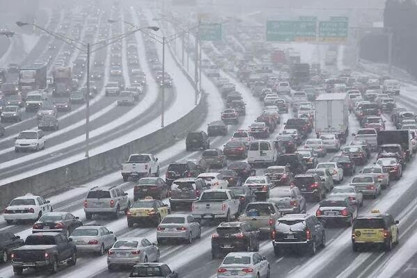
In Dallas at around 1 a.m today, traffic snarled as 19,000 people left American Airlines Center after a Mavericks game and tried to get home on freeways covered in snow and sleet. A hill on the Woodall Rogers Freeway was too much for many cars. 

Nashville today. Via Mark Fairless/Facebook

In St. Louis, for the second time this winter, traffic came to a standstill because of many crashes on the freeways around the city.

Reed Timmer's video of Oxford, Mississippi showed massive destruction to the city's trees. It reminded me very much of the tree carnage here in northwest Vermont during the Great Ice Storm of 1998. 

Similar scenes are playing out in northern Louisiana, Mississippi and Tennessee. It was beginning to get that bad in the Carolinas this afternoon. 

 Snowfall totals are starting to get impressive. Examples include 16.6 inches in Davis, West Virginia, and more than 13 inches at sites in Missouri, Indiana, Illinois and Ohio.

Even greater snow totals are likely by the time the storm ends, especially in parts of Pennsylvania, much of New York and New England. Up to 30 inches of snow could fall in New York's Catskills. 

Areas south of the ice and snow zone have their own troubles. At one point this afternoon, the National Weather Service had the southeast corner of Alabama under a tornado warning, severe thunderstorm warning, tornado watch, freeze warning, cold weather advisory, extreme cold watch, and a wind advisory. 

Air travel is still hopelessly snarled. By midafternoon, 11,727 flights had been canceled today, according to Flight Aware. Already, more than 2,600 flights tomorrow are scrubbed

As darkness fell, most, but not all of the precipitation was confined to the Appalachians, East Coast and eastern Great Lakes. 

VERMONT EFFECTS

Anyone who looks out the window can tell our storm is here. As expected, snowfall this afternoon has been quite a bit heavier in southern Vermont than in the north. 

National Weather Service storm prediction map hasn't
changed much since this morning. They might have
added an inch or two to Northeast Kingdom totals. 

Unlike in the rest of the nation, the storm here in Vermont is arguably doing more good than harm. It's definitely boosting the winter sports industry. 

The exceptionally cold air is keeping the snowflakes tiny, especially in the north, and that has also cut back on total accumulation. For now at least. 

I don't think I've seen a snowstorm this cold since February, 2015. At 4 p.m., Montpelier reported moderate snow and a temperature of 1 below. It doesn't appear any place in Vermont was warmer than 6 above late this afternoon. 

Temperatures should hold steady or grudgingly rise overnight, but not by much. It might be 10 degree or so by dawn, and make it into the mid and upper teens in the afternoon. Not great, but an improvement over the past couple of days, I guess. 

It was really snowing in southern Vermont as of 5 p.m. and snowfall rates were picking up in the north, and that trend will continue into the evening. 

The snow will keep cranking overnight, but tend to taper off in the early morning hours. In some areas, it might not be snowing at all at dawn. This might annoy some people, because a ton of school closings have already been announced for tomorrow. 

But maybe the school closings are a good idea, since the snow will pick up again during the day. 

The main storm will be heading out to sea early tomorrow, which is why we're going to temporarily lose the snow. But the huge system's upper atmospheric support will come through during the day, which will create lift in the atmosphere. Lift means snow at these temperatures. 

The snow is quite dry and is blowing off the roads fairly easily. At least at first. Road crews might have a little trouble keeping up with it is snowing hardest. Plus, salt does not work well at all when it snows at such low temperatures. 

Traffic cam grab shortly after 4 p.m. today caught
Vermont State highway crews clearing snow 
from Route 9 in Searsburg. 

Even during the lull in the snow tomorrow morning, I can't imagine road conditions will be all that great. Since it'll pretty much snow all day, the roads will stay snowy and slick all day, too. 

The National Weather Service in South Burlington hasn't change the expected accumulations much since this morning. 

They've added an inch or two maybe to the Northeast Kingdom, and now they're more or less calling for a foot of snow up there. 

The southern Green Mountains are still looking like the big winners, with an expected 18 to 24 inches. This type of storm sometimes over-performs in the southern Greens, so it's possible they could get more. No promises, though. 

After this storm goes by, I still don't see any signs any new big storms for at least ten days. But we are locked in a cold weather pattern.  If we're lucky, the weather might modify to something just seasonal chilly in about a week. 

But that just gets us up into the 20s during the afternoons. Not exactly warm. But at least the sunsets are getting later.  This coming Saturday will bring us the first 5 p.m. sunset of the year.  

Freezing Rain Nightmare Across The South, Snow In Vermont Starting Soon, Up To 2 Feet S. Greens

Ice storm damage in Oxford, Mississippi. Photo by
Desmond Nugent, via Facebook. 
The big winter storm in the U.S grinds on, pretty much peaking today in terms of snowfall, ice, power outages and other disruptions.  As I've been doing, I'll give a national overview, then, below, you'll see some snowy Vermont specifics. 

The area under the gun is huge. As of early this morning, precipitation was just tapering off in Texas, while snow was entering New England. 

As has been the case throughout this episode, freezing rain has been the worst aspect of this mess. As of around 8:30 this morning eastern time, more than 643,000 American homes and businesses were without power. 

Tennessee had the most with about 197,000 outages. The Nashville area is especially hit hard. 

In Davidson County, Tennessee, where Nashville is located, more than 65,000 homes and businesses were without power early today. That's more than 40% of the customers tracked in the area, according to CNN.

This will be one of the worst power outages the U.S. has seen in awhile. "I think this has the potential to rank up as one of the more consequential storms we've seen in the last five or six years," said Jim Robb, president of the North American Electric Reliability Corporation, according to the Washington Post. 

In addition to the trees and power lines snapping under the weight of ice, many homes in the South are not built for long stretches of cold weather. Heating is inefficient in these houses, so people use more electricity, and that puts more stress on the electrical grid. 

The bulk of the freezing rain is shifting to the Carolinas and northern Georgia today. Freezing rain was already falling in places like Atlanta, Georgia, Columbia, South Carolina, and Asheville, North Carolina as of 8:30 a.m. today. 

Heavy snow was falling across the Ohio Valley and into the Northeast. The storm is unusually cold. As of 9 a.m., it was snowing fairly heavily in New York's Central Park and the temperature there was only 11 degrees. Washington DC was only at 16 degrees. 

In Charlottesville, Virginia, the snow had changed to freezing rain as of 9 a.m. and the temperature was only 13 degrees. It's very rare to have freezing rain with temperatures lower than the mid-20s. 

On top of all this, there's still a risk of severe thunderstorms and maybe a couple tornadoes in and near the Florida Panhandle today. 

This whole mess has completely gummed up the nation's airlines. 

The number of flights canceled Saturday ended up at 4,616, according to Flight Aware. As of 7:30 a.m. the number of flight cancellations had reached a whopping total of more than 10,200.

After the storm, roughly 110 million Americans will endure subzero cold in the coming days. If there's a fresh snowpack, nights can be much colder than they would be with little or no snow. Since Arctic air is still feeding down from Canada and there is now a huge snowpack in the U.S., the frigid air will only get worse. 

VERMONT EFFECTS

The bright blue sky we had yesterday has been replaced by a dull gray as our big snowstorm comes in for a landing today. 

Burlington got down to 8 below shortly before midnight, and that's the coldest temperature we've had so far this winter, the temperatures started to slowly rise after midnight as the clouds rolled in.

Almost everybody else in Vermont started "warming up," if you can call it that after midnight. Before that started happening, Montpelier reached 15 below, St. Johnsbury hit minus 17, and Morrisville hit a frigid 20 below. Lake Eden made it to at least 26 below, which makes me wonder whether anybody in the Northeast Kingdom hit minus 30. More data should come in later to answer that question. 

The Snow

Latest snow accumulation forecast from the National
Weather Service/South Burlington. Storm totals
have increased to 18 inches or more in the 
central and southern Green Mountains. (red shading)
Overall, expected snow totals have increased some in southern Vermont and stayed roughly the same north since last night's forecast. 

Places north of Route 2, should see about a foot, with maybe a little less than that near the Canadian border.

 There's one caveat in that the initial push of heavy snow tonight might not make it as far north as thought. If that happens, snow totals north of Route 2 might go down. But for now, count on a foot or so.

Central Vermont should be in the 12 to 15 inch range. 

Much of southern Vermont should be close to 18 inches or so. Exceptions might be along the immediate western slopes of the Green Mountains. Places like Rutland might "only" get a foot. 

East facing slopes of the Green Mountains, places like Ludlow, could get 18 inches to as much as two feet of snow. Even on valley floors in southeastern Vermont, there could close to two feet. Current projects for Brattleboro give them 21 inches. 

As of 8:30 a.m. radar appeared to show snow starting to move into far southern Vermont. But that was just snow beginning to fall from the clouds and evaporating in the dry air. For awhile this morning, you'll see snow pretty much covering Vermont, but none hitting the ground.

Once the snow up above moistens the air enough, then it will start snowing. I'll mention again you can watch that process happen today.   You'll see the mountain tops blur first as snow starts up there. At first, the snow will evaporate in the dry air up around three or four thousand feet in elevations. 

But the evaporating snow will moisten the air, and you will see the "blurriness" head down the slopes until it's snowing in the valleys. 

Get your supply runs done this morning. Forecasters have slightly moved up the time when the snow wills start falling. The snow should start coming down between noon and 2 p.m south and west of Interstate 89, and between 2 p.m. and 4 p.m. elsewhere. Way up in the Northeast Kingdom it could hold off until  5 .. 

The initial burst of snow will come in hard this evening, especially in central and southern Vermont. Snowfall rates could go up to an inch or more an hour. 

According to the National Weather Service, it seems there might be a bit of a lull in the snowfall early Monday morning. By around 7 a.m., about five to eight inches of new snow will cover the ground north, while southern Vermont might have 8 to 15 inches of fresh, fluffy snow. 

Road conditions for the morning commute will not be great, so try to work at home if you can. If not, plan to spend a lot of time cleaning snow from your car and driving slowly. Since this is a fluffy snow, passing cars and trucks on the highway will really stir up the snow on ground, leaving you blinded at times on the highways. 


At this point, it appears snowfall will pick up steam again in the afternoon. It won't come down as hard as it will tonight, but it will fall heavily enough. The National Weather Service is expecting three to seven inches of new snow during the day tomorrow, give or take. If you do head into work Monday, you're going to have a tricky drive back home, too. 

The snow will finally dwindle off tomorrow night. 

AFTER THE STORM

Plenty of frigid Canadian air will be in place to keep us cold all week. Daily high temperatures should be mostly in the teens. 

Nighttime lows are forecast to be mostly in the single numbers below zero, with maybe the warmer spots staying just above zero.

But remember, we'll have a lot of fresh snow on the ground. In the past, I've been surprised by how cold it gets just after a snowstorm. I wouldn't be surprised if Vermont sees a couple nights in the teens or even 20s below zero in some spots. 

I'm also not seeing any signs of milder weather at least through mid-February. 

We won't see much additional snow for awhile after this storm goes by, either. Maybe just scattered light snow showers occasionally during the next 10 days or so as weak disturbance keep coming through to reinforce the cold air. 

Through yesterday, Burlington has had 38 inches of snow so far this season. That's about four inches behind where we should be this time of year. This storm will put us ahead of normal, but we might end up falling behind again if forecasts for a lack of additional storms comes true. 

 Before the upcoming storm, snow cover wasn't all that impressive in low and some mid elevations in Vermont. An exception is in and near the northern Green Mountains,.  Greensboro had 28 inches of snow on the ground on Saturday and Westfied had 23. It'll be interesting to see what their snow cover looks like after this storm. 


Tuesday, November 11, 2025

Not Just Vermont: Arctic Blast Spreads Snow, Deep Chill Across Eastern Half of Nation

A heavy blanket of snow this morning in St. Albans,
Vermont. It was part of a huge cold and snowy
spell over the eastern U.S. Northern areas had zones
of heavy snow, while the Southeastern U.S.
reported record lows. 
I'm looking out the window today at nearly nine inches of snow outside, which is really something for November 11 in Vermont's Champlain Valley. 

And it's still snowing a little. 

I guess I can take comfort in the fact I have company. A remarkable blast of Arctic air - with snow in many places - has overtaken most of the eastern United States. 

Lake effect snows were the big story in the Midwest Monday. Chicago managed to avoid the worst of the lake effect snow bands that threatened the Windy City with up to a foot of snow. 

The worst of the lake effect snows hit north, south and east of Chicago. The city itself managed only about two or three inches of snow, while 3.5 inches of snow. Some places, like Momence and Cedar Lake, Illinois, got a foot of snow. 

Where it did snow it seemed to come all at once.  Video by Live Storms Media showed whiteout conditions in and around Gary, Indiana. 

Thing were so wild on Lake Michigan that there were waterspouts, or maybe more accurately, snowspouts spinning away out there in the turbulent, cold air over the water. 

The lake effect snows spread eastward during the day Monday. 

Meanwhile, a lake effect snow warning was issued for areas south of Buffalo through tomorrow morning. Some areas could get nearly a foot of snow. Parts of northwest Pennsylvania and northeast Ohio were also getting lake effect snows. 

Snow fell pretty far south, too. Stone Mountain, Georgia and Nashville, Tennessee were among the many southern locations that saw snow flurries. 

SOUTHERN FREEZE

Freeze warnings this week encompassed a huge swath from eastern Texas to southeast Virginia.  

The freeze warnings extended as far south as Brooksville, Florida, which is about 50 miles north of Tampa. 

It was a record 28 degrees in Jacksonville, Florida this morning, the earliest in the season its' been this cold since at least 1976. Charleston, South Carolina was also the coldest since 1976 with a low of 29 degrees. Savannah, Georgia reached 28 degrees. 

Other record lows in Florida this morning included 31 in Pensacola, 36 in Orlando, 35 in St. Augustine, 38 in Melbourne, 45 in Naples, 42 in Fort Myers and 40 in Sarasota.  

Overall, more than 80 record lows were tied or broken this morning, mostly in the southeastern United States. 

Freeze warnings are up again tonight in Florida and southern Georgia.

Ironically, the cold spell may in some weird way be related to climate change. In large swaths of the Arctic, temperatures in recent days have been as much as 30 degrees above normal. It's being cause by something called a Greenland Block. 

The Greenland Block is a large are of high pressure that sometimes sets up over the Arctic. It's a warm air mass, by their standards, anyway. The Block forces the cold air that's usually way up in Canada southward, into the United States. 

The block itself isn't related to climate change, but they're probably boosted by a warmer Earth. We also don't know if climate change makes the Greenland Block happen more frequently than it once did, or is this just some natural thing that happens from time to time with or without climate change. 

In any event, the Greenland Block is re-orienting itself by pressing a little more westward into Canada; This will help shut off a lot of the cold air coming from central Canada, though New England will stay on the cool side for quite awhile yet. 

But for the rest of the East and Southeast, this was just a foretaste of winter. Not the actual start of the season. 


Friday, June 6, 2025

Friday Vermont Early Afternoon Update: "Locally Significant Flash Flooding" Possible in Southern Vermont This Afternoon, Evening

Forecasters are now saying "locally significant flash 
flooding" is possible this afternoon and evening
in parts of southern Vermont, along with much 
of New Hampshire and northern Massachusetts. 
UPDATE: 2:30 PM FRIDAY

Concern is rising in far southern Vermont for the risk of flash flooding this afternoon and evening.  

By 2:15 p.m, pockets of heavy rain and thunderstorms had already developed over the southern Green Mountains.

A large patch of drenching rain, meanwhile, was moving in from the west, beginning to affect most everything south of a Burlington to Newport line,

The part of this drenching patch of rain heading into southern Vermont should intensify as it hits humid, more unstable air there. 

Plus, more torrential thunderstorms should develop, mostly south of Route 4. 

Early this afternoon, NOAA's Weather Prediction Center, put out a statement warning of the risk of "locally significant flash flooding" in steep and hilly terrain of the southern Green Mountains,

This potential significant flash flooding extends into the Berkshires of Massachusetts and much of southern New Hampshire, especially the Monadnock Mountains. 

In these areas - again including the southern Green Mountains - local areas might see as much as three to five inches of rain of rain in just a few hours. Rainfall rates could briefly reach two inches per hour, which is a big indicator of a flash flood risk, 

The ground is also very wet already in southern Vermont, so it can't absorb all that much water.

Some flash flooding is possible as far north as central Vermont, but it won't be potentially as severe and widespread as in the south. 

Take this one serious, especially if you live in southern Vermont, the southern half of New Hampshire and the western half of Massachusetts. 

There were no flash flood warning in effect yet as of 2:30 p.m., but the worst of the rain hadn't arrived yet. The threat will peak between roughly at between roughly 3 to 8 p.m., but could linger beyond that.

If you live in an area prone to flash flooding, have a to-go bag ready now, and a planned route to escape.  Also, some of you in southern Vermont might be temporarily trapped behind washed out back roads, 

It's honestly too late to run out and get food and stuff in advance of any flooding. You don't want to be caught out on the roads, especially ones near small creeks and streams when the rain really hits. Those streams can go from placid brooks to roaring rapids sometimes within minutes.

Not every town in southern Vermont will see a flash flood. But it's time to be on your toes through the rest of the afternoon and evening. Just in case. 
 
PREVIOUS DISCUSSION FROM THIS MORNING
Once again, some localized flood risks have popped
up today. In Vermont, southeastern parts of the 
state especially have a chance of local but
to widespread flash flooding. 

Thunderstorms in Vermont were fewer and further between on Thursday than expected, though some of the some of the widely scattered storms eded up being pretty strong. 

We have no reports of any damage so far, so it doesn't look like any of the storms achieved severe status. 

A couple strong storms originated in or near Addison County and crossed over the Green Mountains to areas north White River Junction. I'm sure some of those towns along the way did experience a rambunctious storm. 

90 DEGREES

The relative lack of thunderstorms Thursday also meant more sun, allowing Burlington to achieve its first 90 degree day of the season. 

That was a day later than expected.  Some forecasts called for 90 degrees on Wednesday, but the city didn't quite make it, stopping at 88 degrees.  The mostly sunny skies that lasted until at least mid-afternoon Thursday let Burlington briefly sneak up to 90 degrees in the mid-afternoon. 

The first 90 of the season has been coming earlier in the season recently, compared to, say a generation ago. That's owing at least in part to climate change. The first 90 of the season on Thursday was earlier than historically common. But compared to the last 20 years, it was sort of so-so early.

In the past decade, four of Burlington's first 90 degree day of the season came at a later date than June 5.  In 2015, the first 90 didn't hit until July 28.

The earliest in the season first 90 came on April 17, 2002. Burlington has had a handful of years, like 1998, 2000 and 2004 with no 90 degree days at all. 

TODAY'S STORMS

We're going to have two very different Vermonts today and tonight. Southern Vermont will be stormy and wet. With even a risk of some flooding and severe storms.

Northern areas, not so much, though a little rain should creep in. Right near the Canadian border it might not rain at all, or it does, it won't amount to much.

Which means all eyes are on southern Vermont.  Yesterday's weak cold front stalled and has become a warm front, which will drift ever so slowly into central parts of the state.

South of the warm front, the air is humid and unstable, which suggest lots of showers and thunderstorms. Especially this afternoon.

The principal threat is local flash floods. There's a level one marginal risk of flash flooding in central and southern Vermont, with a somewhat more substantial level 2 slight risk of flash floods in extreme southeast Vermont. (And in western Massachusetts and the southern half of New Hampshire.)

A few spots in southeast Vermont could see two to as much as three inches of rain in a short amount of time this afternoon, which suggests flash flooding is a possibility there.  It won't be widespread, but a few places are at risk.

I'd say the steep terrain of the eastern slopes of the extreme southern Green Mountains, and the lowlands just to the east where the water will flow has the best shot of flash flooding. 

I'd keep an eye on Whetstone Brook in and near Brattleboro today, and nearby streams, just to be on the safe side. No guarantees of flooding there, but if you've got stuff that can be easily moved away from the brook or those surrounding streams, do it this morning, just in case. 

There's no flood watch currently in Vermont, but flood watches are in effect immediately adjacent to the Green Mountain State in Massachusetts and New Hampshire. 

Another secondary problem in far southern Vermont is severe storms. A few could contain strong damaging winds, maybe a couple of microbursts. Nothing at all like Austin, Texas had on May 28, but a couple towns in far southern parts of the state could suffer some localized tree and power line damage. 

A level one marginal risk of severe storms, meaning isolated damaging winds at most, is in effect for areas along and south Route 4. As of early this morning, level 2 slight risk is up for central New England, just barely creeping into southeastern Vermont around Brattleboro and Guilford.  

SATURDAY

Believe it or not, Saturday is looking....OK. At least in the afternoon and evening. I'm not holding my breath, given our recently history, but at least some of us might enjoy some sun as the afternoon wears on and evening approaches.

At least it won't be a complete washout like last Saturday was. 

Southern Vermont will still have the worst weather in the state, just as they will today. It'll be a rainy morning, as Saturdays in Vermont now seem to be required to have rain. But skies should brighten by mid to late afternoon. Except maybe in far southeast Vermont, where it could remain cloudy all day. 

The further north you go, the less rain and the less chance of rain you'll see.  In fact, it's possible parts of Vermont close to the Canadian border might break the sacred Saturday "rule" and see no rain at all!

Bottom line. If you have outdoor plans Saturday in Vermont, the later in the day they start, they better off you'll be,

The only fly in the ointment later in the afternoon is a secondary cold front will come through. That could touch off a few isolated showers and storms, but nothing widespread at all.

SUNDAY

Another miracle might hit Sunday.  At least some of us in Vermont should end up with a Chamber of Commerce kind of day. You know, perfect for the tourists. After a comfortable night for sleeping overnight Saturday, Sunday's highs should reach the mid 70s, at least in the valleys. The humidity should stay nice and low. 

 Places away from the mountains should have mostly sunny skies, with just some puffy clouds around over the mountains, to make the photos and background for your selfies that much prettier. 

There will probably be still some Canadian wildfire smoke in the atmosphere, so the sky might not be a brilliant deep blue on Sunday. The blue might have that bit of a slate gray tint to it because of that smoke. I guess not everything can be perfect. Still, the smoke shouldn't be as thick as it was earlier this week, and I don't anticipate anything serious enough to prompt air quality alerts. 

If you're in the mountains, the skies could get a little cluttered with those puffy clouds in the afternoon, so the sun won't be consistent there. But it will still be nice. No rain!


Saturday, April 5, 2025

One More Day Of Extreme Rains, Tornadoes To Plague Battered U.S Middle, Here In Vermont, Just Minor Weather Hassles

Hopkinsville, Kentucky is one of a great many communities
in the middle of the U.S. suffering flooding as a weeklong
torrential rain storm and severe weather outbreak causes
havoc from Texas to Ohio. Photo by George Walker IV/AP
 The nation's middle needs to get through one more day of torrential flooding rains today and maybe some more tornadoes before relief begins to arrive tomorrow. 

 Since Tuesday, the Midwest and South have endured at least 83 tornadoes, and that number will go up as damage areas are assessed.  

This includes at least 14 twisters on Friday scattered around northeast Texas, Arkansas and southeast Missouri. 

More tornadoes are in the cards today for parts of Louisiana, Mississippi and southeast Arkansas.

The real story, as expected, is shifting toward the torrential rains, which will continue unabated today. 

The area under the gun is huge. A long string of flash flood warnings extended from northeast Texas to southern Illinois this morning. Flood watches go from Texas to southwest Pennsylvania.

Already, we tragically have one flood death, that of a nine year boy swept away and drowned in Frankfort, Kentucky.

As in virtually all disasters, the flooding is beginning to hit some towns harder than others in the same region. 

Downtown Hopkinsville, Kentucky was under water as six to 10 inches of rain swamped that area. A dozen people had to be rescued from flooded homes.  Similar water rescues were reported in far flung places like Van Buren Missouri and Texarkana, Texas. Four inches of rain fell in Cape Girardeau, in southeast Missouri within eight hours. Three inches of that came within two hours. 

Hundreds of Kentucky roads were blocked by high water as of Friday. It was still raining hard in Kentucky this morning. 

Friday's rainfall curved a little north and west of where it was centered the day before. It was mostly Arkansas and Kentucky that saw the worst of it. 

Both states will get nailed today by up to nine inches of rain falling on already waterlogged ground. Which will exponentially worsen the flooding.  Today will be the worst day of the flooding as a result.  The torrents will also creep back southeastward back into Tennessee and northwest Mississippi, so the flooding will broaden.

 The stalled weather pattern will finally begin to break down Sunday.  There could be some severe storms and local flooding in the Gulf Coast states Sunday, but it won't be as bad as what we've seen this week from Texas to Ohio. 

Even after the rain stops, the flooding will continue and in some cases worsen in the coming days as larger rivers crest.

FLOODS AND CLIMATE

I can't definitively say that this mess was "caused" by climate change but it's consistent with the planet's warming.

Torrential rains and flooding have always struck the South and Midwest occasionally in the spring storm season. But this storm - and several others earlier this year and in recent years - have proven especially torrential and disastrous. 

For instance, this is Kentucky's second "100 year rainstorm" in less than two months. 

Climate change turbocharges storms, and makes what would have been a heavy rain especially torrential. In other words, the weather setup that is causing this week's flood disaster might have happened anyway without climate change. 

But chances are the rain associated with it is much more intense than it would have been in a cooler world. So the flooding is worse than it otherwise would be.  

VERMONT WEATHER

We're getting remarkably close to daffodil bloom
time in St. Albans, Vermont. Earlier than normal 
once again due to a string of warm springs 
recently. However, chilly weather over the next
several days should temporarily slow our 
progress through the spring green up season.
We continue to be blessed with pretty benign weather here in the Green Mountain State, at least compared to so many other areas of the nation. 

The weather will be far from perfect for the next few days, but you have to expect that around here in early April. 

The good news is forecasters have somewhat backed off from the idea of freezing rain in eastern Vermont and the Green Mountains. 

There could still be patchy ice up high in the mountains.  Swaths of the Northeast Kingdom should also be cold enough for freezing rain this afternoon and tonight. 

Those temperatures will be marginal, so the ice will be patchy.  It'll be enough to make some of the roads up that way treacherous today and tonight, but very likely not enough to create some power outages.

The other trouble spot today is the northern Champlain Valley. Ice won't be a problem there, but gusty winds might. 

A wind advisory is up in the central and northern Champlain Valley from mid-afternoon today to after midnight tonight. Gusts could reach up to 50 mph.  The rain falling during this time period might tamp the wind gusts down a little though. 

Everybody will be rainy this afternoon and tonight. It won't really come down that hard, though, so this won't cause any flooding. It'll make mud season a little worse than it already is, but that's about it. 

Sunday is looking a little more optimistic than earlier forecasts, especially the further north and west you go. After a gray morning that will carry the risk of a little lingering rain, we expect some sun in the afternoon. 

It won't be all that warm with highs mostly in the 40s, but still, not bad for early April. 

The next problem is Monday night and Tuesday, when a potent little disturbance and blast of chilly air invade. There won't be much accumulation, but the timing looks lousy. At this point, some heavy snow showers look like they might come through right during the Tuesday morning commute. 

It'll be enough snow in many areas to make the roads slick and awful.  Stay tuned for updates on that.

After that, the weather pattern is shifting for awhile, anyway, in which we'll see mostly near normal temperatures  and  no blockbuster storms in or near Vermont as we head into the middle of the month. 

Thursday, April 3, 2025

Tornado And Flood Tragedy In U.S. Off To A Bad Start, Three More Days Of This; In Vermont, Noisy But Not Destructive

Screen grab of a video showing a monster
tornado mowing through Lake City,
Arkansas. The tornado caused 
extensive damage. 
As expected, swarms of tornadoes strafed a large section of the nation's middle yesterday and overnight, spreading death and destruction across several states. 

That was only the beginning. More tornadoes are expected for the next three days. Worse, cataclysmic flooding is still in the cards for the Mid-South.

Here in Vermont, we've had our noisy overnight and early morning with mixed precipitation, bursts of heavy rain, strong wind gusts, thunder and lighting. 

For us here in the Green Mountain State, we can thank goodness the weather is at worst an inconvenience, not a disaster. 

With that, I'll get into the national picture and toward the end, update you on what's happening in Vermont. 

TORNADOES AND FLOODS

We're just getting toward early morning in the Midwest and South as I wrote this at 8 a.m., so as you'd imagine, assessments and casualty counts are incomplete yet. Many if not most of Wednesday's tornadoes hit after dark, so a full picture of what happened is incomplete.

We're already aware of three storm related deaths in Tennessee and a number of injuries. 

It appears at least some of the tornadoes were intense. Video taken from around Lake City Arkansas showed a large tornado with some horizontal funnels protruding from it. That's a tell-tale sign of a tornado that was probably of EF-4 strength, with winds of 166 to 200 mph. 

Adding to the potential evidence that this tornado was that strong, video taken after the twister shows houses completely leveled and vehicles strewn likely a fair distance from where they originated. 

We saw at least 22 reports of tornadoes yesterday and last night, and that number will almost certainly increase as storm paths and damage are assesses over the next few days. Tornado watches and warnings were still ongoing as dawn broke this morning in Tennessee and Kentucky.

Flooding is already breaking out, the start of what will be some of the worst flooding on record in parts of the Mid-South. Memphis has already had more than four inches of rain from last night, including 2.26 inches in just one hour. 

Things will get much worse before they get better

Tornado Outlook

Tornadoes are forecast to continue today, tomorrow and Saturday, with a particular emphasis on Arkansas, which as mentioned has already been hit hard by twisters.

Tornadoes, some possibly strong could form in central or southern Arkansas today.   On Friday, tornadoes, again some strong, could touch down nearly anywhere in Arkansas and surrounding states. 

More twisters are likely in and and near Arkansas Saturday. I

Flooding

The flooding will be even worse than the tornadoes. 

In addition to the downpours last night, another seven to as much as 15 inches of rain are in the forecast over the next four or five days for late sections of Arkansas, Missouri, Tennessee, Kentucky and southern Illinois. 

Granted this is a repeat of what I reported yesterday.  But the flood event is only just beginning. You'll hear and see on the news incredible flash flooding. This is life threatening and will be easily one of the worst floods, if not the worst flood in the U.S. you'll see this year. 

I would say it could be almost on par with the extreme flooding we saw in western North Carolina and surrounding areas with Hurricane Helene last September. 

Flood watches already extend from northeast Texas through Ohio.   

A stalled weather front with intense moisture from the Caribbean and Gulf of Mexico feeding into it are responsible for all this horrible weather.  Things should finally get unstuck by Sunday, and the weather in the U.S. looks much calmer and much less dangerous next week. 

VERMONT EFFECTS

The WCAX camera feed from the ECHO Center in Burlington
captured this lightning bolt early this morning. 
Those forecasts we heard last night of a noisy early Thursday morning sure came true. 

The wonderful thing is we're avoiding a disaster this time, even if the weather system affecting us are related to the ones causing the extreme weather in the middle of the nation. 

Our first salvo was overnight. The parent storm of the weather front that stalled across the Mid-South is noisily moving through.

This storm is a novelty more than anything else, since it brought us our first bout of lightning and thunder of the season early this morning. Most places in Vermont saw some lightning flashes and experienced rumbles of thunder. 

Some areas of eastern Vermont experienced thunder sleet and/or thunder freezing rain, which is pretty cool. 

Most of the mixed precipitation was over by 7 a.m., though a few lingering pockets of it might still be ongoing in a few cold Northeast Kingdom hollows.  There were a number of delayed school openings in eastern Vermont due to the overnight ice. 

Rainfall has been pretty heavy under the thunderstorms, but most of us should stay under an inch of new precipitation.  A few places that got bullseyed by thunderstorms might go over an inch. Burlington had received 0.7 inches of rain through 8 a.m. and it was still raining there.

Rivers were already running high prior to this rain, so we might end up with pockets of minor flooding here and there later today from the runoff. 

That would hit mostly in places with poor drainage.  Main stem rivers in Vermont will rise today, but we'll very likely avoid any real flooding from those. Hydrologists with the National Weather Service are keeping an eye on things. 

The storm in Vermont peaked generally between the hours of 2 and 8 a.m.  Most of the rain should be out of here by mid to late morning.  

The wind has been really cranking in parts of the Champlain Valley this morning, again, as expected.  On my hillside perch in St. Albans, I'd estimate some of the gusts have reached as high as 45 mph. 

So far, between the wind and lightning and the ice in eastern Vermont, there's only been a small smattering of power outages. Nothing widespread.

A wind advisory is still in effect for northwest Vermont until 8 this evening.  Winds in northwest Vermont might taper off a little for a few hours late this morning then start to crank from the southwest and west at speeds as high as 55 mph in gusts. Then things will calm down this evening. 

At least it will be warm. After the rain departs this morning temperatures should rocket upward well into the 60s in most of Vermont. Maybe upper 50s in the Northeast Kingdom. 

Stalled Front

That stalled weather front that is causing so much destruction in the Mid-Mississippi Valley will start to extend up into our neck of the woods this weekend. 

But up here, we'll miss out on the fire hose of moisture striking the Midwest flood zone. Instead, we'll see kind of a blah weekend with periods of rain. I suppose a little snow or mixed precipitation could mix in Saturday in high spots and maybe the Northeast Kingdom, but this will be rain. 

Early guesses are we'll get a half inch to an inch of rain. Enough to keep river flows pretty brisk, but very likely not enough to cause flooding. We'll watch this, though. There's always a chance this weekend's rain could over-perform. 

Doesn't look likely, but we'll see.  

Saturday, March 15, 2025

Saturday Evening Update: Death Toll Soars As Tornadoes Maraud Across The South

Large tornado spotted in Mississippi today.
Several large tornadoes were sweeping the
South this afternoon, continuing a deadly
and wide-ranging storm that has spread
destruction from New Mexico to
the Great Lakes and across the South
 The death toll climbed to at least 17 this afternoon as the massive storm that has been tormenting the United States continued unabated this afternoon. 

More deaths will probably be reported as a series of "particularly dangerous" tornadoes plunder across Mississippi and Alabama. 

Overnight tornadoes last night killed at least 11 people in Missouri and left long trails of damage.

The count of actual tornadoes that have already landed is big and growing. So far, 31 tornadoes were confirmed to have touched down Friday, and other damage paths are being investigated for signs of tornadoes.

As of late this afternoon, we have at least 10 reports of tornadoes. 

Also As of late afternoon, a "confirmed large and extremely dangerous tornado" was bearing down on the city of Meridian, Mississippi, population 33,500. More potentially big and violent tornadoes were in the forecast well into tonight for Mississippi and Alabama. 

In Oklahoma, we have more assessments of Friday's wildfires. At least 130 wildfires burned in 44 counties in the state, destroying at least 200 homes.

This is just a brief Saturday overview. I'll have much more on this with Sunday mornings post.

Let's next do an update on Vermont's situation.

VERMONT EFFECTS 

For Vermont, it was an incredibly warm for the season, and in some parts of the state, windy day.  The heat, the sun, the wind and the rising humidity has really started a rapid snow melt. My lawn in St. Albans, Vermont was nearly half covered with snow this morning. This evening it's almost gone.

The "Woof River," what I call the small stream that runs by my house, is high and muddy and noisy.

It got to 67 degrees in Burlington today, with wind gusts as high as 48 mph. 

Needless to say, a flood watch remains in effect. Some local small stream flooding could start in spots at any time. But the bulk of any flooding would hit mostly between late Sunday afternoon and Monday afternoon.

There's still some lingering ice jams, some of which are starting to shift around now. That could create new ice jams. The (hopefully!) good news is that recent warm weather over the past week has weakened the ice, so it might break up more readily than it it had remained firmly frozen.

The rain that's coming has been postponed a bit to late Sunday afternoon and night. That means, if there' breaks in the clouds tomorrow, we could make it to 70 degrees in at least a few spots.

That Sunday night rain, and all the melting snow should make most rivers in Vermont approach or exceed flood stage. The hope is that the flooding will be relatively minor. That would mean a few blocked roads, some flooded basements and fields that look more like lakes. 

We'll keep our eye on this in case it gets worse than expected. 

Massive Storm Has Caused Huge Wildfire, Wind And Tornado Damage Already; Could Get Even Worse Today

A home burns in Stillwater, Oklahoma Friday amid 
wildfires that roared through the region. Photo by
Nick Oxford via Facebook. 
After much of the nation endured a day and night of weather chaos Friday, we have more of the same on tap today.  

All thanks to one of the most massive March U.S. storms in memory. 

It started with intense winds, dust storms and wildfires. CBS reports three deaths in Texas involving motorist blinded by dust storms on highways. 

Many highways, including parts of Interstate 35 and 40 were closed in Oklahoma due to crashes, high winds and dust storms.  

At least 50 weather stations in Oklahoma reported winds gusting to  more than 58 mph.  Some gusted past 70 mph.  Amarillo had a peak gust of 83 mph. 

These weren't thunderstorm winds, they were just the power of the parent, intense storm. 

WILDFIRES

The wildfires, sadly, were California style. In other words, tragically destructive. 

No fewer than 150 wildfires were reported in Oklahoma.  One large complex of fires near Stillwater, Oklahoma forced evacuations of numerous homes, some hotels and a Walmart.  At least some homes burned around Stillwater, but we're still waiting on assessment of how bad this one is. "Multiple structures have been impacted," reports News9.com. 

The Stillwater News Press reported multiple homes destroyed in one southwest Stillwater neighborhood.

The fires  were burning houses and other structures elsewhere in Oklahoma, too. About 50 structures burned down around Guthrie, Oklahoma. 

Parts of the Oklahoma City suburb of Norman were briefly evacuated due to another fire on Friday. A wildfire within Oklahoma City limits destroyed two homes

In Texas, another wildfire grew to encompass 12.5 square miles.

TORNADOES

 Severe thunderstorms developed near the Mississippi River late Friday afternoon and the sped east, spinning off tornadoes and severe wind gusts that left a trail of damage. 

Tornado damage in Rolla, Missouri last night. Photo
by Joshua Rogers via Facebook.
We've already had 25 reports of tornadoes and 315 instances of thunderstorm-related wind damage as of early this morning.  

That wind damage doesn't include destruction from the intense winds and dust storms in the Plains yesterday that were nowhere near any thunderstorms. 

Reports are still sketchy and spotty as to how bad the damage was and whether there were any casualties from the overnight tornadoes.

They hit in darkness, so we'll be better able to tell how bad things got after dawn. 

We know there was a lot of tornado damage in towns like Rolla, and Villa Ridge Missouri and Cave City, Arkansas and Elliott, Mississippi. Photos on social media showed a large tornado lit up by lightning late last night near Belzoni, Mississippi. A traffic camera near Campbell Station, Arkansas spotted two simultaneous tornadoes nearby. 

TODAY

The tornado situation is actually going to worsen today.

As the day started, tornado watches were already in effect from southwest Ohio down to Mississippi and Alabama.

In the South, this early round of severe weather is just a foretaste of what's to come. 

Alabama and Mississippi are in a  rare high risk zone for tornadoes this afternoon and evening. That's the first time in four years this tornado-prone region has been designated a high risk for twisters.

Forecasters fear the region will be hit be a series of violent, long-lasting tornadoes. This looks like it could get off to an oddly early start today and last all day.  Already, NOAA's Storm Prediction Center is contemplating issuing a new tornado watch for much of Louisiana and northwest Mississippi as this new, dangerous round of intense storms begins to develop

The risk of this happening is almost as high as well in parts of Georgia, Tennessee and eastern Louisiana. 

On top of everything else a large area in Tennessee and surrounding states are under the gun today for widespread, life-threatening flash floods.  Some areas could see six inches or more of rain, with rainfall rates of up to two inches per hour. 

VERMONT EFFECTS

Here in Vermont, the main risk from this storm continues to be flooding. At least minor flooding looks inevitable. The most likely time frame for this would be from late Sunday afternoon through most of Monday.

We'll prime the pump as it were today with warm temperatures in the 60s in many areas of Vermont. That will get rivers starting to rise, but the main show won't happen until later Sunday. 

By Sunday evening, the remaining snow will have been melting fast amid oddly warm, humid air. A band of showers and possible thunderstorms should come through Sunday night, adding another half inch to an inch of rain to all that snowmelt runoff.

We're starting to get the first flood forecast outlooks for specific rivers in Vermont. Though subject to change, these forecasts call for minor to at times moderate flooding. For instance, the forecasts have the Mad River at Moretown at the cusp of moderate flood stage Sunday night. Forecasts also have the Missisquoi River at North Troy approaching moderate flood state Sunday night. 

Even though the thawing today and Saturday could weaken ice in spots, the risk of more ice jam flooding is definitely there on some rivers. I'm especially watching the WInooski, Lamoille and especially the Missisquoi for that possibility. 

STORM IN PERSPECTIVE

Given the breadth of this almost nationwide storm, the destruction that's already occurred and the inevitable severe damage we'll see today, this will be yet another mega storm that costs more than $1 billion in damage.

Large, multifaceted storms are pretty common this time of year, but this storm is an especially extreme case. It's hitting an even wider area than most early spring storms, and its effects are even more intense than the usual March storms that bluster through the Midwest and East. 

I can't specifically blame climate change for this storm's intensity because I don't yet have enough information about the dynamics of this system. However, it's consistent with climate change in that storms tend to be more intense, windier and in many cases wetter than they would otherwise be had the world not been warming. 

This storm has already taken lives, and I'm afraid it will take quite a few more before it's over. Meanwhile, with foolish cutbacks in staffing and services from NOAA, the National Weather Service and FEMA, there might well be some unnecessary deaths with this storm, and almost certainly some unnecessary suffering. 


Saturday, January 11, 2025

Southerners Weather Winter Storm Better Than In Past Snow/Ice Crises; Northern System Doesn't "Cooperate" So No Nor'easter

National Weather Service map from Thursday. That
huge area of pink in the South was winter storm warnings.
You'd expect a major crisis with that much of the 
South under a winter storm. While the storm proved
disruptive, it was not nearly as chaotic as 
previous, similar-sized southern winter storms. 
That big Winter Storm #2 of the past week just performed as expected Friday, spreading snow and ice from Texas to Georgia and Virginia, but one aspect of this storm did not follow the script. 

The South usually goes into a panic mode and grinds to a halt when it snows or freezes.  There's gridlock on the roads, people are stranded for hours or days, the power goes and out and people freeze in the dark  and it's a huge mess.

All that sort of thing happened, a little bit, but a funny thing happened on the way to the storm. 

For the most part, warnings were heeded, people stayed off the roads, and schools and businesses shut down everywhere. 

That kept most people indoors, and out of danger. People were actually having fun.  If you counted snowmen as people, the population of the South probably would have doubled on Friday. 

The South is not having a weather crisis. 

Part of it is the fact that there really hasn't been a widespread winter storm in the South for two or three years now. So when this one finally hit, people had the proper fear of God and prepared - and stayed home. 

I also think lessons have been learned from previous storms. 

For instance, Atlantans are still gun shy from a 2014 winter storm that stranded thousands of Atlanta area workers and students at their office and schools overnight. 

This time, pretty much everybody who could canceled classes and closed offices, asking people to work from home if possible. 

The 2014 storm gridlocked Atlanta because instead of just canceling things before the storm arrived,  everybody was sent home during the storm at once into three inches of new snow, which was more than enough to thoroughly screw up a southern city. 

This time, things were much more relaxed. That's not to say the current storm didn't mess things up at all. 

Hartsfied-Jackson airport in Atlanta, the nation's busiest, went through two ground stops Friday, meaning planes at those times could not take off from or land at the airport. nearly 1,200 flights were canceled. 

It started as snow in Atlanta, with more than three inches reported, but then during the day, things changed to an uglier freezing rain. 

The chaos in Atlanta during the January, 2014 winter
storm. The one that hit Friday was disruptive, but
did not cause a crisis like the one more than a 
decade ago did. 

Because ice was in the mix along the entire path of the storm, at least 75,000 power outages were reported Friday, mostly in Texas, Arkansas and Mississippi

Cars and trucks were indeed stranded on the roads across the South, but it fell well short of a critical mass. There weren't thousands of people stuck in cold cars on frozen interstates all night. 

The snow was pretty substantial in spots. A few reports of a foot of snow came in from Arkansas.  Little Rock reported a little under 10 inches so snow, a city that averages roughly 4 inches per year.

Parts of South Carolina had wintry weather for the first time in three years. 

Up in North Carolina, they canceled an outdoor inauguration ceremony for new Gov. Josh Stein and other elected officials.

WHY NORTHEAST MISSED OUT

The storm causing the mess in the South is scooting out to sea along the North Carolina coast this morning and eventually become a really powerful storm Sunday well southeast of the Canadian Maritimes. 

Though it's not happening in this go around, Sometimes, this type of storm southern storm comes roaring up the East Coast as a big boisterous nor'easter. 

In order for that to happen, you usually need the cooperation of a weaker northern storm. 

It's called "phasing." That weaker northern storm positions itself roughly due north of the southern storm. That arrangement draws the southern storm up the East Coast. Often the northern and southern systems will merge in the Northeast to become that big ass nor'easter. 

This time, our weak northern storm lagged a little bit. While the southern storm moves off the North Carolina coast, the northern little guy is just getting around to coming off the Great Lakes toward the New England.

The two storms didn't line up properly. They didn't communicate, they didn't line up property. If this were an office, I think the boss would have a word regarding this. 

In any event, the weak northern thing comes through Vermont today, depositing a light inch or two of snow before moving on and being forgotten.

Then, we're left with another upcoming week of seasonably cold temperatures and occasional chances of light snow and flurries. The quiet, chilly January of 2025 continues in New England.  

Wednesday, January 8, 2025

Winter Asserts Itself In Southern U.S. .And Up Here In The Great White North

Snow blows off my St. Albans, Vermont roof today as
we continue to get flurried to death under cold,
moist northwest winds. 
Yet another winter storm is gathering forces in the South, likely to lay down another stripe of heavy snow and ice just south of the path of a similar storm a few days ago. 

Meanwhile, up here in Vermont, our "flurries" have amounted to a bonafide snowstorm in a handful of lucky towns, while the ground has at least gotten white most (but not all places) in the state.

Before we get into that, the next big winter storm. 

SOUTHERN STORM

This one promises to stretch from Texas and New Mexico, the plow through parts of Arkansas, in through Tennessee and Kentucky then northern Alabama, Mississippi, and Georgia and finally on to northwestern South Carolina and a decent chunk of North Carolina.

Dallas, Texas could see its first three inch deep snow cover since February, 2021. Raleigh, North Carolina could see its first inch of snow on the ground in three years. 

This follows the first storm Sunday and Monday that left impressive amounts of snow.

Snow totals from the first storm include, 20 inches in Carrollton, Ohio, 19 inches in Thomas, West Virginia, 18 inches in Chapman and Alta Vista, Kansas, 15 inches in Mount City and Weatherby Missouri, 12.5 inches in Bridgeville3, and Milton, Delaware and McHenry, Maryland, 

The southern winter storm will completely miss us here
in Vermont, but our light snow and flurries will
continue to pile up in northern Vermont and
New York mountains for the next couple days 
As of early this afternoon, winter storm warnings extend from around Dallas/Fort Worth on through Arkansas. All this areas can expect three to eight inches of snow, locally more, with some sleet and freezing rain thrown in for some spots.

Winter storm watches extend all the way east to the mountains of North Carolina.  Those watches will probable extend eastward to near the Mid-Atlantic coast eventually. 

On the western end of this storm, things should go down hill tomorrow morning and remain nasty until Friday morning at least. By the time you get to Tennessee and North Carolina, the storm will wait until Friday night and Saturday. 

While it's been awhile since these areas have had snow, this type of thing does happen from time to time. It'll probably end up being all over the news because these southern storms hit areas where people aren't used to it, and they don't have the snow and ice removing equipment we have up here. 

I notice Atlanta is under the winter storm watch Friday and Saturday because they are expecting a boatload of snow and ice. That'll shut down the city, even though they're only expecting a few inches of snow and a glaze of ice. 

NEW ENGLAND/VERMONT

You might have heard rumors this storm would ultimately create a big nor'easter for New England, maybe extending into Vermont.

Ain't happening. 

Traffic cam shows a snowy, cold and desolate looking
stretch of Route 105 in Berkshire early this afternoon.
A minority of computer models did indicate a nor'easter would blow up this weekend and blast across the New England coast. But those were outliers. Everything else indicated the storm would pass out to sea well south of our region.  

That's still very much true. It's going to be a miss, by a wide margin for us in Vermont and other sections of northern New England.

Instead, we're still getting flurried to death.

Between late Sunday night and Tuesday afternoon, most places in Vermont only got an inch or two of snow. 

But the Green Mountains and some of the western slopes got clobbered. More than flurries, that's for sure. 

I saw reports of 10 inches in Waterville, Starksboro and higher elevations in Waterbury, and just shy of 10 inches in Huntington, Underhill/Jericho and Enosburg. 

By my counting, Westfield, not far from Jay Peak, has collected 31 inches of snow since January 1. Jay Peak says they've collected 40 inches of snow in the past week. 

This persistent light snow is surprising motorists. It's cold, and the light snow often packs down under car and truck tires into a barely discernible, thin layer of black ice. It often looks like dry road until you hit the brakes, and then you're in trouble.

Or, roads remained snow covered, as the falling flakes were pretty persistent. The result was plenty of car accidents and slide offs.

After a lull, the snow is picking up again this afternoon, especially across northern Vermont and really, super especially on the mountains. Another wave of deeper moisture is working its way down from Quebec.

The snow will continue well into tomorrow morning most spots. It'll never snow hard, but once again, the northern mountains can expect at least a half foot, maybe a foot by noon tomorrow. 

It's really cold and windy today, too. So for the rest of today and tonight, expect lousy road conditions in much of northern Vermont, snow, blowing snow and a nasty wind chill. Isn't January wonderful?

I anticipate more of the same as the snow picks up in many areas this afternoon and evening. 

Although the snow might diminish for this weekend, it'll stay on the chilly side.  This won't end up being another mild January.