Saturday, December 31, 2022

Springtime Record Highs Smashed In Vermont As We Celebrate New Year's Eve

I'm joking, of course, but it's so warm in Vermont that
I wonder if I will be tending flowers like these when
I get back to the Green Mountain State in a few days. 
What's next? Daffodils and lilac blooms? 

The current warm spell way over-performed yesterday and overnight in Vermont and in all of the Northeast as incredible spell of spring time weather enveloped the region.

Record highs fell in dozens of cities from Ohio and Michigan to the East Coast and on up through New England and southeastern Canada. Vermont certainly shared in these balmy readings.

The Vermont record highs included readings of 58 degrees in both Burlington and Montpelier, easily exceeding the previous records set in 1990.  Plattsburgh and Massena, New York also set record high temperatures. Low temperatures in Vermont Friday also set records for highest minimum temperatures for the date.

In other spots in this vast heat zone on Friday, some records fell by remarkable margins. Pellston, in northern Michigan,  reached 55 degrees, besting the old record of 42 degrees.

The National Weather Service office in Gaylord, Michigan posted two photos to Twitter, one showing the 25 inches of snow on the ground a week ago, and another showing large patches of bare ground Friday from the huge thaw. 

Ottawa, Canada had its second day in a row with record high temperatures Friday when it reached 48 degrees. The record high there Thursday was 44 degrees.

On Thursday, record highs were set as far west as Iowa and Missouri

Back here in Vermont, last night turned out to be off the charts balmy. In Burlington, the "low" temperature in Burlington was 52 degrees, which is about normal for the opening days of June, not the end of December. 

The record high for today is 56 degrees. I'm not sure we'll make it, as rain moving in will blunt high temperatures. Still, by 10 a.m., it will have been continuously at least 50 degrees in Burlington for a full 24 hours, which is a very rare feat for the dead of winter.  

Even more remarkably, Montpelier reached 61 degrees early this morning as southwest winds pushed balmy air into the state capitol.  Lighter winds later allowed temperatures in Montpelier to drop to 45 degrees. But my gawd! 61 degrees in Montpelier at 2 a.m. is perfectly normal - for the middle of July. 

That 61 degrees is obviously a record high for the date in Montpelier, besting 56 degrees set in 1965.

It was so warm Friday that maple sugar production - a March and April tradition in Vermont - got going. Web cam at Branon Family Maple Orchards in Fairfield showed sap flowing into one of their tanks.  I'm sure other sugar makers in Vermont are taking advantage of this rare winter heat to get a serious, serious jump on the season. 

I'm assured by my friend Matt Crawford, who knows a thing or two about sugaring, that this early sugaring won't harm the trees and will have little if any effect on the "real" sugaring season in March.

Crawford also points out that the fact that people are sugaring in Vermont on New Year's Eve is not a weird sign of climate change.  People just didn't have the wherewithal to tap and collect maple sap off season a generation or two ago. New technology and knowledge makes this possible today.

However, the fact that it's been so warm, and we've had so many of these weird December/winter heat waves in recent years could well be a sign of climate change. 

Some recent examples: It was 70 degrees in Rutland on Christmas Eve, 2015, and Burlington reached 68 degrees that day, its hottest December temperature on record. 

And on Christmas Day, 2020, it was 65 degrees in Burlington for a record high. 

LOOKING AHEAD

The heat wave in Vermont might have peaked for now, but it's going to stay mild for quite awhile yet. Light rain, drizzle, fog and low clouds will rule tonight, so midnight fireworks displays still look tricky in spots.

Temperatures will fall on New Year's Day, but still remain above normal. They'll go from the 40s to the 30s. 

Another surge of very toasty air looks to arrive Tuesday and Wednesday with the next storm. I see potential for more record-threatening temperatures on those days. 

After that, it looks like we'll have a more extensive cool down, but temperatures will probably remain near or a little above normal for January. 

For those of you who love winter, there are some signs we could go toward a colder, snowier pattern in the second half of the month. Before you get too excited, those are some pretty uncertain signs, and there's no guarantee.

Still, it's way, way too soon to write this season off as the year without a winter. 


Friday, December 30, 2022

Warm Weather Pattern In U.S. Could Lead To New Year Springtime Hazards; Record Vermont Warmth?

Forecast rainfall map for the U.S. for the next 7 days.
Parts of California could have more than 10 inches of 
rain or water equivalent in mountain snow. Large
swaths of the Gulf Coast states can expect more
than five inches of rain 
UPDATE: 10:30 a.m.

Burlington, Vermont has already set a new record high for the date. As of 10 a.m. it was 52 degrees, besting the old record of 51 set in 1990.

The temperature will almost surely keep rising through at least part of the day, so today's record high should get even hotter. 

PREVIOUS DISCUSSION

The warm weather enveloping much of the nation has its drawbacks. 

Springlike hazards, like severe thunderstorms, tornadoes and flash flooding, are in play for parts of the nation. Luckily, here in Vermont, this pattern does favor frequent storms. But so far at least, we're not in for any renewed, extreme storms like we saw right before Christmas.  

Up here in Vermont, we'll bask in the springtime warmth as well. More on that below.

The ever present Polar Vortex is way up north, tightly wound and strong. When that happens, it's really  hard for Arctic air to blast south into the U.S.  When we get a situation like this, the door is open for mild Pacific air to flow west to east across the nation. 

In yesterday's post,   I already brought up the flood risk in California, as storms repeatedly smack into the West Coast. California's flooding is not really a spring time thing, but it is something that can cause a lot of damage.

Californians are worried about flash flooding, debris flows and mudslides this week.

As the storms come eastward, they'll draw even more, warm, wet air out of the Gulf of Mexico, which means all kinds of hazards.

The first storm isn't super strong, but it's enough to cause some danger. There's a marginal risk of severe thunderstorms or even a tornado or two near the Gulf Coast today and tomorrow.

A couple to a few inches of rain might come down today in some areas in the Gulf Coast states today, possibly causing some local flooding, and perhaps priming the pump for more flooding as the next few storms to come along in the next week or two. 

Those storms are on the way.  

There were more than the usual number of tornadoes in the U.S. in November and December. It appears there's a risk that this trend might continue in the opening days of 2023.

The second storm to cross the nation from California looks stronger than the first one That gives us the potential, at least to spin off more twisters in the South. Early indications suggest we could see a fairly substantial outbreak of severe weather this coming Monday and Tuesday in the Gulf Coast states.

That severe weather could be accompanied by flooding as well.

This same storm early next week also looks like it wants to lay down a swath of snow across parts of the central and northern Plains. That, by the way, is also a typical scenario with spring type storms. 

With that polar vortex locked up way up north and spinning itself up tightly, any outbreaks of cold Canadian air look brief and not all that wildly cold into the middle of January.  .The parade of storms across the nation will probably continue in one form or another as well. 

It's normal to have a few warm days here and there during the winter. But the length of this warm spell will be pretty remarkable. New York City could have at least 10 days in a row with temperatures reaching at least 50 degrees.  Washington DC has a shot of reaching 60 degrees or more daily today through Wednesday.

VERMONT EFFECTS

Today dawned super warm in much of Vermont. The low temperature in Burlington was 45 degrees, well above the record for the highest low temperature for the date, which was 35 degrees. It won't get down to that level by midnight tonight, so that record will be set.

Vermont AOT traffic cam image from Williston this
morning shows most of the snow received before
Christmas is already gone. More melting will
continue over the next week
Burlington has a great shot at reaching a record high today as well. The record for the date is 51 degrees set in 1990. The forecast high is 52 degrees today in Burlington. Other towns and cities in Vermont will also likely see or come close to record highs.  

It will stay very warm through the New Year's holiday. Rain from that first storm will hold daytime temperatures Friday through Sunday in the 40s.  Those aren't record highs, but they sure are awfully warm for this time of year. 

Rain, low clouds and fog on New Year's Eve might make midnight fireworks viewing a little tricky.

It'll cool off a little Sunday afternoon and into the beginning of next week, but it will remain warmer than normal. Another warm storm is due midweek. That storm is the one that would bring possible tornadoes to the South, but it will just get rainy again in New England. 


Thursday, December 29, 2022

Long Warm Spell To Close 2022 And Begin The New Year

It might not exactly look like this in Vermont as we head
into the New Year, but the the weather will be mostly
springlike from now through at least the first week
of the New Year. 
UPDATE 4 p.m.

The warmth is already over-performing in at least parts of Vermont this afternoon

As of 3 p.m. it was 48 degrees in Burlington.  That's not close to the record high of 58, but it is a good 17 degrees above normal.

Updated forecasts have not changed much, as it will stay warm well into next week.

Winter will eventually return.  There's a lot of time left for snow and cold, that's for sure. But for now, enjoy springtime in winter. 

PREVIOUS DISCUSSION

 The temperature rose above freezing at the National Weather Service office in South Burlington before 4 a.m. this morning. 

It will stay above freezing until Sunday night.  And remain toasty for the season for at least a few days after that.

Welcome to spring time in the dead of winter. 

The long anticipated weather pattern change to warm weather after the Christmas cold blast is here. And it's not going away anytime soon.

It's kind of rare - but not unheard of - for temperatures to stay above freezing for so long this time of year, but it looks like it's in the cards.

The new weather pattern has storm after storm bashing into the West Coast. Another big wave of rain is hitting California tomorrow, prompting widespread flood watches in the state.  They need the rain, but they are getting too much, too fast.

This parade of storms into the Pacific Coast need to go somewhere, so they head east across the United States.  That strong push of storms heading east ensures that mild Pacific air makes cross country trips, making it all the way to the East Coast, including Vermont. 

It'll be an active pattern through much of the U.S., probably for a couple weeks.  That means frequent precipitation chances in Vermont to go along with the warmth.  Which, in turn, means mostly rain storms for now. 

At this point, it looks wet in the Green Mountain State on New Year's Eve and New Year's Day.   It won't be a blockbuster storm, but bring your umbrellas to any New Year celebrations. At least you won't freeze, right?

For the next few days, although high temperatures will be way above normal, I don't expect record highs. But we do have shots at record low high minimum temperatures on some days.  For instance, the highest low temperature on record in Burlington s 35 degrees, and the expected low temperature that day is 39.

Chances are it will temporarily cool off a little later on New Years Day and into the beginning of the week, but still remain warmer than average.  A new storm looks to start Tuesday. At this point, it looks like that system could start off as snow but change to rain as a renewed surge of warm air pushes into the Green Mountain State.


Wednesday, December 28, 2022

Delaware Winter Beach Sunrises Are The Best!

Arctic sea smoke is visible on the ocean just after dawn
December 24, 2022, Bethany Beach, Delaware.
 I'm on vacation in Bethany Beach, Delaware, sharing a big oceanfront home with relatives and friends. 

Among the many perks of this arrangement is winter sunrises over the ocean. 

I'm an early riser, and the sun comes up late just a week after the winter solstice, so I get a great view of the dawn breaking over the ocean.  It's always different, and always sublime. 

The videos, seen below at the bottom of this post, don't do it justice, but are certainly worth watching. (The only problem with them is the sound quality is iffy, oh well).

The videos are still relaxing, so if you want a moment of relaxation, watch 'em. 

The first video was taken Christmas Eve morning, when the East Coast was still in the throes of that Arctic outbreak and aftereffects of that big bomb cyclone.

Sunrise, Bethany Beach, Delaware, December 27, 2022
It was quite cold for this neck of the woods, coastal southern Delaware. Temperatures were in the upper single numbers at dawn. Frigid by Delaware standards, but kind of average "yawn" winter weather for this Vermonter. 

Anyway, as the sun rose that morning, the ocean simmered with Arctic sea smoke, sort of giving me a Lake Superior lakefront in Duluth vibe. 

I enjoyed the sunrises in subsequent mornings, of course. Yesterday, December 27, was much warmer (Upper 20s!) so it was even easier to enjoy the early morning dawn.

There were a few more clouds in the sky than on previous mornings, which made the whole thing more interesting. A sharp red line appeared on the horizon well before sunrise. Then the clouds gradually filled with pastel colors.  Just such an awesome sight.

I'm here for two more mornings.We'll see what those dawns bring!

First video, on December 24. Click on this link if you don't see the image of the video, or click on image below.  And underneath that is the second video.


Next video is a very pastel dawn on December 27 in Bethany Beach.  Click on this link to view or on image below:


Vermont Weather, Cloud, Nature Year 2022 In Photos

A cloudburst unleashes over St. Albans, Vermont in 
August.  Weather is always interesting or at least pretty
in the Green Mountain State and was in 2022
For the most part, weather in Vermont isn't particularly extreme all that often.  I

t's not the national hot spot for storm chasers, that's for sure. 

But the changing seasons, the clouds, the nature and the landscape sure make for pretty weather photos.  Near the end of every year, I like to compile some of my favorites.

The photos were all taken in northwestern Vermont during the course of 2022

Spoiler, you pretty much have to watch the video at the bottom of this post.

Click on the image below to view. Or if you don't see the image, click on this link to check out the photos. 


Tuesday, December 27, 2022

West Coast Weather Woes Were Overshadowed By Eastern Bomb Cyclone

An icy street in Seattle last week. The ice has since
melted and now Seattle is under a flood watch. 
This is part of a weather pattern change that will
bring warmer, wetter weather to most of the
nation, including Vermont.
 While the eastern two thirds of the United States was swallowed by that bomb cyclone are Arctic blast through the Christmas holiday, the West Coast has been enduring its own weather woes.  

And will continue to do so. Although the news isn't 100 percent bad out there. 

By the way, what happens on the West Coast doesn't stay on the West Coast. We'll see some effects up here in the Northeast/Vermont. More on that in a bit. 

The Pacific Northwest shared in the cold weather as Christmas approached. The problem was, so did a warm front. Warm air rose up and over the frigid conditions around Seattle, so they had a rare ice storm. 

Seattle is a hilly town and social media erupted with videos of vehicles sliding down steep slopes and hitting other obstacles like bumper cars.  People resorted to sliding down hills on their butts because they couldn't walk on the slick ice. Around 15,000 people in the region lost power. 

The warm front eventually moved through and it warmed up nicely, at least west of the Cascades. But that introduced new trouble. It rained, pretty heavily, thanks to an atmospheric river off the Pacific. This came as snow and ice melted, so there's a flood threat now. 

On top of that, coastal King Tides are flooding some spots, and a high wind warning is up today for the Seattle area. The soggy ground will make it easier for winds to topple trees. And there's a risk of landslides.

So it's a mess. 

Further down the coast, Oregon and California are getting rain again, with of course snow in the higher elevations. 

For the mountains, this is more good news. The Sierra Nevada mountains got off to a good start with snowfall earlier this month. This raised hopes that accumulations might be good this winter, which would replenish reservoirs when the snow melts in the spring. 

There were also fears things would go like last year, with an initial burst of precipitation then nothing.  There was a lull in rain and snow in California for the past week or two, but that's over now. 

Over ten inches of rain or water equivalent is forecast in the Sierra Nevada in just the next seven days. This week of storms doesn't solve all of California's drought problems, but it will probably put another small dent in it. 

However, the rain might come down heavy enough in California's lower elevations to create flooding.  Especially in burn scar areas where wildfires eliminated vegetation earlier this year and last year. 

PATTERN CHANGE

The storminess in California is part of a major weather pattern change that is flushing the Arctic air out of the United States.

Pretty much everybody gets to share in the warmer air as the week goes on, including us Vermonters.  High temperatures that have been in the teens and 20s in recent days will rise into the 40s starting Thursday and probably continuing through the New Year's weekend. 

New Year's Eve will feel very different from Christmas Eve. Instead of snow, treacherous roads and rapidly falling temperatures, New Year's Eve looks like it will above freezing temperatures and a risk of rain.

Yes, I said rain. That same new weather pattern that is flooding the nation with relative winter warmth is also bringing storminess. Those storms slamming into the West Coast have to go somewhere. The first storm, due New Year's weekend in the Northeast, doesn't look like it will be any kind of blockbuster like the last one. 

It seems like it will bring inclement, but not extreme conditions.

However, there will be more storms waiting in the wings after that. Going into mid-January, it seems we might have frequent chances of rain, snow, or mixed storms. Stay tuned! 

Monday, December 26, 2022

Buffalo Blizzard Now A Full-Blown Tragedy. Why Did So Many People Die?

Snowbound neighborhood in Cheektowaga, New York
following the deadly Christmas weekend blizzard.
Photo by John Waller via AP.
 The death toll from the extreme blizzard in and around Buffalo was up to at least 27 as of late Monday morning.  The toll is likely to rise. 

Stephen Marth of Spectrum News 1 BUF said in a tweet 20 people are so far are known to have died in the city of Buffalo, six more in Erie County and another in Niagara County. 

Not everyone who died were caught in cars out in the open. Some died of heart attacks while trying to clear snow. Others died of other causes because rescue workers could not reach them. At least one died when a heater vent became clogged with snow

Officials say they are almost certain this terrible death toll will rise.

Now, the speculation, and the finger pointing, is already beginning as to why this blizzard was so fatal.

Weather forecasts prior to the blizzard were as dire as they get. The forecast discussion from the National Weather Service office in Buffalo issued at 1:38 a.m. Wednesday, December 21 read in part: 

"As if the very real threat for damage producing winds were not enough....there will also be the risk of a prolonged, paralyzing heavy lake effect snow event. The very strong to damaging winds, blowing and drifting snow with localized blizzard conditions followed by a rapid flash freeze."

Note that this is two full days before the crap really hit the fan in Buffalo. 

The 6:32 Wednesday forecast discussion said, "a once in a generation winter storm to slam the region heading into and THROUGH the Christmas weekend."

The NWS office in Buffalo first released a winter storm watch at 2:20 p.m. Tuesday, December 20, so that's giving nearly a three day warning. That warning said in part, "Travel for the holiday weekend, including Friday, could be very difficult to impossible at times."  The watch also included an alert for possible tree and power line damage, and dangerously low wind chills. "

At 3:54 a.m. December 22, the Buffalo National Weather Service office issued a blizzard warning. That's a good 30 hours in advance of when blizzard conditions began in Buffalo. So people had a long lead time to prepare, with strident wording to get light a fire under residents' butts. 

This might be Monday morning quarterbacking, but a travel ban in Erie County, which is the area that includes Buffalo, did not go into effect until 9:30 a.m. December 23. By then, perhaps thousands of people had already driven to work, shopping or errands. 

Those people ended having to attempt a drive home in zero visibility blizzard conditions, and many of them got stuck.  Soon, things got so bad that emergency vehicles got stuck.  Nobody could rescue anyone who was in trouble. 

Buffalo is by no means out of the woods.  The Washington Post today reports that 10,000 people in the region still had no power as of Monday.  Electrical substations are damaged, including one that is inaccessible for now due to 18-foot tall snow drifts. 

People stuck in shelters and nursing homes are reportedly running out of food, the Washington Post reports. Many streets remain completely blocked, and the airport will remain closed to at least Monday.

Another four to eight inches of snow is in the forecast for Buffalo through tomorrow. At least 49.1 inches of snow have fallen in Buffalo since the storm started.

Yet another danger lurks in Buffalo:  Temperatures are expected to rise into the 50s by next weekend, and rain should break out. That raises the risk of flooding. 

Overall, the death toll nationwide from the storm stood at 49, according to the Associated Press. That includes one person in Castleton, Vermont, who was killed by a falling tree on Thursday. 

Canada was hard hit by the storm as well.

About 380,000 people in Quebec lost power at the height of the storm, mostly from damage caused by high winds. 

The northern edge of the Buffalo blizzard reached into Canadian shorelines along Lake Erie, dumping feet of snow and blocking roads for days. 

I Know, I Know, Climate Change Gets Blamed For Everything, But Hear Me Out On Latest Megastorm

Green Mountain Power released this image of tree damage
in Vermont after last week's superstorm cut power to 
much of the state. Is climate change making these
extreme winter storms more likely? 
 The gigantic "bomb cyclone" storm that pummeled practically the entire United States last feel sure didn't feel like global warming.  

Blizzard and winter storm warnings covered parts or all of at least 17 states. More than half the Lower 48 was below zero.  It sleeted in Melbourne, Florida on Christmas Day.  So much for climate change, right?

Or not. There's a case to be made that climate change made last week's weather situation worse than it otherwise would have. Climate change doesn't only make things warmer. Often and under the right conditions, it can just make things more extreme.

That said, here's a caveat with this storm:  There's no proof climate change had anything to do with this, at least not yet. Scientists will probably study this huge, rambling system to learn if there was any connection. We can say there are consistencies with this storm and it's accompanying Arctic outbreak and climate change. 

First of all, climate change does not cancel winter. Sure, winters are warmer than they used to be. But for most of the United States, it's easily still often cold enough in our now balmier winters to have snow. 

Also, pretty much every winter storm that has ever existed needed warm air to survive. Low pressure systems in the winter pull warmth and moisture from places like the Gulf of Mexico or the warm Atlantic waters off the southeastern coast. 

This warm, wet air encounters the usual cold air that exists in winter. That air is forced to rise up and over that colder air. Rising air cools and condenses, and unleashes a literal blizzard of snowflakes.  This is just basic physics. 

Under climate change, that warm, moist air is even toastier than it used to be decades ago.  The warmer the air, the more moisture it can hold.   More moisture more often than not means more precipitation. So it follows that winter storms can produce heavier snow than they used to. They have more moisture to deal with, so they can make more snowflakes than storms did decades ago.

In last week's storm, however most places didn't have extreme amounts of snow, with the exception of places blasted by lake effect snows around the Great Lakes. 

The storm was certainly huge, both in how strong and big it was. Honestly, the storm was the largest in size that I can remember. This giant tempest was also able to pull down a rapidly advancing Arctic air mass that had its origins in Siberia. 

If you want a big Arctic outbreak and/or a big storm, you want a wildly meandering jet stream. No piddling mini southward excursions or wimpy northward turns here!  If the jet stream has a big plunge southward, it'll pull frigid Arctic air southward from near the poles. 

Then, if that big plunge turns a corner at the bottom and heads back northward, you probably have a big storm on your hands

One reason the storm was able to get so big was an enormous dip in the jet stream deep into the heart of the nation. Then, the jet stream  took a corresponding northward sweep up the East Coast and well into eastern Canada. 

Whether the jet stream can meander like crazy in the winter frequently depends on the polar vortex. The polar vortex, you remember, is that giant swirl of frigid air that's usually somewhere in or near the Arctic all winter. 

If the polar vortex is well north, and tightly wound, the truly frigid air stays up by the Arctic circle where it belongs. 

If the polar vortex weakens, it can get pulled, elongated and/or migrated south toward the mid-latitudes of  Asia, Europe or North America. The polar vortex can even break up into pieces temporarily.

When all this happens, trouble usually follow. It makes the jet stream meander all over the place and somebody gets a big Arctic blast and probably a nasty winter storm. 

 The jet stream depends upon a nice big contrast in temperatures between the Arctic and points further south. Such a contrast helps the jet stream "know its place" and not meander too much. The contrast probably encourages the polar vortex to keep its act together and not get weird or have a breakdown. 

 Here's the controversy:  We know the Arctic is warming faster than the mid-latitudes, where most of us live. There's not as much of a contrast between, say, Houston and Whitehorse as there used to be. This diminished contrast might be encouraging the jet stream to meander, with bigger dips southward and bigger bulges northward.

Bigger dips and bulges in general mean bigger, more powerful storms, and more wild Arctic outbreaks in the winter. 

Additionally, the Arctic warming might be messing with the Polar Vortex, that tightly wound core of super cold air that always hangs out in the far north during the winter.

Increasingly, it seems, this tightly wound vortex that would keep the coldest air above the Arctic circle gets oblong and oddly shaped, allowing the cold air to plunge south occasionally. Is climate change causing this?

As the Washington Post reports, the science isn't settled yet on whether the warming Arctic is creating more havoc with the jet stream, allowing these episodes of frigid air to blast into the United States, periodically. 

It'll take years of more observation and study to really see if there's a connection between the warming at the top of the world and these weird cold blast in otherwise relatively warm years.

However, as Jennifer Francis, seniors scientist at the Woodwell Climate Research Center tells the Washington Post: "We've see the same situation basically the last three years in a row.....Here we go again."

So we have anecdotal indications that climate change can paradoxically give us these huge winter storms and Arctic outbreaks. 

This is obviously bad news.  As of Monday morning, the death toll for last week's superstorm in the U.S. had risen to 46.  It'll probably go up more. This death toll is one of many sad consequences of a stormier, weirder weather world brought to us by climate change 

Even if it is indeed true that we'll have to endure more winter superstorms like the one we just had, overall winters are clearly warming. 

True to form, long range forecasts starting later this week and going through the first week of January call for above normal temperatures for most of the nation.

A week or two of relatively balmy weather in the middle of winter does nothing to prove or disprove climate change, but it is consistent with what we've been seeing in recent winters with the aftermath of these cold blasts and winter storms. 

Sunday, December 25, 2022

Vermont Christmas Climatology: Always Expect Big Weather Surprises From Santa

Snow falls from pine trees on Christmas morning, 2017 in
West Rutland, Vermont. A 3.5 inch snowfall ensured early
in the day ensured a white Christmas that year. 
 It looks like we're in for a cold and blustery Christmas this year in Vermont.

But, the weather won't be too, too unusual for Vermont. Which is a nice break from the extreme weather we've endured in the past few days. 

Still, our Christmas, 2022 will certainly buck recent trends of seeing warm holidays. Today's average temperature will be about ten degrees colder than average for this time of year. 

Christmas week as a whole is known for its sometimes bizarre weather, and we sure had that this year in the days leading up to the Big Day. 

With calmer weather today, in let's go down memory lane with the extremes and oddball weather of Christmases past.  

As any Vermonter knows, Christmas weather varies wildly year to year. Some years it's springlike. Others, you freeze your tush off. Some years are the gorgeous, traditional white Christmas, others look like mud season. 

For the record, the National Weather  Service office in Burlington, Vermont says the average high temperature on Christmas is 31, the low would be 15. Note that this is the "new" normal with climate change. The average Christmas decades ago was a little colder than that. 

On average, you'd expect 0.11 inches of precipitation, which would translate - if it's normal - to an inch of snow. 

All the record for highs, lows, snowiest, wettest etc for Christmas have a lot of asterisks. That's because these records only deal with Christmas Day.  But Christmas is a season, essentially, and the days around the holiday have sometimes been more impressive the actual date itself. The most extreme Christmas weeks were parts of exceptionally weird winters. 

On the actual date, the coldest Christmas was easily in 1980.  The "high" temperature that date in Burlington was minus 5 and the low was a nasty, nasty 25 below. I remember that Christmas as exceeding quiet, as you'd expect, since nobody wanted to go outdoors. 

That winter turned out to be one the weirdest in Vermont. December and January scored in the top 10 coldest. The second half of December featured 14 days below zero in Burlington, and all but one of the first 18 days of January were subzero. Then, that February ended up by far as the warmest on record.

The warmest Christmas was just recently, in 2020, in which the temperature peaked at 65 degrees in Burlington.  The high temperature occurred in the morning, but temperatures stayed at or abov 60 degrees well into the afternoon.  At one point on Christmas morning, Burlington was the warmest spot in the entire Lower 48.  

A very green Christmas, Instead of a snow covered ground,
daffodil shoots emerge in St. Albans, Vermont on 
Christmas Day, 2020, which was the warmest on record.
The temperature in Burlington that day was 65 degrees.

The snowiest Christmas in Burlington was in 1978, when 16.9 inches fell.  That was actually a relatively well-behaved storm, though. Sure, it was disruptive for travel, but at least it was festive, with not a lot of wind or containing any icy mixture. 

The 1978 storm also made for the "wettest" Christmas, as the snow melted down to 0.76 of a inch.

The asterisk for snowiest Christmas goes to 1969.  One of the most extreme winter storms in Vermont history began Christmas night and continued into the 28th. Not much snow fell Christmas night that year, so it doesn't qualify as snowiest Christmas. 

Burlington received 29.8 inches of snow in that huge storm, which finally ended on December 29. This 1969 storm was the biggest snowfall on record in Burlington under even bigger ones hit in January, 2010 and March, 2017.  As much as 44 inches pounded central Vermont. Eastern Vermont suffered a devastating ice storm in that episode.

The whitest Christmas, in terms of the amount of snow covering the ground, occurred just a year later, in 1970. While only 0.2 inches of snow fell on Christmas Day that year, there was 32 inches of snow on the ground. This was part of the snowiest winter on record in Burlington with 56.7 inches during December and 145.7 inches for the entire winter. (A whopping 28.8 inches fell just in the eight days leading up to Christmas Day, 1970).

The chances of having a white Christmas in Vermont ranged wildly, from about 60 percent in the Champlain Islands to virtually certain in cold Northeast Kingdom hollows like Island Pond.  We did manage to score a white Christmas this year.

Almost all of the snow cover melted during our extreme storm on December 23, only to return that evening during a burst of heavy snow. Most of us woke to a few inches of snow on the ground this morning. 

CHRISTMAS TRENDS

I took a look at Christmas average temperatures decade by decade in Burlington since the beginning of the 20th century.. Not surprisingly, with climate change, Christmases are a lot warmer now than they used to be. 

It's interesting that the holiday warmed slightly from the the first decade of the 20th century to the 1930s. 

Then it cooled off again, with average temperatures bottoming out in the upper teens to low 20s from about the early 1940s through the 1970s.

After that, the Christmas holiday in Burlington began to slowly warm up in the 1980s and 1990s. That trend accelerated starting around 2000.

Here's the average Christmas temperature in Burlington per decade:

  • Decade              Average Temperature
  • 1902-1911                 22.0
  • 1912-1921                 16.7
  • 1922-1931                 25.2
  • 1932-1941                 25.4
  • 1942-1951                 17.0
  • 1952-1961                 21.8
  • 1962-1971                 17.2
  • 1972-1981                 21.0
  • 1982-1991                 22.7
  • 1992-2001                 22.4
  • 2002-2011                 27.5
  • 2012-2021                 29.6


Saturday, December 24, 2022

Quick Vermont Christmas Update: Some Power Outages Linger, But Santa Bringing No New Scary Things

Merry Christmas, everyone! 
 The bad news is about 22,000 customers still had no power in Vermont as of 4:30 p.m. Christmas Eve after yesterday's extreme storm. 

The good news is crews are working during the holiday to restore power. And there's no really scary weather coming to Vermont for the Christmas holiday.

Vermont Emergency Management has a list of warming centers if you need them.  Don't be shy going to them. That's what they're there for. 

Main highways in Vermont late this afternoon were in pretty good shape, having been cleaned up nicely from last evening's flash freeze and burst of heavy snow.  At least that's what Vermont's network of traffic cameras shows.  I'm sure some back roads are icy, as are many sidewalks, so be careful! 

Yeah, it's still cold and windy out there, and you'll have to bundle up if you're out Christmas caroling,

Temperatures won't fall too much tonight, bottoming out in the single digits. Gusty winds will keep the wind chill below zero.

Christmas day itself will be pretty nice, relatively speaking. Most of us will see highs in the low 20s, the wind will have died down somewhat and there might even be some glimpses of sun. 

I had another non-weather related blog in the past that I have let go dormant, at least for now. Every year, I had a tradition to give everyone a Christmas greeting. It consists of a recent video of Darlene Love doing her famous "Christmas Baby, Please Come Home."  

This is a clip from the end of a recent concert she performed in Englewood, New Jersey. Merry Christmas to one and all and I hope Santa brings you everything you need.  If you don't see the image of the video below, click on this link. 

Or, if you see the image below click on that.


Can We Just Marvel At Buffalo. It's Turning Into A Tragedy

Screen grab from buffalowebcam.com as of 
Saturday afternoon shows things have scarcely
improved there since yesterday. 
UPDATE: 1 p.m. 12/25/22

I always hate to spread bad news on Christmas, but the Buffalo blizzard is turning into a tragedy.

The death toll has risen to seven, and I'm afraid that will go up as more people are found in stuck cars or buried in snow drifts along the streets.

The snow has finally tapered off in Buffalo, as the main snow band has shifted a little south of the city. 

WABC in New York reports that Erie County Executive Mark Poloncarz said, "We know there are people who have been stuck in cars for more than two days."

If any of those cars ran out of gas, the people inside probably froze to death, is my sad guess. 

Emergency services could not go out and answer calls on Saturday because all the streets and roads were clogged by massive snow drifts.  Now that it's not snowing nearly as hard in Buffalo, crews are clearing main streets. The National Guard is arriving to help. 

Buffalo has now received 43 inches of snow from this snowstorm, with brought winds of up to 72 miles to the city. It appears the city was under full blizzard conditions for at least 37 hours. 

To qualify as a blizzard, a storm must have sustained winds or frequent gusts to at least 35 miles, very low visibility in falling or blowing snow, and these conditions must last at least three hours. 

Heavy snow is still falling downwind of Lake Ontario, as well. As of 1 p.m. Watertown, New York had been reporting heavy snow for five hours. 

The lake effect snow band from Lake Ontario is extending as far as the northern tip of Vermont today.  Jay Peak could receive three to six inches of snow out of this. Light snow and flurries are possible on valley floors in the Green Mountain State.

PREVIOUS DISCUSSION

As wild as the weather has been in Vermont and most of the rest of the nation lately, can we pause and look a little more closely at Buffalo, New York?  

I had predicted before the storm that Buffalo would be the worst-hit city, but I couldn't imagine it would get that bad. 

As of mid-afternoon Christmas Eve, Buffalo has endured 30 hours of zero or very close to zero visibility in snow and blowing snow.  In that mess, they had 16 consecutive hours of gusts to at least 50 mph, with a peak gust of 72 mph. 

After five or six hours this morning in which gusts "only" reached between 45 and 49 mph, winds are howling were howling at about 54 to 55 mph again this afternoon. 

At least three people have died in this blizzard. The storm is extremely life threatening and harrowing. and apocalyptic. 

People had to be rescued from cars even in the city's downtown since nobody could see or move. Many of these victims in and around Buffalo had been stranded in freezing cars overnight. Hundreds of those stranded who escaped or were rescued are hunkered down in businesses and strangers' homes, as they can't go anywhere else. 

Emergency vehicles can't respond to calls for help. All the roads are blocked, and the storm is too intense to clear the roads.  Those roads are also blocked by a multitude of stuck and abandoned cars.  Many people in Buffalo, including the mayor, were without electricity on Christmas Eve.

The Buffalo News reported Saturday that Erie County Executive Mark Poloncarz told them that the cities and towns of Buffalo, Tonawanda, Kenmore, Amherst, Clarence, Lancaster, and Williamsville were without emergency services. He said roughly two thirds of police, fire and EMT vehicles in these areas were stuck in the snow and inoperable.

Video released by WXChasing on YouTube showed several emergency vehicles trapped in drifts, along with damaged utility poles and wires which nobody can fix until the storm subsides. 

It's obviously hard to measure the windblown snow in Buffalo, but at the official measuring site at the airport, they came up with 28.1 inches as of 1 p.m. today.. Video posted to YouTube by storm chaser Reed Timmer showed some parts of streets blown completely clear of snow with the drifts piled up feet deep against parked cars and buildings at the edge of the streets. 

Timmer's video also depicted the near zero visibility and the power of the winds and is a must see to get a glimpse of what it must have been like to be in Buffalo Friday night. 

Another one to two feet of snow is expected in and near Buffalo before the storm finally starts to subside early Christmas morning.

Buffalo suffered one other indignity on Friday. A seiche, which is when strong winds tilt a body of water, did just that to Lake Erie.  It caused a nearly 11-foot storm surge that flooded roads, houses and buildings amid the blizzard in Buffalo, and shoreline towns like Hamburg.

This will be the worst storm in Buffalo's history. Even worse than the famed Blizzard of 1977.

Buffalo will continue to be harassed by snow showers through Tuesday, with light accumulations. 

And let's not forget about the towns further north, downwind from towns along Lake Ontario. Watertown and nearby towns also have had full blizzard conditions since Friday morning.  I don't have updated snow totals for that region but I'm sure at least a couple feet have fallen. The blizzard warning area off of Lake Ontario can expect another two to four feet before the storm subsides on or just after Christmas.

After all this, Buffalo might face yet another challenge in about a week. Temperatures are expected to climb into the 50s, with the possibility of rain.  That could trigger flooding from all the snow melt. 


Historic Storm Goes Into Record Books; For Both Nation And Vermont

I don't know where to begin in describing the enormous storm that swept the nation, including Vermont the past few days.  

This photo released by Green Mountain
Power shows illustrates nicely how
bizarre this destructive storm was
in Vermont. You can see a fallen
tree on power lines in the foreground,
with a nice rainbow behind it. Photo
was taken in Middlebury. 


The huge array of hazards the storm caused, the rapidly advancing Arctic air, the high winds that affected so much of the nation are just incredible. I don't think I've ever seen a storm cause high winds in such a vast part of the U.S.

If you think you've lived through a historic, very, very weird storm in Vermont, you are absolutely correct. 

For most of the nation, and in Vermont, the storm is winding down, and it's time to start assessing. Even as the aftereffects continue. 

So far 11 deaths have been blamed on the storm, but that toll will rise.  Perhaps a million people are still without power, including close to 38,000 here in Vermont as of 7:30 this Christmas Eve morning. 

Hardest hit Buffalo endured 14 consecutive hours of zero to virtually zero visibility in snow and blowing snow, with winds gusting between 53 and 67 mph the entire time.  CNN was reporting that 175 million people were under wind chill alerts as of this morning. 

In Vermont, this was also a wildly multi-faceted, hazardous storm to say the least. The wind damage, the flooding and the flash freeze and snow were a challenge for sure 

The National Weather Service office in South Burlington, Vermont had a gust of 71 mph Thursday morning, ,the second highest wind gust in the city's history. (Top wind gust was 72 mph in 1950).

An interesting aspect of the storm was that the strongest downslope winds were not necessarily along the immediate slopes of the Green Mountains but more to the west, in populated parts of Chittenden and Addison counties.

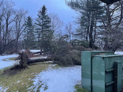
The result was widespread damage, with scores of trees down.  The St. Albans Town fire department lost much of its roof. So did barns in the Champlain Islands. 

I think the momentum of the wind aloft was so strong that the downslope winds came at more of an angle, not straight down the slopes but directed away from the slopes a bit. 

The storm was a snow eater, as the heavy rains and warm temperatures destroyed the existing snow cover quickly, and that led to fast melting.  Burlington's high temperature Thursday was 56 degrees, just two degree shy of the record high for the date.

The east slopes of the Green Mountains and summits also got a extraordinary amount of rain for a winter storm. The summit of Mount Mansfield, for instance, reported 2.47 inches of precipitation. 

I noticed some roads, mostly in southern Vermont, were closed for a time due to flooding. This joined the multitude of roads that were blocked by fallen trees. It was a difficult day to drive anywhere in Vermont. 

Any lingering flooding should subside today. 

This unusual storm also gave Vermonters a rare December treat of thunderstorms and rainbows. The storm was so dynamic that thunderstorms erupted.  Normally, you can't get enough instability in the winter to generate thunder.  This again was a demonstration of how powerful the parent storm was. 

The downslope winds squashed clouds at times, leading to breaks of sun and those rainbows. Sinking air kills clouds, and that's what occasionally happened on Thursday, especially near the worst of the downslope winds. 

The rest of New England suffered, too, from the high winds  Roofs blew off buildings in New Hampshire. The coast of Maine suffered one of its worst storm tides in history, with extensive damage to shoreline buildings. 

Back here in Vermont, the storm gave us one more shot and a surprise in the evening. We knew a flash freeze would hit by late afternoon or evening, and everyone was encouraged to stay off what would quickly become dangerously icy roads. That indeed happened.  Just to continue the day's trend of not being able to get from here to there in the Green Mountain State on Thursday. 

Adding to that mix, a new, sort of mini-storm formed along the Arctic front, causing a burst of heavy snow that worked south to north across the state. Three to five inches of snow fell in a short time, with as much as three inches of snow in one hour.

The blinding snow basically made driving impossible, and interrupted power company crews' workers' attempts to restore power.

At least we got our white Christmas back after the warmth earlier in the day erased the snow cover. 

Today, Vermont will be in recovery mode. Crews will work to restore power. Salt trucks and plows are out this morning. I will caution that salt doesn't work great to melt ice at these low temperatures, so there still will be a lot of slick spots. 

Back roads and sidewalks are especially hazardous.   You'll want to dress for the weather, as temperatures and wind chills are low today.  And, to an extent, tomorrow. 

The intense lake effect blizzards along the shores of lakes Erie and Ontario will continue today with feet of snow expected in places like Buffalo and Watertown, New York.

Those lake effect blizzards might throw a couple snow flurries toward Vermont, but it won't amount to much. 

The storm we just had is another example of some incredibly weird and intense winter storms that have swept much of the nation in the past few years.  Believe it or not, climate change might have had to do with some of this. Counter-intuitive, I know, given how cold it was. I'll have more on this link between winter storms and climate change in a future post. 


Friday, December 23, 2022

Storm Blasting Vermont Now, Lots More To Go Before It's Over

The Arctic front coming in from the southwest to give
Vermont a flash freeze this afternoon is seen here 
approaching Frederick, Maryland at 8:30 a.m. today.
Before the front gets to Vermont, expect 
several more hours of damaging winds. 
UPDATE 11 a.m

A pretty shocking 70,600 customers were without power at this hour, which is a wild number.

Amid all the wind, a LOT of pictures of blue sky and rainbows popped up on social media.

Downslope winds are just that, going down. Sinking air destroys clouds, which is mostly why the sun broke out, especially west of the Green Mountains.

Wind has abated somewhat, but strong gusts are still a risk for the remainder of the day. Before and after the Arctic air arrives.

Though 70 mph gusts are still possible, but becoming less likely. Gusts over 50 mph are still very much in play for the rest of the day.

Interestingly, the highest wind gust reported so far was that 70 mph in Burlington. This is a particularly strong storm with winds aloft screaming harder and faster than has almost ever seen before. So it stands to reason that the downslope winds might have more of an angle away from the immediate slopes at times and further into the Champlain Valley instead.

Numerous roads are closed by fallen trees and wires, so be wary of that. It will take a lot of time to clean up the mess.  
This image of tree damage posted by Green Mountain Power
is just one example of widespread troubles from
today's storm in Vermont.


Flooding is now in play and will continue and perhaps worsen this afternoon.  A flood warning is up for much of the Champlain Valley and central and southern Vermont. 

Around a 1.5 inches of rain has fallen in some areas, with a half inch to an inch more on the way. Plus there's all that melting snow. It's another reason to stay home. 

You might encounter flooding in low spots. 

The flash freeze is still on schedule for the afternoon, which is a huge hazard as roads will turn to glare ice. Gov Phil Scott is sending most state workers home by 1 p.m. in anticipation of the freeze, and he is encouraging other Vermont employers to do the same. 


"'You need to be where you are going to be by 4 p.m.,' said Public Safety Commissioner Jennifer Morrison. "After that, all bets are off and you will be taking a tremendous risk.'"

UPDATE 9 a.m.: A 70 mph wind gusts was just reported at the National Weather Service office in South Burlington. That ties the record for the second highest wind gust on record in Burlington.

This is serious folks!

PREVIOUS DISCUSSION 

As of 8 a.m. we in Vermont were well into the wind phase of this huge storm. 

Power outages are ramping up rapidly, damage reports are starting to come in pretty rapidly now, and winds are howling. 

As is the case in most downslope events, the gusts come sporadically. Some neighborhoods seem relatively protected from the wind and aren't that bad. Other neighborhoods get blasted every few minute by damaging gusts, with lulls in between.

Reports of actual gusts are just starting to come in. We'll see more of those later

As of 8 a.m, VtOutages.org, nearly 29,000 Vermont customers were without power. That was up from just 4,700 outages as of around 4 a.m.  By 8:30, power outages were  up to 38,500, and rising super fast. 

So far, the damage reports are coming mostly from towns that are most prone to downslope winds on the western slopes of the Green Mountains. Wells, a perennial downslope wind epicenter, reports multiple trees own along Route 30 in that town.  A number of trees were down along Browns Trace Road in Jericho. 

Traffic issues will get worse as major roads are affected. As of 8 a.m. for example, Route 7 near Route 17 in New Haven was shut down by fallen trees and power lines. Earlier, Route 5 in Norwich near the intersection of Route 132 was shut down for the same reason.

We'll see more and more examples of this as the morning wears on. 

Storm chaser Nishan Bilazarian has been in the storm around Mendon and Rutland, Vermont overnight and this morning. Video shows his vehicle rocking in the wind,  and traffic signals in Rutland swaying mightily in the gale. Before dawn, he reports power flashes from breaking power lines around Rutland. 

Many of you are probably hearing a sound akin to jet engines outside. That's the sound of winds as high as 100 mph a few thousand feet overhead.  Most of it stays up there, but especially in western Vermont, the wind breaks like a wave over the mountains, and in that fashion is able to roar down the slopes of the mountains as powerful, damaging gusts. 

The strongest winds today should happen between about now, 8 a.m. and 1 p.m. 

Of course, I'll have trouble keeping up with the reports, but you get the idea from the above description. I'd stay home at least until the winds die down.

The highest wind period, through 1 p.m., isn't the end of it. The powerful cold front with this storm passes through this afternoon.

Ahead of it, in addition to the wind, we'll see waves of rain pass through.  

The National Weather Service in South Burlington says the front is so powerful, things might get a little weird as it passes through.

For instance, the sharp drop in temperature will probably occur a few thousand feet aloft a little before the blast of frigid air reaches us on the ground. That cold air aloft could allow a quick burst of snow and sleet while temperatures are still up in the 40s. You might even hear thunder. (There were already a few lightning strikes early this morning in southeastern Vermont).

Then, the cold air will arrive here. The forecast hasn't changed in that regard. Look for roads to rapidly ice up from west to east, or southwest to northeast this afternoon.

Snow and sleet accumulation will only amount to an inch or less for most of us, but that will just add to the icy conditions. Winds will continue to gust to 50 mph in many areas into the evening. That will make repairing power outages that much more difficult, and possibly lead to a few new ones. 

As temperatures crash into the teens, that will just make things more miserable for repair crews, and people who have no power in their homes.


Thursday, December 22, 2022

Vermont Storm Set To Hit Tonight, Cause Havoc Into Saturday

I won't be in Vermont for the big blow. This is the view out
my plane window approaching JFK before dawn today. 
Remember what they say: Red sky in the morning,
sailer take warning. That strip of red sky on the 
eastern horizon was one hint that the eastern United
States, including Vermont, will have quite
a rough weather Friday.
As of Thursday evening, the forecast for a damaging and dangerous, big and multifaceted storm in Vermont is unchanged, so batten down the hatches. 

I'll get to a detailed forecast in a sec, but there is also additional news as everybody in Vermont gets ready for this big tempest.

In anticipation of widespread power outages and plunging temperatures Friday night, Vermont Emergency Management says local shelters and warming centers are being set up. They said to check out vermont211.org for options if you need them.  

Vermont Agency of Transportation announced Thursday that Amtrak is suspending service in Vermont on Friday. This is both the Vermonter and Ethan Allen Express. Apparently, Amtrak came to the sensible conclusion that they really don't want their trains smacking into trees that will have fallen across the tracks. 

Green Mountain Power says they have an army of people ready to work on restoring power from the winds. But restoration might not necessarily be that fast. It will be hard to make repairs while the wind is still roaring due to flying debris and other falling trees and branches near work sites.

Charge your devices now, get bottled water ready, along with LED candles and headlamps if you have them. I wouldn't use regular flame candles. They're a fire hazard.

Another hint: If you have 5 gallon buckets or something like that, fill them with water now. You might not be able to properly flush your toilet without electricity because fresh water won't be pumped into the tank after the first flush. 

You can use those five gallon buckets of water to accomplish this. Hey, as far as I'm concerned, working toilets are important.

Those of you have Christmas decorations outside, especially some that can get blown away easily, should consider taking them in this evening and putting them back out on Christmas Eve when the wind is starting to die down. 

Flying debris of any kind can damage property in wind storms. Do you really want your Rudolph the Red Nose Reindeer statue bashing in the vinyl siding on your neighbor's house?

Given the risk of debris on the roads from the wind, flooding, and the flash freeze coming later in the day, it's probably best to postpone travel plans until Saturday.

Saturday won't be great, as icy patches will linger and it will be quite windy and cold, but at least it won't be nearly as scary on the roads as Friday.

THE FORECAST DETAILS:

Slush and Mush:

A winter weather advisory is up for a good part of tonight for higher elevations of southern and central Vermont. Wet snow and mixed precipitation will dominate the start of the storm tonight.  Valleys will have mostly rain, but some snow mixed in for a time.

Heavy wet snow of two to six inches will make things worse in some high elevations when the high winds arrive later on. Timing of this mix is overnight and the wee early morning hours of Friday.

Then The Wind

The wind, of course, will be the headline feature of this storm. The gusts will rapidly increase, especially after midnight. We were already starting to pick up a southeast breeze in Bennington and Rutland as of 4 p.m. You'll see that increase down there as the evening and overnight wears on.

The worst winds should come through from about 3 a.m. to about early afternoon, then slowly tapering off. 

This is a high end event, possibly among the top five worst wind storms on record in Vermont. Forecasters are still worried that the downslope winds off the Green Mountains will extend well west of those mountains. This could prompt 70 mph or more gusts in places like Rutland, Middlebury, and possibly Burlington and St. Albans.

Not everybody in western Vermont will see such ferocious gusts. Those super powerful winds  will be kind of localized. But pretty much everybody can expect gusts to 50 mph at the very least.

The worst hit areas will see wind gusts reaching or exceeding hurricane force. I still wouldn't be surprised to find the usual suspects - the places that usually see the strongest downslope winds - reach 90 mph.

Candidates for that kind of blow would be places like Wells, Mendon, Ripton, Hanksville, Huntington, Underhill and Cambridge.

We know there will be quite a few power outages and tree damage.  I worry about trees in forested neighborhoods crashing onto or through homes. At the very least, I picture roofing shingles littering a lot of lawns and streets by afternoon. 

The high wind warning covers all of Vermont except the southeast and Grand Isle County 

Where winds are "lighter" they could still gust to 50 or even 60 mph, mainly east of the Greens. That's still enough to cause some tree and power line damage.

Note that after winds "subside" they'll still gust to 50 mph or even a little more in some areas into Friday night, well after the storm starts to depart.

Flooding

Periods of rain and melting snow in the morning, plus a burst of heavy rain ahead of and along the storm's cold front still puts us at risk for some mostly minor flooding. Street flooding, small creeks and probably the Mad River and Otter Creek still look like a fairly decent bet.  Note that much of the flooding will take place while temperatures are crashing towards and below freezing later in the day.

Flash Freeze

That's still very much in play, too. As the powerful cold front moves through, rain will become heavier, and as temperatures plunge we might get a quick period of sleet, then perhaps a brief snow. In any event, all that water around will ice up quickly.  If it snows a bit while temperatures are dipping below freezing, that will make things all the more dicey on the roads. 

It's not certain, but there could even be a little thunder thrown in. The timing of this drop in temperature will be early afternoon to late afternoon depending on where you are.

Note that this weird cold front will move from southwest to northeast. There probably will be a weird moment in which normally mild Bennington already has their teeth chattering in the cold, while normally frost Newport up in the Northeast Kingdom is still enjoying balmy breezes. Or gales, whatever the case might be.

After That

It will be a cold and blustery Christmas weekend, but not as bad as further west in the nation. The Arctic air has been plunging south, toward Texas and the Gulf Coast.  It will have to turn the corner and move toward the northeast to reach us. (Remember that cold front Friday that will move from southwest to northeast).

The detour the cold air will make will give it a chance to modify, to warm up.  Yeah, it'll still be cold, with highs in the teens to around 20 Christmas Eve and barely around the low 20s on Christmas Day. Nights will get into the single numbers and teens, and wind chills will be below zero.

But that's really not a big deal for winter-hardy Vermonters, unless the power is out at your house. And this expected weekend weather isn't nearly as bad as the teens, 20s 30s and even low 40s below zero readings found today and tomorrow in the eastern Rockies and northern Plains.

Just Some Of The Examples Of Wild Weather In U.S.

Virtually all of the nation east of a Portland, Oregon -
El Paso, Texas line is under wind chill, or storm 
alerts as of this afternoon. The huge red area in the
northern Plains is an immense blizzard warning.
Pink is winter storm warnings. The vast majority
of the blue shadings are wind chill alerts 
The long-anticipated horribly cold weather and winter storm was ramping up to full throttle in the United States this afternoon, and it will only get worse. And spread.  

So far, three deaths have been attributed to the storm, originating from vehicle crashes on icy highways in Kansas and Oklahoma. 

That toll will surely rise as dangerous conditions worsen and cover more territory. 

Various dangerous situations have already been cropping up. For instance, about 100 people were stranded in cars amid a blizzard and scary wind chills on Interstate 90 between Rapid City and Wall, South Dakota. 

The wind chill there during this whiteout was in the minus 40s below zero. 

As of 2:15 p.m. early afternoon, more than 1,900 flights in the United States were canceled and nearly 4,800 were delayed, according to flightaware.com

That number, not surprisingly, has been rising all day. Not only from cumulative effects but the fact the bad weather was quickly spreading. 

When the Arctic cold front hit any particular location, people living there sure knew it. 

When the cold front arrived in Denver, it was powerful enough to create a haboob (dust storm). The temperature fell from 41 degrees to 5 degrees in just one hour. The temperature fell 61 degrees between 2 p.m. and midnight in Denver  

The temperature ultimately ended up at 24 below in Denver Thursday morning, the second coldest December temperature on record in the Mile High City. 

Down in Amarillo, the temperature fell from 42 degrees to 11 degrees in just an hour.

Cheyenne, Wyoming was even more impressive. The temperature there fell by 32 degrees in just nine minutes when the cold front blustered through yesterday. 

Meanwhile, in Casper, Wyoming sank to 42 below zero, it's coldest temperature for any date on record. Data for Casper goes back to 1939.

Further east, things weren't really that bad in Chicago until about 11 a.m. local time today. Then, the front arrived, the temperature plunged snow broke out and the wind picked up. It'll keep deteriorating out there the rest of the day and night. 

Grocery and hardware stores, liquor outlets and cannabis distributors in Chicago reported huge crowds of people stocking up before the storm arrived, reports the Chicago Tribune.

Buffalo, New York often gets buried in lake effect snow, but it rarely rises to the level of full blown blizzard because the winds during these things aren't strong enough to qualify. 

Not this time. 

It's raining in Buffalo, now. But starting tomorrow morning, it's a completely new reality. An ugly one. Buffalo is forecasting 37 inches of snow, winds gusting to 65 mph and wind chills going way below zero. I can't imagine how tall the snow drifts will be when all that is said and done. 

Winter storms usually don't warrant a presidential briefing, but President Joe Biden was filled in on the chaos today from the National Weather Service."This is really a very serious weather alert here," Biden told reporters after the briefing. "This is not a snow day when you were a kid. This is serious stuff."

So far, temperatures in at least 18 states have dipped below zero, and that's not including the wind chill. That number will go up.

There is light at the end of the tunnel. This huge winter blast won't last all that long. Long forecasters indicate that virtually the entire Lower 48 will be bathed in at least slightly above normal temperatures within a week.